12 hours ago
Topic:
Agua Alta overnight
Rocko1Posts: 617
|
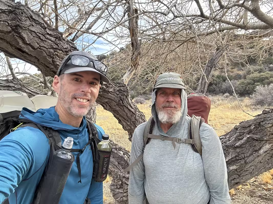
Yes, water was flowing great. 2L/min or so. The 6L I planned on using from Horsethief to Aqua Alta spring and back to the car the next day would not have cut it.
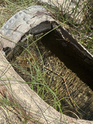
A happy, soon to be not thirsty me.
edited by Rocko1 on 4/14/2025
|
|
|
23 hours ago
Topic:
Tyler Grant-Goat Canyon Trestle bluegrass song
tekewinPosts: 386
|
That was fun! Thanks for sharing.
|
|
|
1 days ago
Topic:
Agua Alta overnight
BrianPosts: 251
|
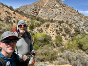
update: Rocko1 and I hiked the Cactus Spring trail from the top to Agua Alta spring. It has good flow now! Lucky for us since it was a hot dry weekend. Maybe Rocko1 will post some pics of the spring later.
|
|
|
2 days ago
Topic:
Desert Pupfish at San Sebastian Marsh
dtoujoursPosts: 35
|
I was fortunate to see some desert pupfish at San Sebastian Marsh aka San Felipe Creek Ecological Reserve. Desert pupfish have been introduced to different parts of the region, but I don't believe they've ever been introduced at San Sebastian Marsh, so the fish I saw were native. They're really fascinating fish, and I tell a little about them in this video with footage of my visit.
https://www.youtube.com/watch?v=PRGcuqPK8pc
|
|
|
2 days ago
Topic:
R.I.P Desert Drifter
dtoujoursPosts: 35
|
This is really sad news, thank you for letting us know.
|
|
|
3 days ago
Topic:
R.I.P Desert Drifter
rockhopperPosts: 674
|
Happened on Jan.31st. I waited till now to post. Check out some of his amazing videos when you have a chance.
|
|
|
3 days ago
Topic:
R.I.P Desert Drifter
BritainPosts: 610
|
Wow. Just started watching his videos. RIP. A car accident bummer. I would think he would have slipped off of one of those cliffs with a ruin on it.
edited by Britain on 4/11/2025
edited by Britain on 4/11/2025
|
|
|
3 days ago
Topic:
R.I.P Desert Drifter
Rocko1Posts: 617
|
That's tragic.
|
|
|
4 days ago
Topic:
R.I.P Desert Drifter
rockhopperPosts: 674
|
Sadly, Andrew Cross has crossed to the other side in an accident. Some on our board may have seen his superb youtube videos of exploration. A true loss. I feel I have lost a hiker friend, although I have never met him personally. When you are hiking out in the wilderness, look up, he is smiling looking down upon us.
Rockhopper
edited by rockhopper on 4/10/2025
|
|
|
13 days ago
Topic:
Tyler Grant-Goat Canyon Trestle bluegrass song
BrianPosts: 251
|
I'm impressed he did that hike with a guitar. It's hard enough without one!
(good tune too, despite my usual dislike of bluegrass)
|
|
|
13 days ago
Topic:
Tyler Grant-Goat Canyon Trestle bluegrass song
dtoujoursPosts: 35
|
Bluegrass has moved west! A great video this artist filmed on site after hiking to the Goat Canyon Trestle:
https://www.youtube.com/watch?v=jl07uFTVM58
|
|
|
14 days ago
Topic:
Sweeney Pass Stone Wall?
tommy750Posts: 1071
|
Dtoujours, looks like natural erosion to me but would have to see up close to be sure. Nice AI poem! Daren, the bollards are still there in the last GE image from 3/2023. Pretty sure I've seen them in the past couple months driving up Sweeney Pass.
|
|
|
16 days ago
Topic:
Sweeney Pass Stone Wall?
dsefcikAdministrator Posts: 2634
|
I remember about 11-12 years ago the BP removed the bollards and the park rangers were pissed and put in all new ones. Maybe the BP removed them again.Nobody is supposed to be driving in those washes.
|
|
|
18 days ago
Topic:
Chuckwalla?
dtoujoursPosts: 35
|
A lot of chuckwalla lizards have loose skin around their abdomen and so they can squeeze into a rock crack and inflate that loose skin and it makes it almost impossible for a predator to remove them. So, I wonder if the lizard you saw had inflated its skin.
|
|
|
19 days ago
Topic:
Sweeney Pass Stone Wall?
dtoujoursPosts: 35
|
After carefully scanning Google Street View, I think I probably just saw some boulders or perhaps the bollards that still remain on either side of the wash. It seems the bollards in the wash itself were removed and there are tire tracks beyond them in some of the satellite views. I tried to make sense of my perceptual errors through AI-assisted poetry:
At Sweeney Pass, I thought I saw
A stone wall rising, sturdy, raw—
A barrier, perhaps, to time's deep flow,
But in the desert, the winds do blow.
Magic lies in each cracked stone,
In rock art whispers, history’s tone.
Artifacts, secrets, each grain of sand,
A thousand stories held in the land.
Yet beware, for the desert's light
Plays tricks on eyes, both day and night.
What seems real may just deceive,
A fleeting mirage, a trick to believe.
edited by dtoujours on 3/26/2025
|
|
|
20 days ago
Topic:
Sweeney Pass Stone Wall?
dtoujoursPosts: 35
|
Maybe I'm just seeing things! I started to trace it out in red, but maybe it's just a shadow on Google Street View. At any rate, I thought I saw something driving through there, so maybe I'll pull over and jump out to see for myself the next time I'm going through there. I was in a hurry to get somewhere the other day.
https://i.postimg.cc/XYw46g09/wall.png
|
|
|
23 days ago
Topic:
Sweeney Pass Stone Wall?
dsefcikAdministrator Posts: 2634
|
I didn't see it either ..but I was wondering what happened to all the bollards that used to be in the wash
|
|
|
24 days ago
Topic:
Sweeney Pass Stone Wall?
tommy750Posts: 1071
|
Okay, I give. What structure?
|
|
|
29 days ago
Topic:
Chuckwalla?
tekewinPosts: 386
|
Thanks for the confirmation. First chuckwalla I've ever seen in A-B.
|
|
|
29 days ago
Topic:
Sweeney Pass Stone Wall?
dtoujoursPosts: 35
|
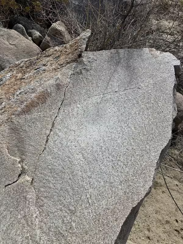
I was driving through Sweeney Pass and noticed this structure, which looks like a curved stone wall.
https://maps.app.goo.gl/JVRwRRpgLRP5ykDq6
I wondered if anyone had any information on it.
|
|
|
29 days ago
Topic:
Chuckwalla?
dtoujoursPosts: 35
|
The Seek app from iNaturalist agrees with your assessment it's a Chuckwalla. It's really crammed in there!
|
|
|
3/13/2025
Topic:
Chuckwalla?
tekewinPosts: 386
|
I saw this guy hiding in a crack in some rocks. At first, I thought this is too big to be a lizard. Is it a snake? No, it looks like a chuckwalla.
What do you think?

I found him on Lizard Peak (aka peak 2865), an unofficial peakbagger peak. I climbed it from Stag Cove off Highway 78.
|
|
|
3/11/2025
Topic:
Agua Alta overnight
rockhopperPosts: 674
|
Brian wrote:
rockhopper wrote:
Cactus spring trail to Agua Alta spring enjoys great views along the way. Thanks for sharing. Brings back some great memories. Been hiking that trail from below and from the top at Hwy 74 about a dozen times past 40 years. Went all the way thru from Hwy 74 to Martinez only once. Great trip report.
I have now done all of it except for a 1.5 mile section in the middle where I didn't make it all the way to Agua Alta when I came up from the bottom. The one thing that really tripped me up was a half mile section climbing out of Martinez Canyon when I came up from the bottom. It was so steep I was on my hands and knees both going up and down. And yet, according to the scanned topo layer on CalTopo (which I think is USGS), I was on the native trail.
Has this been your experience with that section?
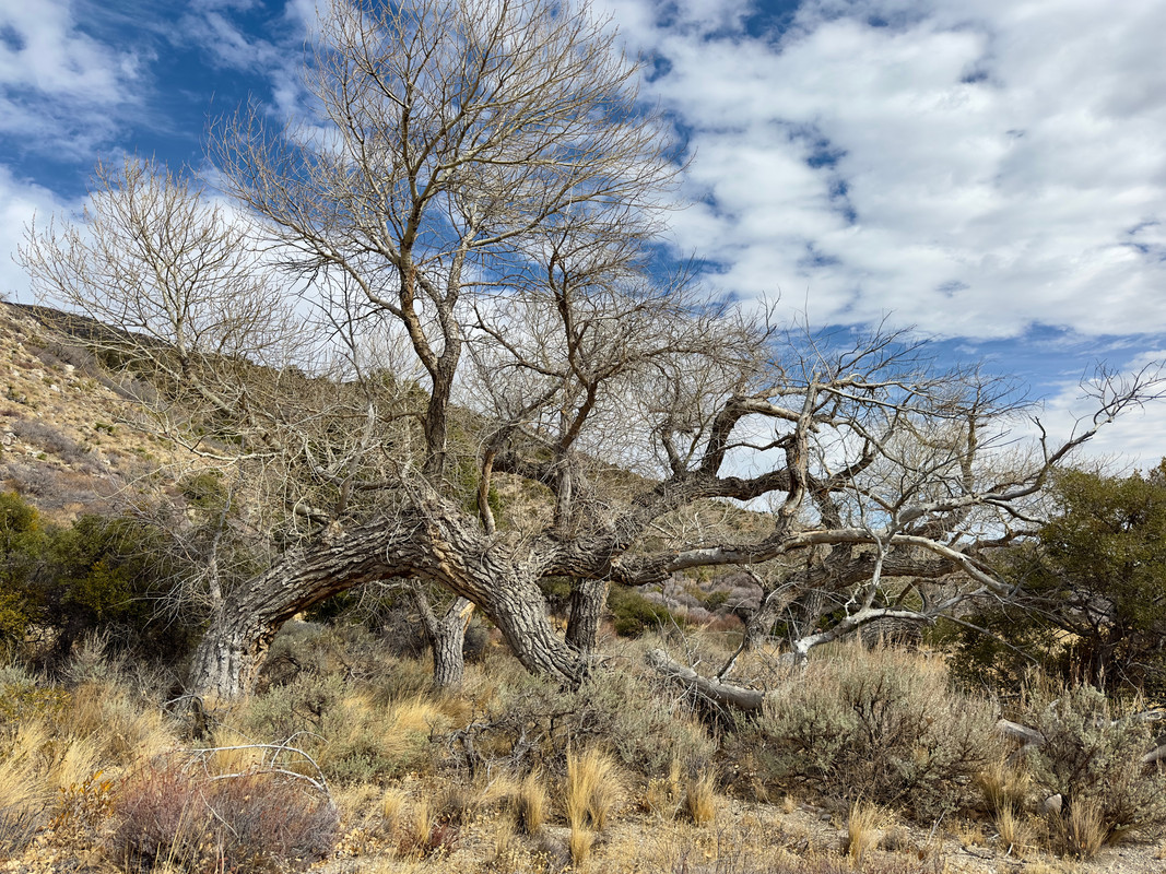
Hiking poles for sure. The CST climb out of Martinez is steep for sure. Straight up the nose - ridge. Even steeper is the climb out of Martinez from the Jack Miller rock house. I just follow the Big Horn trail. I have been meaning to post a few items about Jack Miller that I have discovered over the years. I will try to post later. Here are some random photos of the Cactus Spring trail.

Morning light on Torro peak

Agua Alta spring. Trickel at best

Jack miller Cabin. Look hard in the center.

Alta Pinyon flat


Agua Alta village
edited by rockhopper on 3/12/2025
|
|
|
3/7/2025
Topic:
Coyote Canyon Road current conditions?
tekewinPosts: 386
|
Buford wrote:
Anywhere in the San Diego backcountry with reliable water is a potential grow site.
I found one in a drainage near Collins a couple years ago. “Why are there pots, irrigation hose, garden tools, oh…”
Not a huge grow site, but the gear was there. I don’t remember if it was on the Sheep Canyon or Salvador Canyon side.
I found a coil of black tubing on the Sheep Canyon side of Collins about 5 years ago. I thought it was rather remote for growing. Especially now that you can't drive past 3rd crossing. Seems like there are more accessible areas for bad guys to grow.
|
|
|
3/7/2025
Topic:
Coyote Canyon Road current conditions?
BufordPosts: 467
|
Anywhere in the San Diego backcountry with reliable water is a potential grow site.
I found one in a drainage near Collins a couple years ago. “Why are there pots, irrigation hose, garden tools, oh…”
Not a huge grow site, but the gear was there. I don’t remember if it was on the Sheep Canyon or Salvador Canyon side.
|
|
|
3/7/2025
Topic:
Agua Alta overnight
BrianPosts: 251
|
rockhopper wrote:
Cactus spring trail to Agua Alta spring enjoys great views along the way. Thanks for sharing. Brings back some great memories. Been hiking that trail from below and from the top at Hwy 74 about a dozen times past 40 years. Went all the way thru from Hwy 74 to Martinez only once. Great trip report.
I have now done all of it except for a 1.5 mile section in the middle where I didn't make it all the way to Agua Alta when I came up from the bottom. The one thing that really tripped me up was a half mile section climbing out of Martinez Canyon when I came up from the bottom. It was so steep I was on my hands and knees both going up and down. And yet, according to the scanned topo layer on CalTopo (which I think is USGS), I was on the native trail.
Has this been your experience with that section?
|
|
|
3/7/2025
Topic:
Coyote Canyon Road current conditions?
BrianPosts: 251
|
The Lindsay book mentions there was a major grow site discovery in Alder around the year 2000. Depending on where it was, it's possible that access may have been from the top (Lost Valley Road, which goes to a PCT/Combs Peak trailhead and eventually to the boyscout camp).
|
|
|
3/7/2025
Topic:
Coyote Canyon Road current conditions?
Rocko1Posts: 617
|
Buford wrote:
tekewin wrote:
Buford wrote:
Turkey Track from Anza got graded some time ago, I think to get fire crews back there. Since then it has gotten worse again. I don't know the current status.
Unfortunately I would not expect realistic road conditions from the visitor center employees. They either don't know, or give way too cautious recommendations, for good reason.
edited by Buford on 3/3/2025
edited by Buford on 3/3/2025
Thanks for the info, Buford. I have a buddy who wants to go up Salvador Canyon. I think we are going to try to mountain bike from the gate at 3rd crossing, about 4.7 miles from the entrance to Salvador. Depends on the weather, too.
I know people that have done that when their vehicle was not ready for the bypass road. Only issue is biking in soft sand is a slog.
I made a mistake above, the road from the top of Boulder alley to Salvador is fine. I mixed up Alder and Salvador.
The road to Alder is down the Turkey Track.
Be careful of grow sites if you go up the canyons.
Are there confirmed grow sites up Alder or Salvador canyons? Seems like access would be horrible for an operation.
|
|
|
3/7/2025
Topic:
RHC 3 Day Backpack Trip
Rocko1Posts: 617
|
rockhopper wrote:
Brian wrote:
rockhopper wrote:
I always wanted to complete the ridge trail down to Martinez along the old native trail.
That's on my bucket list too. Rocko1 and I hiked up to the ridge line from the Rockhouse Valley side a couple years ago, but we didn't continue down to Martinez. That trip would be a lot more viable for me if there was a reliable water source on the Martinez side.
My bucket list too! Here is an old map showing the old trail over from Rock house valley to Martinez. This map was generated from aerial photography 1938-1944 so the trail was still visible from the air back then. ( I have embellished info on this map showing the other trails and some springs to the east of the ridge in wet years.) Best approach for a thru hike would be after a major wet storm and or gather snow for the trek down to Jack Miller cabin and out to Valiere.

Brian and I went up on the ridge just south of Stiff. It wasn't too bad. That way and the old native trail shown seem to both be about 1 mile and 1,700-1900ft of gain.
|
|
|
3/7/2025
Topic:
RHC 3 Day Backpack Trip
rockhopperPosts: 674
|
Brian wrote:
rockhopper wrote:
I always wanted to complete the ridge trail down to Martinez along the old native trail.
That's on my bucket list too. Rocko1 and I hiked up to the ridge line from the Rockhouse Valley side a couple years ago, but we didn't continue down to Martinez. That trip would be a lot more viable for me if there was a reliable water source on the Martinez side.
My bucket list too! Here is an old map showing the old trail over from Rock house valley to Martinez. This map was generated from aerial photography 1938-1944 so the trail was still visible from the air back then. ( I have embellished info on this map showing the other trails and some springs to the east of the ridge in wet years.) Best approach for a thru hike would be after a major wet storm and or gather snow for the trek down to Jack Miller cabin and out to Valiere.
|
|
|
3/7/2025
Topic:
RHC 3 Day Backpack Trip
Rocko1Posts: 617
|
Buford wrote:
Great report. Not good that some springs don't have water. I think Gary knows of the trail between Stifferino and the rockhouses?
I've also walked the canyon in the dark a couple times. I've driven the last three miles of road in the dark a couple times too . It can be a nice walk if the rain left a nice hard crust on the canyon bottom.
Nice gloves 
There wasn't much of a crust in the canyon this time. We have hiked it before where there was and it's soo much easier.
Glacier Glove Ascension Bay gloves. A must have.
May be the same track we followed. It has to be the or close to the best route. Saw a few markers but not many.
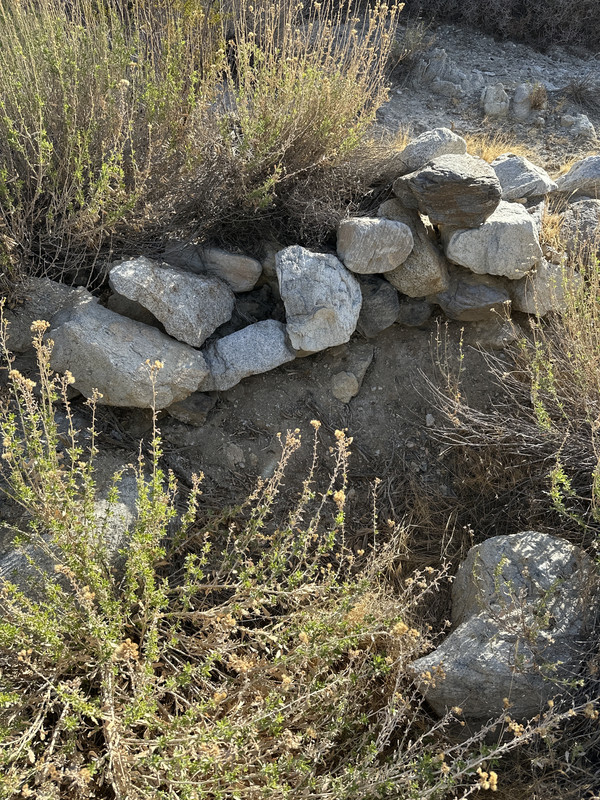
We saw a few large pile of rocks near the trail that skirts the slopes and wondered the meaning. Burial site?
edited by Rocko1 on 3/7/2025
|
|
|
3/7/2025
Topic:
Agua Alta overnight
rockhopperPosts: 674
|
Cactus spring trail to Agua Alta spring enjoys great views along the way. Thanks for sharing. Brings back some great memories. Been hiking that trail from below and from the top at Hwy 74 about a dozen times past 40 years. Went all the way thru from Hwy 74 to Martinez only once. Great trip report.
|
|
|
3/4/2025
Topic:
Coyote Canyon Road current conditions?
BufordPosts: 467
|
tekewin wrote:
Buford wrote:
Turkey Track from Anza got graded some time ago, I think to get fire crews back there. Since then it has gotten worse again. I don't know the current status.
Unfortunately I would not expect realistic road conditions from the visitor center employees. They either don't know, or give way too cautious recommendations, for good reason.
edited by Buford on 3/3/2025
edited by Buford on 3/3/2025
Thanks for the info, Buford. I have a buddy who wants to go up Salvador Canyon. I think we are going to try to mountain bike from the gate at 3rd crossing, about 4.7 miles from the entrance to Salvador. Depends on the weather, too.
I know people that have done that when their vehicle was not ready for the bypass road. Only issue is biking in soft sand is a slog.
I made a mistake above, the road from the top of Boulder alley to Salvador is fine. I mixed up Alder and Salvador.
The road to Alder is down the Turkey Track.
Be careful of grow sites if you go up the canyons.
|
|
|
3/4/2025
Topic:
Coyote Canyon Road current conditions?
tekewinPosts: 386
|
Buford wrote:
Turkey Track from Anza got graded some time ago, I think to get fire crews back there. Since then it has gotten worse again. I don't know the current status.
Unfortunately I would not expect realistic road conditions from the visitor center employees. They either don't know, or give way too cautious recommendations, for good reason.
edited by Buford on 3/3/2025
edited by Buford on 3/3/2025
Thanks for the info, Buford. I have a buddy who wants to go up Salvador Canyon. I think we are going to try to mountain bike from the gate at 3rd crossing, about 4.7 miles from the entrance to Salvador. Depends on the weather, too.
|
|
|
3/4/2025
Topic:
RHC 3 Day Backpack Trip
dsefcikAdministrator Posts: 2634
|
Buford wrote:
I think Gary knows of the trail between Stifferino and the rockhouses?
Yes, there is a trail at the base of the mtns. You will find piles of small rocks along the way. Toss another into the pile to make the spirit gods happy.
|
|
|
3/3/2025
Topic:
Coyote Canyon Road current conditions?
BufordPosts: 467
|
I believe the Lower Willows trail is still closed. They closed it a couple years ago. It was usually a muddy mess anyway.
Middle Willows has a hiking/horse trail through it. Also muddy and overgrown. The equestrians used to keep it open. Last time I was there a couple years ago it was not well kept.
In the last 10 years there have been times boulder alley was 2wd accessible for trucks and SUVs or AWD Subaru accessible. Other times I hit the skidplates on my vehicle pretty good.
If the road opens again, I bet it will be easily accessible to most stock AWD/4x4 vehicles. Then over time degrade again as it always has until they grade it again. If you can get over boulder alley, there is nothing else past that that is difficult going into Alder unless there are drastic changes. If it has rained recently, there are a couple mud pits. If it is forecast to rain heavily, I wouldn't want my vehicle on the wrong side of 1st crossing. There may not be a road left when the rain stops.
Turkey Track from Anza got graded some time ago, I think to get fire crews back there. Since then it has gotten worse again. I don't know the current status.
Unfortunately I would not expect realistic road conditions from the visitor center employees. They either don't know, or give way too cautious recommendations, for good reason.
edited by Buford on 3/3/2025
edited by Buford on 3/3/2025
|
|
|
3/3/2025
Topic:
RHC 3 Day Backpack Trip
BufordPosts: 467
|
Great report. Not good that some springs don't have water. I think Gary knows of the trail between Stifferino and the rockhouses?
I've also walked the canyon in the dark a couple times. I've driven the last three miles of road in the dark a couple times too . It can be a nice walk if the rain left a nice hard crust on the canyon bottom.
Nice gloves
|
|
|
3/3/2025
Topic:
RHC 3 Day Backpack Trip
BrianPosts: 251
|
rockhopper wrote:
I always wanted to complete the ridge trail down to Martinez along the old native trail.
That's on my bucket list too. Rocko1 and I hiked up to the ridge line from the Rockhouse Valley side a couple years ago, but we didn't continue down to Martinez. That trip would be a lot more viable for me if there was a reliable water source on the Martinez side.
|
|
|
3/3/2025
Topic:
RHC 3 Day Backpack Trip
rockhopperPosts: 674
|
Great Trip report. Rock house valley is one of my favorite places in our local area. It's like going back in time.
I always wanted to complete the ridge trail down to Martinez along the old native trail.
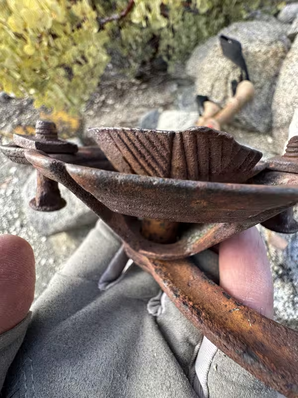
Pic. 7. Could be a hand ore grinder? lots of prospectors traveled thru the area.
thanks for sharing.
|
|
|
2/25/2025
Topic:
RHC 3 Day Backpack Trip
Rocko1Posts: 617
|
tommy750 wrote:
NIce TR. Like your sunrise and evening pics. And glad you found water. If you found a nice trail from the rockhouses to/from Stifferino, that's a great find. The few times I've been out there, that stretch always seems to be where you end up trudging through a dozen different drainages.
I think it was a combo of game trails that turned into a native trail. It certainly wasn't arduous at all and shockingly efficient. 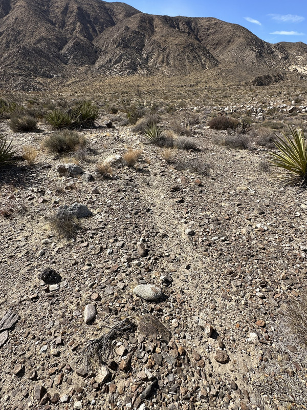
edited by Rocko1 on 2/25/2025
|
|
|
2/21/2025
Topic:
RHC 3 Day Backpack Trip
tommy750Posts: 1071
|
NIce TR. Like your sunrise and evening pics. And glad you found water. If you found a nice trail from the rockhouses to/from Stifferino, that's a great find. The few times I've been out there, that stretch always seems to be where you end up trudging through a dozen different drainages.
|
|
|
2/21/2025
Topic:
Coyote south ridge
Rocko1Posts: 617
|
tekewin wrote:
Rocko1 wrote:
Nice report. Is that mini lake at 33.309572, -116.306719?
Yes, that's it exactly!
When I walked through, it looked like there was a fire circle set up at the mouth where it drains to the east. I didn't walk over to confirm. It might have just been a pile of rocks.
Looks like a good place to camp to get out of the wind that can rip over that mountain.
|
|
|
2/21/2025
Topic:
Coyote south ridge
tekewinPosts: 386
|
Rocko1 wrote:
Nice report. Is that mini lake at 33.309572, -116.306719?
Yes, that's it exactly!
When I walked through, it looked like there was a fire circle set up at the mouth where it drains to the east. I didn't walk over to confirm. It might have just been a pile of rocks.
|
|
|
2/21/2025
Topic:
Coyote south ridge
Rocko1Posts: 617
|
Nice report. Is that mini lake at 33.309572, -116.306719?
|
|
|
2/21/2025
Topic:
Coyote south ridge
BrianPosts: 251
|
Great pics. I hadn't heard of that benchmark. Last year I bought a book by Robin Halford that's all benchmarks in Anza Borrego. Occasionally I do one of those hikes when I want something out of the ordinary.
|
|
|
2/21/2025
Topic:
Coyote south ridge
tekewinPosts: 386
|
The long south ridge of Coyote beckoned. I wanted to visit the Mist benchmark and the west butte that I skipped the first time I hiked Coyote. I parked off Rockhouse Canyon. Mist was less than a mile from the start, but was in a random location. There were 4 fingers stabbing eastward from the ridge and Mist was the third highest. I don't pretend to understand the logic. There was a benchmark and register from 2022. I signed in without removing my pack. I continued up the ridge, eventually descending into a large dry lake. This was the coolest feature of the day. The caked mud on the perimeter suggested it held water at least a little while on the rare occasion of heavy precipitation.


Dry lake
There was a lot of extra gain from the contours. I climbed a steep section of gully, then hit a relatively flat section. A few places had an old road, other segments had a faint use trail, and the rest was open desert with very little vegetation. Even cholla and ocotillo had only a meager presence. Before the final ascent, the ridge gave up 200' to a saddle. I took a gully up to the top, then traversed a short distance to Coyote West Butte. It seemed almost level with the official high point and had a reference mark. There was a plastic jar with several full registers. The oldest from 1993. As I approached the summit, I saw someone already there with a dog. I thought it might be someone local on a Tuesday, but the hiker was John Pru (sp?) with his dog Gracie. He was an avid hiker from Massachusetts and had come up the standard route. We had a lengthy chat about peakbagging and I suggested some nearby off the beaten path hikes. We left the summit at the same time, returning along our different ascent lines. Picked up one mylar.


West butte register


Gracie the dog

|
|
|
2/19/2025
Topic:
RHC 3 Day Backpack Trip
Rocko1Posts: 617
|
Brian wrote:
Nice overview of our trip. It was great to have some extra time to fully explore. So much to see in this area.
Yes, one could really spend a week up there.
|
|
|
2/19/2025
Topic:
RHC 3 Day Backpack Trip
BrianPosts: 251
|
Nice overview of our trip. It was great to have some extra time to fully explore. So much to see in this area.
|
|
|
2/19/2025
Topic:
RHC 3 Day Backpack Trip
Rocko1Posts: 617
|
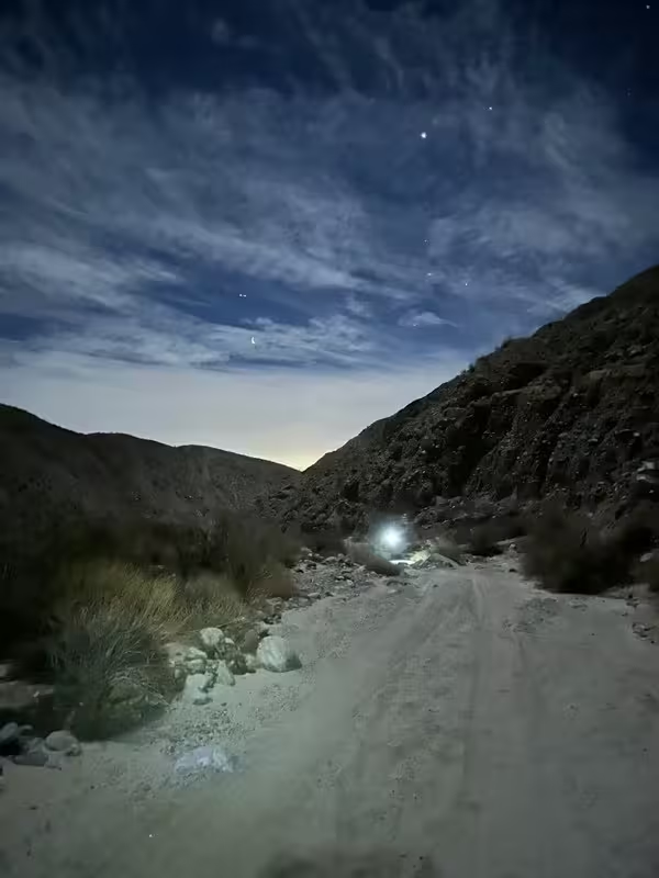
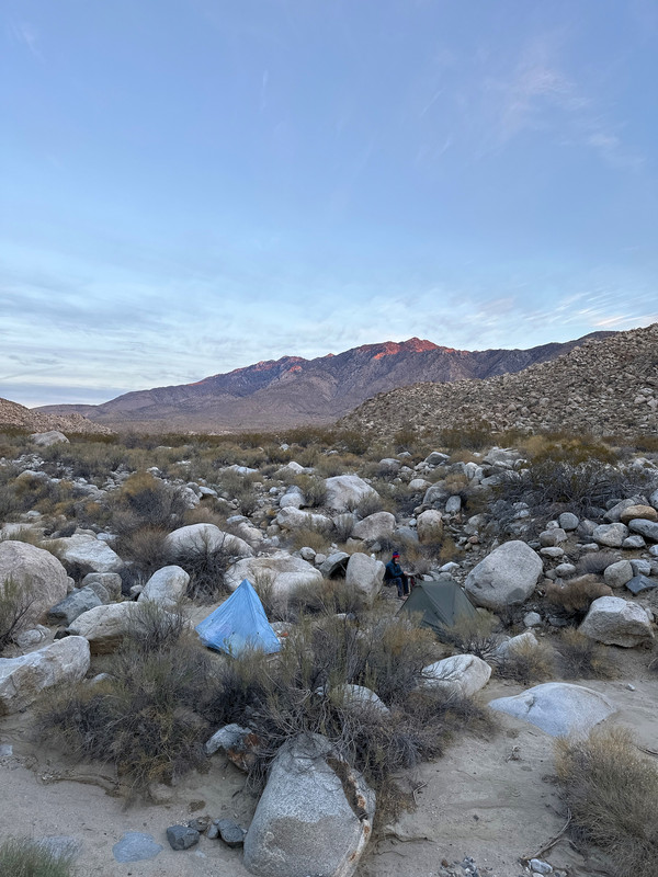
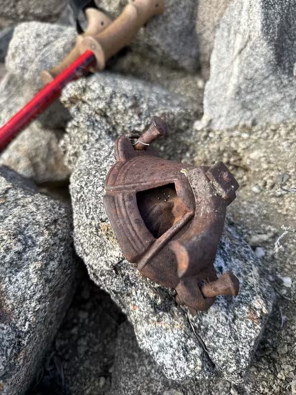
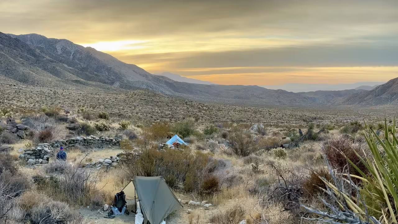
A couple of weekends ago Brian and I did a 3 day tour of RHC and the area that drains into it. We started Friday night and hiked in the dark from 3 miles south of the ‘parking’ area to the north exit of the canyon. Was interesting hiking in the dark through that canyon, the sand was very soft and as the canyon can be, monotonous.
We woke up and decided to check out the original cotton wood spring. Long since dry.
I wondered how long since it had water and if there was any deep under the soil. Some extremely healthy juniper trees must be drinking from somewhere nearby.
We then headed north to connect to the trail that runs along the base of Santa Rosas. We found the trail and headed to OSR and then to barrel spring-as reported earlier, still bone dry.
I poked around but didn’t see any signs of water. I didn’t look too hard.
Next mission was to get to the spring at the cottonwoods and praying it was flowing as it would be a long trek back to the car if not. Lucky for us it was producing. I would say 3-5L per minute.
https://imgur.com/n5KjFHr
We took a break at the cottonwoods then headed down the canyon.
Looks like an old pump for water or oil, not sure.
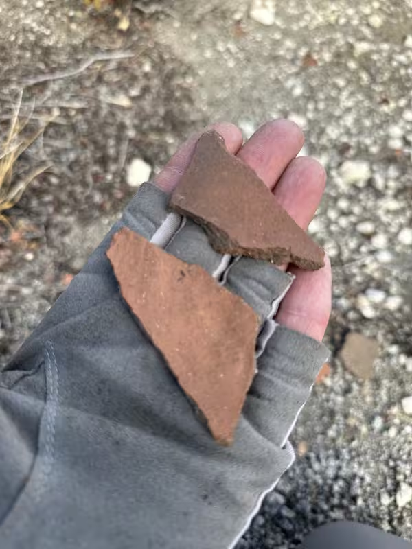
Shards
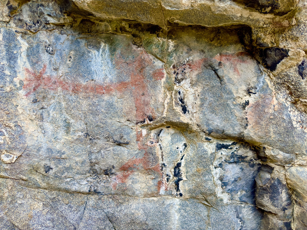
Picto
After making it back to the CW, loading up on water, we headed for OSR for the night.
Was a nice calm night. Brian had a hungry visitor in the form of a mouse.
That morning we headed over to Stiff to check the status of the spring. One drop every couple of seconds at Stiff, but upper Stiff 30-50’ up and to the left was flowing nice.
https://imgur.com/vMRd2km
We signed the register and headed to the lower rock houses. We must have picked up a old native trail as we really made good time-45 minutes.
I explored a higher elevation ‘side’ canyon not far from the zig zag trail.
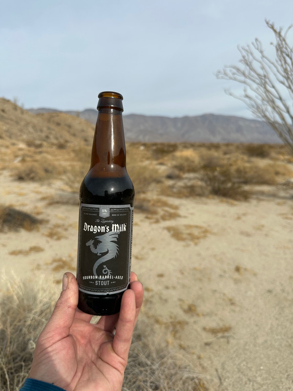
Brian provided the post trip beverages. It was fantastic.
Trip Totals
30 Miles, 5,062’ Gain, 5,075’ Loss
4 balloons recovered
Water Report as of Feb. 9th, 2025
Hidden Spring-could pull 6-8oz or so out of the small depression. Wouldn't count on it.
Stiff, only drips. Upper Stiff-1L/minute
Barrel-Bone Dry
Cottonwoods-flowing great.
Album link-https://postimg.cc/gallery/sDVcNN9
edited by Rocko1 on 2/19/2025
|
|
|
2/18/2025
Topic:
Fish Creek, Did it Rain There?
tommy750Posts: 1071
|
Just got back tonight from driving my pickup out to the bottom of Pinyon Canyon and the road conditions suck. At least for vehicles. Bad washboard the entire way and the sand is not well compacted. Have a fat ebike I ride in the desert and would not have enjoyed the ride. There obviously was some rain out there since morteros have water in them but you might want to wait till a bigger storm hits. Just my two cents. Sounds like a fun ride whenever you do it.
|
|
|
2/17/2025
Topic:
Fish Creek, Did it Rain There?
dmartienPosts: 1
|
A group of us was thinking about riding mountain bikes from Pinyon Mtn Rd through the Squeeze and down Fish Creek to Split Mountain Rd. It's not much fun unless there is some crust to ride on the edges of the road, which happens after a rain. Has anyone been out there since the recent rain? Did it get enough rain to form a crust?
|
|
|
2/17/2025
Topic:
Coyote Canyon Road current conditions?
tekewinPosts: 386
|
Brian wrote:
Also I think the upper road (from the town of Anza to Bailey's Cabin) is open. But last time I drove that it was in very rough shape.
Thanks. I'll check out the upper roads. Not sure I have the skill to drive it.
|
|
|
2/16/2025
Topic:
Coyote Canyon Road current conditions?
BrianPosts: 251
|
Also I think the upper road (from the town of Anza to Bailey's Cabin) is open. But last time I drove that it was in very rough shape.
|
|
|
2/16/2025
Topic:
Coyote Canyon Road current conditions?
BrianPosts: 251
|
tekewin wrote:
Brian wrote:
I've been there recently. The road is fine up until 3rd crossing, but the gate is closed there and probably will remain so for the next several years. The section between the gate and boulder alley is where the creek has taken over the road. The park would need to come up with a new route for the road in order to open it and I haven't heard any definitive word about whether they plan to do that.
So basically it's hike-only past the 3rd crossing (or bike, horse, etc)
Much appreciated. Helpful...and disappointing, haha.
I know this a longshot, but is the Lower Willows Trail passable, or is that just a trail and not a road?
The closed gate is before lower willows. And in any case, Rocko and I tried to go through lower willows a couple years ago and even the foot path was badly overgrown.
I did a backpacking trip to Cougar Canyon about a month ago and the mileage wasn't too bad (about 4 miles from the gate) but it's hard to walk in the soft sand (no vehicles have been going through, so nothing to compact it).
Depending on where you're trying to go, you might be able to go down from the road that goes to Combs Peak?
|
|
|
2/16/2025
Topic:
Coyote Canyon Road current conditions?
tekewinPosts: 386
|
Brian wrote:
I've been there recently. The road is fine up until 3rd crossing, but the gate is closed there and probably will remain so for the next several years. The section between the gate and boulder alley is where the creek has taken over the road. The park would need to come up with a new route for the road in order to open it and I haven't heard any definitive word about whether they plan to do that.
So basically it's hike-only past the 3rd crossing (or bike, horse, etc)
Much appreciated. Helpful...and disappointing, haha.
I know this a longshot, but is the Lower Willows Trail passable, or is that just a trail and not a road?
|
|
|
2/16/2025
Topic:
Coyote Canyon Road current conditions?
BrianPosts: 251
|
I've been there recently. The road is fine up until 3rd crossing, but the gate is closed there and probably will remain so for the next several years. The section between the gate and boulder alley is where the creek has taken over the road. The park would need to come up with a new route for the road in order to open it and I haven't heard any definitive word about whether they plan to do that.
So basically it's hike-only past the 3rd crossing (or bike, horse, etc)
|
|
|
2/16/2025
Topic:
Coyote Canyon Road current conditions?
dsefcikAdministrator Posts: 2634
|
You should be able to call the VC and get current conditions I would think. Of course an actual eye witness that has been there recently would be good also.
|
|
|
2/16/2025
Topic:
Coyote Canyon Road current conditions?
tekewinPosts: 386
|
Hi, everyone.
I was thinking about trying to reach Salvador Canyon next month, but I am concerned about whether I can make the drive to get close enough. I haven't driven that road in the last 5 years.
I read a recent post here about how the creek has covered the road in certain places.
Has anyone been past the crossings to the junction with Sheep Canyon road?
Any info would be helpful. I'd hate to plan a big trip and get turned back before getting close.
|
|
|
2/16/2025
Topic:
upcoming? Rosa (looking for advice)
tekewinPosts: 386
|
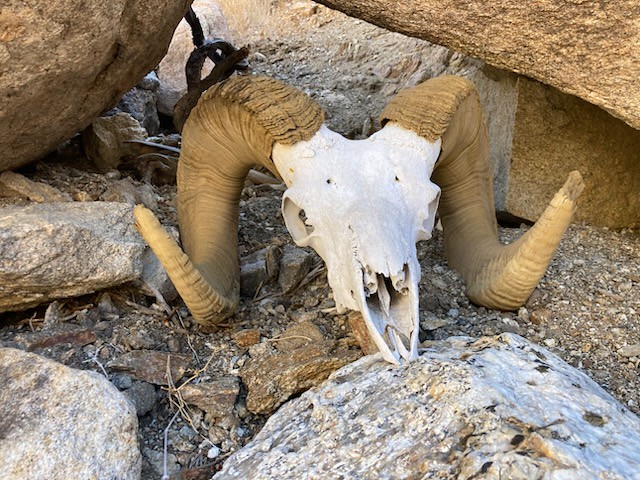
Congrats! I haven't been to Rosa that way. I also went from Pyramid. Love the ram skull.
|
|
|
2/6/2025
Topic:
Dolomite Desert Terraces
dsefcikAdministrator Posts: 2634
|
tommy750 wrote:
dsefcik wrote:
Previous ABDSP ranger(s) have told me of "hippie" settlements back in the day that made all kinds of rock formations. What you found seems oddly close to the mining efforts.
Just found this and thinking hippies may be the final answer:
Nice!
|
|
|
2/5/2025
Topic:
upcoming? Rosa (looking for advice)
BrianPosts: 251
|
Buford wrote:
Didn’t want to add on Mile High since you were right there?
Next time. Now that I know the neighborhood.
Buford wrote:
I think I know where that ram skull is. Near the bottom of a wash as an ancient trail climbs out?
Yes. Rodny posted a pic of it on an Anza Borrego Facebook group and from some of the comments it sounds like it's been there for at least 12 years and is named Herman.
|
|
|
2/5/2025
Topic:
upcoming? Rosa (looking for advice)
BufordPosts: 467
|
Nice work. Rosa is not easy to get to. Didn’t want to add on Mile High since you were right there?
I think I know where that ram skull is. Near the bottom of a wash as an ancient trail climbs out?
|
|
|
2/5/2025
Topic:
Dolomite Desert Terraces
tommy750Posts: 1071
|
dsefcik wrote:
Previous ABDSP ranger(s) have told me of "hippie" settlements back in the day that made all kinds of rock formations. What you found seems oddly close to the mining efforts.
Just found this and thinking hippies may be the final answer:
 Dolomite Hippies by tomteske, on Flickr Dolomite Hippies by tomteske, on Flickr
|
|
|
2/4/2025
Topic:
upcoming? Rosa (looking for advice)
Rocko1Posts: 617
|
That's a big hike. Congrats.
|
|
|
2/3/2025
Topic:
upcoming? Rosa (looking for advice)
dtoujoursPosts: 35
|
Congratulations, I hope you get healed up quickly from your fall!
|
|
|
2/3/2025
Topic:
upcoming? Rosa (looking for advice)
BrianPosts: 251
|
11 months later I returned to the trail to Rosa with a better forecast, a co-pilot and a lot more determination. I started up the same ridge as last time (the one that climbs out of Palo Verde canyon). There was some exposure but nothing worse than the trail to Villager. I was still undecided about the yellow or red route for the final ridge. When I got to a point where I could see both, the red looked like the better option despite adding a bit of mileage.
I often don't bother signing registers, but I was planning to for Rosa. Unfortunately the books were waterlogged despite being in an ammo can. Too bad because it looked like there are entries going back to at least the 80s. Not sure if they are ruined or if they can be salvaged once they dry out.
We went to Pyramid on the return, then I opted to follow Smoke Tree wash all the way to S-22 and road walk back to my car at Palo Verde wash. I've done the Miner's trail before, so I know we could have done that. My decision to go the longer but easier way was influenced by the fact I got pretty banged up during a fall on my way down from Pyramid.

My co-pilot Rodny and I on Rosa peak

Rodny with Mile High and Rabbit in the background

views from the top weren't great because of all the haze

|
|
|
2/2/2025
Topic:
Dolomite Desert Terraces
dsefcikAdministrator Posts: 2634
|
Previous ABDSP ranger(s) have told me of "hippie" settlements back in the day that made all kinds of rock formations. What you found seems oddly close to the mining efforts.
|
|
|
2/2/2025
Topic:
Dolomite Desert Terraces
tommy750Posts: 1071
|
dtoujours wrote:
The Viejas Band of the Kumeyaay mentions stone terraces on their website:
https://viejasbandofkumeyaay.org/viejas-community/kumeyaay-history/kumeyaay-sense-of-the-land/
Of course, that piece of cloth in one of your photos seems more modern.
edited by dtoujours on 1/29/2025
Thanks for the info, Dtoujours. Although it seems well-documented the Kumeyaay used rock walls for water control and agriculture, I can't say I've ever seen obvious examples most likely because I never paid attention or considered the possibility. Will definitely keep that in mind while out exploring. Current known water sources are all about 4 miles away from the terraces site, but probably there were many more closer sources in pre-history.
|
|
|
1/30/2025
Topic:
Agua Alta overnight
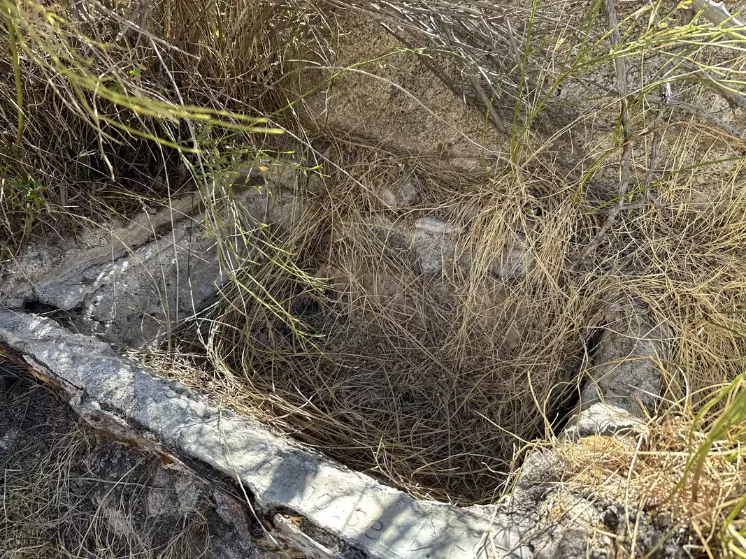
Rocko1Posts: 617
|
dsefcik wrote:
forum members wrote:
Darn. Was hoping it had something. Any chance up the drainage might have a trickle?
Daren would be able to help you with that. Here's a pic taken by Yokes 11/2024 at Barrel Spring. Gary says the pipe from the spring is probably plugged and needs cleaning but again, ask Daren.
It is always possible, it has happened at other springs. The village site is another close possibility but never reliable. You need to go prepared for no water and explore, you just never know.
Will do. Thanks Daren,
|
|
|
1/29/2025
Topic:
Agua Alta overnight
dsefcikAdministrator Posts: 2634
|
forum members wrote:
Darn. Was hoping it had something. Any chance up the drainage might have a trickle?
Daren would be able to help you with that. Here's a pic taken by Yokes 11/2024 at Barrel Spring. Gary says the pipe from the spring is probably plugged and needs cleaning but again, ask Daren.
It is always possible, it has happened at other springs. The village site is another close possibility but never reliable. You need to go prepared for no water and explore, you just never know.
|
|
|
1/29/2025
Topic:
Dolomite Desert Terraces
dtoujoursPosts: 35
|
The Viejas Band of the Kumeyaay mentions stone terraces on their website:
https://viejasbandofkumeyaay.org/viejas-community/kumeyaay-history/kumeyaay-sense-of-the-land/
Of course, that piece of cloth in one of your photos seems more modern.
edited by dtoujours on 1/29/2025
|
|
|
1/29/2025
Topic:
Dolomite Desert Terraces
dtoujoursPosts: 35
|
I'm leaning more toward your desert agriculture theory now. Do you know if there are/were any springs in the area? I'd say this was probably in Kumeyaay territory more than Cahuilla territory, and both were of course mainly hunter gatherers, but it seems they may have used some terraced agriculture, as well, especially the Kumeyaay. Do you think the terraces could have been that old? Here's what ChatGPT has to say:
Cahuilla Agriculture
The Cahuilla lived in the inland deserts and mountains of Southern California, where water was scarce. While they primarily relied on hunting, gathering, and seasonal movement, they also cultivated crops in certain areas. They are known to have grown corn, beans, squash, and melons using irrigation techniques in places where water was available, such as near springs and streams. Some researchers suggest that they may have used rock terraces to help control erosion and retain moisture in hilly areas.
Kumeyaay AgricultureThe Kumeyaay, who lived in the coastal, desert, and mountain regions of present-day Southern California and northern Baja California, are better documented as practicing terrace farming. They built rock terraces along hillsides to prevent soil erosion and capture rainfall for acorn orchards, agave, and other native plants. Additionally, they cultivated tepary beans, maize, and squash in more suitable areas. They also pruned and managed wild plants to encourage better growth, a practice sometimes called "proto-agriculture."
So while neither group was strictly an agricultural society like the Pueblo peoples to the east, they both engaged in forms of intentional cultivation and land management, including terrace farming in certain locations.
|
|
|
1/28/2025
Topic:
Agua Alta overnight
Rocko1Posts: 617
|
tommy750 wrote:
Rocko1 wrote:
tommy750 wrote:
Rocko1 wrote:
Tommy was the second dry spring barrel?
Yes, it was Barrel.
Darn. Was hoping it had something. Any chance up the drainage might have a trickle?
Daren would be able to help you with that. Here's a pic taken by Yokes 11/2024 at Barrel Spring. Gary says the pipe from the spring is probably plugged and needs cleaning but again, ask Daren.
 20241128_134556 by tomteske, on Flickr 20241128_134556 by tomteske, on Flickr
Thanks Tommy, that is bone dry!
|
|
|
1/28/2025
Topic:
Agua Alta overnight
tommy750Posts: 1071
|
Rocko1 wrote:
tommy750 wrote:
Rocko1 wrote:
Tommy was the second dry spring barrel?
Yes, it was Barrel.
Darn. Was hoping it had something. Any chance up the drainage might have a trickle?
Daren would be able to help you with that. Here's a pic taken by Yokes 11/2024 at Barrel Spring. Gary says the pipe from the spring is probably plugged and needs cleaning but again, ask Daren.
20241128_134556 by tomteske, on Flickr
|
|
|
1/28/2025
Topic:
Dolomite Desert Terraces
tommy750Posts: 1071
|
dtoujours wrote:
These are good theories.
I wondered if it was related to slope stabilization or gravel collection. It reminds me of the Topock Maze a little bit, but there are certainly differences and this doesn't seem like a cultural site.
There's a lot of internet info on desert farming/permaculture using various techniques including swales, gabions and terraces. All the locations I see utilizing these seem to have a lot more water than the Colorado Desert but who knows.
 microclimates by tomteske, on Flickr microclimates by tomteske, on Flickr
Pic is from: https://permaculturepractice.com/arid-climate-permaculture/
|
|
|
1/27/2025
Topic:
Dolomite Desert Terraces
dtoujoursPosts: 35
|
These are good theories.
I wondered if it was related to slope stabilization or gravel collection. It reminds me of the Topock Maze a little bit, but there are certainly differences and this doesn't seem like a cultural site.
|
|
|
1/27/2025
Topic:
Desert Kit Fox Trailcam Footage
dtoujoursPosts: 35
|
That's some really great footage! I think the fox you caught is also a kit fox. It looks like you have a good quality camera. I went the cheap route in case they were stolen. I was at the Blue Spring guzzler recently and the state locked trail cam is still there.
|
|
|
1/27/2025
Topic:
Agua Alta overnight
Rocko1Posts: 617
|
tommy750 wrote:
Rocko1 wrote:
Tommy was the second dry spring barrel?
Yes, it was Barrel.
Darn. Was hoping it had something. Any chance up the drainage might have a trickle?
|
|
|
1/27/2025
Topic:
Agua Alta overnight
tommy750Posts: 1071
|
Rocko1 wrote:
Tommy was the second dry spring barrel?
Yes, it was Barrel.
|
|
|
1/27/2025
Topic:
Agua Alta overnight
Rocko1Posts: 617
|
tommy750 wrote:
Looks like a great trip, Brian. Disappointed to hear Agua Alta was not flowing well. Have been thinking about a loop using that spring and was assuming the flow would be good based on this video showing the spring completely rehabbed compared to the one time I visited years ago. Check it out at 1:29 https://www.youtube.com/watch?v=wZlVN5xiFHI&t=89s Rockhopper also said it was flowing well in the recent past. Guess the Santa Rosas are pretty dry right now. Was in Rockhouse Canyon with Gary and Yoks a month ago and two of the three springs out there were dry (Cowboy was a wet spot but we located good flow about 40 feet uphill so actually 1 spring dry). Gary said for the past thirty years he's been hiking RHC, all three water sources were a sure thing. Not this year.
Am thinking the vehicles may have been stolen and got stripped out out there.
Tommy was the second dry spring barrel?
|
|
|
1/27/2025
Topic:
Dolomite Desert Terraces
AndyPosts: 13
|
Wow, that is very strange. First thought is it looks like an ancient shoreline and/or fish traps of some kind. But I agree it looks more recent. Interesting and would love to hear others theories.
|
|
|
1/27/2025
Topic:
Dolomite Desert Terraces
tommy750Posts: 1071
|
Found this on GE a while back and just couldn't convince myself it was natural so I went out and took a peek. You guys ever seen this before? Was present at least on 2014 GE imaging and I suspect it's at least decades old. My guess is hippies doing some sort desert farming experiment. Don't think it's a cultural site. Just seems like a weird endeavor at this location yards from S2.
 Terraces 2 by tomteske, on Flickr Terraces 2 by tomteske, on Flickr
 IMG_0022 (1) by tomteske, on Flickr IMG_0022 (1) by tomteske, on Flickr
 IMG_0024 (1) by tomteske, on Flickr IMG_0024 (1) by tomteske, on Flickr
 IMG_0015 by tomteske, on Flickr IMG_0015 by tomteske, on Flickr
 IMG_0013 by tomteske, on Flickr IMG_0013 by tomteske, on Flickr
 IMG_0020 by tomteske, on Flickr IMG_0020 by tomteske, on Flickr
|
|
|
1/27/2025
Topic:
Agua Alta overnight
tekewinPosts: 386
|
Thanks, everyone, for the tips on getting unstuck. I'll think it over.
|
|
|
1/27/2025
Topic:
Agua Alta overnight
surfpontoAdministrator Posts: 1369
|
We carry traction boards but have never used them. Some guy on YouTube was saying if traction boards helped you get unstuck then you weren't really stuck. Not sure about that one
We usually air down to 20 - 22.
Better traction and makes the washboard sections a little easier to deal with.
|
|
|
1/27/2025
Topic:
Agua Alta overnight
dsefcikAdministrator Posts: 2634
|
I have never had to use it but always figured I could use the full 8' long thick rubber truck bed liner.
|
|
|
1/26/2025
Topic:
Agua Alta overnight
BrianPosts: 251
|
I've heard of floormats working, but I've also heard of (and experienced) having the tire simply bury the thing you're using for traction if the sand is soft and deep. Traction boards are substantial enough to avoid that. But I'd say one of the more helpful things you can do in sand is to air down the tires. I usually go to 20 PSI but I've heard of people going as low as 10. At some point you have to worry about the tire bead separating from the rim. I've never had a problem at 20. To do this you should carry an air pump to bring them back up before driving on asphalt.
|
|
|
1/26/2025
Topic:
Desert Kit Fox Trailcam Footage
tekewinPosts: 386
|
Nice! Lots of animals come out at night.
I used to put out trail cams, but had all but one stolen. The desert is probably a safer place than more populated areas.
I got a ringtail and a cougar at the Blue Spring guzzler. The state also had a locked trail cam set up there, but that was 5 years ago.
|
|
|
1/26/2025
Topic:
Hiker shot by Mexican Cartel in Jacumba Wilderness
tekewinPosts: 386
|
I am shocked this happened. I hope the hikers recover quickly.
I've also hiked Blue Angels and visited the monument just over the border. I liked the area and there were a couple of border patrol trucks that passed me on the road, but did not engage me. I thought about going back to the area, but not now.
Do the cartels really want a hot war with US forces? How does that help their situation?
|
|
|
1/26/2025
Topic:
Agua Alta overnight
tekewinPosts: 386
|
dtoujours wrote:
I got stuck when my front passenger tire made it over a rock step but the back tire didn't. When the back tire stopped, the front tire dug into the sand, preventing me from backing up. I jacked the car up and put a traction board under both passenger side tires, which allowed me to back off. Besides the traction boards, the only extra piece of gear I used was a small square of aluminum plate that I carry to put under the jack in soft sand.
Looks like a fun trip. Thanks for the photos.
Speaking of getting stuck. I haven't faced that situation yet. I was thinking if it was just sand, I could use my Weathertech all season floor mats for traction. They are pretty thick rubber, Do you think that would work, or should I carry a traction board in the desert?
|
|
|
1/25/2025
Topic:
Hiker shot by Mexican Cartel in Jacumba Wilderness
dtoujoursPosts: 35
|
I hope your friend recovers quickly, Brian. This is a real shame, I've also hiked a lot in that area without any problems. However, a few months ago a friend and I hiked Davies Valley into Pinto Canyon and as we were heading back, near the mouth of Pinto Canyon or at the south end of Davies Valley, we saw a guy slipping between the gap where the border wall ends and the mountainside begins. He saw us as he was in the gap and just froze there, so we continued our hike out. Two border patrol vans flew past us as we were hiking up Davies Valley, so he must have tripped a sensor or camera.
|
|
|
1/25/2025
Topic:
Hiker shot by Mexican Cartel in Jacumba Wilderness
tommy750Posts: 1071
|
That's too bad this happened in such a beautiful location. Always found the Jacumba Wilderness to be serene and a pleasure to hike. Hope your friends make a full recovery, Brian.
|
|
|
1/25/2025
Topic:
Hiker shot by Mexican Cartel in Jacumba Wilderness
BrianPosts: 251
|
surfponto wrote:
Sorry to hear that and hope they recover OK.
Have not hiked over there. Looks beautiful, but sounds a little bit like the Wild West.
Brian wrote:
The hikers who were shot were friends of friends of mine. Apparently their destination was Blue Angels Peak. Most people who hike that peak also visit the border monument close to there, so I'm guessing it was in that area. News reports say they were only 1000' N of the border, so that's how the assailants were able to escape back to Mexico so quickly.
I've hiked many time in Valley of the Moon, Myer Valley and last year I even did Pinto Canyon. Never had a problem in any of them. There's usually a heavy border patrol presence, both in person and by way of remote cameras and sensors. I think the problem in this case is that the incident occurred so close to the border that the assailants were able to cross back into Mexico before BP could get there.
|
|
|
1/25/2025
Topic:
Hiker shot by Mexican Cartel in Jacumba Wilderness
surfpontoAdministrator Posts: 1369
|
Sorry to hear that and hope they recover OK.
Have not hiked over there. Looks beautiful, but sounds a little bit like the Wild West.
Brian wrote:
The hikers who were shot were friends of friends of mine. Apparently their destination was Blue Angels Peak. Most people who hike that peak also visit the border monument close to there, so I'm guessing it was in that area. News reports say they were only 1000' N of the border, so that's how the assailants were able to escape back to Mexico so quickly.
|
|
|
1/24/2025
Topic:
Hiker shot by Mexican Cartel in Jacumba Wilderness
BufordPosts: 467
|
That sucks. Hope your friends are ok.
I’ve done Blue Angel and walked to the border marker. Saw lots of evidence of people, but didn’t see anyone. I was at least expecting BP to check on us. I think I hiked it in summer though.
Lots of wrecked, stripped, and shot up vehicles in the area. Glad to come back to mine in one piece.
|
|
|
1/24/2025
Topic:
Hiker shot by Mexican Cartel in Jacumba Wilderness
BrianPosts: 251
|
The hikers who were shot were friends of friends of mine. Apparently their destination was Blue Angels Peak. Most people who hike that peak also visit the border monument close to there, so I'm guessing it was in that area. News reports say they were only 1000' N of the border, so that's how the assailants were able to escape back to Mexico so quickly.
|
|
|
1/24/2025
Topic:
Hiker shot by Mexican Cartel in Jacumba Wilderness
dsefcikAdministrator Posts: 2634
|
I saw the Fox5 news this morning but it really does't have much details.
|
|
|
1/24/2025
Topic:
Hiker shot by Mexican Cartel in Jacumba Wilderness
surfpontoAdministrator Posts: 1369
|
Wow did you guys read this? 
Read it was near Valley of the Moon
https://www.cbp.gov/newsroom/local-media-release/american-citizen-shot-jacumba-wilderness-north-us-mexico-border
https://fox5sandiego.com/news/border-report/american-hikers-come-under-cartel-fire-near-border/
edited by surfponto on 1/24/2025
|
|
|
1/17/2025
Topic:
Carrizo Creek Badlands
BritainPosts: 610
|
tommy750 wrote:
Nice you could get out Britain and being able to hike after New Year's Eve is a good thing!
Best of all when you get back to your rig...its still there!
|
|
|
1/9/2025
Topic:
Desert Kit Fox Trailcam Footage
dsefcikAdministrator Posts: 2634
|
I like the kit foxes, We had one come up to our camp on egg Mtn once. I will have to try and find the bunny video.
|
|
|
1/8/2025
Topic:
Desert Kit Fox Trailcam Footage
tommy750Posts: 1071
|
Nice footage, Dtoujours! I'm like Rocko1, tried it a few times and didn't get much. Daren, if you see this, you should post your 800 Bunnies! trailcam pics from the round trough up in Potrero. Definitely will make everyone smile.
|
|
|