|
Britain Posts: 610
3/1/2017
|
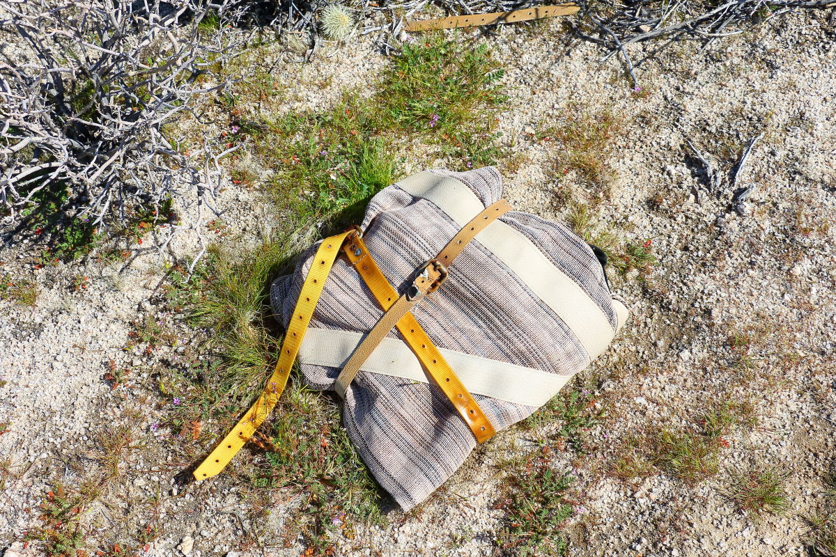
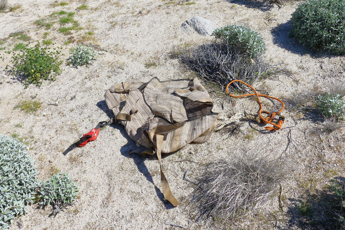
Was out hiking about found 2 survey markers. They were about 100ft apart. Matched up to the San Diego - Imperial County border. Was a good day to hike. Only 5 miles . I've been hiking this area for about 5 years on and off. Some Big Horn , Deer no Indian artifacts. Perhaps some good quartz here and there. Found a tool bag when they put in the Sunrise power lines. Must of fell out of a copter.
Great weather.
Bridge near Mountain Springs

Looking off toward Table Mountain

Single Survey marker.

Both survey markers

Tool Package. Lots of heavy buckles and stuff once un-wrapped.
edited by Britain on 3/1/2017
--
Cant drive 55
Britain
http://icorva.com
|
|
|
link
|
|
ziphius Posts: 911
3/1/2017
|
That's pretty cool, stumbling across the markers on the county line. Is that just north of Devil's Canyon?
--
http://www.coyotelearning.org
|
|
|
link
|
|
dsefcik Administrator Posts: 2634
3/2/2017
|
What was in the tool bag? That looks more like a crossers home made backpack, what is that an old bicycle toe strap and some plastic plumbers strap?
--
http://www.sefcik.com
http://www.darensefcik.com
http://www.carrizogorge.com
|
|
|
link
|
|
rockhopper Posts: 678
3/2/2017
|
The pack looks migrant made. Anything inside?
I believe those double survey bench marks might be at a Section or Range, to account for the curvature of the earth. I need to go back and look at my old survey books or others please chime in.
|
|
|
link
|
|
Britain Posts: 610
3/2/2017
|
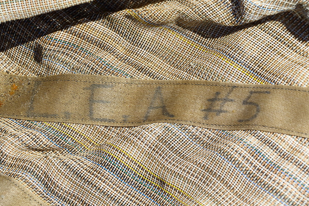
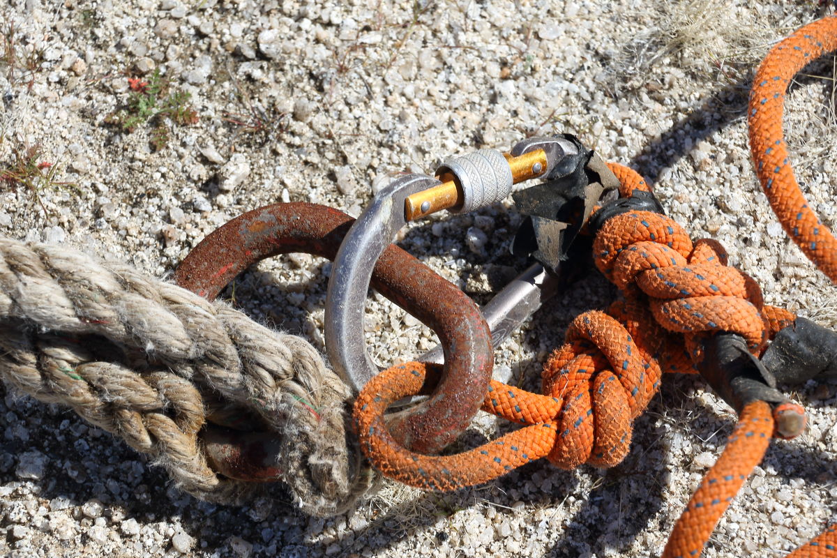
Survey markers are north of Devils Canyon. The pack once opened was full of heavy buckles. There was also some high end knotting of the ropes.
I think it was used on the Sunrise power link. Fell out of a copter perhaps.
--
Cant drive 55
Britain
http://icorva.com
|
|
|
link
|
|
Britain Posts: 610
3/2/2017
|
The survey markers are about 1 mile north west of the bridge by Mountain springs.
--
Cant drive 55
Britain
http://icorva.com
|
|
|
link
|
|
tommy750 Posts: 1086
3/2/2017
|
rockhopper wrote:
I believe those double survey bench marks might be at a Section or Range, to account for the curvature of the earth. I need to go back and look at my old survey books or others please chime in.
Those are Public Land Survey System markers and they are designed to mark property boundaries. You'll find them at the four corners of every section you see on your topo map. Occasionally, you'll see them marking just the linear boundary of a section like the one pictured here. Assuming it was found along a boundary of section 18 west of the I-8 island. The GLO became the BLM post WWII so the newer ones should have BLM on them. These are different than Geodetic markers like the nearby Jacumba, Windy, Gasp etc which mark a specific vertical and horizontal spot on the earth's surface.
|
|
|
link
|
|
Britain Posts: 610
3/3/2017
|
tommy750 wrote:
rockhopper wrote:
I believe those double survey bench marks might be at a Section or Range, to account for the curvature of the earth. I need to go back and look at my old survey books or others please chime in.
Those are Public Land Survey System markers and they are designed to mark property boundaries. You'll find them at the four corners of every section you see on your topo map. Occasionally, you'll see them marking just the linear boundary of a section like the one pictured here. Assuming it was found along a boundary of section 18 west of the I-8 island. The GLO became the BLM post WWII so the newer ones should have BLM on them. These are different than Geodetic markers like the nearby Jacumba, Windy, Gasp etc which mark a specific vertical and horizontal spot on the earth's surface.
Thanks good information to know.
--
Cant drive 55
Britain
http://icorva.com
|
|
|
link
|
|
rockhopper Posts: 678
3/3/2017
|
I just noticed the Section 18 on the marker. So it is an alignment marker along a straight line of Section 18. Why two markers so close? 100 feet apart. I last surveyed about 35 years ago. We always set or next marker at the furthest distance possible. Tommy750 may know.
|
|
|
link
|
|
tommy750 Posts: 1086
3/3/2017
|
rockhopper wrote:
I just noticed the Section 18 on the marker. So it is an alignment marker along a straight line of Section 18. Why two markers so close? 100 feet apart. I last surveyed about 35 years ago. We always set or next marker at the furthest distance possible. Tommy750 may know.
Late one Friday afternoon in 1924: "Hey Billy Bob, weren't you supposed to put this section marker way over on the far side of 18?" The end. 
|
|
|
link
|
|
Britain Posts: 610
3/3/2017
|
Marker #2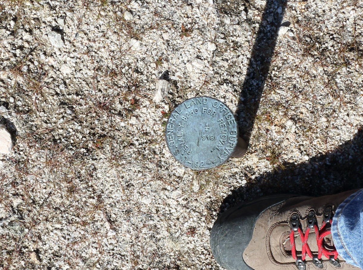
--
Cant drive 55
Britain
http://icorva.com
|
|
|
link
|
|
tommy750 Posts: 1086
3/3/2017
|
So that's a quarter section marker. The sections are supposed to be one square mile or 640 acres. When divided, it should be 4 sections of 160 acres or 16 quarter-quarter sections of 40 acres. Section 18 is a funky shape presumably because it's next to a county line and has 8 q-q sections and 4 slivers with only 362 acres. Here's a screen grab off GE with an overlay you can download temporarily from earthpoint.us or permanently if you pay. I find this quite fascinating in the GPS age and can't imagine the amount of craziness it took to put that one marker in that spot nearly 100 years ago.
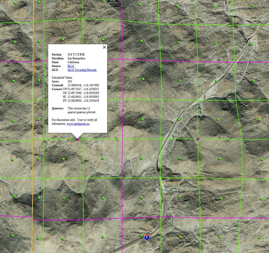 Section 18 by tomteske, on Flickr Section 18 by tomteske, on Flickr
|
|
|
link
|
|
Britain Posts: 610
3/3/2017
|
Marker .gpx locations..
http://icorva.com/Photography/7D2C/SURVEY.gpx
http://icorva.com/Photography/7D2C/SURVEY2.gpx
edited by Britain on 3/3/2017
edited by Britain on 3/3/2017
--
Cant drive 55
Britain
http://icorva.com
|
|
|
link
|