Talk about a trip you took out to Anza Borrego
Sombrero Peak via McCain Valley
|
dsefcik Administrator Posts: 2634
6/19/2010
|
I hiked out with a friend of mine on 6-12-2010 to Sombrero Peak via McCain Valley. It was a great hike, perfect weather and not a soul in sight. I really liked this trip as it saved a few hours of driving by starting in McCain valley instead of dropping down into the desert floor. We camped out overnight and explored the Sawtooth Mtn range the following day. A complete report can be read on my website with more pictures.
http://www.sefcik.com/2010/06/sombrero-peak-via-mccain-valley-hike.html
The trip from Google Earth

An interesting rock face along the trail

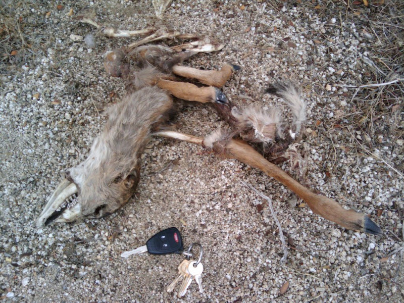
Young deer we found at the bottom of peak 4553

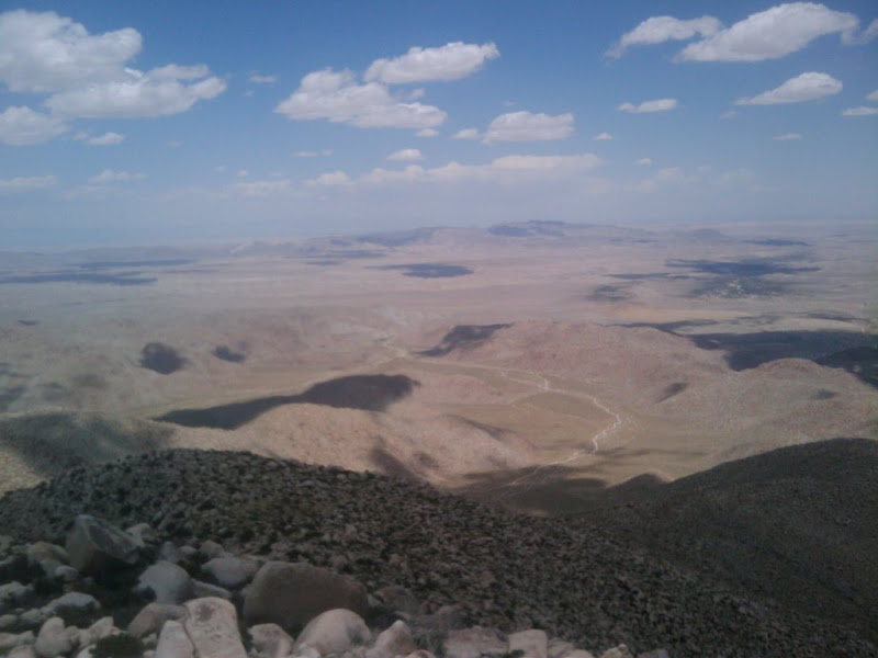
View of Anza Borrego from the top of Sombrero Peak

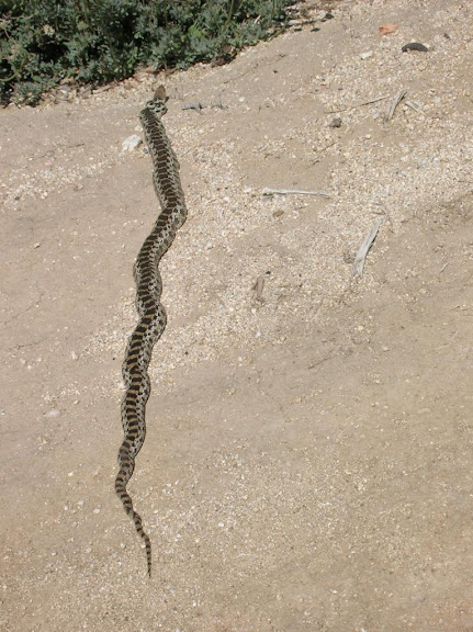
Anybody know what kind of snake this is? California glossy snake??

Daren
edited by dsefcik on 6/19/2010
edited by dsefcik on 6/19/2010
edited by dsefcik on 9/28/2010
edited by dsefcik on 9/28/2010
<em>edited by dsefcik on 9/28/2010</em>
--
http://www.sefcik.com
http://www.darensefcik.com
http://www.carrizogorge.com
|
|
|
link
|
|
surfponto Administrator Posts: 1369
6/29/2010
|
Hey Daren,
What is the distance on that hike?
From the Google Earth shot it looks far :-)
Bob
dsefcik wrote:
I hiked out with a friend of mine on 6-12-2010 to Sombrero Peak via McCain Valley. It was a great hike, perfect weather and not a soul in sight. I really liked this trip as it saved a few hours of driving by starting in McCain valley instead of dropping down into the desert floor. We camped out overnight and explored the Sawtooth Mtn range the following day. A complete report can be read on my website with more pictures.
http://www.sefcik.com/index.php/2010/06/19/sombrero-peak-via-mccain-valley-hike/
The trip from Google Earth

An interesting rock face along the trail

Young deer we found at the bottom of peak 4553

View of Anza Borrego from the top of Sombrero Peak

Anybody know what kind of snake this is? California glossy snake??

Daren
edited by dsefcik on 6/19/2010
edited by dsefcik on 6/19/2010
--
https://www.anzaborrego.net/


|
|
|
link
|
|
dsefcik Administrator Posts: 2634
6/29/2010
|
I think the total was around 10-11 miles. I would consider it an easy hike, mostly sandy trail with some boulder climbing to get up to the peak but not much. It took us around 7 hours total and we explored around a bit, no hurry at all. All of the boulders out there are really cool!
surfponto wrote:
Hey Daren,
What is the distance on that hike?
From the Google Earth shot it looks far :-)
Bob
--
http://www.sefcik.com
http://www.darensefcik.com
http://www.carrizogorge.com
|
|
|
link
|
|
quidditian Posts: 46
7/24/2010
|
Beautiful pics! Love the second one of the laughing man rock. If you haven't yet identified what kind of snake that was, I vote for "Myocardial Infarction Snake"...he's definitely in the Soiled Panties family.
I wonder what demise the little deer met -- seems like a cat or coyote would've eaten more...and/or the vultures would've picked him clean. Maybe there wasn't enough meat to bother with on his little limbs...looks like they completely gobbled up the torso. Poop little guy.
Heading over to your blog for full report. I'm so used to facebook, I miss being able to hit the "like" button under pics.
|
|
|
link
|
|
chevell Posts: 4
10/16/2011
|
In case your still wondering what kind of snake that is.
It's a Gopher snake, most likely either Sonoran or a San Diego Gopher snake.
I've caught them a couple times out in McCains valley. Seems like I find snakes every time I am in McCains valley.
Old post I know, but I just had to say something.
http://www.californiaherps.com/snakes/pages/p.c.annectens.html
|
|
|
link
|
|
dsefcik Administrator Posts: 2634
10/16/2011
|
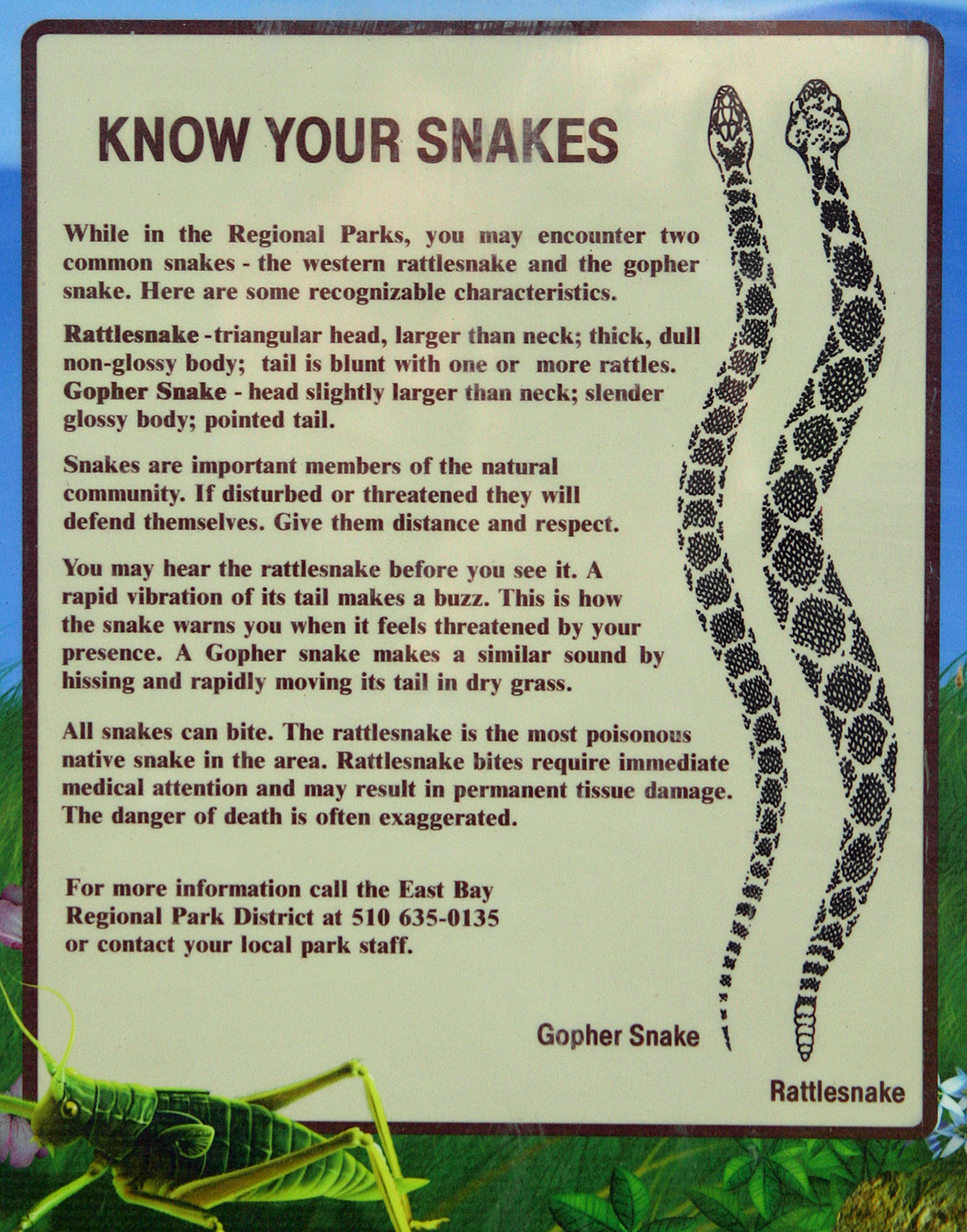
Thanks..I just couldn't find anything that was an exact match but this sign from the website you posted sure makes it hard unless you see the rattle or head....

--
http://www.sefcik.com
http://www.darensefcik.com
http://www.carrizogorge.com
|
|
|
link
|