|
tommy750 Posts: 1069
8/24/2016
|
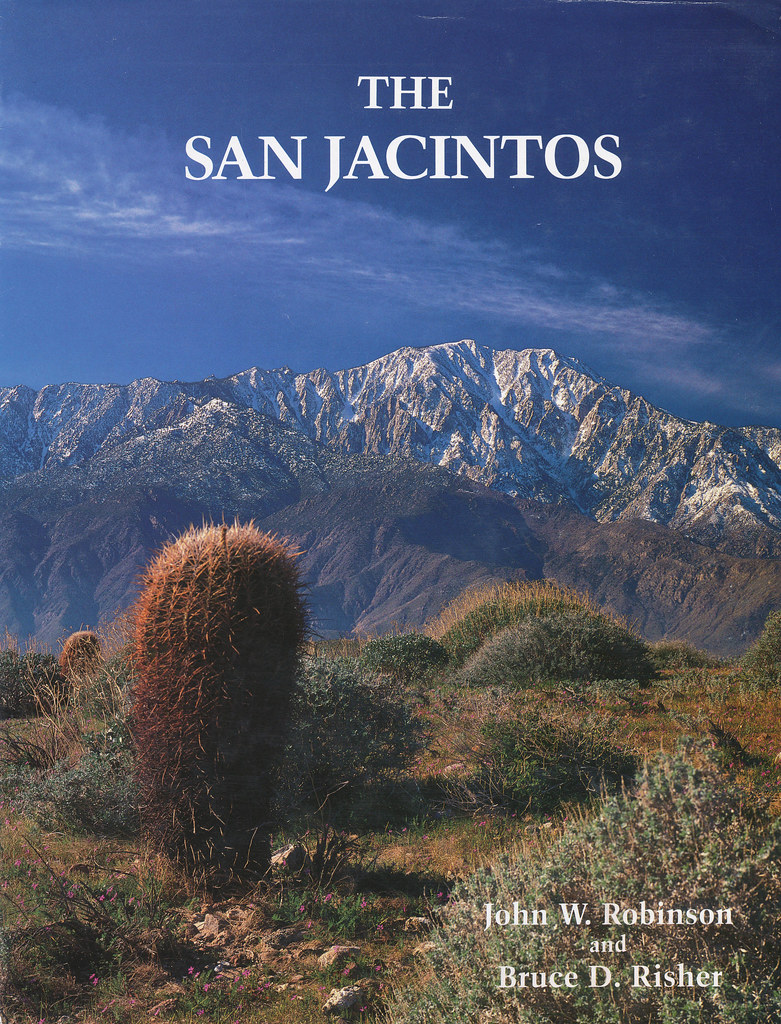
Was looking for a good way to put in some hiking and dodge the heat so I decided to head out to the Santa Rosas this past weekend for an overnight trip. Was curious about the dirt road that switch backed up the northern slopes toward Toro Pk. The road was built in the 1930's to access timber in the Santa Rosas. A mechanic from ND named Arthur Nightingale became interested in the Santa Rosas and bought land on top and built a cabin near Stump Spring. With the Palms to Pines Hwy under construction, he decided to purchase land at Pinyon Flats and sell lots. To furnish lumber for the new construction, he built the sawmill near the treeline. Little remains except a kiln and a nearby log splitter. A great resource for this area and the adjacent San Jacintos is "San Jacintos" by Robinson and Risher. The BW photos below are from this book:
 San Jacintos by tomteske, on Flickr San Jacintos by tomteske, on Flickr
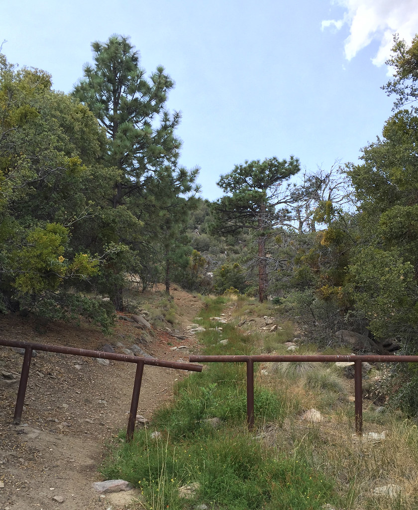
The Sawmill trail dirt road. It ends five miles up at the sawmill ruins where a trail continues to the top.
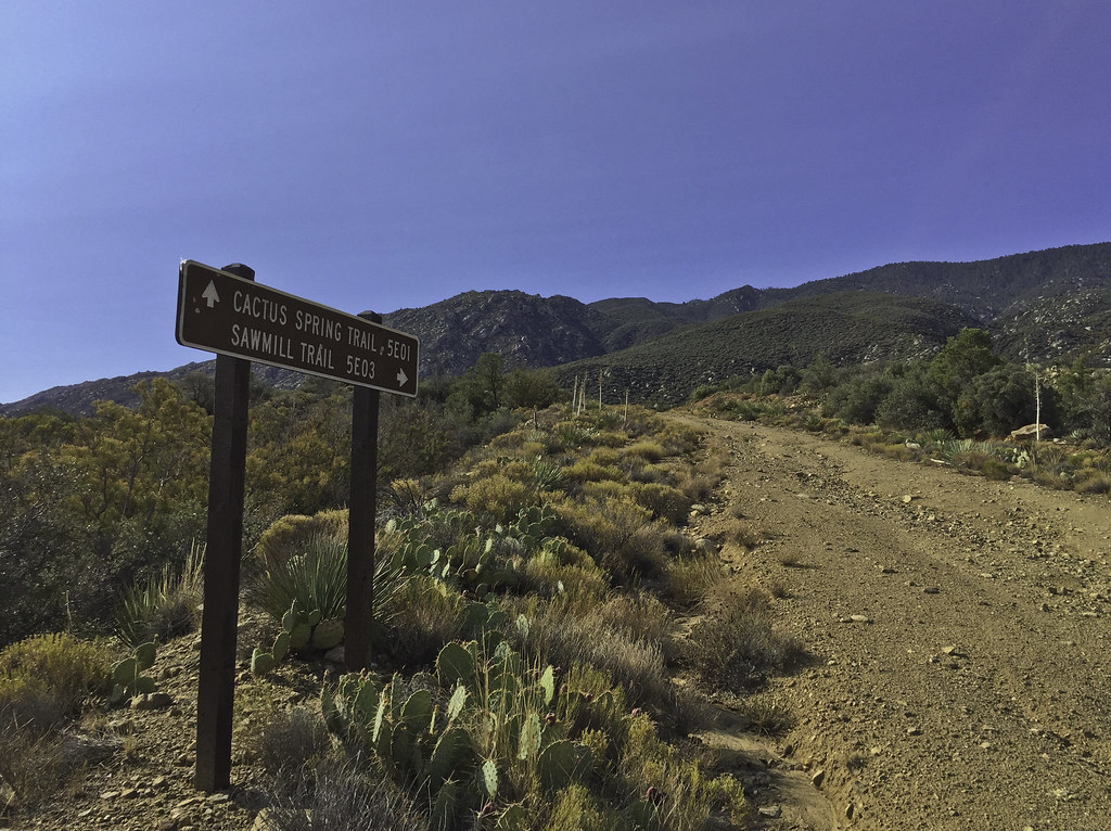 Sawmill Trail Sign by tomteske, on Flickr Sawmill Trail Sign by tomteske, on Flickr
 Sawmill Trail Sign2 by tomteske, on Flickr Sawmill Trail Sign2 by tomteske, on Flickr
Was a little disconcerting to note smoke coming from the west Santa Rosas when I started and almost thought of calling it in till I saw a spotter plane circling. Later from far up the road, watched a Huey land in the parking lot multiple times blasting my car with rotor wash. Not sandblasted when I got back luckily. Lots of aircraft overhead all day. Here's a water drop by a helo near the center of the screen. My iPhone doesn't have a zoom lens 
 Water Drop by tomteske, on Flickr Water Drop by tomteske, on Flickr
Arrived at the old sawmill ruins. The most notable structure is the old charcoal kiln.
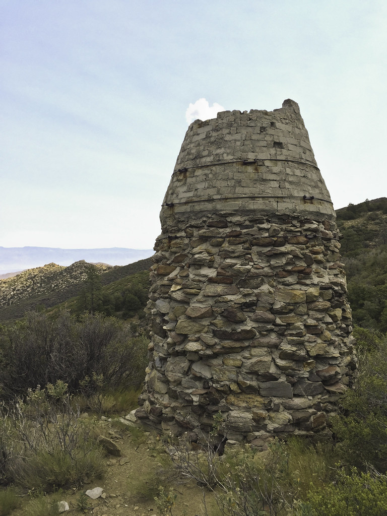 Kiln by tomteske, on Flickr Kiln by tomteske, on Flickr
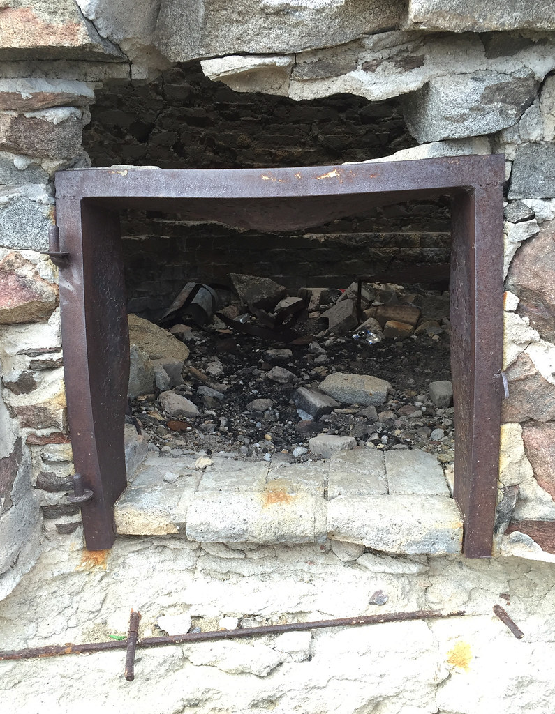 Kiln Door by tomteske, on Flickr Kiln Door by tomteske, on Flickr
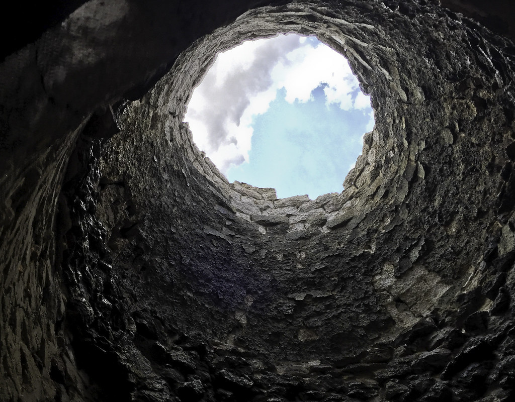 Kiln Clouds by tomteske, on Flickr Kiln Clouds by tomteske, on Flickr
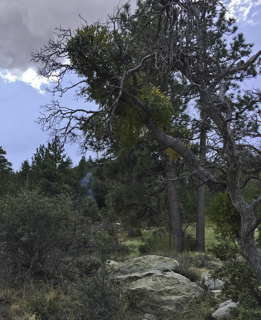
Was going to take a leisurely lunch and explore two springs to the west when I noted smoke coming out of the forest ahead.
 First Smoke by tomteske, on Flickr First Smoke by tomteske, on Flickr
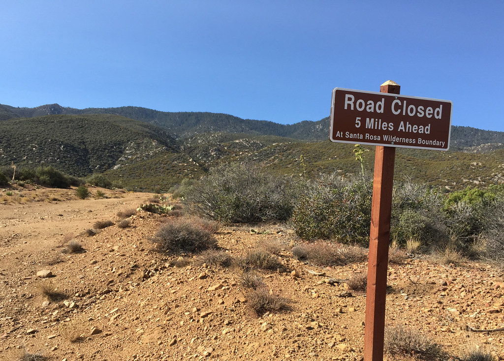
Had to head further up the road into the wilderness toward the smoke.
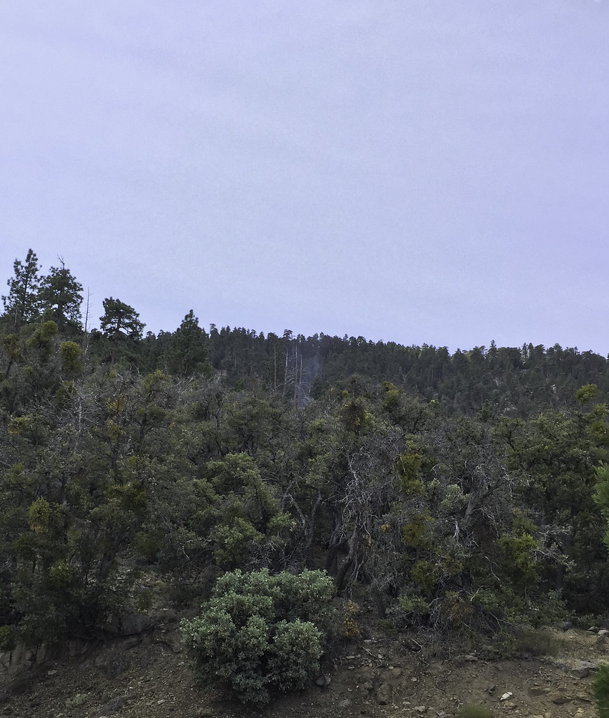
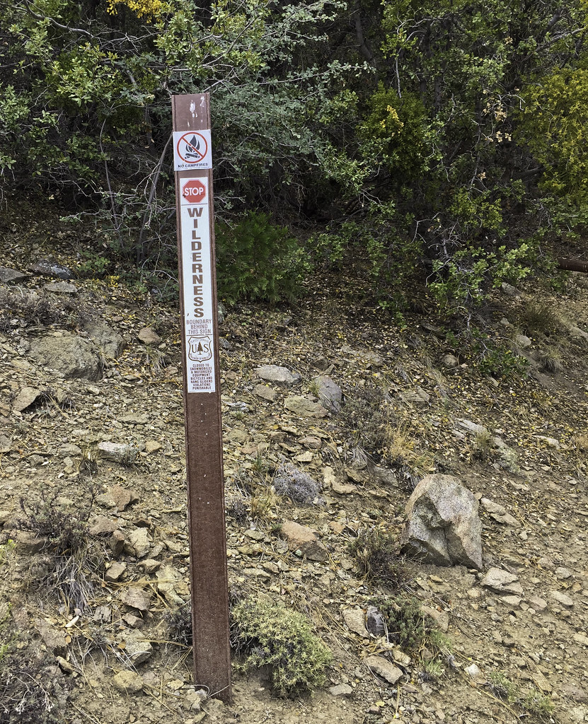 Wilderness by tomteske, on Flickr Wilderness by tomteske, on Flickr
 Sawmill Trail Barrier by tomteske, on Flickr Sawmill Trail Barrier by tomteske, on Flickr
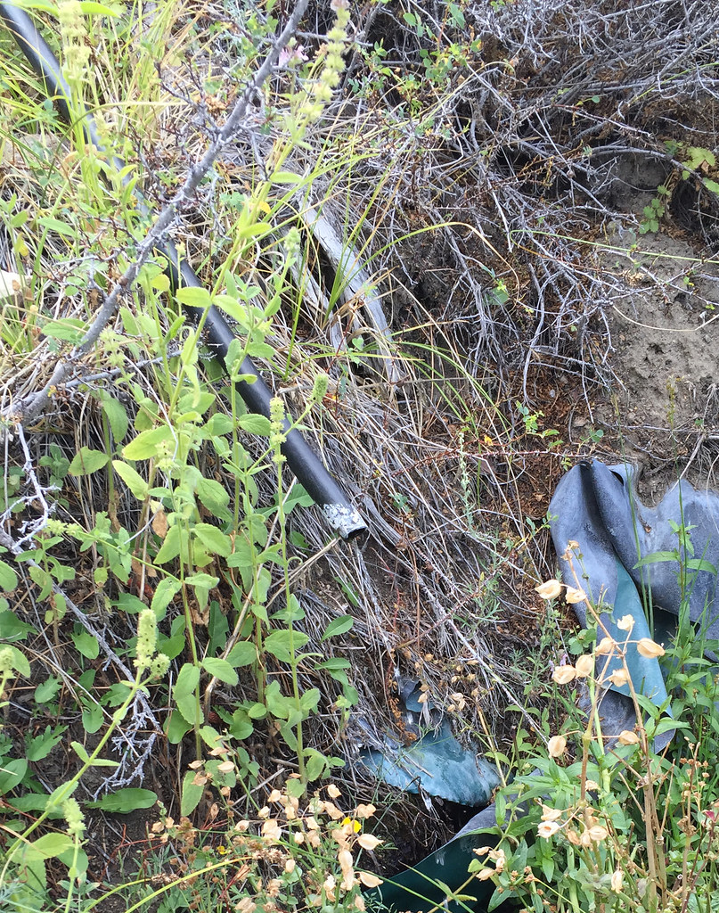
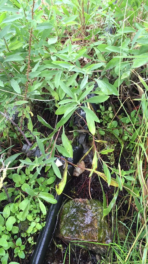
It was uphill from a meadow with an active spring and lots of plastic piping which started making me a speck nervous since informal farming operations are know to occur this time of year in the Santa Rosas. Gave a couple yells to make sure I wasn't interrupting anyone and ended up startling a deer and myself.
 First Smoke2 by tomteske, on Flickr First Smoke2 by tomteske, on Flickr
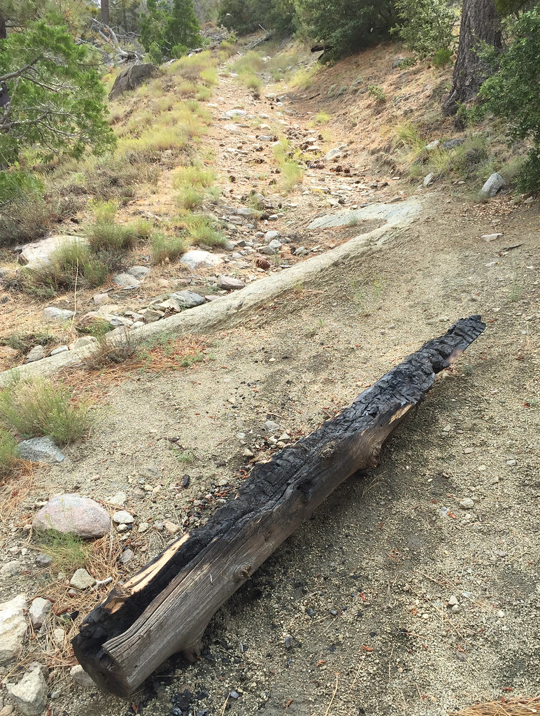
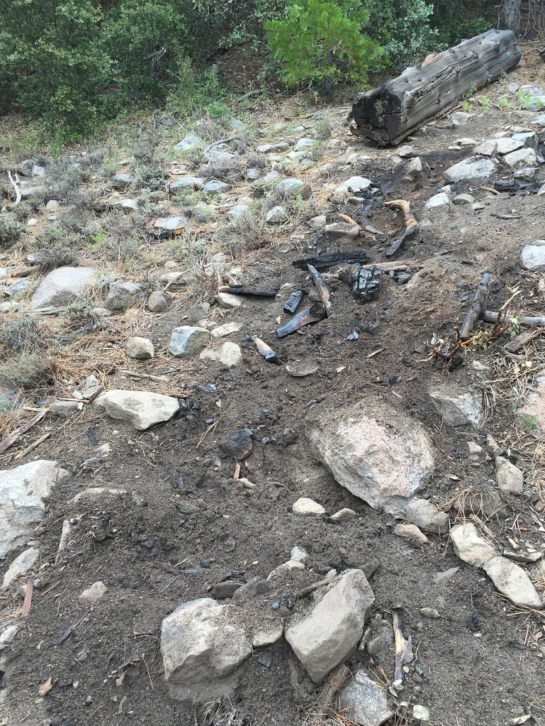
Ended up calling the fire in and got a call back from a BLM firefighter who said he would take care of it. Was a log on fire and this pic is after me stomping on the part in flames and dumping about 2L of my drinking water and another liter I got from the spring on top of it.
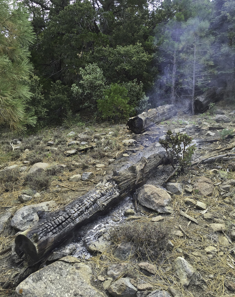 Lightning Log by tomteske, on Flickr Lightning Log by tomteske, on Flickr
Nearby, another burned out log.
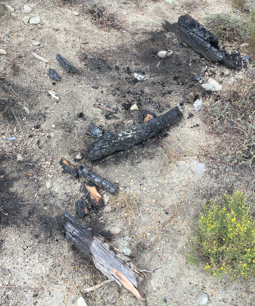 Lightning Strike by tomteske, on Flickr Lightning Strike by tomteske, on Flickr
The spring pipe had a trickle coming from it and the plastic lined basin below was in disrepair
 Sawmill Spring by tomteske, on Flickr Sawmill Spring by tomteske, on Flickr
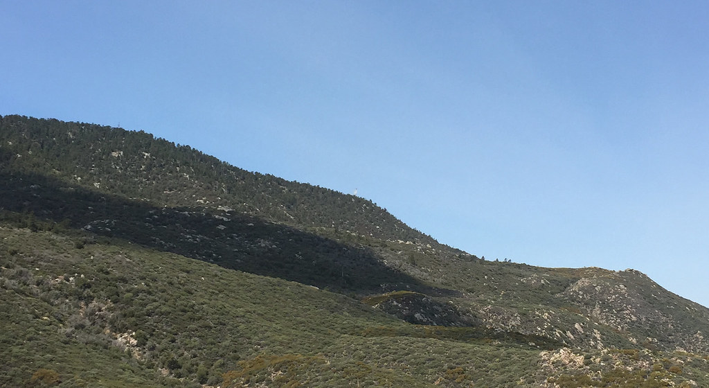
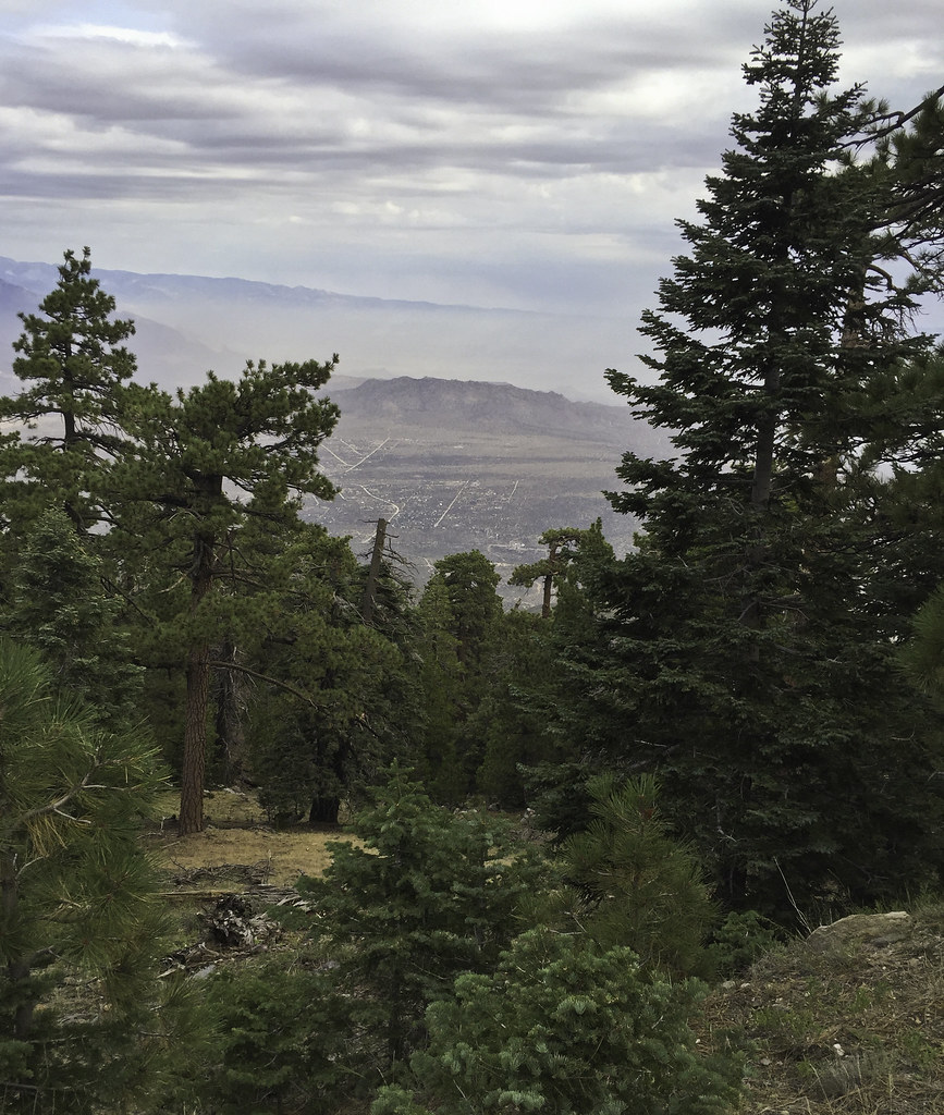
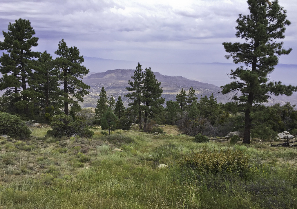
The smoldering log didn't seem to be a threat and when some other people showed up, I decided to head on up the dirt road that travels up to the Santa Rosas crest. The road to the sawmill is a nice gradual incline and fairly smooth, but after the sawmill, it's pretty rocky and a lot steeper. Here's a nice smooth section with a great view of San Jacinto.
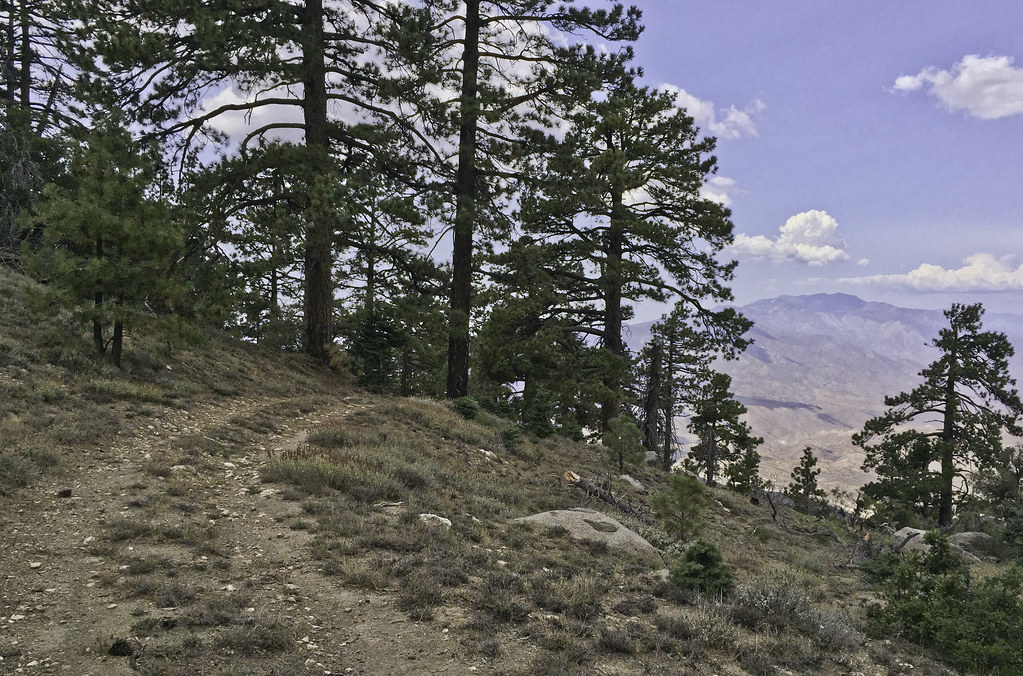 San Jacinto by tomteske, on Flickr San Jacinto by tomteske, on Flickr
Shortly thereafter, it started to lightly rain and was a nice way to finish the rest of the climb to the top. Now, pretty much out of water after losing some on the log fire, I headed the two miles straight toward Santa Rosa Spring, the one fairly sure thing water source up on top.
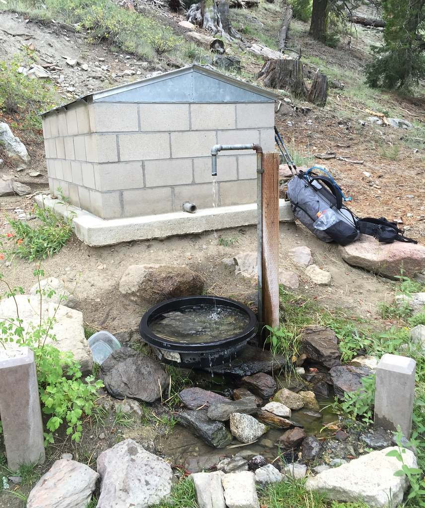 Santa Rosa Springs by tomteske, on Flickr Santa Rosa Springs by tomteske, on Flickr
Lots of fire prevention signage on the way. Place by Desert Steve Ragsdale in the 1940's after a fire, his cabin on top of Santa Rosa Mt unfortunately fell victim to what his poetry railed against.
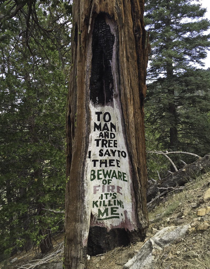 DSR Poetry by tomteske, on Flickr DSR Poetry by tomteske, on Flickr
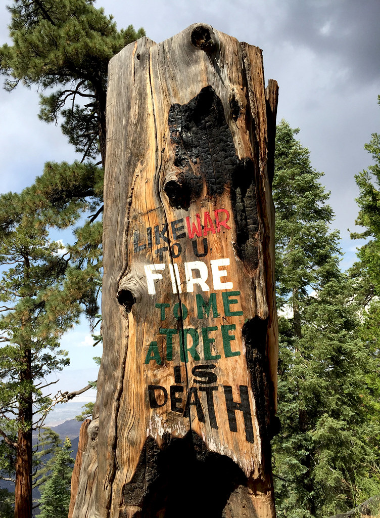 DSR Poetry2 by tomteske, on Flickr DSR Poetry2 by tomteske, on Flickr
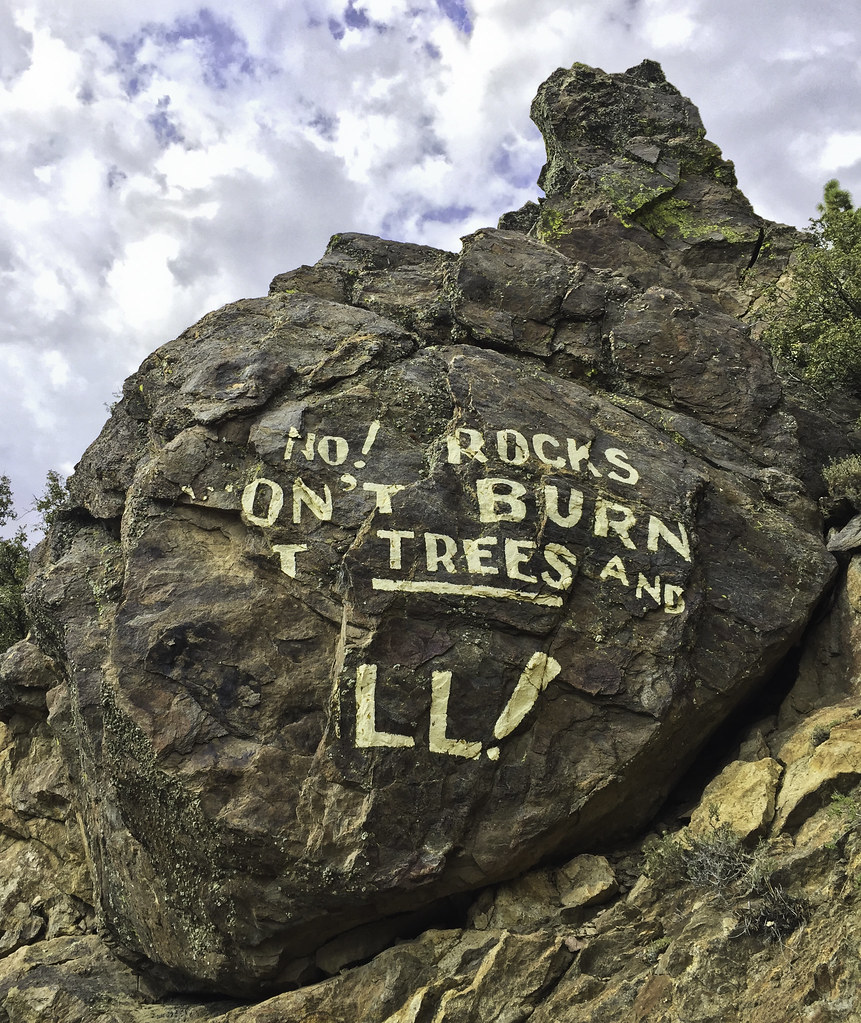 DSR Poetry3 by tomteske, on Flickr DSR Poetry3 by tomteske, on Flickr
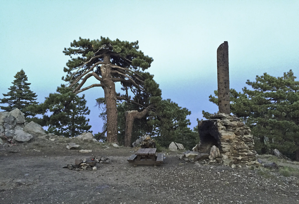
Wanted to spend the night somewhere near Santa Rosa Pk and after scouting out some nice view spots, got lazy and ended up with a sweet spot with level ground and a big picnic table. Guess everyone's serious about fire prevention up here 
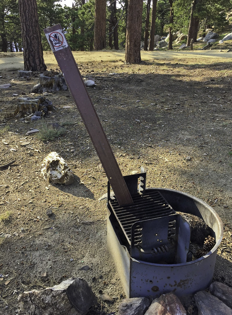 No Campfires by tomteske, on Flickr No Campfires by tomteske, on Flickr
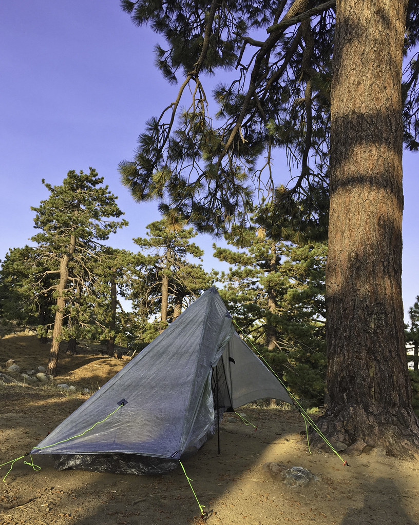 ZPack Altaplex by tomteske, on Flickr ZPack Altaplex by tomteske, on Flickr
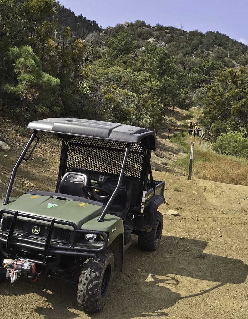
A few hundred feet up are the remains of Desert Steve Ragsdale's cabin. Nearby was parked a Civil Air Patrol vehicle bristling with antennas presumably helping out with the swarm of aircraft involved in fire suppression.
 Desert Steve Ragsdale Cabin Site by tomteske, on Flickr Desert Steve Ragsdale Cabin Site by tomteske, on Flickr
 Desert Steve Ragsdale Cabin by tomteske, on Flickr Desert Steve Ragsdale Cabin by tomteske, on Flickr
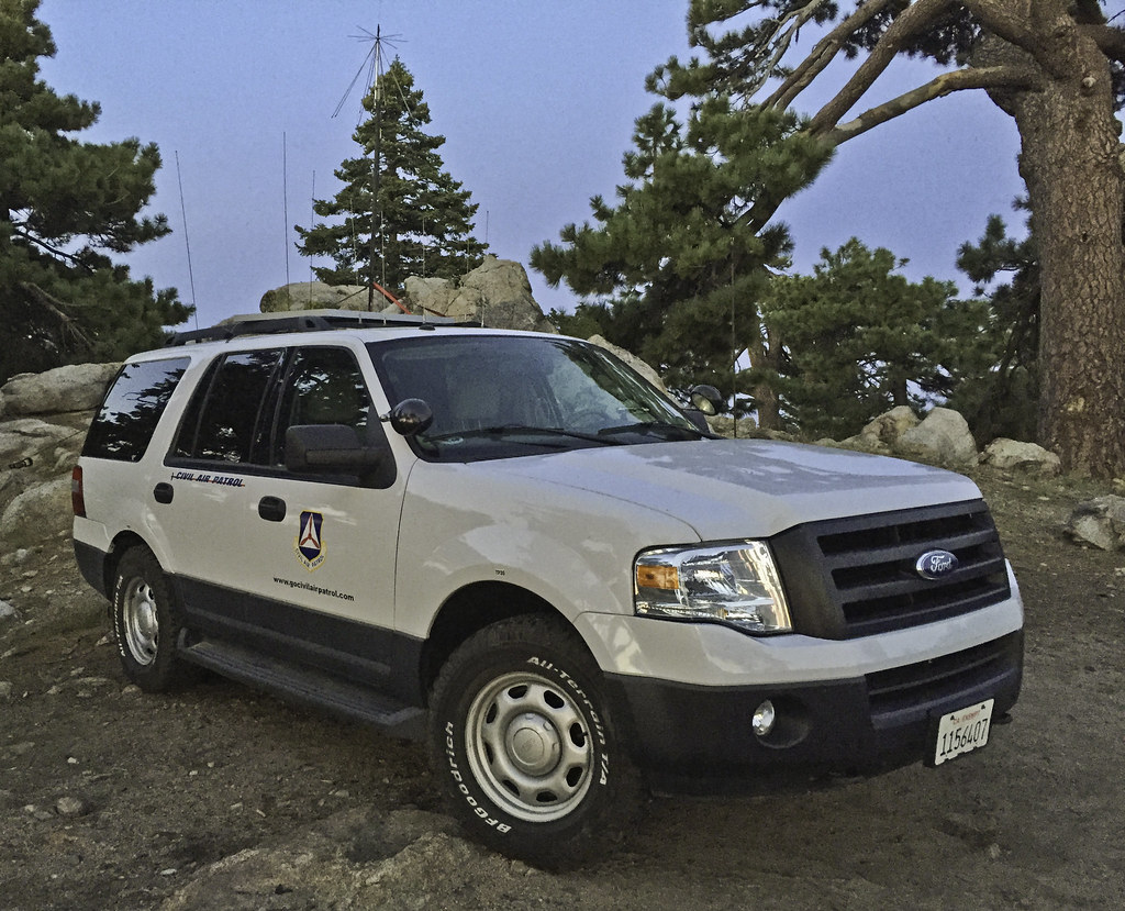 Santa Rosa CAP2 by tomteske, on Flickr Santa Rosa CAP2 by tomteske, on Flickr
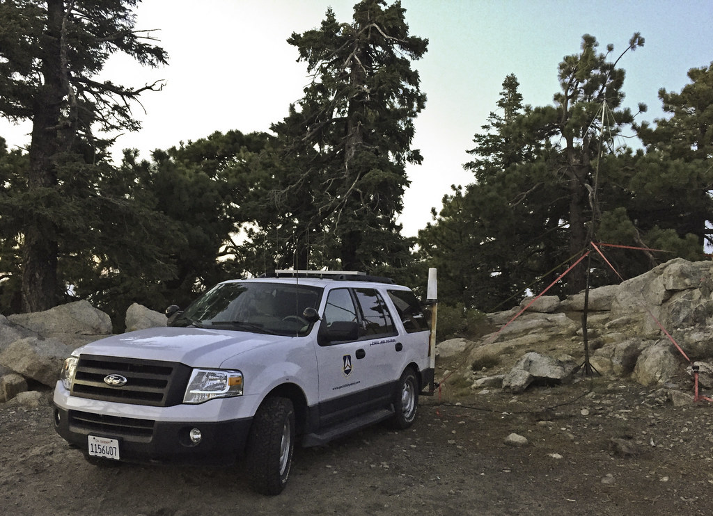 Santa Rosa CAP by tomteske, on Flickr Santa Rosa CAP by tomteske, on Flickr
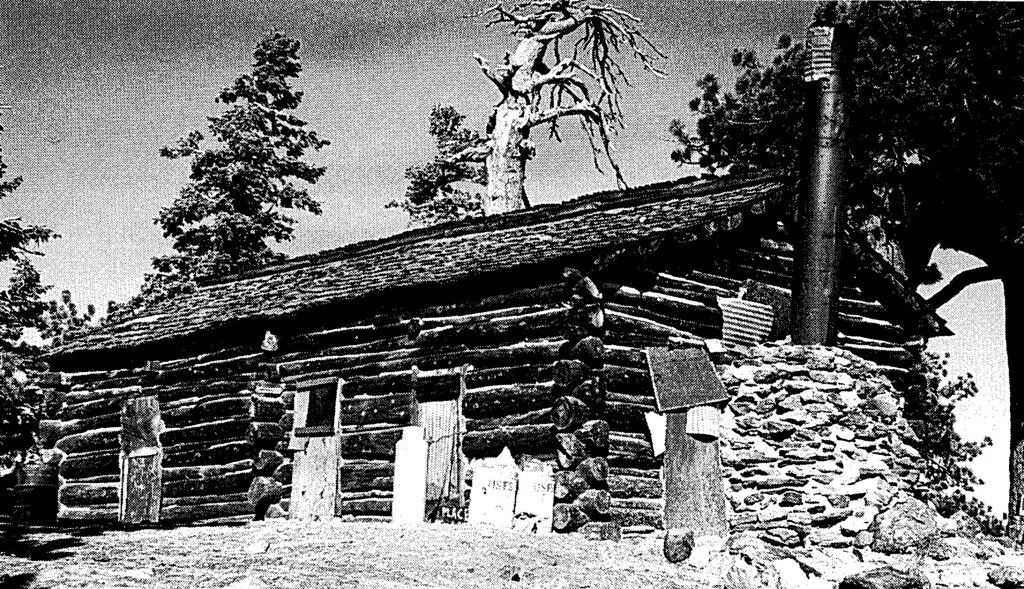
The next morning, headed out toward Stump Spring to see if I could see the old cabin nearby, the only other cabin on top of the Santa Rosas. However, it was fenced and signed and fresh tire tracks since yesterday's rain leading to it made me keep on hiking. A pic from yesteryear.
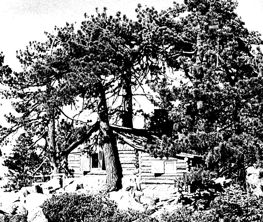 Stump Springs Cabin by tomteske, on Flickr Stump Springs Cabin by tomteske, on Flickr
Heading back down. Pinyon Flat and the parking lot far below.
 Pinyon Flats by tomteske, on Flickr Pinyon Flats by tomteske, on Flickr
Wanted to see if BLM actually showed up yesteday. Not sure why BLM was involved since it wasn't on BLM land but interagency cooperation I guess. The burning log was dragged a couple hundred feet out of the forest onto a road while the site was dug up and drenched. Shortly thereafter, bumped into the firefighters who were coming back to take a second look and make sure everything was okay. They said they had lots of fires in the Santa Rosas in the previous days secondary to multiple lightning strikes and this fire was from yet another.
 Burning Log by tomteske, on Flickr Burning Log by tomteske, on Flickr
 Afterward by tomteske, on Flickr Afterward by tomteske, on Flickr
 BLM Firefighters by tomteske, on Flickr BLM Firefighters by tomteske, on Flickr
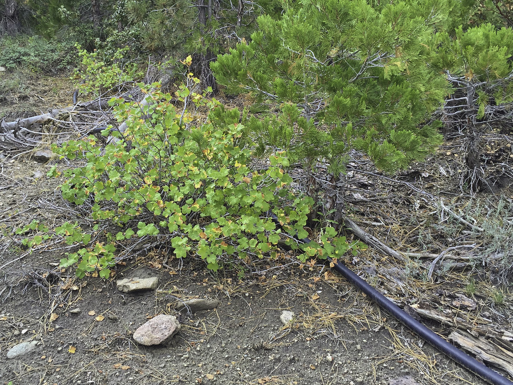
The meadow nearby. Heard a funny noise and discovered the spring actually has pretty high flow! Tried to trace the 2" piping uphill to the origin but it went underground and I lost interest. Click on the "Gurgling Spring" pic to see a short clip.
 Sawmill Spring Meadow by tomteske, on Flickr Sawmill Spring Meadow by tomteske, on Flickr
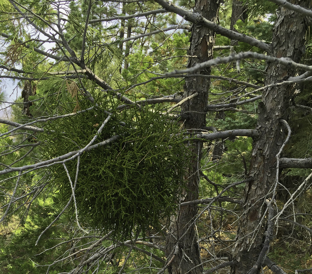 Mistletoe by tomteske, on Flickr Mistletoe by tomteske, on Flickr
 Gurgling Spring by tomteske, on Flickr Gurgling Spring by tomteske, on Flickr
 Spring Pipe by tomteske, on Flickr Spring Pipe by tomteske, on Flickr
The trip ended up being about 23 miles and 5K G/L. THOUGHT I had climbed the Sawmill Trail to the top till I realized later from other internet posts/pics the real trail exited the sawmill ruins to the west and ended up near the communication tower access road near Santa Rosa Springs. Next Time! Enjoy. Tom
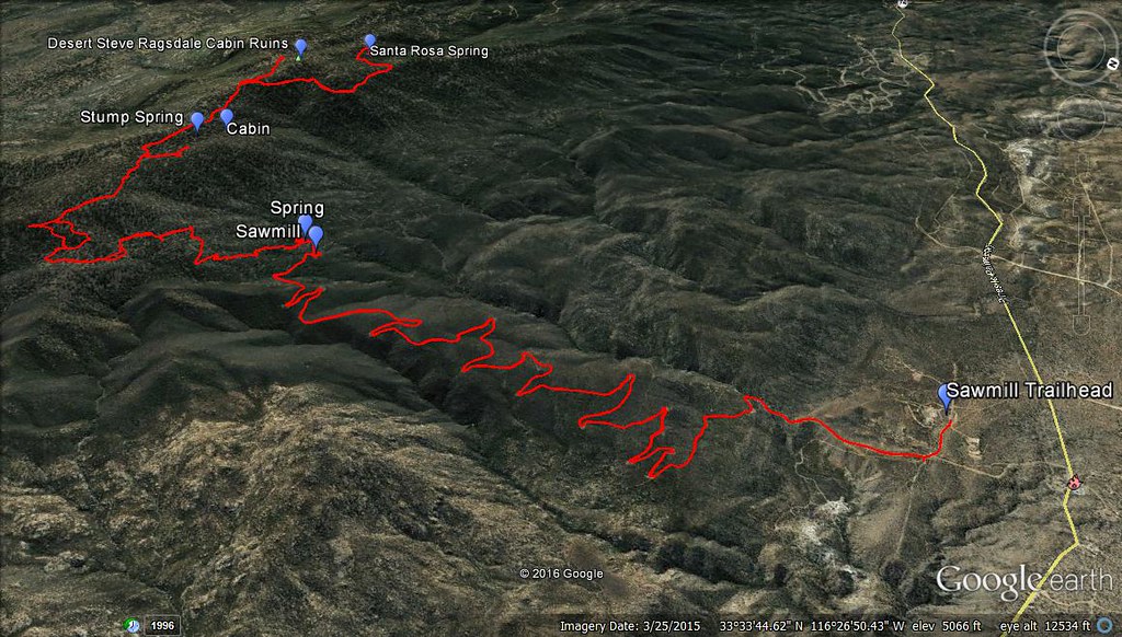 Sawmill Trail GPS by tomteske, on Flickr Sawmill Trail GPS by tomteske, on Flickr
edited by tommy750 on 8/24/2016
|