|
tekewin Posts: 368
2/10/2018
|
The weather was favorable for a partial traverse of the Santa Rosa range crossing five peaks, four of them on the Sierra Club San Diego Peaks list. The plan was to start at the Villager trailhead, ascend Smoke Tree Canyon to the major ridge, then hit five peaks in this order:
Pyramid Peak (SDC #62)
Marble Peak (Unofficial)
Rosa Point (SDC #28, DPS #67, HPS #281)
Mile High Mountain (SDC #24)
Villager Peak (SDC #12, HPS #208)
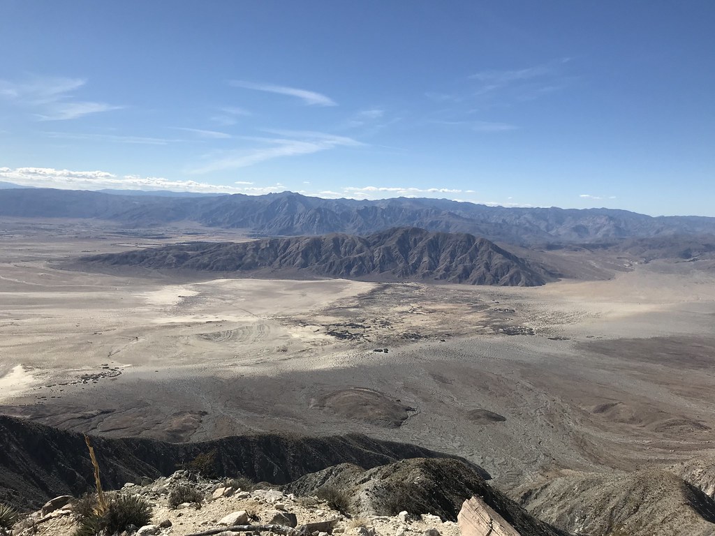
I started and finished in the dark. I decided to back load the night hiking, figuring it would be easier to follow the VIllager trail down than ascend a canyon. I started at 5:45 AM, covering the mile or so up Palo Verde Canyon to the Smoke Tree Canyon split before sunrise. I made a short side trip to the Natural Rock Tanks. Despite the lack of rain, there was water in the first tank I visited. On Pyramid Peak, I had great views to Travelers Peak and Salton Sea. Next was the long 1700' climb to Rosa Point, one of the toughest sections of the day. I hunted around the long flat summit until I found the benchmark. It was about 100' southeast of the summit rocks in an open, flat area.


Natural Rock Tank with water

Travelers and Salton Sea

Looking back from Rosa Point
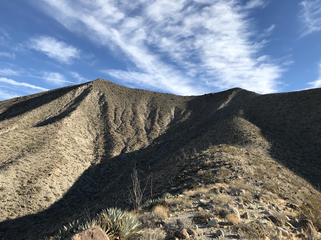
After a few false summits, I spotted Mile High Mountain. The terrain above 5000' started to change. Pines and junipers grew along with other shrubs missing from the lower desert slopes. The hardest part of the day was the 1000’ drop off Mile High then up an alluvial fan to the Villager Ridge. Mostly class 2 and 3. From there, I was only one mile and 500’ gain from Villager. The views into Clark Valley were stunning. I can see why Villager is so popular. I didn’t stay long because I only had an hour of daylight left.
At sunset, I stopped to unpack lights (headlamp and flashlight) and take inventory. I was behind schedule, a mile in the air and 5 miles from the truck. Worse, I was dehydrated and down to 8 oz. of water. Despite drinking two bottles of water on the drive to the trailhead, I hadn't brought enough. None of the bars or food I had left was appealing, but I forced myself to eat something to power the descent. Thankfully, the trail remained clear and well defined. My knees, hips, and lower back all complained from accumulated minor insults. I thought I would be back at the car by 7:00 PM. When that time came, I was still 3 miles out, watching tiny headlights below dance along the S22. I had cell service so I texted my wife to let her know I was OK. When I reached the truck, I sat down to guzzle two bottles of water before starting the drive home. 19.2 miles, 7107’ gain, 14 hours 45 minutes. More gory details here.

Villager from Mile High

Mile High from the saddle

Villager summit


edited by tekewin on 2/10/2018
|
|
|
+1
link
|
|
dsefcik Administrator Posts: 2622
2/11/2018
|
Very nice...been a long time since I have done anything that ambitious, nice TR, thanks for sharing.
--
http://www.sefcik.com
http://www.darensefcik.com
http://www.carrizogorge.com
|
|
|
link
|
|
rockhopper Posts: 668
2/11/2018
|
That's one aggressive day hike! That is a lot of terrain to cover in a day. Wow! At least you can move quickly with a daypack and poles. Sounds like you wish you needed more H2O. We all wish we brought more water on desert hikes! Great trail report and photos. Reminds me of doing Rabbit peak in one day with no headlamp.
edited by rockhopper on 2/11/2018
|
|
|
link
|
|
Britain Posts: 602
2/11/2018
|
Wow, fearsome hike. Congrats!
--
Cant drive 55
Britain
http://icorva.com
|
|
|
link
|
|
tekewin Posts: 368
2/11/2018
|
Darren: I can only muster one or two attempts like this a year. I think it's been three years since I completed one this big.
rockhopper: Not quite the stats of Rabbit. I did need more water, but it's always a black art to figure out the trade off between extra weight, speed, and how much you need. I usually carry too much. Couldn't cache any because it was a loop. I planned to spend hours in the dark, so that wasn't a problem (as long I didn't see green eyeshine following me!).
Britain: Thanks! It pushed me in several ways.
No mylar balloons to my surprise, but I did collect a white running hat while climbing up to the Villager ridge from Mile High. Also found some kind of trashy romance paperback on a rock about a half mile from the road on the way back. I didn't touch it.
edited by tekewin on 2/11/2018
edited by tekewin on 2/11/2018
|
|
|
link
|
|
ziphius Posts: 911
2/11/2018
|
Nice trip! Amazing that there is still some water at Natural Rock Tanks. How much water did you actually carry with you? Read your blog too... my favorite electrolyte drink is 9/10 water + 1/10 orange juice + dash of table salt. The acidity of the O.J. is no problem because it is so dilute and it doesn't go bad in warm weather either. Again, impressive trip. - Jim
--
http://www.coyotelearning.org
|
|
|
link
|
|
tekewin Posts: 368
2/11/2018
|
ziphius wrote:
Nice trip! Amazing that there is still some water at Natural Rock Tanks. How much water did you actually carry with you? Read your blog too... my favorite electrolyte drink is 9/10 water + 1/10 orange juice + dash of table salt. The acidity of the O.J. is no problem because it is so dilute and it doesn't go bad in warm weather either. Again, impressive trip. - Jim
JIm: I carried 212 oz (6.2 liters / 13.25 pounds). That was combined water, propel water, and G2 gatorade. I also had a couple of salt pills (sodium/ potassium). Not sure if electrolytes were a bigger problem than lack of water. Never heard of that OJ trick, will keep it in mind. I've been in spots like that before and figured I could ration it, even though it was unpleasant. I envy ultra runners that get by with half the water I need.
|
|
|
link
|
|
ziphius Posts: 911
2/11/2018
|
I think you said it well when you referred to the black art of balancing weight vs water needs. I see the ultrarunners galloping up and down El Cajon Mountain with these tiny packs and seemingly no water... but they aren't out there for long either.
--
http://www.coyotelearning.org
|
|
|
link
|
|
rockhopper Posts: 668
2/12/2018
|
Tekewin , I feel your hike was more aggressive. More elevation gain/loss and big mileage for a mostly rock scramble. You were using 11oz. of H2O per mile shows how rapid your pace was. You bagged some awesome peaks of the Southern Santa Rosas. Cheers!
edited by rockhopper on 2/12/2018
|
|
|
link
|
|
Buford Posts: 456
2/12/2018
|
Nice work. That is a long, tough day. I have seen your signature in a couple remote registers in Borrego.
I have been planning on doing the same loop soon,minus Villager (already bagged it), if I can find the time and cooperative weather.
--
Links to my photos: ABDSP photos, Bighorn sheep photos, ABDSP time lapse video, Wildlife photos (mainly birds)
|
|
|
link
|
|
tekewin Posts: 368
2/12/2018
|
Rockhopper: I'm with you about awesome peaks of the Southern Santa Rosas. One I won't forget.
Buford: Thanks. Good luck with the loop to Mile High. Do you think you'll come down Villager Ridge from Mile High or down Rattlesnake Canyon?
|
|
|
link
|
|
Buford Posts: 456
2/12/2018
|
If I do the loop, the decision between heading down Rattlesnake or the Villager ridge will depend on what I see when I get there. I saw a report somewhere that Rattlesnake Canyon is passable all the eay down with a couple dry falls to contend with.
I think I saw your blog in the Goat BM register recently and just made the connection with the post here.
--
Links to my photos: ABDSP photos, Bighorn sheep photos, ABDSP time lapse video, Wildlife photos (mainly birds)
|
|
|
link
|
|
tekewin Posts: 368
2/12/2018
|
Buford wrote:
If I do the loop, the decision between heading down Rattlesnake or the Villager ridge will depend on what I see when I get there. I saw a report somewhere that Rattlesnake Canyon is passable all the eay down with a couple dry falls to contend with.
I think I saw your blog in the Goat BM register recently and just made the connection with the post here.
Bob Burd descended Rattlesnake Canyon, hit a few class 3 falls on the way down, but it didn't look too bad. Yeah, I did Goat last year in September. I felt really isolated out there, in a good way. Found a baby deer skull in one of the gullys.
|
|
|
link
|
|
tommy750 Posts: 1049
2/12/2018
|
Nice trip, Tekewin. Great pics as well. Have climbed exactly zero of those peaks so need to get busy.
|
|
|
link
|
|
Buford Posts: 456
2/18/2018
|
Tekewin’s post got me motivated enough to do the loop today. Thanks for posting the route!
Started at 6:45 am, a little later than planned.
Bagged Pyramid at 8:30 after a straight forward climb.
I was surprised at how good the use trail was going to Rosa.
Made it to Rosa Point about 10. The final stretch was rough.
Summited Mile High at noon.
Dropped down to the saddle at the top of Rattlesnake Canyon. Decided to hit the Villager ridge line for the superior views.
Climbed the Villager ridge line and topped out at 1:00.
Realized I was ahead of schedule and had plenty of food and water and could hit Villager again since it was only 1k of gain and a mile away, but then realized I was ahead of schedule and could get to Dudley’s before closing. Immediately went downhill and out.
Back At the car at 3:00, Dudley’s about 4:15.
No sheep on the hike, but plenty of signs of them. I did see a ram cross Montezuma grade this morning about 6:00 am.
Tons of roasting pits along the route.
There was an icy wind up high. I had to find a sheltered spot on each summit to sign the register and eat a snack. A couple gusts were strong enough to affect my footing. The cold wind helped cut down on water needs.
Edit, can’t get pictures to show up from mobile. I’ll add a few later.
edited by Buford on 2/18/2018
edited by Buford on 2/18/2018
--
Links to my photos: ABDSP photos, Bighorn sheep photos, ABDSP time lapse video, Wildlife photos (mainly birds)
|
|
|
+1
link
|
|
tekewin Posts: 368
2/19/2018
|
Buford wrote:
Tekewin’s post got me motivated enough to do the loop today. Thanks for posting the route!
Started at 6:45 am, a little later than planned.
Bagged Pyramid at 8:30 after a straight forward climb.
I was surprised at how good the use trail was going to Rosa.
Made it to Rosa Point about 10. The final stretch was rough.
Summited Mile High at noon.
Dropped down to the saddle at the top of Rattlesnake Canyon. Decided to hit the Villager ridge line for the superior views.
Climbed the Villager ridge line and topped out at 1:00.
Realized I was ahead of schedule and had plenty of food and water and could hit Villager again since it was only 1k of gain and a mile away, but then realized I was ahead of schedule and could get to Dudley’s before closing. Immediately went downhill and out.
Back At the car at 3:00, Dudley’s about 4:15.
No sheep on the hike, but plenty of signs of them. I did see a ram cross Montezuma grade this morning about 6:00 am.
Tons of roasting pits along the route.
There was an icy wind up high. I had to find a sheltered spot on each summit to sign the register and eat a snack. A couple gusts were strong enough to affect my footing. The cold wind helped cut down on water needs.
Edit, can’t get pictures to show up from mobile. I’ll add a few later.
edited by Buford on 2/18/2018
edited by Buford on 2/18/2018
Wow, you made awesome time. Well done!
|
|
|
link
|
|
dsefcik Administrator Posts: 2622
2/19/2018
|
Buford wrote:
Tekewin’s post got me motivated enough to do the loop today. Thanks for posting the route!
Nice...
--
http://www.sefcik.com
http://www.darensefcik.com
http://www.carrizogorge.com
|
|
|
link
|
|
Buford Posts: 456
2/19/2018
|
Glad I did it after looking at the route for the last year or so but never committing to it.
Almost to Pyramid:

Almost at Rosa:

The view from Rosa Point looking at Rabbit and Mile High:

Looking at Coyote from the Villager ridgeline:

--
Links to my photos: ABDSP photos, Bighorn sheep photos, ABDSP time lapse video, Wildlife photos (mainly birds)
|
|
|
link
|
|
rockhopper Posts: 668
2/21/2018
|
Now that's how to exercise! With great views. Great trip. Nice photos.
edited by rockhopper on 2/21/2018
Some pics from my trip to Villager


edited by rockhopper on 2/21/2018
|
|
|
link
|
|
tekewin Posts: 368
2/22/2018
|
rockhopper: I recognize the view to Mile High, but where is that boulder in relation to the Villager summit?
|
|
|
link
|