Review a product you have used out on the trail
CalTopo is stepping up their game
|
dsefcik Administrator Posts: 2631
10/22/2019
|
Was just looking at the CalTopo Blog and they have several new cool features, 4WD road map layers for BLM and USFS lands, mobile app for Android and iOS. Check out the blog for more info about CalTopo. After using it for several years now it's one of those things you wonder how you made do without.


--
http://www.sefcik.com
http://www.darensefcik.com
http://www.carrizogorge.com
|
|
|
+2
link
|
|
tekewin Posts: 379
10/25/2019
|
Thanks for the heads up. I love CalTopo and use it for planning almost every hike.
|
|
|
link
|
|
Buford Posts: 463
10/26/2019
|
Could have used that last week. Didn't know that was now included. Awesome.
--
Links to my photos: ABDSP photos, Bighorn sheep photos, ABDSP time lapse video, Wildlife photos (mainly birds)
|
|
|
link
|
|
deborah Posts: 115
10/28/2019
|
Yes, thanks for the info! CalTopo is a great tool. These new features are really cool.
|
|
|
link
|
|
tommy750 Posts: 1067
10/28/2019
|
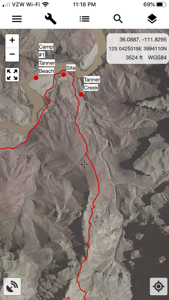
Downloaded the caltopo app recently. Since it's beta, you need to download TestFlight from the App Store (I have an iPhone) and then get a link from caltopo to their app. Used it yesterday on a bike ride and it worked well enough. You can access your entire map collection and then hit start to begin tracking. Looked at the new motor vehicle MVUM layer Daren mentioned but didn't seen to add much useful and a lot of the roads are labelled "unspecified" or "limited access." ABDSP is pretty much completely blacked out of this layer. The app doesn't have a GE satellite layer but if you pull up one of your saved maps it will give you what looks to be GE if it's your saved base layer on your map. Props to Daren for introducing me to caltopo. It's a great tool to have.
Here's a screen grab from a Grand Canyon hike last year:
 app3 by tomteske, on Flickr app3 by tomteske, on Flickr
A list of some of my saved maps easily accessed with the app:
 app2 by tomteske, on Flickr app2 by tomteske, on Flickr
Starting your track:
 app1 by tomteske, on Flickr app1 by tomteske, on Flickr
|
|
|
link
|
|
Rocko1 Posts: 607
10/31/2019
|
Thanks. I DL the app for IOS and it wasn't as intuitive as I had hoped. Lots of blank map area and drawing a line is difficult. I am sure things will improve as it's just a beta. For now Gaia has been my staple for all hiking routes.
|
|
|
link
|