|
hikerdmb Posts: 423
3/30/2010
|
I went back to Indian Hill on Monday with a buddy that until now didn't really like the desert. I was suppose to take this hike with him on March 7, 2010. That was the weekend it rained all night (see the post "Still too early") and he was coming out on Sunday morning to meet us to do this hike, but didn't make it because of the weather.
Before yesterday he always thought the desert was someplace to drive across to get to someplace better. I am pretty sure after this trip that he has a new appreciation for why I go to the desert so much.
We took the long way by taking old highway 80 from Ocotillo and drove west and then came into the Piedras Grande/ Indian Hill area from the south. I must say that the grasses in this area are starting to brown up but the cactus blooms more than make up for it.
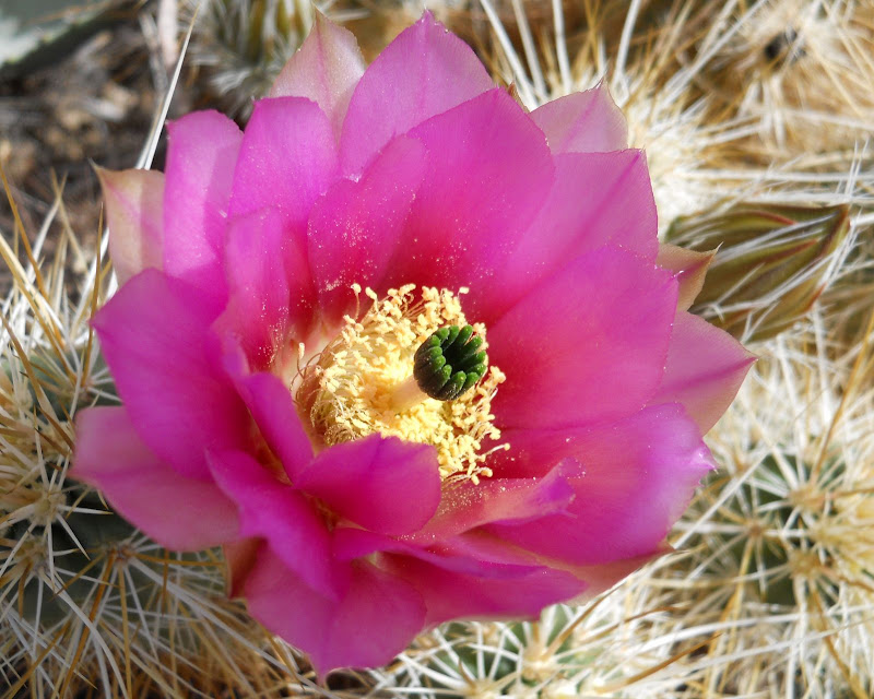
Hedghog Cactus
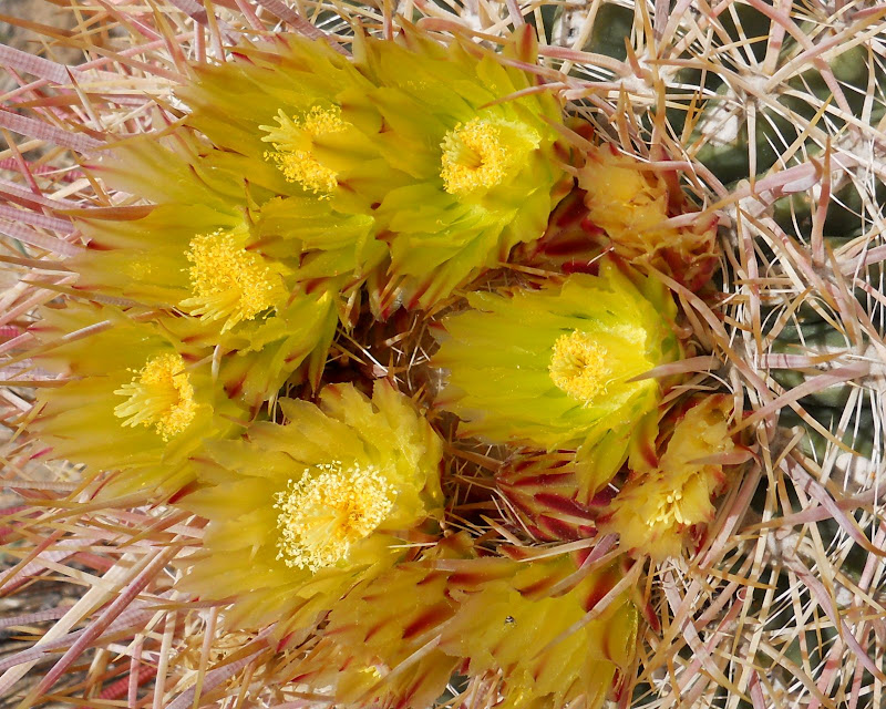
Barrel Cactus
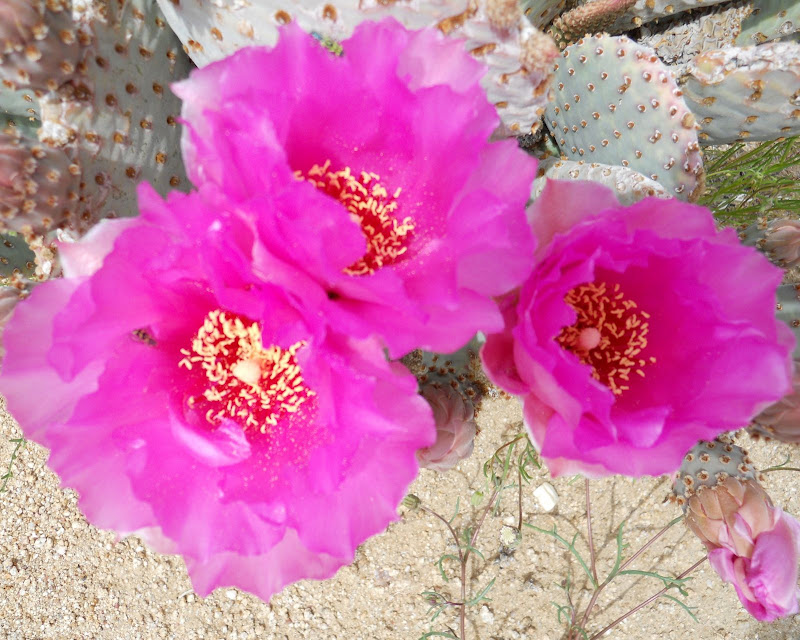
Beavertail Cactus
There are also plenty of flowers still at their peak.
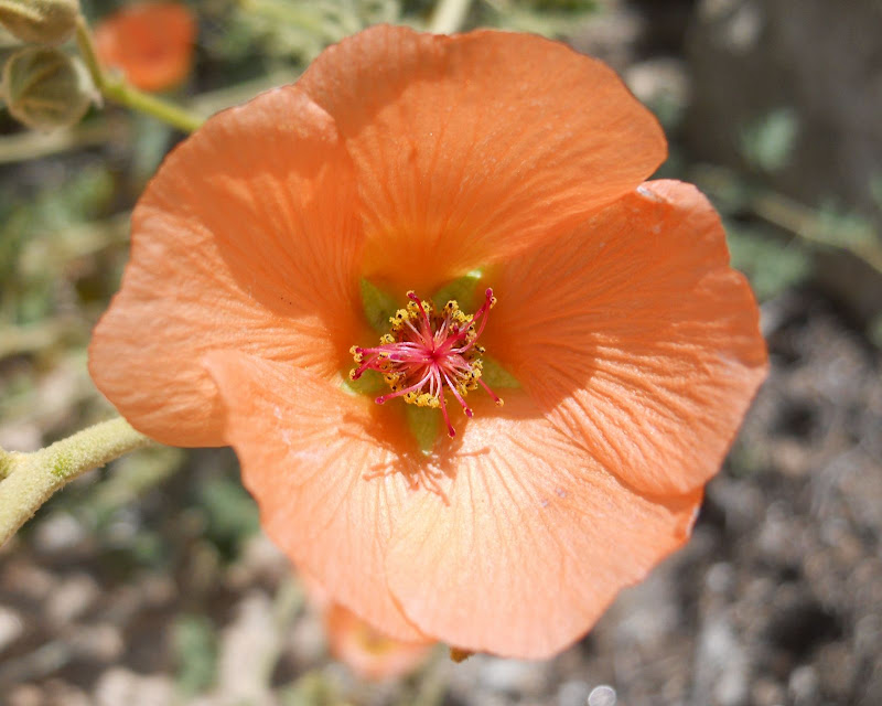
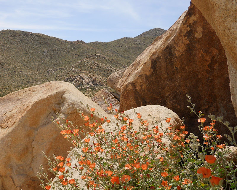
Desert Mallow
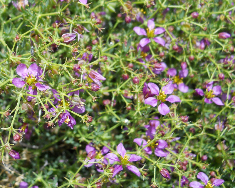
California Fagonia
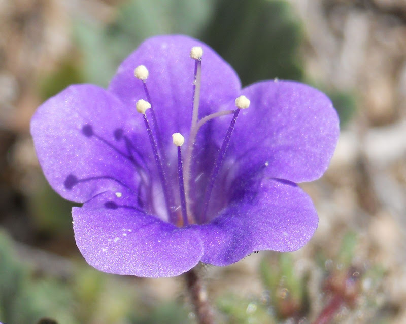
Canterbury Bell
The vistas were magnificent on Monday with the flowers adding to the beauty of the rocks and mountains.
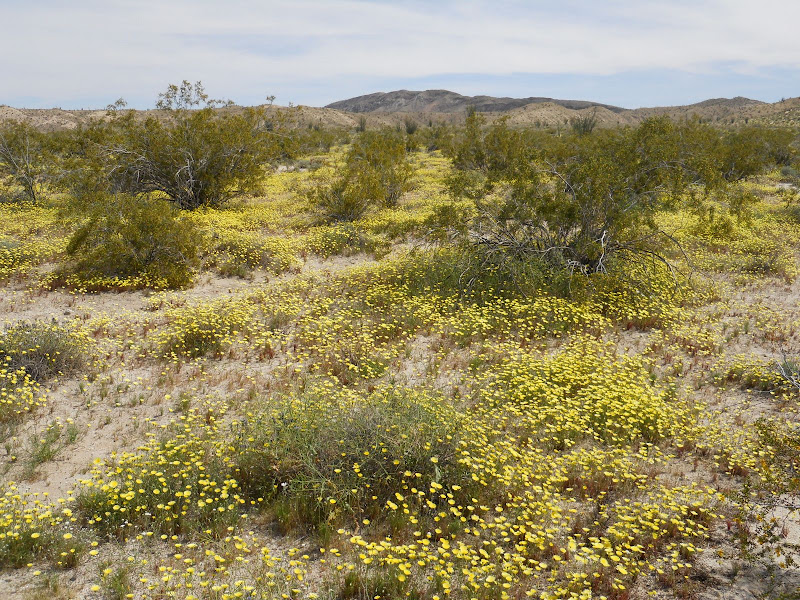
After hiking through Indian Hill we drove down Canyon Sin Nombre and out South Carrizo Creek. We had been here three weeks ago and the grass is definitely browning up but the Desert Dandelions are so thick that you don't really notice the grass. I don't recall seeing fields like this before. And to think someone on Desert USA said there would be no flowers in the southern part of the park this year. If you have not been down to this part of the park this year, GO NOW!
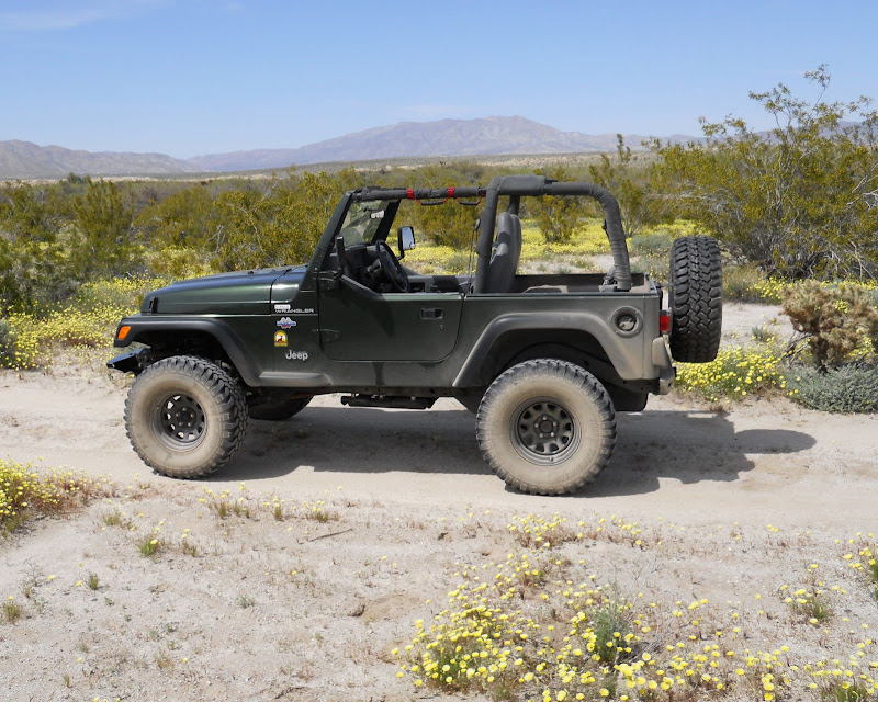
Here is a picture of my Jeep, Desert TJ, that took us on this wonderful day and more flowers with Whale Peak in the distance.
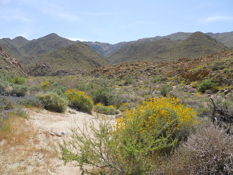
We ended the day with a drive up Corrizo Gorge. It took us about half an hour to reach the water but it was beautiful up there. We ran out of time and had to turn around before we got to the end but it will still be there for another trip. I love the rugged beauty of this part of ABDSP.
|
|
|
link
|
|
surfponto Administrator Posts: 1366
3/30/2010
|
David,
You have some awesome flower pictures!
The macro shots are amazing.
I really like the color of the globe mallows also.
Did you make it to the pictographs in Carrizo?
Bob
--
https://www.anzaborrego.net/


|
|
|
link
|
|
hikerdmb Posts: 423
3/30/2010
|
Bob,
We went as far up the gorge to where the road goes down a short steep bank and crosses the creek. I think it is the same place as the pic in your post from going up there that shows your LC by the water. Although there was much less water at that crossing now than when you were there. We only went about 100 yards or so past that crossing before we turned around. It was right near this water cache.
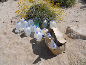
I think it is the same cache as in pic 30 from your Picasa pics from your solo trip. It looked familiar.
I am not sure how much farther the road went on from there but we needed to turn around and get back home by 5:00. How much farther from that crossing were you able to drive? It has been a bunch of years since I have been that far up the gorge and I couldn't believe how much it had changed in that time. Next time I go up that way though I will be sure to ask for some help finding the pictographs up there.
I wasn't even considering looking for the pictographs on this trip because of time constraints so please don't tell me I was only a hundred yards from them. Lots of good 4 low driving in the upper part of the gorge. FUN!
David
|
|
|
link
|
|
surfponto Administrator Posts: 1366
3/30/2010
|
OK I won't tell you but you were very close to the pictographs. 
How about that trail?
Like you said 4wd low range in the upper part of the gorge.
Sounds like you parked right where I did. The trial got impassable a few yards later.
There used to be a sign I believe that marked the end of the trail "Closed Area" but I think it has been washed away.
Bob
hikerdmb wrote:
Bob,
We went as far up the gorge to where the road goes down a short steep bank and crosses the creek. I think it is the same place as the pic in your post from going up there that shows your LC by the water. Although there was much less water at that crossing now than when you were there. We only went about 100 yards or so past that crossing before we turned around. It was right near this water cache.

I think it is the same cache as in pic 30 from your Picasa pics from your solo trip. It looked familiar.
I am not sure how much farther the road went on from there but we needed to turn around and get back home by 5:00. How much farther from that crossing were you able to drive? It has been a bunch of years since I have been that far up the gorge and I couldn't believe how much it had changed in that time. Next time I go up that way though I will be sure to ask for some help finding the pictographs up there.
I wasn't even considering looking for the pictographs on this trip because of time constraints so please don't tell me I was only a hundred yards from them. Lots of good 4 low driving in the upper part of the gorge. FUN!
David
--
https://www.anzaborrego.net/


|
|
|
link
|
|
quidditian Posts: 46
4/4/2010
|
Gorgeous flower pics! Love those light orangey-peachy guys.
|
|
|
link
|
|
surfponto Administrator Posts: 1366
4/5/2010
|
Just got an email from the DzrtGrls over at http://www.dzrtgrls.com.
They were able to find the Carrizo Gorge pictographs from my description.
They said they were enjoying the solitude until 7 Jeeps came roaring up Carrizo Gorge.
--
https://www.anzaborrego.net/


|
|
|
link
|
|
quidditian Posts: 46
4/5/2010
|
Not directed toward the desert girls, but to 7 jeeps -- ew?
Annoying question:
Was wondering -- with the quake we had today, which was quite fascinating, since it's the strongest I've felt (and I usually don't feel them at all) -- is that enough to shake and shift the rocks off the mountains when on is driving the narrow roads?
Not that I'm looking for another excuse to avoid driving...buuuuut.... I love how precariously they're all balanced. Am wondering just how precarious it all is...
|
|
|
link
|
|
surfponto Administrator Posts: 1366
4/5/2010
|
My thought exactly 
I think those rocks are pretty solid. I would be more concerned being inside one of the mud caves during a 7.2 earthquake.
Some areas of the caves seem a little precarious.
Bob
quidditian wrote:
Not directed toward the desert girls, but to 7 jeeps -- ew?
Annoying question:
Was wondering -- with the quake we had today, which was quite fascinating, since it's the strongest I've felt (and I usually don't feel them at all) -- is that enough to shake and shift the rocks off the mountains when on is driving the narrow roads?
Not that I'm looking for another excuse to avoid driving...buuuuut.... I love how precariously they're all balanced. Am wondering just how precarious it all is...

--
https://www.anzaborrego.net/


|
|
|
link
|
|
quidditian Posts: 46
4/5/2010
|
*hands and feet start sweating again at the mere thought of it*
Speaking of which, a friend took this pic somewhere in SD...love it... she said no tape, or adhesives were used... (this is really an excuse to test the pic embedding)....
[img=http://www.flickr.com/photos/9702179@N08/4493754206/]" border="0">
|
|
|
link
|
|
quidditian Posts: 46
4/5/2010
|
crap.
|
|
|
link
|
|
surfponto Administrator Posts: 1366
4/6/2010
|
Pic
Looks like it has to go between the tags since that is a link.
I was able to copy the actual image location at farm3.static.flickr.com/2729/4493754206_15a94e8941.jpg

<em>edited by surfponto on 4/6/2010</em>
--
https://www.anzaborrego.net/


|
|
|
link
|
|
quidditian Posts: 46
4/6/2010
|
Sweet. Like how I just gave up? I'd been up for about 30 hours at that point. Thanks!
|
|
|
link
|