Talk about a trip you took out to Anza Borrego
After an autumn rain
|
hikerdmb Posts: 423
10/24/2010
|
Our plan was to go out and backpack up Whale Peak but my buddy hurt his back so we decided to head out and just camp from the truck. We had no plan on where we would go we just took off. When we left North County it was getting cloudier and we had a little rain as we went over the mountains. Heading down the hill into Borrego Springs the clouds had cleared for the most part but we saw a couple of huge dust clouds blowing across the desert floor and got concerned that it would be windy. However when we got down to Borrego Springs there was not too much wind and it was 80 degrees. Our first trip off road was up to a place we had camped before. We couldn't believe all the green Ocotillos up on the hills and we had to go up and take a look. The road was completely clean of tracks from the recent rains. Here is a view north toward Toro Peak and Clark Dry Lake.
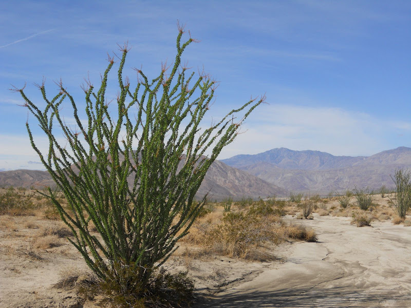
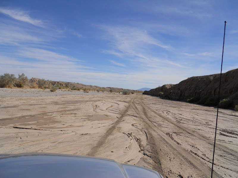
We returned back to the highway and then continued east to Palo Verde Wash. There was lots of wet sand and some mud in this wash but nothing that proved to be too difficult. I was amazed at how much mud there was all the way down this wash.
Palo Verde Wash looking south.
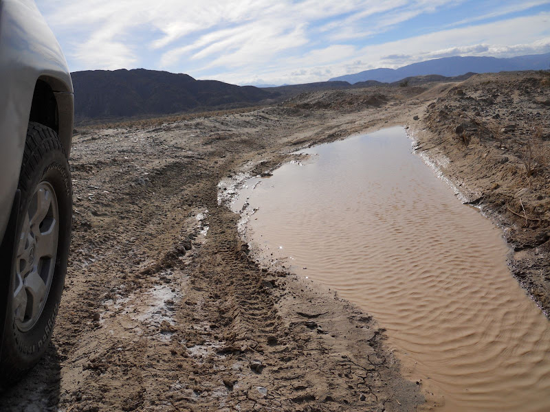
When we got to the Cut Across Trail we turned right and headed west toward San Felipe Wash. There were several places along the Cut Across Trail with huge mud puddles but again we found nothing too difficult. I don't remember rain like this in the fall.
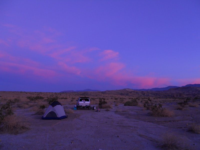
We got down to San Feliipe Wash and found more wet sand and mud and continued on to Rainbow Wash and back to a campsite we have stayed at several times in the last few years.
Here is a pic of our camp site.
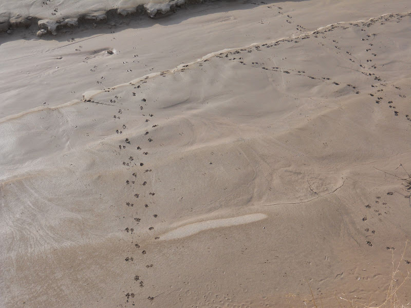
I took a little walk up the wash, this is not Rainbow Wash but it is close to there. Saw lot of animal tracks in the new mud. This is some small animal track but not sure what.
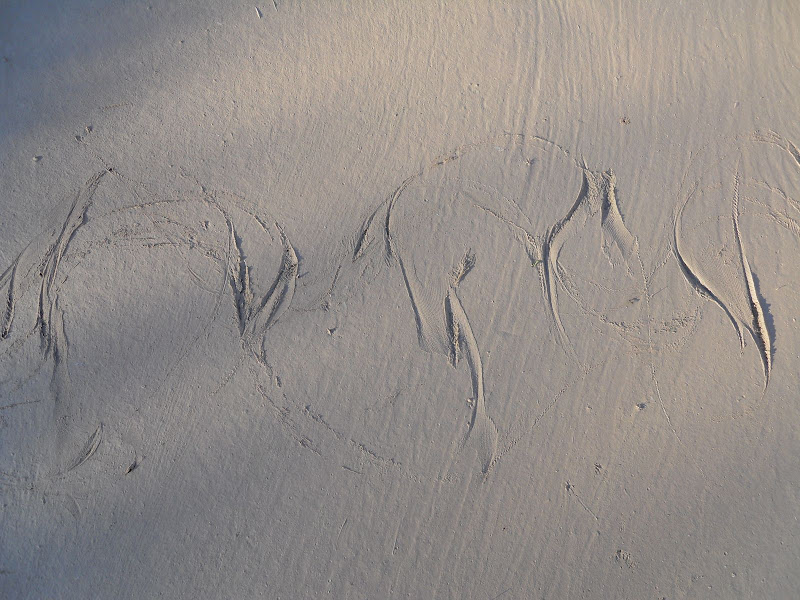
And this is a snake track that went across the wash.
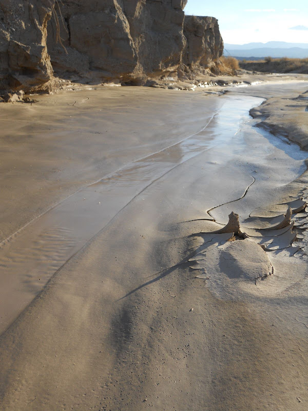
Never saw any water in this wash but lots of mud that sure liked like water with the sun light on it.
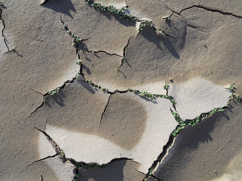
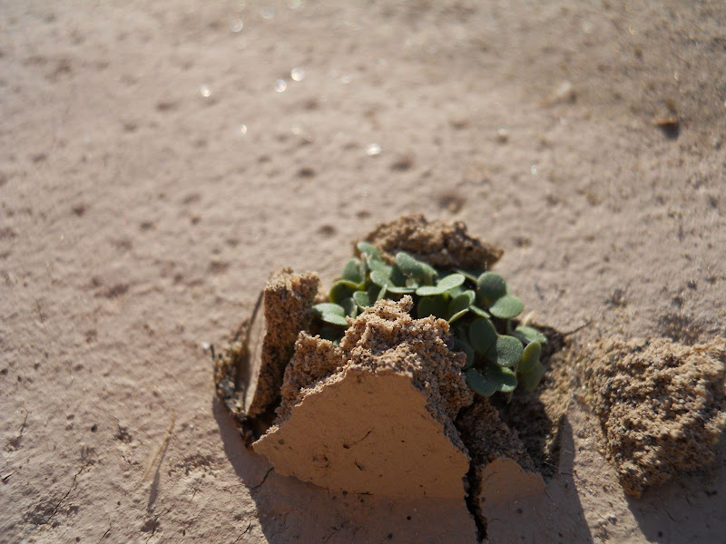
One of the coolest things on this hike was all the little plants that were just coming up from seed. It was incredible how such small plants could push through the thick mud to start growing in the sun.
All afternoon the wind was quite calm which was nice. It seemed last year it was windy on pretty much every trip. We had a nice sunset. But it was nothing compared to the sunrise Sunday morning.
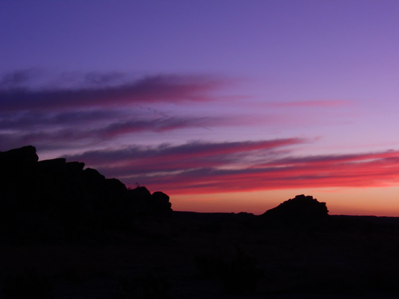
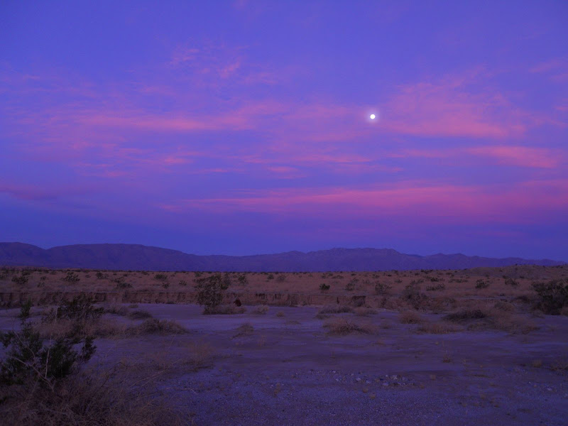
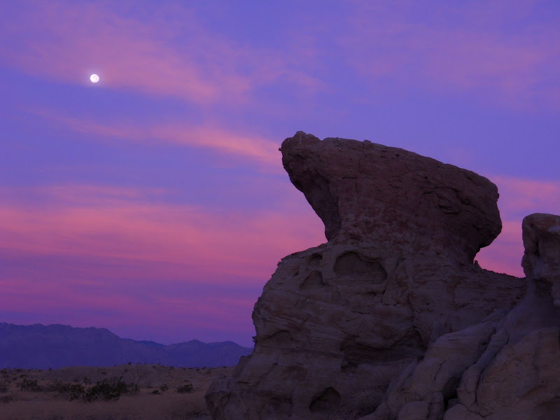
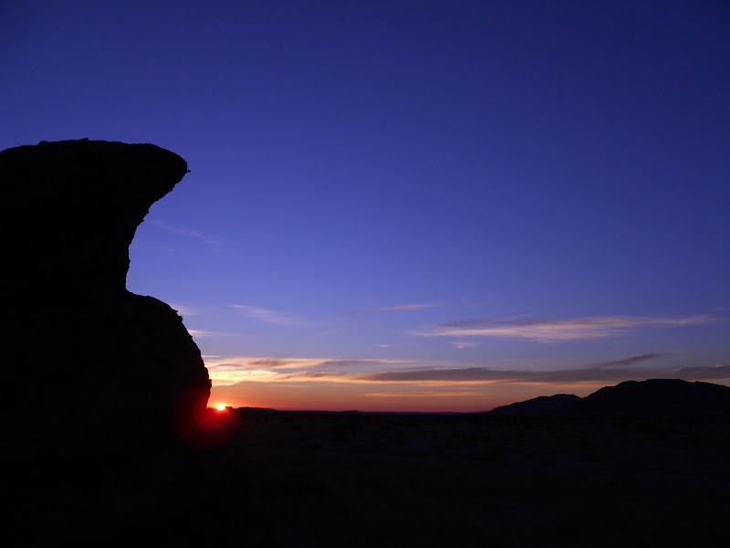
Left around noon and got home just in time to see most of the Charger game. Should have stayed in the desert longer.
But that Charger loss was made up by an Auburn win on Saturday and first time ever BCS ranking of #1.
|
|
|
+1
link
|
|
dsefcik Administrator Posts: 2622
10/24/2010
|
Those are some really nice pictures, thanks for the report!
I have also gone out the last two weekends and it has been really beautiful. I have not had time time write anything up but pictures are here:
Bisnaga Wash
Inner Pasture
--
<em>edited by dsefcik on 10/24/2010</em>
--
http://www.sefcik.com
http://www.darensefcik.com
http://www.carrizogorge.com
|
|
|
link
|
|
dsefcik Administrator Posts: 2622
10/24/2010
|
Do you have a link to a better, more close up pic of the animal tracks?
--
http://www.sefcik.com
http://www.darensefcik.com
http://www.carrizogorge.com
|
|
|
link
|
|
surfponto Administrator Posts: 1364
10/25/2010
|
Looks like a great trip David,
I really like the pictures of the plants coming up through the mud.
Pretty amazing. Looking forward to getting out to the Park soon,
Bob
hikerdmb wrote:
Our plan was to go out and backpack up Whale Peak but my buddy hurt his back so we decided to head out and just camp from the truck. We had no plan on where we would go we just took off. When we left North County it was getting cloudier and we had a little rain as we went over the mountains. Heading down the hill into Borrego Springs the clouds had cleared for the most part but we saw a couple of huge dust clouds blowing across the desert floor and got concerned that it would be windy. However when we got down to Borrego Springs there was not too much wind and it was 80 degrees. Our first trip off road was up to a place we had camped before. We couldn't believe all the green Ocotillos up on the hills and we had to go up and take a look. The road was completely clean of tracks from the recent rains. Here is a view north toward Toro Peak and Clark Dry Lake.

We returned back to the highway and then continued east to Palo Verde Wash. There was lots of wet sand and some mud in this wash but nothing that proved to be too difficult. I was amazed at how much mud there was all the way down this wash.
Palo Verde Wash looking south.

When we got to the Cut Across Trail we turned right and headed west toward San Felipe Wash. There were several places along the Cut Across Trail with huge mud puddles but again we found nothing too difficult. I don't remember rain like this in the fall.

We got down to San Feliipe Wash and found more wet sand and mud and continued on to Rainbow Wash and back to a campsite we have stayed at several times in the last few years.
Here is a pic of our camp site.

I took a little walk up the wash, this is not Rainbow Wash but it is close to there. Saw lot of animal tracks in the new mud. This is some small animal track but not sure what.

And this is a snake track that went across the wash.

Never saw any water in this wash but lots of mud that sure liked like water with the sun light on it.

One of the coolest things on this hike was all the little plants that were just coming up from seed. It was incredible how such small plants could push through the thick mud to start growing in the sun.


All afternoon the wind was quite calm which was nice. It seemed last year it was windy on pretty much every trip. We had a nice sunset. But it was nothing compared to the sunrise Sunday morning.


Left around noon and got home just in time to see most of the Charger game. Should have stayed in the desert longer.
But that Charger loss was made up by an Auburn win on Saturday and first time ever BCS ranking of #1.
--
https://www.anzaborrego.net/


|
|
|
link
|
|
hikerdmb Posts: 423
10/25/2010
|
Daren,
I like the pics in the Inner Pasture link. That is a place we talked about going to for many years but have not been in there. It looked pretty interesting. I always wondered what kind of signs of Indian life were in there. Just the name got me interested in going. I am going to need to add that to my list of places to get to.
Was Bisnaga wash your attempt at Whale Peak or just a scouting trip? Did you go by the large dark cliff area that is in that area a few hundred feet above the highway? It looks like it would be an interesting place to check out. It might be a little eastof where you went up
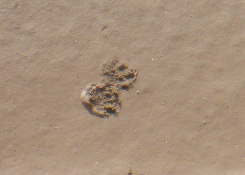
I found a couple more pics of the tracks from my trip. Maybe you can figure out what it is. The tracks were only about one and one half inches to two inches long. Some, that I did not get pics of, had very small claws, four claws per foot if I remember. I was thinking maybe a kit fox.
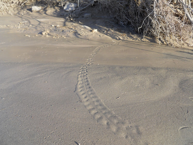
I also included another track that at first I thought was another snake but in the middle of going across the wash it looks more like footprints. What do you think?
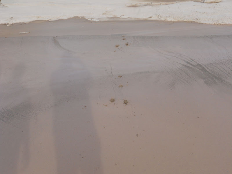
And the last pic is coyote. I thought this was pretty cool how he/she did not want to get too muddy and jumped twice to get across the mud. All the other tracks walked right through.
David
|
|
|
link
|
|
dsefcik Administrator Posts: 2622
10/25/2010
|
Those are some great track photos!
Kit fox prints are about 1.5", 4 paw and have signs of claws when quickly walking or running so that could be. The second one looks like some kind of lizard or other tail dragging critter. I have not seen one like that before, I am gonna try to research it some more.
Here is a similar looking track from Death Valley I found:
.jpg)
Bisnaga Wash was my re-con mission to check out the Whale Peak hike. Yes, it can be done, it will be steep and rocky though the last 2 miles (as seen in my pictures). In fact, I dare say the whole hike could be done in a single day with cool weather. I have that on my itinerary.
Inner Pasture was supposed to be a backpack trip with a climb up Red Top but the night before I had some other things happen that prevented me from doing that and I went for a quick day hike instead. The entire route I traveled was about 8.5 miles and I did it in 3.5 hours with a 50lb backpack on (for training). So you should be able to make a nice full day hike out of it if you wanted and possibly cover more ground than I did. There is supposed to be numerous areas around there that have signs of indian occupation. I saw (4) sets of prints from illegals all coming out of the wash, all the same shoe print, (3) walking closely together and the fourth always off to the side..kinda interesting. I really did not think illegals would be out there but all of the discarded water bottles, clothing and such seem to indicate it is a popular area for them.
Daren
--
<em>edited by dsefcik on 10/25/2010</em>
--
http://www.sefcik.com
http://www.darensefcik.com
http://www.carrizogorge.com
|
|
|
link
|