|
Britain Posts: 610
9/8/2017
|
Are there any good resources for finding these? Some maps have them, have them on the wrong locations. I didnt know about these until reading the posts on this forum about them. So far I've walked over the INKO and MOAN BM's. And were close to others. I figure if I'm in the area why not and try and bag a few.
--
Cant drive 55
Britain
http://icorva.com
|
|
|
link
|
|
tommy750 Posts: 1077
9/8/2017
|
Try these. Both are incomplete but have lots of info. Tom
https://www.ngs.noaa.gov/CORS-Proxy/NGSDataExplorer/
https://www.geocaching.com/mark/
|
|
|
link
|
|
Britain Posts: 610
9/8/2017
|
Thanks NOAA site has some good stuff.
--
Cant drive 55
Britain
http://icorva.com
|
|
|
link
|
|
dsefcik Administrator Posts: 2634
9/8/2017
|
Caltopo with the MapBuilder layer will also have them and have been accurate for me until PAH.
--
http://www.sefcik.com
http://www.darensefcik.com
http://www.carrizogorge.com
|
|
|
link
|
|
Britain Posts: 610
9/9/2017
|
Yes I'll use that as a source also. Just double check the gps. If theres 2 location check both if possible.
--
Cant drive 55
Britain
http://icorva.com
|
|
|
link
|
|
tommy750 Posts: 1077
9/9/2017
|
Peakbaggers.com has BMs. They list BM PAH at the incorrect location and three people report bagging it but none actually leave a trip report.
http://www.peakbagger.com/peak.aspx?pid=27325
|
|
|
link
|
|
dsefcik Administrator Posts: 2634
9/9/2017
|
tommy750 wrote:
Peakbaggers.com has BMs. They list BM PAH at the incorrect location and three people report bagging it but none actually leave a trip report.
http://www.peakbagger.com/peak.aspx?pid=27325
John Strauch, the first entry at peakbagger is the first entry on the register and the date matches...but the map is wrong.

--
http://www.sefcik.com
http://www.darensefcik.com
http://www.carrizogorge.com
|
|
|
link
|
|
Britain Posts: 610
9/10/2017
|
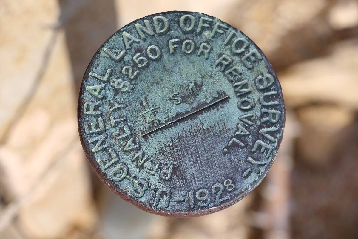
Though not a BM I found this near the Turbine that collapsed south of 8. I didn't have the gps so no exact location.


--
Cant drive 55
Britain
http://icorva.com
|
|
|
link
|
|
tommy750 Posts: 1077
9/10/2017
|
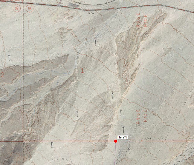
Guessing this is probably the exact location.
 Here by tomteske, on Flickr Here by tomteske, on Flickr
|
|
|
link
|
|
Britain Posts: 610
9/10/2017
|
Question, Why would it be 1/4 S on S33? Caltopo survey map.
edited by Britain on 9/10/2017
edited by Britain on 9/10/2017
--
Cant drive 55
Britain
http://icorva.com
|
|
|
link
|
|
tommy750 Posts: 1077
9/10/2017
|
Britain wrote:
Question, Why would it be 1/4 S on S33? Caltopo survey map.
edited by Britain on 9/10/2017
edited by Britain on 9/10/2017
I'm interpreting that marker to mean it's a quarter of the way along a boundary of Section 1. Assuming it's that particular S1 since you said it was near the downer turbine and that section also has a junction approximately 1/4 the way west of one of its corners.
Here's a nice blurb on Township and Range stuff: https://nationalmap.gov/small_scale/a_plss.html
I find the topics of surveying and geodetics fascinating on a superficial level but overwhelming past the basics.
|
|
|
link
|
|
Britain Posts: 610
9/10/2017
|
Thanks makes sense.. I'm sort of familiar been working with Plat maps. I'll gps it next time to see how it matches up. .
--
Cant drive 55
Britain
http://icorva.com
|
|
|
link
|
|
Britain Posts: 610
9/11/2017
|
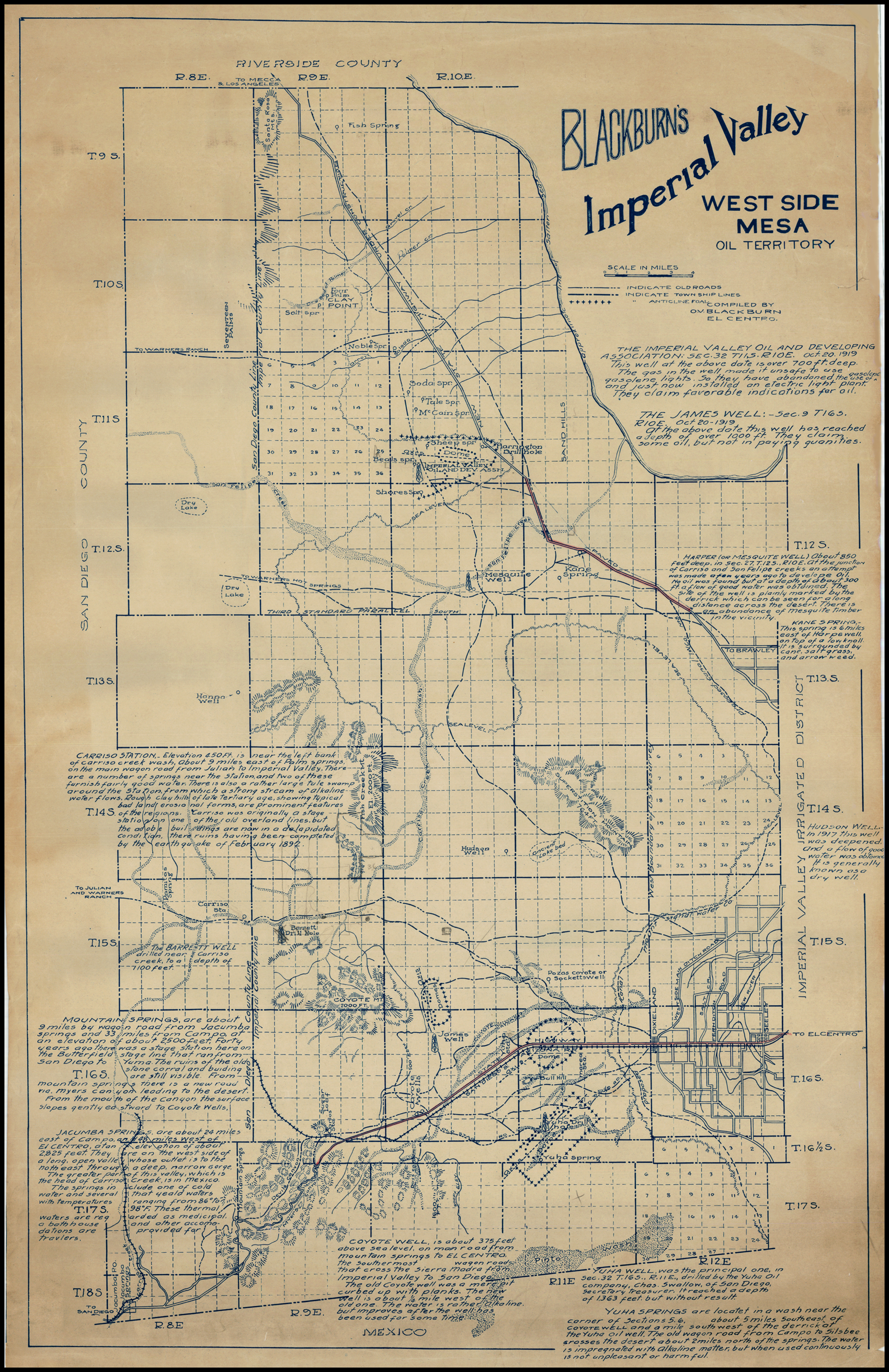
I was wondering why a 1/4 section was marked. So I dug into some old maps. Didn't find the reason yet but found this cool map from 1910 of Western Imperial County. Its a bit large.

edited by Britain on 9/11/2017
--
Cant drive 55
Britain
http://icorva.com
|
|
|
link
|
|
tommy750 Posts: 1077
9/11/2017
|
That is a cool map! Thanks.
|
|
|
link
|
|
dsefcik Administrator Posts: 2634
9/11/2017
|
Ditto, very cool...thanks for posting.
--
http://www.sefcik.com
http://www.darensefcik.com
http://www.carrizogorge.com
|
|
|
link
|
|
rockhopper Posts: 675
9/18/2017
|
Fantastic map with great old time info. Thanks for sharing! I really like the "under construction" new State hwy.
|
|
|
link
|