|
tommy750 Posts: 1048
8/24/2016
|
Was looking for a good way to put in some hiking and dodge the heat so I decided to head out to the Santa Rosas this past weekend for an overnight trip. Was curious about the dirt road that switch backed up the northern slopes toward Toro Pk. The road was built in the 1930's to access timber in the Santa Rosas. A mechanic from ND named Arthur Nightingale became interested in the Santa Rosas and bought land on top and built a cabin near Stump Spring. With the Palms to Pines Hwy under construction, he decided to purchase land at Pinyon Flats and sell lots. To furnish lumber for the new construction, he built the sawmill near the treeline. Little remains except a kiln and a nearby log splitter. A great resource for this area and the adjacent San Jacintos is "San Jacintos" by Robinson and Risher. The BW photos below are from this book:
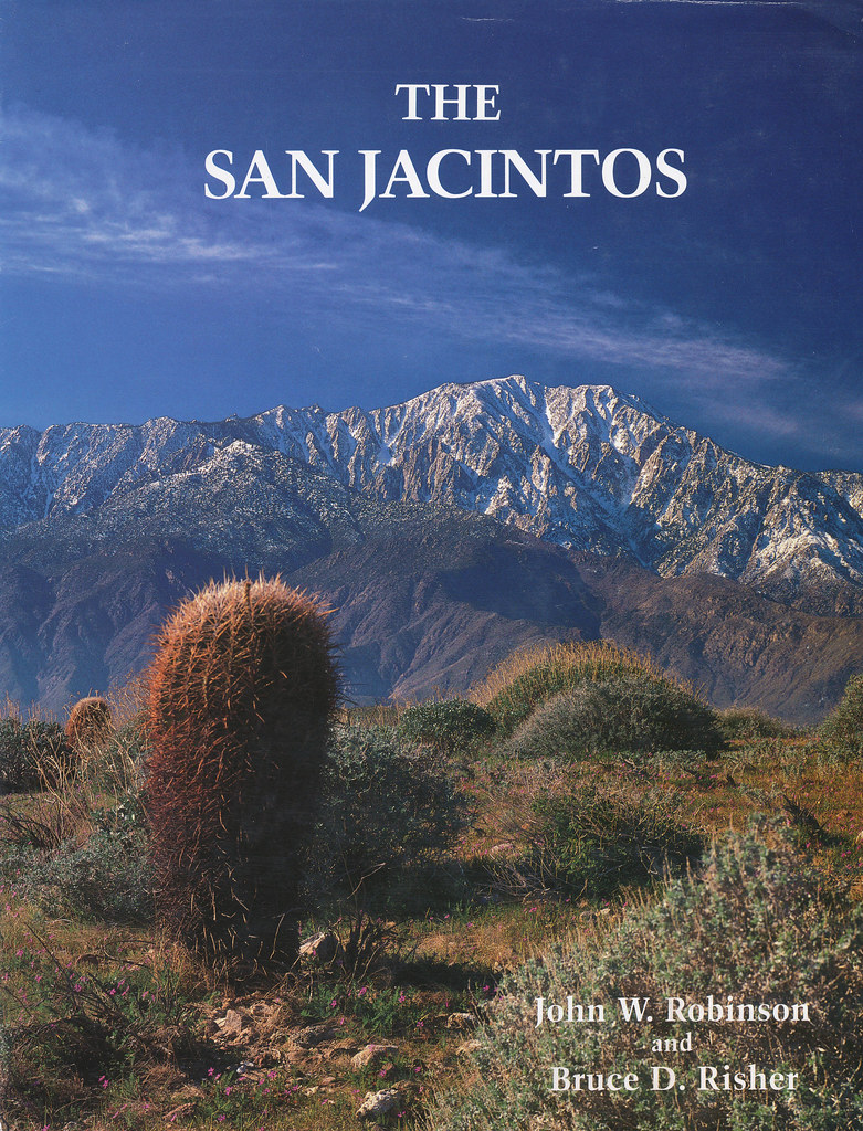 San Jacintos by tomteske, on Flickr San Jacintos by tomteske, on Flickr
The Sawmill trail dirt road. It ends five miles up at the sawmill ruins where a trail continues to the top.
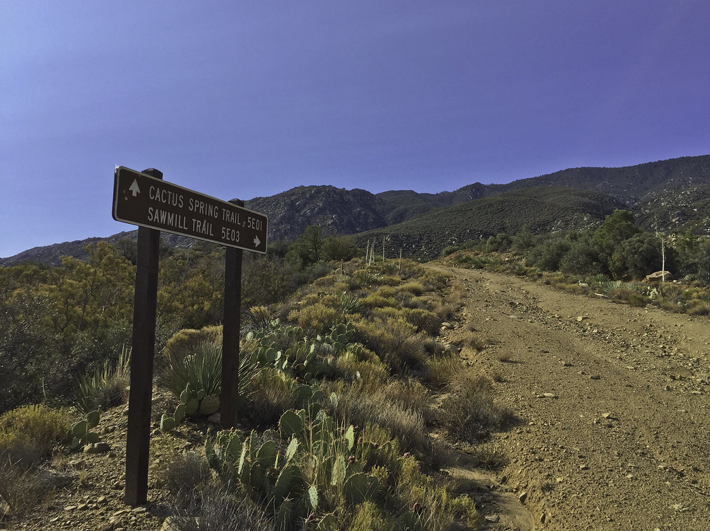 Sawmill Trail Sign by tomteske, on Flickr Sawmill Trail Sign by tomteske, on Flickr
 Sawmill Trail Sign2 by tomteske, on Flickr Sawmill Trail Sign2 by tomteske, on Flickr
Was a little disconcerting to note smoke coming from the west Santa Rosas when I started and almost thought of calling it in till I saw a spotter plane circling. Later from far up the road, watched a Huey land in the parking lot multiple times blasting my car with rotor wash. Not sandblasted when I got back luckily. Lots of aircraft overhead all day. Here's a water drop by a helo near the center of the screen. My iPhone doesn't have a zoom lens 
 Water Drop by tomteske, on Flickr Water Drop by tomteske, on Flickr
Arrived at the old sawmill ruins. The most notable structure is the old charcoal kiln.
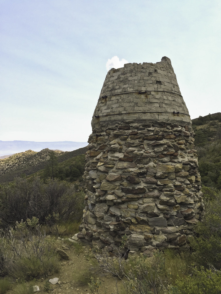 Kiln by tomteske, on Flickr Kiln by tomteske, on Flickr
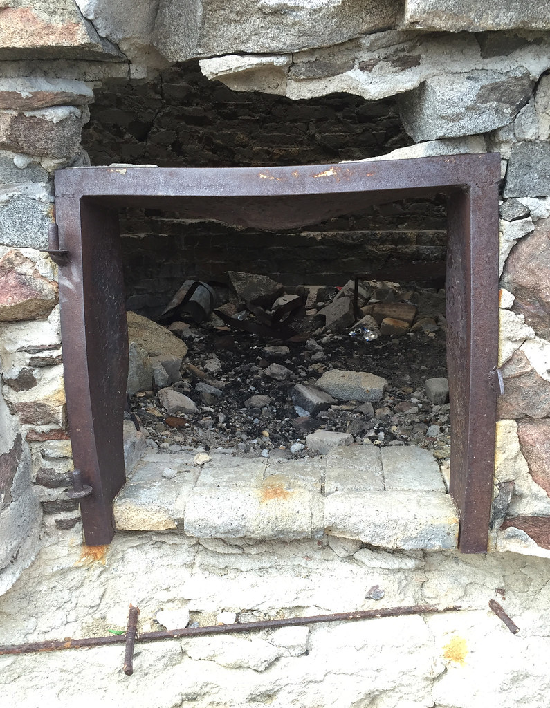 Kiln Door by tomteske, on Flickr Kiln Door by tomteske, on Flickr
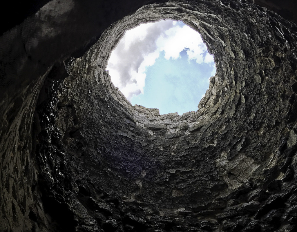 Kiln Clouds by tomteske, on Flickr Kiln Clouds by tomteske, on Flickr
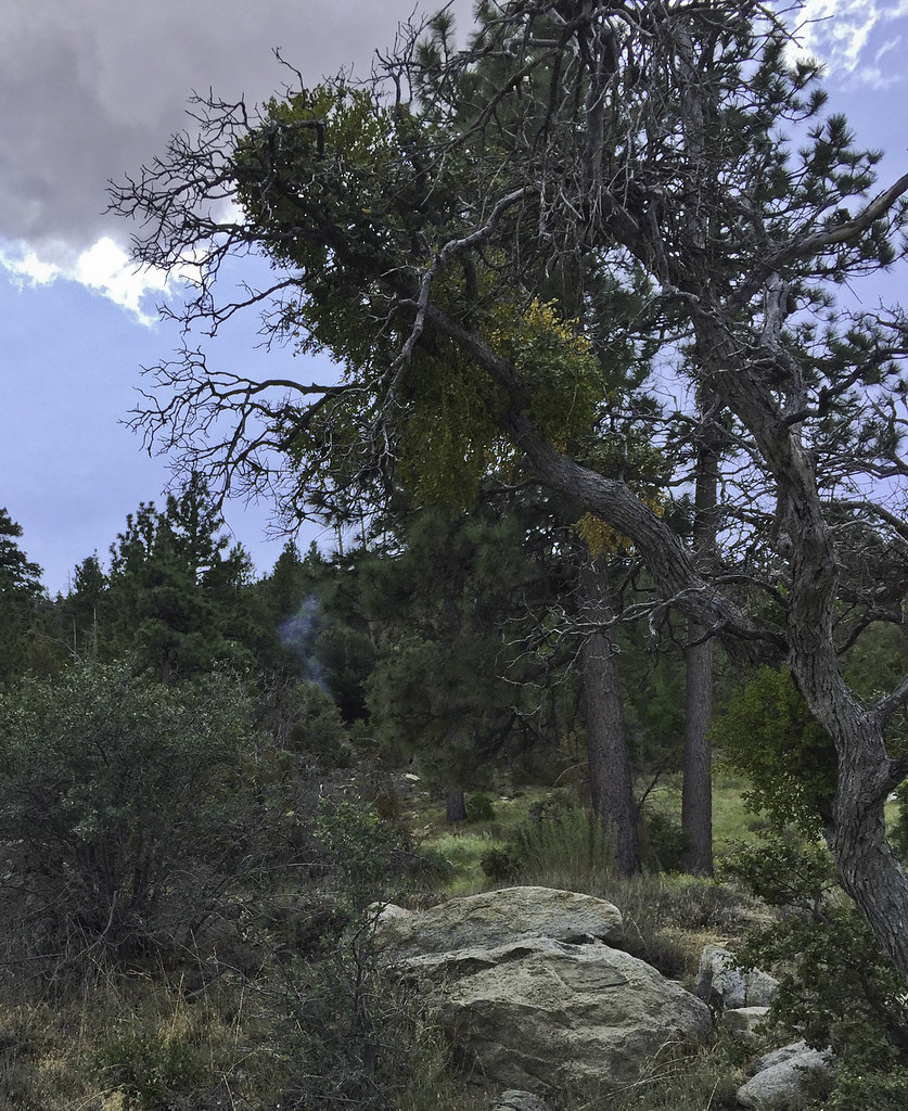
Was going to take a leisurely lunch and explore two springs to the west when I noted smoke coming out of the forest ahead.
 First Smoke by tomteske, on Flickr First Smoke by tomteske, on Flickr
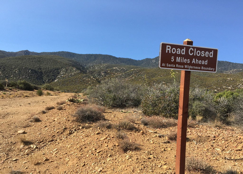
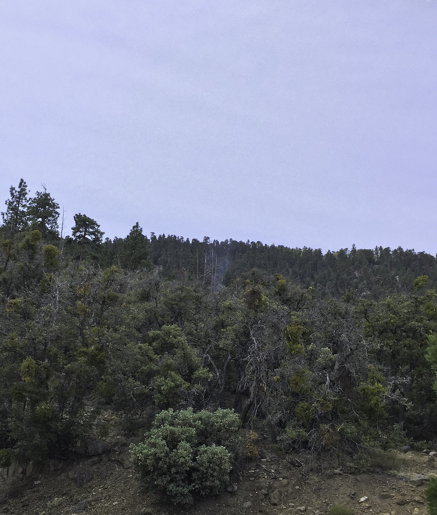
Had to head further up the road into the wilderness toward the smoke.
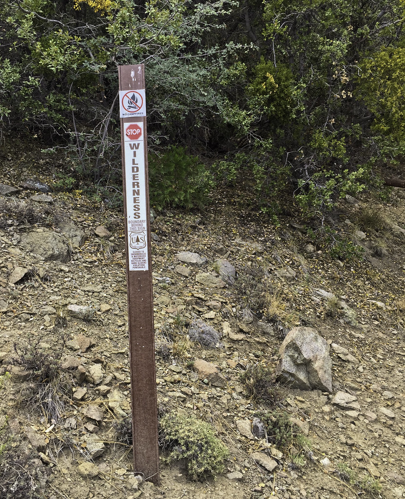 Wilderness by tomteske, on Flickr Wilderness by tomteske, on Flickr
 Sawmill Trail Barrier by tomteske, on Flickr Sawmill Trail Barrier by tomteske, on Flickr
It was uphill from a meadow with an active spring and lots of plastic piping which started making me a speck nervous since informal farming operations are know to occur this time of year in the Santa Rosas. Gave a couple yells to make sure I wasn't interrupting anyone and ended up startling a deer and myself.
 First Smoke2 by tomteske, on Flickr First Smoke2 by tomteske, on Flickr
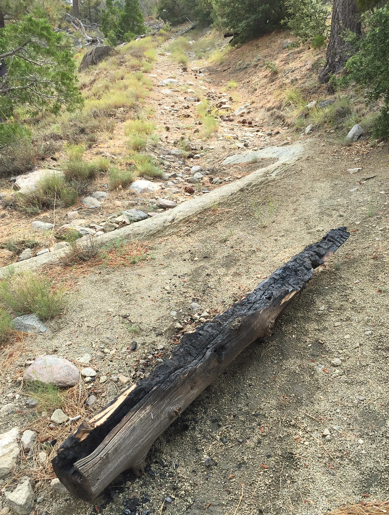
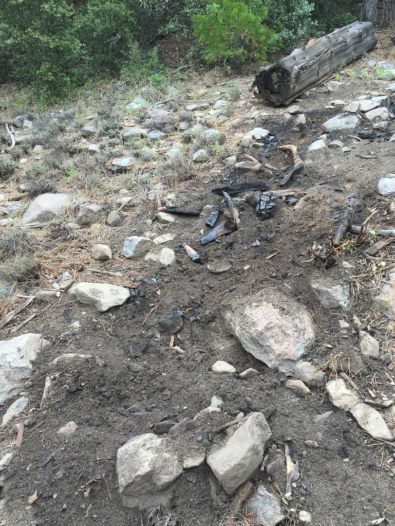
Ended up calling the fire in and got a call back from a BLM firefighter who said he would take care of it. Was a log on fire and this pic is after me stomping on the part in flames and dumping about 2L of my drinking water and another liter I got from the spring on top of it.
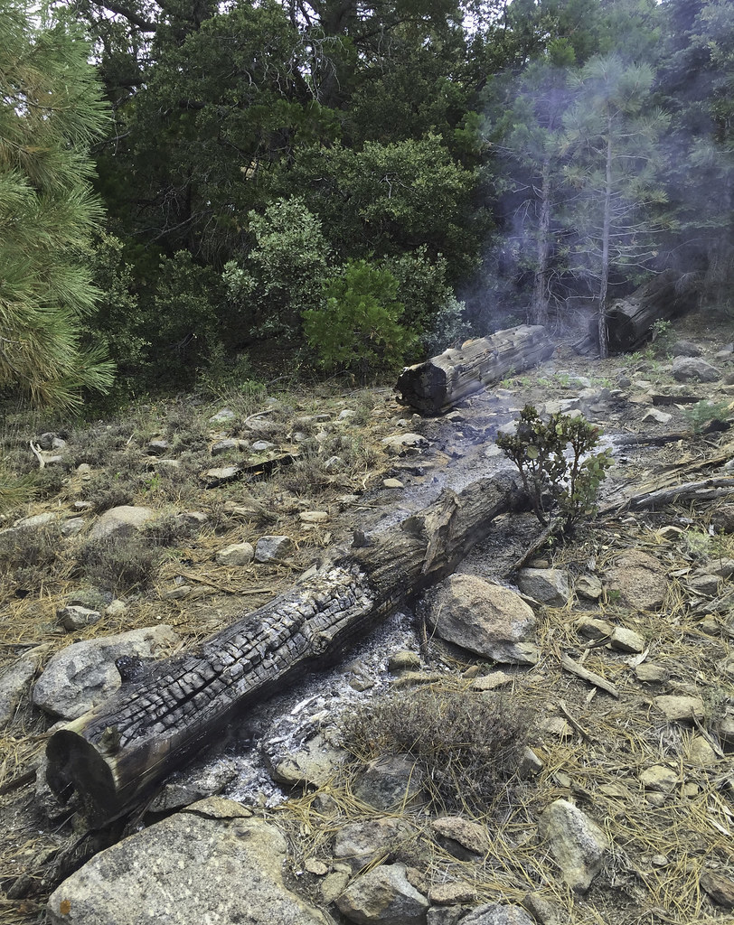 Lightning Log by tomteske, on Flickr Lightning Log by tomteske, on Flickr
Nearby, another burned out log.
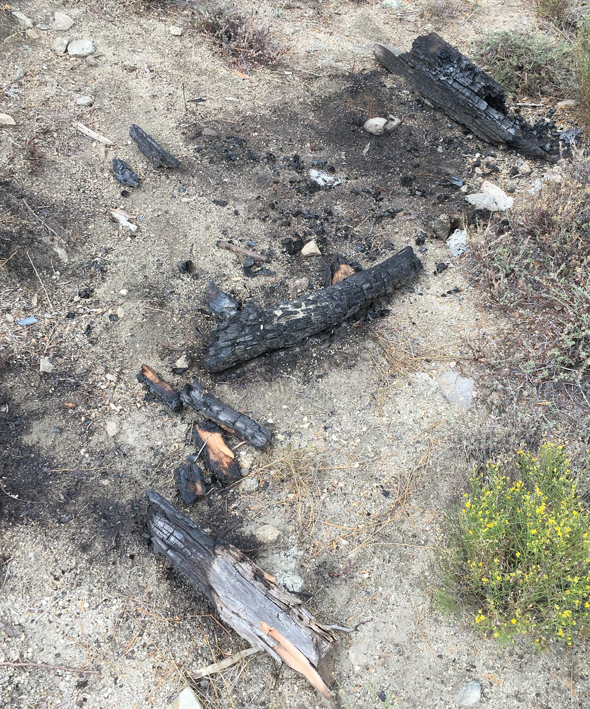 Lightning Strike by tomteske, on Flickr Lightning Strike by tomteske, on Flickr
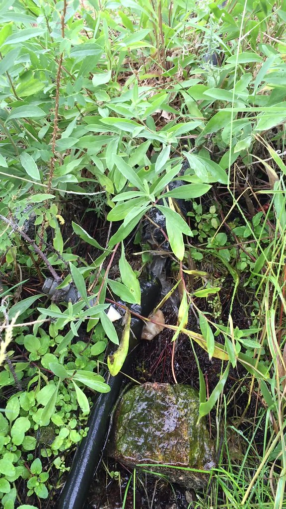
The spring pipe had a trickle coming from it and the plastic lined basin below was in disrepair
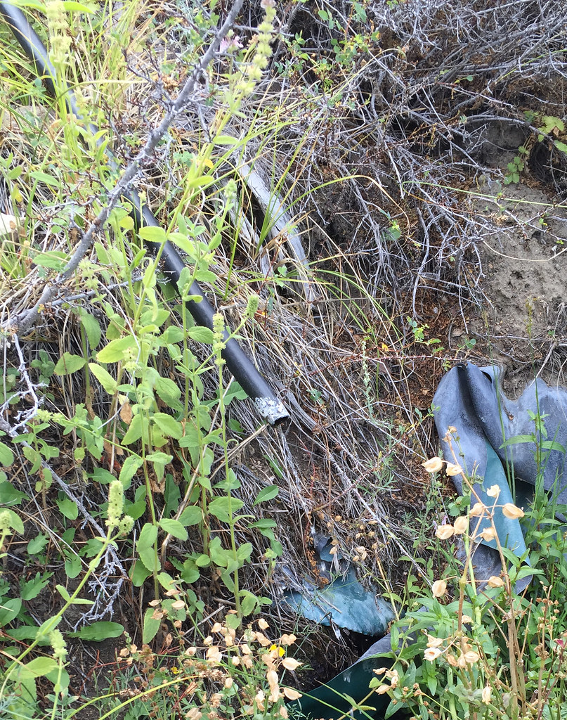 Sawmill Spring by tomteske, on Flickr Sawmill Spring by tomteske, on Flickr
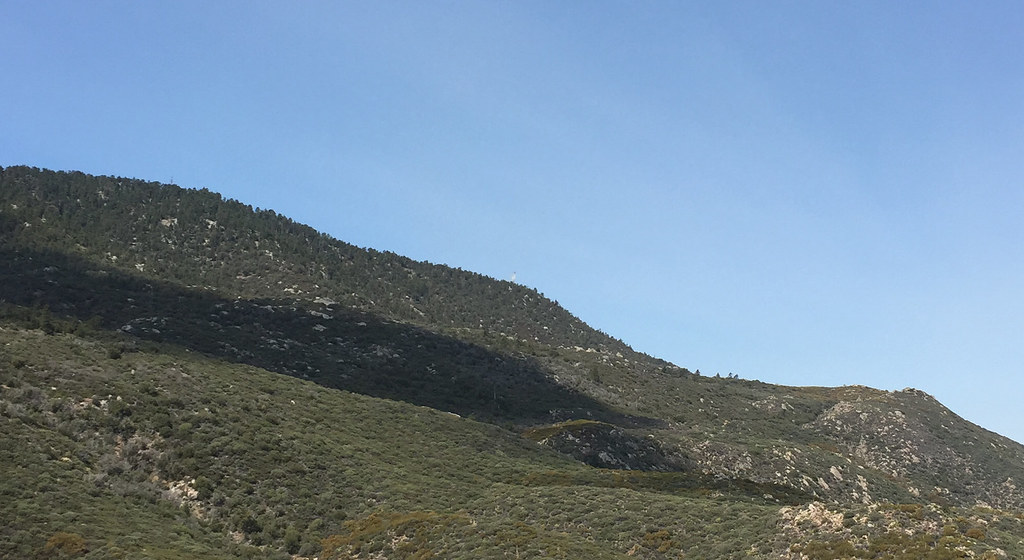
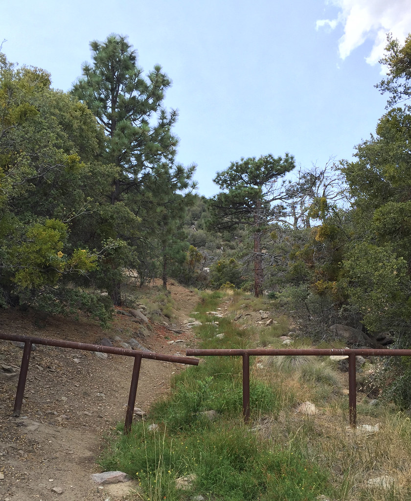
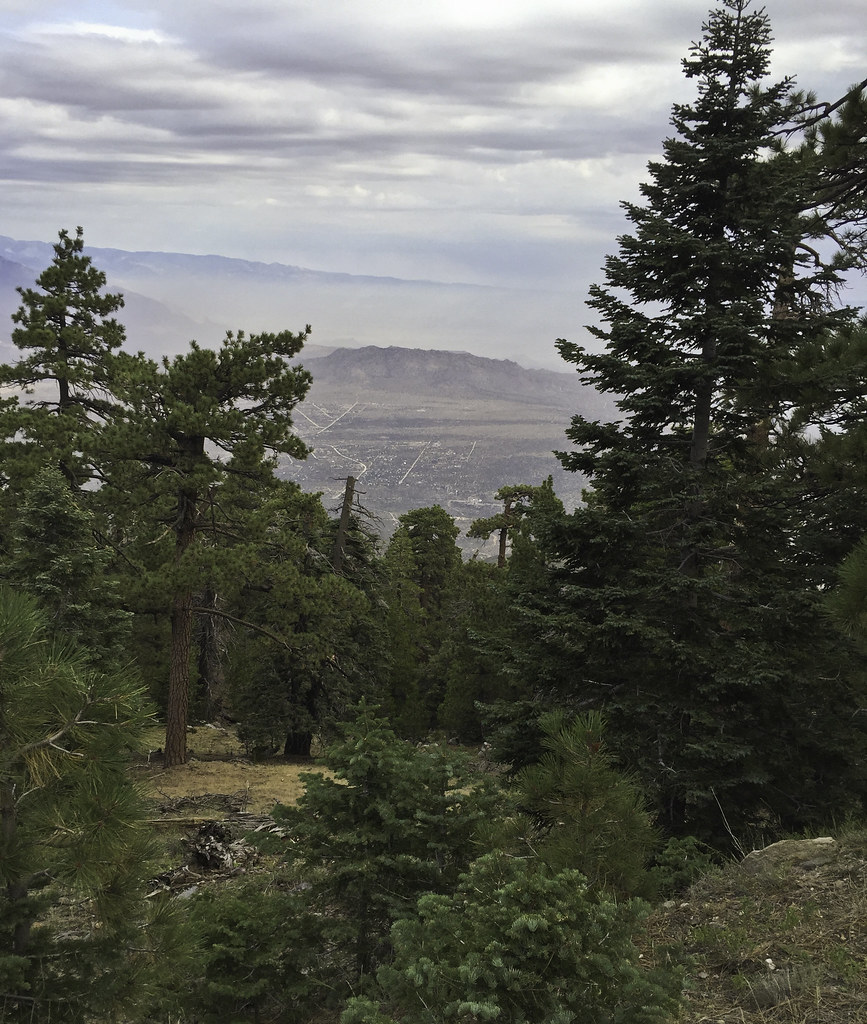
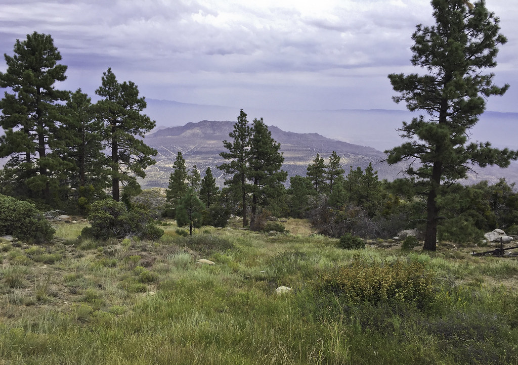
The smoldering log didn't seem to be a threat and when some other people showed up, I decided to head on up the dirt road that travels up to the Santa Rosas crest. The road to the sawmill is a nice gradual incline and fairly smooth, but after the sawmill, it's pretty rocky and a lot steeper. Here's a nice smooth section with a great view of San Jacinto.
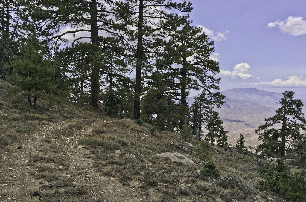 San Jacinto by tomteske, on Flickr San Jacinto by tomteske, on Flickr
Shortly thereafter, it started to lightly rain and was a nice way to finish the rest of the climb to the top. Now, pretty much out of water after losing some on the log fire, I headed the two miles straight toward Santa Rosa Spring, the one fairly sure thing water source up on top.
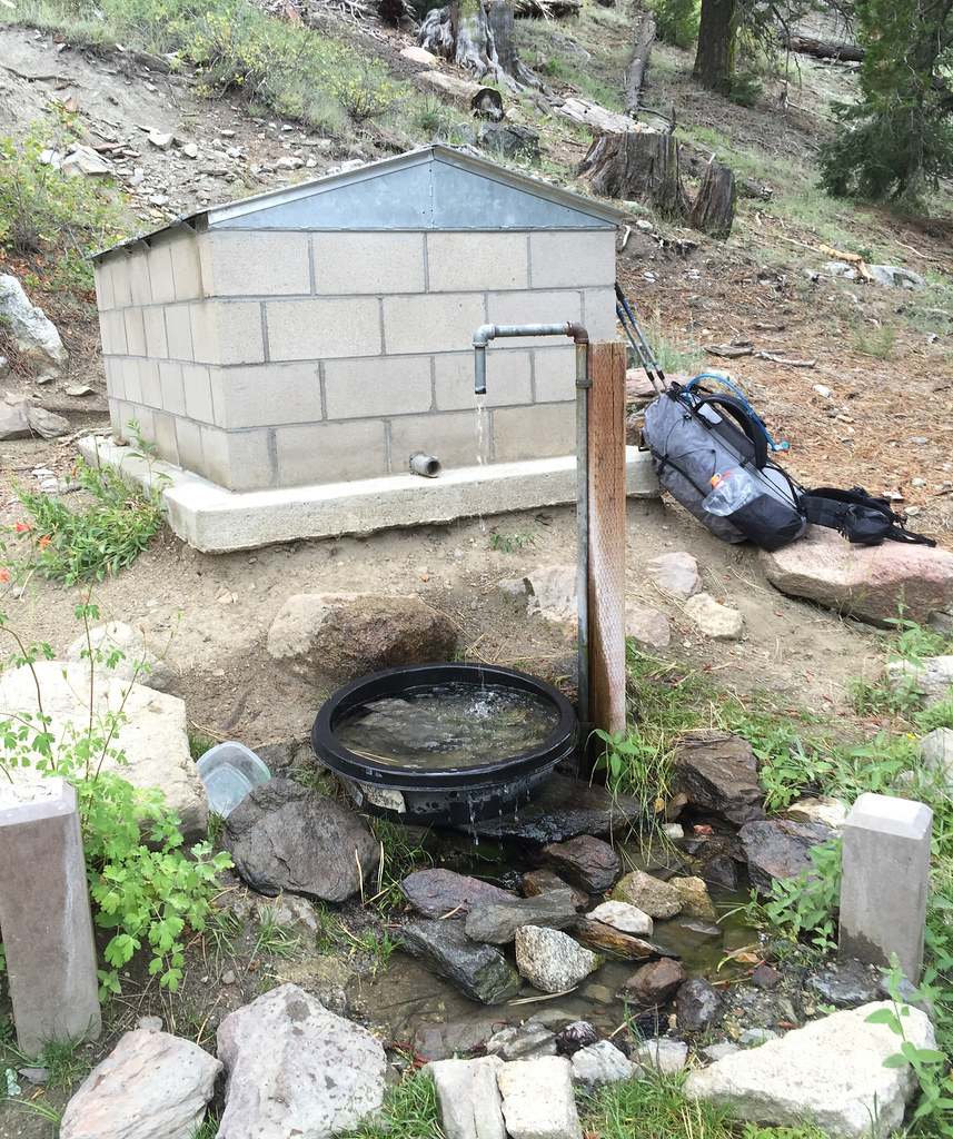 Santa Rosa Springs by tomteske, on Flickr Santa Rosa Springs by tomteske, on Flickr
Lots of fire prevention signage on the way. Place by Desert Steve Ragsdale in the 1940's after a fire, his cabin on top of Santa Rosa Mt unfortunately fell victim to what his poetry railed against.
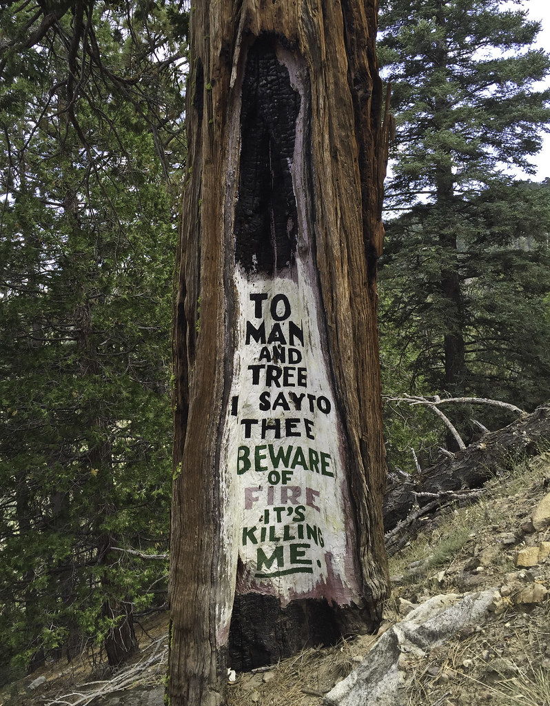 DSR Poetry by tomteske, on Flickr DSR Poetry by tomteske, on Flickr
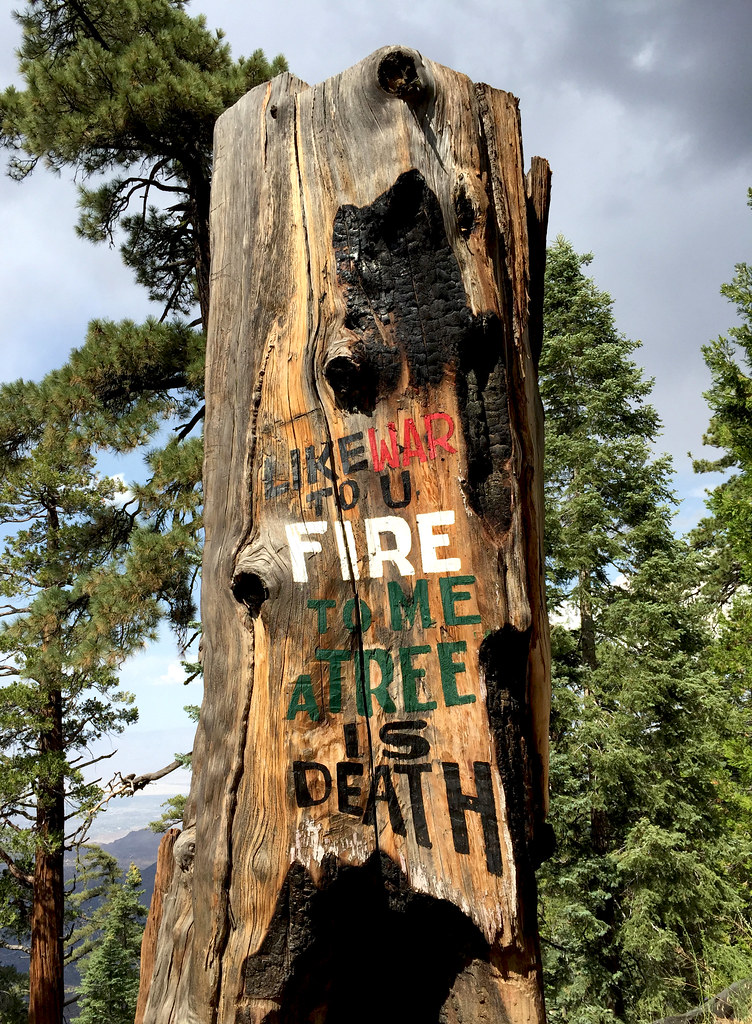 DSR Poetry2 by tomteske, on Flickr DSR Poetry2 by tomteske, on Flickr
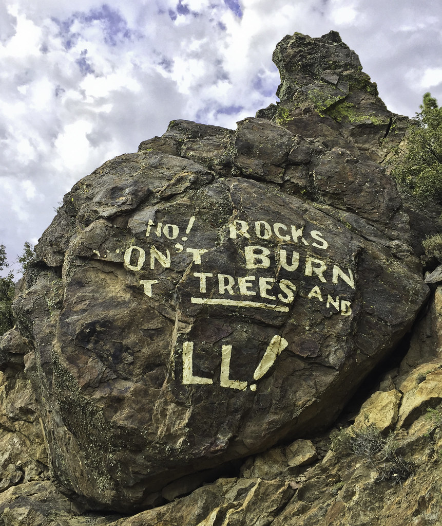 DSR Poetry3 by tomteske, on Flickr DSR Poetry3 by tomteske, on Flickr
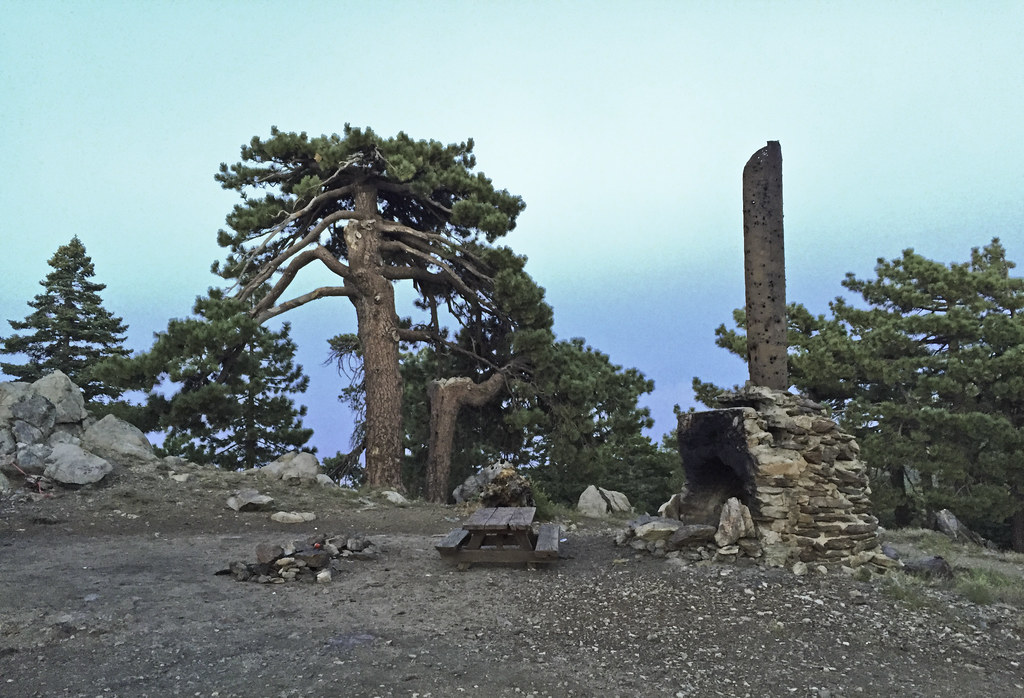
Wanted to spend the night somewhere near Santa Rosa Pk and after scouting out some nice view spots, got lazy and ended up with a sweet spot with level ground and a big picnic table. Guess everyone's serious about fire prevention up here 
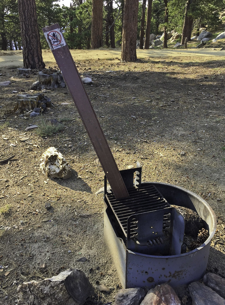 No Campfires by tomteske, on Flickr No Campfires by tomteske, on Flickr
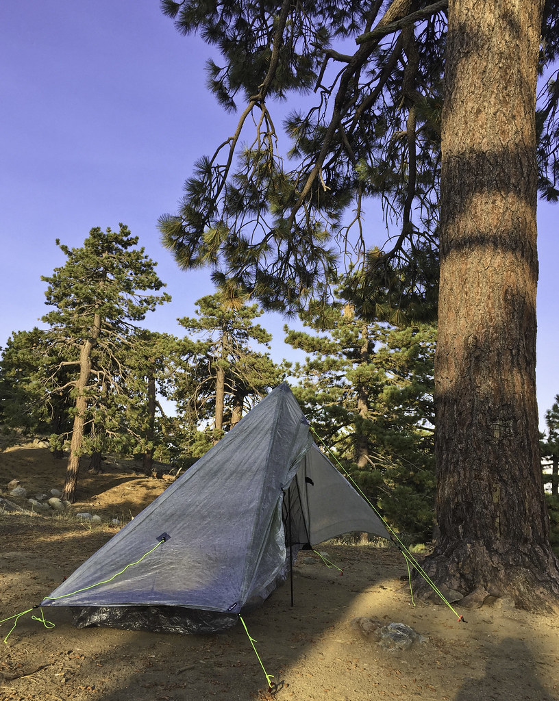 ZPack Altaplex by tomteske, on Flickr ZPack Altaplex by tomteske, on Flickr
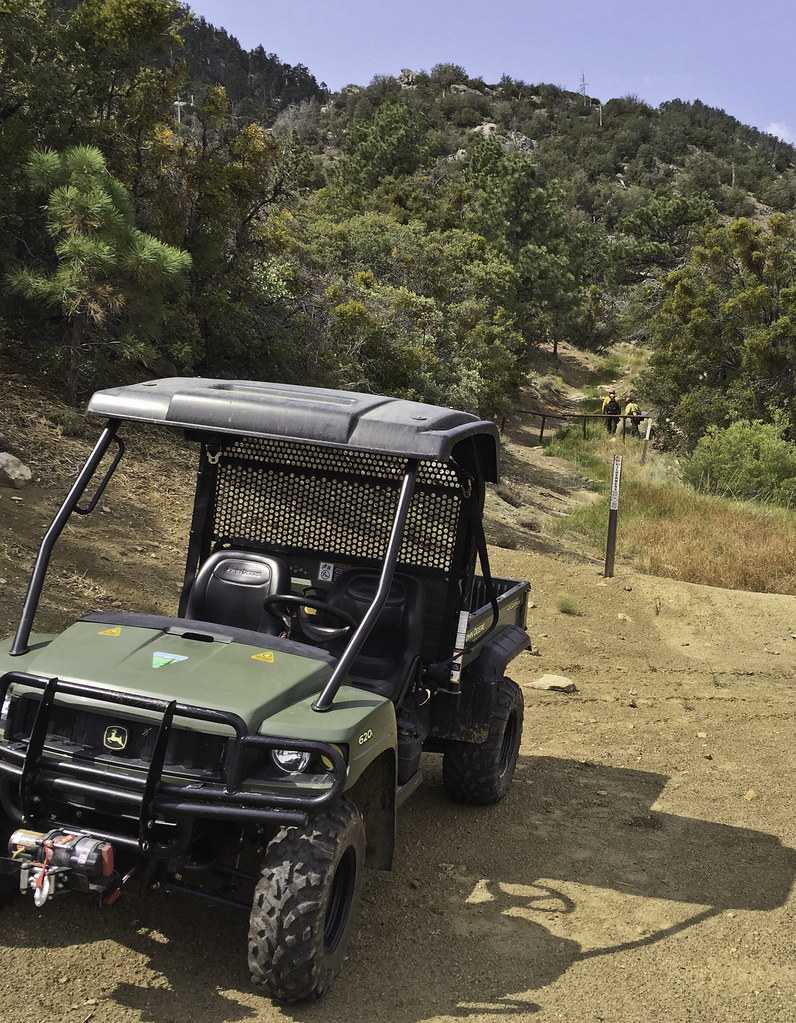
A few hundred feet up are the remains of Desert Steve Ragsdale's cabin. Nearby was parked a Civil Air Patrol vehicle bristling with antennas presumably helping out with the swarm of aircraft involved in fire suppression.
 Desert Steve Ragsdale Cabin Site by tomteske, on Flickr Desert Steve Ragsdale Cabin Site by tomteske, on Flickr
 Desert Steve Ragsdale Cabin by tomteske, on Flickr Desert Steve Ragsdale Cabin by tomteske, on Flickr
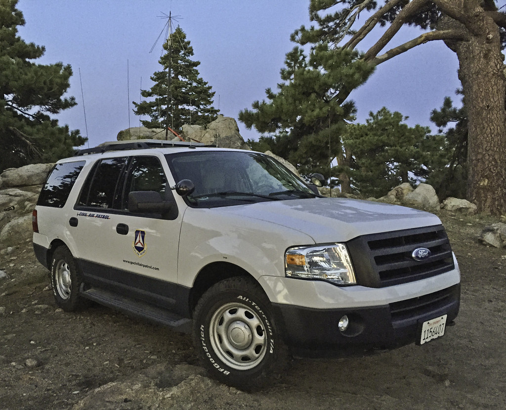 Santa Rosa CAP2 by tomteske, on Flickr Santa Rosa CAP2 by tomteske, on Flickr
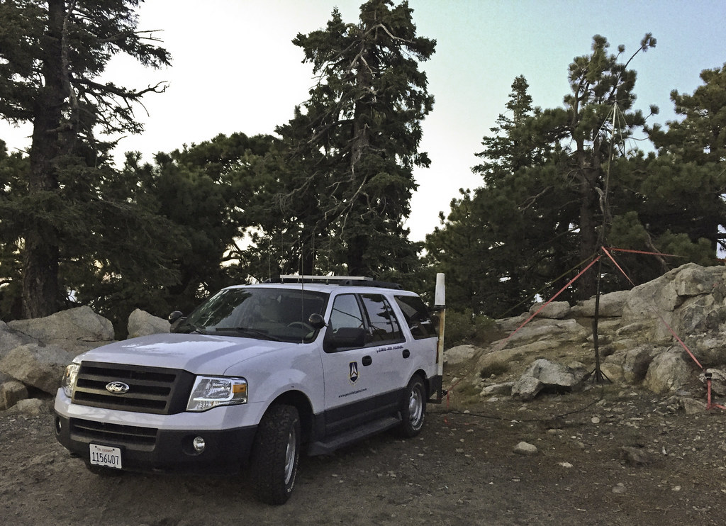 Santa Rosa CAP by tomteske, on Flickr Santa Rosa CAP by tomteske, on Flickr
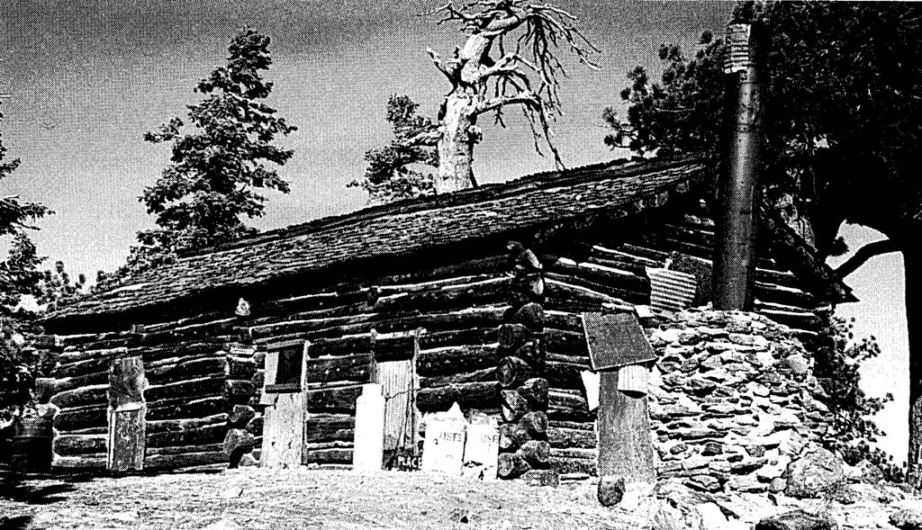
The next morning, headed out toward Stump Spring to see if I could see the old cabin nearby, the only other cabin on top of the Santa Rosas. However, it was fenced and signed and fresh tire tracks since yesterday's rain leading to it made me keep on hiking. A pic from yesteryear.
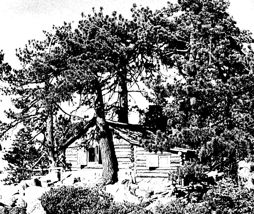 Stump Springs Cabin by tomteske, on Flickr Stump Springs Cabin by tomteske, on Flickr
Heading back down. Pinyon Flat and the parking lot far below.
 Pinyon Flats by tomteske, on Flickr Pinyon Flats by tomteske, on Flickr
Wanted to see if BLM actually showed up yesteday. Not sure why BLM was involved since it wasn't on BLM land but interagency cooperation I guess. The burning log was dragged a couple hundred feet out of the forest onto a road while the site was dug up and drenched. Shortly thereafter, bumped into the firefighters who were coming back to take a second look and make sure everything was okay. They said they had lots of fires in the Santa Rosas in the previous days secondary to multiple lightning strikes and this fire was from yet another.
 Burning Log by tomteske, on Flickr Burning Log by tomteske, on Flickr
 Afterward by tomteske, on Flickr Afterward by tomteske, on Flickr
 BLM Firefighters by tomteske, on Flickr BLM Firefighters by tomteske, on Flickr
The meadow nearby. Heard a funny noise and discovered the spring actually has pretty high flow! Tried to trace the 2" piping uphill to the origin but it went underground and I lost interest. Click on the "Gurgling Spring" pic to see a short clip.
 Sawmill Spring Meadow by tomteske, on Flickr Sawmill Spring Meadow by tomteske, on Flickr
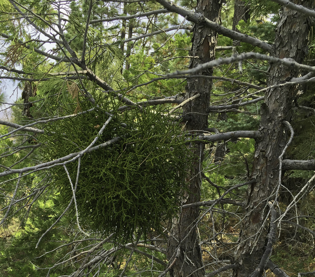 Mistletoe by tomteske, on Flickr Mistletoe by tomteske, on Flickr
 Gurgling Spring by tomteske, on Flickr Gurgling Spring by tomteske, on Flickr
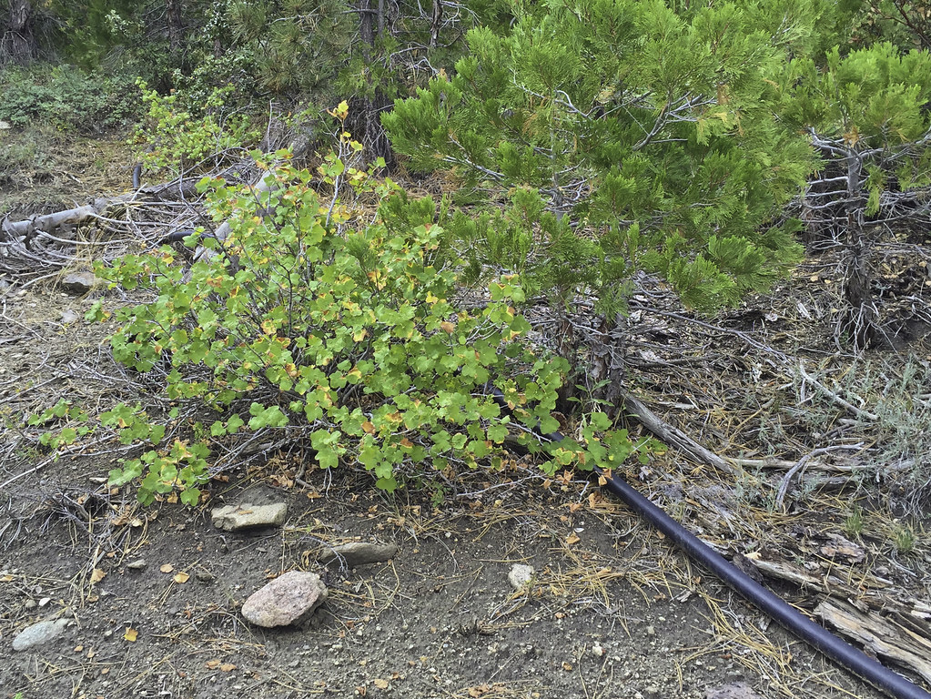 Spring Pipe by tomteske, on Flickr Spring Pipe by tomteske, on Flickr
The trip ended up being about 23 miles and 5K G/L. THOUGHT I had climbed the Sawmill Trail to the top till I realized later from other internet posts/pics the real trail exited the sawmill ruins to the west and ended up near the communication tower access road near Santa Rosa Springs. Next Time! Enjoy. Tom
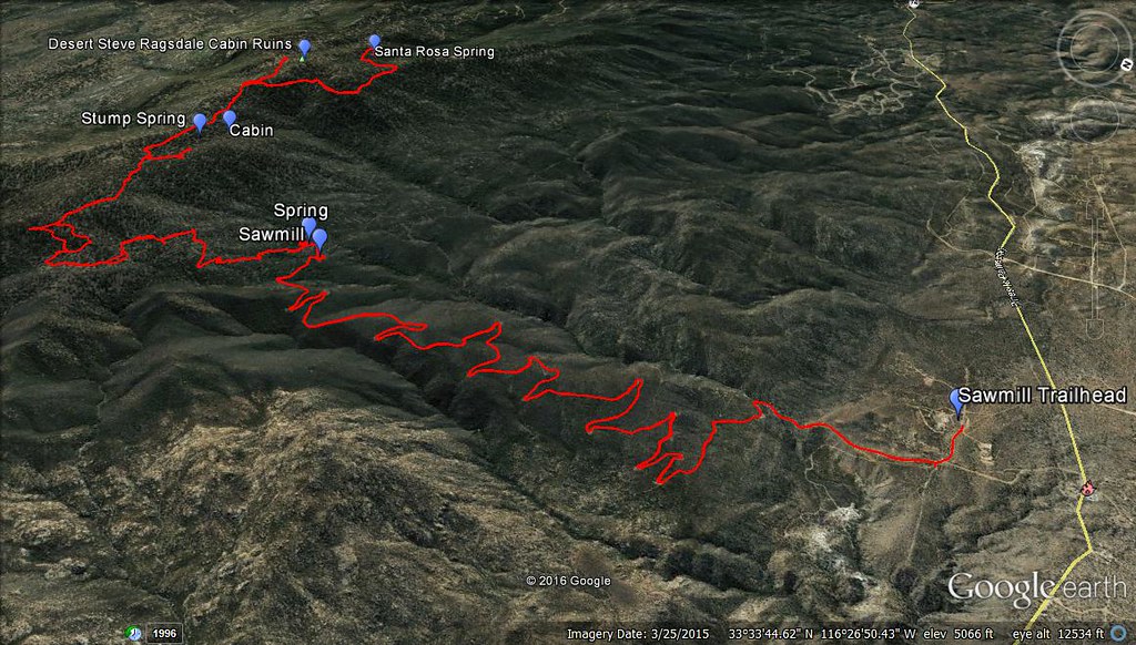 Sawmill Trail GPS by tomteske, on Flickr Sawmill Trail GPS by tomteske, on Flickr
edited by tommy750 on 8/24/2016
|
|
|
+1
link
|
|
dsefcik Administrator Posts: 2622
8/25/2016
|
Nice trip and report Tom, wish I could have joined you. I was exploring Pine Valley gold mines Sunday and saw lots of lightning just up towards the Lagunas. Looks like a good trip, hope your new Zpack gear earned it's pay....8-)
--
http://www.sefcik.com
http://www.darensefcik.com
http://www.carrizogorge.com
|
|
|
link
|
|
ziphius Posts: 911
8/26/2016
|
I like the view from inside the kiln. Funny-sounding spring too. That tent is known for its head room big man.
--
http://www.coyotelearning.org
|
|
|
link
|
|
tommy750 Posts: 1048
8/27/2016
|
dsefcik wrote:
Nice trip and report Tom, wish I could have joined you. I was exploring Pine Valley gold mines Sunday and saw lots of lightning just up towards the Lagunas. Looks like a good trip, hope your new Zpack gear earned it's pay....8-)
Zpack stuff seems to be working out well so far. Just wish they'd make water lighter . Got any pics from the mines??
|
|
|
link
|
|
tommy750 Posts: 1048
8/28/2016
|
ziphius wrote:
I like the view from inside the kiln. Funny-sounding spring too. That tent is known for its head room big man.
Was kind of a weird sound to hear out there. From old pics the pipe drained into a plastic lined basin and then over to a pond near the kiln that's now dry.
|
|
|
link
|
|
rockhopper Posts: 668
9/5/2016
|
Great trail report! I remember the old cabin before it burned down. 20 years ago?? I might have some old film pictures buried some where. It's nice to get up and in the shade of the pines this time of year. I see Borrego Springs dipped into the 90's this week. Yeah!
Thanks for sharing.
edited by rockhopper on 9/5/2016
|
|
|
link
|
|
tommy750 Posts: 1048
9/6/2016
|
rockhopper wrote:
Great trail report! I remember the old cabin before it burned down. 20 years ago?? I might have some old film pictures buried some where. It's nice to get up and in the shade of the pines this time of year. I see Borrego Springs dipped into the 90's this week. Yeah!
Thanks for sharing.
edited by rockhopper on 9/5/2016
Would be nice to see your pics of the Ragsdale cabin. Walked outside this morning in El Centro and agree the weather is starting to feel a little better.
|
|
|
link
|
|
Roryborealis Posts: 17
9/12/2016
|
Awesome trip! Id love to check that area some day.
|
|
|
link
|
|
sddarkman619 Posts: 153
9/20/2016
|
the cabin by the spring you didn't go see, why didn't you go further? what did the sign say? and could you not go see it from a different angle?
How many miles was the hike? and did you walk it from the bottom where your tracks begin?
edited by sddarkman619 on 9/20/2016
|
|
|
link
|
|
surfponto Administrator Posts: 1364
9/20/2016
|
Very cool trip Tom,
Couldn't stop scrolling back and forth through the pictures.
Bob
edited by surfponto on 9/20/2016
--
https://www.anzaborrego.net/


|
|
|
link
|
|
tommy750 Posts: 1048
9/20/2016
|
sddarkman619 wrote:
the cabin by the spring you didn't go see, why didn't you go further? what did the sign say? and could you not go see it from a different angle?
How many miles was the hike? and did you walk it from the bottom where your tracks begin?
edited by sddarkman619 on 9/20/2016
The cabin is on private property and well fenced and signed. The sign at the locked gate said "No Trespassing." I possibly could have attempted to skirt the property for a view but wasn't that interested.
The trip was about 23 miles and I started in the Cactus Spring Trail parking lot. You can drive the five miles to the sawmill ruins but I didn't.
|
|
|
link
|
|
sddarkman619 Posts: 153
9/20/2016
|
Nice TR and cool trip. looked at the images on Flickr and bought that book today, thanks!
|
|
|
link
|
|
RobertMarcos Posts: 23
10/23/2016
|
A powerful effort and accomplishment. I've ridding my mountain bike about halfway up the Sawmill Trail. Not easy at all, especially when you consider that the parking lot at Cactus Spring Trail is 3,600-feet elevation, while the summit of Toro Peak is 8,717, meaning that you hiked about 5,000 up, (and back down).
|
|
|
link
|
|
David Byrum Posts: 1
8/20/2017
|
Cool trip report...I love the Santa Rosas, spend a lot of time up there escaping the El Centro heat.
|
|
|
link
|
|
tommy750 Posts: 1048
8/3/2023
|
This interesting video showed up in my youtube feed about Desert Steve Ragsdale and I thought I'd pass it on. Wasn't aware he founded Desert Center before retiring to the Santa Rosas. Enjoy: https://youtu.be/XqGNFJRAtwg
|
|
|
link
|
|
Brian Posts: 224
8/5/2023
|
tommy750 wrote:
This interesting video showed up in my youtube feed about Desert Steve Ragsdale and I thought I'd pass it on. Wasn't aware he founded Desert Center before retiring to the Santa Rosas. Enjoy: https://youtu.be/XqGNFJRAtwg
Great video, thanks. Too bad they didn't show more of Santa Rosa MTN, but I guess that wasn't the topic of the video.
|
|
|
link
|
|
tommy750 Posts: 1048
8/13/2023
|
Brian wrote:
tommy750 wrote:
This interesting video showed up in my youtube feed about Desert Steve Ragsdale and I thought I'd pass it on. Wasn't aware he founded Desert Center before retiring to the Santa Rosas. Enjoy: https://youtu.be/XqGNFJRAtwg
Great video, thanks. Too bad they didn't show more of Santa Rosa MTN, but I guess that wasn't the topic of the video.
Agree. Going to try an camp out at the top in the next weeks weeks and do a few day hikes with the spouse.
|
|
|
+1
link
|
|
Scooter Posts: 113
8/24/2024
|
Did a car camping trip to Toro Peak last September. Nice place to explore without the desert heat.
About a half mile before the gate at the peak is a very nice campsite on the left. About 8200’ level. Flat with a large rock fire pit.
A nice day hike is exploring the Alta Seca bench. This is a high valley just east of Toro Peak.
Also the forest service website has information on if the lower gate is locked due to snow.
San Bernardino Forest website.
|
|
|
+1
link
|
|
dsefcik Administrator Posts: 2622
8/25/2024
|
There is an old helicopter crash site up at the top also. Near Alta Seca if I remember correctly.
--
http://www.sefcik.com
http://www.darensefcik.com
http://www.carrizogorge.com
|
|
|
+1
link
|
|
tommy750 Posts: 1048
8/25/2024
|
Was up there July 5 with friends to escape the heat dome or whatever they were calling it. Was 122 in Palm Springs before we ascended Hwy 74 and in the 90s climbing the Santa Rosas truck trail. Was planning on doing some hiking toward Alta Seca but not at those temps. Glad we brought the camp shower and lots of ice and booze Last weekend, it was 63 at the San Jacinto tram station at nearly the same elevation. Than would have been great camping/hiking weather. The CH-53 wreckage location is now labeled on GE north of the Toro summit and is clearly in the reservation. Not sure if it's accessible before the locked gate with signage, though.
|
|
|
link
|
|
dsefcik Administrator Posts: 2622
8/25/2024
|
tommy750 wrote:
The CH-53 wreckage location is now labeled on GE north of the Toro summit and is clearly in the reservation. Not sure if it's accessible before the locked gate with signage, though.
Can't say I recollect seeing any fences or signs when we looked for it. IIRC it was just off the road at some point.
On a side note, for any HAM's, I was able to do a check in from Toro peak to the repeater in Otay with 5w and full quieting on a handi talkie.
--
edited by dsefcik on 8/25/2024
--
http://www.sefcik.com
http://www.darensefcik.com
http://www.carrizogorge.com
|
|
|
link
|
|
Rocko1 Posts: 596
9/17/2024
|
Scooter wrote:
Did a car camping trip to Toro Peak last September. Nice place to explore without the desert heat.
About a half mile before the gate at the peak is a very nice campsite on the left. About 8200’ level. Flat with a large rock fire pit.
A nice day hike is exploring the Alta Seca bench. This is a high valley just east of Toro Peak.
Also the forest service website has information on if the lower gate is locked due to snow.
San Bernardino Forest website.
I really like the Alta Seca area. has some really great pines and views. Brian and I went up there a few years ago and saw cairns leading down to Cottonwoods. Hope to plan a trip from RHC up to Alta Seca some day.
|
|
|
link
|
|
dsefcik Administrator Posts: 2622
9/17/2024
|
Rocko1 wrote:
I really like the Alta Seca area. has some really great pines and views. Brian and I went up there a few years ago and saw cairns leading down to Cottonwoods. Hope to plan a trip from RHC up to Alta Seca some day.
That is a good trip, base camp at the cottonwoods and day hike up to the peak, good long day hike.
--
http://www.sefcik.com
http://www.darensefcik.com
http://www.carrizogorge.com
|
|
|
+1
link
|
|
Scooter Posts: 113
9/18/2024
|
Wow. That would be a tough one. Was in Rock house earlier this year, the road is completely impassable about a mile before Hidden Spring. When we were exploring the Alta Seca Bench, we hiked down to the area where the old topographical maps show the Native American trail crossing the ridge line. We had plenty of time and could find no evidence of the old trail coming up from the upper rock hoses in Rock House Valley.
I think my days of doing a day hike from the cottonwoods to Toro and back are over !!
|
|
|
+1
link
|
|
Rocko1 Posts: 596
9/18/2024
|
Scooter wrote:
Wow. That would be a tough one. Was in Rock house earlier this year, the road is completely impassable about a mile before Hidden Spring. When we were exploring the Alta Seca Bench, we hiked down to the area where the old topographical maps show the Native American trail crossing the ridge line. We had plenty of time and could find no evidence of the old trail coming up from the upper rock hoses in Rock House Valley.
I think my days of doing a day hike from the cottonwoods to Toro and back are over !!
We have gained the Santa Rosa ridge from old native trail near Stiffereno. The trail was 'visible' in areas. Takes a keen eye to see these old trails. Just compacted enough that the vegetation can't really take off on it.
|
|
|
link
|
|
dsefcik Administrator Posts: 2622
9/19/2024
|
Sooo....everybody knows this post is 8 years old right..??? AWESOME post Tommy750..!!
--
http://www.sefcik.com
http://www.darensefcik.com
http://www.carrizogorge.com
|
|
|
+1
link
|
|
dsefcik Administrator Posts: 2622
9/19/2024
|
Scooter wrote:
Wow. That would be a tough one.
I should have a GPS track if you want..yeah, good "day hike" for sure.
--
http://www.sefcik.com
http://www.darensefcik.com
http://www.carrizogorge.com
|
|
|
link
|
|
dsefcik Administrator Posts: 2622
9/19/2024
|
Rocko1 wrote:
We have gained the Santa Rosa ridge from old native trail near Stiffereno. The trail was 'visible' in areas. Takes a keen eye to see these old trails. Just compacted enough that the vegetation can't really take off on it.
That is a fun trail up and tough on the knees down. The climb from the cottonwoods to Toro is a bit tougher, longer and can be hard to find if the brush is bad but makes a good day of hiking to relax later at the peaceful cottonwoods campsite.
--
http://www.sefcik.com
http://www.darensefcik.com
http://www.carrizogorge.com
|
|
|
+1
link
|
|
Rocko1 Posts: 596
25 days ago
|
dsefcik wrote:
Rocko1 wrote:
We have gained the Santa Rosa ridge from old native trail near Stiffereno. The trail was 'visible' in areas. Takes a keen eye to see these old trails. Just compacted enough that the vegetation can't really take off on it.
That is a fun trail up and tough on the knees down. The climb from the cottonwoods to Toro is a bit tougher, longer and can be hard to find if the brush is bad but makes a good day of hiking to relax later at the peaceful cottonwoods campsite.
It looked pretty gnarly from the top. Do you have a gpx of a decent approach?
|
|
|
link
|
|
dsefcik Administrator Posts: 2622
25 days ago
|
Rocko1 wrote:
It looked pretty gnarly from the top. Do you have a gpx of a decent approach?
I thought I did but after looking thru all my tracks I did not find anything. There was a period of time when my back was bad I didn't carry a gps, it may have been then. Basically just go up the ridgeline from the cottonwoods, you should should faint trail markings and cairns here and there.
Here is the basic idea:
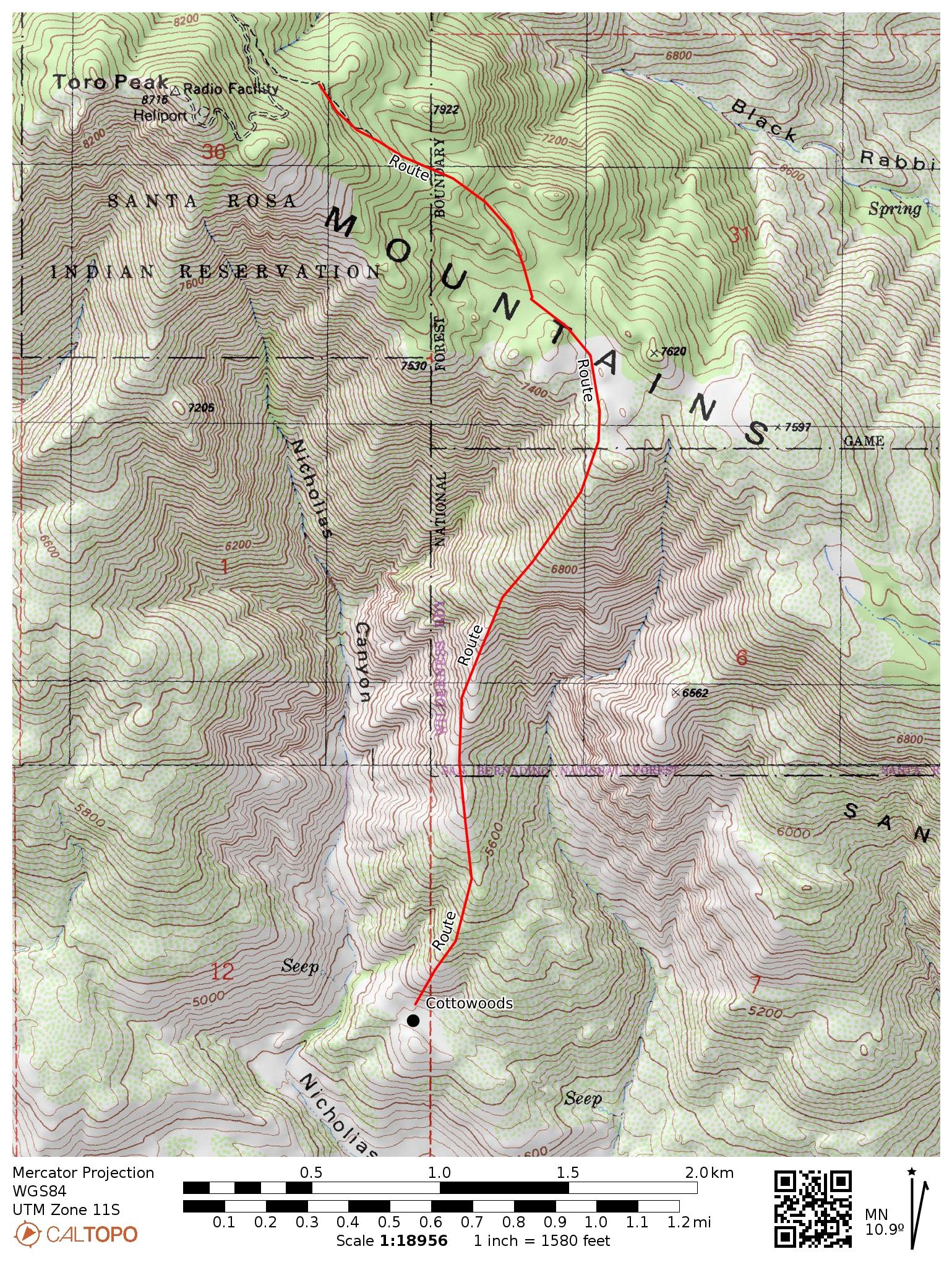
Hope this helps
--
---Map Edit--
edited by dsefcik on 9/26/2024
--
http://www.sefcik.com
http://www.darensefcik.com
http://www.carrizogorge.com
|
|
|
link
|
|
tommy750 Posts: 1048
23 days ago
|
I definitely remember this hike! Have been thinking about it recently as the start (or end) of a Cactus Spring-Agua Alta-Stifferino-Cottonwood-New Santa Rosa-Toro loop. Maybe something like this? https://caltopo.com/m/1TVFE
|
|
|
link
|
|
Rocko1 Posts: 596
19 days ago
|
dsefcik wrote:
Rocko1 wrote:
It looked pretty gnarly from the top. Do you have a gpx of a decent approach?
I thought I did but after looking thru all my tracks I did not find anything. There was a period of time when my back was bad I didn't carry a gps, it may have been then. Basically just go up the ridgeline from the cottonwoods, you should should faint trail markings and cairns here and there.
Here is the basic idea:

Hope this helps
--
---Map Edit--
edited by dsefcik on 9/26/2024
Thank you.
|
|
|
link
|
|
Rocko1 Posts: 596
19 days ago
|
tommy750 wrote:
I definitely remember this hike! Have been thinking about it recently as the start (or end) of a Cactus Spring-Agua Alta-Stifferino-Cottonwood-New Santa Rosa-Toro loop. Maybe something like this? https://caltopo.com/m/1TVFE
Now that looks like a great trip!
|
|
|
link
|
|
Brian Posts: 224
15 days ago
|
tommy750 wrote:
I definitely remember this hike! Have been thinking about it recently as the start (or end) of a Cactus Spring-Agua Alta-Stifferino-Cottonwood-New Santa Rosa-Toro loop. Maybe something like this? https://caltopo.com/m/1TVFE
I had considered that loop too. The only thing that gives me pause is that it seems like the stretch between Stifferino to Martinez Canyon to Horsethief Creek is a pretty long stretch with no reliable water source (AFAIK). But if you were planning to do it and wanted company, I would certainly be interested. I've hiked many individual sections of this but haven't connected them.
The more modest loop I have been thinking about would be to park at Toro, hike Alta Seca Bench then descend to Stifferino, then over to the Cottonwoods, then back up to Toro. Or the other way around.
|
|
|
link
|
|
tommy750 Posts: 1048
15 days ago
|
My understanding confirmed by Rockhopper a while back is the spring at Agua Alta was rehabbed and has a good flow. If that's no longer true, then you're right.
|
|
|
link
|
|
Brian Posts: 224
14 days ago
|
tommy750 wrote:
My understanding confirmed by Rockhopper a while back is the spring at Agua Alta was rehabbed and has a good flow. If that's no longer true, then you're right.
Oh wow, that would be amazing. I remember asking him about it here and he said it was a no go, but that would have been a few years ago.
|
|
|
link
|
|
tommy750 Posts: 1048
14 days ago
|
https://www.anzaborrego.net/anzaborrego/Forum/topic1438-martinez-peak-and-little-pinyon-flat.aspx
He mentions it here. I saw a video on YT showing a few seconds of the spring and it looked good. But all this was up to five years ago, so...
|
|
|
link
|
|
Brian Posts: 224
14 days ago
|
tommy750 wrote:
https://www.anzaborrego.net/anzaborrego/Forum/topic1438-martinez-peak-and-little-pinyon-flat.aspx
He mentions it here. I saw a video on YT showing a few seconds of the spring and it looked good. But all this was up to five years ago, so...
This is probably one of those cases of my memory being bad.
Anyway I hope you're able to do it this season. That route between Santa Rosa MTN and Nicholias Canyon looks especially interesting. I remember seeing that on the historic map.
|
|
|
link
|