|
davidwyby Posts: 46
1/11/2020
|
Taking a shot a trip report. This was a long one. Too long and therefore hurried for my taste. 7am-8pm. Started with frost on the ground and ice on the puddles.
Will likely go back in snatches or learn to backpack camp and explore more thoroughly.
Ah...well, I don’t see where I can add pics from my phone, and a report is nothing without pics, so I’ll be back with them later.
|
|
|
+1
link
|
|
Britain Posts: 610
1/12/2020
|
Get those picture up David!. That was an awesome trip you did!
--
Cant drive 55
Britain
http://icorva.com
|
|
|
link
|
|
davidwyby Posts: 46
1/22/2020
|
Photobucket isn't much good any more...suggestions?
|
|
|
link
|
|
Rocko1 Posts: 620
1/22/2020
|
davidwyby wrote:
Photobucket isn't much good any more...suggestions?
Use Imgur. Free and very easy to upload. When posting go to the image on Imgur. On the right hand side at the bottom choose large thumbnail. Then copy the BBCode link and paste it in the body of the post here.

|
|
|
link
|
|
davidwyby Posts: 46
1/23/2020
|
I'll give it a shot. Upload straight from phone?
I think I have a flickr account I've never used too...
|
|
|
link
|
|
Rocko1 Posts: 620
1/23/2020
|
davidwyby wrote:
I'll give it a shot. Upload straight from phone?
I think I have a flickr account I've never used too...
You can upload straight from your phone via the app. I don't think you can copy the BBcode on your phone though. Go to Imgur on desktop computer and login and look at your uploaded pictures, there you can choose large thumbnail and copy the BBcode link in the picture I posted.
|
|
|
link
|
|
davidwyby Posts: 46
8/17/2020
|
Start at VOM
 VOM to Davies by david wyby, on Flickr VOM to Davies by david wyby, on Flickr
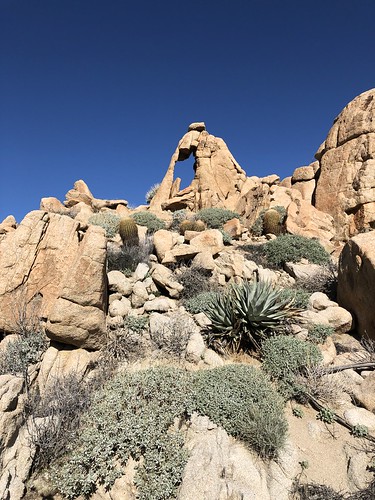
Puddletop Rock at the base of the scramble down. Lone Pine is also here. Somewhere after here there was a grove of palms and lots of sherds.
 VOM to Davies by david wyby, on Flickr VOM to Davies by david wyby, on Flickr
 VOM to Davies by david wyby, on Flickr VOM to Davies by david wyby, on Flickr
Looks like evidence of vehicle exhaust, but as I remember, was not accessible by vehicle.
 VOM to Davies by david wyby, on Flickr VOM to Davies by david wyby, on Flickr
Lots of morteros. I believe this was at the intersection of the furthest southern reaching BP Jeep road out of Meyer's valley and the canyon we hiked down.
 VOM to Davies by david wyby, on Flickr VOM to Davies by david wyby, on Flickr
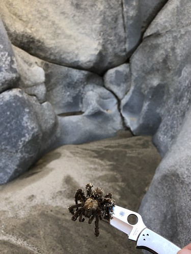
Next was Tarantula Falls. Had to scramble to get around/down it.
 VOM to Davies by david wyby, on Flickr VOM to Davies by david wyby, on Flickr
The namesake...note the coincidence of the spider on the spiderco. Looked like he had drowned.
 VOM to Davies by david wyby, on Flickr VOM to Davies by david wyby, on Flickr
Side canyon had water coming down it. Needs exploring.
 VOM to Davies by david wyby, on Flickr VOM to Davies by david wyby, on Flickr
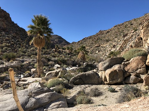
A grove getting closer to Davies.
 VOM to Davies by david wyby, on Flickr VOM to Davies by david wyby, on Flickr
Lo siento
 VOM to Davies by david wyby, on Flickr VOM to Davies by david wyby, on Flickr
Finally in Davies. At this point we were hoping to set off sensors and get picked up by BP.
 VOM to Davies by david wyby, on Flickr VOM to Davies by david wyby, on Flickr
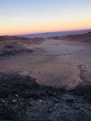
...but we still had to hike across the valley, scramble up (and down the in the dark) the dark ridge that bisects the valley N to S, then across the remainder of the valley to the gate to an awaiting campfire with chili, etc.
 VOM to Davies by david wyby, on Flickr VOM to Davies by david wyby, on Flickr
 VOM to Davies by david wyby, on Flickr VOM to Davies by david wyby, on Flickr
Yours Truly
 Billy Goat by david wyby, on Flickr Billy Goat by david wyby, on Flickr
|
|
|
+1
link
|
|
davidwyby Posts: 46
8/17/2020
|
That's about half the pictures. Some weren't that interesting and some so as not to disclose locations.
|
|
|
link
|
|
ziphius Posts: 911
8/18/2020
|
Good-looking trip! What was the diameter, roughly, of those burrows? I see some kangaroo rat tail drag marks outside the burrows. The 'exhaust' clearing is interesting. Sometimes quail will create similar dustbath circles in dirt, but this looks more like gravel. Have also seen smaller clearings created by desert sidewinders in gravelly substrate.
--
http://www.coyotelearning.org
|
|
|
+1
link
|
|
davidwyby Posts: 46
8/18/2020
|
It's been a few months now. I'd say maybe rabbit size. Too big for rat...too small for Coyote. Maybe too small for badger. Note claw dig marks to right side.
|
|
|
link
|
|
rockhopper Posts: 675
8/19/2020
|
Nice Cross country expedition and photos. Can't wait till lower temps in "our back yard". Meanwhile coastal hikes will have to do. It's hot here too. I'm sweating buckets! Stay safe.
|
|
|
+1
link
|
|
tommy750 Posts: 1077
8/20/2020
|
Have hiked out to Peak 4004 a few times along with Davies and Pinto but never that route. Looks like fun. Great TR. Thanks
|
|
|
+1
link
|
|
Britain Posts: 610
8/21/2020
|
That was a good hike David. Thanks for the share.
--
Cant drive 55
Britain
http://icorva.com
|
|
|
+1
link
|
|
davidwyby Posts: 46
8/21/2020
|
The map showed 10 miles...people's fitbit watches were showing 16-18 miles...almost all rockhopping or sand.
|
|
|
link
|
|
tommy750 Posts: 1077
8/25/2020
|
Spent about 45 minutes today talking with a BP agent regarding desert hiking and he said the wall was already being built in Davies Valley and possibly Valley of The Moon. Couldn't really believe this was happening but I was wrong. Here's satellite imaging from two days ago and four months ago. Have to admit, Davies Valley was one of the most serene and placid places I've ever hiked, but not anymore. Valley of The Moon doesn't look like it's been touched---yet.
 ezgif.com-gif-maker by tomteske, on Flickr ezgif.com-gif-maker by tomteske, on Flickr
|
|
|
link
|
|
Britain Posts: 610
8/26/2020
|
All things come to past. Wonder how much destruction will be caused from the wall running it from Davis to VOM?
--
Cant drive 55
Britain
http://icorva.com
|
|
|
link
|
|
davidwyby Posts: 46
8/26/2020
|
I wish I could get BLM to let me into Davies to get the 3 abandoned vehicles out.
|
|
|
link
|
|
tommy750 Posts: 1077
8/26/2020
|
Heard BLM already towed them. Three? I only remember two, the blue Chevy Blazer and the grey/maroon ?Nissan.
|
|
|
+1
link
|
|
davidwyby Posts: 46
8/26/2020
|
There was another closer to the border per a BP buddy.
|
|
|
link
|
|
cercidium Posts: 11
9/6/2020
|
thanks for posting these updates, especially the recent satellite view from tommy. was that from a service you subscribe to?
i was curious to see the area up close and decided to drive in to this location on thursday last week via smuggler roads from the mexican side. they've cleared a lot of earth but the fence is still about a mile away as seen in the satellite view seen. the construction crew was pretty freaked out when i walked into what they perceived as their site, telling me i needed to leave the area. i politely informed them, from about 6 feet away and in two distinct countries, that i was in mexico and the rules set forth by the u.s. gov't did not apply to the earth i was standing on. they were perplexed by this, and said they were going to detain me (and on it went). needless to say, the border patrol arrived and there were no arrests that day.
i'm happy to share photos but it appears they need to be uploaded from a url. if there are alternate ways to do this please let me know.
|
|
|
link
|
|
cercidium Posts: 11
9/6/2020
|
i forgot to add a link that shows the extend of new border fencing, which you can zoom in on for reasonably detailed information. this map suggests the fence will not be constructed through valley of the moon. it was also clear from mx hwy 2 that the fence is not going to connect the area east of davies valley with the desert floor south of the 98 and ocotillo. they appear to be avoiding the most mountainous stretches of desert.
https://www.cbp.gov/border-security/along-us-borders/border-wall-system
|
|
|
link
|
|
tommy750 Posts: 1077
9/7/2020
|
cercidium wrote:
thanks for posting these updates, especially the recent satellite view from tommy. was that from a service you subscribe to?
I got the images from caltopo.com. At the bottom of the drop down base layers menu there is a choice for "live satellites" but you have to be a pro member which is about $50/year. I use that site so often I'm happy to give them that amount yearly.
Thanks for the wall update, Cercidium. Looking forward to seeing you pics.
|
|
|
link
|
|
tekewin Posts: 386
9/19/2020
|
Great report and photos! I haven't been around the forum much since COVID, but I missed this report back from back in January. I'll add VOM to my hike list based on your great photos.
With most forest areas closed right now, I'm tempted to head back to the desert before temps become comfortable. Might not be a good idea.
|
|
|
link
|
|
davidwyby Posts: 46
9/19/2020
|
There are some interesting blm areas in the mntns. I live down here...I recommend maintaining some elevation for another month.
|
|
|
+1
link
|
|
deborah Posts: 115
10/26/2020
|
Thanks for posting, really nice trip report and photos. The rock arch is really unique.
|
|
|
link
|