|
Brian Posts: 249
5/6/2022
|
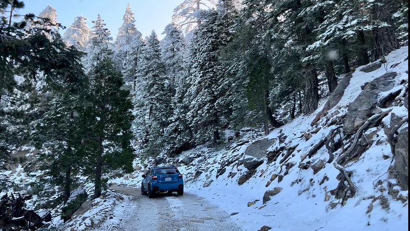
Rocko1 and I wanted to get in one more overnight trip before the desert gets too hot (this isn't quite Anza Borrego but it's adjacent). We were looking at high desert options and settled on Alta Seca Bench near Toro Peak. This was 2 weekends ago and a snow storm blew through a day before we went. We didn't set any firm destination goals because we didn't know what conditions we would find. We managed a thorough exploration of the bench despite both of us feeling the effects of the altitude (it's easy to forget that the starting point of this trip is 1000' higher than the highest peaks in Anza Borrego).
All pics courtesy of Rocko1
A good view of the bench from one of our previous trips to Rockhouse Valley.

There was still snow at the top when we arrived. It was gone by the next day.

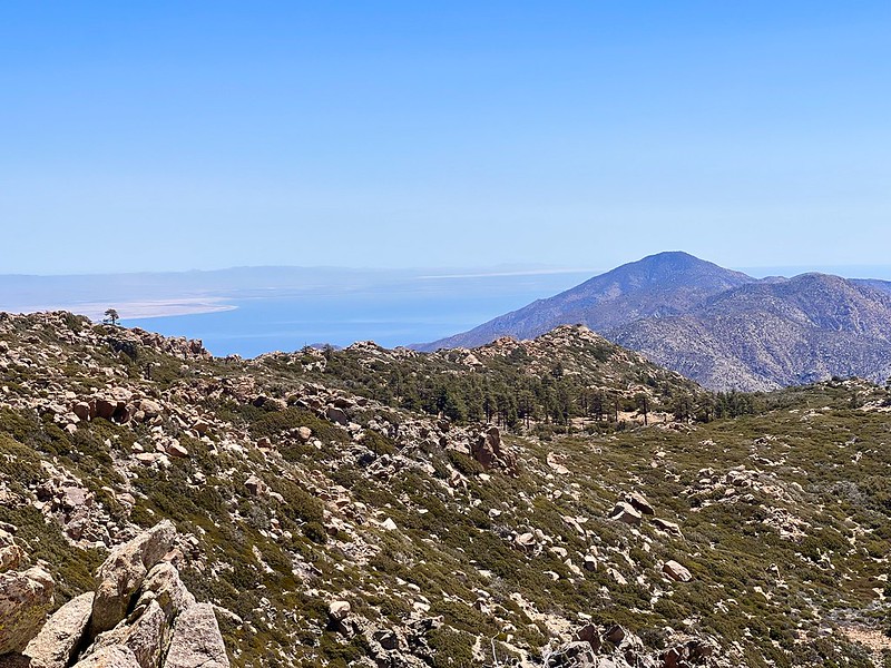
Views of Borrego Springs, Rockhouse and Clark Valleys.


We found the top of the ridge that descends to the Cottonwoods. We're talking about a Toro to Rockhouse traverse next fall.

Conditions on the bench were much drier than at Toro.

Views to the S/E

Our campsite had great views but also wind exposure.

Sunrise from camp.

|
|
|
+1
link
|
|
Brian Posts: 249
5/10/2022
|
tekewin wrote:
A very interesting trip and great photos!
Did you start on Toro or just below it?
Seems like a mostly unexplored area.
The plan was to start by the locked gate just below the summit of Toro. We encountered more ice than expected on the road near Stump Spring campground and decided to park there since there are limited places to turn around if the road got worse. Of course as it turned out we would have been totally fine driving to the end, but this worked out OK.
|
|
|
+2
link
|
|
Buford Posts: 467
5/9/2022
|
Nice. There is so much up there to explore. Very few people up there I assume? I am a little surprised the road was open, they sometimes close it due to weather.
Glad you found the ridge down to the cottonwoods. I have really enjoyed hikes like Rockhouse to Toro where you can go through multiple biomes in a day hike.
--
Links to my photos: ABDSP photos, Bighorn sheep photos, ABDSP time lapse video, Wildlife photos (mainly birds)
|
|
|
+1
link
|
|
dsefcik Administrator Posts: 2634
5/10/2022
|
Looks like a great trip. There is a wrecked military helo up towards the peak, you should find that next time out that way.
--
http://www.sefcik.com
http://www.darensefcik.com
http://www.carrizogorge.com
|
|
|
+1
link
|
|
Brian Posts: 249
5/10/2022
|
Buford wrote:
I am a little surprised the road was open, they sometimes close it due to weather.
I always check this page before I go.
https://www.fs.usda.gov/recarea/sbnf/recarea/?recid=81714&fbclid=IwAR0GW9delpT-LLXErehAP2YEXkFyHbYr4U-NhM4I3wc21SgP4g3fwiL0rys
The forecast for the storm that rolled through didn't call for any accumulation (although there was some), so that's probably why they didn't bother to close it.
|
|
|
+1
link
|
|
rockhopper Posts: 672
5/12/2022
|
To Add: So nice to see the sky island of Jeffrey pine, Ponderosa pine amongst other Conifers on the Southern Bench photo. They looked healthy. Hope they can hang on. I need to go there someday!
|
|
|
+1
link
|
|
rockhopper Posts: 672
5/13/2022
|
Rocko1 wrote:
rockhopper wrote:
To Add: So nice to see the sky island of Jeffrey pine, Ponderosa pine amongst other Conifers on the Southern Bench photo. They looked healthy. Hope they can hang on. I need to go there someday!
I called the ranger the day before to confirm the gate was unlocked. Really great area. I commented to Brian while walking through the pine meadows-'you know what you don't see many of? Dead trees'. What was there looked pretty healthy. But as with everything-better go see it sooner than later.
I was shocked at all the cairns leading to the southern edge of the bench-there are quite a few old ones and trails that are choked, we struggled in a few spots. Seems to be 3 'routes' going south-dead center on the ridge and to the east and just west of center. These converge about 1/4 mile before the bench drops onto the crest.
If you haven't been up there I suggest a trip-Even for a day or so. Park near the end of the road and explore the bench.
I will definitely plan a trip to the Southern bench sometime. I have hiked down to around the 7500 ft. elevation just above the bench on the south side and hiked off Toro to the East down to Black Rabbit and to the West down to the "other" abandoned Sawmill several times. That southern bench looks sweet to base camp at. Thanks for posting the video. A little ground snow for water and light winds would be perfect.
|
|
|
+1
link
|
|
davidwyby Posts: 46
9/13/2022
|
I very much like those mountains. Have spent a lot of weekends up there for over 10 years. Good escape from this desert heat.
|
|
|
+1
link
|