|
tommy750 Posts: 1077
8/15/2022
|
Haven't been out hiking in maybe a month so decided to head out to my favorite summer day hiking spot, McCain Valley. Have literally been out there dozens of times but there's always somewhere new to explore. It was 106 when I left the desert floor and 84 when I got to the Cottonwood Campground, but clouds were starting to build. Looked like it rained a fair bit in the recent past and even the washboard road wasn't that bad. Headed out on the Sombrero trail before veering east. Looks like a couple small tinajas got some water.
 IMG_0106 by tomteske, on Flickr IMG_0106 by tomteske, on Flickr
Came across a site Daren and I stumbled on a few years back just when it started to rain. Was a decent shower lasting 15-20min and enough to fill up a few morteros.
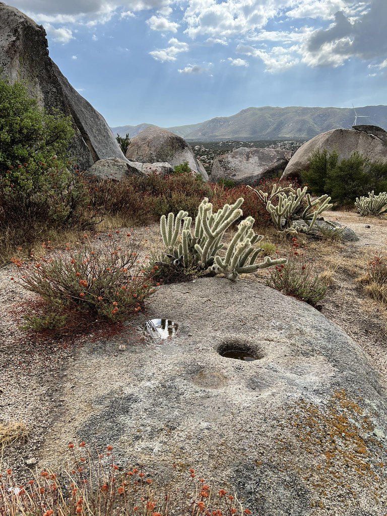 IMG_0114 by tomteske, on Flickr IMG_0114 by tomteske, on Flickr
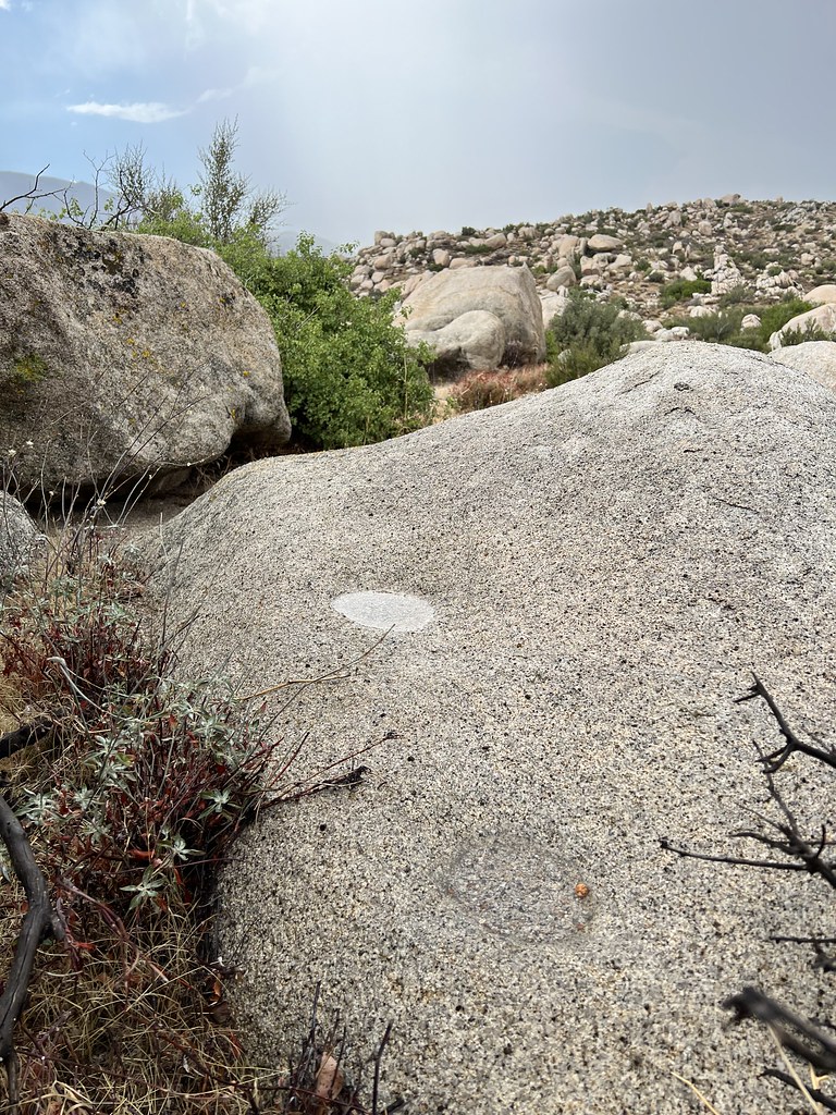 IMG_0115 by tomteske, on Flickr IMG_0115 by tomteske, on Flickr
Metate piece.
 IMG_0118 by tomteske, on Flickr IMG_0118 by tomteske, on Flickr
Found this little quartz Desert Side Notch point. It's a little beat up and missing a tang and barb but pretty hard to find anything these days out in McCain due to massive illegal collection over the decades.
 IMG_0126 by tomteske, on Flickr IMG_0126 by tomteske, on Flickr
Rock shelter with a few faded pictos all DStretched.
 IMG_0129 by tomteske, on Flickr IMG_0129 by tomteske, on Flickr
 IMG_0153 by tomteske, on Flickr IMG_0153 by tomteske, on Flickr
 IMG_0157 by tomteske, on Flickr IMG_0157 by tomteske, on Flickr
 IMG_0149 by tomteske, on Flickr IMG_0149 by tomteske, on Flickr
Found another Desert Side Notch walking on a stream bank. It also lost one of its tangs and a bit of a barb.
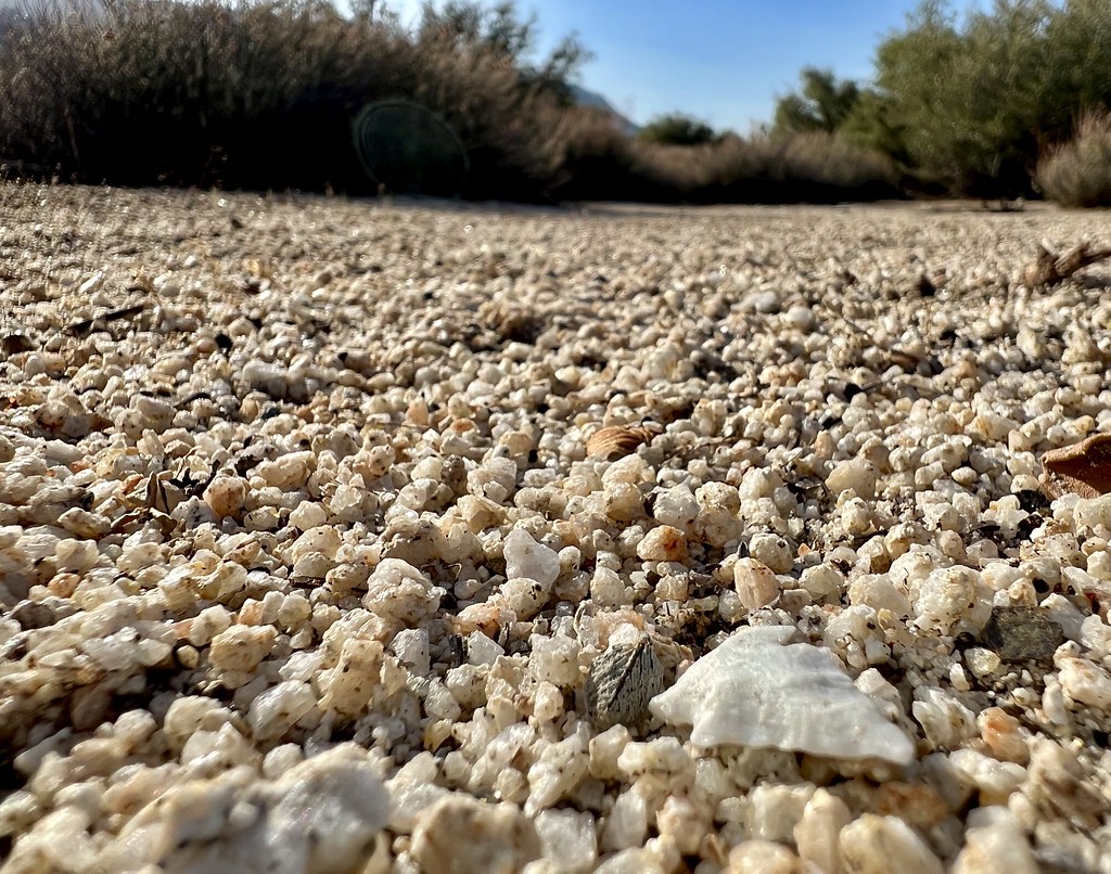 IMG_0178 by tomteske, on Flickr IMG_0178 by tomteske, on Flickr
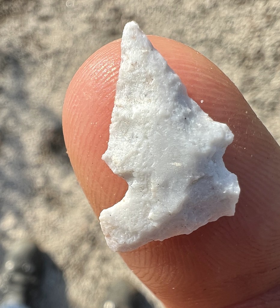 IMG_0190 by tomteske, on Flickr IMG_0190 by tomteske, on Flickr
Headed over to a "topo spring" I'd never been to. Didn't expect much but almost looked like it could still have some water.
 IMG_0204 by tomteske, on Flickr IMG_0204 by tomteske, on Flickr
Did have a wet spot but may have just been the rain.
 IMG_0207 by tomteske, on Flickr IMG_0207 by tomteske, on Flickr
Expected ranching stuff was around. These metal troughs are kinda tough to escape if you're a critter and this rodent and his amphibian buddy didn't make it out alive.
 IMG_0230 by tomteske, on Flickr IMG_0230 by tomteske, on Flickr
 IMG_0237 by tomteske, on Flickr IMG_0237 by tomteske, on Flickr
 IMG_0233 by tomteske, on Flickr IMG_0233 by tomteske, on Flickr
Nearby was this benchmark. Don't think I've ever seen a Boy Scout BM but why not? Looks like it was run over since I couldn't move it upright.
 IMG_0244 by tomteske, on Flickr IMG_0244 by tomteske, on Flickr
 IMG_0250 by tomteske, on Flickr IMG_0250 by tomteske, on Flickr
A nice 8 mile hike with little elevation g/l but was a "chilly" 74 when I made it back. This toad was making the perilous journey across from Cottonwood West to East right when I was leaving. Hope he makes it. Enjoy!
 IMG_0263 by tomteske, on Flickr IMG_0263 by tomteske, on Flickr
|
|
|
+1
link
|
|
Rocko1 Posts: 620
8/16/2022
|
Great finds! You really have a built in dowsing rod for artifacts! I find a couple of pot shards and I am ecstatic. Was that trough being fed by that spring or just collecting rain water? How hot was it while you were out there?
|
|
|
link
|
|
dsefcik Administrator Posts: 2634
8/16/2022
|
Surprised that old trough is holding water..looks like a nice day bike.
--
http://www.sefcik.com
http://www.darensefcik.com
http://www.carrizogorge.com
|
|
|
+1
link
|
|
tommy750 Posts: 1077
8/16/2022
|
Rocko1 wrote:
Great finds! You really have a built in dowsing rod for artifacts! I find a couple of pot shards and I am ecstatic. Was that trough being fed by that spring or just collecting rain water? How hot was it while you were out there?
There was a few inches of water in the trough and assuming it was from a recent rain. Smelled really bad from the decomposing critters. May stop by in the future to check on it. Earlier this year, I spotted a beat up trough on GE near the end of McCain Valley Rd and it had a nice nearby spring with decent flow. It was not present on the topo map
Was in the low 80s most of the hike and got nice and cool with the rain. Usually too lazy to get out early when it's cooler
|
|
|
+1
link
|
|
tommy750 Posts: 1077
8/16/2022
|
dsefcik wrote:
Surprised that old trough is holding water..looks like a nice day bike.
Trough must have been Boy Scout Strong  Wanted to put a rescue stick/ladder in it but didn't seen anything handy. Wanted to put a rescue stick/ladder in it but didn't seen anything handy.
|
|
|
link
|
|
Brian Posts: 253
8/16/2022
|
Great pics. I've only been to McCain Valley a couple times. I did the hike to Sombrero Peak and a bike ride to Carizo overlook. The bike ride was probably about 10 years ago. I remember there were helicopters placing the towers for the power lines at the time. I've always intended to go back and explore more but it hasn't happened yet.
|
|
|
+1
link
|
|
Brian Posts: 253
8/16/2022
|
This was November, 2011
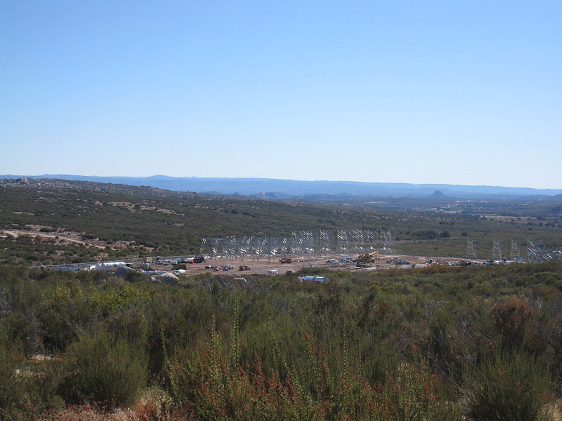


Going through my old pics I realized I also did the Pepperwood trail at some point. Some of these trips are far enough in the past to be straining my memory.
|
|
|
+1
link
|
|
dsefcik Administrator Posts: 2634
8/17/2022
|
I remember those days and before the sunrise power link. The owner of this forum and I were out there protesting the ground breaking and I went to several ocotillo town meetings when they were soliciting community input.
--
http://www.sefcik.com
http://www.darensefcik.com
http://www.carrizogorge.com
|
|
|
+1
link
|
|
Rocko1 Posts: 620
8/17/2022
|
tommy750 wrote:
Rocko1 wrote:
I spotted a beat up trough on GE near the end of McCain Valley Rd and it had a nice nearby spring with decent flow. It was not present on the topo map
That is a rare find, unmapped spring flowing this late in the year.
|
|
|
link
|
|
Rocko1 Posts: 620
8/17/2022
|
tommy750 wrote:
Rocko1 wrote:
I spotted a beat up trough on GE near the end of McCain Valley Rd and it had a nice nearby spring with decent flow. It was not present on the topo map
That is a rare find, unmapped spring flowing this late in the year.
|
|
|
link
|
|
tommy750 Posts: 1077
8/17/2022
|
Brian wrote:
Great pics. I've only been to McCain Valley a couple times. I did the hike to Sombrero Peak and a bike ride to Carizo overlook. The bike ride was probably about 10 years ago. I remember there were helicopters placing the towers for the power lines at the time. I've always intended to go back and explore more but it hasn't happened yet.
If you liked the transmission towers, c'mon on back and check out the few dozen wind turbines! Not happy with them, but at least they're producing clean energy unlike the Ocotillo Wind project which only produced a dirty corporate tax break.
|
|
|
link
|
|
Brian Posts: 253
8/17/2022
|
Yeah the wind turbines were there when I hiked Sombrero.
I'm not a fan of the transmission towers but thought I might as well capture the moment on camera since I was there.
|
|
|
+1
link
|
|
rockhopper Posts: 675
8/21/2022
|
Good eye on those quartz arrow points! Probably hunting for rabbit, squirrel and bird. The obsidian source was below the surface of Lake Cahuilla at the time perhaps? Nice trail report.
|
|
|
link
|
|
tommy750 Posts: 1077
8/21/2022
|
rockhopper wrote:
Good eye on those quartz arrow points! Probably hunting for rabbit, squirrel and bird. The obsidian source was below the surface of Lake Cahuilla at the time perhaps? Nice trail report.
Perhaps indeed. Did see a few obsidian flakes but I'm assuming there's been a lot of disturbance all through that area so who knows when they showed up.
|
|
|
link
|
|
ziphius Posts: 911
8/26/2022
|
Nice trip Tommy, love the tinajas and points.
--
http://www.coyotelearning.org
|
|
|
link
|
|
davidwyby Posts: 46
9/13/2022
|
I used to really like McCain...I know a spot where water runs through boulder caves sometimes. Found it once when I was out too far too long in the heat, very nice. Need to get up there again and give it another chance.
|
|
|
+1
link
|