|
tekewin Posts: 371
5/27/2019
|
I thought I was done in the desert until Fall, but my friend Henry pushed me to do Rabbit's East Ridge. From the TH on Fillmore Street, it's a tough 18-miler. But "Hardcore Henry" pushed for a longer loop descending a ridge near Villager to pick up 3 additional benchmarks:
That would add more than 3 miles and 1000' of gain to a Rabbit day hike. Oh, boy.
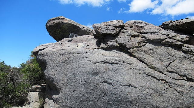
We marched out at 3:45 AM with headlamps and gibbous moonlight. The approach in Barton Canyon is braided with washes and large rocks that make it slow and difficult. Some cairns were placed with white rocks that stand out at night easing part of the ordeal. It took 3 hours to start up the ridge. We found a decent use trail to gain the ridge crest that ended in a class 2 section below a flat area. At around 3300', we began 2000' of sustained and steep class 2. It was a long, grueling section of ridge. Above that was a short, brushy, class 3 traverse around a prominent outcrop. Henry ended up going over the top of it, while I scrambled around below. The final section was crossing a couple of false summits, arriving at the broad summit plateau. We stopped at the boulders that make up the high point, but another boulder pile held the HPS register. The view east down to the Salton Sea was blocked by trees and I had to move closer to the western side to see the great views into Clark Valley. It took us 7 hours to reach the summit and we spent another 30 minutes resting. I knew we would be late, so I texted my wife (Verizon had bars on Rabbit).


Finishing up the easy part of the ridge


This is the short class 3 section


This rabbit was in the register box
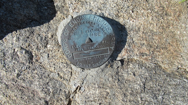
After fresh coats of sunscreen, we dropped 800' from Rabbit to the Santa Rosa ridge toward Villager. Views on this ridge are phenomenal. To reach the descent ridge, we endured 3 miles of undulating bumps, almost reaching Villager Peak. After climbing to Rabbit, these bumps were unwelcome. The ridge was mostly open, unclogged with brush or other obstacles. A pleasant surprise. It wasn't as fast as a trail, but we made reasonable time moving down the gentle slope. I had loaded GPS waypoints making it easy to find Zosel benchmark, then Crab benchmark. Both had registers with few signatures, especially Crab with a register stuffed in a 35mm film canister. As the late afternoon daylight started to cast shadows, I wished the ridge was dropping faster. Half of the 5000' drop to Barton Canyon came at the end and we would end up doing it in the dark.


The mighty east ridge of Rabbit


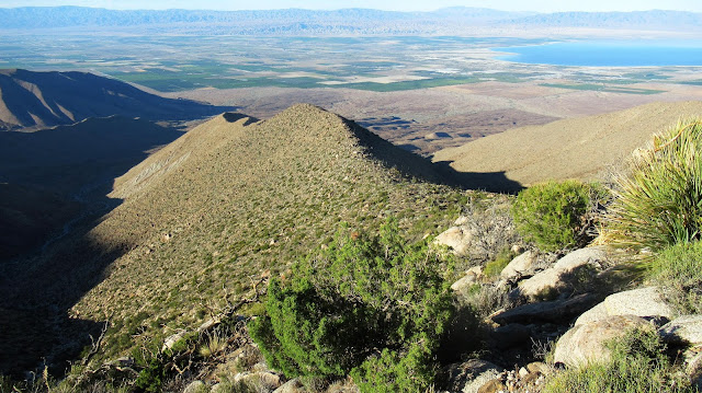
The final benchmark we visited was Dawn. We found no register at Dawn, but knowing what was ahead, unpacked our headlamps and hurried down as fast as we could. The setting sun was partially blocked by the Santa Rosa ridge, leaving us in a long, lingering twilight. We had about 2 miles of the steepest part of ridge left when it got dark. Just after that, my headlamp fell off and broke open, spilling its 3 triple AAAs into the dirt. I was only able to find 2. No problem, I had a strong backup handheld flashlight and deployed it immediately. Meanwhile, Henry's phone had died trying to record our GPS track. Also, his rechargeable headlamp was toast from the early morning. No problem, he had a backup handheld light as well. So far, so good. We worked our way back, dipping in and out of 20' gullies and stumbling over boulders. With a couple miles left, my flashlight went dark. No problem, I always pack spare batteries. Score one for battery operated devices. With one mile to go, Henry's last rechargeable light went dim. We would have been seriously in trouble without light. We got back to the truck at 11:45 PM utterly pooped. It was a 13 hour descent from Rabbit and 20 hours truck to truck. Still technically a day hike, 20 hours from 3:45 AM to 11:45 PM! At the park and ride on the way back, Henry and I both took naps before driving the rest of the way home. Every time I do something like this, I swear never again, then I forget.
Final stats: 21.5 miles, 7628' gain, 20 hours.


Dawn just before dusk


|
|
|
+1
link
|
|
Britain Posts: 608
5/27/2019
|
Wow epic. Congrats.
--
Cant drive 55
Britain
http://icorva.com
|
|
|
+1
link
|
|
ziphius Posts: 911
5/28/2019
|
Quite the accomplishment and ordeal! Congratulations and thanks for sharing the story.
--
http://www.coyotelearning.org
|
|
|
+1
link
|
|
Buford Posts: 461
5/28/2019
|
That is an interesting way to hit Rabbit plus the extra BMs. How did it look from Dawn to Alice?
--
Links to my photos: ABDSP photos, Bighorn sheep photos, ABDSP time lapse video, Wildlife photos (mainly birds)
|
|
|
link
|
|
tekewin Posts: 371
5/28/2019
|
Buford wrote:
That is an interesting way to hit Rabbit plus the extra BMs. How did it look from Dawn to Alice?
I thought the east ridge was a fun route to Rabbit. Definitely a different experience. Alice BM is on a spur ridge a little south of Dawn but the same kind of terrain. It was generally open country and not hard to navigate. You could side hill between the two without difficulty, but we were so tired and behind schedule by then that we skipped Alice.
|
|
|
link
|
|
Scooter Posts: 114
5/28/2019
|
Nice way to end the season! I felt your pain and fatigue while reading your trip report. Great report, might have to skip that one 😀
|
|
|
link
|
|
rockhopper Posts: 668
5/29/2019
|
Good show man! Rabbit peak from the East is in the top 3 toughest hikes of my life! We did the same Barton canyon accent route as you did. I have an identical pick of photo #5 but decades earlier. We decended back down from the summit via Barton route. No hiking poles, no headlamps, hiked back under starlight. Your route was truely a heroic effort.
Cheers!
|
|
|
+1
link
|
|
tekewin Posts: 371
5/29/2019
|
rockhopper wrote:
Good show man! Rabbit peak from the East is in the top 3 toughest hikes of my life! We did the same Barton canyon accent route as you did. I have an identical pick of photo #5 but decades earlier. We decended back down from the summit via Barton route. No hiking poles, no headlamps, hiked back under starlight. Your route was truely a heroic effort.
Cheers!
Thanks, Rockhopper. I won't forget it for sure. You must have had great starlight, there are so many boulders and washes in that canyon.
|
|
|
link
|
|
dsefcik Administrator Posts: 2625
5/29/2019
|
uhhh....count me out...nice work!...
Not sure what motivates that kind of "day hike" but power to y'all..!!
--
http://www.sefcik.com
http://www.darensefcik.com
http://www.carrizogorge.com
|
|
|
+1
link
|
|
tekewin Posts: 371
5/29/2019
|
dsefcik wrote:
uhhh....count me out...nice work!...
Not sure what motivates that kind of "day hike" but power to y'all..!!
Yeah, the route is pretty outrageous and I would not recommend it to anyone (except the many people faster than me). We weren't really going for an epic, but we greatly underestimated the descent. We really thought it was going to be 7 more hours, and of course getting caught in the dark made it worse. East ridge of Rabbit by itself is worthy and not as much of a stretch.
|
|
|
link
|