|
tommy750 Posts: 1069
3/17/2020
|
Haven't been in Canebrake Valley for a while but wasting time on GE one morning, I spotted what appeared to be a spring exploited by ranchers that I've never noticed before. That led to three Saturdays and about 45 miles wandering around, twice starting at North Fork Indian Valley and once accompanied with Daren from Mile Marker 41. Checked out an occupation site and found a few projectile points. Not sure if these broke during production or returned inside the prey after a successful hunt. Nice broken Cottonwood point:
 IMG_3047 by tomteske, on Flickr IMG_3047 by tomteske, on Flickr
Equally nice Desert Side Notch point. Supposedly if it has a basal notch it's a Sierra Side Notch:
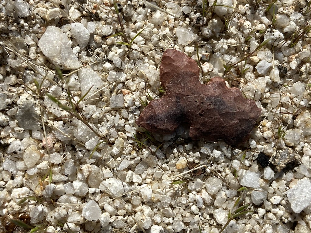 IMG_3058 by tomteske, on Flickr IMG_3058 by tomteske, on Flickr
Cremated bone:
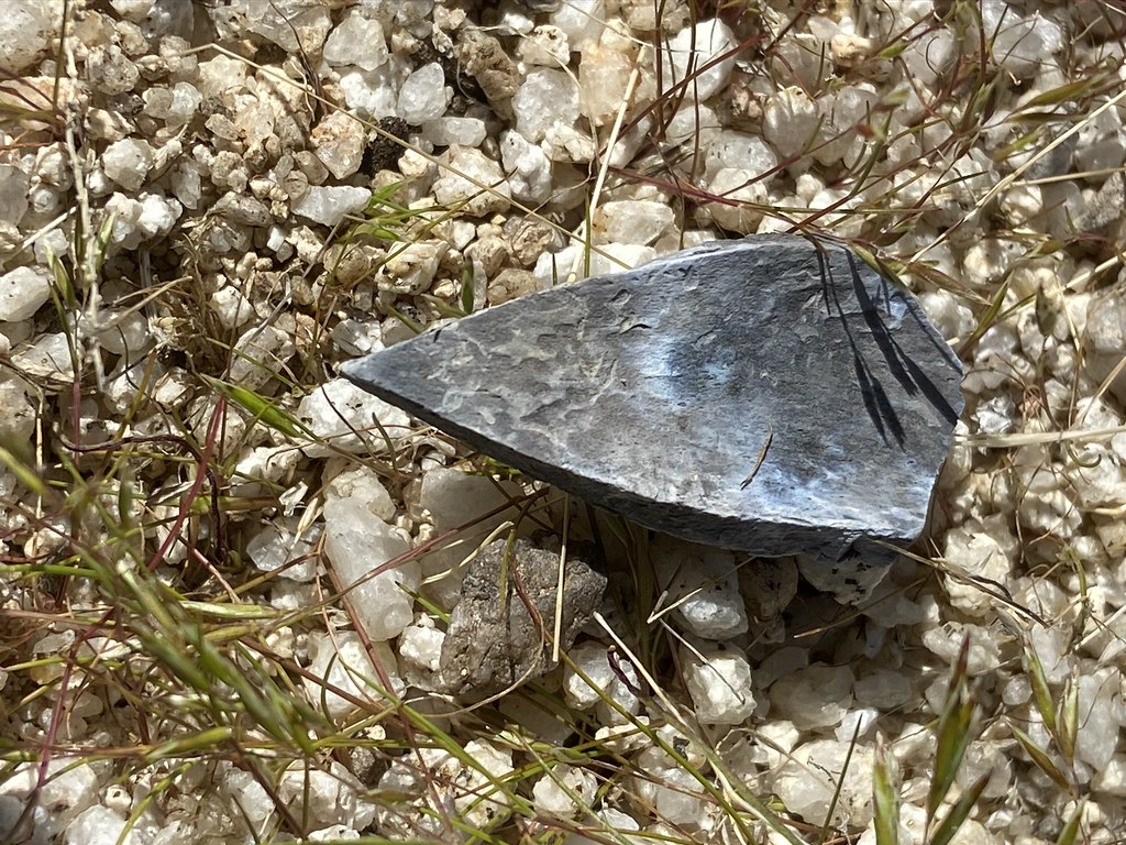 IMG_3045 by tomteske, on Flickr IMG_3045 by tomteske, on Flickr
Crawling out of a rock shelter was surprised to find this striped Desert Side Notch:
 IMG_3108 by tomteske, on Flickr IMG_3108 by tomteske, on Flickr
Further up valley came across these straps and ?harness. Immediately suspected it was from the parachute or ejection seat of the downed T-33 near Agua Caliente:
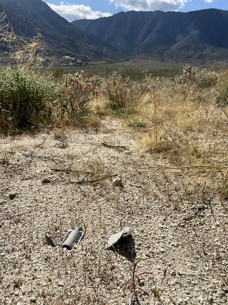 IMG_3227 by tomteske, on Flickr IMG_3227 by tomteske, on Flickr
 IMG_3230 by tomteske, on Flickr IMG_3230 by tomteske, on Flickr
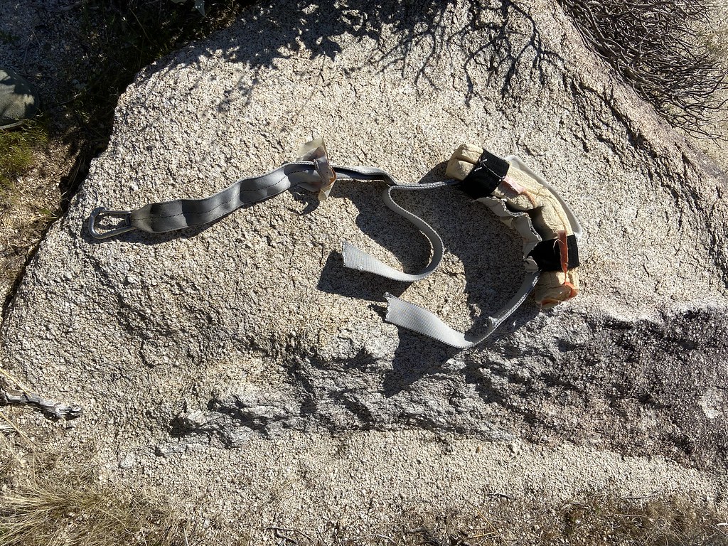 IMG_3236 by tomteske, on Flickr IMG_3236 by tomteske, on Flickr
French INOX carabiner:
 IMG_3238 by tomteske, on Flickr IMG_3238 by tomteske, on Flickr
But if you compare the straps cut from the T-33 ejection seat Daren found a while back ( the other one was recovered), the straps look quite different so who knows. You guys know what this is??
 Two Belts by tomteske, on Flickr Two Belts by tomteske, on Flickr
Daren showed me an old ranching camp which also was a native occupation site:
 IMG_3339 by tomteske, on Flickr IMG_3339 by tomteske, on Flickr
 IMG_3348 by tomteske, on Flickr IMG_3348 by tomteske, on Flickr
And this historical artifact:
 IMG_3341 by tomteske, on Flickr IMG_3341 by tomteske, on Flickr
Almost stepped on this guy:
 IMG_3196 by tomteske, on Flickr IMG_3196 by tomteske, on Flickr
Skid marks:
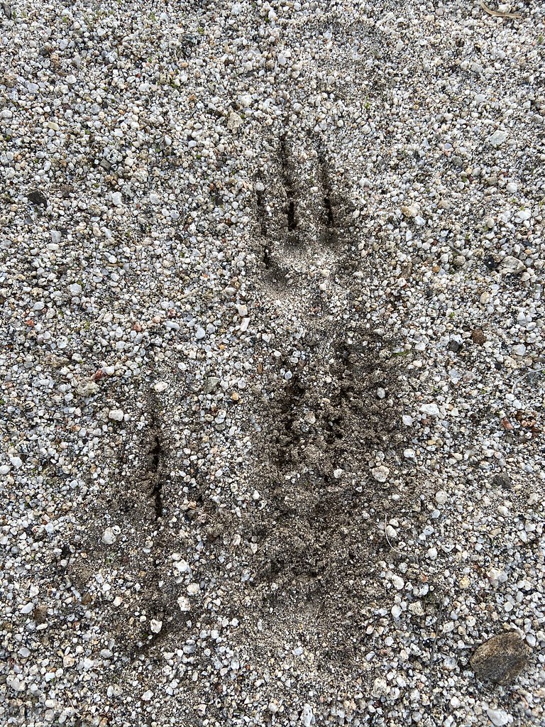 IMG_3159 by tomteske, on Flickr IMG_3159 by tomteske, on Flickr
Beautiful scenery all around:
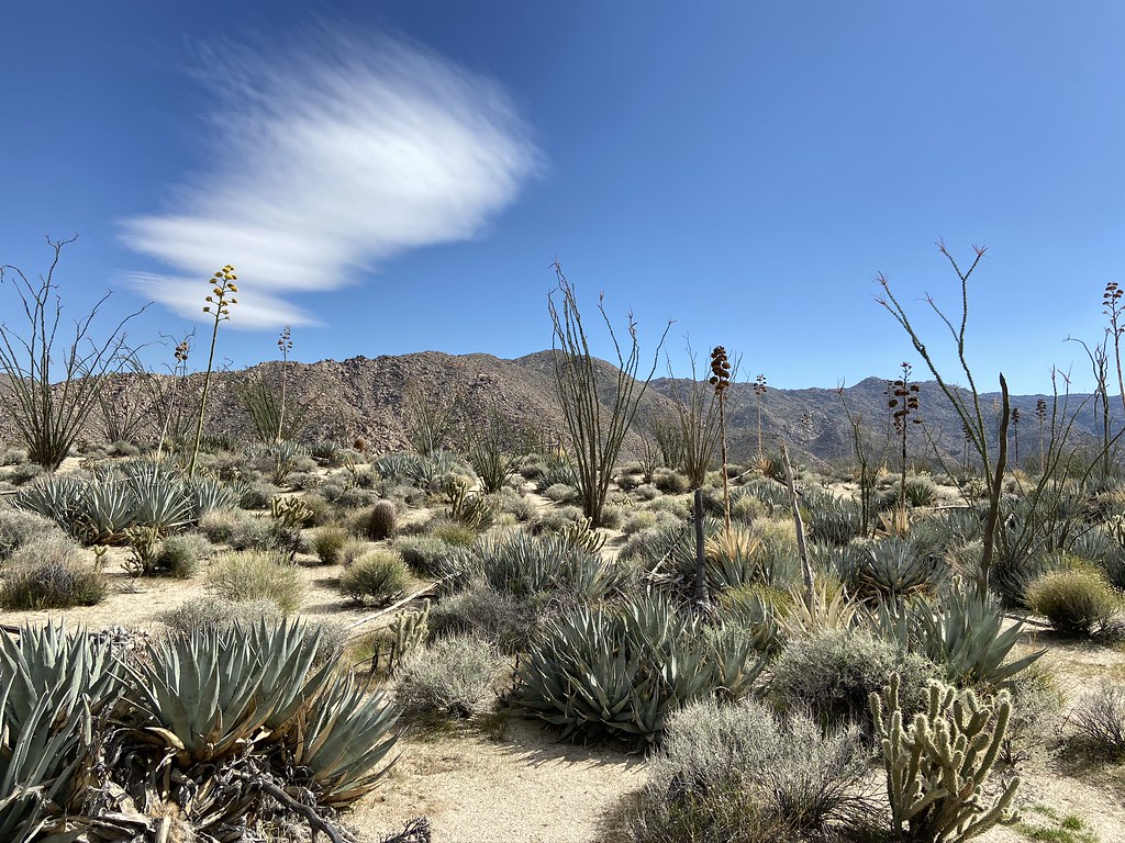 IMG_3356 by tomteske, on Flickr IMG_3356 by tomteske, on Flickr
 IMG_3351 by tomteske, on Flickr IMG_3351 by tomteske, on Flickr
Daren checking out cattle bones:
 IMG_3371 by tomteske, on Flickr IMG_3371 by tomteske, on Flickr
Actually, I think the main reason Daren went was to recover this old school radiosonde Unfortunately, we didn't have time to swing by and collect it. Daren says you might get a nice tour of the local NOAA site if you drop off a vintage model.
 IMG_3276 by tomteske, on Flickr IMG_3276 by tomteske, on Flickr
Oh yeah, the spring! So, the now dry spring was an occupation site and then much later used for a cattle watering trough. A water trough was constructed on top of a boulder that contained multiple morteros and still has pottery next to it. A modern round trough was apparently added later. You can see piping heading up to a green spot above. Never seen anything like it:
 IMG_3250 by tomteske, on Flickr IMG_3250 by tomteske, on Flickr
Morteros inside the trough:
 IMG_3255 by tomteske, on Flickr IMG_3255 by tomteske, on Flickr
Lots of dried grass below the now dry spring:
 IMG_3269 by tomteske, on Flickr IMG_3269 by tomteske, on Flickr
Heading home. Enjoy! Tom
 IMG_3294 by tomteske, on Flickr IMG_3294 by tomteske, on Flickr
edited by tommy750 on 3/17/2020
|
|
|
link
|
|
Rocko1 Posts: 615
3/17/2020
|
Wow! Some fantastic finds. I would assume the spring would have some dampness/trickle with the weather we have had.
|
|
|
link
|
|
rockhopper Posts: 671
3/17/2020
|
Looks like you covered a lot area on foot of that vastly in under explored place in our county. 45 miles. Wow! Good eye on the arrow points. The fact that the points were not made of the preferred obsidian means that most likely Lake Cahuilla was full thus covering the locals preferred obsidian source. Good point on the ranchers / miners building atop of older habitations. I've noticed that too.
|
|
|
+1
link
|
|
Scooter Posts: 114
3/17/2020
|
Thank you for a great trip report. I have backpacker in over night from the North Fork of Indian Valley not to bad. Great area to explore
|
|
|
link
|
|
tommy750 Posts: 1069
3/17/2020
|
Rocko1 wrote:
Wow! Some fantastic finds. I would assume the spring would have some dampness/trickle with the weather we have had.
Would be nice to find at least seasonal flow. The vegetation and organic layer is so dense at this location I'm not sure a small amount of flow would be visible but who knows and maybe it's worth another visit.
|
|
|
+1
link
|
|
tommy750 Posts: 1069
3/17/2020
|
rockhopper wrote:
Looks like you covered a lot area on foot of that vastly in under explored place in our county. 45 miles. Wow! Good eye on the arrow points. The fact that the points were not made of the preferred obsidian means that most likely Lake Cahuilla was full thus covering the locals preferred obsidian source. Good point on the ranchers / miners building atop of older habitations. I've noticed that too.
Really like that area since it's so desolate and peaceful. That's a good observation about the alternative materials when Obsidian Butte was under water. Don't know if the obsidian hydration techniques are accurate enough to determine if all the obsidian artifacts around here dated to periods when the butte was exposed or whether it's already been looked at. Did find one obsidian point but pretty beat up.
|
|
|
link
|
|
tommy750 Posts: 1069
3/17/2020
|
Scooter wrote:
Thank you for a great trip report. I have backpacker in over night from the North Fork of Indian Valley not to bad. Great area to explore
Definitely agree. Pepperwood Canyon is my favorite way in and of course there's that little 2000 ft bounce on your way out that's always a healthy pulse quickener 
|
|
|
+1
link
|
|
Scooter Posts: 114
3/17/2020
|
On our trip in from North Indian Valley, took an experienced backpacker that had not done any desert off trail hiking. He picked up three cholla bombs in about the first half mile. He learned quickly and that was it for the rest of the two day trip. 🤣
|
|
|
+1
link
|
|
Brian Posts: 249
3/18/2020
|
Seeing artifacts - even relatively recent ones like the ejection strap - always makes me think of the event that caused that object to be there and how it has been undisturbed and mostly unobserved since. It gives a sense of the scale of time. It's one of the things I love about the desert.
|
|
|
+1
link
|
|
ziphius Posts: 911
3/18/2020
|
Great trip report and points Tom! I think your 'skid marks' are from a gray fox.
--
http://www.coyotelearning.org
|
|
|
link
|
|
tommy750 Posts: 1069
3/18/2020
|
Brian wrote:
Seeing artifacts - even relatively recent ones like the ejection strap - always makes me think of the event that caused that object to be there and how it has been undisturbed and mostly unobserved since. It gives a sense of the scale of time. It's one of the things I love about the desert.
Definitely agree. Lots of backstories to ponder.
|
|
|
link
|
|
Rocko1 Posts: 615
3/19/2020
|
Brian wrote:
Seeing artifacts - even relatively recent ones like the ejection strap - always makes me think of the event that caused that object to be there and how it has been undisturbed and mostly unobserved since. It gives a sense of the scale of time. It's one of the things I love about the desert.
This is why I love the desert so much. It really puts into scale how insignificant one lifetime is. Thinking about previous lives of the people who lived here is really mind blowing.
|
|
|
link
|
|
tekewin Posts: 383
3/22/2020
|
Very nice! Those old soda pull tops could be made into a launcher. You separate the flat part of the tab from the ring, then load the ring onto the wide side of tab using the notch on either side , then fire!
|
|
|
+1
link
|
|
rockhopper Posts: 671
3/24/2020
|
tommy750 wrote:
rockhopper wrote:
Looks like you covered a lot area on foot of that vastly in under explored place in our county. 45 miles. Wow! Good eye on the arrow points. The fact that the points were not made of the preferred obsidian means that most likely Lake Cahuilla was full thus covering the locals preferred obsidian source. Good point on the ranchers / miners building atop of older habitations. I've noticed that too.
Really like that area since it's so desolate and peaceful. That's a good observation about the alternative materials when Obsidian Butte was under water. Don't know if the obsidian hydration techniques are accurate enough to determine if all the obsidian artifacts around here dated to periods when the butte was exposed or whether it's already been looked at. Did find one obsidian point but pretty beat up.
Tommy, Found this from an old article. Shows how far Obsidian butte material traveled. To the coast and up north and down to Northern Baja over thousands of years. The early Native Americans of the area were known to have walked up to 40 miles in a day carrying trading goods. I need to hike more!

edited by rockhopper on 3/24/2020
|
|
|
+1
link
|
|
Rocko1 Posts: 615
3/24/2020
|
rockhopper wrote:
tommy750 wrote:
rockhopper wrote:
Looks like you covered a lot area on foot of that vastly in under explored place in our county. 45 miles. Wow! Good eye on the arrow points. The fact that the points were not made of the preferred obsidian means that most likely Lake Cahuilla was full thus covering the locals preferred obsidian source. Good point on the ranchers / miners building atop of older habitations. I've noticed that too.
Really like that area since it's so desolate and peaceful. That's a good observation about the alternative materials when Obsidian Butte was under water. Don't know if the obsidian hydration techniques are accurate enough to determine if all the obsidian artifacts around here dated to periods when the butte was exposed or whether it's already been looked at. Did find one obsidian point but pretty beat up.
Tommy, Found this from an old article. Shows how far Obsidian butte material traveled. To the coast and up north and down to Northern Baja over thousands of years. The early Native Americans of the area were known to have walked up to 40 miles in a day carrying trading goods. I need to hike more!

edited by rockhopper on 3/24/2020
Interesting! 40 miles with no shoes or leather moccasins.
|
|
|
link
|
|
rockhopper Posts: 671
3/24/2020
|
Rocko1 It is my understanding that they did use simple footwear made from animal skins and sewn with yucca and other fashioned footwear. Also of note is that the thousands of miles of foot trails interlacing the entire region and beyond were extremely well groomed over the course of thousands of years and repaired constantly. There are remnants of these trails still in existence and you can walk them barefoot!
|
|
|
link
|
|
tommy750 Posts: 1069
3/24/2020
|
Here's a recent article on Obsidian Butte: http://www.swxrflab.net/obsbutte.htm Looks like it just formed 2500 years ago. Most of our local obsidian is from Obsidian Butte but smaller amounts are sourced from Coso Volcanic Field to the north and San Felipe to the south. Nice how the chemical signature can definitely identify the source. Obsidian Butte is listed by the USGS as a "high to very high" volcanic threat rank and the only one so designated in So Cal.
|
|
|
link
|
|
Rocko1 Posts: 615
3/25/2020
|
rockhopper wrote:
Rocko1 It is my understanding that they did use simple footwear made from animal skins and sewn with yucca and other fashioned footwear. Also of note is that the thousands of miles of foot trails interlacing the entire region and beyond were extremely well groomed over the course of thousands of years and repaired constantly. There are remnants of these trails still in existence and you can walk them barefoot!
I have seen what I thought was an old trail-very worn path. Can't recall where in the park though.
|
|
|
link
|
|
dsefcik Administrator Posts: 2632
4/12/2020
|
tekewin wrote:
Very nice! Those old soda pull tops could be made into a launcher. You separate the flat part of the tab from the ring, then load the ring onto the wide side of tab using the notch on either side , then fire!
I loved doing that as a kid....then enough dumb people put the tang in the can and drank it cutting their throat open so they stopped making them (fact or fiction??)
--
http://www.sefcik.com
http://www.darensefcik.com
http://www.carrizogorge.com
|
|
|
link
|
|
dsefcik Administrator Posts: 2632
4/12/2020
|
Did anybody mention Fossil Falls area in the Owens Valley / Coso Range? That was another source for obsidian and if you have never been there, you should stop by for an hour or so next time you are driving the 395.
--
http://www.sefcik.com
http://www.darensefcik.com
http://www.carrizogorge.com
|
|
|
link
|
|
davidwyby Posts: 46
8/13/2020
|
Good stuff.
@tommy750, I am local if you're ever looking for someone to hike with or a backup or whatever.
|
|
|
link
|