|
tekewin Posts: 375
4/16/2020
|
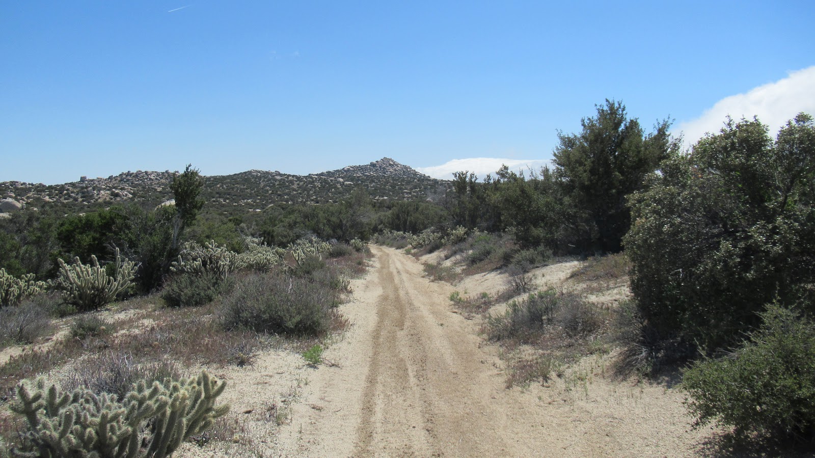
Drove the end of McCain Valley Road last Sunday for a BLM hike. Well, almost to the end of the road. The last half mile was badly rutted from rain so I stopped at the last windmills. No cars around, no people. It had rained on me the entire drive until the end when I saw patches of blue sky.
A single track continues north from the end of the road. It's mostly gently rolling land and half open desert. Eventually, I hit an old dirt road heading toward Pepperwood, which sits just above Canebrake.

Pepperwood, the high point is the middle bump. Red Top rising behind.
Pretty good scramble to the top, but only a couple of hundred feet. Thought I had found a register on top, but it turned out to be some kind of solar powered radio relay or something. Views were so nice into Canebrake and toward the Sawtooth Mountains.

Radio?


The tippy tops of False Sombrero and Sombrero
It was a few miles back on the road to get to the base of unofficial Bow Willow Peak. There was already the start of a some nice yellow blooms around the base. There is a line of giant boulders making up the summit. The highest boulders were class 5 and beyond reach without a rope. No register or marks found on either one. It felt great to get outside. Too bad so much public land is closed right now.
Bow Willow ahead


Looking back toward Pepperwood

Baby gopher snake, maybe 18 inches long
[edited for formatting]
edited by tekewin on 4/16/2020
|
|
|
+1
link
|
|
Rocko1 Posts: 605
4/16/2020
|
Very nice! Isn't the route into Canebreak from there a heavily traveled immigrant route? Maybe the radio is used by them?
|
|
|
link
|
|
tekewin Posts: 375
4/16/2020
|
Rocko1 wrote:
Very nice! Isn't the route into Canebreak from there a heavily traveled immigrant route? Maybe the radio is used by them?
I'd probably guess border patrol over immigrants based on resources, but who knows. I didn't take the rocks off to open it or get serial numbers. Should have.
|
|
|
link
|
|
Brian Posts: 239
4/16/2020
|
Great trip report. I've done hikes leaving from Cottonwood campground, but have never driven the road beyond there. Always meant to some day. It's on my very long list of places I want to explore some day.
|
|
|
+1
link
|
|
tekewin Posts: 375
4/17/2020
|
Brian wrote:
Great trip report. I've done hikes leaving from Cottonwood campground, but have never driven the road beyond there. Always meant to some day. It's on my very long list of places I want to explore some day.
There's maybe a mile of road after Cottonwood. I chickened out when facing the deep ruts, probably could have driven them but was happy to hike a little extra. I'm thinking about looking around Mojave until AB reopens. Or going further east on I-8. I can do those trips with one stop for self serve gas and no interactions.
|
|
|
+1
link
|
|
dsefcik Administrator Posts: 2627
4/17/2020
|
I love that area, Tom and I have been at the base of Pepperwood like a million times but never scrambled up. You should have looked closer at that radio thing to see what it was, most likely BP but not sure what for but would not doubt crossers at all. We have run into folks on the path out there at least 3 times now. That rutted section only lasts a few hundred feet, usually you can straddle it and get past if you have some ground clearance.
--
http://www.sefcik.com
http://www.darensefcik.com
http://www.carrizogorge.com
|
|
|
link
|
|
dsefcik Administrator Posts: 2627
4/17/2020
|
tekewin wrote:
I'm thinking about looking around Mojave until AB reopens. Or going further east on I-8. I can do those trips with one stop for self serve gas and no interactions. I think parts of CNF are open as well as wilderness areas of BLM, all within reach of ABDSP areas.
--
http://www.sefcik.com
http://www.darensefcik.com
http://www.carrizogorge.com
|
|
|
+1
link
|
|
tekewin Posts: 375
4/17/2020
|
dsefcik wrote:
I love that area, Tom and I have been at the base of Pepperwood like a million times but never scrambled up. You should have looked closer at that radio thing to see what it was, most likely BP but not sure what for but would not doubt crossers at all. We have run into folks on the path out there at least 3 times now. That rutted section only lasts a few hundred feet, usually you can straddle it and get past if you have some ground clearance.
It is a cool area. I had only started around there once before heading to Al Holden Peak. I have plenty of clearance (4Runner) but didn't know the road got better so backed down.
|
|
|
link
|
|
tekewin Posts: 375
4/17/2020
|
dsefcik wrote:
I think parts of CNF are open as well as wilderness areas of BLM, all within reach of ABDSP areas.
Thanks, I'll do some more research. Caltopo has nice overlays for BLM. I probably shouldn't complain about closed parks. First world problem.
|
|
|
link
|
|
Rocko1 Posts: 605
4/17/2020
|
tekewin wrote:
dsefcik wrote:
I think parts of CNF are open as well as wilderness areas of BLM, all within reach of ABDSP areas.
Thanks, I'll do some more research. Caltopo has nice overlays for BLM. I probably shouldn't complain about closed parks. First world problem.
Domelands looks interesting. Decent amount to explore in that area.
|
|
|
link
|
|
tekewin Posts: 375
4/17/2020
|
Rocko1,
Can you point me toward Domelands? Not sure where that is.
|
|
|
+1
link
|
|
tommy750 Posts: 1065
4/17/2020
|
Nice TR Tekewin. My favorite place to head out to in the warmer summer months. Nice snake pic.
The Domelands are on the North side of the Coyote Mts. The most common route out there is the Wind Caves trail. You can also go up Fossil Canyon and just keep going over the top. Another route to the north side is taking the first mile of the Wind Caves trail and when you drop into the main drainage, turn left down stream and keep going. Nice scramble down a dry falls and lots of interesting views to follow.
|
|
|
link
|
|
tekewin Posts: 375
4/17/2020
|
Tommy 750,
Thanks! Will take a look.
|
|
|
link
|
|
Buford Posts: 462
4/17/2020
|
I assume the small solar panel and array is BP, but I don't know for certain. I do know I stumbled on a similar setup somewhere in the vicinity of the Stage BM.
--
Links to my photos: ABDSP photos, Bighorn sheep photos, ABDSP time lapse video, Wildlife photos (mainly birds)
|
|
|
+1
link
|
|
deborah Posts: 115
4/25/2020
|
Great pictures and info! Thanks for sharing!
|
|
|
+1
link
|
|
rockhopper Posts: 668
4/25/2020
|
Nice clear desert views. Your expedition was perfectly timed. Thanks for sharing.
|
|
|
link
|
|
tekewin Posts: 375
4/27/2020
|
rockhopper wrote:
Nice clear desert views. Your expedition was perfectly timed. Thanks for sharing.
Just lucky on timing. 
|
|
|
link
|