|
tommy750 Posts: 1071
9/29/2013
|
Wanted to see if we could make it all the way to the Pinyon Dropoff yesterday. Only made it to Hapaha Flat where it descends into Pinyon Wash before getting the "it's way past turn-around time" evil eye from my driving buddy. We started at Plaster City so it was already over 50 miles off road. Passed the ranger near Elephant Knees and he said there had been seven flash floods in the last couple months. Really green in Olla Wash and Hapaha Flat area. Lots of flowers, insects and grasses. Fish Creek above Olla Wash was much smoother than I recall but still had some large rocks in areas that added a few more scrapes to the Tundra underbelly. There were no tire tracks past Dave McCain Spring with the road a channelized stream bed.
Olla Wash Ocotillos. My friend Amy noticed the ocotillos are really straight and vertical or really convoluted. Some genetic difference? Who knows.
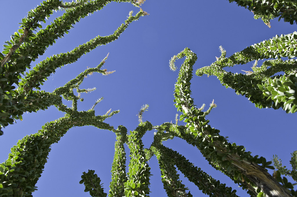
Olla Wash Ocotillos by tomteske, on Flickr
Upper Fish Creek tight spot.

Upper Fish Creek Squeeze by tomteske, on Flickr
Right next to the road, a rock seemed to have a strange motion. Not sure why that rock was special but you'd think the zillion lizards out there would have found it.
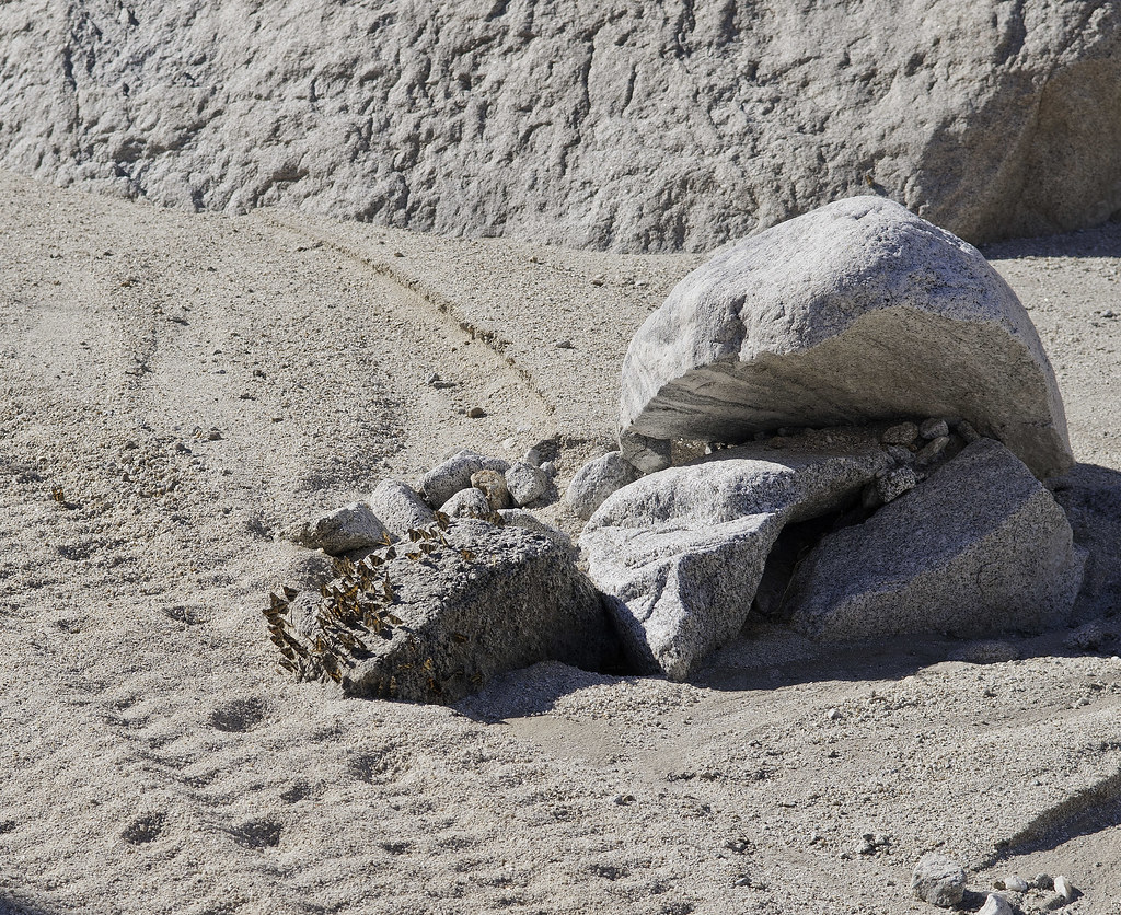
Butterfly Rock3 by tomteske, on Flickr
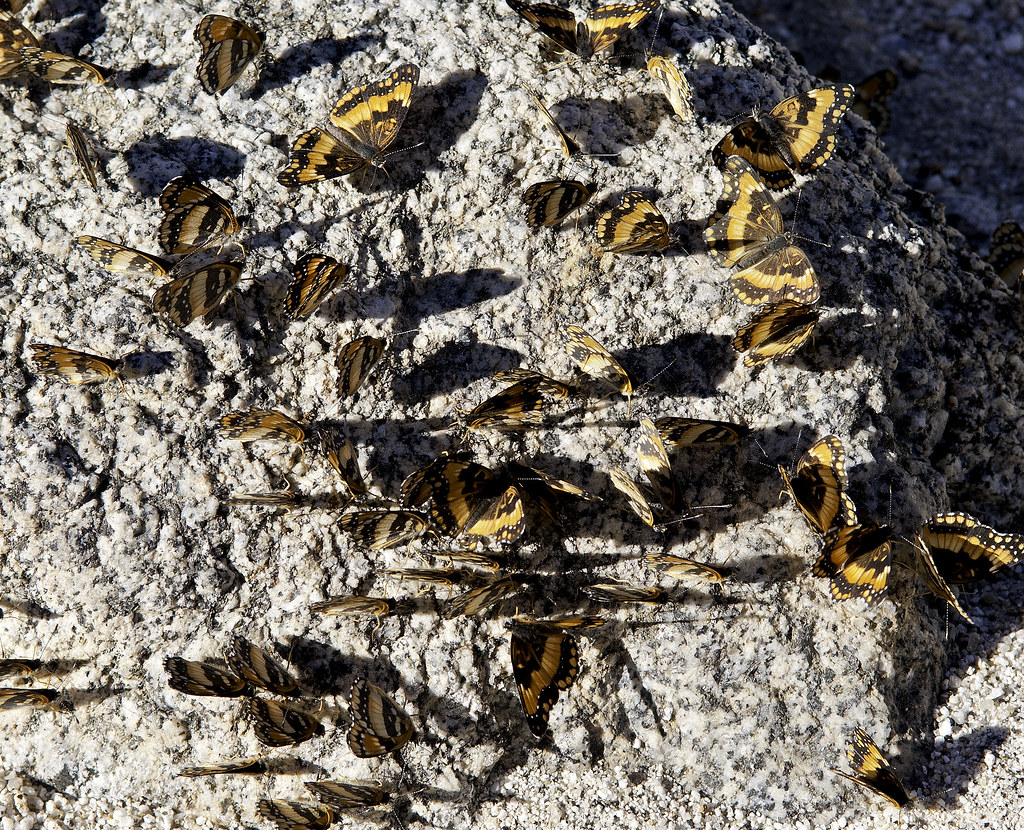
Butterfly Rock by tomteske, on Flickr
Still a few faded glyphs at Split Rock.
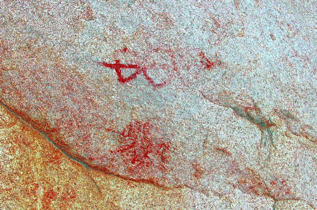
Split Rock Picto_yrd by tomteske, on Flickr
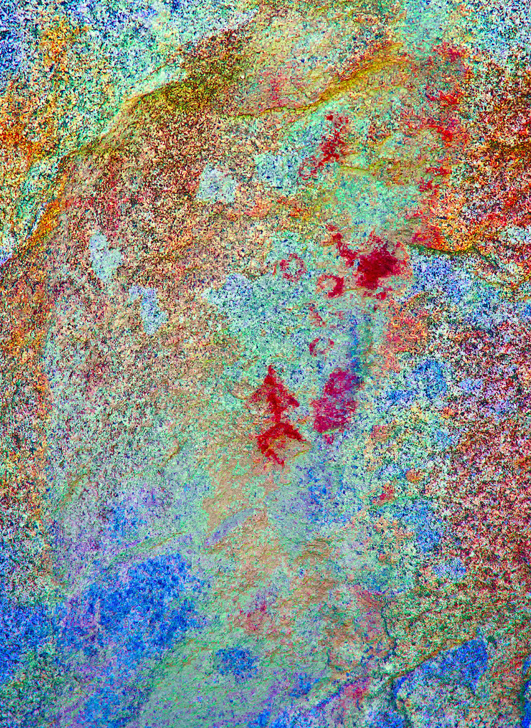
Split Rock Picto2_lxx by tomteske, on Flickr
Not sure if this is a picto or a historical graffito in the bottom center.
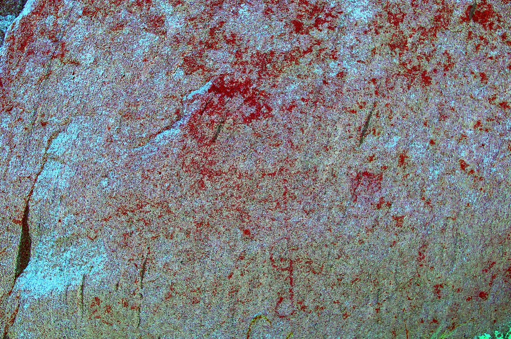
Split Rock Picto3_yrd by tomteske, on Flickr
Caterpillar.
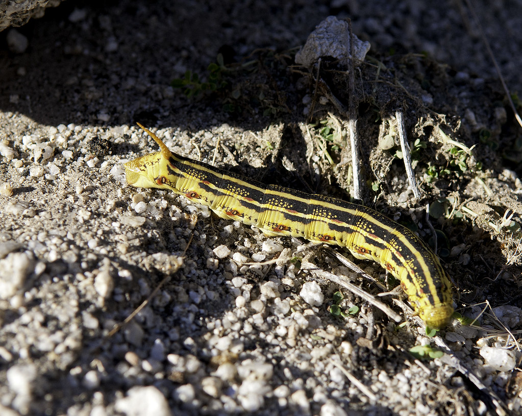
Catepillar by tomteske, on Flickr
Heading home. Enjoy. Tom
Few more pics at: http://www.flickr.com/photos/tommy750/sets/72157636002082846/
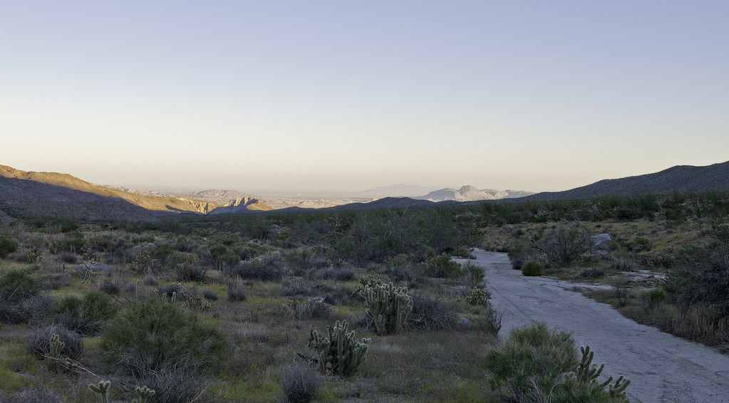
Hapaha Flat2 by tomteske, on Flickr
|
|
|
link
|
|
DesertWRX Posts: 135
9/29/2013
|
2 days ago we drove up to the intersection of Olla and Fish Creek. Could not see any tire tracks going up Fish Creek. Nice to see your pictures!
|
|
|
link
|
|
tommy750 Posts: 1071
9/29/2013
|
DesertWRX wrote:
2 days ago we drove up to the intersection of Olla and Fish Creek. Could not see any tire tracks going up Fish Creek. Nice to see your pictures!
Yeah, we drove right into Olla by mistake since most of the tracks headed that way. Glad to hear you we're out there. Really pretty now. Tom
|
|
|
link
|
|
anutami Posts: 491
9/29/2013
|
Upper Fish Creek tight spot.

Upper Fish Creek Squeeze by tomteske, on Flickr
Last year I camped right at that spot and helped with some road work,


Love that area! Has to be one of my favorites. It wasn't too washed out from all the rain? How were the temps?
|
|
|
link
|
|
tommy750 Posts: 1071
9/29/2013
|
Looks like that rocky step left an impression on a lot of us, Nolan  That was actually the only real tough spot since a few of the boulders were a little too large as you know! Had to do some rearranging to get by. Were you able to get through the winding canyon upstream with your camper? Those vertical walls looked like a tight squeeze. Thought further upstream was better than last year since a lot of the melon sized rock had been covered up by a layer of sand. Temps were mid-upper 80's but dropped to 70 at dusk at Hapaha Flat. Tom That was actually the only real tough spot since a few of the boulders were a little too large as you know! Had to do some rearranging to get by. Were you able to get through the winding canyon upstream with your camper? Those vertical walls looked like a tight squeeze. Thought further upstream was better than last year since a lot of the melon sized rock had been covered up by a layer of sand. Temps were mid-upper 80's but dropped to 70 at dusk at Hapaha Flat. Tom
|
|
|
link
|
|
dsefcik Administrator Posts: 2634
9/30/2013
|
Gorgeous 'pillar...can't believe how green it is out there. I wish had time to get out there right now....
--
http://www.sefcik.com
http://www.darensefcik.com
http://www.carrizogorge.com
|
|
|
link
|
|
surfponto Administrator Posts: 1369
9/30/2013
|
Ditto
Butterfly shot is great and the Ocotillo look amazing.
Way to put that Tundra in a hairy situation Tom.. 
dsefcik wrote:
........ I wish had time to get out there right now....
edited by surfponto on 9/30/2013
--
https://www.anzaborrego.net/


|
|
|
link
|
|
ziphius Posts: 911
9/30/2013
|
Very nice Tom! Those are California Patch butterflies! Quite the mysterious aggregation on that one rock. I forget what the caterpillar is... my girlfriend and I saw many of them in the Oriflamme Canyon area last week. Apparently, the natives ate 'em. 
edited by ziphius on 9/30/2013
--
http://www.coyotelearning.org
|
|
|
link
|
|
tommy750 Posts: 1071
9/30/2013
|
Jim (ziphius) wrote:
Very nice Tom! Those are California Patch butterflies! Quite the mysterious aggregation on that one rock. I forget what the caterpillar is... my girlfriend and I saw many of them in the Oriflamme Canyon area last week. Apparently, the natives ate 'em. 
edited by ziphius on 9/30/2013
Found it, the White Lined Sphinx Moth caterpillar. Internet is amazing. Would assume eating those is an acquired taste. Thanks for the butterfly ID. Agree, seemed weird seeing all of them on that rock. Maybe someone dumped out their coke or beer there  Tom Tom
|
|
|
link
|
|
tommy750 Posts: 1071
9/30/2013
|
surfponto wrote:
Ditto
Butterfly shot is great and the Ocotillo look amazing.
Way to put that Tundra in a hairy situation Tom.. 
dsefcik wrote:
........ I wish had time to get out there right now....
edited by surfponto on 9/30/2013
Sounds like you guys are in need of a vacation! Tom
|
|
|
link
|
|
ziphius Posts: 911
10/1/2013
|
tommy750 wrote:
Jim (ziphius) wrote:
Very nice Tom! Those are California Patch butterflies! Quite the mysterious aggregation on that one rock. I forget what the caterpillar is... my girlfriend and I saw many of them in the Oriflamme Canyon area last week. Apparently, the natives ate 'em. 
edited by ziphius on 9/30/2013
Found it, the White Lined Sphinx Moth caterpillar. Internet is amazing. Would assume eating those is an acquired taste. Thanks for the butterfly ID. Agree, seemed weird seeing all of them on that rock. Maybe someone dumped out their coke or beer there  Tom Tom
Maybe an animal took a pee on that rock and initiated a butterfly party. Looks like some tracks right near the rock...
--
http://www.coyotelearning.org
|
|
|
link
|
|
DesertWRX Posts: 135
10/1/2013
|
Found a bunch of these little yellow ones enjoying the damp soil... 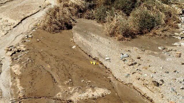
edited by DesertWRX on 10/1/2013
|
|
|
link
|