7/12/2012
Topic:
Rain in Anza Borrego today
surfpontoAdministrator
|

According to the ABF it is raining out in Anza Borrego today  |
7/13/2012
Topic:
2012 Bighorn Sheep Count
surfpontoAdministrator
|
True.
Back in 2008/2009 the Fish and WildLife Service de-designated a huge portion of their protected habitat.
Coincidentally some of it is where I believe the Ocotillo Wind Farm is currently being built.
Penninsular Bighorn Sheep threatened again
dsefcik wrote:
tommy750 wrote:
Do they still do helicopter surveys for PBS? Does it correlate with what you guys find each year?
Great question, they briefly talked about that this year. They used to do them with some regularity but not any more, some reasons why were financial and others political. That is why the volunteer program is even more important now. In the days past golf resorts were able to buy up land that took away from the sheep but golf resorts are now passe and instead green energy projects have moved in and are taking their place. When you look at the "peninsular" range they once used it has now become fragmented by development and roadways, their "range" has shrunk considerably. |
7/13/2012
Topic:
Rain in Anza Borrego today
surfpontoAdministrator
|
Thanks for the update BorregoLinda
We have friends that live close to Indian Head also.
Cloudy on the coast with a few sprinkles also 
Bob
Borregolinda wrote:
We got a few sprinkles here is all. But really humid all day! I took almost that same picture on our morning walk! We're near the Indian Head side of town so maybe other parts got more than we did!
edited by Borregolinda on 7/12/2012
edited by Borregolinda on 7/12/2012 |
7/13/2012
Topic:
2012 Bighorn Sheep Count
surfpontoAdministrator
|
Wow that looks rough David 
Where was that?
Bob
hikerdmb wrote:
Nice pics Daren, and video. I saw some cars and trucks parked along S-22 going down into Borrego Springs and I figured they were counting sheep too. It is great that you do this.
We were out there last weekend too but we were keeping cool by the pool. It was brutal but we managed.

David |
7/13/2012
Topic:
2012 Bighorn Sheep Count
surfpontoAdministrator
|
I thought so.
I have been inside there.
Looks like you had the pool to yourself?
hikerdmb wrote:
Bob,
That is the Borrego Springs Resort and Spa. It used to be Borrego Springs Resort and Country Club but they changed their name. Nice place and good summer rates. We got a king room for $79. Very relaxing place. We have been going there for many many years. Here's the link.
http://borregospringsresort.com/
David |
7/14/2012
Topic:
2012 Bighorn Sheep Count
surfpontoAdministrator
|
I agree

dsefcik wrote:
hikerdmb wrote:
We were out there last weekend too but we were keeping cool by the pool
How do you keep cool "by the pool" ?? When I looked at the photo all I imagined was me in a floaty thing and a drink in my hand, not an empty pool! |
7/15/2012
Topic:
Rain in Anza Borrego today
surfpontoAdministrator
|
Would love to see a flash flood out there sometime.
From a safe vantage point of course 
Bob
rockhopper wrote:
Excellent! Love those desert rains. Yes we also had a few sprinkles out here on the coast. Felt great, the sub-tropical Mexican air mass moving through. |
7/17/2012
Topic:
Dream Find!!!
surfpontoAdministrator
|
Very nice,
Amazing it was left intact after all this time.
thanks for sharing,
Bob
anutami wrote:
With the weather way too extreme for me thought I would post a pic of an Olla I discovered about 10 years ago. As a kid I grew up right next to an Indian cermonial site in Ramona, Ca. I would come across broken pottery shards and has always been my dream to come across a fully intact Olla. In 6th grade I found a peace pipe and donated it to the Ramona Musuem. Exploring in ABDSP "way off trail" I came across a small cave. When I peaked inside there it was! A fully intact approx 3 gallon size Olla. I left it in place and just admired the awesome beauty of this thing, snapped a few pics and headed out. There are MANY treasures out there to find and please DO NOT touch, take, alter them in anyway if you come across them.

<em>edited by surfponto on 7/17/2012</em> |
7/18/2012
Topic:
Big Ram in Coyote Canyon!
surfpontoAdministrator
|
Awesome shots Linda,
What a magnificent animal.
Thanks for sharing those.
Bob
Borregolinda wrote:
Bill and I are stewards in ABDSP so we went out to Coyote Canyon today to do some clean up. While we were cleaning up an old fire site near 2nd crossing this big Ram passed nearby. He was on his way to get a drink. When he was done drinking he stopped right in front of me and stared! Bill had the camera trying to get a shot of him drinking so I didn't have a picture of it! He then climbed up the hill and looked around for a long time. Pretty cool.
Our GSD Abi saw him too!
edited by Borregolinda on 7/17/2012
<em>edited by surfponto on 7/18/2012</em> |
7/19/2012
Topic:
Older Anza Borrego maps
surfpontoAdministrator
|
I remember when I was arguing about the existence of a jeep trail that certain administrative type people denied ever existed.
I found and older Anza Borrego Map and there it was.
Area is now off limits, which was a bit of a drag since it was a great car camping site.
I will have to check Daren's CalTopo link to see when it disappeared
Anyway.....
rockhopper wrote:
Hello all. Found these while looking through "my stuff". While not real "old" I thought this would be a start of an interesting thread.
Please continue to add any older maps you might find interesting. Older map information is often "removed" and or missing from the later generation of maps
and is of great information to us, the "explorer" community.
Map A : Army Corp of Engineers. 1953 road data.
[IMG]http://i67.photobucket.com/albums/h294/metalmeister/ABDSP/CopyofABUSGS004.jpg[/IMG]
Map B: Army Corp of Engineers. 1977 road data.
[IMG]http://i67.photobucket.com/albums/h294/metalmeister/ABDSP/CopyofABUSGS002.jpg[/IMG]
Few points of interest.
1. Notice the old spelling of "borego" on map A
2. Notice the new location of Borrego Springs on map B
3. Notice the town of Ranchita moved to the East on map B
4. Map a was created prior to the "ABDSP"
edited by rockhopper on 7/19/2012
edited by rockhopper on 7/19/2012 |
7/19/2012
Topic:
Older Anza Borrego maps
surfpontoAdministrator
|
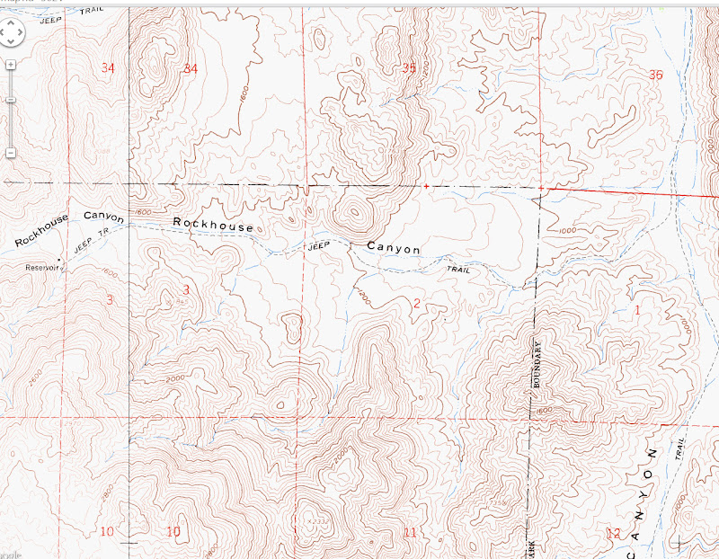
Yep the mysterious Jeep Trail still shows up on the CalTopo maps 
 |
7/19/2012
Topic:
Older Anza Borrego maps
surfpontoAdministrator
|
Yeah I did see that a while ago. 
It was great camp spot
dsefcik wrote:
surfponto wrote:
Yep the mysterious Jeep Trail still shows up on the CalTopo maps 
You know they have really fenced that trail off now right?? Lots of wood posts all around that area now. |
7/19/2012
Topic:
Border Angels
surfpontoAdministrator
|
Great documentary Daren.
That fence is crazy. I didn't realize you could slip through it.
Is that the fence near Jacumba? |
7/21/2012
Topic:
Border Angels
surfpontoAdministrator
|
That is pretty messed up 
dsefcik wrote:
Apparently the Border Patrol have been seen destroying some water jugs also.
http://www.10news.com/news/31291349/detail.html |
7/23/2012
Topic:
California State Parks Director Resigns
surfpontoAdministrator
|
Just read this on the Sacramento Bee
California State Parks Director resigns amid scandal
In summary :CA Parks dept sat on $54 million in surplus money for as long as 12 years.
Apparently this money could have kept the 70 State Parks opened that were slated for closure this past year. 
<em>edited by surfponto on 7/24/2012</em> |
7/24/2012
Topic:
California State Parks Director Resigns
surfpontoAdministrator
|
That is my fear also.
Sad things like this happen especially in this economy,
when the Parks could really use the money.
rockhopper wrote:
I hope this money specifically designated for the state parks dosen't end up going down into the states general fund black hole.
When, where is the protest?
<em>edited by surfponto on 7/24/2012</em> |
7/25/2012
Topic:
Older Anza Borrego maps
surfpontoAdministrator
|
Great link
I checked out a few of the San Diego county maps available.
NIce resource
Welcome to the forum 
lcota wrote:
Hi all,
This website is a great resource. I enjoy reading all the trip reports. I am also quit fascinated with maps, I can't pass a map without stopping to look at it. So when I saw
this thread I figured I would share some of the results of my Google searching for maps.
There is a nice open-source data base of USGS 7.5 minute maps at link. You can search for maps using feature names or by feature type.
Another good website for USGS maps of Southern California is link. This site covers all of San Diego, Riverside, Imperial, and San Bernardino counties. |
7/25/2012
Topic:
Older Anza Borrego maps
surfpontoAdministrator
|
rockhopper wrote:
Pretty much confirms what we already know. Scientists have confirmed the the deserts have moved North approx. 100 miles in the past 100 years.
Does that mean we will have Boojum Trees and Cardon Cactus in Anza Borrego sometime in the future 


<em>edited by surfponto on 7/25/2012</em> |
7/26/2012
Topic:
Dezert Magazine July Printed Versions available
surfpontoAdministrator
|
Hey All,
John Grasson the Editor/Publisher of Dezert Magazine asked me to put a link to copies of his printed version.
Looks like a great issue with stories about Diana Lindsay, Steve Bier and photos by Ernie Cowan
Click image to check it out.
Bob

<em>edited by surfponto on 7/26/2012</em> |
8/2/2012
Topic:
Fish Creek Wash Rd Conditions
surfpontoAdministrator
|
That video of the flash flood is crazy!! I can't believe how much water flowed through there.
Borregolinda wrote:
dsefcik wrote:
Borregolinda wrote:
Talked to Ranger Steve today. Split Mtn. rd is closed right now. Lots of mud. Had to rescue someone by helicopter from Wind Caves area after his vehicle became mired in muck.
Here is the story http://www.10news.com/news/31322575/detail.html
I think I will wait awhile until no more flash floods will occur, can't say I want my truck to look like that.
Looks like we may be done with the rain for now. Just super humid! But the roads are still a mess! |
8/2/2012
Topic:
Looking for tinajas on San Clemente Island
surfpontoAdministrator
|
What an awesome place
Would love to see some coastal shots of the beaches 
rockhopper wrote:
Excellent report! Thanks for sharing. |
8/5/2012
Topic:
Looking for tinajas on San Clemente Island
surfpontoAdministrator
|
Speaking of San Nicolas Island here is an interesting story
The Lone Woman of San Nicolas Island
Apparently she lived alone there for 18 years |
8/5/2012
Topic:
Take a Stand in Ocotillo this Saturday July 11'th
surfpontoAdministrator
|
Thanks for posting that Daren
I will make the flyer available on the main site
Bob |
8/5/2012
Topic:
Perseid meteor shower this weekend
surfpontoAdministrator
|
Jus got back from a week in Mammoth
Amazing weather
I think you should have some of the same 
Have Fun
hikerdmb wrote:
I'll be in the Sierra one more time before school starts. I am hoping it will be great viewing.
David |
8/7/2012
Topic:
Split Mountain/Sandstone Canyon after the Rains!
surfpontoAdministrator
|
Wow. Crazy. I haven't been over that way in a few years.
I am liking the " It's definitely a 4WD road " Will have to take a trip out
Like Daren says real bummer for the truck owner. Glad they made it out safe though
Bob
<em>edited by surfponto on 8/7/2012</em> |
8/10/2012
Topic:
Tule Wind Project and ENERGIA JUAREZ SUBSTATION
surfpontoAdministrator
|
San Diego's backcountry under assault
this sucks
SUPERVISORS IGNORE HEALTH AND FIRE SAFETY CONCERNS, APPROVE TULE WIND AND ENERGIA JUAREZ SUBSTATION IN EAST COUNTY |
8/12/2012
Topic:
Take a Stand in Ocotillo this Saturday July 11'th
surfpontoAdministrator
|
Thanks for making it out there
I heard Pattern shut down operations for the day
How was the turnout?
tommy750 wrote:
This morning at the Take a Stand in the Sand Protest.
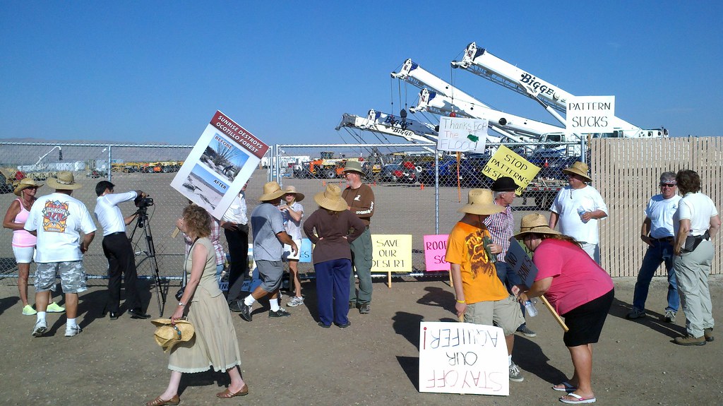
2012-08-11_08-16-01_377 by tomteske, on Flickr |
8/13/2012
Topic:
More Split Mountain Flash Flood
surfpontoAdministrator
|
Crazy pics.
I heard there was suppose to be more rain out there Sunday evening.
Any reports on more flooding? |
8/13/2012
Topic:
Perseid Meteor Shower 2012
surfpontoAdministrator
|
Those are cool.
The shot with the fireworks going off is nice.
Your time lapse video is amazing. |
8/13/2012
Topic:
More Split Mountain Flash Flood
surfpontoAdministrator
|
Thanks Linda
I could see some huge looking storm clouds out to the East yesterday.
Looked like some serious weather...
Borregolinda wrote:
surfponto wrote:
Crazy pics.
I heard there was suppose to be more rain out there Sunday evening.
Any reports on more flooding?
Have heard anything out here in Borrego. Great lightning storm over there last night though! |
8/14/2012
Topic:
Storms and fires
surfpontoAdministrator
|
Man that lightning picture is insane!!
Love Jilberto's in Borrego 
Thanks for posting that Daren,
Bob |
8/14/2012
Topic:
OWEF
surfpontoAdministrator
|
I would say yes Daren,
That is ridiculous.
Talk about not seeing the forest through the trees.
Owner trying to capitalize off the Ocotillo Express Wind farm while the community gets screwed.
dsefcik wrote:
Can we boycott the Ocotillo Fuel Mart?

|
8/16/2012
Topic:
Ranchita Fire
surfpontoAdministrator
|
Those guys have a tough job.
dsefcik wrote:
Saw this photo posted on ECM this morning http://www.eastcountymagazine.org/node/10729
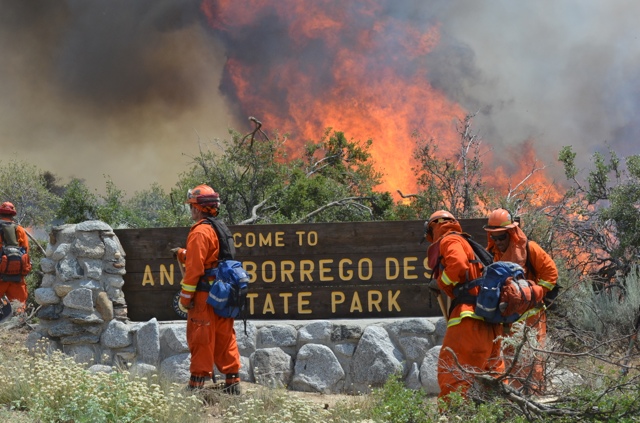 |
8/17/2012
Topic:
Mt. Laguna and Blair Valley
surfpontoAdministrator
|
Liking the picture of your Land Cruiser also TR. 
As I have said before/ Land Cruisers are extremely photogenic in the backcountry. |
8/17/2012
Topic:
No Sunrise Powerlink in Anza Borrego Banners
surfpontoAdministrator
|
Joe over at California Overland forwarded me some vintage Sunrise Powerlink banners.

Some classic stuff here  |
8/17/2012
Topic:
No Sunrise Powerlink in Anza Borrego Banners
surfpontoAdministrator
|
I'll ask Joe over at California Overland 
anutami wrote:
Now that is a bumper sticker I would put on my Rig! Where can I get mine? |
8/26/2012
Topic:
Four wheel campers coming to little Blair
surfpontoAdministrator
|
Thanks
Think I will try to swing by one of the days to check it out.
Should be a fun event and it will be cool to see the different camper setups |
8/26/2012
Topic:
The Destruction of Ocotillo Ca
surfpontoAdministrator
|
Beyond sad to watch this boondoggle project come to fruition. 
Kind of wondering how many of the residents will move once the towers go up and are operational.
dsefcik wrote:
If you want to see the day-to-day destruction from the eyes of an Ocotillo resident take a look at this site where he uploads daily photos.
http://saveocotillo.picturepush.com/album/225256/p-OWEF-08252012.html
It is heart wrenching to anyone that loves the desert. |
9/4/2012
Topic:
Lost Valley
surfpontoAdministrator
|
Haven't been there but we did hike up to Hot Springs Mountain which I believe is close by.. Real interesting area. 
Bob
anutami wrote:
Cool article in the "Ramona Journal" about Lost Valley
Anybody ever been out there?
http://ramonajournal.com/on-memorys-back-trail-tales-of-lost-valley-p4499-88.htm |
9/4/2012
Topic:
Calcite Mine Slot Canyons
surfpontoAdministrator
|
Yeah I really need to update this forum software. It is getting very dated 
Bob
kylekai wrote:
Just going thru some old posts, getting reading for desert camping. I noticed you used an iPhone to take your pictures? If so, then the pictures (usually) also have the GPS coordinates attached to the image. I use my iPhone almost exclusively for taking pictures now, as it helps me remember where I took the picture. On my Macintosh computer, using the app Preview, I can open a picture and easily view the picture's location. Or I upload them to Flickr which also displays a map with the image location -- see this example: http://www.flickr.com/photos/modesitt/7127141619/in/set-72157629565943292/. Wouldn't it be great if we could click on a photo in this forum and it takes us to a Google map using the GPS coordinates associated with the picture?
anutami wrote:
Still trying to figure out how to do the google map screen shot w/ the route, but It looks like I went through Palm Wash. There is the south fork which is west of the calcite mine rd, and Palm wash due east and north east of the rd. Then there is the North fork which is way east of the calcite mine road. When I looped back around I was about in the middle of the North Fork and main Palm Wash.
edited by kylekai on 9/3/2012
edited by kylekai on 9/3/2012 |
9/7/2012
Topic:
Gettin the itch...
surfpontoAdministrator
|
Well I would say Mortero Wash and Dos Cabezas, but the Ocotillo Express Wind Farm has kind of ruined that area. 
Like Daren I wouldn't mind doing the Bow Willow loop that comes out through RockHouse Canyon / Carrizo Gorge
There is alot to explore in that area.
anutami wrote:
Well, I am pretty much over the crowded beaches and Finally I think/I hope today was the turn towards fall  Looking forward to a great season!!!!! I am sure everyone is craving some desert solitude. Curious to know what your first trips are going to be for the season (some of you the season never ended Looking forward to a great season!!!!! I am sure everyone is craving some desert solitude. Curious to know what your first trips are going to be for the season (some of you the season never ended 
I will probably end up checking out Indian hill area again and the wind turbine project going on. |
9/14/2012
Topic:
Gettin the itch...
surfpontoAdministrator
|
Thinking the same thing
Gets its' beach time again.
At least the summer hordes have left
anutami wrote:
So much for a cool down |
9/17/2012
Topic:
Short McCain Valley Trip
surfpontoAdministrator
|
Looks like a great trip.
Snake picture is great. looks like it is 6' long in your picture.?
Glad things are cooling down out there. Going to try to make it out in the next couple weeks.
Bob |
9/18/2012
Topic:
The Destruction of Ocotillo Ca
surfpontoAdministrator
|
Thanks for posting the link.
Kevin does a great job of keeping up with this.
I remember back in February 2010 when I wrote this post about the Ocotillo Express, think I found some obscure article in the IV Press.
To be honest I really didn't think it would ever happen 
DesertWRX wrote:
http://www.basinandrangewatch.org/OcotilloWind-Spring2011.html
DesertWRX wrote:
http://www.basinandrangewatch.org/OcotilloWind-Spring2011.html
edited by surfponto on 9/18/2012
<em>edited by surfponto on 9/18/2012</em> |
9/18/2012
Topic:
It's Not a 4WD But It Does More!
surfpontoAdministrator
|
That is pretty awesome
Reminds me of this off road vehicle built by Lamborghini
Of course the price tag is $115,000 

edited by surfponto on 9/18/2012
<em>edited by surfponto on 9/18/2012</em> |
9/18/2012
Topic:
After The Rains
surfpontoAdministrator
|
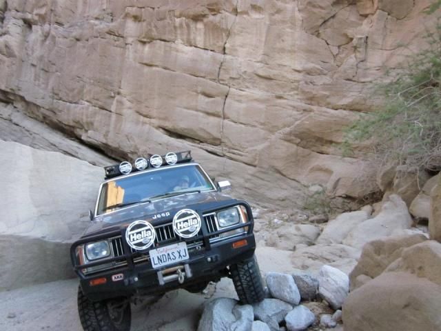
Love this shot  |
9/18/2012
Topic:
Gettin the itch...
surfpontoAdministrator
|
Thanks for the update.
We are going to try to get out during the first weekend in October
Borregolinda wrote:
Been cooler out here in Borrego than west of the mountains! Barely hit 100 today. Humidity is gone. Nights are in the mid 70's. Nice! |
9/18/2012
Topic:
Wind Alternatives-Solar Roadways
surfpontoAdministrator
|
Any option that uses existing infrastructure gets a thumbs up from me. 
It seems ludicrous to tear up public lands to build thes projects.
Since corporations can pick up desert lands for pennies on the dollar, they stand to make a s&*t load of money for their shareholders and investors.
Guess that is where the priority is nowadays
DRT Lakeside wrote:
Not specific to Anza Borrego, but could be a somewhat elegant solution to a sea of 400 foot wind turbines.
You may have already seen stuff on this but I thought it was an interesting option.
Solar Roadways
link
TED Talk on same stuff
link
I like the idea of something serving several purposes... |
9/18/2012
Topic:
Hike & Hops Happy Hour
surfpontoAdministrator
|

Any one thinking of attending?
Love Ballast Point and it may be a good opportunity to meet other Anza Borrego folks  |
9/24/2012
Topic:
State of Kansas likes wind towers :(
surfpontoAdministrator
|
Crazy 
 |
9/27/2012
Topic:
Borrego Badlands
surfpontoAdministrator
|
Welcome to the forum John,
Nice pictures. Funny I have never been out the Pumpkin Patch. Would like to check that out sometime.
Also enjoy the Goat Canyon area and have hiked out there with Daren a bit.
Checked out your trip report. Pretty cool that someone took a Subaru Outback out there.
have kind of wondered how those would do.
Time to gear up for another desert season.

Bob
<em>edited by surfponto on 9/27/2012</em> |
9/30/2012
Topic:
My Jeeps (and past rides)
surfpontoAdministrator
|
Oh man I am liking this thread 
Give me a day or two to round up some pictures |
10/3/2012
Topic:
iPhone app for Anza Borrego Desert State Park?
surfpontoAdministrator
|
Hey Bill
Sounds like a great idea. Especially the idea of caching the maps for use in the backcountry.
Appreciate the offer but I would say donate the money to the ABF since they do a lot to preserve the park.
I use the google ads to pay for my hosting so would prefer the money go tho the ABF 
Let me know if you decide to pursue the ABDSP app and I will advertise it on this site,
Best,
Bob
<em>edited by surfponto on 10/3/2012</em> |
10/3/2012
Topic:
Ocotillo Express Wind Energy Project Progress
surfpontoAdministrator
|
Daren,
It is heart breaking to see what they have done to the southern end of Anza Borrego and the community of Ocotillo.
Like you I have not been out for a while and wonder if I will even camp in the Dos Cabezas area anymore.
I am bummed that the view is destroyed. It was sone of my favorites.
Bob
<em>edited by surfponto on 10/3/2012</em> |
10/3/2012
Topic:
Ocotillo Express Wind Energy Project Progress
surfpontoAdministrator
|
I wolud like to see some shots of the view from Piedras Grandes if you have taken any?
Bob
<em>edited by surfponto on 10/3/2012</em> |
10/11/2012
Topic:
My Jeeps (and past rides)
surfpontoAdministrator
|
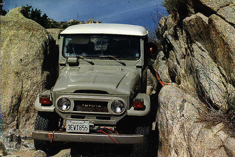
Our 1977 Toyota Land Cruiser FJ40 we named MuMu
Brought this back from Kauai with 25,000 original miles on her.
This picture was from the Squeeze a long time ago
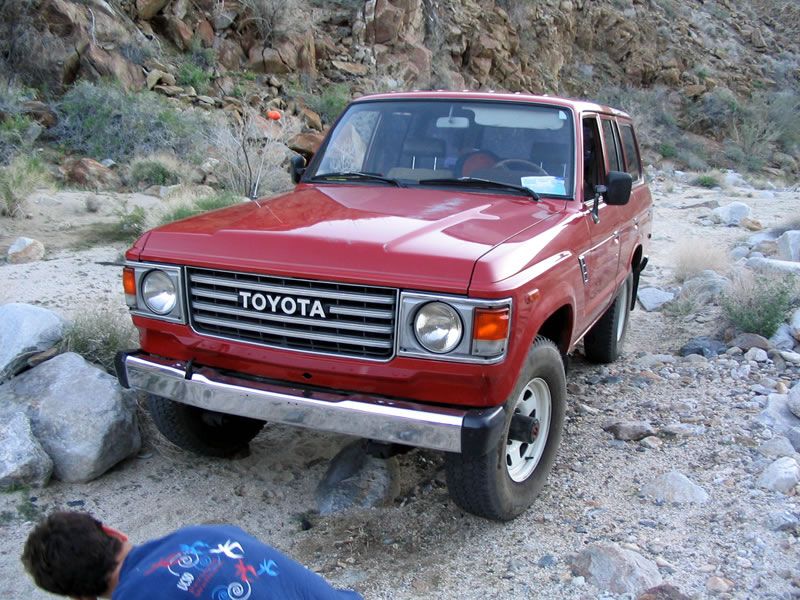
Our 1982 Toyota Land Cruiser FJ60 we named Clifford for obvious reasons  (sold) (sold)
Loved the room of this truck.
Ended up driving it all the way down to Cabo and back.
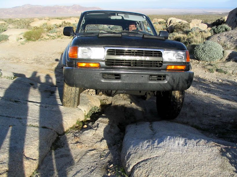
Our 1992 3FE powered Toyota Land Cruiser we affectionately named Tubbs. (Sold)
Slow as molasses but built like a tank. This picture is in Mortero Wash
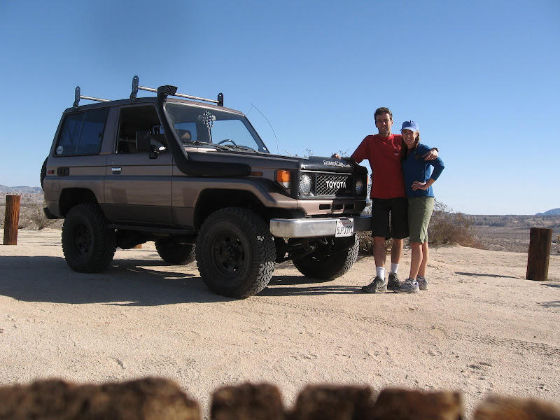
Our 1985 Canadian Spec 3B Powered Toyota Land Cruiser. (non turboed 4 cylinder diesel)
Very slow with its' 90hp motor but it was amazing offroad.
Took this out to Anza Borrego many times. We eventually sold it to a guy in Ohio who has restored it into amazing shape.
More To Come.... 
edited by surfponto on 10/11/2012
edited by surfponto on 10/11/2012
edited by surfponto on 10/11/2012
edited by surfponto on 10/11/2012
edited by surfponto on 10/11/2012
<em>edited by surfponto on 10/11/2012</em> |
10/15/2012
Topic:
Chariot, Oriflamme, Rodriguez MTB Loop
surfpontoAdministrator
|
Great trip report
Did you do it solo?
May have to do that on my new MTB at some point. 
Great find on the collar.
Bob |
10/15/2012
Topic:
Border patrol finds artifacts
surfpontoAdministrator
|
I am with you on that 
ziphius wrote:
Not sure what it means when they say The Forest Service "took charge" of the artifacts. But I'm assuming they were removed from their resting site. It's one reason I never report the locations of anything I find to ANY 'authorities'. The chain of history is forever broken when artifacts are removed from the wild, notwithstanding the usual arguments of "well, they have to be protected from those who might REMOVE them illegally." Same result. We have enough stuff in dusty drawers in locked rooms. 
edited by ziphius on 10/15/2012 |
10/15/2012
Topic:
My Jeeps (and past rides)
surfpontoAdministrator
|
....and our latest 4x4
Diesel powered Toyota Land Cruiser 80 Series. Powered by a Toyota 1HZ inline 6 cylinder motor. (non-turbo)
Really fun truck that we run on Bio-Diesel and has clocked many Baja and Anza Borrego miles 

<em>edited by surfponto on 10/15/2012</em> |
10/18/2012
Topic:
Orionid Meteor Showers this weekend
surfpontoAdministrator
|
Shoot.
Will miss it by a week.
We will be out there next weekend |
10/19/2012
Topic:
2012 BorregoFest Event (October 19th - 21st, 2012)
surfpontoAdministrator
|
Hey John,
Would love to see some pics after the event, especially from the trail runs.
Unfortunately our schedule didn't workout this time. 
Bob
BorregoWrangler wrote:
I know this is kinda last minute but I figured I'd post this up anyway for anyone who might be interested. BorregoFest is an annual event hosted by OutdoorAdventureUSA. Folks from many different SoCal forums attend for a weekend of good times spent in the desert. I'll be heading out Friday evening with my family. Here's some info and a link to the site:
Well it's time to start planning our annual OAUSA BorregoFest event. The dates are set for the 19th through the 21st of October. This is a family friendly event that never fails to impress. We will be holding trail runs, ham radio testing, a potluck, wine and beer tasting, and probably a small raffle. Please let us know if you plan on attending. Fees and sign up info are below.
We will be using Butterfield Ranch RV Resort for this year's event. OAUSA depends on the donations from this event, and SummerFest, to help it stay in operation. Campsite fees, taxes, website expenses all add up, and OAUSA is comprised of a completely volunteer, unpaid staff. We have done our best to keep the fees reasonable, and ask that all that can, please join us at Butterfield Ranch to help support OAUSA. BorregoFest, with it’s group camping, promotes a feeling of camaraderie among the members, and creates an opportunity for those who many not know each other to share in the event face to face, as well as contribute to the future of Outdoor Adventure USA.
However, no fee is required if you are only coming out for one day or are making other accommodations outside of the group camp for spending the night. You are still allowed to come into the group site for the trail run meetings, potluck, and evening festivities each day. Fees are the same whether you stay for one night or two in the group site. Please post your interest in attending in the format you see below and your name will be added to the OAUSA Roster…
For fees, payment information, and other details go to the following link…
http://forums.oausa.net/viewforum.php?f=165
<em>edited by surfponto on 10/19/2012</em> |
10/19/2012
Topic:
2012 BorregoFest Event (October 19th - 21st, 2012)
surfpontoAdministrator
|
Yeah that is an easy section for the Land Cruiser 
Last year we came up to that spot and there was a lady with a Saturn Vue that had attempted to make it up that hill.
Needless to say she didn't make it and we had to help her back down.
Bob
TR wrote:
anutami:
If you're worried about your rig making it through the one steep, rutted section of Dos Cabezas road, 
there's a way around this section of road. It starts from Mortero Wash about 300 or 400 yards short of the tracks, and goes down and to the right. It winds it's way around and comes out right at the top of the steep, rutted section.
Daren has made it through the steep, rutted section with his truck, albeit with a little mudflap damage if I recall correctly. But he doesn't have the camper on the back. My Land Cruiser just walks up that section like it was paved.
Tom |
10/19/2012
Topic:
Hike & Hops with the Anza Borrego Foundation
surfpontoAdministrator
|
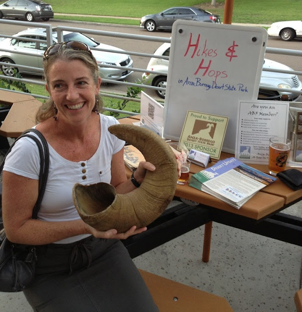
The Anza Borrego Foundation has been sponsoring Hike & Hops events which are basically happy hour meetups throughout San Diego.
This past Tuesday, Mary and I drove out to Ballast Point Brewery and met up with Paige from the ABF.
There was a table setup and if you gave a donation to the ABF you received beer taster tickets.
No brainer in my opinion. 
We even got to check out a large Bighorn Sheep horn as we enjoyed our Sculpin IPA.
Bob
edited by surfponto on 10/19/2012
<em>edited by surfponto on 10/19/2012</em> |
10/22/2012
Topic:
Iphone in the backcountry somebody shoot me!
surfpontoAdministrator
|
Looks like a great weekend with your family.
We are FINALLY heading out there next weekend with a small group!
Very excited! |
10/22/2012
Topic:
End of Dos Cabezas Road
surfpontoAdministrator
|
Looks like a great trip. We have hiked that way many times and there is lots to see along the tracks, especially for the little one's.
Great above shot of the Carrizo Palms. There is a great hike up the East Fork of Carrizo Gorge that will take you to the Carrizo Palms.
Bummer on the wind farm.
We are heading out next weekend and I am not looking forward to driving by that ridiculous project. 
<em>edited by surfponto on 10/22/2012</em> |
10/22/2012
Topic:
First trip this season
surfpontoAdministrator
|
Sounds perfect!
Any pics of your trip? Heading out this next weekend.
Trying to decide between Inner Pasture hiking or possibly Goat Canyon Trestle 
borrego wrote:
Went out this past weekend to the cabin and had a splendid time! Weather was awesome, with highs in the 80's and lows in the 50's, some wind but not too bad. Worked a lot, maybe next time some 4 wheeling or hiking. That beer sure tasted great after a days work! |
10/22/2012
Topic:
Jeep lift questions
surfpontoAdministrator
|
I am sure David will respond. He has a nice tricked out jeep.
I would say suspension because of the better handling but like you say, those tend to be more expensive.
<em>edited by surfponto on 10/22/2012</em> |
10/23/2012
Topic:
Best Desert Beer?
surfpontoAdministrator
|
For Mexican beer I will have to say,
Bohemia
In the colder months my good friends from Austria have made some
Mulled Wine which is amazing 
borrego wrote:
My faves are the Mexican beers, usually Tecate in the can. Although last trip I fell for Corona bottles. Yummmmm, after a hard day, a nice shower and then an ice cold cerveza from an ice chest, what a great combo....My faves are:
Tecate
XX Dos Equis Amber
Corona
Carta Blanca
Modelo
Then in the winter, i bring in the heavier beers, Newcastle, Bass, etc......
what about you guys? |
10/23/2012
Topic:
Squaw Tit, Table Mountain and 10 other Benchmarks
surfpontoAdministrator
|
That shot of the border fence is pretty cool.

Were the Border Patrol waiting for you to return to your truck?
Bob |
10/23/2012
Topic:
Jeep lift questions
surfpontoAdministrator
|
Found this post on a jeep forum which may help you make a decision.
Bob
<em>edited by surfponto on 10/23/2012</em> |
10/24/2012
Topic:
Squaw Tit, Table Mountain and 10 other Benchmarks
surfpontoAdministrator
|
Have had the same thing at the S2 checkpoint and I agree it is a drag 
I talk about it in this post.
anutami wrote:
Yeah it is pretty lame how they make you feel like you are doing something wrong. I got questioned pretty hard on the checkpoint on S-2 right before the mortero wash turnout, the guy even freaked the kids out a little bit by his tone and multiple questions. |
10/25/2012
Topic:
End of Dos Cabezas Road
surfpontoAdministrator
|
Hi and welcome,
I am slowly working on upgrading this Forum and the BLOG.
Sorry if you had trouble posting.
I am hoping in a few weeks to have everything migrated,
Bob
waning moon wrote:
Well third attempt to post
Anutum,
If I may suggest, look into a set of air bags for your rear axle, your truck has very stiff suspension as is, but your overloads do not engage until you are already tilting, air bags will stop this. You can order online and install yourself as I did or have them installed. I usually put in 35 to 40 pounds (camper on) with an air chuck, they also have an auto system with a pump, costs more though. I installed on my Ford 7.3 Turbo 12 years ago, never regretted it.
On swaying when camped, I will drop two of my camper struts if it is bad enough where I cannot sleep, I see you have auto struts, lucky you, I went for cheaper version "hand cranks"
Your photos are wonderfull, looks like you made it to tunnel 11
Hope this helps |
10/25/2012
Topic:
Rockhouse Cyn Road Conditions Report
surfpontoAdministrator
|
Can't wait to see your TR.
I really like that area.
Bob
dsefcik wrote:
Just FYI as of 10-22-2012 the road from the highway to Butler Canyon / Rockhouse Cyn junction has about a 1 mile stretch of very deep soft sand right around where Alcoholic pass is, 4WD for sure, no more 2WD to the junction. From there the "road" to Rockhouse Cyn is mostly gone, we were in an Isuzu Trooper and had to rock pile in 3 spots and made many new routes to get in. It took us 1-1/2 hours to/from the junction to get to the RH trailhead. The whole Rockhouse canyon floor and Nicholias Canyon floor are cement hard sand bottoms. The recent rains really worked the canyons hard out there.
A TR on my 4 day backpack trip is coming soon.....
edited by dsefcik on 10/24/2012 |
10/25/2012
Topic:
Squaw Tit, Table Mountain and 10 other Benchmarks
surfpontoAdministrator
|
Classic..
Sure they loved that 
tommy750 wrote:
Never had any real problems at the S-2 checkpoint but they do ask a lot of the standard questions. Always figured it's where they send the newbies to learn the ropes. On my first trip a few years back to the Coyote Mts Wind Caves, I missed the turn off and did an apparently very provocative U turn in front of the checkpoint. Was stopped with lights flashing and both agents' hands on their holsters. Didn't help I was driving a white cargo van at the time! |
10/29/2012
Topic:
Rockhouse Canyon 4 Day Backpack TR
surfpontoAdministrator
|
Great trip Daren,
What an interesting area.
We have only been as far as the lower rockhouses in Rockhouse Valley.
Great find on the pictographs.
Bob |
10/29/2012
Topic:
Hiking the Carrizo Gorge Railway and Indian Hill
surfpontoAdministrator
|
My main motivation for this trip was to check out the Ocotillo Express Wind Farm.
The damage and utter disregard for the Desert was far worse than I imagined. 
I was disheartened to see that the wind towers were visible from Indian Hill.

My friend managed to navigate the large Toyota Tundra up the tricky part near Dos Cabezas

View of Carrizo Palms from the tracks above Carrizo Gorge

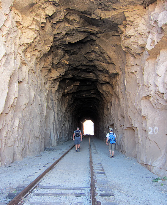
Love this tunnel
Something made a good meal out of this small deer

We hiked far enough to get a view of the Goat Canyon Trestle.

Group Shot

Mary on the hike back

If you were stuck in the tunnel when a train came this would be your best option.


Desert moon over Ocotillo


Interesting spider web hole. Reminds me of the movie Aliens.

View from Indian Hill

Morteros at Indian Hill

Mary at Indian Hill

Group Shot

<em>edited by surfponto on 10/29/2012</em> |
10/29/2012
Topic:
Hiking the Carrizo Gorge Railway and Indian Hill
surfpontoAdministrator
|
I do not believe so. First three coming from the Dos Cabezas side were wide open.
Last time we hiked this with Daren, there was one that had been cleared after the Mexicali shake.
The small excavator was still at the tunnel.
If you do this hike be wary of security since technically this route is considered trespassing.. 
Best,
Bob
TR wrote:
Bob;
Are there any tunnels that have collapsed, that you had to hike around, in taking the tracks down to the trestle?
Tom |
10/29/2012
Topic:
Indian Hill and June Wash
surfpontoAdministrator
|
Hey David and Daren,
I know this is an old post but I went and checked out "David's Tank".
Unfortunately no water but cool spot nonetheless.
Will have to check it after a storm 

Bob
dsefcik wrote:
What's out in June Wash? I always drive by it but have never really thought much about exploring that area. |
10/29/2012
Topic:
Hiking the Carrizo Gorge Railway and Indian Hill
surfpontoAdministrator
|
No we only got to the first place where you could view it after the 3rd tunnel. I think we had hiked about 3 miles in.
As far as the Mortero Palms hike it would be difficult for your kids.
This post kind of shows a bit of the terrain.
Some good climbing and descending, and to actually get to the trestle itself from that route is a bit technical.
The tracks from Dos Cabezas would be easier but longer.
anutami wrote:
Bob, did you guys make it to the trestle? Thinking of heading out to the trestle through mortero palms. How hard is the hike to the trestle once you get to goat canyon? Or is it better to follow the tracks from dos cabezas? |
10/29/2012
Topic:
Culp Valley to Palm Canyon
surfpontoAdministrator
|
Really nice view from up there.
Nothing wrong with hiking downhill in my opinion.
Our friends have a place in Borrego Springs and I have seen those palms from a distance.
Looks like a good hike.
Bob |
10/31/2012
Topic:
Best Desert Beer?
surfpontoAdministrator
|
Mongo from Port Brewing is good.
Probably not the best "session" beer since it is a strong IPA 
 |
11/1/2012
Topic:
Rockhouse Canyon 4 Day Backpack TR
surfpontoAdministrator
|
Wow
I never knew you could buy refried beans like that.
Awesome!
Bob
dsefcik wrote:
ziphius wrote:
What was your menu like? 
Jim
Hah..! Great question, I was already thinking about posting something about it.....
Pretty simple stuff on the menu, no stove or cooking, just ready to eat out, of the bag foods.
I took a cue from a backpack of food left by an undocumented traveler out in Myer Valley I found. It had 16oz bags of refried beans ready to eat.

I went to my local Northgate Market and found SunVista makes a similar product but also in black bean flavor (which was my favorite). I bought a couple packages and tried them out at home first, they were good so I figured I would take them out on a backpack trip. The ingredients really are not too bad either.

---

---

My nightly dinner was bean & cheese burritos. I brought a 12 pack of Trader Joe's tortillas in a ziplock bag and Gary brought some mozzarella cheese so we shared.
Other foods were mostly Trader Joe's dried apples rings, trail mix, peanut butter filled cracker things, dried banana chips, oriental salty snack chip things and one of my favorites, pumpernickel pretzels. Also brought one fresh apple for each morning and two Cliff Bars for each day. I also brought a couple packages of ready to eat tuna, I am not a tuna eater but they did taste good.
The burritos were the best..I will definitely be taking refried black beans and tortillas on my next trip!
Oh yeah...the big bottle of Jack Daniels mixed with Bacardi spiced rum didn't hurt much each night either..... |
11/2/2012
Topic:
Best Desert Beer?
surfpontoAdministrator
|
Nice. Possibilities are endless 
Be sure to report back.
We won't be heading back out until our annual Anza Borrego Thanksgiving Trip 
borrego wrote:
Heading out tomorrow for the weekend, gonna go with Dos Equis due to the weather cooling down. Some good scotch, too.......mmmmmm |
11/5/2012
Topic:
East Fork Carrizo Creek
surfpontoAdministrator
|
Great post. Love that hike.
We have also found many backpacks, clothing etc. there.
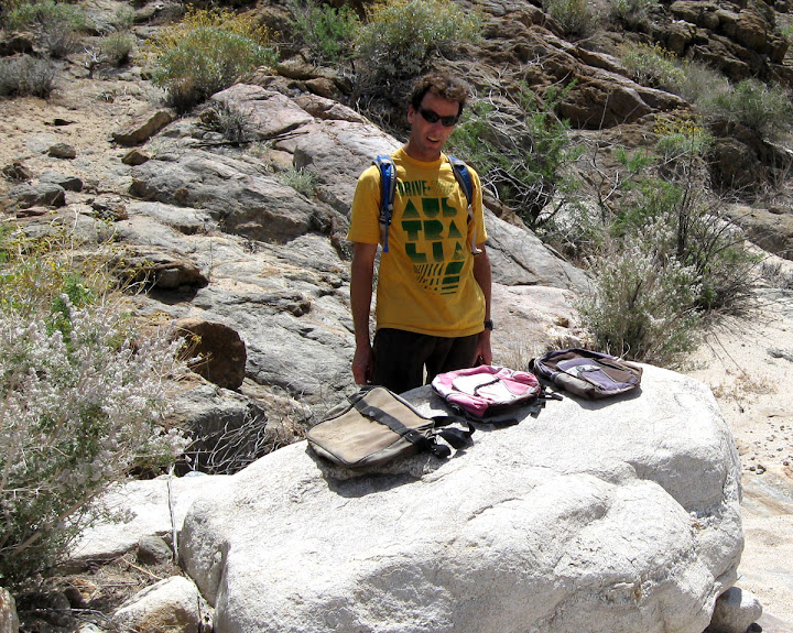
A few years back we also stumbled upon a Mexican blanket inside a small cave that had something the size of a basketball in it.
Noone was brave enough to unwrap it to see what it was. 
Looks like your big camper had no trouble getting up into Carrizo Gorge. Seems certain times of year the sand gets pretty soft.
Bob |
11/5/2012
Topic:
Best Desert Beer?
surfpontoAdministrator
|
I found this one from Kona brewing a few weeks back.
Very good desert beer 
Hey where did you find those Sierra Nevada in the can?

<em>edited by surfponto on 11/5/2012</em> |
11/5/2012
Topic:
Goat Canyon Trestle Hike
surfpontoAdministrator
|
Would love to go but we will be out the following weekend for out annual
Thanksgiving Borrego Trip
Report back after your trip . Sounds like a good time.
Bob
edited by surfponto on 11/5/2012
<em>edited by surfponto on 11/5/2012</em> |
11/5/2012
Topic:
Plaster Blaster & Salvation Mtn
surfpontoAdministrator
|
Salvation Mountain is on my list to see also.
Awesome your trip happened to be on Leonard's Birthday. 
Would love to see some pictures if you have any.
Bob |
11/5/2012
Topic:
East Fork Carrizo Creek
surfpontoAdministrator
|
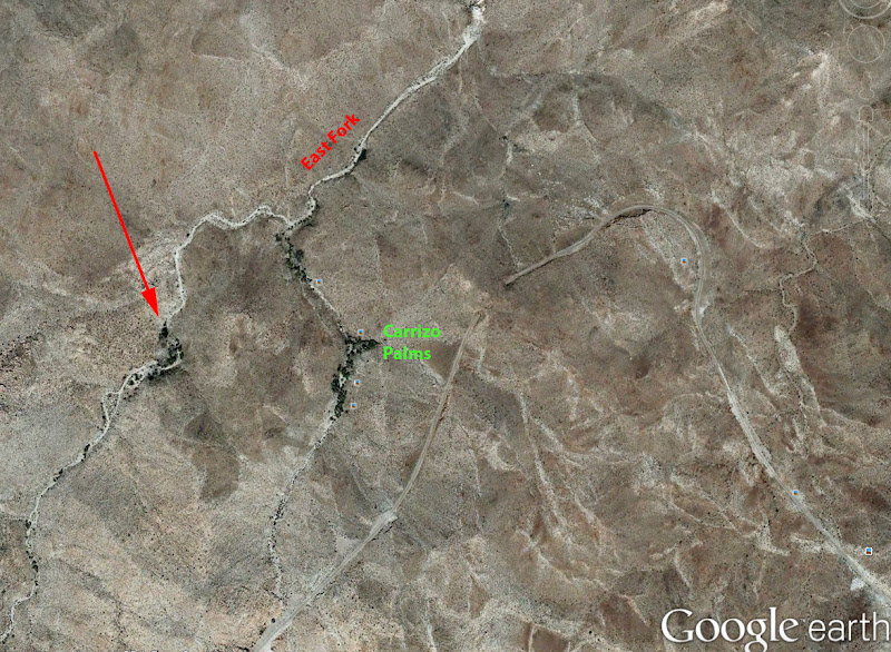
Actually I think we saw the northern palm grove from up on the trestle a couple weeks back.
It looked that if you forked right from the turnoff to the southern Carrizo Palms you would run right into it.
Will try to look on Google Earth to pinpoint it.
Here you go (red arrow) although I am not sure that is North of the Carrizo Palms
Bob
tommy750 wrote:
Nice pics and report. Made it up to Carrizo Palms in Februrary 2009 via the East Fork. Was under 4 miles to the southern Carrizo Palms. The northern Carrizo Palms doesn't seem to exist except on the topo map. Found running water and some nice pools, but maybe dried up this time of year. Also, found this guy's remains. Thanks. Tom

East Fork Carrizo Pool by tomteske, on Flickr

East Fork Carrizo Ram by tomteske, on Flickr
edited by surfponto on 11/5/2012
<em>edited by surfponto on 11/5/2012</em> |
11/5/2012
Topic:
East Fork Carrizo Creek
surfpontoAdministrator
|
Great video by the way 
anutami wrote:
surfponto wrote:
Great post. Love that hike.
Looks like your big camper had no trouble getting up into Carrizo Gorge. Seems certain times of year the sand gets pretty soft.
Bob
I took it out of 4wd when heading up the east fork and ended up burrying my rear wheels. As soon as I put it back in 4wd I climbed right out.
http://youtu.be/8YWJgXlQhwM |
11/6/2012
Topic:
Dos Cabezas Road
surfpontoAdministrator
|
Is that the same cave as the handprints?
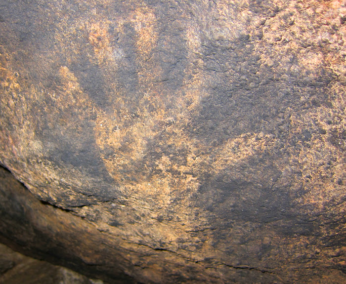
Never found out the story on those.
dsefcik wrote:
You need to go past the signed pictos and keep poking around, you can't miss it....it's right next to the big boulder.... |
11/6/2012
Topic:
DStretch tutorials
surfpontoAdministrator
|
Great resource!
Thanks Daren,
Bob
dsefcik wrote:
I wrote a few tutorials on getting started with DStretch. I plan to try and write a few more with some of the more advanced techniques.
http://www.sefcik.com/2012/10/dstretch-tutorials-getting-started.html
http://www.sefcik.com/2012/11/dstretch-tutorials-modifying-default.html
http://www.sefcik.com/2012/11/dstretch-tutorials-batch-mode.html |
11/6/2012
Topic:
Truck Camper
surfpontoAdministrator
|
It is my understanding that SEMA is not open to the general public.
Is that correct?
Bob
DRT Lakeside wrote:
Spent some time at the SEMA show (Specialty Equipment Market Assoc.) in Vegas this week and took a few quick pictures of some of the off-road/camping/safari type vehicles. Clearly some are more for show, but interesting to look at. Lots of individual vendors as well, there must have been at least 50 booths just for Jeep stuff, I think if you only had a door hinge, you could still probably restore it back to normal with all the stuff available : ) Not much for our little Suzuki...
Sorry about the blurriness, lack of close ups, etc. but I was trying to move fast and people were everywhere
link |
11/8/2012
Topic:
Nov 9 Piedras Grandes to Carrizo Gorge
surfpontoAdministrator
|
One thing to mention is that what looks doable on Google Earth is sometimes not.
When I originally thought I could hike along Carrizo Gorge to the bottom of Goat Canyon I used Google Earth as a guide.
Turns out what looked like minor bushes on Google was 8 foot tall catclaw that tore us to shreds.
Welcome to the forum 
Bob |
11/8/2012
Topic:
Nov 9 Piedras Grandes to Carrizo Gorge
surfpontoAdministrator
|
Would love to see what you find out.
Post back once you return
Maybe I will have the new Forum software running by then 
harmono wrote:
It's funny you mentioned that, because after reading your post that was one of my concerns. I can't see rocks cactus and brush on the map, or even sand in the wash. I'll have to wait and see. |
11/9/2012
Topic:
Nov 9 Piedras Grandes to Carrizo Gorge
surfpontoAdministrator
|
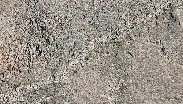
I am guessing those are large boulders that you will have to scramble over.
Sounds like a great adventure 
harmono wrote:
This looks like the most treacherous part of the path. Rocks seem to obstruct the creek path. Not sure how big the rocks are.
Image In Photo Stream
edited by harmono on 11/8/2012
edited by surfponto on 11/9/2012
<em>edited by surfponto on 11/9/2012</em> |
11/12/2012
Topic:
Fish Creek Wash Rd Conditions
surfpontoAdministrator
|
Hi Linda,
I think that is great that you live in Borrego Springs but still get out and camp in the Park 
Bob
Borregolinda wrote:
We're going camping at Fish Creek Tuesday, I know, we live here in Borrego but still like to camp in the Park! But plan to driving up to Sandstone and into so will report back when we return at end of week. |
11/13/2012
Topic:
Pinto Wash Petroglyphs
surfpontoAdministrator
|
Wow that looks like it was an exciting hike!
Your pics are great.
Petroglyphs, human skull and a burial cross, geesh crazy.
I was going to try to decipher the cross with my rudimentary Spanish skills but....
Bob
<em>edited by surfponto on 11/13/2012</em> |
11/13/2012
Topic:
Pinto Wash Petroglyphs
surfpontoAdministrator
|
Thanks
Better than what I came up with 
harmono wrote:
"Do not fill your hearts with pain and sorrow more memories each morning memories the laughter and joy they quiver solemente ad I've gone though I rest a bale Ascencia dollar and cause" best I could do to translate it. |
11/13/2012
Topic:
Pinto Wash Petroglyphs
surfpontoAdministrator
|
Thanks for the translation Daren,
I agree.
It is amazing what migrants must endure to come over the border .
dsefcik wrote:
Great trip Tom, I always wanted to go out there. There are some pictos you passed by also but they are very faint.
here is what I got from the sign:
"In memory of Martin Zam Torres born 11/29/1969 and passed on 07/20/2008 Do not fill your hearts with pain and guilt instead remember me each day, remember the joy, the smiles and the laughter. I have gone to rest a bit even if my absence causes pain and .....diminishes my pain..."
Every time I find undocumented packs and such I wonder how they do it and why it is worth so much......next time you are out hiking with your cushy Camelbak and name brand boots think of that sign and skull...... |
11/14/2012
Topic:
New Forum
surfpontoAdministrator
|
Sounds good.
I could make you an administrator or moderator if you would like?
Upgrade has been a pain. Probably be fixing stuff all day 
Main site is a bit buggy but Forum seems to be pretty good. |