4/16/2012
Topic:
Exploring The Island and Myer Valley
tommy750
|
Nice trip. Have started a few hikes from Old Hwy 80 and crossed under the tunnel toward Boulder Creek and Myers Creek but never checked out the island. Is that For Sale sign still up? Assumed it was the ranch to the west but never called the number. I hear there's a pile of cars that went off I-8 over by the ranch. Actually saw a PU fly off a few years ago. Didn't end well. |
4/16/2012
Topic:
Exploring The Island and Myer Valley
tommy750
|
I stumbled on that cabin in 2005 heading out to Myers Valley. Stopped by last December and it looked about the same. If you have a copy of Chris Wray's "The Historic Backcountry," it has a blurb on this cabin and mentions another a little way down I-8, one I've never seen. It's listed as being at 32 40.39, -116 04.40. On Google Earth, looks like it's on a little rise near where a dirt road peels off the eastbound lanes. |
4/17/2012
Topic:
Exploring The Island and Myer Valley
tommy750
|
dsefcik wrote:
tommy750 wrote:
I stumbled on that cabin in 2005 heading out to Myers Valley. Stopped by last December and it looked about the same. If you have a copy of Chris Wray's "The Historic Backcountry," it has a blurb on this cabin and mentions another a little way down I-8, one I've never seen. It's listed as being at 32 40.39, -116 04.40. On Google Earth, looks like it's on a little rise near where a dirt road peels off the eastbound lanes.
Thanks for that info...maybe I missed something but those coordinates put a marker right at the shack we have posted pics of. I will look and see if I can find his book.
Oops! You're absolutely right. The other site is 32 41.42 -116 3.68 |
4/17/2012
Topic:
Exploring The Island and Myer Valley
tommy750
|
surfponto wrote:
Thanks for the tip Tommy750,
You also inspired another one of my trips up the East Fork of Carrizo Gorge a few years back.
Welcome to the forum
Bob
Thanks! You guys have already got me out to see the petroglyphs at Indian Hill and Carrizo Canyon. Tried finding the Summer Solstice Cave from McCain Valley but whiffed on that one. |
4/17/2012
Topic:
Exploring The Island and Myer Valley
tommy750
|
dsefcik wrote:
surfponto wrote:
Here you go Daren
Seller is actually the author Chris Wray 
http://tierrablancabooks.com/retailers.htm
Looks like he has his own website, I may just email him and see if I can pick it up locally, or stop at the Desert Tower..haha...thanks Bob!
Got my copy at the Desert View Tower. |
4/17/2012
Topic:
Exploring The Island and Myer Valley
tommy750
|
dsefcik wrote:
tommy750 wrote:
I hear there's a pile of cars that went off I-8 over by the ranch. Actually saw a PU fly off a few years ago. Didn't end well.
Check the pictures on this website, scroll down about 3/4 of the way: http://nexthill.com/Photo's/Devils%20Canyon/index.htm
Thanks. Those vehicles look like they sailed off Old Hwy 80 some years ago. |
4/19/2012
Topic:
Near Piedras Grandes and Dos Cabezas
tommy750
|
Had the afternoon off so decided to drive out to Piedras Grandes. Kinda got side tracked when I saw a rock pile in the distance and decided to investigate. Found one mortero, possibly some faded petroglyphs, a yoni and a bunch of pottery shards. Two weird rock formations made me smile. Saw what appeared to be a Rosy Boa. Passed by Dos Cabezas and Piedras Grandes as the sun was setting.
The rock pile
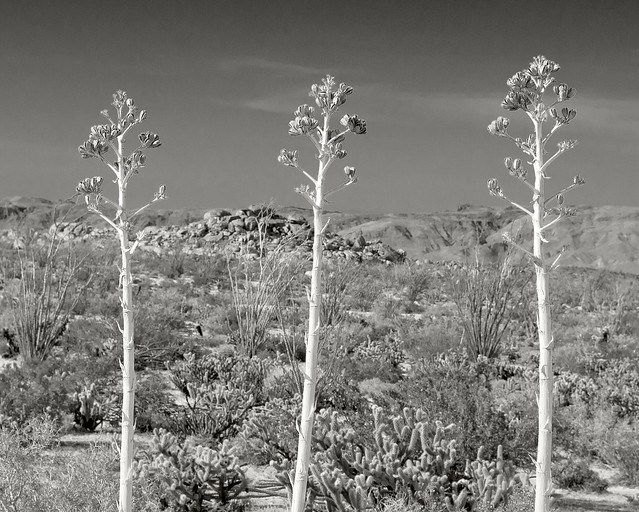
Three Yucca by tomteske, on Flickr
Mortero
 
Mortero by tomteske, on Flickr" border="0">
Saw probably a couple dozen shards
 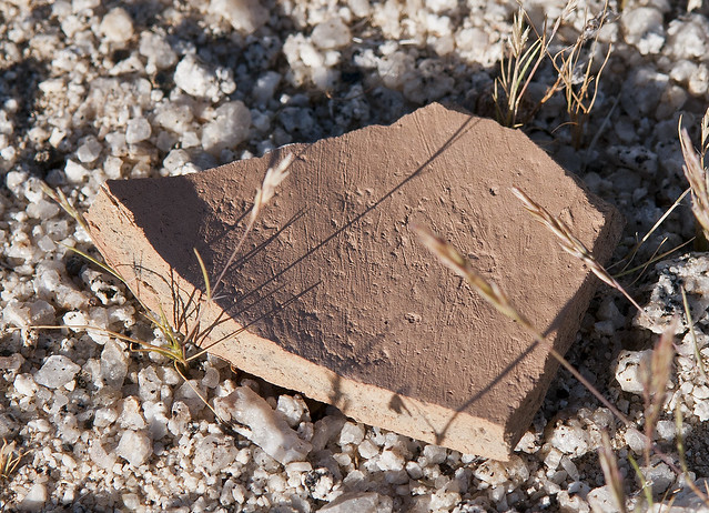
Pottery with Striations by tomteske, on Flickr" border="0">
Milky quartz cutting tool?
 
Cutting Tool by tomteske, on Flickr" border="0">
Yoni?
 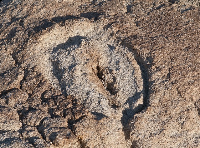
Yoni or Yonibe by tomteske, on Flickr" border="0">
Possible faded glyphs
 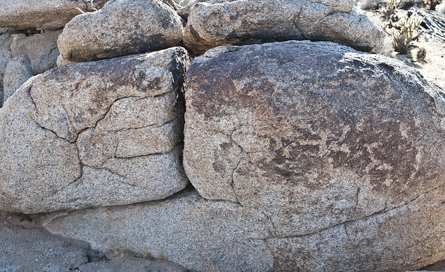
Faded Glyphs? by tomteske, on Flickr" border="0">
Dog Rock
 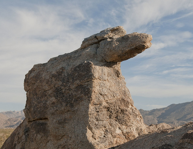
Dog Rock by tomteske, on Flickr" border="0">
We've all been wondering where these ended up
 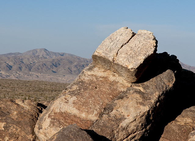
Ten Commandments by tomteske, on Flickr" border="0">
Looks like a Rosy Boa to me
 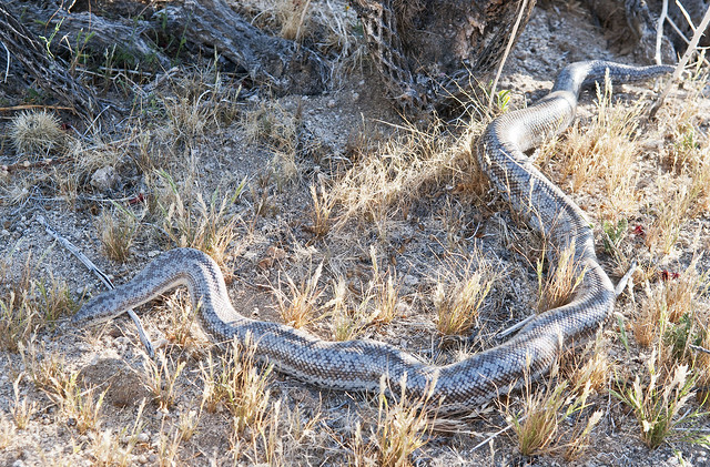
Snake4 by tomteske, on Flickr" border="0">
 
Snake by tomteske, on Flickr" border="0">
Headed over to Dos Cabezas as the sun was setting
 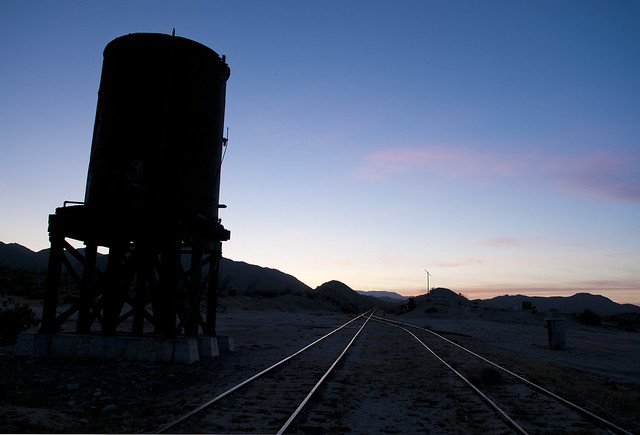
Dos Cabezas by tomteske, on Flickr" border="0">
 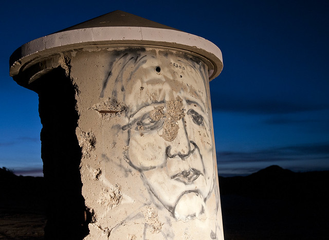
Face by tomteske, on Flickr" border="0">
 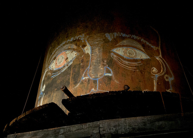
Dos Cabezas by tomteske, on Flickr" border="0">
Finally ended up near Piedras Grandes and watched Venus setting.
 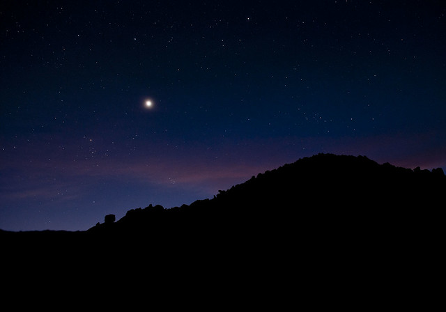
Venus Rising by tomteske, on Flickr" border="0">
Brought the iPad2 along to see how it would work. Obviously problems in direct sun but sure looked nice at night.
[img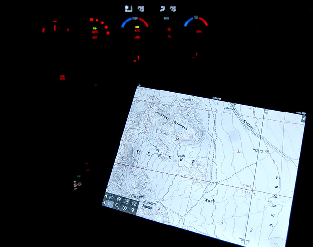
iPad2 at Piedras Grandes by tomteske, on Flickr]" border="0"> |
4/19/2012
Topic:
Near Piedras Grandes and Dos Cabezas
tommy750
|
dsefcik wrote:
OK, you almost had me going on the ten commandments photo...until I zoomed in on the original..nice try..8-)
How are you doing the lighting on the water tower, are you "painting" it with a flashlight?
Ok, you got me. The numbers on the "tablets of stone" showed up in photoshop. Really did look like the real thing from a distance. I painted the Dos Cabezas water tower and the other structure with the headlights of the Tundra. Was able to put one tire up on the railroad tracks and barely illuminate the face. Had to photoshop the concrete pipe face to remove a few choice expletives. |
4/19/2012
Topic:
Near Piedras Grandes and Dos Cabezas
tommy750
|
surfponto wrote:
Definitely a Rosy Boa and a lot bigger than the Rosy Boa in Indian Valley we found

Awesome find.
Yeah, was really neat seeing the snake up close. It barely moved for a few minutes and was quite cooperative with photos. Wasn't sure what kind it was but picked it out of a line up on californiaherps.com. It's a great website for identifying any reptile out there and also includes range maps.
Bob
edited by surfponto on 4/19/2012
edited by surfponto on 4/19/2012
<em>edited by surfponto on 4/19/2012</em> |
4/24/2012
Topic:
Inner Pasture / Myer Valley
tommy750
|
Snakes are out

Up close

Nice trip. Red Diamond Rattlesnake, perhaps? How do you do "D Stretch?" Is it available as a photoshop plugin? |
4/24/2012
Topic:
Inner Pasture / Myer Valley
tommy750
|
dsefcik wrote:
tommy750 wrote:
How do you do "D Stretch?" Is it available as a photoshop plugin?
You can get DStretch from the website, you have to email the author of the software. http://www.dstretch.com/
Thanks for the link. The slideshows on the website are pretty cool. Emailed the author for the plugin. Tom |
4/30/2012
Topic:
Devil's Canyon
tommy750
|
Took a quick trip to see if my friend Amy's '91 (think OJ replica) Bronco's 4X4 was working. Was getting tired of towing her out of the crazy stuff she gets in. A skiploader had to remedy this:

Bronco by tomteske, on Flickr
Ended up by Sugarloaf Mt. Not sure what these foundations were for, but presumably related to the railroad.
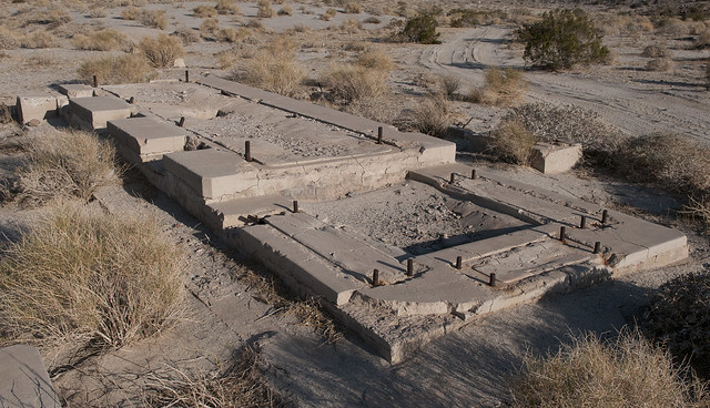
Foundation by tomteske, on Flickr
Railroad track markings give away its age.
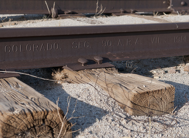
Railroad Track by tomteske, on Flickr
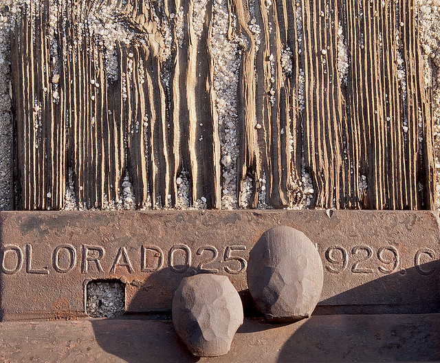
Railroad Spikes by tomteske, on Flickr
Crossed the tracks and headed up Devil's Canyon. Walked up the canyon till the I-8 bridge was in sight.

Railroad Crossing by tomteske, on Flickr
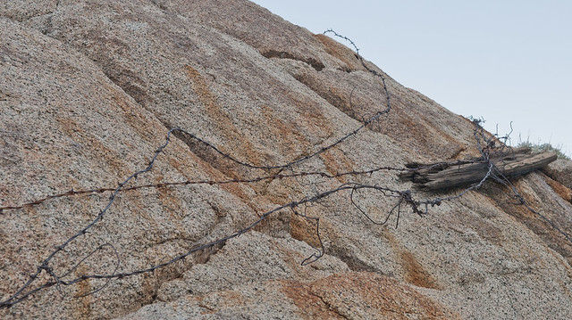
Devil's Canyon5 by tomteske, on Flickr

Devil's Canyon4 by tomteske, on Flickr
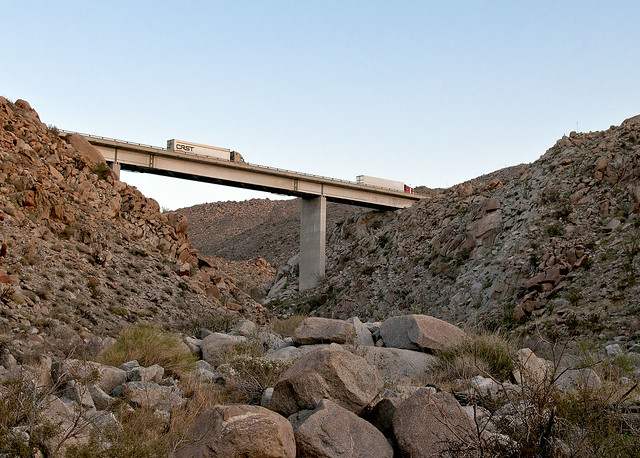
Devil's Canyon by tomteske, on Flickr
Took 149 over toward Mortero Palms. Then to Dos Cabezas Road and S2. The Bronco seemed to be working well.

Road to Mortero Palms by tomteske, on Flickr

Entering ABDSP by tomteske, on Flickr
iPad2 topo with GPS marks the spot.

iPad2 Topo by tomteske, on Flickr |
4/30/2012
Topic:
Devil's Canyon
tommy750
|
dsefcik wrote:
Looks like there were a lot of footprints in Devils Canyon.
There were a few. Looked like someone with a rock crawler drove up the canyon almost to the bridge. |
4/30/2012
Topic:
Devil's Canyon
tommy750
|
surfponto wrote:
Love the "stuck" Bronco picture.
Where was that taken?
reminds me of a recent Baja trip where I zigged when I should have zagged 

That looks like it was tough to get out of! Wouldn't let your dog drive from now on.
The Bronco was stuck in a tributary of San Felipe Creek after a rain storm. We were driving toward Fish Creek Mts next to the gypsum railroad when my friend decided to do some "exploring" on her own. I think it actually ended up in the San Sebastian Area of Critical Environmental Concern. She called the BLM as a preemptive move and they said just get it out of there ASAP. The bill was $1500 since the standard 4X4 towing company rig couldn't get it out and heavy equipment was called in. Life lessons are never cheap. |
4/30/2012
Topic:
Devil's Canyon
tommy750
|
anutami wrote:
if the 4x4 was working, I am not sure you could have gotton out of that anyway :0
at least your rear window rolls down so you could escape!
Looks like she just eased it into the mudhole. My favorite part was telling her if she let air out of all four tires she might be able to power out. She's still mad at me about that one! |
5/2/2012
Topic:
Missing hiker Anza Borrego Mud Caves
tommy750
|
dsefcik wrote:
I am not seeing any status updates for this, has he been found or what? Anybody know?
danielle179 wrote:
Thank you for posting this!
facebook.com/FindGuillermoPinoJr
I've been following this guy's FB page ever since this happened and there's never really been any substantive info posted. I agree, this seems bizarre. Every weekend some cave rescue group has been out there and apparently nothing has been found except possibly his shirt. What, there's about 22 known caves? You'd think they'd have cleared them all by now. Tapiado is between Hueso and Del Diablo and both have roads so wandering off seems weird, especially with bare feet. Sad story. |
5/2/2012
Topic:
Whale Peak - Backpacking
tommy750
|
A Boy Scout troop from Point Loma has put a nice new sign on the summit but I missed the old wooden sign. Anybody know what happened to it?
Was on Whale Peak in December 2011 and didn't see it for the first time. Tom |
5/7/2012
Topic:
Coyote Mountains
tommy750
|
Decided to drive out to the Elliott Dolomite Mine since I've driven by it a hundred times and never stopped. According to Chris Wray's book, dolomite was big in the early '50s as roofing decorative rock. Was hauled to Dos Cabezas and shipped out by train.
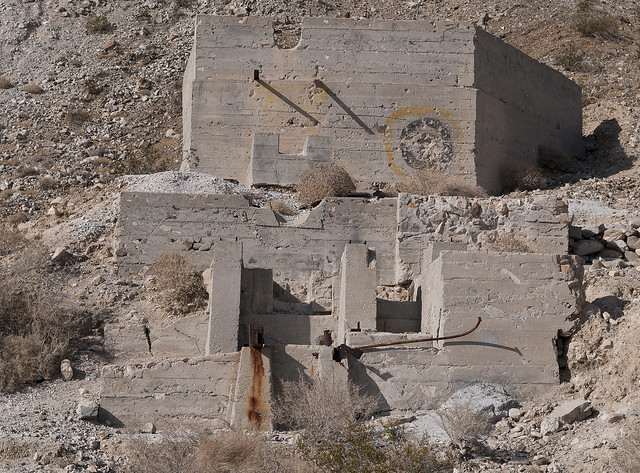
Dolomite Mine by tomteske, on Flickr
This looks like the stuff on every roof in Sun City.
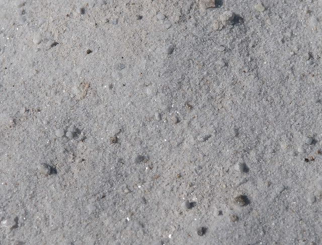
Dolomite by tomteske, on Flickr
Climbed up the dirt road above the mine and ended up at Mine Peak.
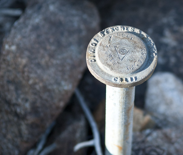
Mine Benchmark by tomteske, on Flickr
The register had comments back to 1996.
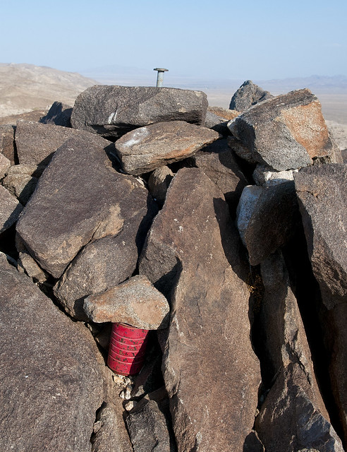
Mine Peak by tomteske, on Flickr
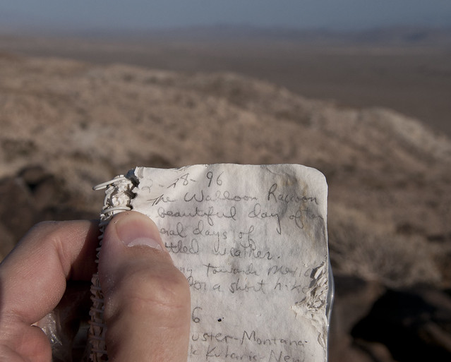
Mine Peak Register2 by tomteske, on Flickr
Looks like it was a little hotter last May. Was only 91 when I started at about 1700.
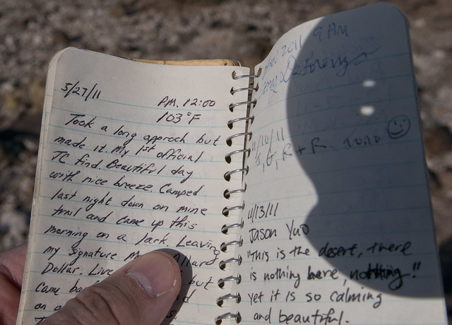
Mine Peak Register by tomteske, on Flickr
Saw a Tarantula Hawk searching a bunch of holes for baby food. Didn't find what it was looking for. Did witness a successful attack down in Baja a few years back. The hawk was ferocious. The sting is supposedly the worst ever.
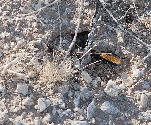
Tarantula Hawk2 by tomteske, on Flickr

Tarantula Hawk by tomteske, on Flickr

Tarantula Hawk3 by tomteske, on Flickr
Cross overlooking Carrizo Badlands.
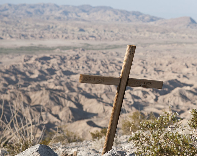
Cross by tomteske, on Flickr
Farther south, came across the Mother of All Ducks.
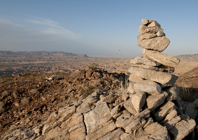
Mother Duck by tomteske, on Flickr
This number is listed as a cell phone in Palm Desert. Took the last four off because it looks like a kid. Any thing you want me to text this person, Daren?
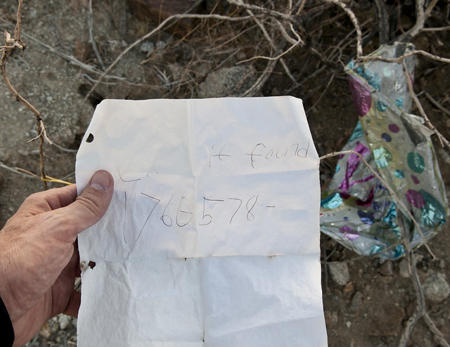
Call if Found by tomteske, on Flickr
Time to head back.
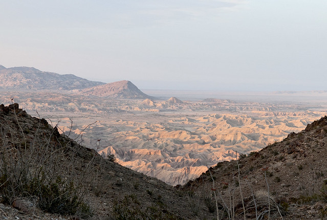
Carrizo Badlands by tomteske, on Flickr |
5/7/2012
Topic:
Coyote Mountains
tommy750
|
hikerdmb wrote:
Nice pics. I especially like the last one. Great light on the badlands!
David
Thanks. I love the stark contrast in the late afternoon in the badlands. Tom |
5/7/2012
Topic:
Coyote Mountains
tommy750
|
dsefcik wrote:
Great post, I camped out there with my son last October, it was a quiet, peaceful place to camp. I just pick up the ballons and pack them out, big horn and other wildlife eat them and die. I picked up (4) last week in Indian Valley.
http://cawsf.org/Floating_Menace.pdf
Wow. Just thought they were yet another piece of trash left by the careless. Will check out the link. Tom |
5/7/2012
Topic:
Inner Pasture / Myer Valley
tommy750
|
dsefcik wrote:
tommy750 wrote:
How do you do "D Stretch?" Is it available as a photoshop plugin?
You can get DStretch from the website, you have to email the author of the software. http://www.dstretch.com/
Well, I got DStretch and it proved to be last week's delightful yet colossal time-waster! Am wondering what you think of this pic from Carrizo Canyon. Is that really a grafitto? I'm seeing something like 1865. Don't have any close ups of this area because I thought it was a blank spot in the panel. Did you take any hi res pics of this part of the cave when you were there?

1865? by tomteske, on Flickr |
5/8/2012
Topic:
Coyote Mountains
tommy750
|
The Carrizo Badlands are so amazing at dusk. Any where you go in the Coyotes with the sun setting is guaranteed to deliver a gorgeous view. Tom
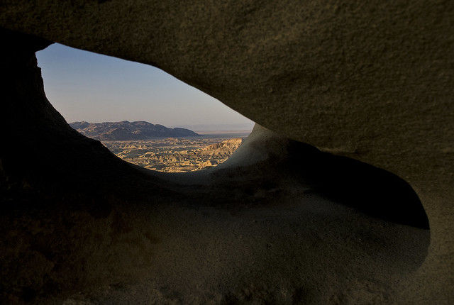
Fish Creek Mts from Wind Cave by tomteske, on Flickr

Carrizo Badlands Panorama by tomteske, on Flickr

Carrizo Badlands by tomteske, on Flickr

Carrizo Panorama by tomteske, on Flickr |
5/8/2012
Topic:
Coyote Mountains
tommy750
|
dsefcik wrote:
Ditto on the Badlands photo, very cool...is that is Diablo BM of in the distance?? That whole area always looks very cool at sundown.
The hill in the background is the 1401 ft rise just south of Fish Creek Mts. Tom |
5/13/2012
Topic:
Best Mylar Ballon Trip
tommy750
|
dsefcik wrote:
What is your best mylar ballon take for a trip?
Canebrake Wash (as Tommy750 found, one of these had a note..an "I love you so much" type note)
My average number of baloons picked up per hike was zero---till I joined this forum. Now I scoop up every one I see thanks to you. Tom |
5/13/2012
Topic:
EL VALLECITO AND LA RUMOROSA STYLE
tommy750
|
According to Manfred Knaak's "The Forgotten Artists," ABDSP has three main rock art styles: Western Petroglyph, San Luis Rey and La Rumorosa. I've never actually seen the first style and like many, have only seen the Little Blair Valley example of San Luis Rey. Have enjoyed the wonderful Indian Hill and Carrizo Canyon examples of La Rumorosa style and decide to investigate this style further. The name comes from a Kumeyaay site in Northern Baja with "La Rumorosa Style" being coined by Ken Hedges in the early '70s. He described it as:
"characterized by the presence of digitate anthropomorphs (human figures with the fingers
and/or toes represented), sauromorphs (lizard forms), sunbursts, circles, and rectangular
grids as defining elements. Although both representational and abstract forms are present,
it is the occurrence of the representational elements, particularly the digitate
anthropomorph, which sets this style apart from others in southwestern California.
Designs occur in at least four colors – red, black, white, and yellow – with most sites
having at least two colors."
(Rock Art in Southern California. Pacific Coast Archaeological Society Quarterly 9(4):1-28)
Decided to head down to La Rumorosa (El Vallecito) site and see what he was talking about. The girlfriend and I made our way south through Mexicali and headed west on Hwy 2. If you enjoy the I-8 grade entering/leaving the Imperial Valley, La Rumorosa grade is that times 5. Here's a link to a 2 min video from yesterday while driving down the grade:
[flash=http://www.flickr.com/apps/video/stewart.swf?v=109786]width="400" height="225" flashvars="intl_lang=en-us&photo_secret=4697bcb88b&photo_id=7192676762" bgcolor="#000000" allowFullScreen="true"[/flash]
The exit sign from Hwy 2. You'll need to head north on an unmarked dirt road for about a mile and will arrive at the archeological site. It's open Wed-Sun till 4pm. The caretaker said Sunday is crowded. We saw two other small groups the entire time we were there on Saturday. The fee is a few bucks each. You're given a simple map of the site and off you go. Expect 1-2 miles of walking and containers are not allowed although the locals all had them. The site was quite clean and well-ordered (Daren, even the morteros were poop-free).
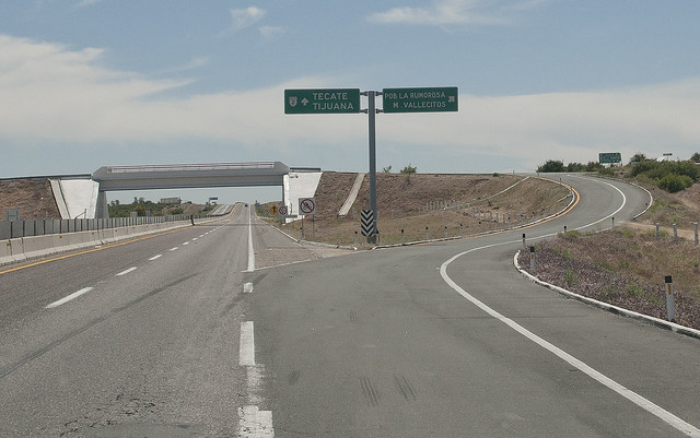
Vallecitos Exit by tomteske, on Flickr
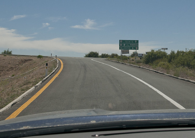
Vallecitos Exit by tomteske, on Flickr
There's about 14 named sites but only five are accessible to the public: El Tiburon (the rock looks like a shark), El Diablito/Solstice Cave, El Hombre Enraizado (man with roots), El Indio/El Hongo (again, the rock looks like a mushroom) and Los Solecitos (little suns)/Wittinnur (someone's name?). The last two sites are stupendous.
The Shark Cave. Only a few glyphs including one that reportedly looks like a butterfly.
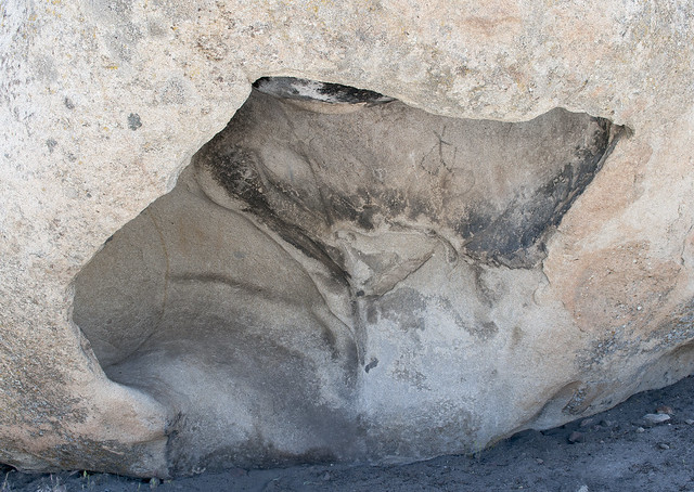
Cueva de Tiburon by tomteske, on Flickr
Diablito/Solstice Cave. Apparently, the winter solstice sunrise illuminates the little devil's eyes.

Cueva del Diablito o Solsticio by tomteske, on Flickr
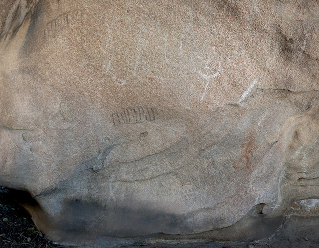
Cueva del Diablito o Solsticio by tomteske, on Flickr
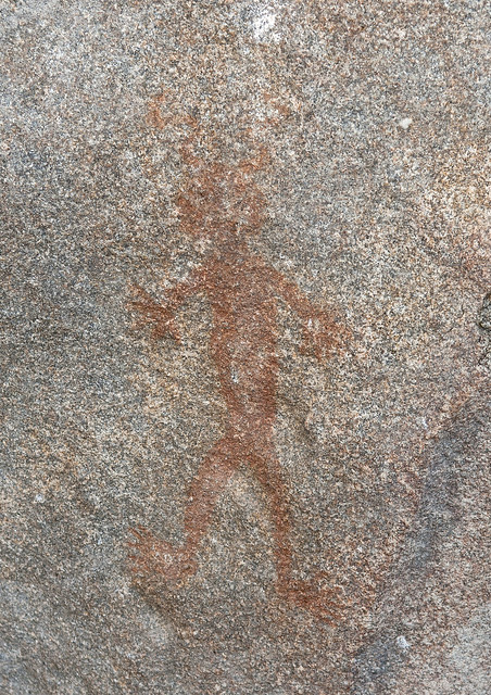
El Diablito by tomteske, on Flickr
El Diablito DStretched.
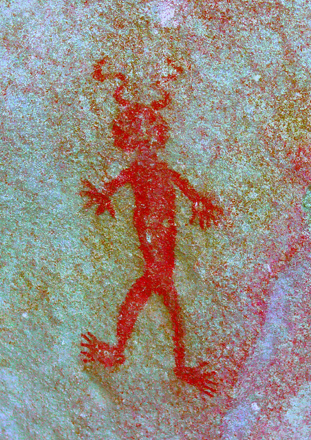
El Diablito o del Solsticio by tomteske, on Flickr
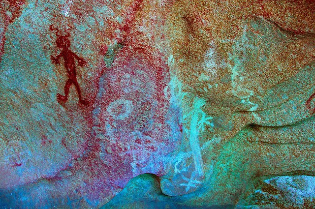
Cueva del Diablito o Solsticio Panel by tomteske, on Flickr
Rooted Man Cave. This figure looked like a pictograph/petroglyph combination. A strange symbol is present in an adjacent cave.
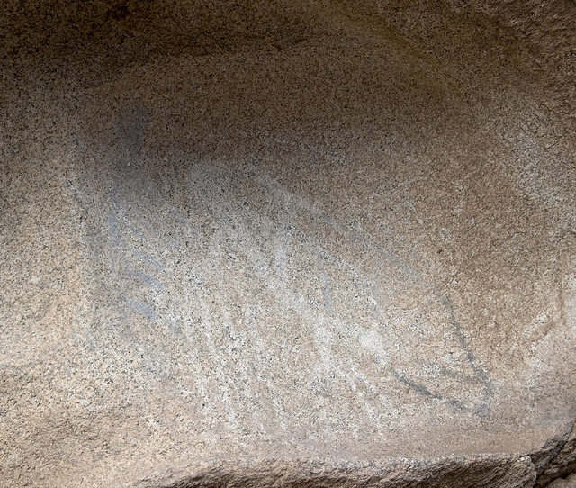
Cueva del Hombre Enraizado by tomteske, on Flickr
El Hombre Enraizado DStretched.
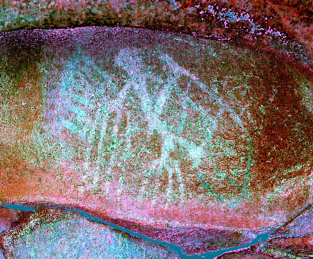
Cueva del Hombre Enraizado by tomteske, on Flickr
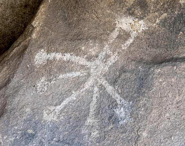
Cueva del Hombre Enraizado by tomteske, on Flickr
On the way to the next cave, a couple of rock circles were obvious. The caretaker said these were original to the site but other rocks arranged into symbols were later additions.
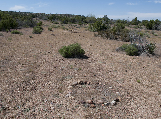
Rock Circles by tomteske, on Flickr
Didn't see any snakes this trip.
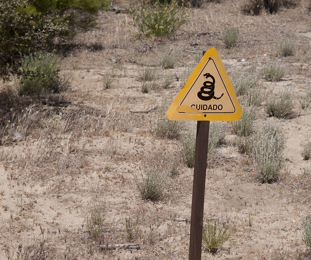
Cuidado by tomteske, on Flickr
The Indian/Mushroom Cave was stunning. Here's a few DStretched images.
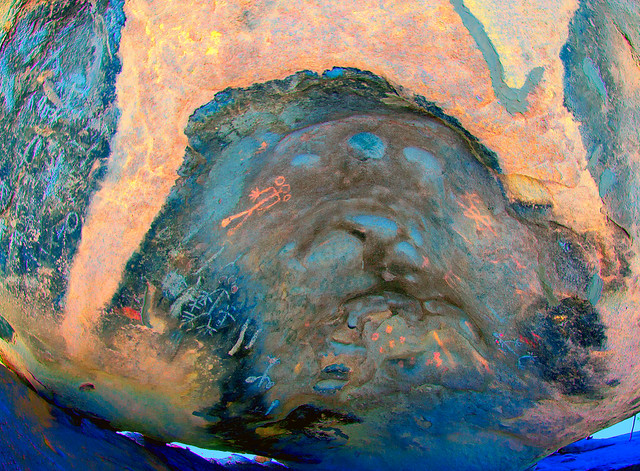
Cueva del Indio o El Hongo West by tomteske, on Flickr
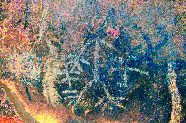
Cueva del Indio o El Hongo West by tomteske, on Flickr
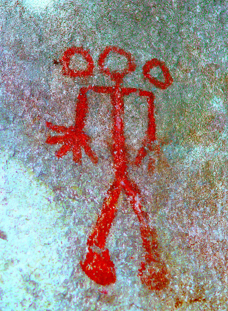
Cueva del Indio o El Hongo West by tomteske, on Flickr
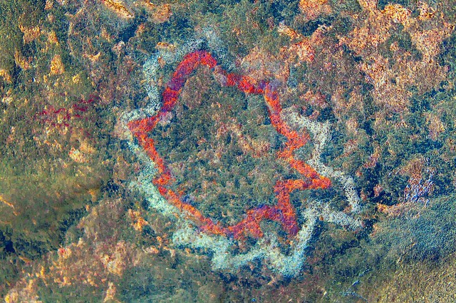
Scotoma_lds by tomteske, on Flickr
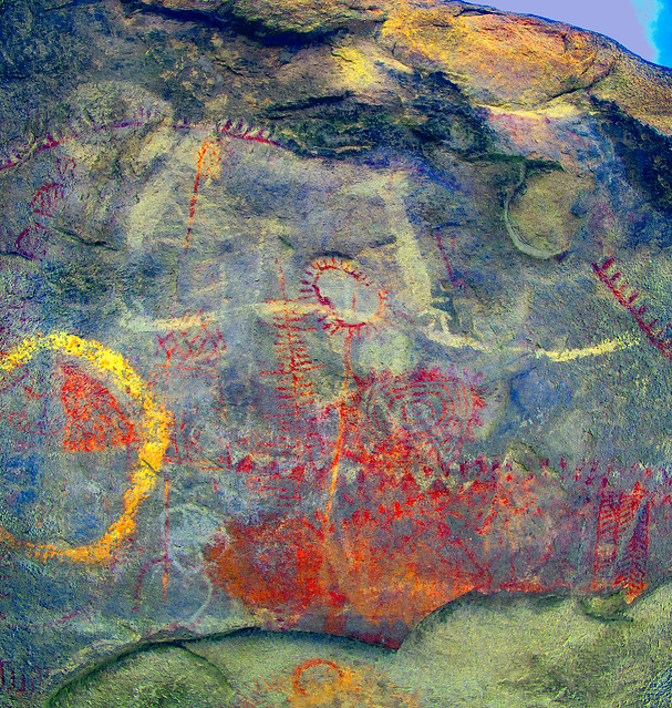
Cueva del Indio o Hongo East by tomteske, on Flickr
The last cave was The Little Suns/Wittinnur. Also an amazing site.

Los Solstices o Wittinnur Panel by tomteske, on Flickr
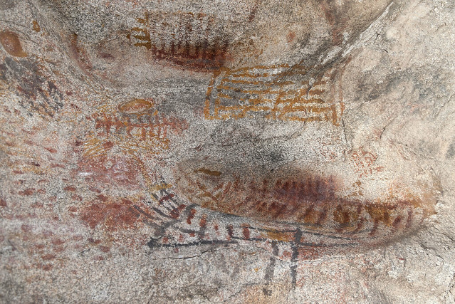
Solstice Cave by tomteske, on Flickr
Kind of a long post, but there was an incredible amount of cave art to see. Although now artificially separated from the Kumeyaay sites we routinely encounter on our side of the border, El Vallecito is only about five miles due south of Blue Angels Peak and 15 miles south of Indian Hill. Would definitely recommend a visit if you're looking for a great day trip. Here's a link to more Vallecito pics if you're interested. Tom
http://www.flickr.com/photos/tommy750/sets/72157629714899716/ |
5/13/2012
Topic:
EL VALLECITO AND LA RUMOROSA STYLE
tommy750
|
dsefcik wrote:
Nice...very nice!
DStretch brings a whole new dimension to rock art doesn't it??
I have seen a video of the solstice sun shining on the eyes of the diablito.
I will be looking a bit more closely at all of the photos you posted, I have always wanted to get down there.
I have found so many pictos just taking pictures of (blank to me looking at them) rock surfaces and then running them thru DStretch later that it is amazing.
You should definitely go down there. You're right, DStretch is incredible. Thanks for the link. I need to paypal DStretch a donation!
Great post Tom, thanks for sharing that!
Daren |
5/14/2012
Topic:
EL VALLECITO AND LA RUMOROSA STYLE
tommy750
|
surfponto wrote:
Awesome trip Tom.
Really like the El Diablito pictograph.
We went by there a few years back to camp at the hot springs in Guadalupe Canyon.
Wish I had know about thsoe pictos then
I guess there is also a famous picto cave down near Catavina that is suppose to be pretty cool.
Thanks for posting the pics of your adventure
Bob
The caretaker at El Vallecito had a cool El Diablito tshirt which sold at the site until two years ago when they quit making them  There's another site at "mile marker 57" that looks like the great mural sites of central Baja. Was going to check it out but was getting late. Not sure if it's on the toll road or the old road but suspect the latter. Recall driving by the Catavina site but it was closed when I last was there. Its online pics look pretty cool. Check out this link to a pictograph cave above Canyon Guadalupe: There's another site at "mile marker 57" that looks like the great mural sites of central Baja. Was going to check it out but was getting late. Not sure if it's on the toll road or the old road but suspect the latter. Recall driving by the Catavina site but it was closed when I last was there. Its online pics look pretty cool. Check out this link to a pictograph cave above Canyon Guadalupe:
http://www.scahome.org/publications/proceedings/Proceedings.22Porcayo2.pdf Tom |
5/14/2012
Topic:
EL VALLECITO AND LA RUMOROSA STYLE
tommy750
|
ziphius wrote:
Awesome pictos, thanks for sharing. The contrast between the normal and D-stretched versions is amazing. I'll definitely pay more attention to 'smudges' on rocks in the future. I was near Escalante Utah this spring and saw a few pictos high on cliff walls that I wouldn't have seen otherwise if I hadn't been looking through my binoculars for birds.
Glad Daren sent me the link (www.dstretch.com). And at FREE, the price is unbeatable. Tom |
5/23/2012
Topic:
Misc Photos from last week
tommy750
|
dsefcik wrote:
Was out on some volunteer efforts last week and took a few photos while out in the field. No spectacular mountain summits or multi day backpack trips, just some photos.
That's it, hope you like the photos.
Nice pics. That centipede close up is downright scary. Been trying to get the girlfriend out camping in the desert more and therefore will NEVER be showing her this post! |
5/29/2012
Topic:
Memorial Day Weekend: Sombrero Peak
tommy750
|
Since the temperature dropped so much this past weekend, figured I give finding the Solstice Cave and climbing Sombrero one more shot till it cools in the fall. Convinced the girlfriend to go and we were off.
After exiting in Ocotillo, remembered we'd never been to the Imperial Valley Desert Museum, so I whipped a U in front of the Lazy Lizard and headed south. The building is very nice but very empty. Spoke with their archeologist, Jennica, who's new to the Valley, but excited about commencing work on their large yet disorganized Indian artifact collection. Here's one of a cache of three ollas reported found "somewhere up S-2."

Olla by tomteske, on Flickr
Some type of shovel and pick. You can see the museum is in its early stages. Bought a pamphlet on geoglyphs located near Needles, joined the museum for $25 each and we headed north.
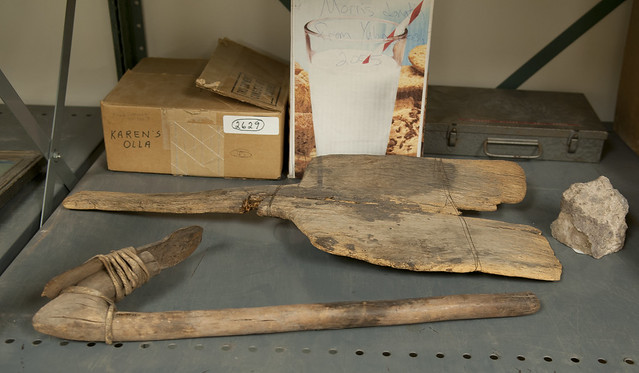
Shovel and Pick by tomteske, on Flickr
Saw some strange looking RVs as we drove toward Indian Gorge.
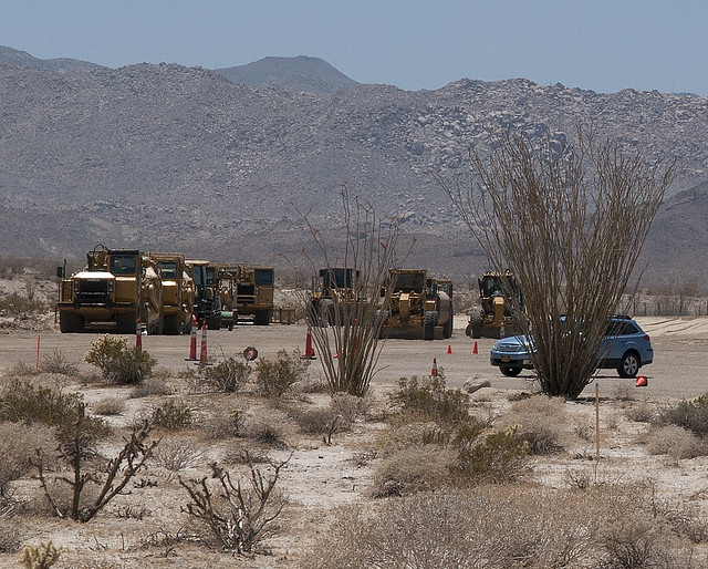
Memorial Day Campers by tomteske, on Flickr
We saw this yoni-maybe while headed up the initial draw toward the ridge.
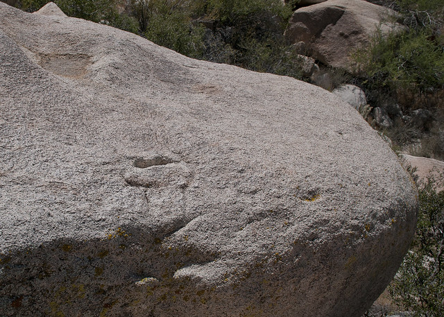
Sombrero Yoni by tomteske, on Flickr
The view from the ridge toward the South Fork.
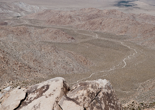
South Fork Indian Gorge by tomteske, on Flickr
Not too far away, heard a lot of buzzing and found this opening to a wild hive. There's 100 bees swarming into this crack, but can't see any in the pic and wasn't that motivated for a closeup.
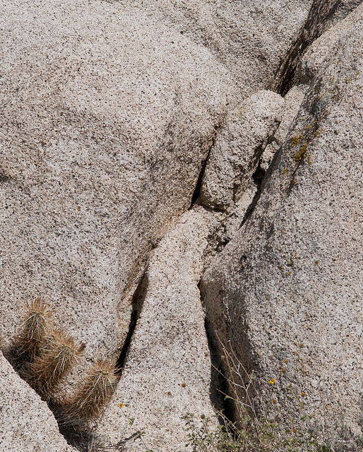
Wild Bee Hive by tomteske, on Flickr
The GPS said 3.0 miles to the top and 1.8 down so it's not like we didn't look for that cave. By this point, we both had had enough and just wanted to get to the top. So, most likely we walked right past it.

Sombrero Peak by tomteske, on Flickr
Saw two morteros on the way down.

Sombrero Morteros by tomteske, on Flickr
Never tire of looking at the beautiful yucca flower.
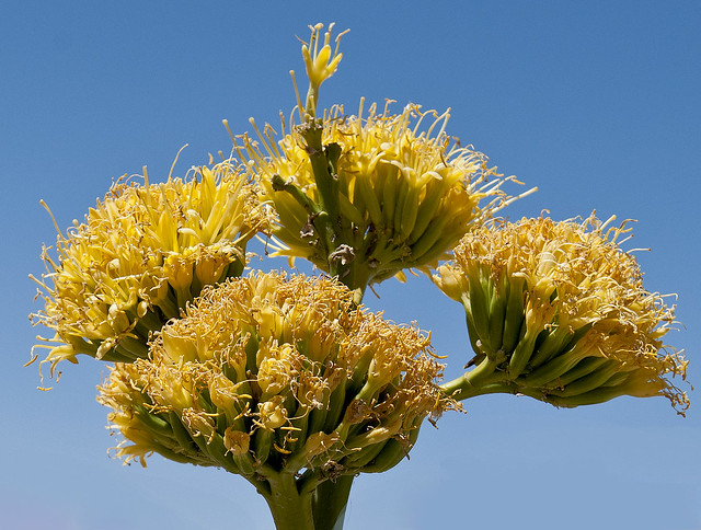
Yucca Flower2 by tomteske, on Flickr
A nice dinner prepared on the tailgate as the sun set finished off the hike.
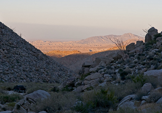
Indian Valley View by tomteske, on Flickr |
5/29/2012
Topic:
Memorial Day Weekend: Palo Verde/Blythe Intaglios
tommy750
|
Palo Verde Point and Blythe Intaglios are just a wee bit outside ABDSP and Kumeyaay territory, but they're so cool you have to see these sites. Both sites, for better or worse, are mere yards from major desert highways. Both have signage and barriers in place. Had some free time yesterday so headed toward the river to see the Palo Verde petroglyphs, a series of stunning panels carved in limestone along ancient trails on the west side of the Colorado. Unfortunately, they're being eroded rather rapidly and blasting at a quarry straddling the site has probably led to some collapses.
This Chevy, easily seen on Google Earth, marks the approximate southern extent of the site and is less than 10 miles south of Palo Verde.
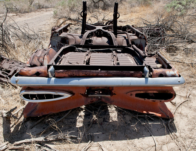
Wreck From Space by tomteske, on Flickr
Numerous panels are present in various arroyos over the next mile. As you can see, the highway is very close in places.
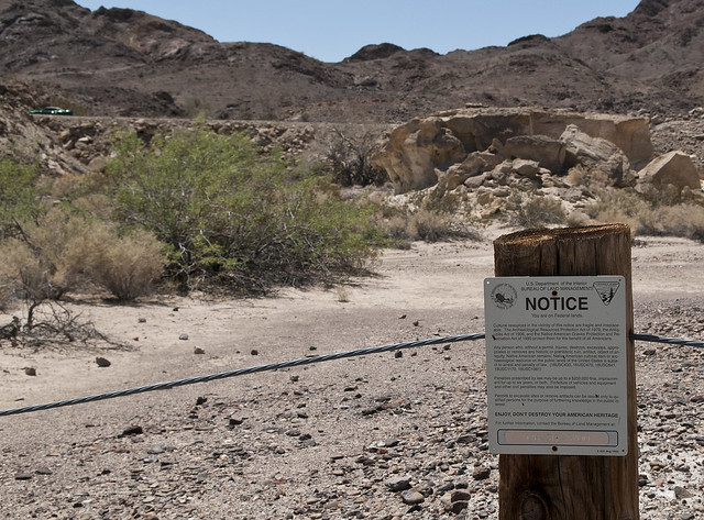
Blythe South Sign by tomteske, on Flickr

Blythe South Panel2 by tomteske, on Flickr
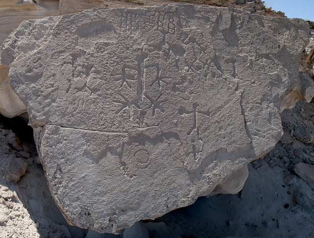
Blythe South Anthromorph Panel by tomteske, on Flickr
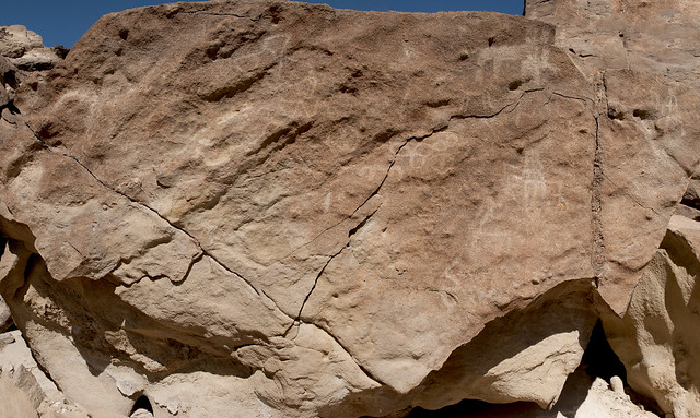
Blythe South Panel 2 by tomteske, on Flickr
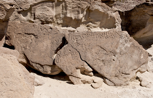
Blythe South Panel3 by tomteske, on Flickr
Although these petroglyphs are somewhat to the East of Kumeyaay territory, they still have stylistic similarities and contain my favorite glyph, the "digitate anthromorph."
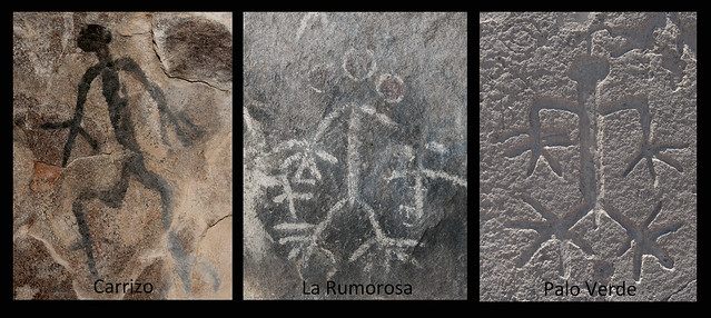
Digitate Anthromorphs by tomteske, on Flickr
A detailed description of the site by archeologist Ken Hedges is here: http://www.scahome.org/publications/proceedings/Proceedings.18Hedges.pdf
The Blythe Intaglios were discovered in the 1930's when a local pilot noticed them returning from Las Vegas. There are multiple sites, both anthromorphic and zoomorphic and are really cool to see. The desert pavement is very smooth and very varnished at this site which creates the stark contrast.

Blythe Intaglio Sign by tomteske, on Flickr
Not sure how the Indians viewed these except close up. The nearest hill is about a mile away. My technique for photographing these was sticking the camera at the top of my monopod and holding it as high as possible. Still not the best aerial view.
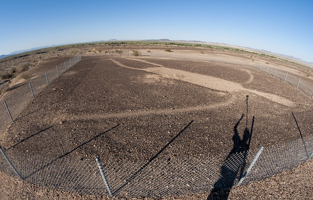
Blythe Intaglio by tomteske, on Flickr
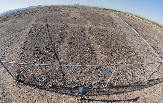
Blythe Intaglio2 by tomteske, on Flickr
The BLM link is below. Enjoy. Tom
http://www.blm.gov/az/st/en/prog/cultural/intaglios.html |
5/29/2012
Topic:
Memorial Day Weekend: Sombrero Peak
tommy750
|
dsefcik wrote:
Nice post, glad you AND the GF got out to the desert.
The IVDM is actually one reason I was out there last week, I was helping catalog and inventory some of their collections. Yes, Jennica and the others are very excited to get the museum open. I encourage everyone to stop by and check it out, they have some neat stuff there. They have a Facebook page also for more info http://www.facebook.com/IVDMuseum
You obviously also saw the destruction of Ocotillo beginning, the wind generators will be up in no time if we are not able to stop them. More info here http://www.basinandrangewatch.org/OcotilloWind.html
I got stung once by africanized (I believe) bees in Indian Valley once, wasn't a good start to the day, Bob can tell you about that one. Good call, stay away from the bees out there, they are mean and will chase you.
From your Flickr set it looks like you got out to Blythe and saw the intaglios and quite a few petroglyphs, I liked those photos, I want to get out there one of these days.
No balloons this trip??
That's interesting you were at the museum. Should be a really neat place. The only balloon was actually ribbon remnants stuck deep in a cholla. Tried fishing them out with the hiking pole but no luck. The only other desert hive I've seen was also at Indian Hill on the north side of the valley near the tracks.
<em>edited by tommy750 on 5/30/2012</em> |
5/30/2012
Topic:
Memorial Day Weekend: Palo Verde/Blythe Intaglios
tommy750
|
dsefcik wrote:
The BLM website mentions (6) glyphs total at (3) different sites, do they all still exist and did you visit them? You only show photos of (2) glyphs.
There are six near the road: three stick figures, two animals and a serpent. They're located at three sites, two north of the dirt road and one across an arroyo to the south. To me, there's another one outside the south enclosure that looks like a circle with a cross drawn through it. So many tire tracks nearby, it makes it hard to know what's ancient. Reportedly, there's more up the road but they may not be on BLM land. Search "Blythe Intaglios" on Google Earth and you can see them all from space. Tom |
5/30/2012
Topic:
Memorial Day Weekend: Palo Verde/Blythe Intaglios
tommy750
|
ziphius wrote:
Those intaglios and panels are amazing. Anyone know the estimated ages on them?
From the little I've read, seems like the estimates are quite variable. Up to thousands of years ago. Tom |
5/30/2012
Topic:
Memorial Day Weekend: Palo Verde/Blythe Intaglios
tommy750
|
surfponto wrote:
Those are great.
Amazing that they are so close to the highway.
Have never been up that way but would like to check it out, thanks to your pics and trip report,
Bob
Have driven by there a dozen times and never knew about either site. The intaglio site now has large signs and a monument marker which are recent. Tom |
5/30/2012
Topic:
Memorial Day Weekend: Sombrero Peak
tommy750
|
ziphius wrote:
Nice report and virtual tour of the museum. I learn so much on this forum. I've been up Sombrero Peak several times (from the west) and never knew about the solstice cave. Were the ollas a recent find by someone? I remember reading Marshal South's chronicles of life on Ghost Mountain and his mention of finding ollas back in the 1940s. I reckon that pot hunters have probably removed most of the things out there. If I'm ever lucky enough to find something like that, I will photograph it in place and leave it for the next person to find.
This was my first time up the "regular way." Have been up Sombrero multiple times, but like you, from McCain Valley. Once, went all the way up South Fork and looped around to ascend on the West side but lots of vegetation in the way. Heard about the Solstice Cave on this forum but haven't been lucky enough to find it. Couldn't tell you more about the ollas. Maybe Daren could since he's doing some curation work at the museum. Tom |
5/30/2012
Topic:
Inner Pasture on a cool 5/26. 5 balloon trip!
tommy750
|
The different thing about this canyon is the amount of TRASH, compared with Moonlight Canyon. One of the first artifacts I found was this Mexican phone card:
[IMG]http://i412.photobucket.com/albums/pp204/Berardius/Inner%20Pasture%20May%202012/InnerPastureMay201239.jpg[/IMG]
How ironic the little story on the phone card you found in the middle of the desert is about the cliff divers of "La Quebrada" in Acapulco. Nice post. Would love to get out there some day. Happened to have met one of the current owners of the Crawford Ranch earlier this year. When I asked about pictographs etc. in Inner Pasture, the owner hesitated a while and then suggested I try Blair Valley! Tom |
5/31/2012
Topic:
Inner Pasture on a cool 5/26. 5 balloon trip!
tommy750
|
You can find the pictos, just need to go look for them....how about asking your new friend if we can drive out in my truck thru their property to cleanup all the illegal clothing and trash???
That's an interesting idea. Will bring it up when I see the owner. Tom |
6/12/2012
Topic:
Best Mylar Ballon Trip
tommy750
|
dsefcik wrote:
What is your best mylar ballon take for a trip?
Apparently these mylar balloons are bad for the environment both in the city and wilderness!
http://www.msnbc.msn.com/id/47781743/ns/local_news-san_diego_ca/#.T9emOxdYvgE |
6/18/2012
Topic:
Desert View Tower and Table Mt
tommy750
|
Decided to post SOMETHING cuz a little warm spell seems to be keeping the Borrego crowd away. It's still officially Spring, folks! Built in the 1920's, everyone has seen this desert landmark. If you haven't actually stopped for a visit, you're missing a panoramic view of the Colorado Desert and 20th Century Americana.
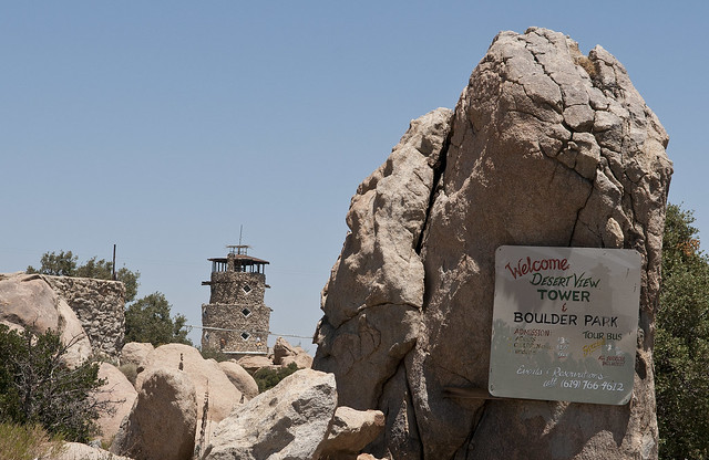
Desert View Sign by tomteske, on Flickr
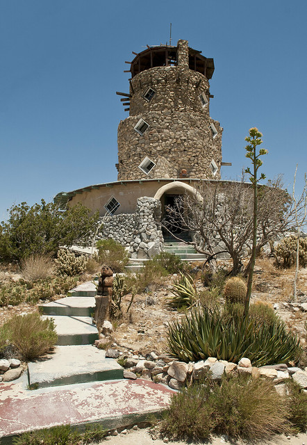
Desert View Tower by tomteske, on Flickr
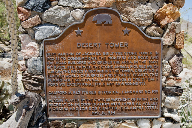
Desert Tower Sign by tomteske, on Flickr
The tower's views of the desert are matched only by its eclectic content ranging from books, art, taxidermy to Indian artifacts and old photographs. Presumably a post card with one of the many taxidermy specimens.
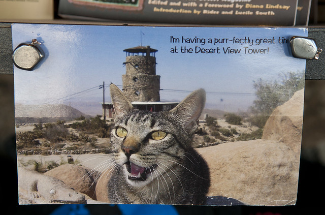
Tower Cat by tomteske, on Flickr
The view from the top provides a nice view of the Valley below and the many remnants of previous roads up the grade.

Desert View3 by tomteske, on Flickr
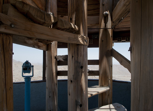
Desert View2 by tomteske, on Flickr
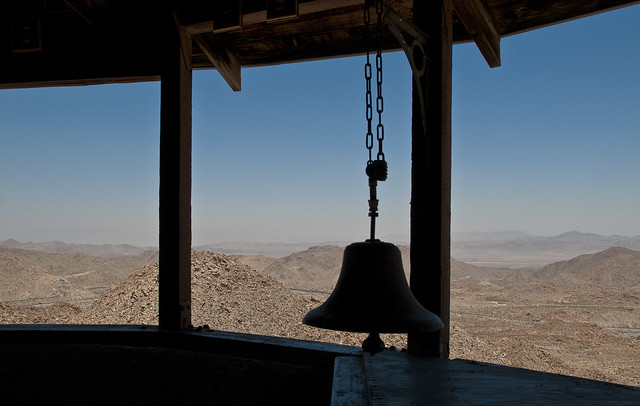
Desert View by tomteske, on Flickr
The whimsical rock art in back of the tower was carved in the 1930's.

Rock Art by tomteske, on Flickr
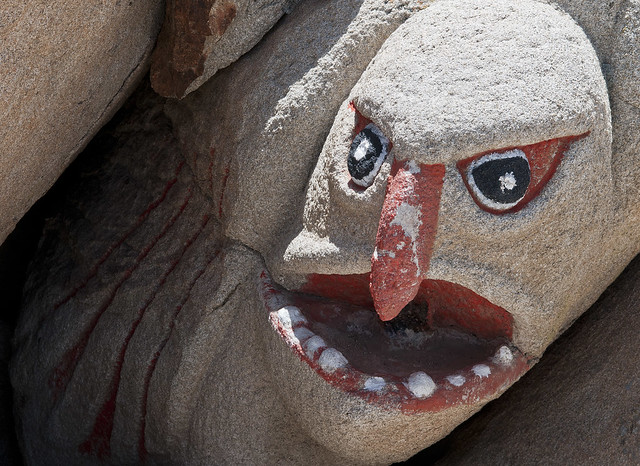
Rock Art2 by tomteske, on Flickr
On your way to the tower, you can't but see some really eclectic Americana strategically placed by the road. Apparently the owner didn't appreciate alien paparazzo and marched out yelling at me. Decided it was time to head to Table Mountain.
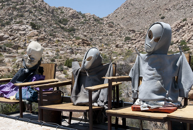
In Ko Pah Aliens by tomteske, on Flickr

In Ko Pah Alien by tomteske, on Flickr
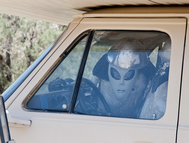
In Ko Pah Alien Camper by tomteske, on Flickr
Table Mountain is partly in ABDSP so this is still a legitimate post! According to Lawrence Hogue in "All The Wild and Lonely Places", Table Mountain was home to at least two Kumeyaay villages and is "one of the most abused places in the Anza-Borrego region." Used by cattle ranchers till the 1970's, it was the site of the infamous 1880 "Jacumba Massacre" when natives were confronted by ranchers about slaughtered cattle. Will McCain along with 4-19 nameless Kumeyaay were killed. This marked the end of Kumeyaay presence in the area. The area is now dotted with abandoned mines and a few houses.
The road to Table Mountain.
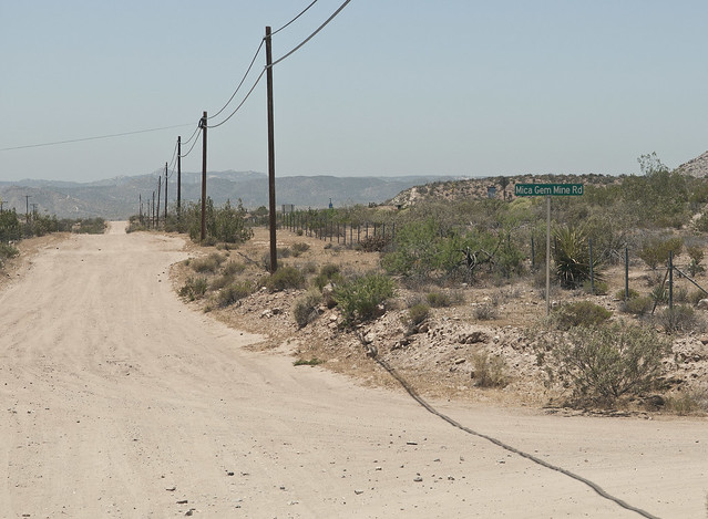
Mica Gem Mine Rd by tomteske, on Flickr
Cross under I-8 and you're on your way.

Mica Gem Mine Rd and I-8 by tomteske, on Flickr
The Mica Gem Mine ruins. The shaft is filled in.
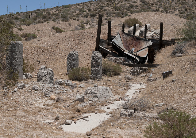
Mica Gem Mine2 by tomteske, on Flickr
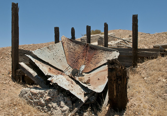
Mica Gem Mine by tomteske, on Flickr
Some of the dirt roads lead to private property. Spelling apparently is not a requirement for the outback.
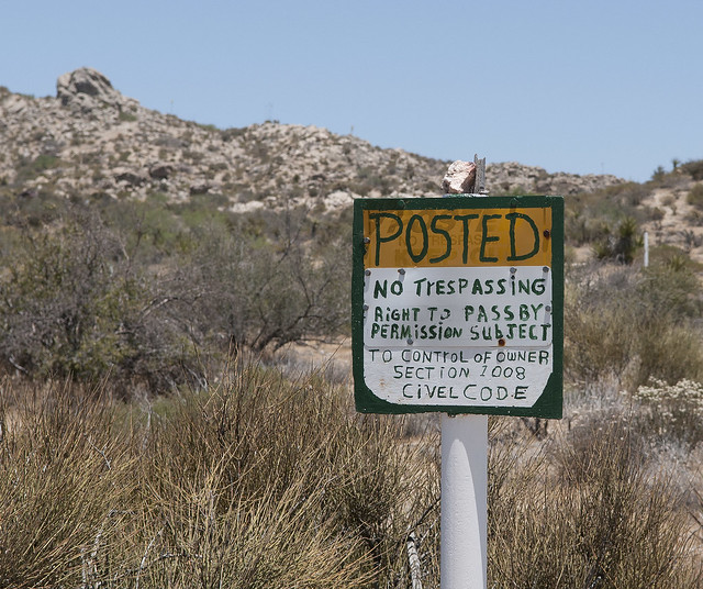
Civel Code by tomteske, on Flickr
The Little Randsburg Mine ruins. Only a few pieces of wood and an old barrel are nearby.
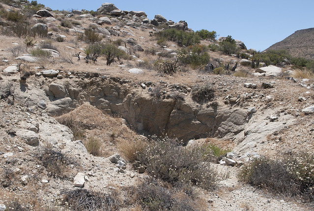
Little Randsburg Mine by tomteske, on Flickr
Wanted to head up the road to the top of Table Mountain and check out the Indian village sites but was stymied. With the temperature at 85 degrees and only an empty coke can in the truck, figured I'd walk up the road to scout out the area for a return trip.
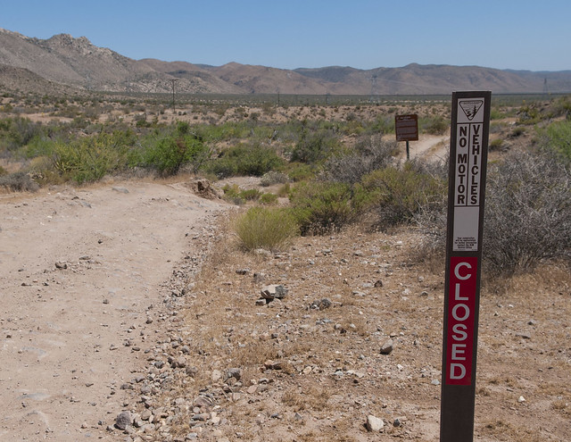
Closed by tomteske, on Flickr

Table Mt Sign by tomteske, on Flickr
A half mile or so up the road didn't reveal much more so called it quits for now. Although the road is "closed," looks like someone is up there with a big antenna on the back of their truck.

Table Mt Road by tomteske, on Flickr
Here's a couple of unrelated pics on the drive home of the fire at Golden Acorn Casino which was threatening I-8 Sunday afternoon.
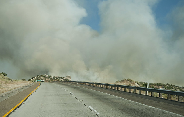
Golden Acorn Fire2 by tomteske, on Flickr
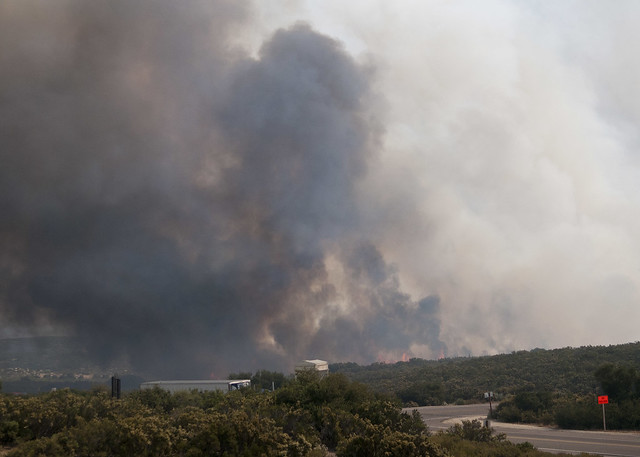
Golden Acorn Fire3 by tomteske, on Flickr

Golden Acorn Fire by tomteske, on Flickr |
6/18/2012
Topic:
Old Fire at Live Oak Springs
tommy750
|
dsefcik wrote:
Driving back from ABDSP I took a few photos of the Old Fire. It looked really, really bad. I hope they are able to contain it.
Looks like it had spread closer to I-8 when you drove by. San Diego UT says it should be controlled by tomorrow. Hopefully. |
6/18/2012
Topic:
Old Fire at Live Oak Springs
tommy750
|
Here is what the fire looked like from the S2 at Canyon Sin Nombre

So what were you up to out in Canyon Sin Nombre on such a lovely warm day? |
6/18/2012
Topic:
Desert View Tower and Table Mt
tommy750
|
ziphius wrote:
Thanks for posting SOMETHING Tom!  Great photos and story. Thanks for the mini-history on Table Mtn too. The misspelling of 'civil' on the no trespassing sign could have been done on purpose... there is a passage in 'Rancho Costa Nada', by Phil Garlington, where he describes purposefully misspelling a word on his version of a No Trespassing sign, to foster an image "of an unlettered and possibly demented" individual guarding the place. Great photos and story. Thanks for the mini-history on Table Mtn too. The misspelling of 'civil' on the no trespassing sign could have been done on purpose... there is a passage in 'Rancho Costa Nada', by Phil Garlington, where he describes purposefully misspelling a word on his version of a No Trespassing sign, to foster an image "of an unlettered and possibly demented" individual guarding the place.  Rancho Costa Nada has become something of a cult classic I guess, I see that copies on Amazon and EBay are selling for over $100, but there is a cheaper Kindle edition. If you want to read about some truly odd desert characters out near Blythe and how they get by, read this. One review says "Finally, the wacko homesteading book for me!" Rancho Costa Nada has become something of a cult classic I guess, I see that copies on Amazon and EBay are selling for over $100, but there is a cheaper Kindle edition. If you want to read about some truly odd desert characters out near Blythe and how they get by, read this. One review says "Finally, the wacko homesteading book for me!"
I stopped by Desert Tower back in late May and the guy who runs the place is a great, an old-school hippie with at least 3 dogs. He was reading the latest issue of The New Yorker when I got there and we discussed alternative fuel vehicles, among other things. He used to live in Normal Heights, things perhaps did not go so well living with a woman there, and now he apparently lives 'upstairs' at the tower. Loves his commute. Desert Tower has quite the selection of natural history and local history books. I picked up a copy of Chris Wray's The Historic Backcountry and a Historic Highway 80 t-shirt there.
links: http://www.ranchocostanada.itgo.com/
Thanks for the info. That's an interesting spin on the sign! Would agree with you on that being an effective technique. Will check out the Rancho Costa Nada link. Tom |
6/18/2012
Topic:
Desert View Tower and Table Mt
tommy750
|
dsefcik wrote:
Did you go see the Hidden Spring at the top of the hill near the tower?
Apparently the owner didn't appreciate alien paparazzo and marched out yelling at me
That's coyotejeff, he took me on a grand tour in the space craft last time I stopped by, we went by the worm hole and everything. Weird you got barked at.
Didn't get around to climbing up to the spring. Have climbed up to the top of the ridge and headed north to a nice Valley overlook but was a little cooler then.
Must have been my winsome personality that put off Coyote Jeff. Saw some big guy with a dog heading toward me yelling something and after a quick wave, I was outta there! Tom |
6/18/2012
Topic:
Desert View Tower and Table Mt
tommy750
|
surfponto wrote:
Hey thanks for posting the trip to Desert Tower
We have talked about stopping there but for some reason or another have never done it. It looks really cool. Loving the alien stuff.
Maybe I can talk to the owner and do a BLOG post about the history of the tower.
That would be interesting. Lots of layers to that place. Thanks. Tom |
6/18/2012
Topic:
Desert View Tower and Table Mt
tommy750
|
ziphius wrote:
Thanks for posting SOMETHING Tom!  Great photos and story. Thanks for the mini-history on Table Mtn too. The misspelling of 'civil' on the no trespassing sign could have been done on purpose... there is a passage in 'Rancho Costa Nada', by Phil Garlington, where he describes purposefully misspelling a word on his version of a No Trespassing sign, to foster an image "of an unlettered and possibly demented" individual guarding the place. Great photos and story. Thanks for the mini-history on Table Mtn too. The misspelling of 'civil' on the no trespassing sign could have been done on purpose... there is a passage in 'Rancho Costa Nada', by Phil Garlington, where he describes purposefully misspelling a word on his version of a No Trespassing sign, to foster an image "of an unlettered and possibly demented" individual guarding the place.  Rancho Costa Nada has become something of a cult classic I guess, I see that copies on Amazon and EBay are selling for over $100, but there is a cheaper Kindle edition. If you want to read about some truly odd desert characters out near Blythe and how they get by, read this. One review says "Finally, the wacko homesteading book for me!" Rancho Costa Nada has become something of a cult classic I guess, I see that copies on Amazon and EBay are selling for over $100, but there is a cheaper Kindle edition. If you want to read about some truly odd desert characters out near Blythe and how they get by, read this. One review says "Finally, the wacko homesteading book for me!"
links: http://www.ranchocostanada.itgo.com/
Just checked out your link and nearly peed my pants. That was insane! Requested a copy of Tenting Today from Mr. Garlington. Thanks. Tom |
6/18/2012
Topic:
Desert View Tower and Table Mt
tommy750
|
dsefcik wrote:
If you continue down the dirt road past the Table Mtn area you can see a couple of microwave/radio towers and then further on several mines and an "ornate stone cabin" or something similar Lindsay describes it as. The area is rich with Indian history and you can find morteros and pottery in the area. There are as many as 5-6 wildlife guzzlers out there also, I can't remember exactly how many I have seen..maybe even seven or so. Really, really neat area.
edited by dsefcik on 6/18/2012
Seems I need to head back! Only made it as far as the mines I mentioned. Looks like various roads keeps going all the way toward Carrizo Gorge. Are any of them closed or is the road to Table Mt and the USBP truck the only one? Was really looking forward to seeing the top. Tom
Will check out the spring the next time I'm there. Thanks. Tom |
6/18/2012
Topic:
Desert View Tower and Table Mt
tommy750
|
ziphius wrote:
Thanks for posting SOMETHING Tom!  Great photos and story. Thanks for the mini-history on Table Mtn too. The misspelling of 'civil' on the no trespassing sign could have been done on purpose... there is a passage in 'Rancho Costa Nada', by Phil Garlington, where he describes purposefully misspelling a word on his version of a No Trespassing sign, to foster an image "of an unlettered and possibly demented" individual guarding the place. Great photos and story. Thanks for the mini-history on Table Mtn too. The misspelling of 'civil' on the no trespassing sign could have been done on purpose... there is a passage in 'Rancho Costa Nada', by Phil Garlington, where he describes purposefully misspelling a word on his version of a No Trespassing sign, to foster an image "of an unlettered and possibly demented" individual guarding the place.  Rancho Costa Nada has become something of a cult classic I guess, I see that copies on Amazon and EBay are selling for over $100, but there is a cheaper Kindle edition. If you want to read about some truly odd desert characters out near Blythe and how they get by, read this. One review says "Finally, the wacko homesteading book for me!" Rancho Costa Nada has become something of a cult classic I guess, I see that copies on Amazon and EBay are selling for over $100, but there is a cheaper Kindle edition. If you want to read about some truly odd desert characters out near Blythe and how they get by, read this. One review says "Finally, the wacko homesteading book for me!"
links: http://www.ranchocostanada.itgo.com/
Just emailed Phil Garlington and told him about your "civel" post and requested his other piece, "Tenting Today." He fired back a copy right away. It comes in an old wps format so it needed converting but should be a fun read. Thanks again for the link! Tom |
6/21/2012
Topic:
Lower Willows Trail
tommy750
|
Nice hiking trip. By the way, has anyone ever been to the Cougar Canyon Solstice Cave? Supposedly a solitary badly weathered pictograph will be illuminated in a few hours in a cave somewhere in Cougar Canyon and again in exactly six months. It's reportedly a "dual purpose" cave with a natural opening for the winter solstice and and artificial walled-in opening (severely damaged in a rock fall) for the summer event. |
6/21/2012
Topic:
Myer Valley / Rockhouse Cyn
tommy750
|
dsefcik wrote:
No big tortuous hike or backpacking trip, not even a crazy whiskey induced campfire story....just some side trip photos from driving out to the annual BHS count orientation meeting. Drove out last Friday after work and pulled off the highway to try and find the "second" old shack near Myer Valley.
My friend Amy with the "OJ" Bronco and I drove out to Table Mountain this afternoon for a redux of last Friday's brief trip and were going to pull in to look for the cabin on the way back. Was a little too late and dark so we skipped it. No ruins at all of the shack? |
6/21/2012
Topic:
Myer Valley / Rockhouse Cyn
tommy750
|
My large truck made it to the end of the trail but not without scratches and damage. Several differential and exhaust pipe scrapes and all of the tires cut up. There were several narrow areas for my truck that needed boulder climbing.

That's exactly how my alleged "Rugged Trails" tires looked about 50 yards after I left the pavement for the first time. Blew one out after hitting a pebble driving up Painted Gorge for a night hike up Carrizo Mt and spent an hour cursing Toyota for putting them on their TRD equipped Tundras while I wrestled with the spare in the dirt. Happy happy with the BFG A/Ts all around. Tom |
6/21/2012
Topic:
Myer Valley / Rockhouse Cyn
tommy750
|
dsefcik wrote:
tommy750 wrote:
No ruins at all of the shack?
I didn't get far enough to really look, there are No Vehicles Allowed BLM Wilderness signs almost immediately after you get going. Of course that doesn't stop the Border Patrol. I asked the BP agents about it and they said they have seen the one down by the culvert but not anything going up into Myer Valley. I am going to hike in when I get a chance.
If we're talking about the second miner's shack down the eastbound lanes from the one near bolder creek, it maps on Google to the little plateau just yards up the dirt road from I-8. Just found the coordinates in an earlier post re your Island trip: 32 41.42 -116 3.68 Tom
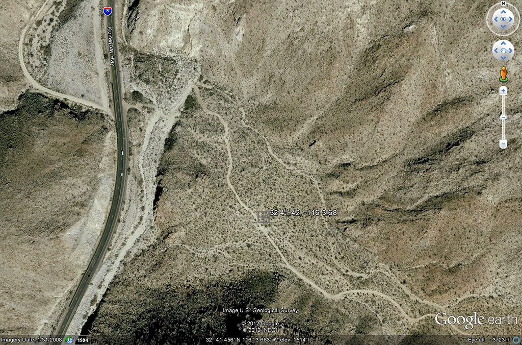
Miner's Shack by tomteske, on Flickr |
6/22/2012
Topic:
Myer Valley / Rockhouse Cyn
tommy750
|
surfponto wrote:
You could always go with the BFG Mud Terrains KM2 
Those look like they definitely would do! Tom |
6/23/2012
Topic:
Desert View Tower and Table Mt
tommy750
|
dsefcik wrote:
tommy750
Just checked out your link and nearly peed my pants. That was insane! Requested a copy of Tenting Today from Mr. Garlington. Thanks. Tom[/quote wrote:
The Tenting Today was hilarious...I did not order it so you will have to let us know if the rest of the book is as funny as the webpage excerpt.
Finished reading the story last night. About 80 pages. Really an enjoyable tale about life sans excessive materialism. Also a lot of random strangers dropping by the camp fire retelling their colorful past. Would definitely download it. Again, it's in some old file type that needs converting. Tom |
6/25/2012
Topic:
Best Mylar Ballon Trip
tommy750
|
I've been performing a little experiment in my office the last three months. Was out looking for the Carrizo Canyon shamen cave on 4-14-12 and came across a mylar trifecta under the gaze of BM Windy.
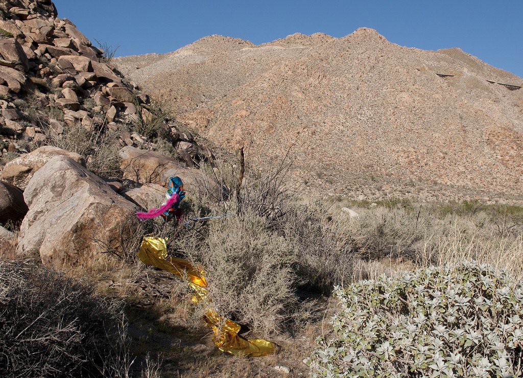
Trifecta at Windy by tomteske, on Flickr
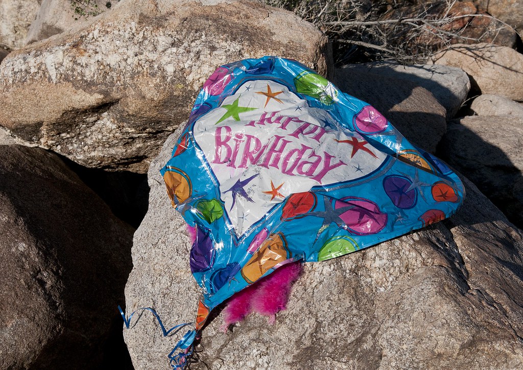
Happy Birthday by tomteske, on Flickr
The larger Happy Birthday balloon looked quite similar to the Happy Birthday mylar balloon floating in my office. Mine was missing the pink boa, but let's not get picky. Purchased by my wonderful but mylar-balloon-naive staff (they're well-informed now!) March 22, 2012, it has floated at the ceiling of my office for over three months. This pic was taken 5-01-12.

Happy Birthday 5-01-12 by tomteske, on Flickr
Today and only today, the balloon began its slow descent toward earth. Although it spent the last three months in a semi-protected environment, it appears these things AND the gods are the only immortals! Can't imagine how far they drift.

Birthday Balloon June 2012 by tomteske, on Flickr
Collected two mylar and one latex balloons this past weekend on a six mile hike over Table Mountain. That place is so littered with garbage, it would take a few trash trucks to make a noticeable difference. Tom |
6/26/2012
Topic:
Squaw Tit and Table Mountain
tommy750
|
The camp Rick Perry used to visit in Texas is not the only local with a non-PC moniker. Squaw Tit is definitely in the same category and even has infamously made a book title, "From Squaw Tit to Whorehouse Meadow: How Maps Name, Claim, and Inflame" (probably referring to the same peak name in the Phoenix area, but you get the drift). To the southeast is my favorite, a BM right on the Mexican border named "Puto!" Couldn't believe it when I first saw it. Anyway, decided to take a hike over Table Mountain this past Saturday since weather.com promised highs of 82 degrees in Jacumba while the rest of ABDSP was 20 degrees warmer. Well, they lied! Was 92 when I got back to the Tundra and some of the volcanic areas were at least 5-10 degrees hotter. Glad I brought 3 liters and had a nice breeze.
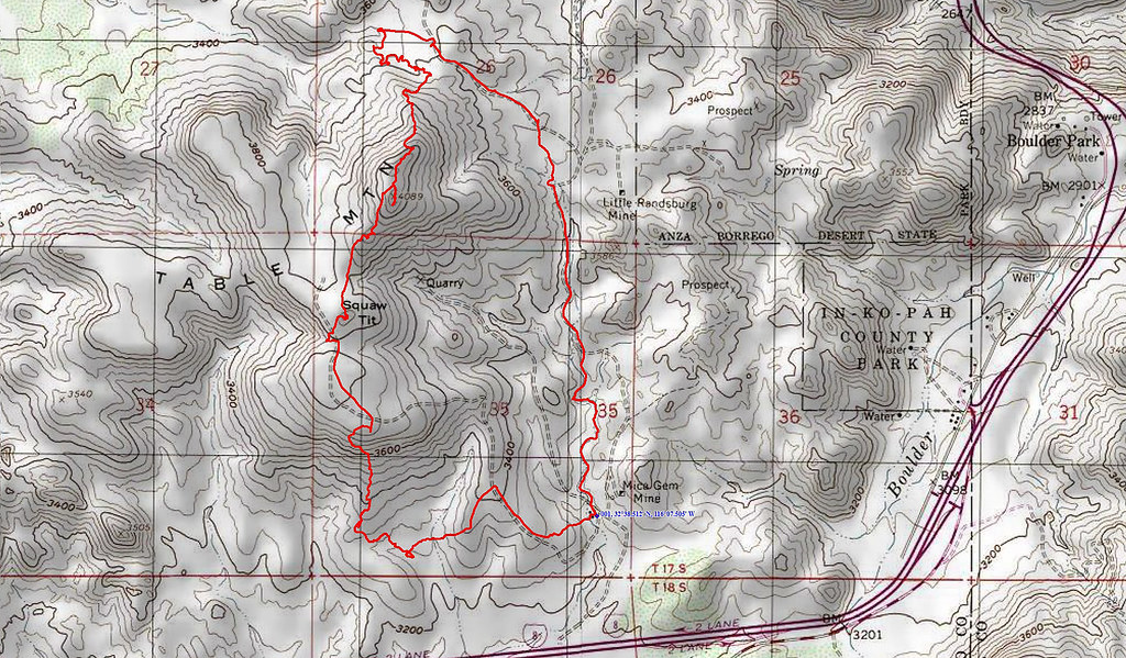
Table Mt GPS by tomteske, on Flickr

Table Mountain by tomteske, on Flickr
Worked my way over toward a dam-looking structure crossing a stream bed. Actually ended up being a granitic dike but it easily could have been a useful natural feature.
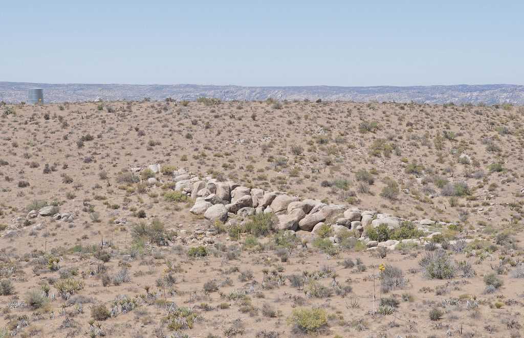
Table Granitic dike by tomteske, on Flickr
Grey Mountain to the southwest is a granitic remnant of the Peninsular Batholith but Table Mt is a result of later volcanic activity. Round Mountain is the higher peak in the right background and is south of I-8.
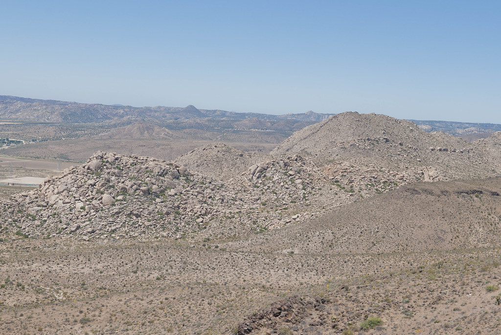
Grey Mountain and Round Mountain by tomteske, on Flickr
After hiking straight up the south side, I crossed over a large open plateau. Was completely alone-except for the three USBP vehicles (one left before the pics) and a half dozen cameras. Asked two young agents if they knew anything about a couple of Indian villiages reportedly on Table Mt. One informed me there were Indians here but they had left a long time ago. Got really disillusioned but decided to head for Squaw Tit.
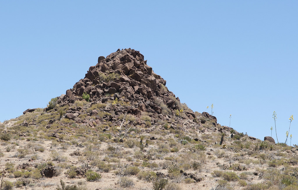
Squaw Tit by tomteske, on Flickr
The view from Squaw toward south Table Mt and the border fence in the far distance.
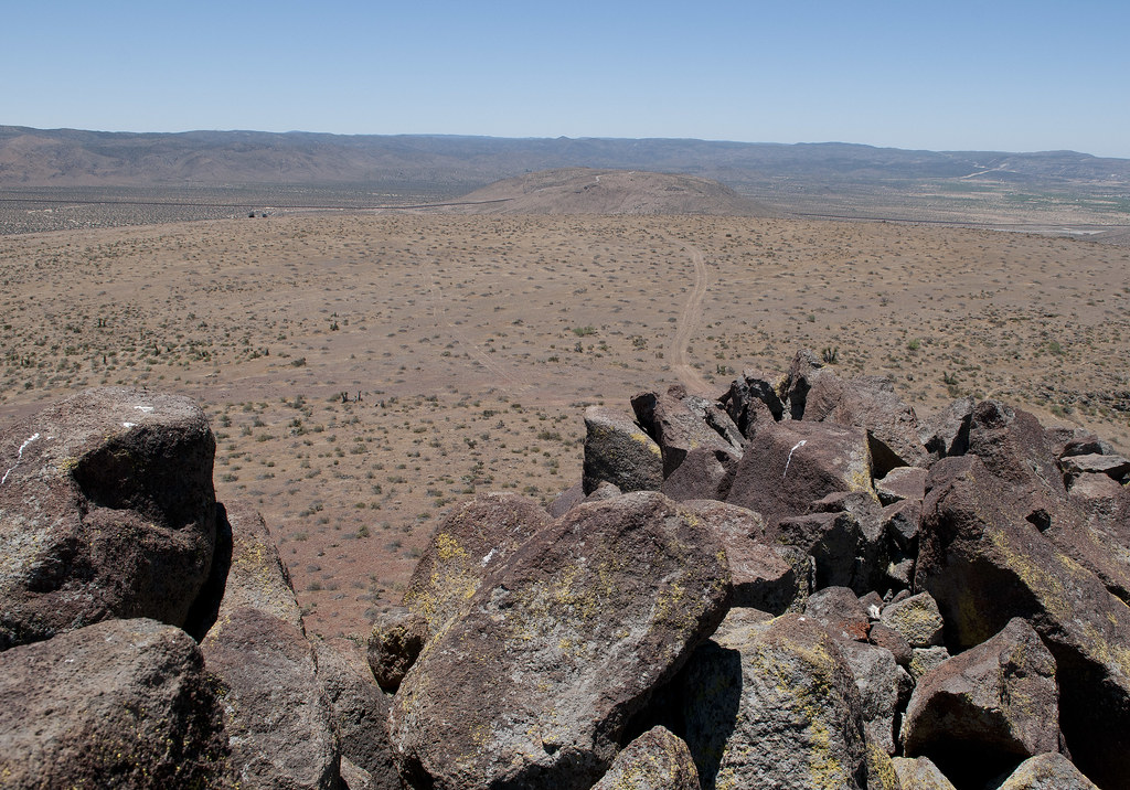
From Squaw Tit by tomteske, on Flickr
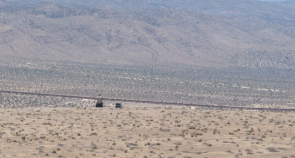
Border Patrol at Table Mt by tomteske, on Flickr
The view from Squaw toward the summit of Table Mt.
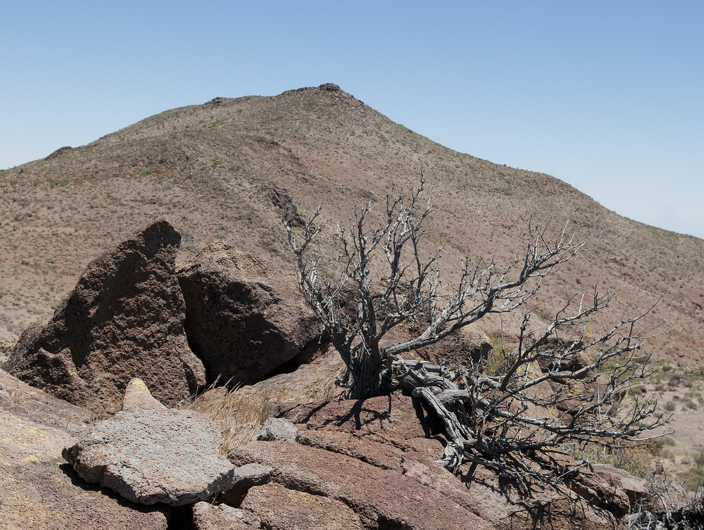
Squaw Tit Toward Table Summit by tomteske, on Flickr
The top of east Table Mt toward Squaw.
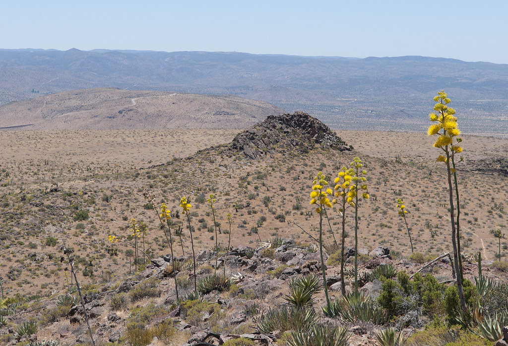
Toward Squaw Tit by tomteske, on Flickr
The only rock art I encountered was this:
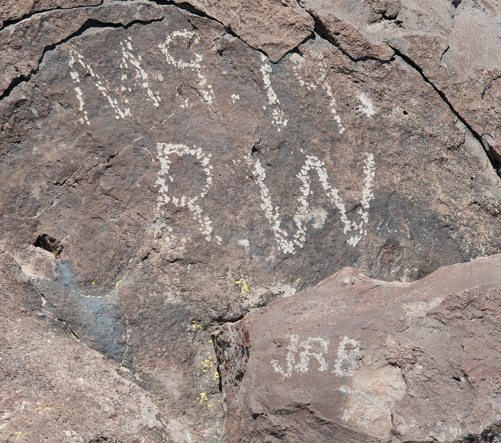
Pecking Style by tomteske, on Flickr
This artifact and the inevitable question were found at the Table Mt summit.
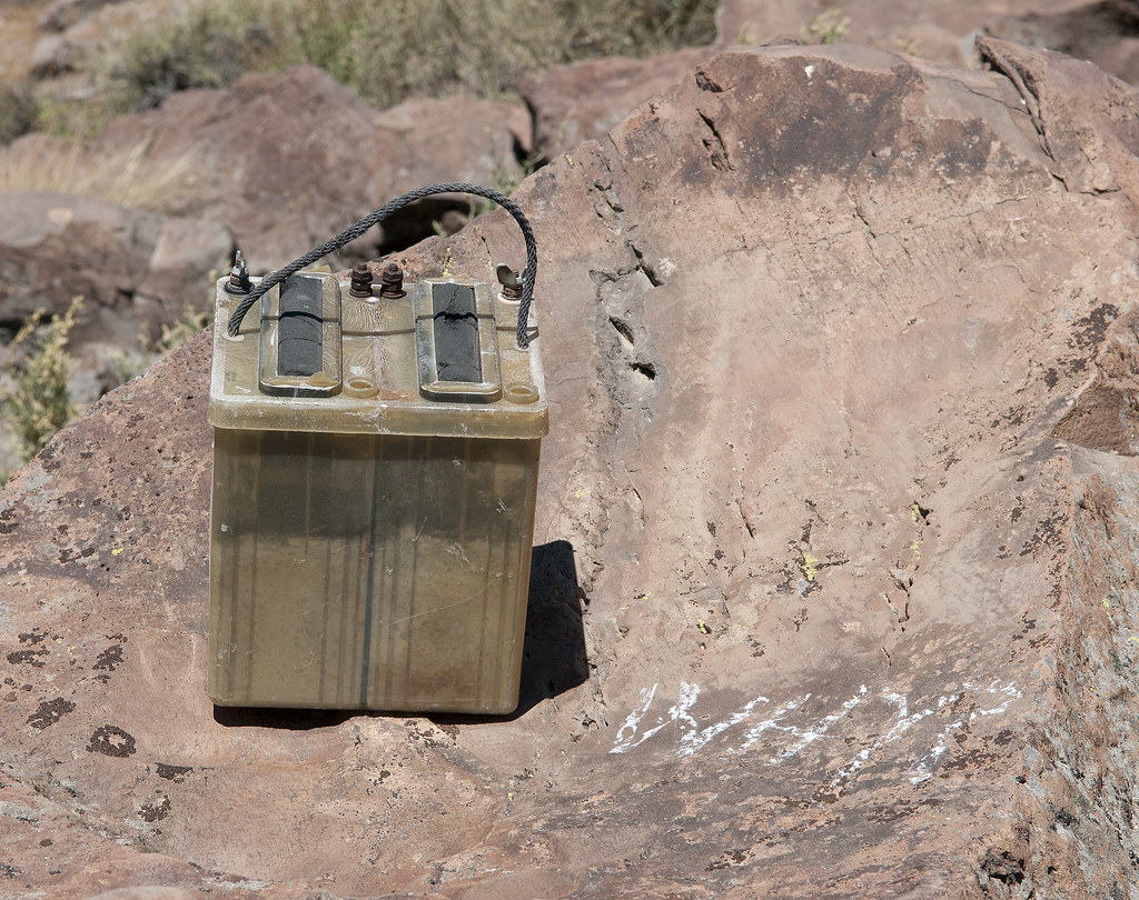
Table Mt Battery by tomteske, on Flickr
Looking NE from the eastern part of Table, you can see just about everything in ABDSP.

Table Mt Panorama by tomteske, on Flickr
On the southern flank and on the top, tarantula nests were everywhere.
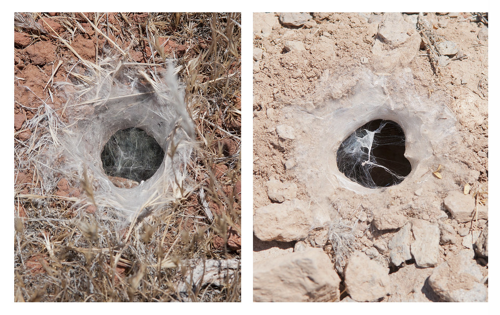
Tarantula Dens by tomteske, on Flickr
Their nemeses, the Tarantula Hawks, were nowhere nearby, either having already completed their deadly missions or completely distracted by mesquite blossoms. Saw 10+ swarming these bushes.
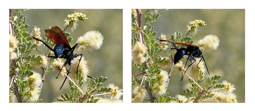
Tarantula Hawks by tomteske, on Flickr
After descending the northern slope, I came across this young desiccated coyote. Looked like it was still running.
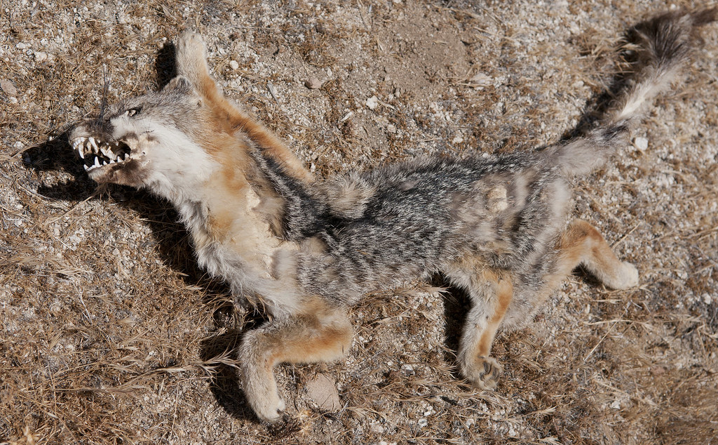
Running Coyote by tomteske, on Flickr
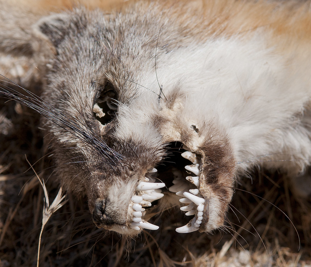
Coyote Mouth by tomteske, on Flickr
No noticeable human foot traffic was present. Did find this faded immigrant cache.
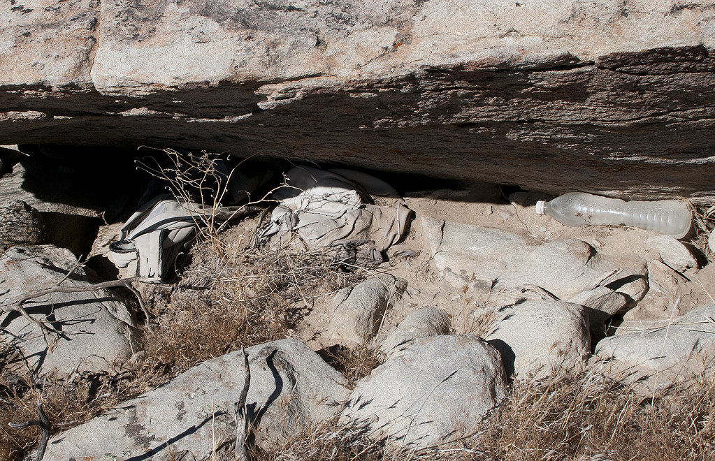
Old Clothing by tomteske, on Flickr
Yet another reason USC deserved those NCAA sanctions.
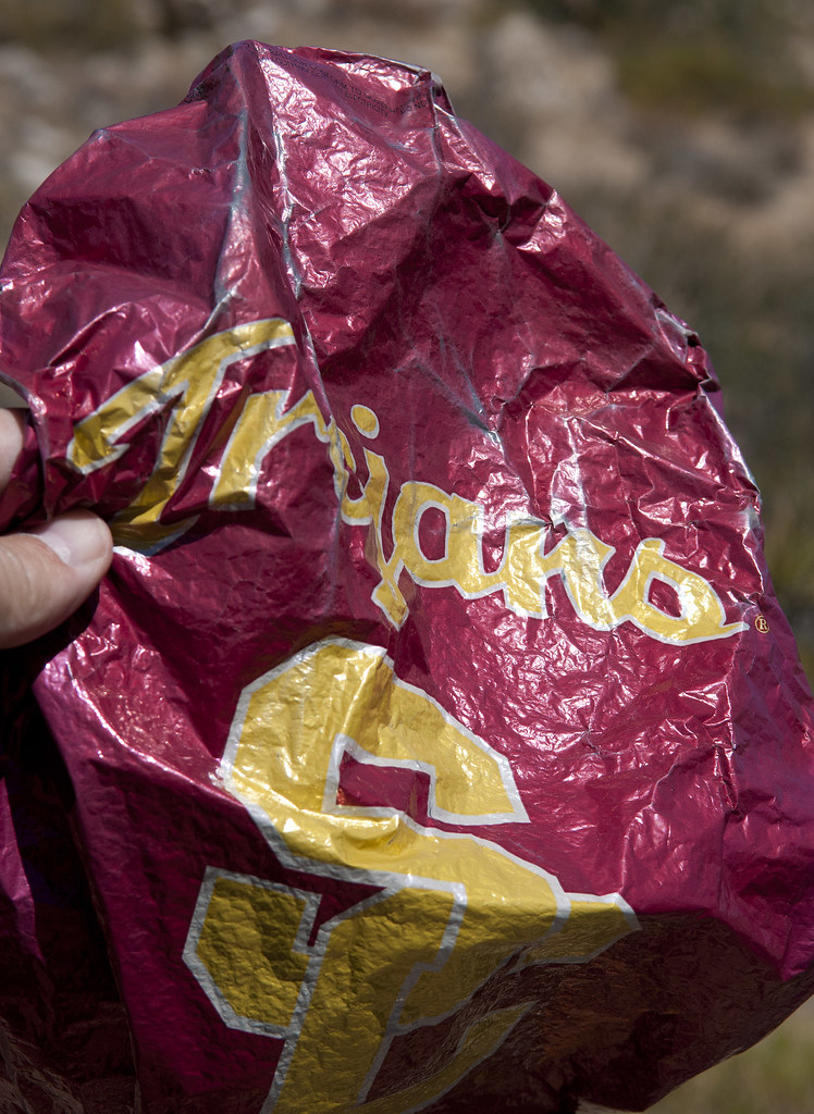
Trojan Mylar by tomteske, on Flickr
Daren mentioned there were "wildlife guzzlers" out here but I had no idea what he was referring to:
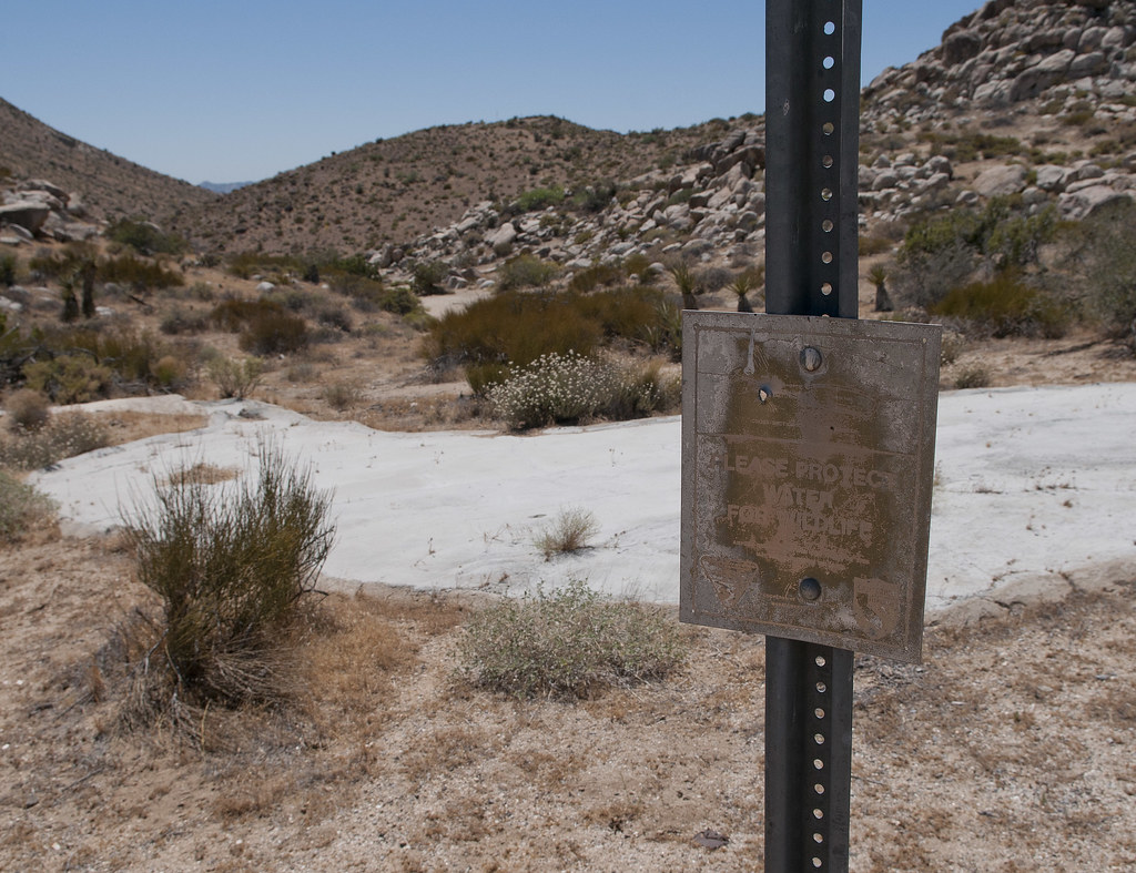
Wildlife Guzzler by tomteske, on Flickr
Apparently water drains off these luxurious patios (visible from outer space) and fill nearby cisterns. Little animals then have extra water. Daren, do these things really work?? Seems a little overkill to me. Tried to find "Post 376" but only located a Troop 376 in nearby Milwaukie, Oregon. Was going to lift the metal plate off the cistern and check out the water level but the heat kinda sapped my curiosity.
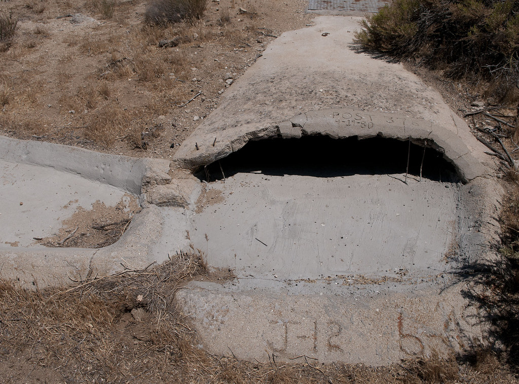
Wildlife Guzzler2 by tomteske, on Flickr
Just feet from the Tundra on the way back was the remnants of an old pickup. What was really weird was finding a wild hive in the nearby half-buried frame!
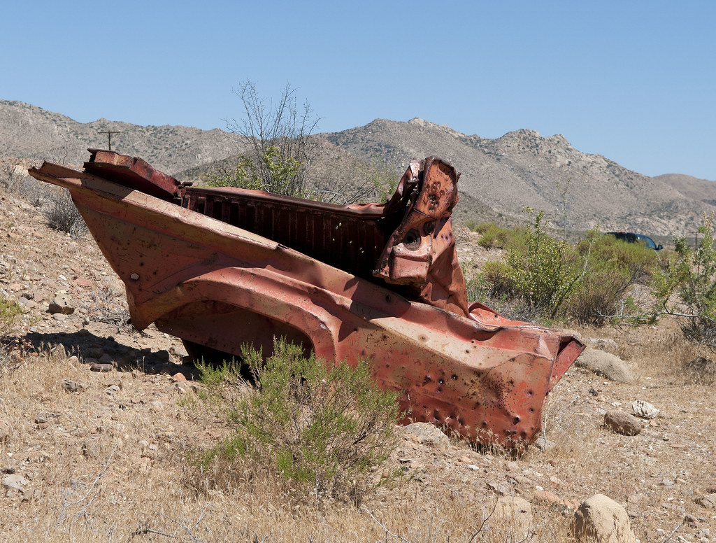
Pick Up by tomteske, on Flickr
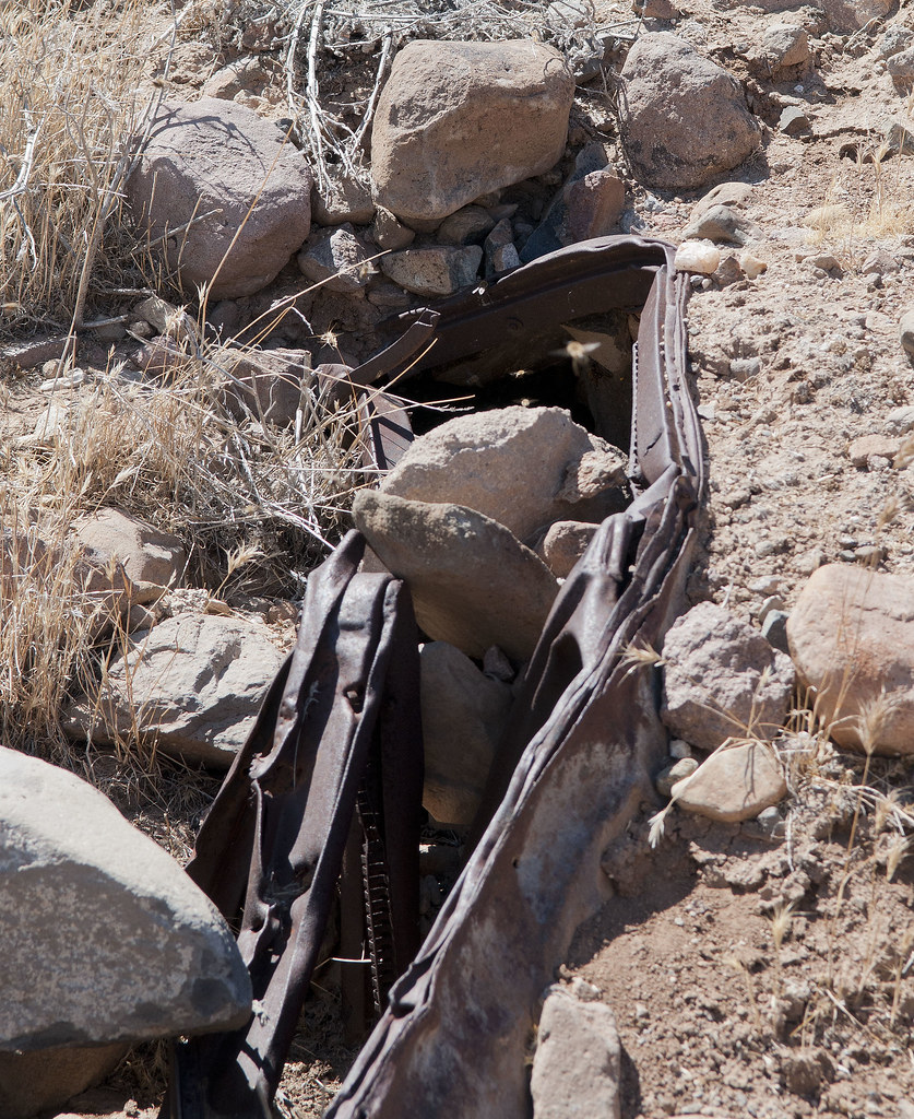
Metal Hive by tomteske, on Flickr
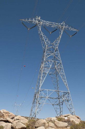
Headed west toward Jacumba and saw the newly-energized Sunrise 500KV lines.
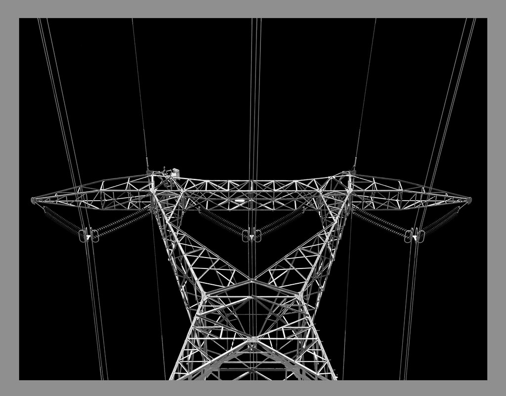
Sunrise Power by tomteske, on Flickr
In closing, here's a pic from last Wednesday leaving Table Mt between the lanes of I-8 looking east.
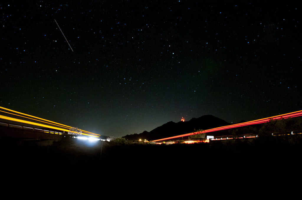
Mica Gem Road and I-8 by tomteske, on Flickr
About six miles hiking and some fun pictures on my way to the coast. Have a great week! Tom
edited by tommy750 on 6/26/2012
edited by tommy750 on 6/26/2012
<em>edited by tommy750 on 6/26/2012</em> |
6/26/2012
Topic:
Squaw Tit and Table Mountain
tommy750
|
dsefcik wrote:
Awesome post...I love those night photos, I want to learn how to do those. The powerline photo I am guessing you painted with a flashlight or something? I can only guess the guzzlers work, BLM has those things everywhere. Like I said before, I have found 7 or so just in the Table Mtn area, there is actually one right at the bottom of Tule Mtn next to Sacatone Overlook also. ABDSP has them also but they are of a different design. Last time I went to Squaw Tit there were no BP there, that mobile vehicle is recent, last couple of years or so.
That battery was maybe used to blow up stuff in the quarry? Did you find all of the white post markers? Doesn't look like you crossed down into the quarry so I am guessing not.
You should continue to explore that area, there are a lot of really neat things to see the deeper you go north/west.
Saw a few of the white markers in between Squaw and the summit. Do you know if they marked some boundary? Yeah, want to go back and visit the entire NW portion. That's a really neat pictograph photo. Need to find that! The power lines were converted to BW with a high contrast red filter just to give it a more omninous look  |
6/26/2012
Topic:
Squaw Tit and Table Mountain
tommy750
|
mrkmc wrote:
not that I like the power lines but that picture is awesome! Thanks for the trip report.
Yeah, the double row of towers is hard to miss out there east of Jacumba. The new ones are definitely fired up since you can hear the buzz a mile away. Tom |
6/26/2012
Topic:
Squaw Tit and Table Mountain
tommy750
|
ziphius wrote:
surfponto wrote:
Coyote shot is creepy. Looks like a gremlin or a chubacabra 

thanks for posting that and keeping the forum alive during the hot summer months.

Anyone ever seen a chupacabra in ABDSP? Makes sense that their northern range would poke into our southern deserts... 
Doesn't that "x-ray man" pictograph in the In-Ko-Pah Mts Daren posted a pic of look a lot like your Chupacabra image?? You may be on to something! Tom |
6/26/2012
Topic:
Squaw Tit and Table Mountain
tommy750
|
ziphius wrote:
Great TR and photos, I felt like I was on the trip with you.  Hey, without a sense of scale, it is difficult to tell how large the coyote is. When I first saw the photo, my brain immediately said "kit fox". But that isn't based on anything solid. You took such a good photo of the teeth, that it inspired me to research any potential differences between coyote and kit fox 'dentition'. I haven't found anything yet... Hey, without a sense of scale, it is difficult to tell how large the coyote is. When I first saw the photo, my brain immediately said "kit fox". But that isn't based on anything solid. You took such a good photo of the teeth, that it inspired me to research any potential differences between coyote and kit fox 'dentition'. I haven't found anything yet...
Daren's teaser photo of the pictographs shows a double-helix design that I also saw in Utah along the Escalante River, except the double-helix was about 25 ft. in length. I wish I knew more about the native designs and how they are interpreted. Again, great post. - Jim
Thanks! My repetoire of small furry things with fangs only contains a baby coyote. Was clearly not adult size. You got me on whether this could be a kit fox.
I'm interested in your Escalante comment since I'm heading to southern Utah for a week or two late next month. Was going to do the Grand Tour through Zion, Bryce, Canyonland and Arches. Are there some rock art sites I shouldn't miss? Was going to try and see the Horseshoe Canyon site for sure. Thanks for any advice. Tom |
6/26/2012
Topic:
Squaw Tit and Table Mountain
tommy750
|
dsefcik wrote:
surfponto wrote:
Wild you got the shooting star in there.
Gonna go with "aero-plane" on that one...
Yup. There were westbound shooting stars about every three minutes for the entire time we were hangin out there. |
6/26/2012
Topic:
Squaw Tit and Table Mountain
tommy750
|
X EAGLE 23 X wrote:
tommy750 wrote:
That's an awesome pic of the power line! How'd you do it?
I always shoot in RAW format and photoshop anything that seems worth sharing. Here's a pic of the same tower at a different angle.
Sunrise Power3 by tomteske, on Flickr
For this one, I converted it to B/W in photoshop. They offer you several filter options and when there's a nice blue sky, I like to use the red high contrast filter since it makes the sky dark. Looks nice if the object of interest is light and bright.
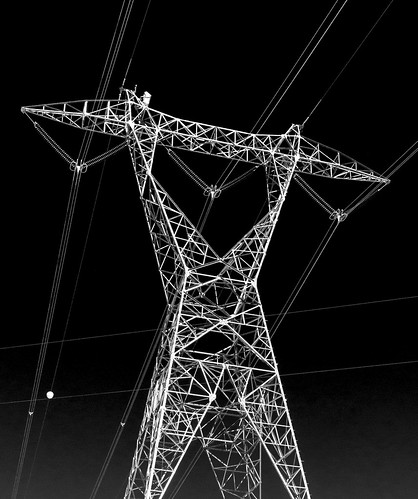
Sunrise Power2 by tomteske, on Flickr
Here's one more with the same technique in the East Fork of Carrizo Canyon:
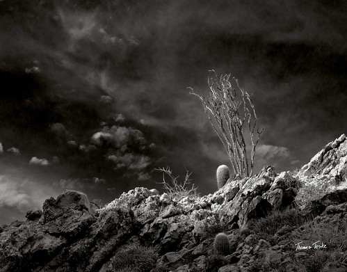
Megans Carrizo Ridge by tomteske, on Flickr
Oh, and my avatar is done the same way, a marble statue in the Vatican Library Garden in the rain.
<em>edited by tommy750 on 6/26/2012</em> |
6/26/2012
Topic:
Squaw Tit and Table Mountain
tommy750
|
dsefcik wrote:
tommy750 wrote:
Saw a few of the white markers in between Squaw and the summit. Do you know if they marked some boundary?
I don't know what they marked but they seemed to mark corner'ish boundaries, probably for the quarry? I found at least four but if I remember it was more like 5 or 6...hummm, I see another trip forming...amazing how red the rock and soil is there.
Me and "Bones" my dog heading down into the quarry

Nice. How do you keep the cactus off Bone's paws? Last time I was out with my friend and her dog, we spent half the time pulling cholla barbs out of its paws. I see one of the jeep trails heads way NW and ends up overlooking Carrizo Gorge. Is that open? Looks like it would have a great view and maybe a nice jump off spot for gorge hiking. |
6/27/2012
Topic:
Squaw Tit and Table Mountain
tommy750
|
dsefcik wrote:
tommy750 wrote:
Nice. How do you keep the cactus off Bone's paws? Last time I was out with my friend and her dog, we spent half the time pulling cholla barbs out of its paws. I see one of the jeep trails heads way NW and ends up overlooking Carrizo Gorge. Is that open? Looks like it would have a great view and maybe a nice jump off spot for gorge hiking.
Yeah, I don't take Bones much to the desert, he gets cholla in his paws all the time, usually only take him when I know it will be cool and we will be on roads and not off trail. The road does go where you see it but once you hit ABDSP boundaries you must hike, no motor vehicles allowed beyond that. I describe a hike I did there on my website
The Lindsay book is a great resource for that area. http://www.amazon.com/Anza-Borrego-Desert-Region-Adjacent-Colorado/dp/0899974007/ref=as_li_wdgt_ex?&linkCode=wey&tag=daresefc-20
I have that book! Will check out what it says. Thanks. Tom |
6/29/2012
Topic:
Squaw Tit and Table Mountain
tommy750
|
ziphius wrote:
tommy750 wrote:
I'm interested in your Escalante comment since I'm heading to southern Utah for a week or two late next month. Was going to do the Grand Tour through Zion, Bryce, Canyonland and Arches. Are there some rock art sites I shouldn't miss? Was going to try and see the Horseshoe Canyon site for sure. Thanks for any advice. Tom
Tom, I don't know much about that area, other than there is an impressive cliff dwelling with pictographs along the Escalante River, just east of Escalante Natural Bridge. If I hadn't been looking for birds at the time, I would have probably walked right by the ruins, which are up quite high. Once you see one set of ruins, it kind of turns on your brain to the types of ledges that you should be looking for. Suddenly, you are finding stuff everywhere... Stop by Escalante Outfitters in town when you pass through Escalante (eat their pizza too). They have a very good selection of books in there, in addition to local knowledge of where to look for pictographs, ruins, etc. The folks who work there are hikers themselves when they are not running the store...so they are a wealth of knowledge. If you want a great 2-3 day backpack, do the Boulder Mail Trail into Death Hollow. The best desert walking I've done yet. - Jim
Thanks for the info. Will stop by Escalante Outfitters on my way through. Just ordered some books on amazon as well. Tom |
7/2/2012
Topic:
Dragonfly and damselfly project
tommy750
|
ziphius wrote:
Nice one Daren! (and correct on the ID). Congrats on contributing the first data point. You recall the month? 
When can I start getting college level credits for reading these posts?? You guys are amazing! Haven't really paid attention to either insect, till now! You mentioned bees. Have stumbled onto two hives in the last month if that's of interest. Tom |
7/3/2012
Topic:
Dragonfly and damselfly project
tommy750
|
ziphius wrote:
tommy750 wrote:
When can I start getting college level credits for reading these posts?? You guys are amazing! Haven't really paid attention to either insect, till now! You mentioned bees. Have stumbled onto two hives in the last month if that's of interest. Tom
Tom, the more the merrier. Maybe an honorary doctorate degree is in your future. I just ordered a copy of 'Dragonflies and Damselflies of The West', and am excited to get species IDs on whatever we can.  Active bee hives are probably even better indicators of cryptic water sources than far-ranging dragonflies. Where did you see your hives and when? - Jim Active bee hives are probably even better indicators of cryptic water sources than far-ranging dragonflies. Where did you see your hives and when? - Jim
edited by ziphius on 7/3/2012
This was on 3-5-05 and is north of Indian Hill at: 32 45.696, -116 10.142 The exact center of the pic is where all the bees were entering/exiting.
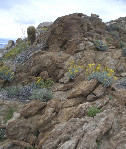
Indian Hill Hive by tomteske, on Flickr
This was on 5-26-12 on the east flank of Sombrero Peak at: 32 50.264, -116 16.819 The bees ingress/egress was near the top of the crack.
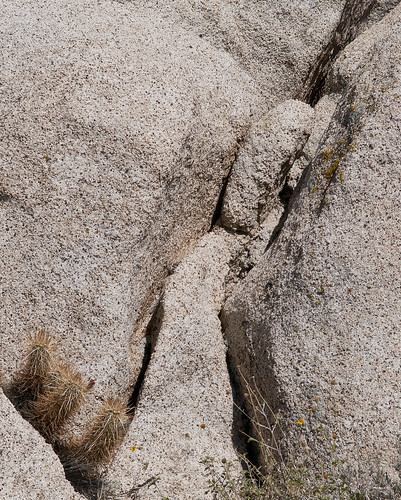
Wild Bee Hive by tomteske, on Flickr
Finally, this Table Mt hive spotted 6-23-12 was in this half-buried PU frame just north of the PU body remnants at 32 38.550, -116 7.525 You can actually see the bees in this pic.
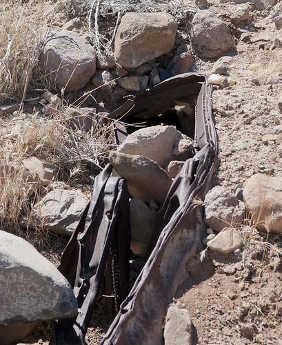
Metal Hive by tomteske, on Flickr
Any idea if these are European vs Africanized bees? Here's a few blurry enlargements from Table Mt. Wasn't about to get too close and wasn't carrying a telephoto. Tom
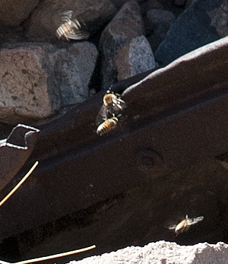
Table Mt Bees by tomteske, on Flickr
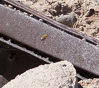
Table Mt Bee by tomteske, on Flickr |
7/5/2012
Topic:
Catavina Pictographs in Central Baja
tommy750
|
surfponto wrote:
Not Anza Borrego related but we were amazed by the similarities to the Blue Sun Cave pictographs at Indian Hill.
The cave at Catavina is amazing and despite the 108' Baja desert heat the cave was quite comfortable. It sits atop a ridge overlooking the large Cardon filled desert.
Those are really neat pics! The pictographs hardly looked faded. Is is well protected? Tom |
7/10/2012
Topic:
2012 Annual Bighorn Sheep Count
tommy750
|
DesertWRX wrote:
I was lucky enough this year to be assigned to the 1st palm grove in Palm Canyon. Beautiful spot with lots of sheep used to humans and we also had plenty of hikers to watch!
Great post! Kinda have a handle on the defining characteristics relevant to the last pic, but would you mind commenting on determining the age, sex, etc of the bighorn sheep in your other photos? Thanks. Tom |
7/12/2012
Topic:
2012 Bighorn Sheep Count
tommy750
|
Do they still do helicopter surveys for PBS? Does it correlate with what you guys find each year? |
7/13/2012
Topic:
2012 Bighorn Sheep Count
tommy750
|
dsefcik wrote:
tommy750 wrote:
Do they still do helicopter surveys for PBS? Does it correlate with what you guys find each year?
Great question, they briefly talked about that this year. They used to do them with some regularity but not any more, some reasons why were financial and others political. That is why the volunteer program is even more important now. In the days past golf resorts were able to buy up land that took away from the sheep but golf resorts are now passe and instead green energy projects have moved in and are taking their place. When you look at the "peninsular" range they once used it has now become fragmented by development and roadways, their "range" has shrunk considerably.
Thanks for the info. Great pics. Tom |
7/17/2012
Topic:
The Search For Geocache "Yoni"
tommy750
|
Still have barely scratched the surface of Table Mt so decided to head out again. Was only 88 degrees till sunset, so quite a bit cooler than the rest of ABDSP. My Bronco buddy agreed to come along if I helped her search for the nearby geocache, "Yoni." Headed south of I-8 at In-Ko-Pah and started searching.
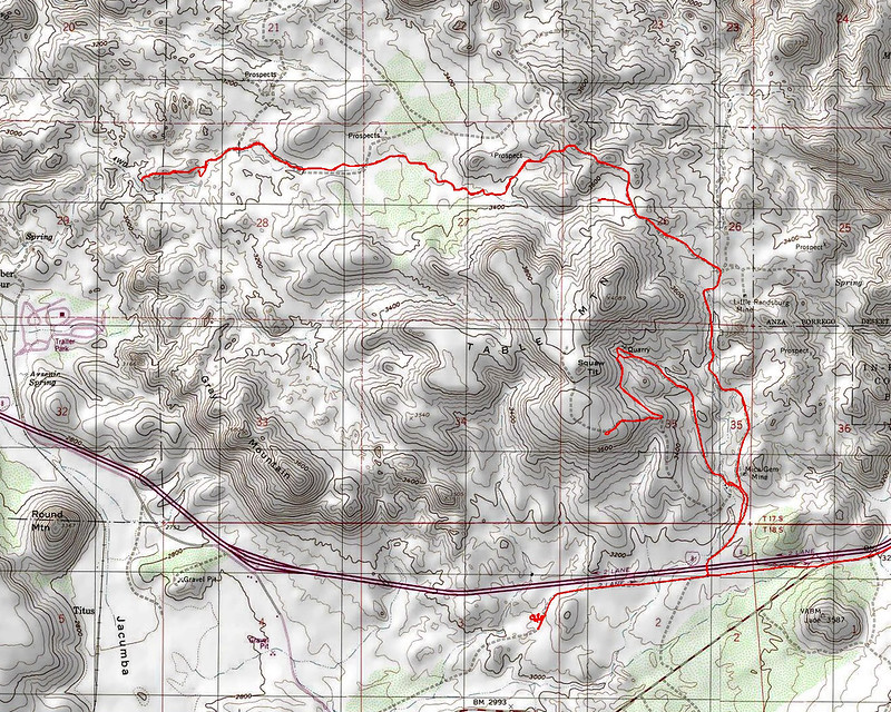
Table Mt Topo by tomteske, on Flickr
After following her around led by her smart phone (a dubious navigational decision) found lots of yonis but not "the" yoni.

Yoni by tomteske, on Flickr
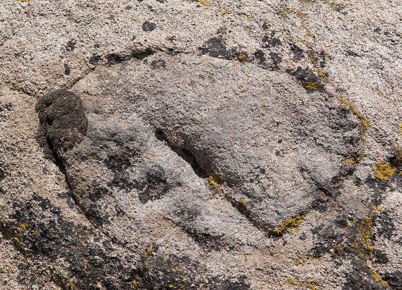
Yoni by tomteske, on Flickr

Yoni by tomteske, on Flickr
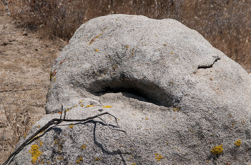
Yoni by tomteske, on Flickr
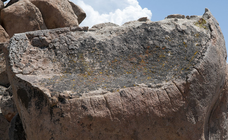
Yoni by tomteske, on Flickr
Finally decided to get serious and typed the coordinates into the Garmin. Five feet from the road we found this. Thought the half dozen other ones within 500 ft were more impressive.
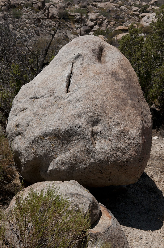
Yoni Geocache by tomteske, on Flickr
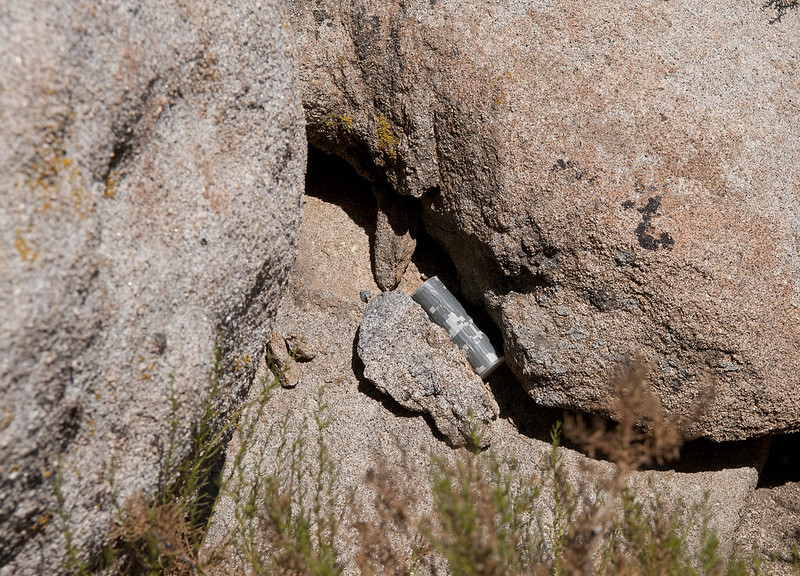
Yoni Geocache by tomteske, on Flickr

Yoni Geocache by tomteske, on Flickr
Headed toward the quarry and found this 40G hard drive someone wanted to get rid of.
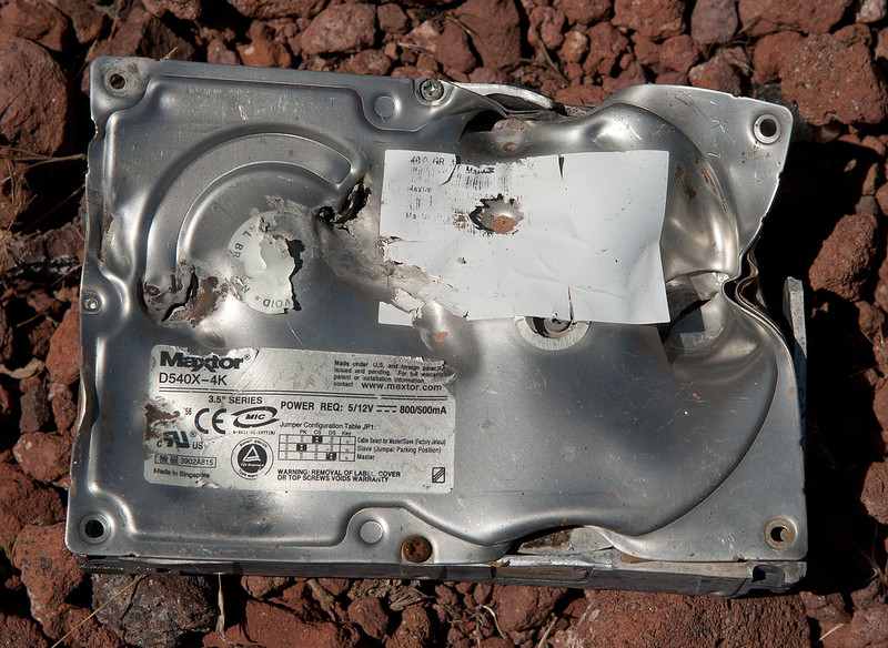
Maxtor Hard Drive by tomteske, on Flickr
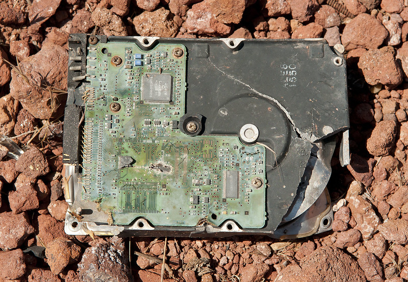
Hard Drive by tomteske, on Flickr
The area was littered with bone fragments. This one looks like the lambdoidal suture on the posterior skull. Almost sounds like a crime scene from a cheap novel. Or maybe not.
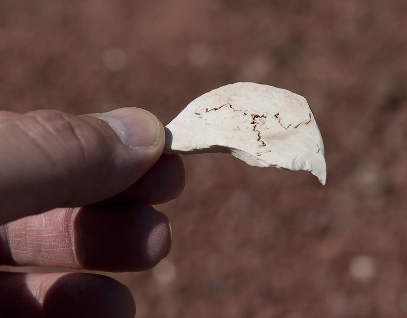
Lambdoidal Suture by tomteske, on Flickr
Kept heading up toward Table Mt and saw several markers like this as previously mentioned by Daren. Seemed to be mainly around the quarry.

Table Mt Marker by tomteske, on Flickr
Kept expecting "Road Closed" BLM Markers but there were none. Finally ended up on top of Table Mt. Squaw Tit is to the left and the Table Mt summit to the right.
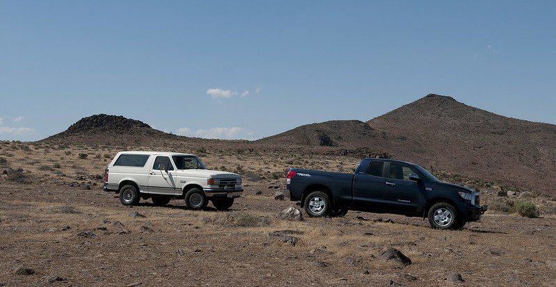
Table Mt Summit by tomteske, on Flickr
Parked 75 yards east of the BP truck and the Jeep behind it. They didn't seem to care we were taking in the view next door.
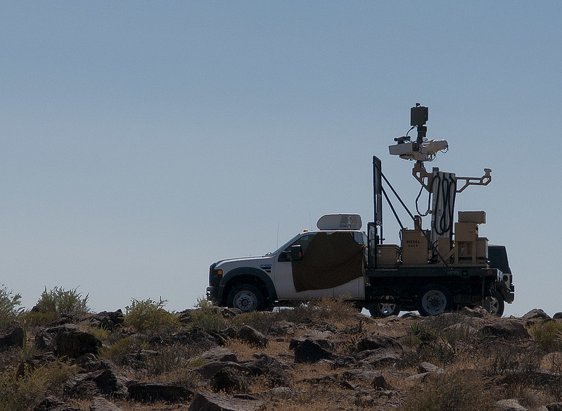
Table Mt BP by tomteske, on Flickr
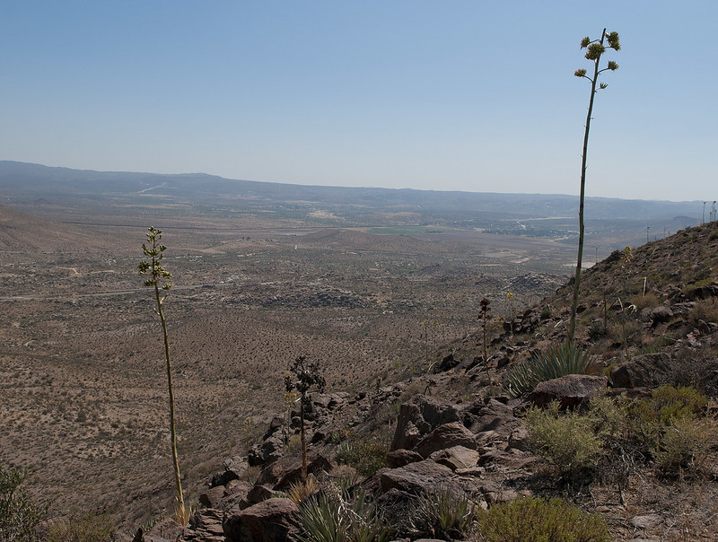
Toward Jacumba by tomteske, on Flickr
Headed down the way we came and stopped by a wildlife guzzler I mentioned in a previous post. Decide to pull the top and see if any water was present after the recent rain.
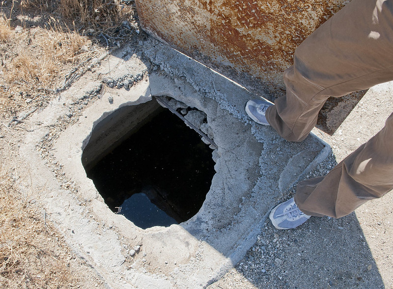
Guzzler Uncovered by tomteske, on Flickr
Looks like it was capturing some water and the stick shows about a 6-8" depth.
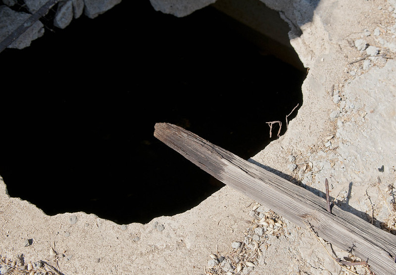
Guzzler Depth Gauge by tomteske, on Flickr
Here's a literal bird's eye view. Had a few feathers in the relatively clear water but not enough to think a predator got lucky.
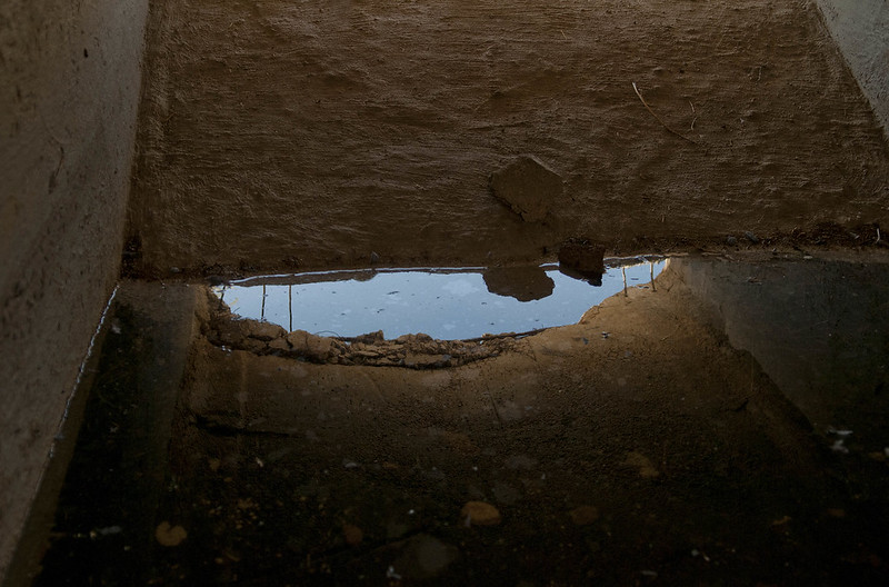
Table Guzzler Interior by tomteske, on Flickr
Headed west and saw an amazing amount of trash and carnage.
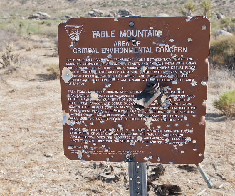
Table Mt Concern by tomteske, on Flickr
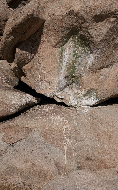
Painted Rocks by tomteske, on Flickr

Grafitto by tomteske, on Flickr
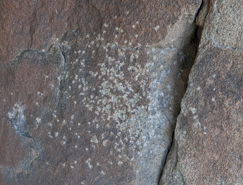
Shotgun Petroglyph by tomteske, on Flickr
Even littering with money.
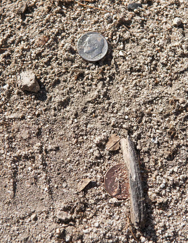
Eleven Cents by tomteske, on Flickr
Found a weathered spine fragment, presumably a deer or maybe bighorn. You anatomists will appreciate the thoracic spine with attached rib fragments and prominent left-leaning spinous processes and the non-ribbed cervical vertebrae. Deer lumbar and thoracic vertebrae appear quite similar to humans but the neck looks very different.

Thoracolumbar Spine by tomteske, on Flickr
Both of us needed a little extra clearance in places but the Bronco got beached in this pic and we needed to pull out the jack and shovel.
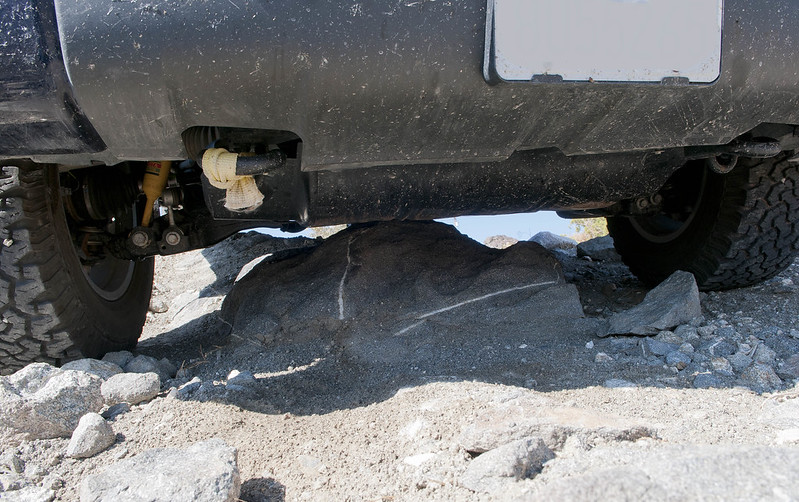
Lift Kit by tomteske, on Flickr

Beached by tomteske, on Flickr
And now, to make this a legitimate post, the ABDSP sign, a view of Jacumba and the one collected mylar balloon. Hope you enjoyed this rambling summer "slow news day" post. Tom

Table Mt ABDSP by tomteske, on Flickr
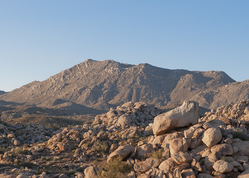
Jacumba by tomteske, on Flickr
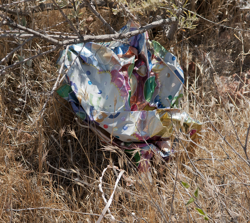
Mylar Balloon by tomteske, on Flickr |
7/17/2012
Topic:
Dream Find!!!
tommy750
|
That is really impressive. Nice find. Tom |
7/17/2012
Topic:
The Search For Geocache "Yoni"
tommy750
|
Why would anyone want to get rid of a 40gb hard drive?
BTW, you drove right past the boulders with the pictos I posted awhile back on your last TM post.
Daren
Thanks for the tip. Will definitely get out there on foot as soon as it cools down. Hard to see pictographs from inside the cab. Tom |
7/18/2012
Topic:
Best Mylar Ballon Trip
tommy750
|
dsefcik wrote:
What is your best mylar ballon take for a trip?
Was out in McCain Valley late this afternoon taking a short hike. Found two latex ballons and a mylar. Was dismayed to find a bunch of large plastic bags used by Sunrise scattered over the chaparral. Picked five out of the brush. Not sure I got all of them since it was getting dark.
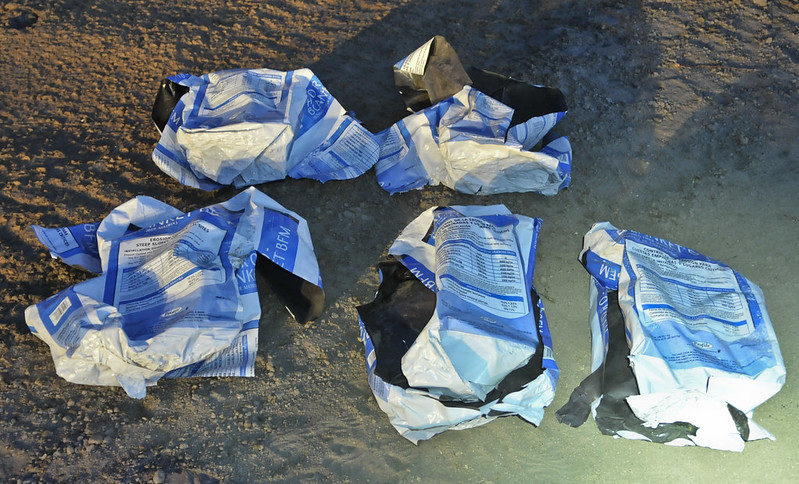
Baggy Count by tomteske, on Flickr
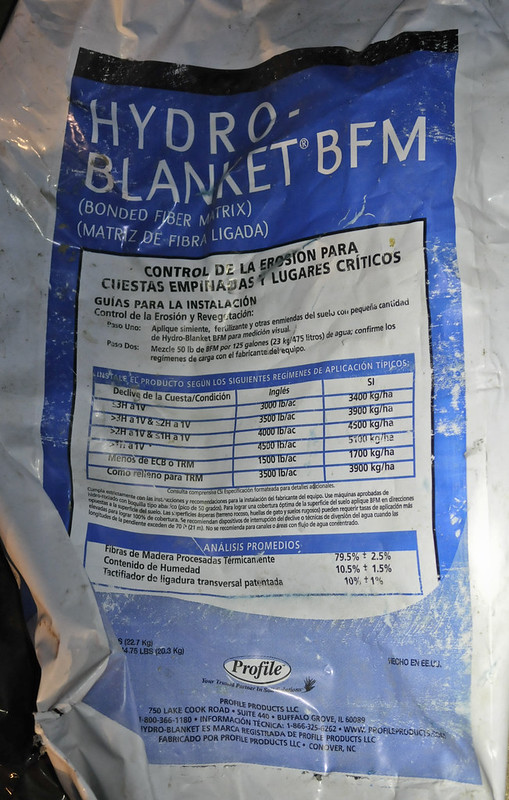
Hydro-Blanket BFM by tomteske, on Flickr

Trash Truck by tomteske, on Flickr |
7/20/2012
Topic:
Older Anza Borrego maps
tommy750
|
dsefcik wrote:
Great thread..I love maps.
Check out www.raremaps.com. It's run by a real nice guy named Barry Ruderman and is located near Pearl and Girard in La Jolla. They have a bunch of interesting maps of Baja and California not to mention the rest of the world. Their website is amazing and the store is well worth the visit. |
7/20/2012
Topic:
Dream Find!!!
tommy750
|
Looks like there still is lots of stuff out there. Check out this link: http://www.tucsonsentinel.com/local/report/050812_borderpatrol_artifacts/agents-discover-archaeological-artifacts-west-tucson/ |
7/23/2012
Topic:
Fish Creek Wash Rd Conditions
tommy750
|
dsefcik wrote:
I was thinking of driving out the Fish Creek Wash road to Sandstone canyon in the next week or so. I have never been there and wondered if anybody could tell me what the road is like and if my big crewab 4wd diesel would make it. I have driven it out to the end of Carrizo Gorge several times and Rockhouse canyon, it does well on hard rocky surfaces but deep sand may be problematic.
TIA,
Daren
You'll have zero problems. Last year there was a large rock fall that blocked Sandstone Canyon about halfway in. When I was there earlier this year, a route had opened up around it but too tight for my Tundra. Still an easy hike to the end of the canyon. Have a few pics posted on panoramio/google earth of the rock fall. The one mistake I made was trying to drive out of Fish Creek via The Dropoff. Don't try that with a long wheelbase vehicle! Took me forever during 100 degree weather. Wasn't aware it's one-way when I did it.
Just found a pic of the rock fall from January of this year. The new opening is on the right with the old left side still blocked. Tom

Sandstone Canyon Collapse by tomteske, on Flickr
<em>edited by tommy750 on 7/23/2012</em> |
7/24/2012
Topic:
Hydration and Desert Hiking
tommy750
|
Wow, was not really aware of this! Have always believed "by the time you're thirsty, it's too late." Maybe not. That large corporations would promote junk science to protect their profit centers is certainly no surprise.
"Bottom line: drinking ahead of thirst:
General public—Drinking ahead of thirst may worsen performance in endurance exercise and carries a rare but serious risk of hyponatraemia. The body’s internal mechanism for staying hydrated is cheaper, easier, and seems to be the best way to optimise performance
Professional athletes—Elite endurance athletes perform best when they drink to thirst; some studies suggest exercise induced dehydration can improve performance"
Here's the link to the suite of "Start of the Olympics" exercise/sports drink/hydration articles released by the eminent British Journal of Medicine. The others can be accessed by clicking on the "related content" tab. Only one has a pay wall.
http://www.bmj.com/content/345/bmj.e4171.full?rss=1&utm_source=feedburner&utm_medium=feed&utm_campaign=Feed%253A+bmj%252Frecent+%2528Latest+from+BMJ%2529 |
7/24/2012
Topic:
Fish Creek Wash Rd Conditions
tommy750
|
dsefcik wrote:
Great, thanks! I was afraid it would be deep sand. Wasn't the rock fall from the Easter earthquake a couple of years ago?
Yup, you're right. Was out there 2/10 and no collapse and 11/10 with a collapse. Tom |
8/5/2012
Topic:
Looking for tinajas on San Clemente Island
tommy750
|
Great report. Google Earth has a nice view of the island with a few panoramio pics. I see several pics from boats in the harbor at the south end with quite a few craters not too far away. No offshore exclusionary zone? |
8/5/2012
Topic:
Zion Bighorns
tommy750
|
Just got back from a trip through southern Utah. Leaving Zion, we saw several bighorns by the roadside. Apparently not uncommon on the park's east side. There was grass everywhere, but they insisted on eating by the side of the road. Higher salt content from de-icing? Have no idea. Tom

Zion Desert Bighorns by tomteske, on Flickr
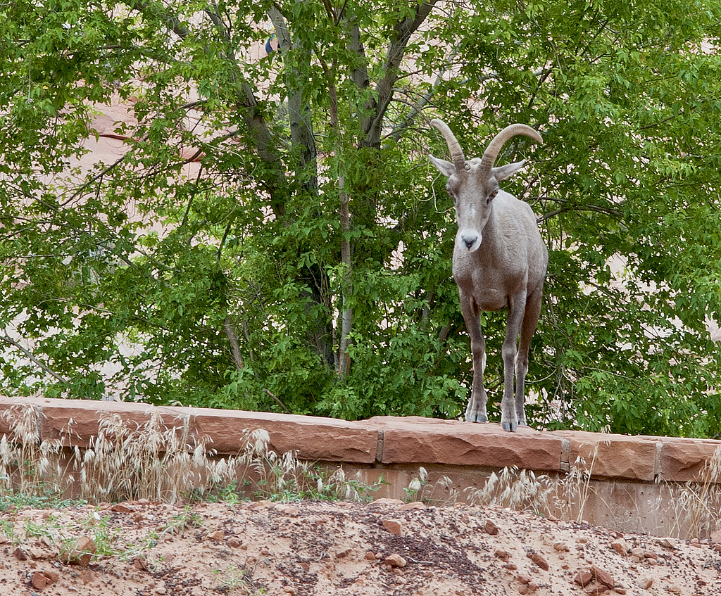
Zion Ewe by tomteske, on Flickr
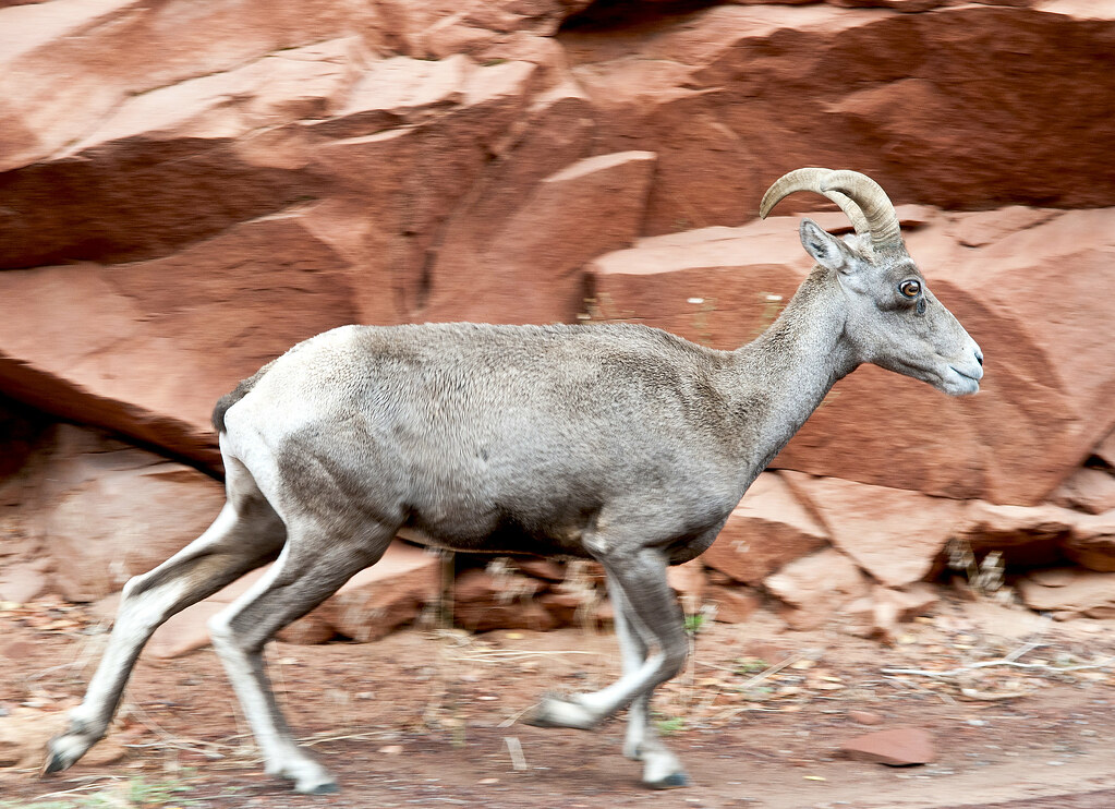
Zion Desert Bighorn Ewe by tomteske, on Flickr |
8/5/2012
Topic:
Horseshoe Canyon Rock Art Site
tommy750
|
Canyonlands is a little far from ABDSP but I know you guys are into rock art. Horseshoe Canyon AKA Barrier Canyon has four spectacular sites containing the best examples of "Barrier Canyon Style" rock art dating from 2000 BCE to 500 CE. The trailhead is at the end of a dirt road 32 miles from the highway. It's a 6.5 mile hike with a 750ft descent into the canyon. Here's a few of the amazing panels and their DSTRETCHED enhancements. Enjoy. Tom
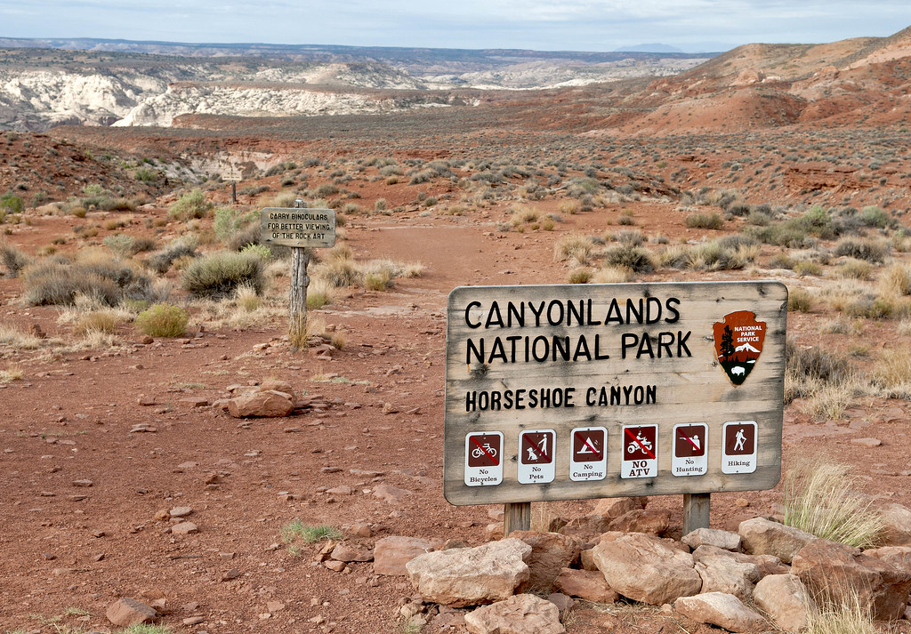
Horseshoe Canyon Trailhead by tomteske, on Flickr
Horseshoe Shelter Site

Horseshoe Shelter Panel by tomteske, on Flickr

Horseshoe Shelter Panel_lds by tomteske, on Flickr

Horseshoe Shelter Detail4 by tomteske, on Flickr

Horseshoe Shelter Detail4_ybk by tomteske, on Flickr
The Alcove Site
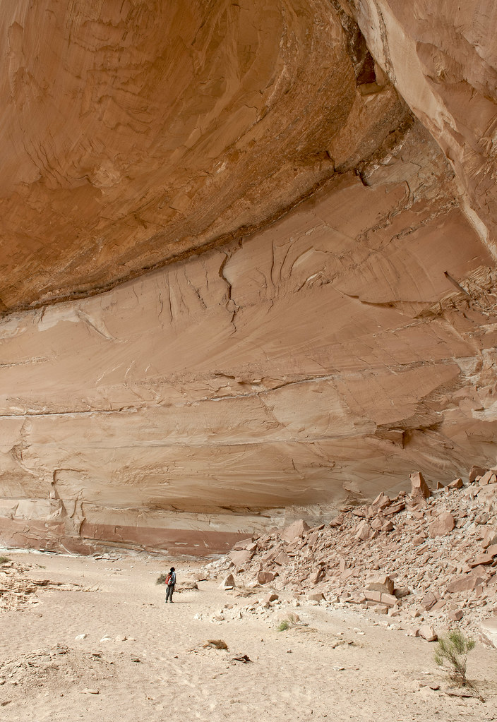
Sandie at The Alcove by tomteske, on Flickr
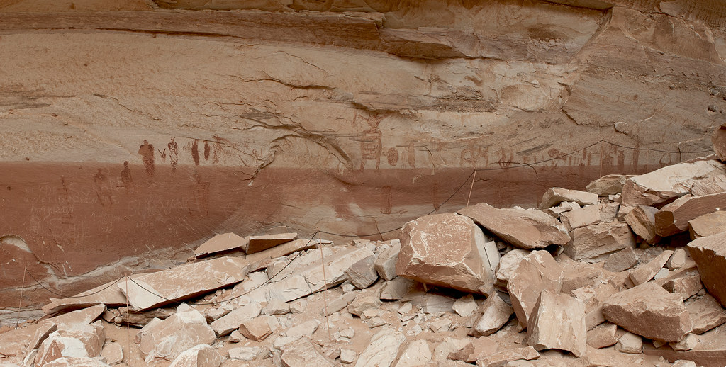
The Alcove Panel by tomteske, on Flickr
Few deer spotted on the way.
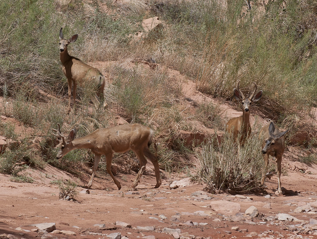
Foursome by tomteske, on Flickr
The Great Gallery Site

Great Gallery Panel by tomteske, on Flickr

Great Gallery Panel_lds by tomteske, on Flickr
With DSTRETCH, you can see a bunch of sheep appear on this figure's chest.

Horseshoe Canyon Great Gallery Detail by tomteske, on Flickr
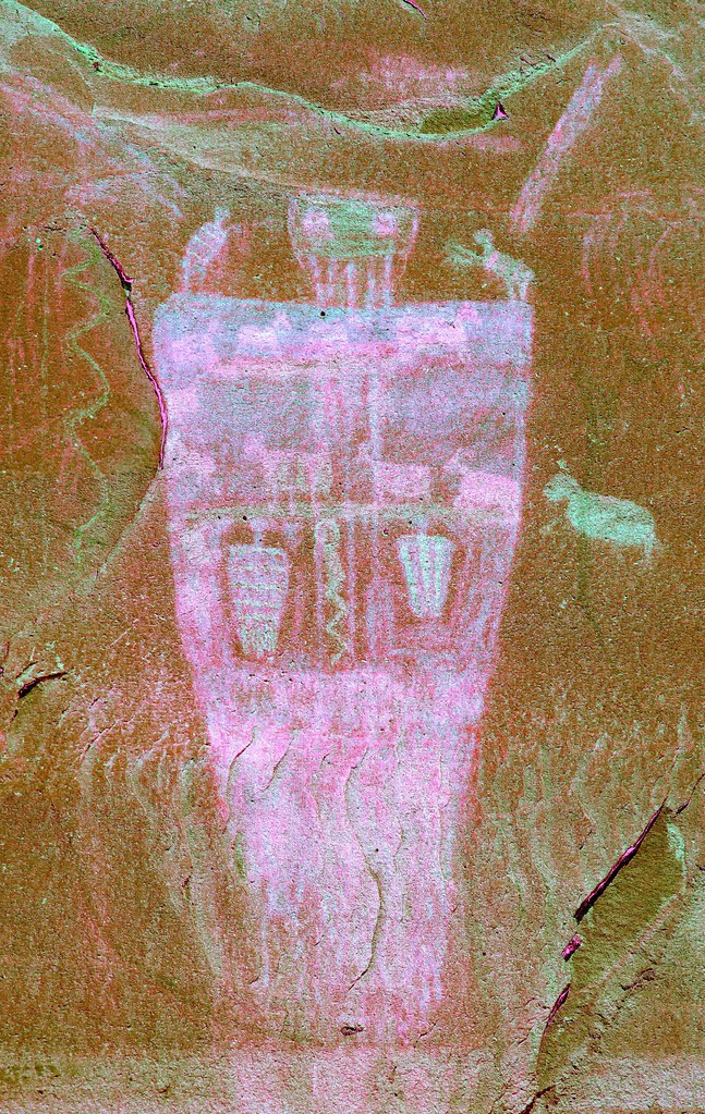
Horseshoe Canyon Great Gallery Detail_yye by tomteske, on Flickr
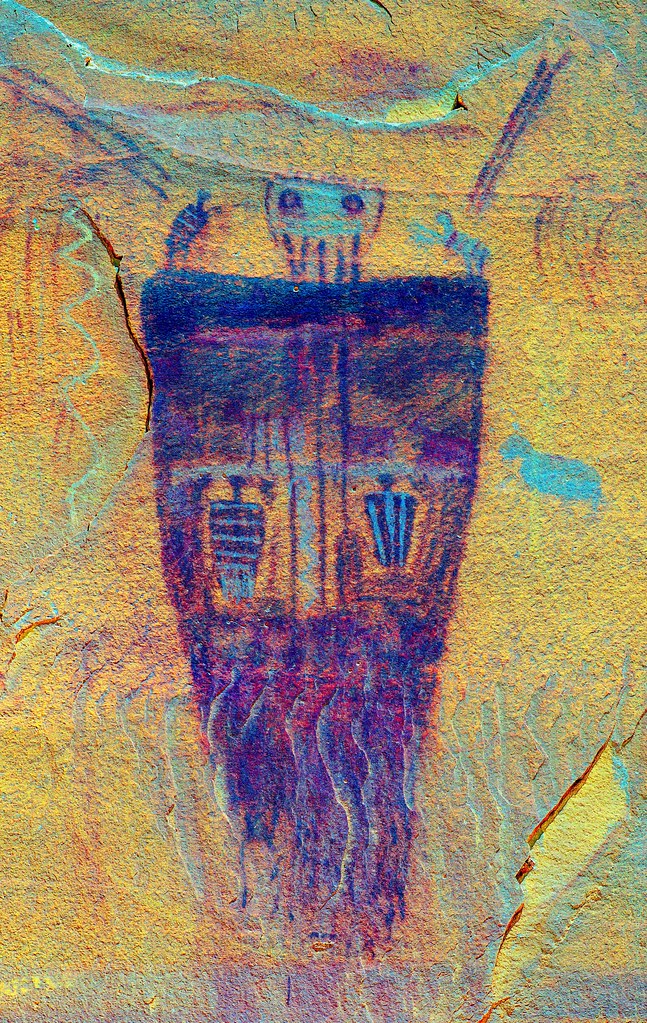
Horseshoe Canyon Great Gallery Detail_lds by tomteske, on Flickr
High Gallery Site
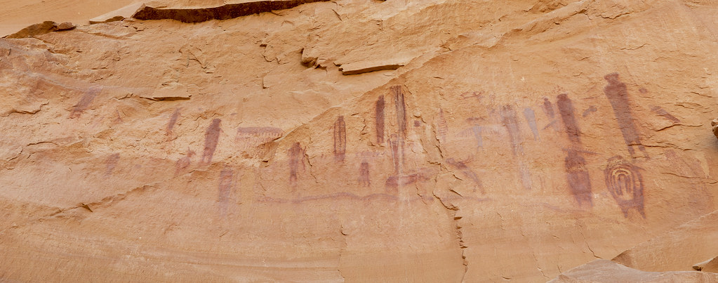
Horseshoe Canyon High Gallery by tomteske, on Flickr

Horseshoe Canyon High Gallery_lds by tomteske, on Flickr |
8/5/2012
Topic:
Horseshoe Canyon Rock Art Site
tommy750
|
dsefcik wrote:
All very cool.....
I like hidden sheep on the chest picto. DStretch is pretty cool, glad you are using it.
Are any of those photos stitched panoramas or are they just wide angle distance shots? I like how they look.
Yeah dstretching everything is kinda fun and every once in a while something unexpected pops out. Always appreciative of you sharing the link. The panels are stitched together in photoshop. Tom |
8/5/2012
Topic:
Zion Bighorns
tommy750
|
dsefcik wrote:
Looks like she has some thick ring grooves to her horns, nice....
Assuming that's a good thing? |
8/6/2012
Topic:
Horseshoe Canyon Rock Art Site
tommy750
|
ziphius wrote:
That's amazing stuff. Especially the hidden sheep that dstretch brings out. I bet the area isn't too crowded, given the distance from the nearest paved road.
When we looked through the trailhead register which was only the month of July, we saw only 2-3 people per day. We saw no one the entire hike but it was about 90 degrees by noon, maybe a factor! Tom |
8/8/2012
Topic:
Split Mountain/Sandstone Canyon after the Rains!
tommy750
|
Now that is impressive! Definitely want to get out there to see how thing look now. Can't believe that PU! Thanks for the pics. |
8/9/2012
Topic:
Perseid meteor shower this weekend
tommy750
|
Some friends and I will be out in Fish Creek Saturday afternoon and somewhere out in the desert to watch the meteor shower later that night. Will stop by if we see your truck in Blair Valley. Tom |
8/10/2012
Topic:
Perseid meteor shower this weekend
tommy750
|
dsefcik wrote:
tommy750 wrote:
Some friends and I will be out in Fish Creek Saturday afternoon and somewhere out in the desert to watch the meteor shower later that night. Will stop by if we see your truck in Blair Valley. Tom
Will you not be at the Ocotillo Wind Energy protest? If I make it out to BV I will most likely be near the road where you turn right towards the Marshal South parking area, that is my usual spot.
Would love to go out to Fish Creek also but committed myself to the protest, what time are you going out?
I'm planning on making out to Ocotillo tomorrow morning to join you. Will be heading out to Fish Creek sometime in the mid afternoon. The agenda for the protest? Travelling elsewhere or in Ocotillo? Tom |
8/10/2012
Topic:
Perseid meteor shower this weekend
tommy750
|
We downloaded "Meteor Counter," a free app for iPhone and Android available at their respective app stores. Apparently NASA wants data from stargazers on meteor magnitude and frequency. The app is a handy way to collect and forward the data to NASA. |
8/11/2012
Topic:
Take a Stand in Ocotillo this Saturday July 11'th
tommy750
|
This morning at the Take a Stand in the Sand Protest.
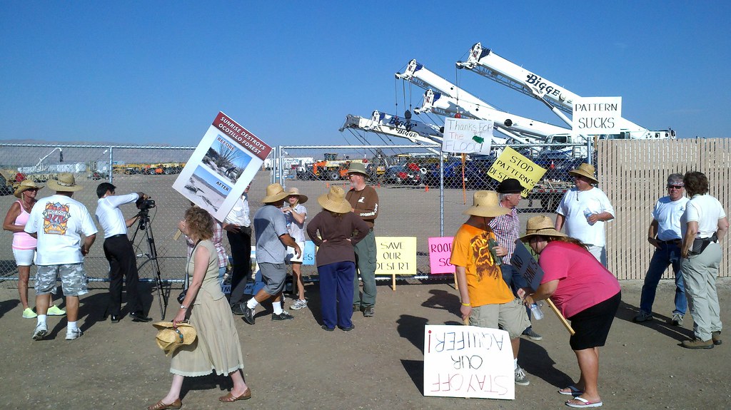
2012-08-11_08-16-01_377 by tomteske, on Flickr |
8/12/2012
Topic:
Take a Stand in Ocotillo this Saturday July 11'th
tommy750
|
surfponto wrote:
Thanks for making it out there
I heard Pattern shut down operations for the day
How was the turnout?
Probably 30-40 people showed up. Someone said Pattern gave everyone the day off because of the protest. Here's the IV Press link:
http://www.ivpressonline.com/news/ivp-dozens-head-out-to-protest-wind-farm-project-in-ocotillo-20120812,0,2891105.story
Tom |
8/12/2012
Topic:
More Split Mountain Flash Flood
tommy750
|
Drove out to Split Mt. after seeing Borregolinda's post. The pickup was amazing! Thought I heard they were parked near the Wind Caves trail head when the flood hit. According to my odometer, that's 2.0 miles from the pickup location! Here's a few more pics:

Fish Creek F150 by tomteske, on Flickr
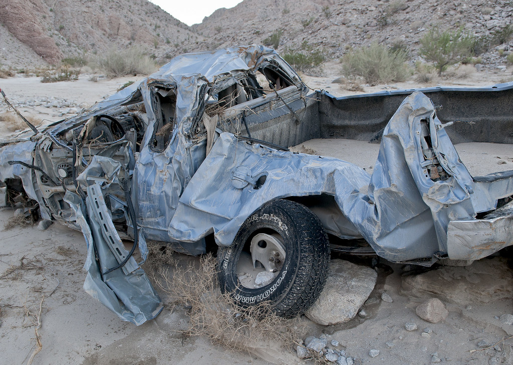
Fish Creek PU3 by tomteske, on Flickr
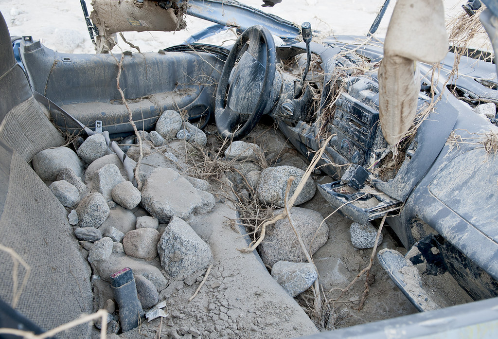
Fish Creek PU by tomteske, on Flickr
Looks like the truck is starting to leak fluids.
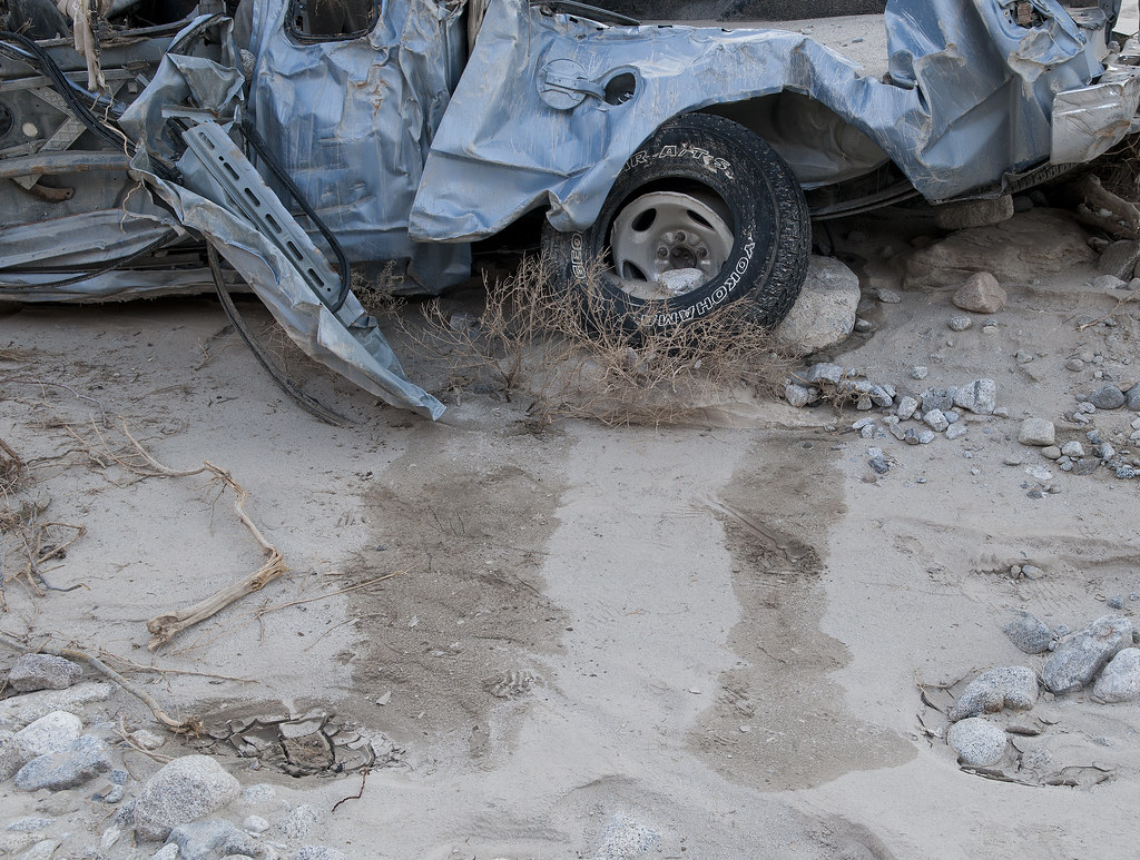
Fish Creek PU Leaks by tomteske, on Flickr
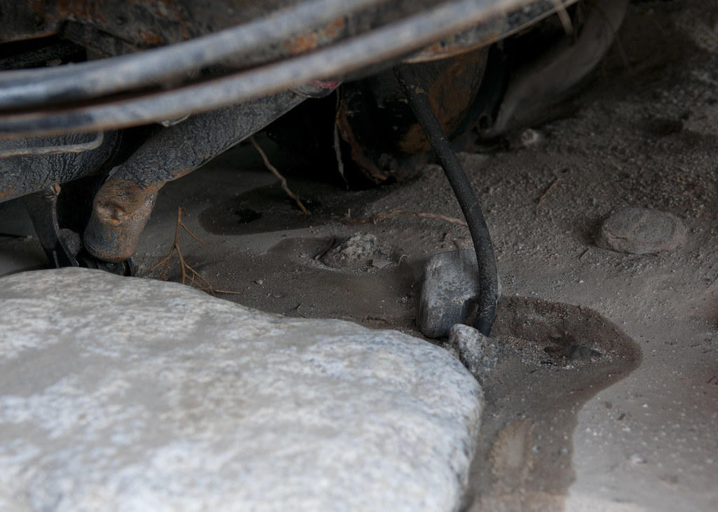
Fish Creek PU Leak by tomteske, on Flickr

Fish Creek PU5 by tomteske, on Flickr

Fish Creek PU4 by tomteske, on Flickr
Assuming they didn't place this sign this low to the ground!

ABDSP Sign by tomteske, on Flickr
A solitary Bighorn a couple hundred yards up the canyon.

Fish Creek Bighorn by tomteske, on Flickr
The truck on the way out to Blair Valley to find Daren and view the Perseid meteor shower

Fish Creek Noc PU by tomteske, on Flickr |
8/13/2012
Topic:
More Split Mountain Flash Flood
tommy750
|
dsefcik wrote:
Great pics, too bad for that truck and owner!
You said the bighorn had "nubs" (or I think asked that..), it looks like maybe an older ewe and not a lamb.
It was great meeting you and your companions even though I doubt I would be able to recognize any of you in the daylight 
I will post up some pics later of the meteor shower and my tour of the OWEF as soon as I can. I managed to get a few good shots and some with meteors in them.
Great meteor shower for sure and I was in total disbelief of how many people were camping out there.
Daren
Yeah, glad to have met up with you Saturday night. Was great how it cooled down in Blair Valley after having been 113 in Fish Creek a few hours before. The dark night sky was amazing and definitely was a nice meteor show. Tom (and Sandie and Amy) |
8/13/2012
Topic:
More Split Mountain Flash Flood
tommy750
|
Nice shots! We took about 100 pictures last week and couldn't decide which ones to post here! My Tracks program on my phone showed it 1.76. Went a long ways! Tree stopped it. Talked to Supervising Ranger Friday and she says the owner will be responsible for getting the truck out of there. Sounds expensive!
I agree! Would like to see a video of the towing company trying to extract that mess. Tom |
8/13/2012
Topic:
Perseid Meteor Shower 2012
tommy750
|
Very nice. What exposure lengths were you using? Tom |
8/15/2012
Topic:
Perseid Meteor Shower 2012
tommy750
|
dsefcik wrote:
tommy750 wrote:
Very nice. What exposure lengths were you using? Tom
7mm Fisheye Lens, f/3.5, 1600 ISO, 30 second exposure
Thanks, just saw your video. Really nice. Tom |
8/27/2012
Topic:
Yuha Well and Geoglyphs
tommy750
|
On Friday, decided to take a drive out to the Yuha Basin, a place I'd never been. Stopped off at BLM El Centro and picked up a few maps and headed out. It's between I-8 and Hwy 98 southeast of Ocotillo. In 1962, a USBP pilot spotted some curious shapes on a ridge and thus "discovered" the Yuha Geoglyphs. They apparently had already been discovered by vandals and SDSU spent the next decade restoring them. In 1975, they were totally trashed and after further restoration are still badly damaged. Compared to the Blythe Intaglios I posted on before, these are in a miserable state.
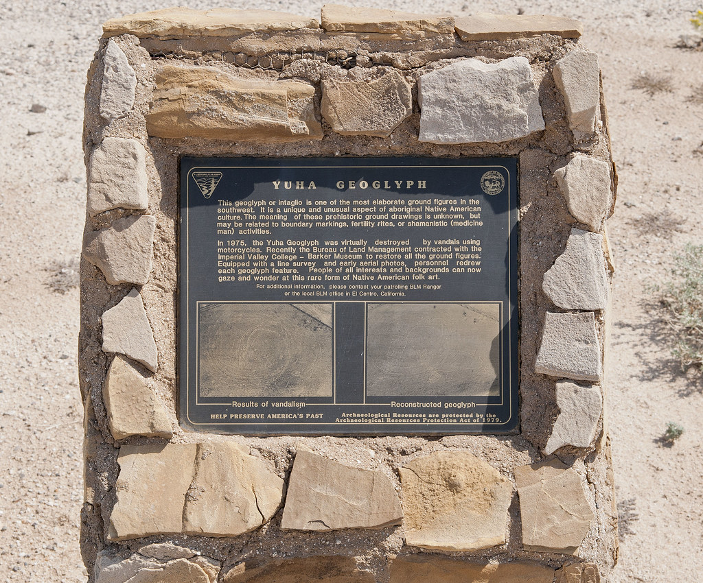
Yuha Geoglyph by tomteske, on Flickr
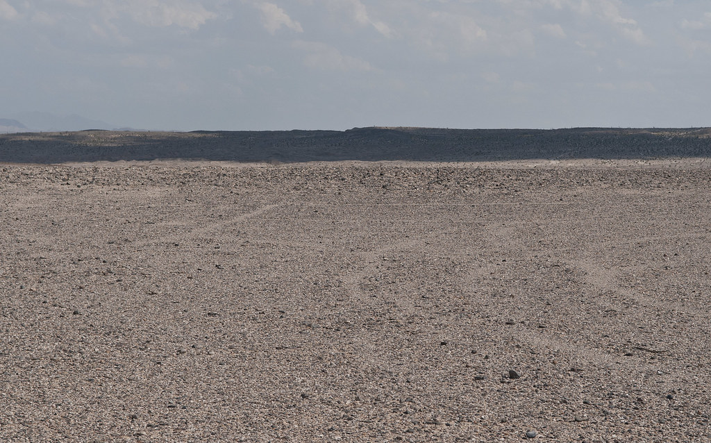
Yuha Glyph by tomteske, on Flickr
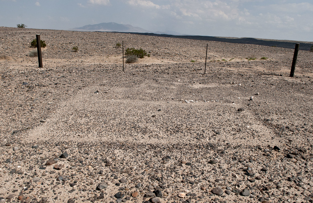
Centinela From Yuha Glyphs by tomteske, on Flickr
This is looking toward Carrizo and the Coyote Mts
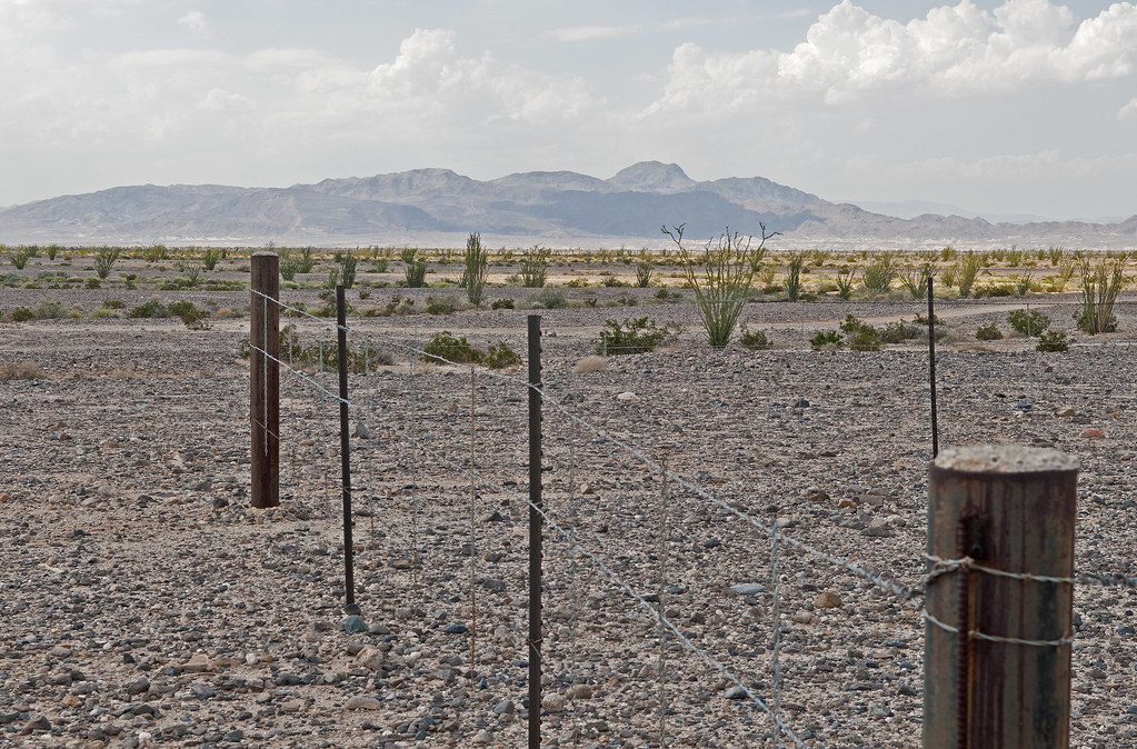
Carrizo Mt From Yuha Glyphs by tomteske, on Flickr
Not too many people have been out here since the torrential rains a few weeks back so a lot of the roads have no fresh tracks.

Tundra on EC 301 by tomteske, on Flickr

Fresh Tracks by tomteske, on Flickr
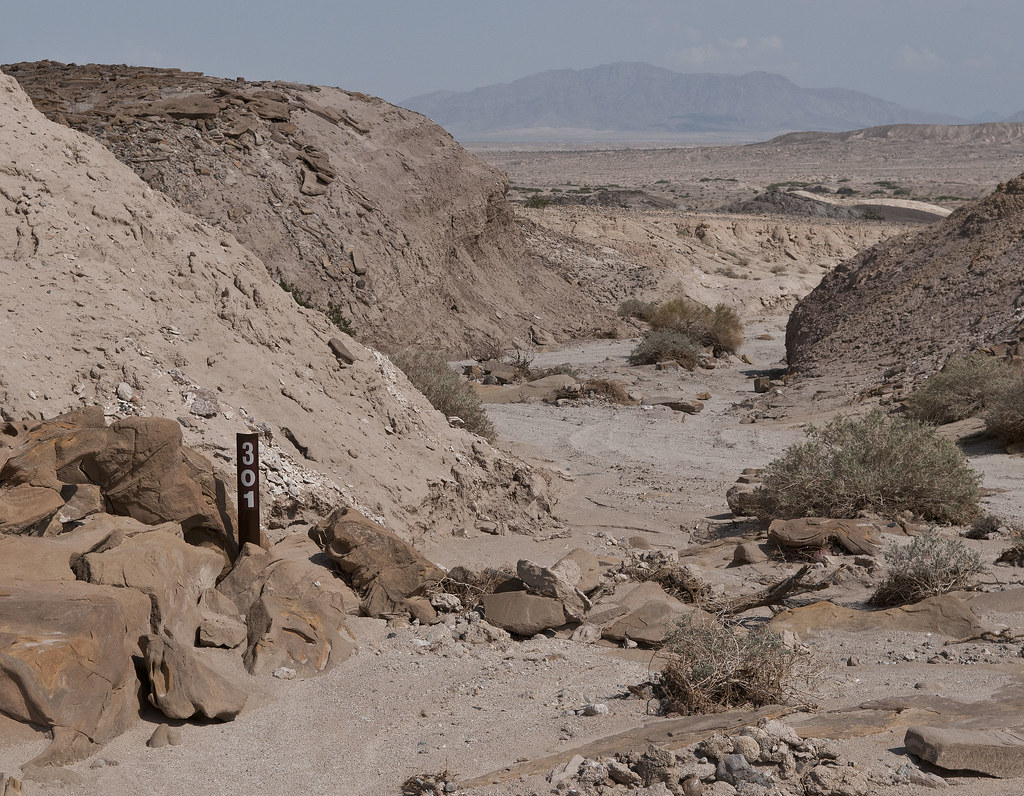
EC 301 by tomteske, on Flickr
The Yuha Well was used by Anza's party in 1775. Their Indian guide's name was Sebastian Tarabal and farther to the north, San Sebastian Marsh, their next water source, is supposedly named after him.
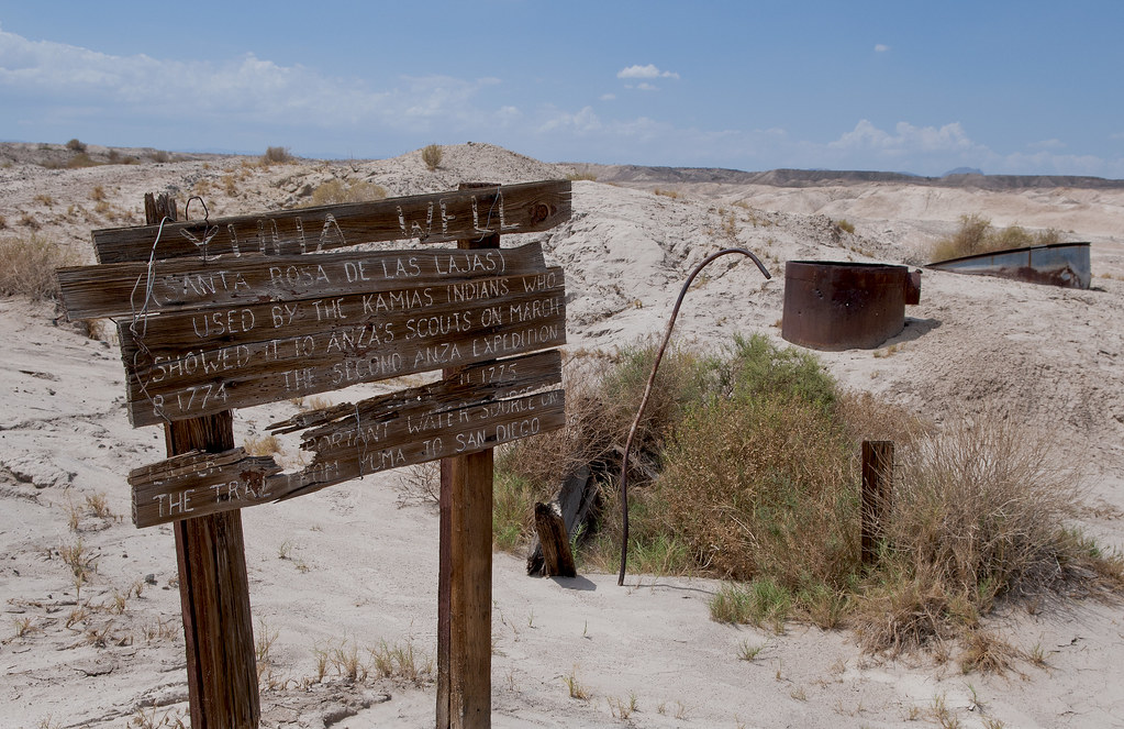
Yuha Well by tomteske, on Flickr
The well is not currently flowing and the visible ruins reportedly date to the mid-1900's.

Yuha Well2 by tomteske, on Flickr
Found these funny looking tracks. One looks like a sidewinder and the other maybe a lizard?
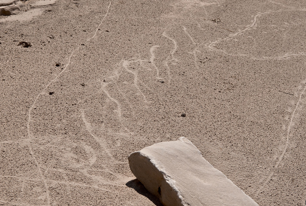
Tracks2 by tomteske, on Flickr
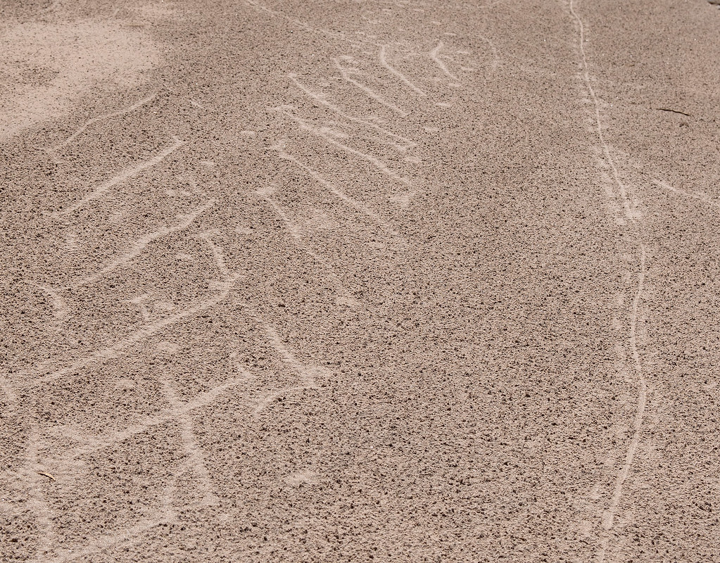
Tracks by tomteske, on Flickr
Here's a Desert Iguana losing his skin.
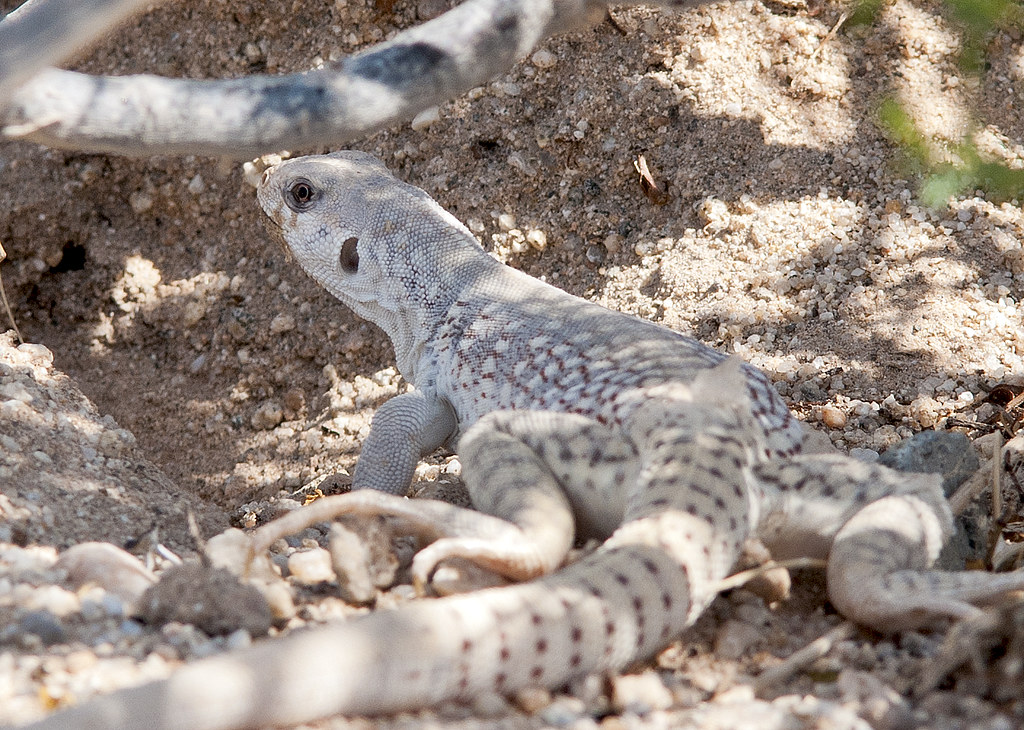
Shedding by tomteske, on Flickr
This is in Yuha Wash. The wash really gets you into some deep sand as you head east.
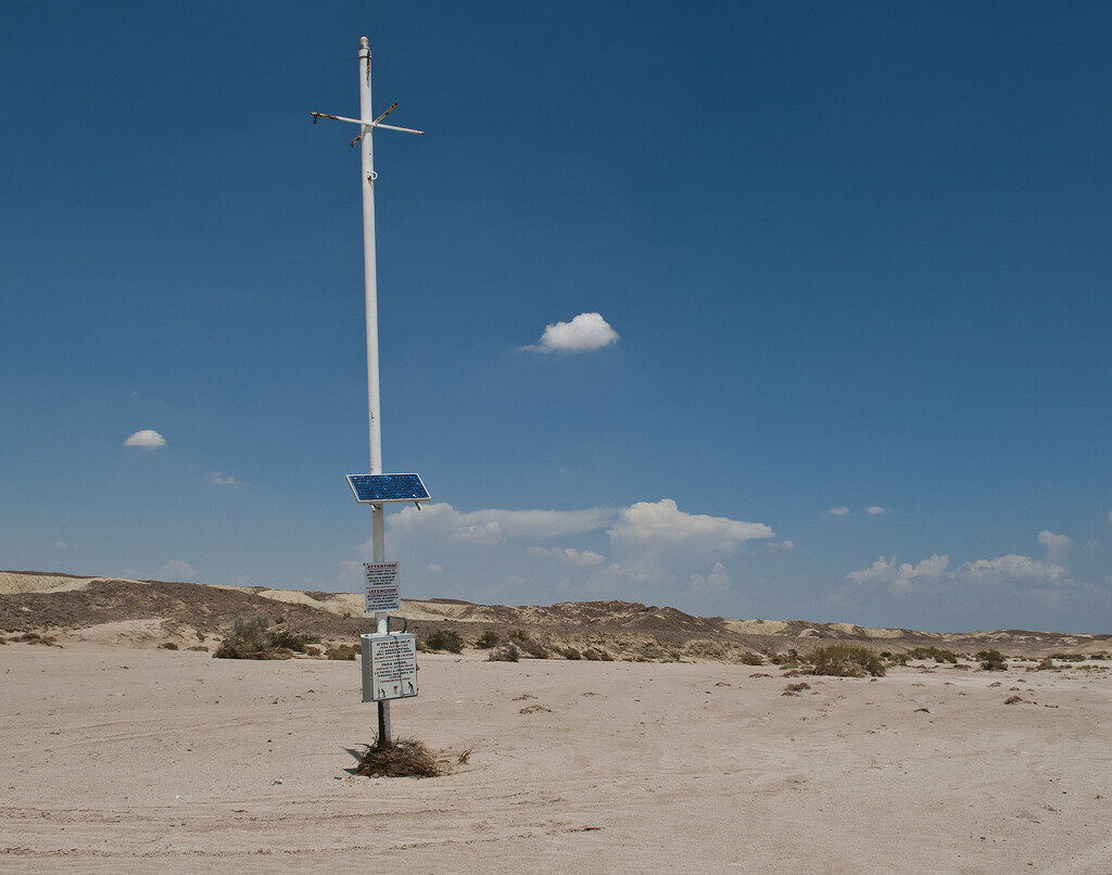
Red Button by tomteske, on Flickr
El Boton Rojo by tomteske, on Flickr
Didn't have time to check out the large shell reefs nearby. Next time. Enjoy. Tom |
8/27/2012
Topic:
Yuha Well and Geoglyphs
tommy750
|
rockhopper wrote:
That's getting out towards the Yuma to San Diego wooden road. Yes?
That's a good question. We're talking about the origins of Old Hwy 80, the link from San Diego to Yuma. It first followed The San Diego to Fort Yuma Wagon Road and passed somewhere through the Yuha Desert south of I-8. The old plank road came in the early 1900's and was 6-8 miles of wooden planks that crossed the Algodones Dunes far to the east. I stole most of this info from Chris Wray's great book, "The Historic Backcountry." That book has everything about San Diego and Imperial County historic sites. Tom |
8/27/2012
Topic:
Yuha Well and Geoglyphs
tommy750
|
ziphius wrote:
Thanks for the tour! I remember reading "The Anza Trail and The Settling of California" years ago. Real explorers back then, without any emergency buttons to push! 
Exactly. Those "red buttons" will probably go the way of the roadside emergency phones when everyone on planet earth has a cell phone. Which is probably soon! Tom |