12/6/2021
Topic:
Surf1div1 intro
Brian
|
surf1div1 wrote:
Hey Brian, me and a fellow hiker are planning sometime around April (depending on remod project finish here) to do Pinto but based on those of you in the Jacumba Hikers group it appears that going by way of Boulder/Meyers it's a fair amount of rock scrambling. Not sure that were up for it even though it's the much shorter route (From Myers I have approx 11 mile based on the route on GE). From Davies it's further but not nearly as much rock scrambling. I'm keeping my eyes open on planned hikes from the group and if I see them doing Pinto I will most likely attend it since it's a led hike vs. an exploratory (which is what we normally do).
I think you're right that length vs technical difficulty is the tradeoff between the 2 routes. It seems like Jacumba Hikers are doing shorter hikes lately so I doubt they will do that one, but I think they have in the past so who knows. Not sure what I'll be doing in April, but I hope you continue to check in here as your plans evolve and maybe I'll be able to go. |
12/23/2021
Topic:
Pyramid Peak
Brian
|
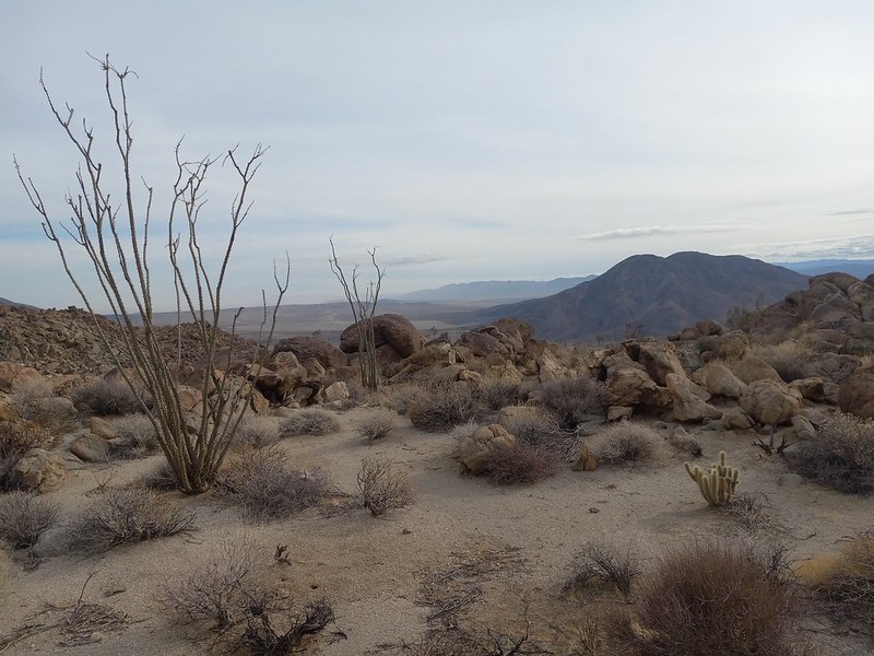
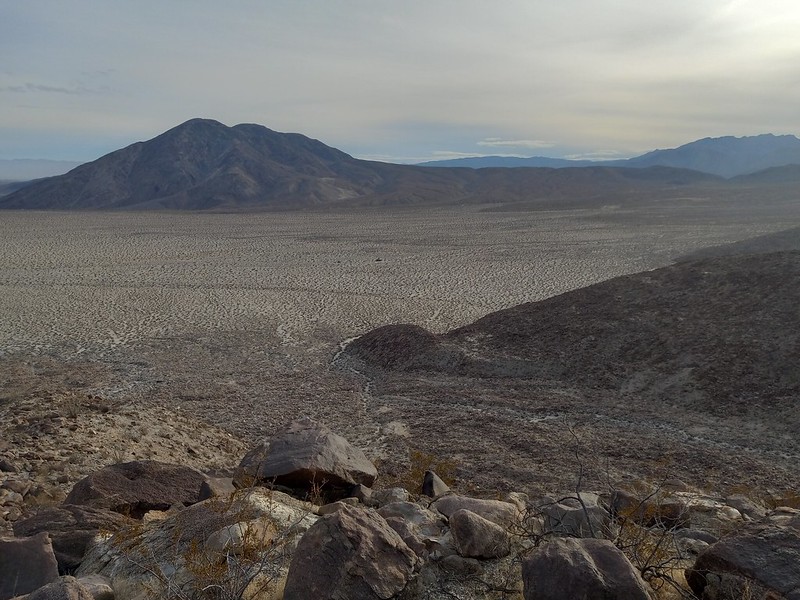
On Monday I climbed Pyramid Peak for the first time. I had tried a couple months ago via Palo Verde wash. But I lost the miner's trail a few times and generally wasn't making very good time, so I decided to leave it for another time and another route.
This time I went straight up Smoke Tree Wash, which doesn't seem like a common route (based on GPX tracks I've seen) but worked out much better for me. It had been a cold clear night of camping in Coachwhip Canyon Sunday night, but that paid off with great clear views from the peak. I just had time to get a few pics before the weather started to change with clouds rolling in.
The only obstacle going up Smoke Tree is this small easily climbed dry fall.


 |
12/23/2021
Topic:
Pyramid Peak
Brian
|
Buford wrote:
I'm surprised the miner's trail was that hard to follow. It is steep. Finding the start of it is tough out of Palo Verde, but after that it has been very easy to follow for years. Did it get washed out in a storm? I know a huge storm hit that area in March 2020 and rearranged some of the canyon bottoms. Or were you on a different mine trail? There are at least two old trails back there in Palo Verde.
It was a combination of factors. I had done Schad's Rock Tanks loop 10 years ago and remembered the miner's trail as being marked by a cairn. It wasn't there this time. Also I had downloaded a GPX track which I assumed was going to follow this trail. It took me up a dry fall and then along a canyon bottom, which wasn't terrible but was kind of slow. I didn't remember that from before, but it had been 10 years so I thought my memory was off. The track eventually converged with the real trail.
When I got home I looked on Google Earth and saw the beginning of the trail out of Palo Verde is still there just as I had remembered it, but unfortunately I wasn't on it.
In any case I decided I would prefer an approach from Smoke Tree so I wouldn't have any up hill on the return.
edited by Brian on 12/23/2021 |
12/26/2021
Topic:
Pyramid Peak
Brian
|
tekewin wrote:
Nice! Smoke Tree is the way I went and thought it was a good route. I got pretty far up the wash before I spotted the trail, but it was clear from there. Did you happen to swing by the rock tanks? I was just thinking they are probably holding a decent amount of water now.
I had read a trip report where someone mentioned seeing them from the ridge, so I was looking but didn't see them. That person may have been on a different ridge. I had gone up the side canyon to see them 10 years ago and didn't do that this time. |
12/27/2021
Topic:
Pyramid Peak
Brian
|
Rocko1 wrote:
Looks like a great trip Brian. Fantastic views up there. What was your mileage and elevation gain/loss?
edited by Rocko1 on 12/27/2021
10 miles round trip / 2600'
 |
1/5/2022
Topic:
Jacumba hikers calendar
Brian
|
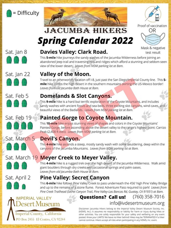
Latest calendar of hikes.
 |
1/13/2022
Topic:
2022
Brian
|
Very nice pics. I always love seeing your shots of the ramp. |
1/17/2022
Topic:
Rockhouse / Clark Valley loop
Brian
|
This is a repeat of the loop I did last year when I ran into Darren and Gary (with a slight variation this time as I went down a different ridge). On last year's trip I felt like I was rushing through it since it was a hot day and I was worried about my water supply. This time I tried to plan in a way that would give me more time to explore. I didn't find much in the way of native artifacts and the problem this time wasn't with the logistics of the trip but rather my personality. I find it hard to linger in an area and look around when I'm not sure what I'm looking for. I have a drive to always be moving forward.
So this turned into a different kind of trip. At 1 PM I found myself on a nice plateau where I has planned to camp, and I had my tent, food and plenty of water. And I couldn't bring myself to stop, knowing that I had enough daylight to complete the loop that day.
The final descent was a one mile stretch that took me 2 hours. It ended up being a 10 hour / 15 mile hike with no breaks. This ended up being a different type of day than I had planned, but that's one of the things I find interesting about going to the desert. I often find something different than what I was looking for.


 |
1/18/2022
Topic:
Rockhouse / Clark Valley loop
Brian
|
Rocko1, that area in pic 6 is right at the top of the ridge spur I went down (just before dropping into the wash if you were going up). That is the reason I took that pic - there were so many spots in that area that looked perfect for camping. And since it's only a mile from the valley floor, I figured I would keep it in mind as an option for a future "easy" trip. But right after that I hit a boulder field and then it was super steep the rest of the way down. I realized it would still be a nice place to camp, but there's nothing easy about getting there. |
1/18/2022
Topic:
Rockhouse / Clark Valley loop
Brian
|
Buford wrote:
Now that looks like a fun and adventurous loop! What day did you do it? I saw footprints on Rockhouse Truck Trail this weekend near the old trail leaving Rockhouse Canyon that you took. Was the petroglyph photo one of the ones near Corp BM? I assume the loop was clockwise?
I did the loop on Sunday 8AM-6PM, and yes it was clockwise. If I did it again I would probably go counterclockwise since descending that ridge was no fun. With my limited climbing ability I figured clockwise was more of a sure bet for this time.
There were other footprints besides mine for most of the route with one exception. As I was heading down the wash toward the ridge I descended, there were mountain lion tracks but no footprints. Then when I got to the split in the wash there were lots of footprints again, evidently on the Dawn's Peak expressway.
The petroglyph wasn't one of the ones near Corp. It was near the top of the trail you mentioned coming out of Rockhouse (and thanks for confirming it's a petroglyph - I was pretty sure it was but I often see patterns in the color of rocks and on closer inspection I'm not sure). |
1/22/2022
Topic:
The Killing of Frank Fox
Brian
|
I've only been to the old stage station once. I'd like to go back some time and look for that. |
1/27/2022
Topic:
Is it just me or is there something not right?
Brian
|
Some people are "experienced" in the sense they've hiked a lot of miles on trails. That doesn't mean they know what to do in the desert when there isn't a trail. It would be easy to lose the trail on the Mortero Palms route.
Having said that, if he did start from Mortero Palms and didn't know how to get back, he could have followed the tracks around to Dos Cabezas. It would be illegal but better than being rescued. The only way someone wouldn't know to do that is if they hadn't looked at a map or done any research on the area at all before setting out. |
1/31/2022
Topic:
2022
Brian
|
Buford wrote:
Very close to Toro. Roughly ESE of the high point.
Wow, that's quite an undertaking to get to that area from Rockhouse. I've explored Alta Seca Bench from the top, but never gone up any of the ridges from the bottom. Maybe soon though! |
2/2/2022
Topic:
2022
Brian
|
Here's a pic I took from Alta Seca Bench. Is the ridge in the middle / behind the bush the same one you marked on the map?

Buford wrote:
edit -> more like this:

Both routes probably go and are close enough.
|
2/3/2022
Topic:
Spirit Jar Found
Brian
|
Nice find! I had to look up what a spirit jar is. |
2/7/2022
Topic:
Oasis Peak
Brian
|
I love seeing reports on areas that are seldom visited. How do you think the vehicle got there? Is this an area that would have had a mining road at one time? |
2/7/2022
Topic:
Whale Peak Overnight
Brian
|
Thanks for organizing this trip, Rocko1. My legs are still feeling it today. Good workout and a fun trip.


 |
2/15/2022
Topic:
Ghost Mtn, Shake BM and 3899
Brian
|
Great pics. The Marshall South cabin was one of my early trips when I started going to Anza Borrego regularly. Maybe 12 years ago now? I haven't been back since. I wonder how much it's deteriorated in the last decade. |
2/15/2022
Topic:
Ghost Mtn, Shake BM and 3899
Brian
|
Rocko1 wrote:
Not too much left.
Here's what it looked like in February, 2009

 |
2/21/2022
Topic:
Rockhouse to Santa Rosa Crest
Brian
|
I wanted to check out the old Indian trail that goes from Stifferino to the crest (it then continues to Martinez but we didn't do that part).This was a weekend trip with Rocko1. We made good time to the spring on Saturday. Rocko1 would have been able to get to the crest that afternoon, but that would have been too hard for me, so we went with plan A and tackled it Sunday morning.
On Sunday we were on the crest at 9AM and back at the Butler/Rockhouse split at 3:30 driving out. On the way out Rockhouse Canyon we ran into Sicco Rood (I didn't know it was him at the time but I figured it out later). He was there taking pictures and gave us some good information from the time he hiked the crest from Villager to Toro. I think I remember seeing pics from someone here who did a hike to Granite with him on a very windy day.
The spring had much more flow than it did when I was there in November. Still lot of bees.
Rocko1 went ultralight for this trip.

The task ahead.

Rocko1 leading the way up the ridge as the sun comes up.

The view from the top.


edited by Brian on 2/21/2022 |
2/21/2022
Topic:
Rockhouse to Santa Rosa Crest
Brian
|
Scooter wrote:
Wow, I am impressed. Did you see any signs of the old native American trail ? Great trip report. Thanks for sharing
There were definitely sections where the worn trail was obvious and occasional cairns. But it would fade in and out, so we weren't always on it.
I remember you telling me that you looked for the crossing while you were doing a traverse of the crest. I did see a couple cairns at the top that would mark the starting point for descending the ridge to Rockhouse. Didn't think to get a pic of that, unfortunately.
edited by Brian on 2/21/2022 |
2/23/2022
Topic:
Rockhouse to Santa Rosa Crest
Brian
|
rockhopper wrote:
Great trip report! Here is a 1959 map which shows the trail to Martinez creek based on 1927 data but oddly doesn't show the S.R.I.R. I have hiked up from the East a little past the Jack miller cabin several times and hiked up from the S.R.I.R. on the west up the ridge trail but never have completed the middle section but is on my list to do. :-)
Rocko1 and I were talking about doing a similar thing - doing sections of the trail a little bit at a time rather than all at once. I'd like to do a section starting in Martinez Canyon and going up to the ridge, as you have done. This last one did a number on my feet so I may have to wait until next season to do more.
Which trail are you talking about that goes up from the west? I've driven up to Toro, so I know about the road and the Sawmill trail, but it sounds like you're talking about something else? We were wondering whether the reservation ever gives hikers permission to pass through. |
2/23/2022
Topic:
Rockhouse to Santa Rosa Crest
Brian
|
rockhopper wrote:
From the S.R.I.R side which is the same trail as you did. The reservation has no trespassing signs, so I've never gone in through that way. I have come down heading south from near the old cabin west of Toro peak (Burned down) down into the sawmill valley. The "other sawmill". But I like your idea of doing sections at a time. I am hoping to get out to Martinez canyon. Base camp near Jack Miller cabin and do a day trip up and back from the east side to complete the trail.
The only historic maps I have are the ones on CalTopo and they're at a different scale than the one you posted, but I think I understand now the route from the west that you're talking about. I was looking at that on Google Earth one time, trying to decide if it's feasible but I'd never heard of anyone doing it. Nice to know it's possible!
As for the route up from the Jack Miller Cabin, it sounds like you want to do the same section that I do. I misunderstood what you wrote before and thought that was one of the parts you already did. If you'd like a hiking partner for that I'd be interested. But at this point I don't have a good feel for how long it will be until my feet can handle a serious hike. Last time I had foot pain like this it took several months to resolve. |
2/24/2022
Topic:
Snow
Brian
|
I checked out the Toro webcam but the view toward Rockhouse that I really wanted to see looked like the lens got covered with snow. |
3/18/2022
Topic:
Coyote Mountain
Brian
|
I love that first pic. But the clear skies make me think it was cold AF. |
3/18/2022
Topic:
Road conditions Jasper Trail to Wilson Pk Trl Head
Brian
|
I did that last September. Of course, the conditions of desert roads can change even in a few months, but it was fine then and my guess would be that it still is. I entered on the Jasper trail. I didn't go quite all the way to the trailhead. I turned off at one of the camping spots before that. But if my memory from previous trips is correct I think it actually gets better between there and the trailhead. There's a lengthwise rut along the top of the hill (the part I did drive), but it's easy enough to steer around. I'm also in a Crosstrek. |
3/21/2022
Topic:
Pinyons and Wreckage
Brian
|
Great trip. I know there are plane wrecks in a few different areas of Anza Borrego, but I've never come across any myself. One wreck is near Ghost Mountain and I've read about another one above Mine Wash. |
3/22/2022
Topic:
Jacumba hikers calendar
Brian
|
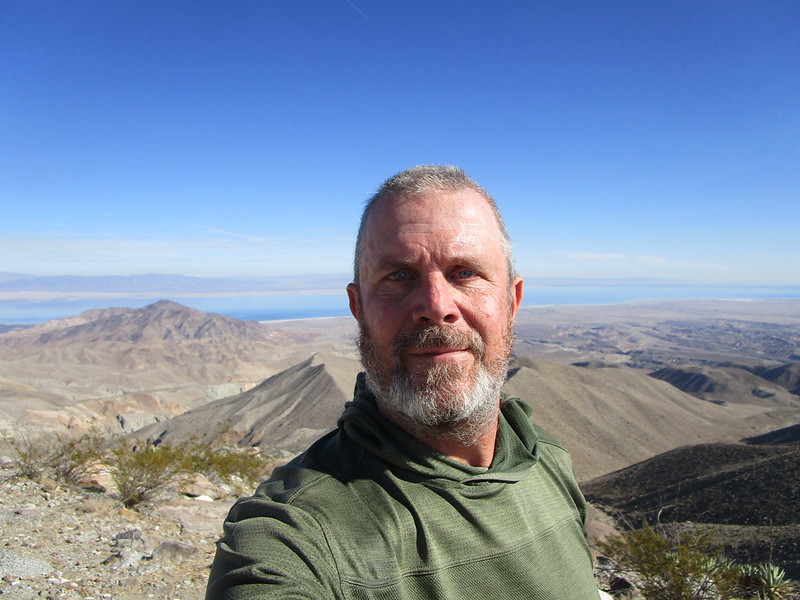
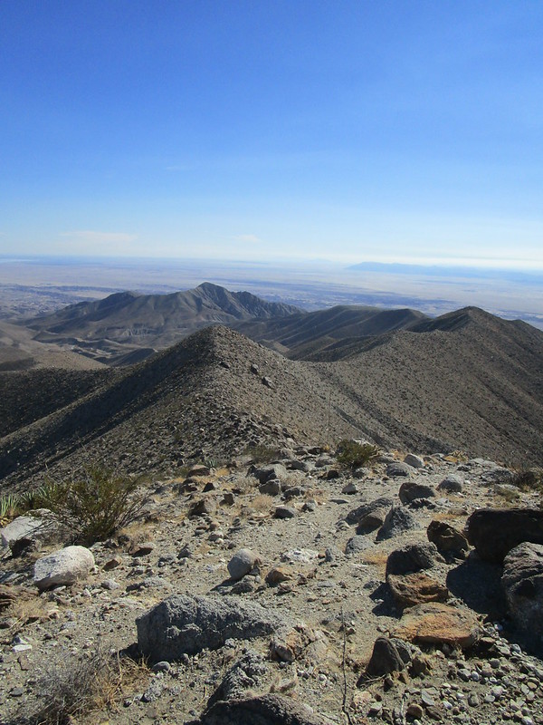
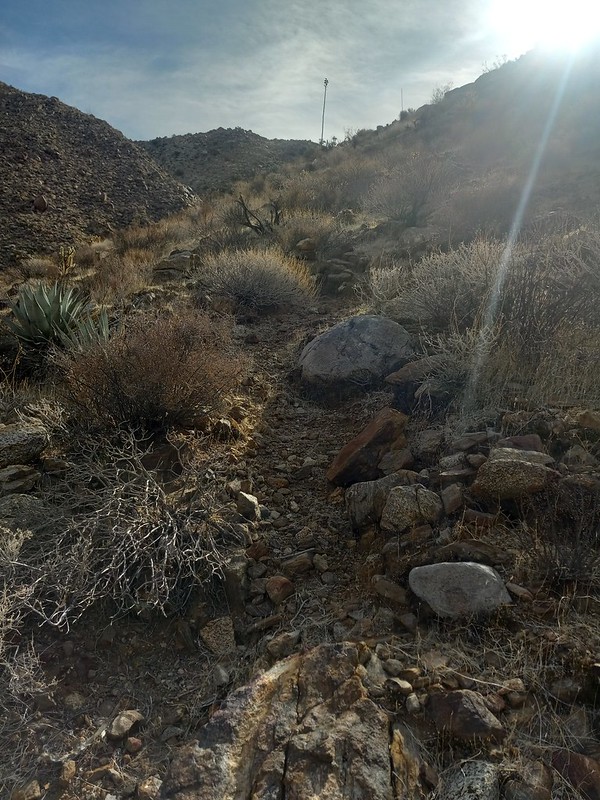
On Saturday I did a hike with the Jacumba Hikers in Myer Valley
This initial section of bouldering was steep but quicker than Schad's route, which I had done previously

crossing Myer Valley

picking up the BP road that goes toward Pinto

we went to the head of Pinto, then turned around. This ended up being an 8.5 mile loop

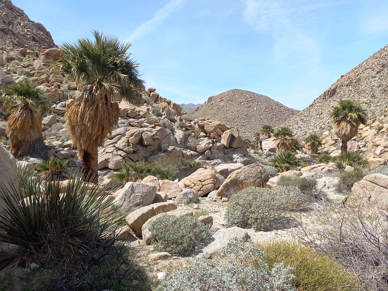
palm oasis in Boulder Creek on the return

crossing under I-8
 |
3/23/2022
Topic:
Jacumba hikers calendar
Brian
|
I think I remember seeing a trip report that mentioned water further down in Pinto near the petroglyphs. But I'm not certain enough about that to rely on it. |
3/29/2022
Topic:
Impossible railroad trip
Brian
|
I want to go back and finish the route from Mortero Palms some time. I've been to the point where there's a dry fall overlooking the trestle but I was afraid to downclimb it. But I know that groups of all skill levels have done it, so it must not be that hard. I would have felt better if I was with someone who had done it before and knew the best approach. |
4/1/2022
Topic:
Dawns Peak Day Hike
Brian
|
Well done and great pics. On a loop trip I did earlier this season, I descended that ridge spur that you took up from Clark Valley. Even that part is no joke! And I was imagining what it must be like to deal with that at the end of the day when you've already tackled Dawn's and just want to be done. |
4/6/2022
Topic:
Back to Whale
Brian
|
Yeah, you really packed a lot of exploration into one day. You really need to start checking out the other side (Harper and Hapaha flats). |
4/6/2022
Topic:
Back to Whale
Brian
|
Rocko1 wrote:
Yes, that is the plan. Access is an issue as it's tougher/maybe impossible to get my vehicle to get to that side. I'd like to check out the Fish Creek drainage and east of that.
Here's the starting point I would suggest: 33°04'41"N 116°17'16"W
Your Rav4 could easily make it there. The road is sandy but not rocky. From there I've done a dayhike to Split Rock in Hapaha flat, so I know it easily gets you into the area you're looking at. |
4/7/2022
Topic:
Back to Whale
Brian
|
Rocko1 wrote:
Oh nice. The furthest I have gone up there is 33.111949, -116.315743.
Do you think it's any worse than that sandy section of Rockhouse Canyon Rd?
It's been a while since I've driven that road, but I did it quite a few times before my car had skid plates or A/T tires and I never remember scraping in the sand. So I'm going to say slightly better than Rockhouse for sand and much less rocks. If you've driven to the end of Nolina it's similar. One thing about these alluvial fans is you're going uphill the whole time on the way in, so if you can make it in, you can make it out. |
4/7/2022
Topic:
Martinez and Agua Alta 3 Day backpack
Brian
|
That's impressive GE research as well as impressive hiking. I've done the top part of the Cactus Spring trail as far as Cactus Spring and I've done Martinez to the Miller Cabin and back, but never that section that connects them. I have a few questions.
How was the section with the reeds in Martinez? That really slowed me down on the way up but was quicker on the return when I had figured out the best way to get through. But I could imagine it being a problem if the growth got any thicker.
The dry spring you mentioned with the cat's claw and seasonal camp - is that Agua Alta spring?
When you encountered the 20' dry fall, is that along the route that would be marked on a map as the trail, or were you off trail there?
edited by Brian on 4/7/2022 |
4/8/2022
Topic:
Martinez and Agua Alta 3 Day backpack
Brian
|
rockhopper wrote:
Brian,
The vegetation is rapidly changing from year to year. Martinez up to Millers rock house is pretty straight forward. The vegetation past millers cabin really get thick heading towards the falls. What section are you mentioning?
That dry spring is not Agua Alta. Just a unnamed spring in the lower canyon. Agua Alta is up on the cactus spring trail at elev. 4300 ft.
The trail is a combination of following the creek bottom and side canyon scrambling. Dry waterfalls and cats claw forces you out of the canyon bottom. I will give the first person a bottle of my finest booze if someone takes a flame thrower to the invading cats claw taking over sections of the canyon bottom. I did find some faint trail sections along the canyon walls.
Thanks you for the answers. The spot where I had problems was a choke point in Martinez Canyon where the only way I could get through was to squeeze between the reeds and a rock wall on the right. I'm not entirely sure, but it may have been here: 33°29'51"N 116°17'06"W
edited by Brian on 4/8/2022 |
4/9/2022
Topic:
Martinez and Agua Alta 3 Day backpack
Brian
|
rockhopper, now that I see your route map I realize the mistake I was making. I had been thinking your base camp was at the confluence of where the Cactus Spring trail comes into Martinez. I guess that's Tahquitz Canyon. I forgot that Agua Alta Canyon comes in more toward the mouth of Martinez. So I don't think you passed the choke point I was mentioning, and my other questions were also based on the assumption you were on the other trail. |
4/18/2022
Topic:
Martinez and Agua Alta 3 Day backpack
Brian
|
rockhopper wrote:
Here are the Google Earth pictures that got me motivated to go out and check it out.
The trail. Center of picture.
I found it on GE. That would be quite the needle in a haystack to find that without the clues. Do you trace out the parts you can see on some app before you go, or do you just note the starting point and do it all from what you can see on the ground?
edited by Brian on 4/18/2022 |
4/24/2022
Topic:
The Cahuilla and the Santa Rosa Mountain Region
Brian
|
Downloaded. I'm looking forward to reading this. |
5/6/2022
Topic:
Alta Seca Bench
Brian
|
Rocko1 and I wanted to get in one more overnight trip before the desert gets too hot (this isn't quite Anza Borrego but it's adjacent). We were looking at high desert options and settled on Alta Seca Bench near Toro Peak. This was 2 weekends ago and a snow storm blew through a day before we went. We didn't set any firm destination goals because we didn't know what conditions we would find. We managed a thorough exploration of the bench despite both of us feeling the effects of the altitude (it's easy to forget that the starting point of this trip is 1000' higher than the highest peaks in Anza Borrego).
All pics courtesy of Rocko1
A good view of the bench from one of our previous trips to Rockhouse Valley.

There was still snow at the top when we arrived. It was gone by the next day.

Views of Borrego Springs, Rockhouse and Clark Valleys.


We found the top of the ridge that descends to the Cottonwoods. We're talking about a Toro to Rockhouse traverse next fall.

Conditions on the bench were much drier than at Toro.

Views to the S/E

Our campsite had great views but also wind exposure.

Sunrise from camp.
 |
5/6/2022
Topic:
2022
Brian
|
Great pics as always, Buford. I don't recognize the last one so I'm sure I've just driven past it too. |
5/10/2022
Topic:
Alta Seca Bench
Brian
|
tekewin wrote:
A very interesting trip and great photos!
Did you start on Toro or just below it?
Seems like a mostly unexplored area.
The plan was to start by the locked gate just below the summit of Toro. We encountered more ice than expected on the road near Stump Spring campground and decided to park there since there are limited places to turn around if the road got worse. Of course as it turned out we would have been totally fine driving to the end, but this worked out OK. |
5/10/2022
Topic:
Alta Seca Bench
Brian
|
Buford wrote:
I am a little surprised the road was open, they sometimes close it due to weather.
I always check this page before I go.
https://www.fs.usda.gov/recarea/sbnf/recarea/?recid=81714&fbclid=IwAR0GW9delpT-LLXErehAP2YEXkFyHbYr4U-NhM4I3wc21SgP4g3fwiL0rys
The forecast for the storm that rolled through didn't call for any accumulation (although there was some), so that's probably why they didn't bother to close it. |
5/10/2022
Topic:
Alta Seca Bench
Brian
|
Buford wrote:
How accurate is the site?
I'm not sure. One time I was driving Black Mountain in Ramona and a ranger closed the gate as I left because of an approaching rain storm. When I got home I checked the page and it was listed as closed. So I know at least some pages are up to date. I'm sure it depends on the agency, as you said. In this case Rocko1 went the extra mile and called to double check it would be open. |
5/21/2022
Topic:
2022
Brian
|
Nice pics, rockhopper. |
5/21/2022
Topic:
Camera found in Santa Rosas- Update
Brian
|
Now I want to go back to Martinez Canyon. Counting the days until it's desert season again. (I know for some it still is) |
8/16/2022
Topic:
McCain Valley
Brian
|
Great pics. I've only been to McCain Valley a couple times. I did the hike to Sombrero Peak and a bike ride to Carizo overlook. The bike ride was probably about 10 years ago. I remember there were helicopters placing the towers for the power lines at the time. I've always intended to go back and explore more but it hasn't happened yet. |
8/16/2022
Topic:
McCain Valley
Brian
|
This was November, 2011


Going through my old pics I realized I also did the Pepperwood trail at some point. Some of these trips are far enough in the past to be straining my memory. |
8/17/2022
Topic:
McCain Valley
Brian
|
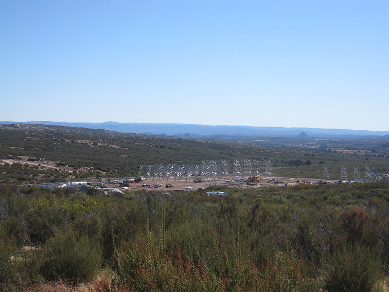
Yeah the wind turbines were there when I hiked Sombrero.
I'm not a fan of the transmission towers but thought I might as well capture the moment on camera since I was there. |
8/23/2022
Topic:
Cuyamaca
Brian
|
That reminds me of when I lived in Sausalito and did a lot of mountain biking. One time I turned onto a trail called the Bobcat Trail and there were a couple bobcats sitting right there in the middle of the trail. I thought "as advertised." |
9/9/2022
Topic:
Hi there!
Brian
|
Welcome to the site. It's a little dead here in the summer months but will pick up during the cooler season. I'm sadly not in good enough shape to tackle peak 6582 myself, but I've been in the "neighborhood." Having done a significant portion of Schad's suggested approach route, I think if I ever were to do it I'd approach from Rockhouse Canyon instead. Slightly longer but much less demanding. I know several people here have summited it from various routes, so hopefully they will chime in. |
10/30/2022
Topic:
Indianhead North Ridge
Brian
|
Great pics. S Summit doesn't look like a place I'd be comfortable (fear of heights kicking in just from your video). |
11/2/2022
Topic:
Tropical Storm Kay aftermath
Brian
|
I know hurricane Kathleen wiped out part of the line in that area in 1976. I wonder if it was the same spot. |
11/2/2022
Topic:
Pinyon Ridge and Wilson BM
Brian
|
Great trip report and pics. Definitely a lot more green than when I was there in 2016. |
11/7/2022
Topic:
Lucia and Alamo Canyon Rock House Ruins 2-3 day BP
Brian
|
Great trip report. I love hearing about areas that aren't in the books. I did Martinez Canyon one time, so I know the parking challenge in that area. |
11/8/2022
Topic:
Lucia and Alamo Canyon Rock House Ruins 2-3 day BP
Brian
|
tommy750 wrote:
Brian wrote:
Great trip report. I love hearing about areas that aren't in the books. I did Martinez Canyon one time, so I know the parking challenge in that area.
Definitely agree. Looks like someone spent the summer building a 300 acre golf course right near the mouth of Martinez Canyon. Curious.
That's wild. My version of GE is still showing an agricultural field in that spot. It doesn't look like it would affect how I went in before, from 68th and Van Buren.
edited by Brian on 11/8/2022 |
11/8/2022
Topic:
White, Wee, Chimney Rock and Pines
Brian
|
Always fun to explore a new area of the park. I haven't done anything in that area myself. Great looking trip. I remember Schad's book has a trip that descends into upper Hellhole from Pena spring. I did part of that a long time ago, but I wasn't experienced at off-trail travel then and it was a steep descent, so I didn't finish it. |
11/8/2022
Topic:
White, Wee, Chimney Rock and Pines
Brian
|
Rocko1 wrote:
Is this the Schad hike or similar? https://borregohiking.com/hiking/2019_pena_spring_hellhole_canyon.html
edited by Rocko1 on 11/8/2022
Same entry point, but Schad's hike describes going along the canyon bottom to a tributary canyon with a waterfall. It sounds like much bushwhacking is involved. I didn't get that far as I turned around at the point where he mentions you lose 800' in .2 miles. |
11/12/2022
Topic:
Happy cabins and Myer Valley
Brian
|
On Saturday, Rocko1 and I did a hike in the Jacumba Wilderness, with the goal of exploring Happy's upper and lower cabins. My understanding based on oral history passed down by the Jacumba hikers is there were a couple different guys in the Jacumba area in the early/mid 20th century with the nickname "Happy." This particular Happy had a lower elevation winter cabin and a higher elevation summer cabin. He evidently worked at Miller's Garage in Ocotillo and made the "commute" by walking down Myer Creek. The nickname was evidently the result of a facial deformity resulting from a gunshot wound that made him appear to have a permanent smile.
The lower cabin is visible from the eastbound lanes of I-8 and is easily visited by anyone hiking into the Myer Valley area. The upper/summer cabin is more remote - perched on an obscure ledge that's difficult to reach from any direction, but has a perennial water source. The perfect place for a hermit, although I'd imagine that if you arrived home and realized you'd forgotten something at the grocery store, it'd be a pisser.
It's possible to do a shortish but technical loop to visit the upper cabin (as seen on AllTrails). We extended it into Myer Valley to give Rocko1 an overview of the area since he hadn't been there before. Hopefully he will add some pics here. I was too busy trying to keep up and didn't take very many.
Rocko1 exploring what's left of the lower cabin

The remains of the upper cabin and surrounding area


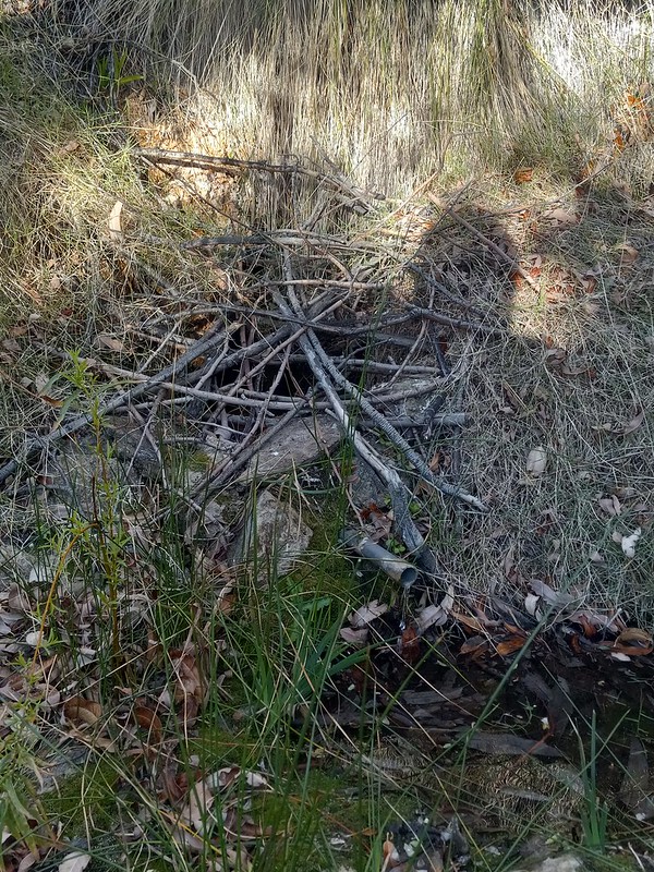
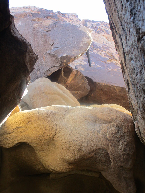
A large rock shelter we found on the way down from the ledge

A couple pics from my previous trip to the area with the Jacumba Hikers last March

 |
11/12/2022
Topic:
Happy cabins and Myer Valley
Brian
|
A couple more from another previous trip

 |
11/21/2022
Topic:
Bighorn Canyon, 3,567 Peak and Guzzlers
Brian
|
It takes real commitment to keep going when faced with that sort of terrain.
I remember reading that not everyone in park management is on the same page about whether the guzzlers should even be maintained. Some prefer a natural selection approach (IE, let the sheep die out if they can't survive without human intervention).
https://www.sandiegouniontribune.com/news/environment/story/2022-05-07/anza-borrego-bighorn-sheep
edited by Brian on 11/21/2022 |
11/30/2022
Topic:
Elephant Benchmark
Brian
|
I went to the Elephant Tree Area over 10 years ago. It was when I was still driving a Sentra. Going over a rocky section in the road, the suspension bounced and put a good sized dent in a plate under the fuel tank. It was one of many incidents that convinced me I needed a different car if I was going to keep doing the desert thing.
Always meant to go back at some point and visit Starfish Cove since it's in Schad's book, but never got around to it.
Great trip report! Looks like a fun exploration of a seldom visited place. |
12/13/2022
Topic:
Elephant Benchmark
Brian
|
That area sure seems to be a mountain lion hot spot. I remember seeing a sign warning about them in Hapaha Flat. Where would they get water around there? The closest thing I can think of would be the guzzlers by Big Horn Canyon. |
12/14/2022
Topic:
Elephant Benchmark
Brian
|
I didn't remember until after I posted that there's a guzzler at the head of June Wash on the hill above Hapaha Flat. That would be the obvious choice for that neighborhood. Funny that I forgot that one as it's the only one I've hiked to. |
12/14/2022
Topic:
Hapaha Flat Thanksgiving Weekend
Brian
|
Hapaha is a great place for sunsets.

How was the road condition going up to Hapaha from Sandstone? I've done it in my Crosstrek, but it seems like all the roads got slammed this summer and are in worse shape than normal. |
12/14/2022
Topic:
Salton Sea to Lake Cuyamaca-SDTCT
Brian
|
Impressive trip and great pics. I think it would bother me to do all that climbing out of Hellhole and then immediately give back that elevation gain going down Grapevine. I know you were looking at a shorter route that wouldn't have done that, but opted for the official route. |
12/14/2022
Topic:
Hapaha Flat Thanksgiving Weekend
Brian
|
tommy750 wrote:
Brian wrote:
How was the road condition going up to Hapaha from Sandstone? I've done it in my Crosstrek, but it seems like all the roads got slammed this summer and are in worse shape than normal.
There's always been that one 20 ft sketchy spot when you're exiting the canyon after Olla and before Hapaha. It got way better after they ran a dozer through there a few years ago but it's icky again. Had my wife get out and help me dodge boulders on the way in and heard a few too many scrapy sounds on the way out. Don't think you'd have any problems with any other location. Hope that helps!
That does help, thanks. If you're scraping with your truck I'm going to assume it isn't Subi-friendly at the moment. When I went in before I had a similar experience as you described. Made it past that section with some care going in, but on the way out dropped off a rock and hit my skid plate hard. |
12/14/2022
Topic:
Hapaha Flat Thanksgiving Weekend
Brian
|
tommy750 wrote:
Dug up a couple pics from before and after the dozer. I would say it's worse than the pre dozer pic now.
Yep, that's the spot! I remember it well. I was there in January 2020 and the condition was about like that first rocky pic. |
12/21/2022
Topic:
2022
Brian
|
First pic looks like Middle Willows? Rocko1 and I did a very wet traverse through there last year. |
12/27/2022
Topic:
Grapevine Mountain
Brian
|
I went partway up one time on Schad's route, which starts from the other side in Grapevine canyon. It starts by going up a dry fall, which isn't too difficult when you figure out the route. Then it went up a hillside that as I recall was a bed of loose rocks interspersed with cactus. That part kicked my ass and when I topped out on the ridge and saw Grapevine one ridge over, I decided not to continue.
That was a few years ago before I was used to that sort of terrain. I like to think I'd do better now. |
12/30/2022
Topic:
Stone Circle
Brian
|
Nice pics. Glad to hear your rig is back up and running. You probably have a backlog of places to explore! |
1/9/2023
Topic:
first desert weekend of 2023
Brian
|
I usually like to spend New Years eve in Anza Borrego, but the weather wasn't cooperating this year so I did it a week later. Friday night I was camped in Jojoba Wash and hiked over to see the Piepkorn Slot. It looks like quite the technical challenge to drive through. I'd love to see someone do it.
Memorial is still there.

Saturday I hiked to Carrizo Peak with the Jacumba Hikers. I was too focused on trying to keep up with them to take many pics (besides I've been there before) and the ones I took from the peak didn't turn out good. I like the fact that you can see the Carrizo Impact Area from up there and the Butterfield Stage route between the Coyote and Fish Creek mountains.
The badlands and Carrizo Creek

Looking NE toward the Salton Sea

After another night of camping I hiked to the pictographs in Carrizo Canyon. S Carrizo Creek road was in better shape than I was expecting, but being in a Subaru I still only drove about half way, which made for a 6 mile round trip hike.


 |
1/10/2023
Topic:
first desert weekend of 2023
Brian
|
Britain wrote:
LOL we were at the slot for a visit about a month ago. Wife chuckled at the 20 peso note.
Do you drive through when you go? The dropoff that comes after that looked pretty sketchy. |
1/10/2023
Topic:
first desert weekend of 2023
Brian
|
Rocko1 wrote:
Very cool. Have those pictographs been touched up at some point?
I've read that they have been, so I'm sure the darker ones are touched up. There were also a lot of fainter ones I wasn't as sure about (middle pic for example). |
1/10/2023
Topic:
first desert weekend of 2023
Brian
|
Buford wrote:
The UT just had an article that featured the Carrizo Gorge Pictos.
I saw that article. They were talking about how the train would disturb the serenity of the "Solstice Cave" (pretty sure they meant the Blue Sun Cave since the Solstice Cave is nowhere near the tracks) and then had a picture of the Carrizo pictos which is neither of those things. |
1/10/2023
Topic:
2023 ABDSP and surrounding areas
Brian
|
"6582 just after dawn"
I see what you did there. |
1/23/2023
Topic:
Hi there!
Brian
|
Brian wrote:
I'm sadly not in good enough shape to tackle peak 6582 myself
It turns out I was wrong about that, because Rocko1 and I just did it. We used the Rockhouse Canyon route. |
1/27/2023
Topic:
6582
Brian
|
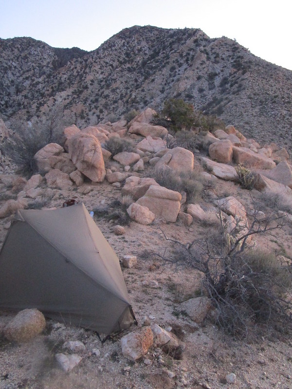
Last year I was doing a hike of the plateaus above Clark Lake and I descended the ridge that Schad recommends as an approach for a hike to Dawn's. The whole way down that steep ridge, I kept thinking "this is the last thing I'd want to be doing after summiting Dawn's." After some good advice from Sicco Rood, I decided the Rockhouse Canyon approach would be viable for me. I knew I could make it to a base camp at the base of the ridge. I wasn't fully convinced of my ability to make it up that final ridge until I was actually up there. Rocko1 improved on my game plan by coming up with a base camp part way up the ridge, meaning we would "only" have to climb 2000' on the morning of day 2. That helped a lot.
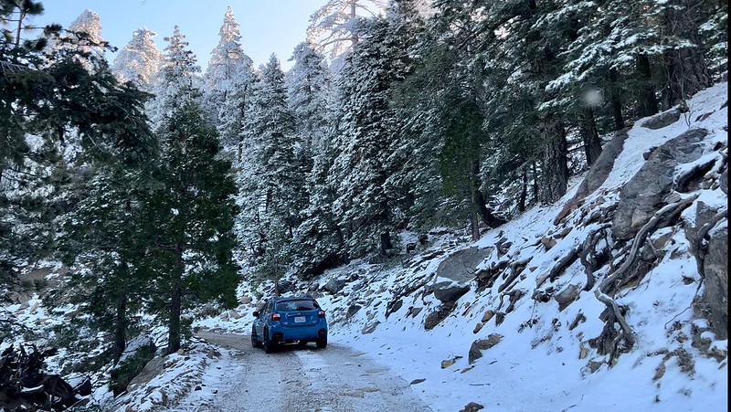
Pre-dawn view of a snowy Toro as seen from base camp. We had originally planned this trip for the previous weekend, but delayed it due to weather. Good call!

Our accommodations.

Climbing (I can't get any pics of Rocko1 climbing since he's always ahead).


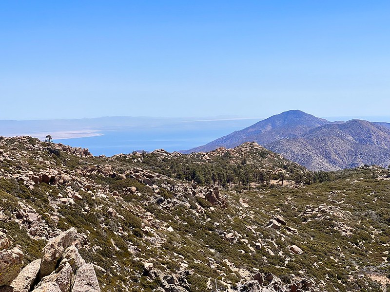
The views.


edited by Brian on 1/27/2023 |
1/28/2023
Topic:
6582
Brian
|
Thanks Scooter, nice to see you here again. |
1/28/2023
Topic:
6582
Brian
|
Buford wrote:
Nice. Going up the gentler Rockhouse approach must take some of the sting out of that final climb. Still, no way it is easy. Is Rockhouse longer mileage wise?
Was the register there? It was in 2019 when I did 6582, but the recent report from Tekewin indicates it disappeared.
I think the mileage would be about the same as the traditional route IF one's vehicle could make it to the road end (which is pretty screwed up right now - we didn't see any evidence of recent tire tracks for about the last 1.5 miles). Since I parked in my usual spot at the Rockhouse/Butler split, our route was 6 miles longer than the traditional route (but those extra miles are essentially road walking).
We didn't find any register. We might have spent more time looking if not for the persistent blasts of cold wind that were encouraging us to get on our way. |
1/31/2023
Topic:
6582
Brian
|
I forgot about that unfortunate former resident of the Hidden Springs metropolitan area. |
2/5/2023
Topic:
6582
Brian
|
Buford wrote:
I have always been able to get my vehicle to the end of the Rockhouse Truck Trail even when it is in bad condition. However, it is not any quicker than walking.
I remember seeing your truck parked at the end one time last year when it turned out we were both exploring different areas that started from there.
The weird thing about the last section of road now is that there are spots where I can't tell where the road is supposed to be (along with spots where I know it used to be somewhere else but now has a new route). |
2/5/2023
Topic:
Any flowers or blooms showing in Anza Borrego yet?
Brian
|
surfponto wrote:
Did a quick write up
https://www.anzaborrego.net/2023/02/03/winter-wildflower-search-in-anza-borrego/
Pardon the grammar 😫
I love that "ocotillo illuminated by my bonfire" shot in the write up. |
2/7/2023
Topic:
White Whale/Pinyon
Brian
|
I've never gone up Pinyon. That's a nice view of the northern part of the park.
I love driving along S-2 when the Lagunas have snow. Makes a nice contrast with the desert. |
2/14/2023
Topic:
Haystack Mountain
Brian
|
Man, there's so much to explore in the Santa Rosas. I've only done a little bit on the east and north sides (basically both ends of the Cactus Spring Trail). I have a nice map of the Santa Rosa and San Jacinto Mountains National Monument that I got at the visitor center at the bottom of the Pines to Palms HWY. Every time I look at that map, I just see lots of places I want to explore. |
2/22/2023
Topic:
Indian Canyon
Brian
|
On Sunday of President's day weekend, I drove into Collins Valley. Turns out a lot of other people had the same idea! I've never seen so much traffic on Coyote Canyon Road. When I was driving out Monday, I waited at first crossing while 11 cars passed on their way in. Luckily most people didn't go beyond second crossing, but a lot of people did stop there and hang out. Unfortunately that meant I had an audience of onlookers as I negotiated my Crosstrek through the water crossing. But that went fine and boulder alley was in the best shape I've ever seen it (although I had to deal with oncoming traffic in the middle of it both on the way in and the way out).
My knees haven't quite recovered from the Dawn's Peak hike, so I didn't do much hiking but I did explore Indian Canyon to get a feel for what I could do on a future trip. On Sunday night I found a nice camp site far away from the mob who were at Sheep Camp. All I heard was the sound of frogs in the stream below.


I had been looking at an old native trail on a map that climbs a ridge out of the canyon, but it became apparent that just getting to the base of the ridge was going to involve a lot of bushwhacking. This is what the canyon looked like just past the split with Bennis Bowl.

Monday morning I started up a ridge that had a gentle slope, good footing and great views. Some time I'd like to return and continue all the way up to Palm Mesa.

My final stop of the weekend was a brief detour into the bottom of Cougar Canyon. I had explored this before, but it was 10 years ago. I had a very interesting encounter with a group (possibly Japanese tourists?) who had rappelled down the canyon and were on their way out that morning. They were telling me how cold it had been that night, which confused me because I think it was probably mid-40s. Then they mentioned "but we found a cave to stay in, so we survived." It was then I realized they hadn't brought any tents or sleeping bags. They had intended to do the whole thing the day before, but it took longer than expected. They had horror stories about how it had taken all day just to go a mile and their parting words were "don't rappel, it's no fun."
Naturally I was curious how they got to the head of the canyon (the only way I know would be through the Los Coyotes reservation). They told me about a wiki page that has the route and it turned out I had a pic of the approach they would have taken. They would have climbed the wall up to the notch in the center/top of this pic.

Here's the wiki page with the route:
http://ropewiki.com/Cougar_Canyon_(Anza_Borrego_Desert) |
2/22/2023
Topic:
Indian Canyon
Brian
|
Scooter wrote:
on Friday did Schad's route from Box Canyon over to Hidden Springs. Have never done this before. Really cool to follow the old Native American trail that is still in great shape.
I've done that route in 2 halves. The first half was going from Box canyon up to one of the playas where I camped. I remember that one very well because I went up on the day the state shut down for the pandemic. There's hardly a more isolated place to camp so it was a nice spot to get away from the craziness, but I didn't know what I would find when I went back down. Then last year Rocko1 and I went up to the playas from the Butler Canyon side so that I could see the rest of the route.
Scooter wrote:
Wish the bypass road was not as well maintained. A lot more traffic up there.
I have mixed feelings. It's nice when I can drive in with my Subaru rather than the long road walk hiking in. But it certainly does increase the traffic. If the last few years are any indication, it won't take long for boulder alley to be back in a condition that isn't driveable for a car like mine, so I guees everyone gets a bit of what they want at different times. |
2/23/2023
Topic:
Indian Canyon
Brian
|
Rocko1 wrote:
Cool trip. Looks like you had decent weather as well. How deep did the water come up on your Sub?
It was great weather. Got a few sprinkles while I was setting up my tent, then it stopped.
Hard to say about the water level. I didn't see any evidence of water on the trim below the doors. I spent a lot of time watching other cars drive through and even took my shoes off and waded around to find any deep spots. At second crossing I favored the left side going in and at third crossing I favored the right. I think that avoided some spots where I saw other vehicles sink in more. |
2/24/2023
Topic:
Indian Canyon
Brian
|
rockhopper wrote:
Nice adventure Brian. I like the story of the Japanize tourists. Los Coyote reservation access has jeep trails heading toward the direction Coyote canyon. We went to hike up to Hot Springs Mountain. San Diego's counties highest peak. Later we drove and hiked east to some great overlooks into Sheep / Coyote canyon. Looked like it would be a tough scramble down.
I've also hiked to Hot Springs MTN. Unfortunately, some time in the past few years the reservation gated off the road just past the campground and it's now their policy that Hot Springs MTN is the only hike that's allowed on the reservation (for non-residents anyway). There are a number of interesting hikes that could leave from there that I know about now and I wish I had done before that restriction was put in place. |
3/15/2023
Topic:
Bisnaga Alta to Near Whale Peak
Brian
|
That's an ambitious route for a dayhike. I love seeing reports of routes that are rarely visited. Nice to know there are a few of those left. |
3/29/2023
Topic:
Cacti are blooming in southern Anza Borrego
Brian
|
Nice! I don't think I've been to Indian Gorge at all this season. Or Fish Creek for that matter. Sometimes I get caught up in certain areas of the park and neglect others. |
4/30/2023
Topic:
oldBayHiker
Brian
|
Welcome! I also live in Chula Vista and I also started out with local and mountain hikes. I did a similar expansion to the desert starting in 2009. At first I got ideas from Jerry Schad's book and more recently from here. And somewhere along the way, I realized that 4WD (or at least AWD) is a must. I have a Subaru Crosstrek, which mostly gets me where I want to go, or close enough to walk. |
4/30/2023
Topic:
June Wash Camping/Diablo Hike (April 2023)
Brian
|
I used to go to June Wash a lot. I used Schad's route to access Sandstone Canyon from there. It was before I had a car with AWD, so I couldn't drive to Sandstone from the usual route through Fish Creek. It's been a few years now since I've been to June Wash, but it sounds like more people know about it now. I never remember seeing people camping there when I used to go. |
8/5/2023
Topic:
The Santa Rosas Sawmill Trail (Sort Of)
Brian
|
tommy750 wrote:
This interesting video showed up in my youtube feed about Desert Steve Ragsdale and I thought I'd pass it on. Wasn't aware he founded Desert Center before retiring to the Santa Rosas. Enjoy: https://youtu.be/XqGNFJRAtwg
Great video, thanks. Too bad they didn't show more of Santa Rosa MTN, but I guess that wasn't the topic of the video. |
11/16/2023
Topic:
Indian Valley Weekend
Brian
|
Glad to see that finally got posted. I was the other one on the trip but couldn't get the trip report posted before I went out of town. |
11/26/2023
Topic:
some pics from Wednesday
Brian
|
dsefcik wrote:
Here is the route we took down:

I always meant to revisit this and try this alternate route (for 2.5 years now I guess? Time flies). I finally did it. I figured this would be one of the few places in Anza Borrego that wouldn't have a crowd on a Thanksgiving weekend. I did the route in reverse, climbing from the parking area to BM Sarg, then working my way over to the ridge that people use as an approach to Dawn's and I descended that to Clark Valley. 9 mile loop / 9 hours hiking / endless rock hopping.
I'm happy to report that Rockhouse Road is still passable in a Subaru as far as the Butler junction. I was expecting much worse considering that Hillary apparently wiped out a good chunk of Coyote Canyon Road. |
12/17/2023
Topic:
Sad News about Anza Borrego
Brian
|
I've been following this story on various Anza Borrego facebook groups. I've seen reports that the bypass road is in such bad shape at this point that the park will need permits from the state for the level of work that will be required to make it passable. I have no way of knowing if that's coming from a reliable source or just rumor. But it does give me some hope that the situation could change if/when the road is repaired, which I hope the park intends to do.
As for Nicolais and Rockhouse valley, I was under the impression that this is BLM land once you enter Riverside county at the dry fall.
edited by Brian on 12/17/2023 |
12/29/2023
Topic:
Indian Gorge Campout
Brian
|
First weekend in November? The Subaru you saw parked at the end was mine! Rocko1 and myself were climbing Sombrero. I think we saw your campsite with the red popup too. We were camped nearby. |
1/6/2024
Topic:
Indian Gorge Campout
Brian
|
surfponto wrote:
Great trip report. Love that area
Brian is your Subaru lifted with bigger tires?
No, I have skid plates and Falken Wildpeak A/T tires, but other than that it's a stock Crosstrek. I've been in some situations where a lift would definitely help, but in the case of Indian Gorge the main issue was the soft sand. My car does great in that. |
1/16/2024
Topic:
Sandstone Canyon question
Brian
|
10 years ago (May 7, 2014 to be exact) I was hiking in Sandstone Canyon and saw some pictographs. I photographed them but didn't get a GPS waypoint. They were in the main canyon in an obvious location, so I figured it must be a well known site like the ones near Blair Valley. I thought I would be able to easily find them again on future visits.
I have been back several times and have never seen them again. Also, as I've become more knowledgeable about Anza Borrego, I realize that I've never seen anyone mention pictographs in this location. I wonder whether these were modern fakes and/or whether they have disappeared due to weather or a collapse.
I have photos from the canyon that I took that day both before and after the photos of the pictographs. By using the timestamps and identifiable features of these other photos, I may be able to narrow down the location on a future trip. In the mean time, I thought I would post my pics here to see if anyone knows anything about these.

 |