8/27/2012
Topic:
The Destruction of Ocotillo Ca
tommy750
|
dsefcik wrote:
If you want to see the day-to-day destruction from the eyes of an Ocotillo resident take a look at this site where he uploads daily photos.
http://saveocotillo.picturepush.com/album/225256/p-OWEF-08252012.html
It is heart wrenching to anyone that loves the desert.
Just looked at the album. Those things are huge. Have walked around the ones near Golden Acorn and I agree with Rockhopper these are supersized. Now, we can see The Great Wall and these from the ISS! Tom |
9/11/2012
Topic:
Plane Crash
tommy750
|
anutami wrote:
http://m.nbcsandiego.com/nbcsandiego/pm_107837/contentdetail.htm?contentguid=4esmMo2Z&rwthr=0
For those not aware, check the link
Second San Diego doctor I know of to die out there in a plane crash. Leon Thal, a world renown Alzheimer's Disease researcher at UCSD died in early 2007 about 8 miles SW of Borrego Springs. Sad to hear about this guy. |
9/16/2012
Topic:
After The Rains
tommy750
|
DesertWRX wrote:
We've had 3 pretty big storms out here this summer. Each time the flood waters change the washes where the trails are. So, if you want to have some fun bring your 4WD out and try to figure where you are! Some areas are washed out, some are very sandy, and some washes are super wide, it's all great! Some signs remain to keep you from getting into areas that you don't want to go into. A simple trip up to Fonts in your mini van or rental car is a thing of the past. When nature removes or hardens the sand then they can still get up there and who knows how long that will take. Plus someone can make a lot of money pulling tourists out of Fonts Wash!
You're right on. Took a drive out to Yuha Desert 8-24-12 and barely could tell if I was on the road or off. Here's a few pics before and after the flash flood at the Sandstone Canyon Collapse. One is from 11-7-10 and the others from 8-12-12. Notice where the large boulder is when compared to the little sagebrush hanging on the wall on the right side of the pics. One of the night shots is a composite and not exactly the same view but I think it shows what happened. Tom
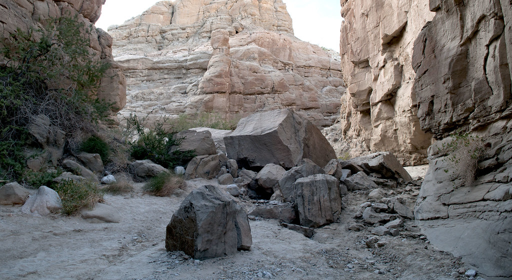
Before Sandstone Flashflood by tomteske, on Flickr

Sandstone Canyon Flash Flood by tomteske, on Flickr
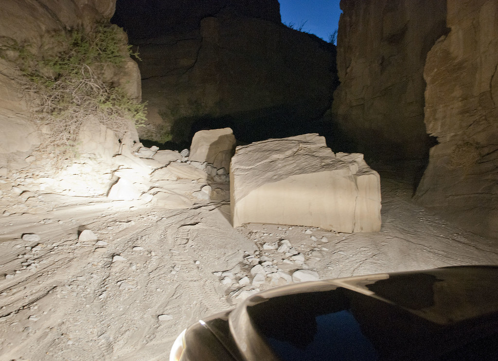
Sandstone Canyon Flash Flood2 by tomteske, on Flickr |
9/16/2012
Topic:
Short McCain Valley Trip
tommy750
|
Still a little hot in the Colorado Desert so took a quick trip out to McCain Valley yesterday. Was only about 84 degrees with a nice breeze.
This guy was sunning himself on the side of the road and didn't move till I tried to get out of the truck for close ups. Best I can tell, it's a Coast Patch-nose Snake. First one I've seen.
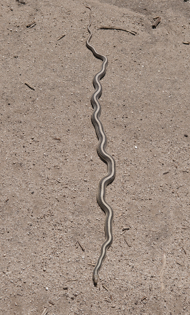
Coast Patch-nose Snake by tomteske, on Flickr
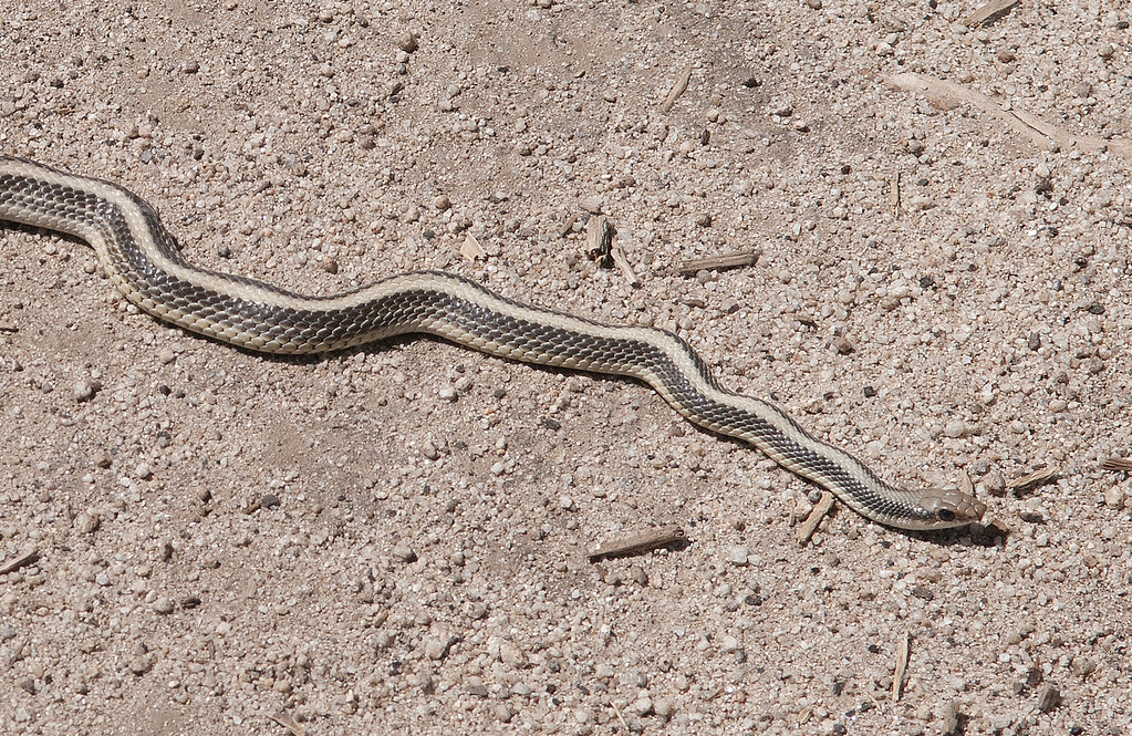
Coast Patch-nose Snake2 by tomteske, on Flickr
Was walking on Lost Valley Road and nearly bumped into this guy when I came over a slight rise. He was a little more scared than me and took off. Amazing how its coat blends into the grass on the third pic.
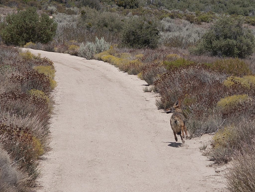
Coyote on Lost Valley Rd2 by tomteske, on Flickr
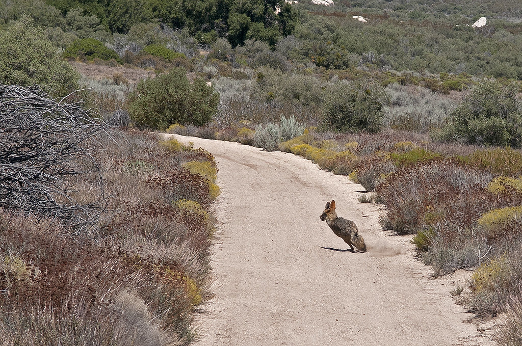
Coyote on Lost Valley Rd by tomteske, on Flickr
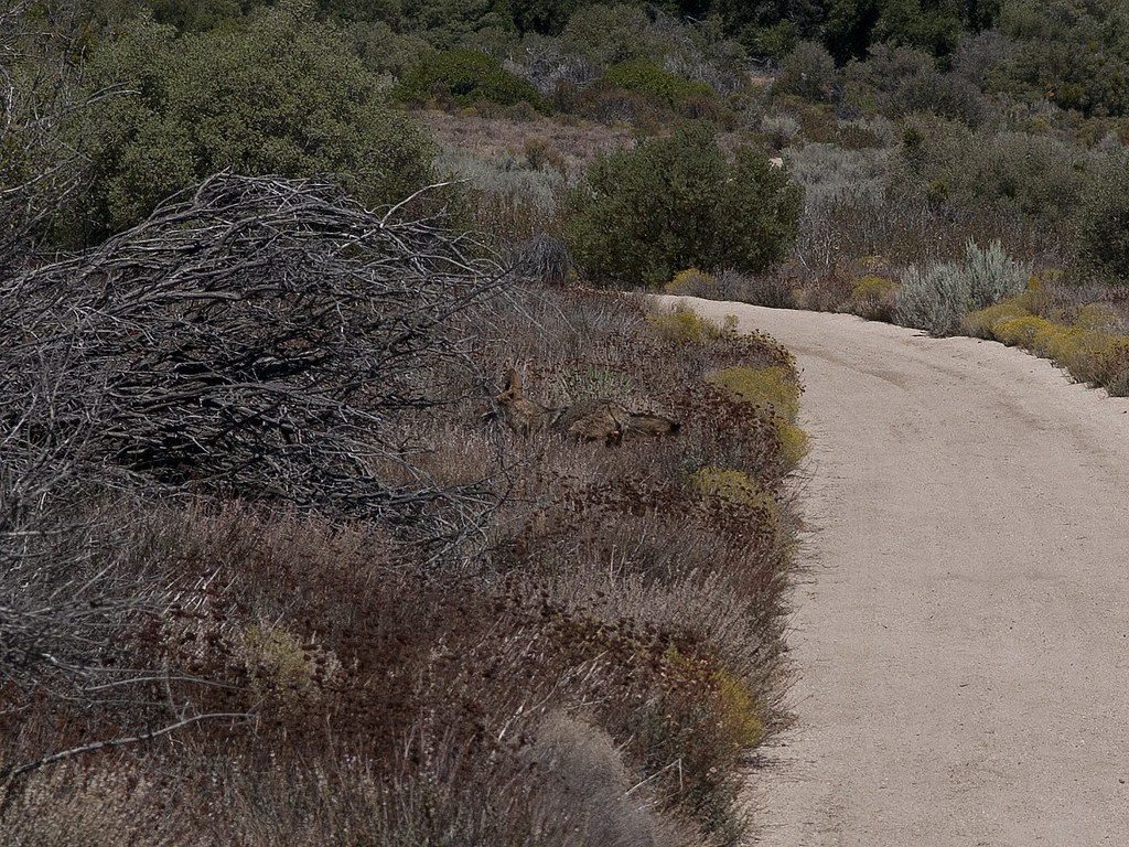
Blending In by tomteske, on Flickr
This probably means a spring is nearby so I thought I'd try and find it.

Lost Valley Rd Spring by tomteske, on Flickr
Farther up, was surprised to find it not dried up.
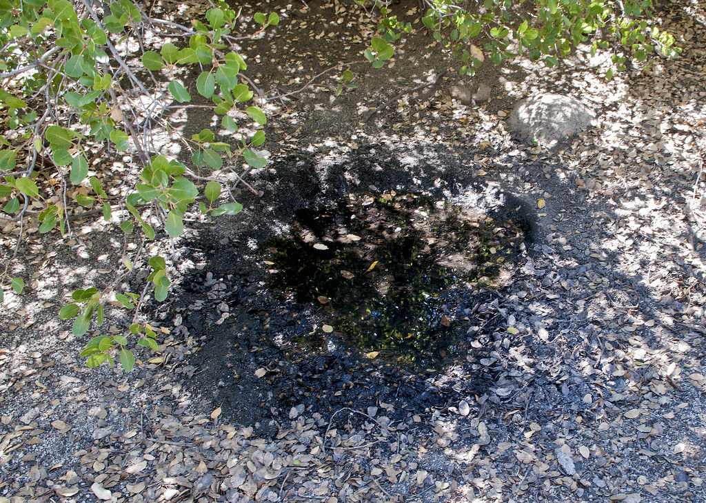
Lost Valley Rd Spring2 by tomteske, on Flickr
Must have been a villiage nearby since the ground was covered with hundreds of pottery sherds.
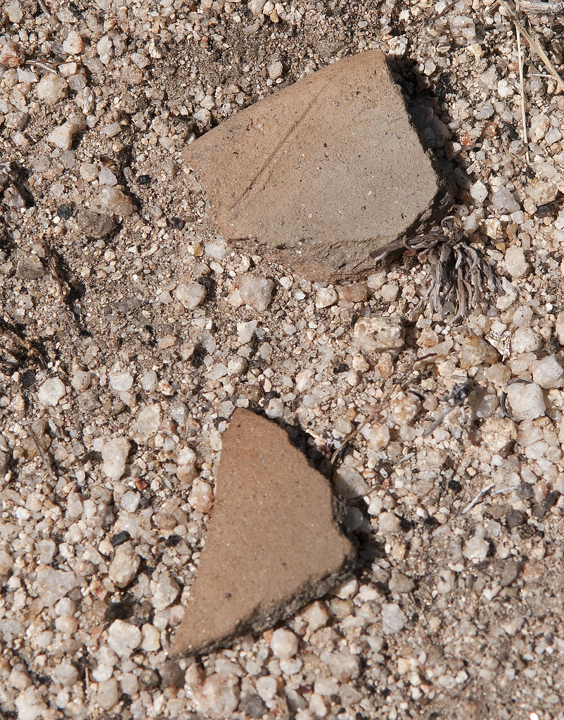
Lost Valley Rd Pottery Sherds by tomteske, on Flickr
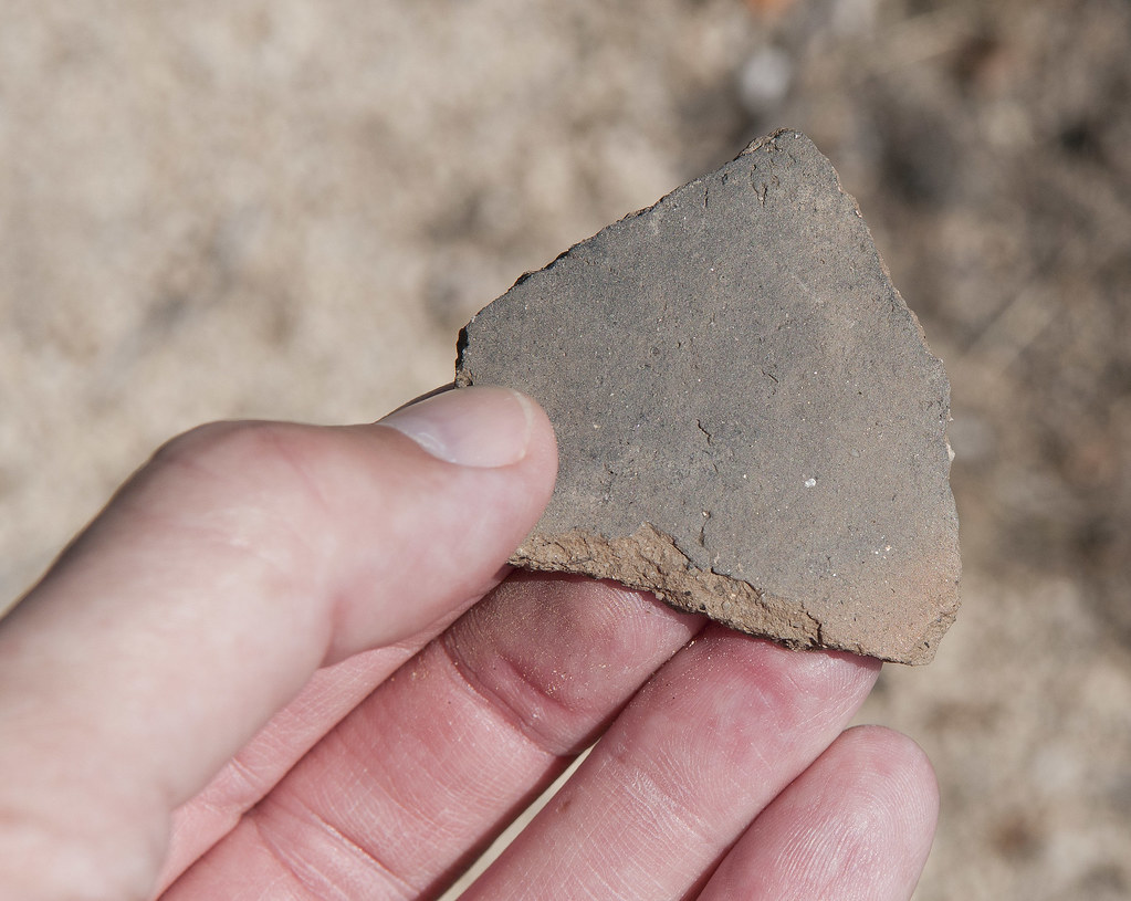
Lost Valley Rd Sherd by tomteske, on Flickr
Drove up to the old Lost Valley Airway Beacon site. The tower has been taken down and these are the remains of the generator shack. They were to guide pilots into S.D. from the east before radio navigation. Remains are still found at the base of Mt. Tule and near Coyote Wells among other places. Volcan Mt apparently has the only remaining tower.
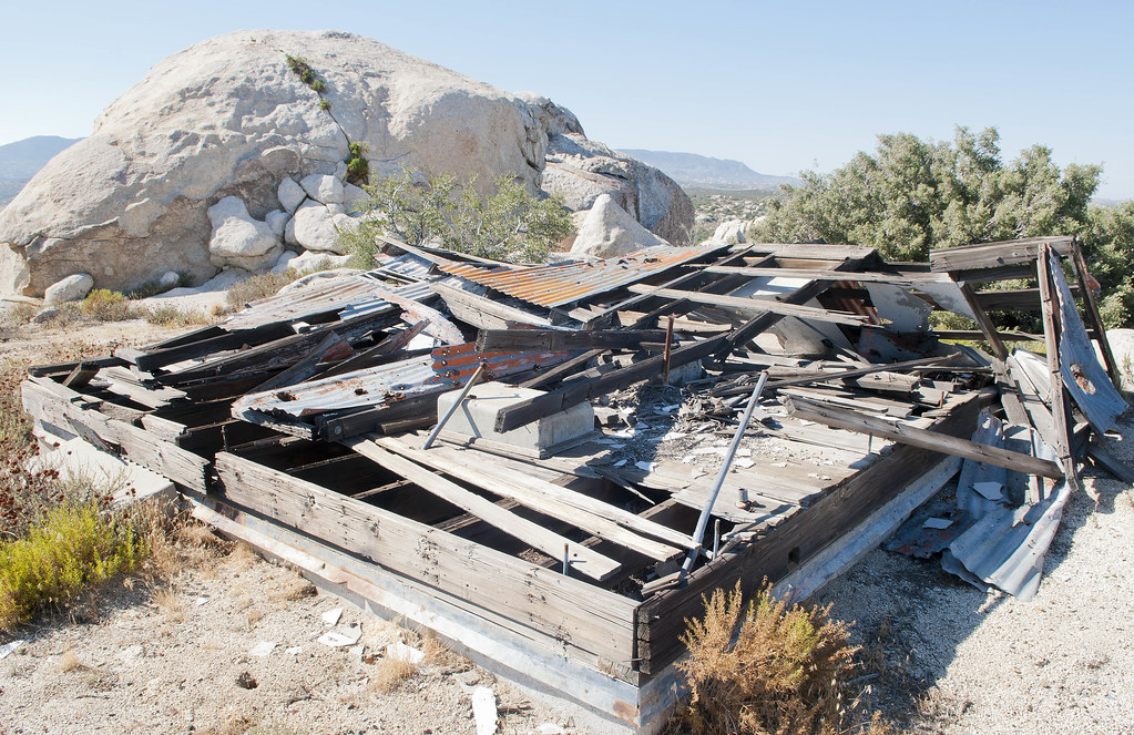
Airway Beacon2 by tomteske, on Flickr

Airway Beacon by tomteske, on Flickr
Turkey Vultures overhead.
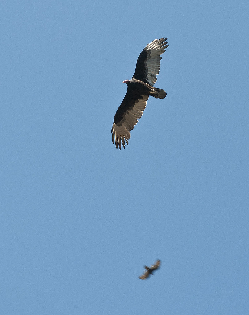
Turkey Vultures by tomteske, on Flickr
This vicious killer landed on my window and started devouring this poor little butterfly.

Stone Cold Killa2 by tomteske, on Flickr

Stone Cold Killa by tomteske, on Flickr
Another nearby spring with lots of plant life. And lots of detritus, recent and native.

Manzanita Cottonwood Spring Flora by tomteske, on Flickr
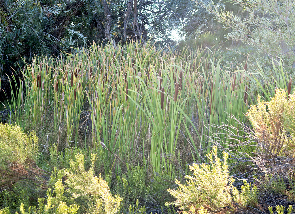
Manzanita Cottonwood Spring by tomteske, on Flickr
The Coors Light "best if used by" dates on these cans were only 9 months before the one on the can I was just drinking from. Need to clean the fridge out more often.

JUN 27 2010 by tomteske, on Flickr
Lots of pottery sherds near this spring as well.
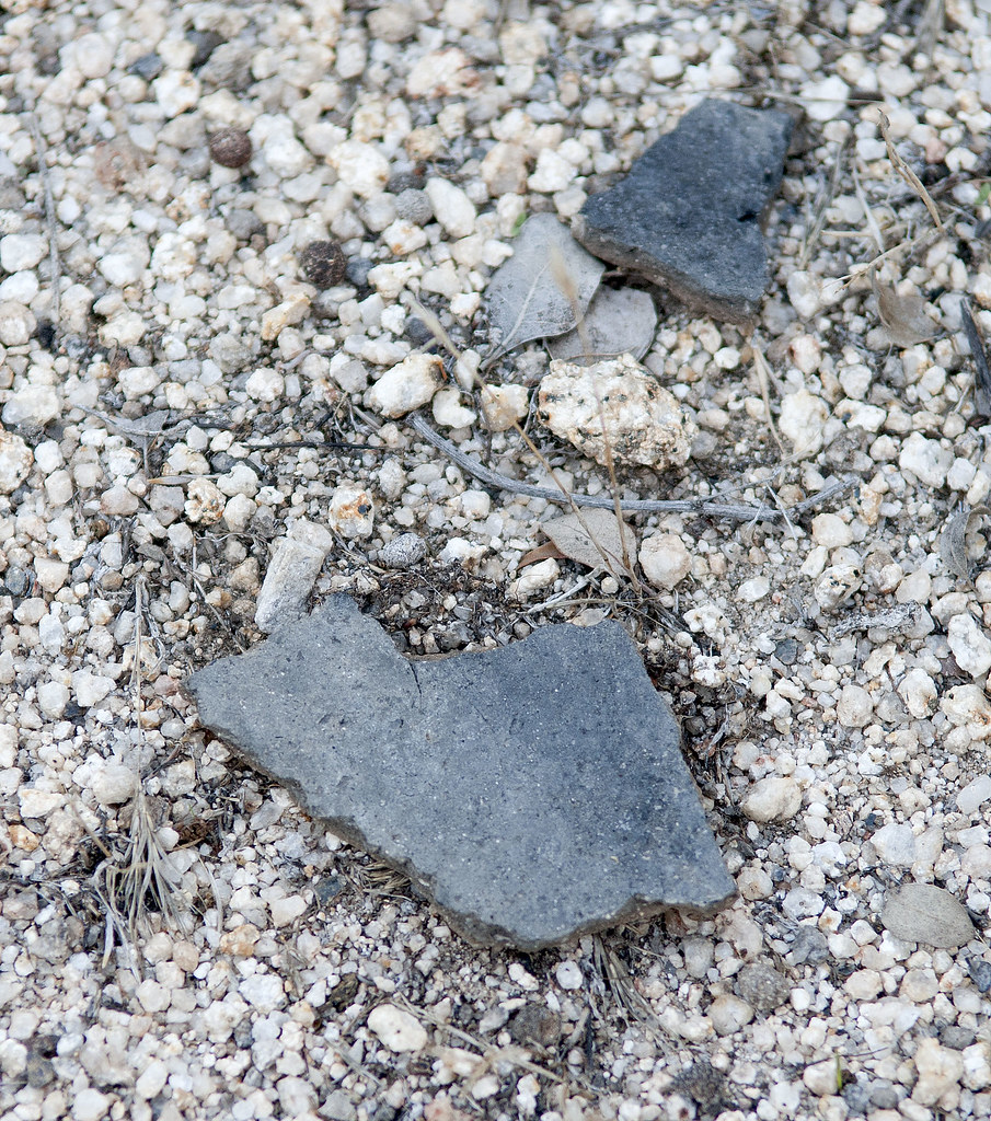
Manzanita Cottonwood Sherds by tomteske, on Flickr
The one view you always have in McCain Valley. Enjoy.
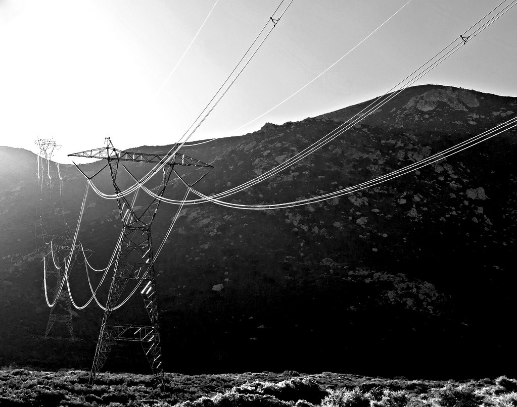
Sunrise Powerlink by tomteske, on Flickr |
9/16/2012
Topic:
After The Rains
tommy750
|
DesertWRX wrote:
This is that fall in Sandstone Canyon early August. You used to drive up and over it on the far left. You need a rock crawler vehicle to do it now! We made it through another way.
We just drove through the narrow spot to get out!
Nice. My pickup is about 80" wide and doesn't have the clearance for pulling that stuff off! |
9/17/2012
Topic:
Short McCain Valley Trip
tommy750
|
surfponto wrote:
Looks like a great trip.
Snake picture is great. looks like it is 6' long in your picture.?
Glad things are cooling down out there. Going to try to make it out in the next couple weeks.
Bob
Thinkin it was about 4 ft. Had no idea what kind it was but quickly found it on a range map at www.californiaherps.com. Great site for IDing reptilian stuff. Tom |
9/18/2012
Topic:
Short McCain Valley Trip
tommy750
|
dsefcik wrote:
Crap...you found my cooler...! I really thought the duct tape would last until I got out there again...gonna buy Gorilla tape next time!
McCain Valley is a great place to find snakes, I have seen many out there. Is the old shack up on El Cajon mtn also a radio shack like the one in McCain Valley?
I was hoping you'd have left more than empties, Daren!
About, El Cajon Mt., always thought everything on that peak was involved with mining. Did read a post where someone said it had to do with some kind of antenna. Was pretty well fenced in the last time I walked by so didn't really get a feel for what it was. Here's a link about the old airway beacons. It lists the exact locations of a bunch leading out of LA but not SD. Tried to leave a comment but not signed up with Google+.
http://www.dustyway.com/2011/11/airway-beacons-across-desert.html |
9/18/2012
Topic:
Short McCain Valley Trip
tommy750
|
dsefcik wrote:
ziphius wrote:
Daren, your second photo implies a climbing of the barbed / razor wire?!! Or good technique with the long lens...
Neither, I just slipped thru the opening of the gate.
So what do you think it was for? Isn't there a fair amount of stuff outside the fenced-in shack? Used to pass by the shack on my way up/down El Cajon as a short cut to avoid losing that 300ft after you make the saddle at 4 miles. But the brush grew back after the fire and made cross-country impractical. Tom |
9/18/2012
Topic:
Hike & Hops Happy Hour
tommy750
|
surfponto wrote:

Any one thinking of attending?
Love Ballast Point and it may be a good opportunity to meet other Anza Borrego folks 
Would love to join you but will be boarding a flight at the same time for a "Subsonic and Tonic" meetup on the way to a Euro vacay. Enjoy. |
9/18/2012
Topic:
Sequoia
tommy750
|
Nice pics. Glad to see the drug cartels haven't trashed the entire place! Need to get back there. Tom |
9/18/2012
Topic:
It's Not a 4WD But It Does More!
tommy750
|
surfponto wrote:
That is pretty awesome
Reminds me of this off road vehicle built by Lamborghini
Of course the price tag is $115,000 

edited by surfponto on 9/18/2012
edited by surfponto on 9/18/2012
Notice how interested the people in the background are with the awesome Lambo 5 ft away! Looks like they drew on all their years of off-road experience to build this beauty. |
10/7/2012
Topic:
Ocotillo Express Wind Energy Project Progress
tommy750
|
Heard Pattern et al were going to do mitigatation at Carrizo Marsh and remove all the Tamarisk that took over in 1976. Have they started yet? Thought it was to start this month. Those tamarisks "broke in" my new Tundra's pristine paint job a few week after I bought it!
http://www.blm.gov/pgdata/etc/medialib/blm/ca/pdf/elcentro/nepa/ocotilloexpress/feis.Par.82636.File.dat/AppL2.pdf |
10/15/2012
Topic:
Chariot, Oriflamme, Rodriguez MTB Loop
tommy750
|
Nice trip and great collar find. Looks like some burned brush in one of your pics. Any significant damage from the Banner Fire in Rodriguez/Chariot/Oriflame? The Cal Fire map looks like it was all to the NE on Granite. Thanks Tom

Banner Fire by tomteske, on Flickr |
10/15/2012
Topic:
Border patrol finds artifacts
tommy750
|
Nice link. Had a USBP agent in my office last week who said a helo pilot found some geoglyphs in/near Davies Valley. He tried to vector a couple of agents on ATVs over to the area but they were unable to go. Said he could get me the coordinates. Does this sound familiar to anyone? Any know geoglyphs out there? Tom |
10/17/2012
Topic:
Border patrol finds artifacts
tommy750
|
ziphius wrote:
Tom,
I wonder if a careful Google Earth search would yield any results on the geoglyphs. I guess the place to start is with *known* geoglyphs, to see if the Google imagery is actually good enough to reveal them in the first place.
Jim
Yeah, I tried looking around Davies Valley on Google Earth after I heard that from the agent and didn't see anything obvious. The Blythe Intaglios are very obvious from Google Earth but the Yuha geoglyphs a few miles away look like a washed out area. Need to call that agent back and see if he has more info. Thanks. Tom |
10/20/2012
Topic:
Iphone in the backcountry somebody shoot me!
tommy750
|
Guessing that's NE of Indian Hill? Great shots. Enjoy your weekend. Tom |
10/21/2012
Topic:
Squaw Tit, Table Mountain and 10 other Benchmarks
tommy750
|
Benchmark Puto (not to mention the nearby Squaw Tit) continues the long glorious tradition of obscene and offensive place names in official maps. There's even a book on the subject called "From Squaw Tit to Whorehouse Meadow: How Maps Name, Claim, and Inflame." A slew of articles on map expletives emerged after Rick Perry's leased "Niggerhead" hunting camp hit the news cycle last Republican Primary. Was surprised to find this BM a few years back and quickly sent off a screen grab to a few Hispanic friends who were somewhat amused at seeing this homosexual slur in an official USGS document. Nice pics. Tom |
10/24/2012
Topic:
Fish Creek Wash Rd Conditions
tommy750
|
anutami wrote:
I am planning a trip in about 3 weeks and may head through fish creek to split rock/dave mccain spring. Curious to know if it is do able with my rig. We went as far as olla wash in 09 but things have changed a bit out there. Looking on a topo map it looks a bit tight going through olla wash and dave mccain spring.
TIA
Drove to Split Rock in my stock Tundra 4X4 in January and found the canyon between Olla Wash and Split Rock rocky and slow going but quite passable. Drove as far as Sandstone Canyon in August after the flash flood without any major problems. Not sure what has changed beyond that. Hope that helps. Tom |
10/24/2012
Topic:
Squaw Tit, Table Mountain and 10 other Benchmarks
tommy750
|
Never had any real problems at the S-2 checkpoint but they do ask a lot of the standard questions. Always figured it's where they send the newbies to learn the ropes. On my first trip a few years back to the Coyote Mts Wind Caves, I missed the turn off and did an apparently very provocative U turn in front of the checkpoint. Was stopped with lights flashing and both agents' hands on their holsters. Didn't help I was driving a white cargo van at the time! |
10/28/2012
Topic:
Rockhouse Canyon 4 Day Backpack TR
tommy750
|
Very nice trip. That one pictograph figure at 3'X3' is huge! Is that the largest one out there? Tom |
11/4/2012
Topic:
More Split Mountain Flash Flood
tommy750
|
Just saw this article in East County Magazine ( http://eastcountymagazine.org/node/11619 ) referring to Hurricane Sandy. It links to a book entitled "Tropical Storm Kathleen" by James L. Larson, a Cal-Trans employee who apparently saw the results of this devastating 1976 storm first hand. The storm really battered San Diego and Imperial Counties. Fish Creek flash flood was bad but this looks apocalyptic:
http://www.scribd.com/doc/9354989/Tropical-Storm-Kathleen |
11/4/2012
Topic:
East Fork Carrizo Creek
tommy750
|
Nice pics and report. Made it up to Carrizo Palms in Februrary 2009 via the East Fork. Was under 4 miles to the southern Carrizo Palms. The northern Carrizo Palms doesn't seem to exist except on the topo map. Found running water and some nice pools, but maybe dried up this time of year. Also, found this guy's remains. Thanks. Tom

East Fork Carrizo Pool by tomteske, on Flickr

East Fork Carrizo Ram by tomteske, on Flickr |
11/4/2012
Topic:
Dos Cabezas Road
tommy750
|
Took my friend out to see the Piedras Grandes and Indian Hill caves last Friday. Turned onto Dos Cabezas Road and got stuck in a traffic jam.
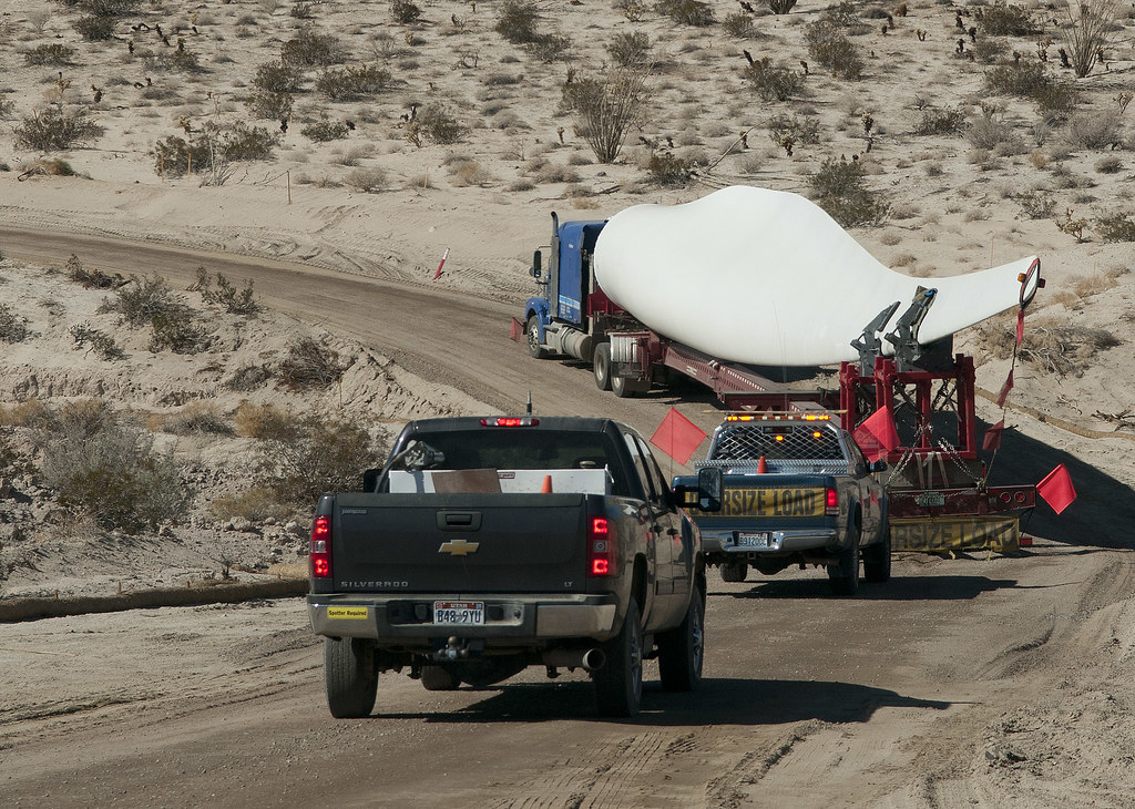
Dos Cabezas Blade2 by tomteske, on Flickr
The road is so different we had trouble finding our way and had to backtrack a couple times, all under the watchful eyes of a pair of Pattern Energy vehicles that only became disinterested near the county line.
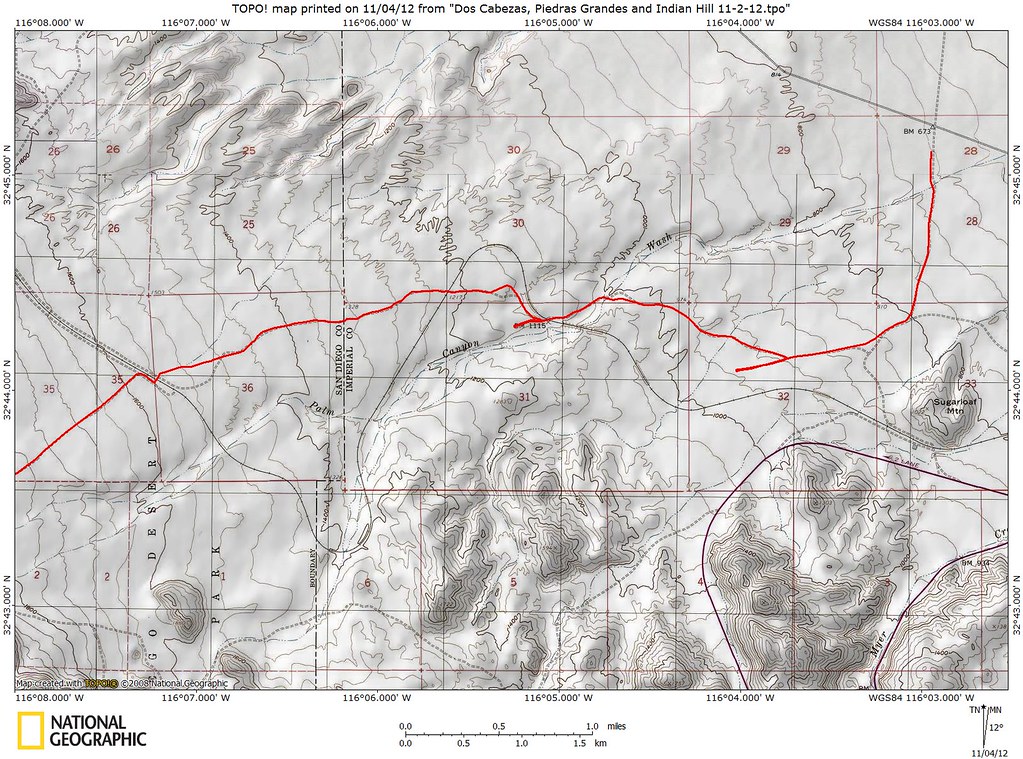
Dos Cabezas Road by tomteske, on Flickr
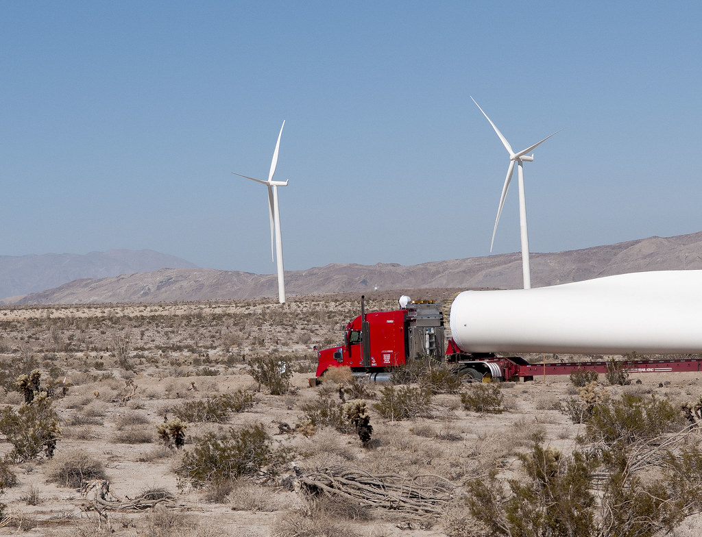
Dos Cabeza Wind by tomteske, on Flickr
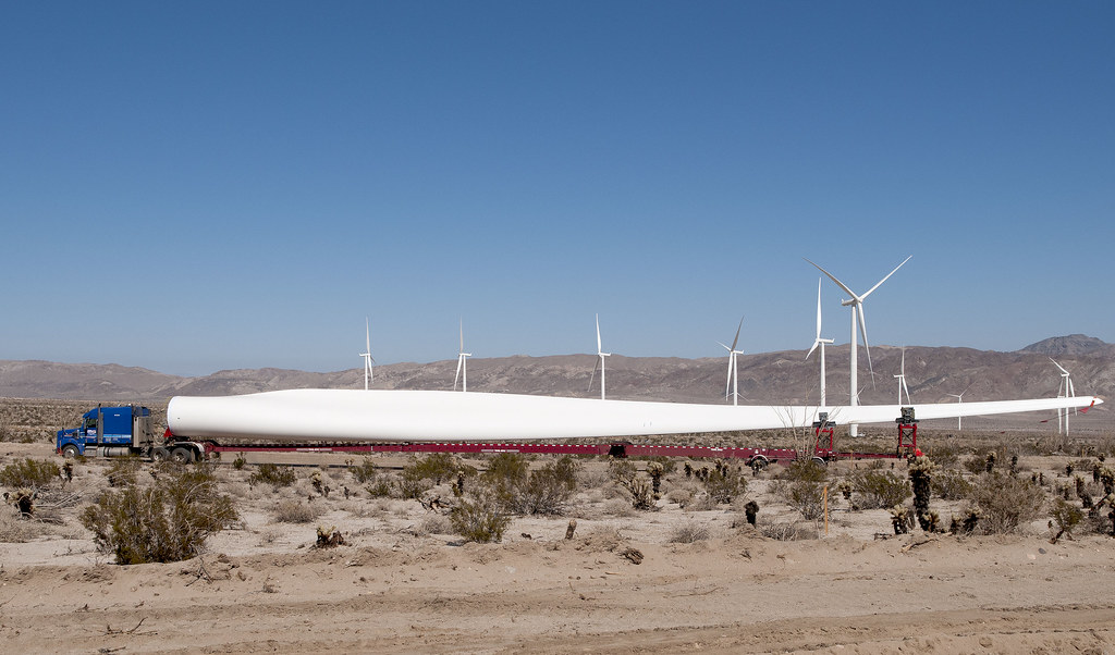
Dos Cabeza Blade by tomteske, on Flickr
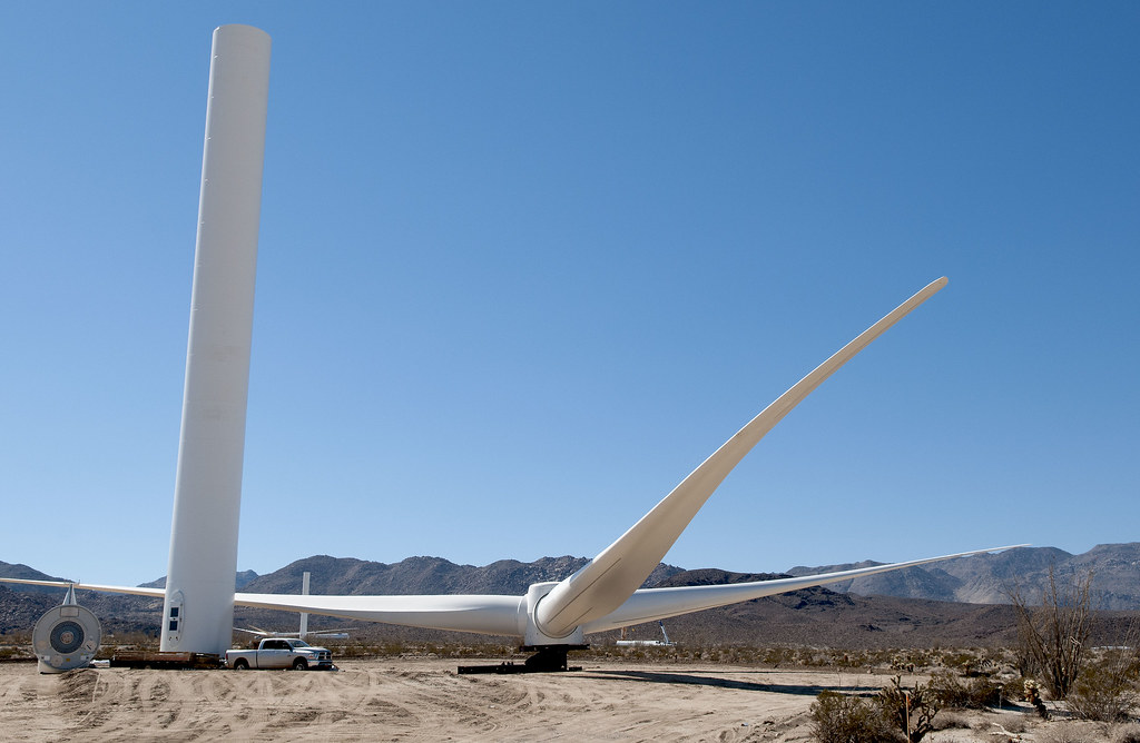
Dos Cabeza Blades by tomteske, on Flickr
On the way to Piedras Grandes site, stopped to get the drinks out of the heat in this little cave.

Piedras Grandes Cave by tomteske, on Flickr
Not sure how legit this is. Maybe a guy with a surfboard.
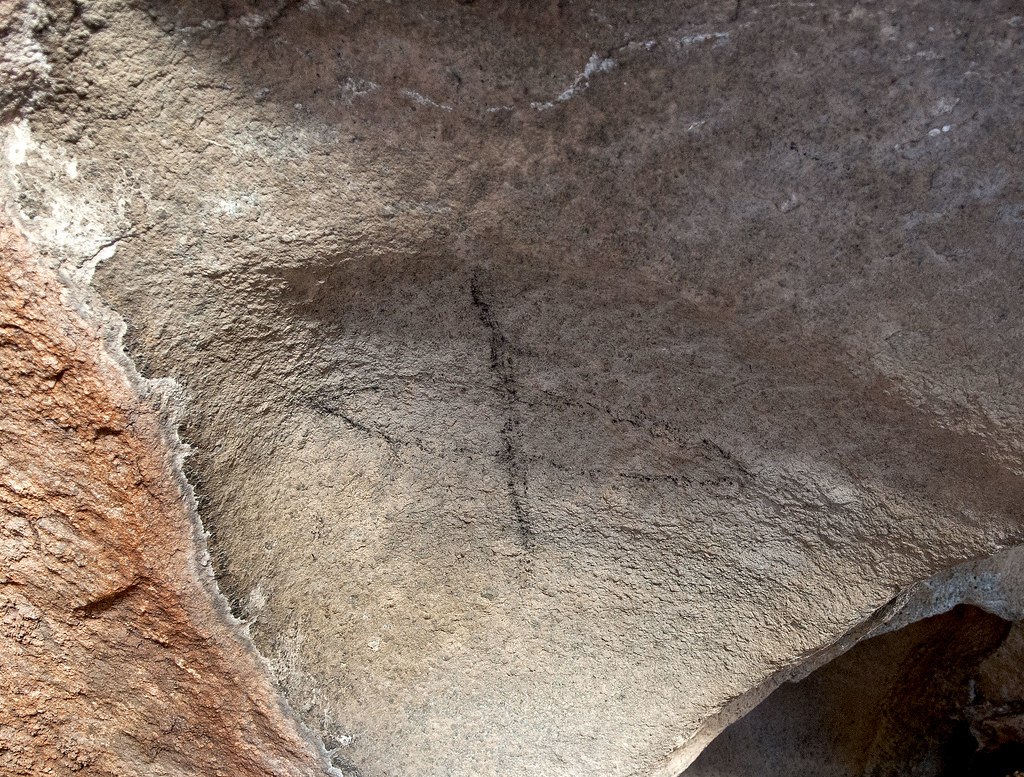
Piedras Grandes Surfer by tomteske, on Flickr
Outside was a nice yoni.
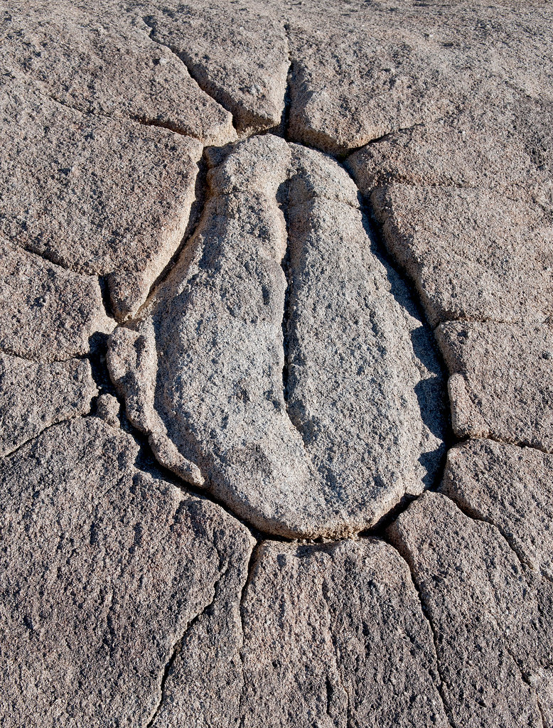
Piedras Grandes Yoni by tomteske, on Flickr
Further up, the cave. The sign shows the table-like pictograph in the wrong place.
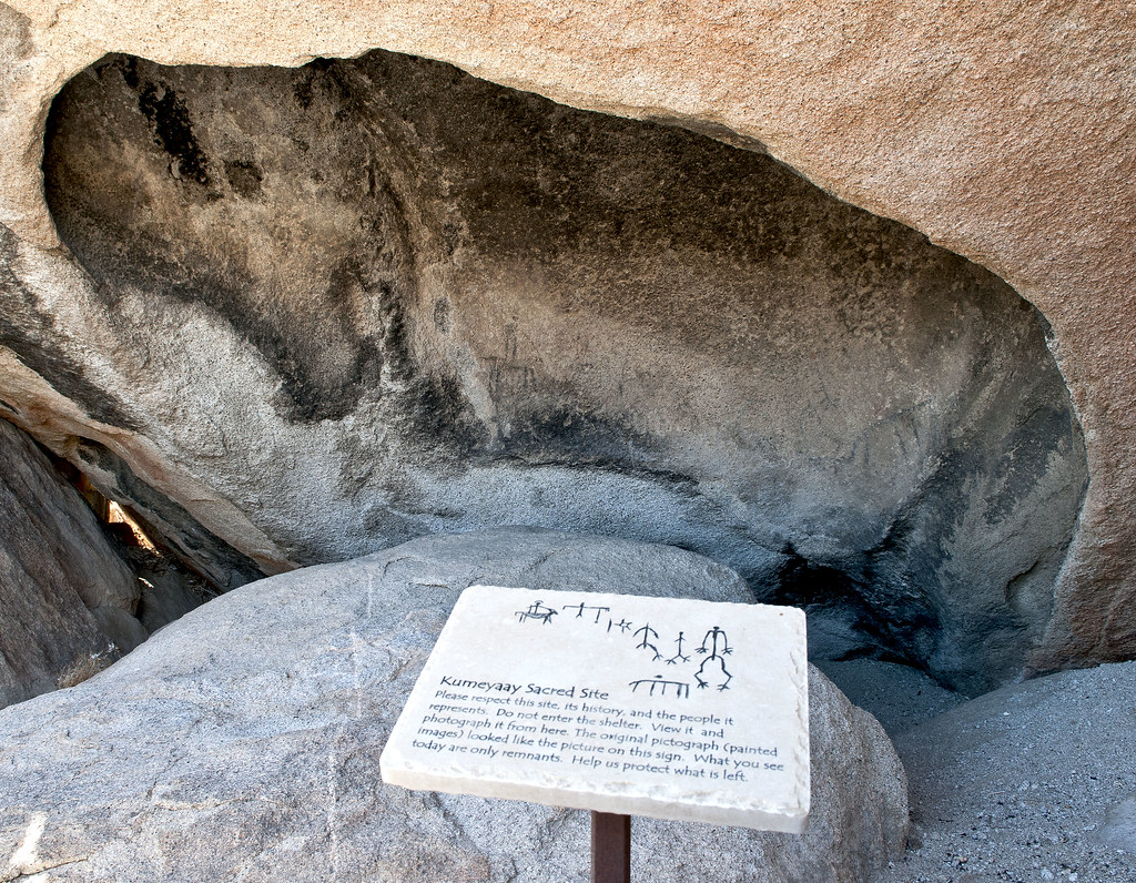
Piedras Grandes Cave Sign by tomteske, on Flickr
The pictographs looked pretty faded and even DStretch didn't do much.
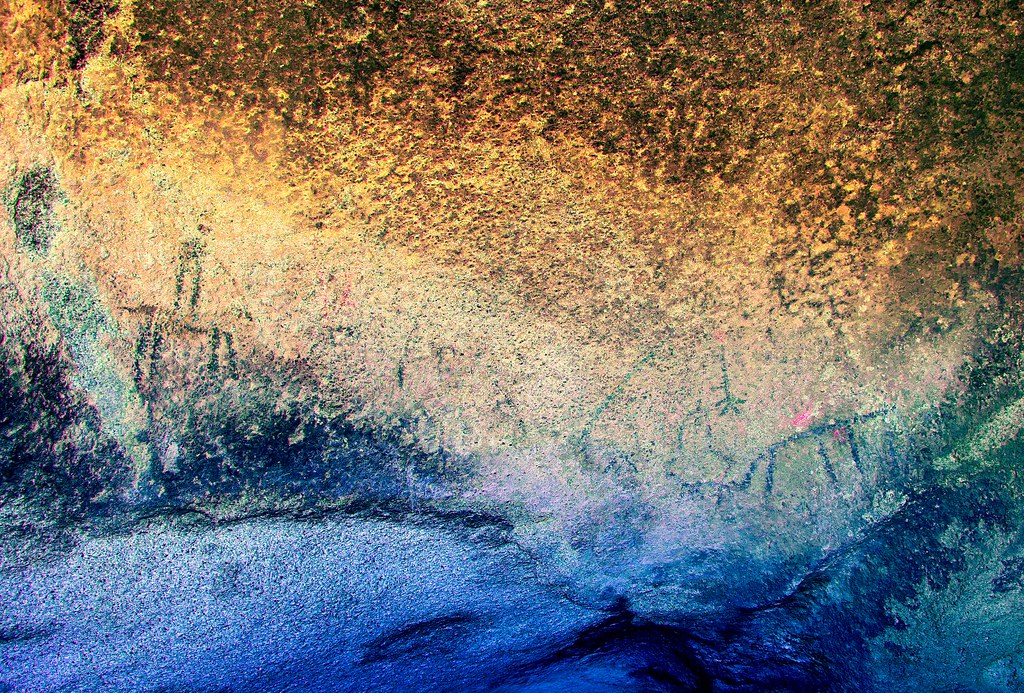
Pieadras Grandes Panorama_lbk by tomteske, on Flickr
The famous rider on a horse.
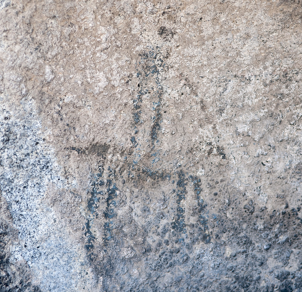
Piedras Grandes Horseman2 by tomteske, on Flickr
Indian Hill is always a neat place and different pictographs seem to stand out every visit. These are in the lower recess to the left of the main part of the cave.
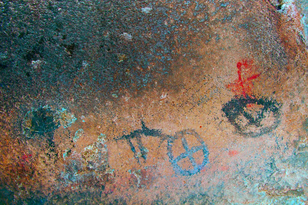
Blue Sun Cave Details_lab by tomteske, on Flickr
Found this guy hiking back.

Tarantula2 by tomteske, on Flickr
Finished up by driving through the Volcanic Hills to Jojobo Wash. Kinda tight for a full size PU.
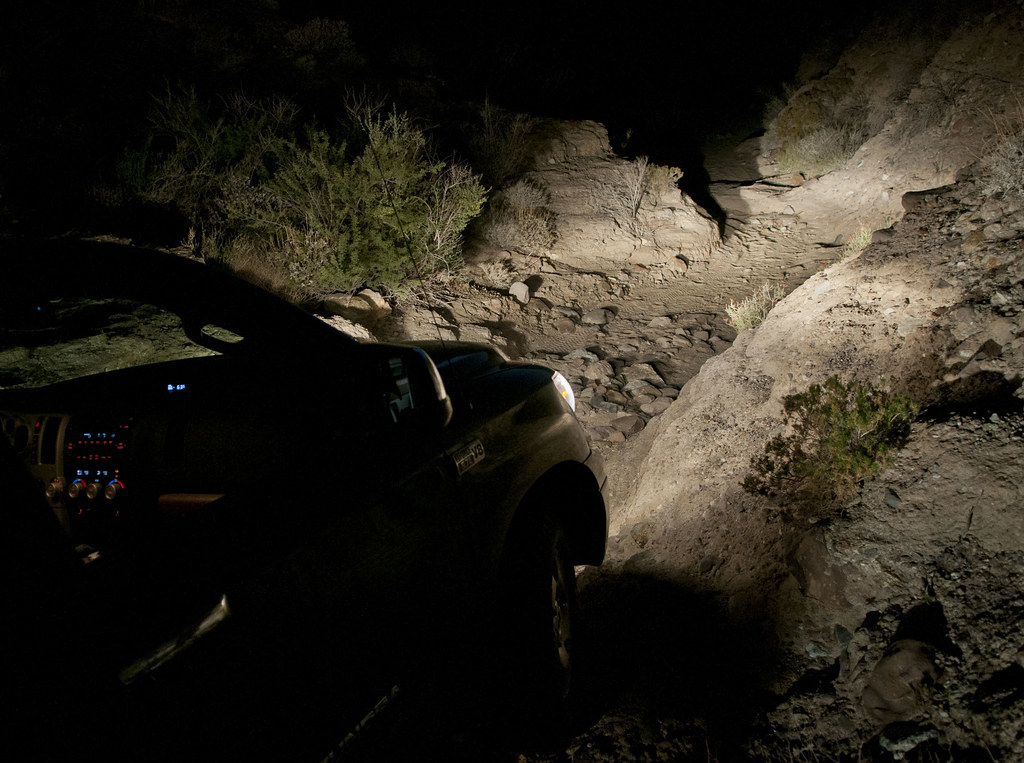
Volcanic Hills Wash Tundra by tomteske, on Flickr
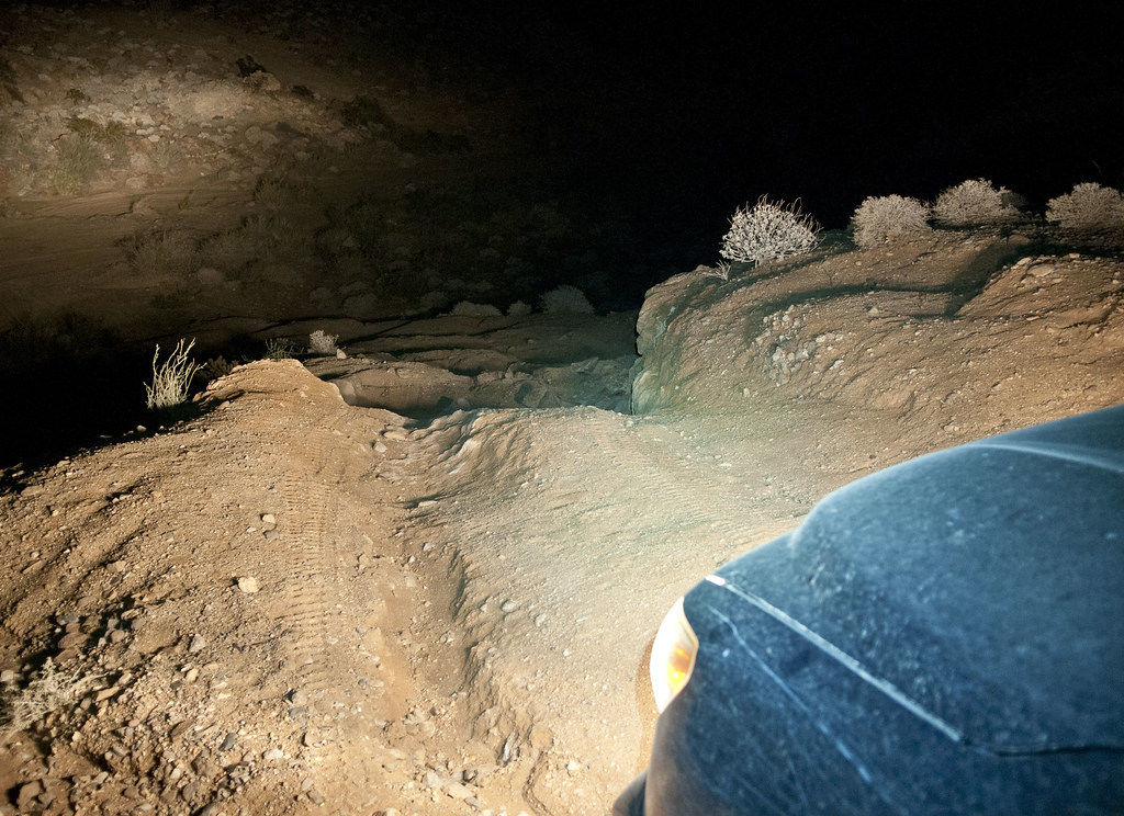
Volcanic Hills Crossing by tomteske, on Flickr
Enjoy. Tom |
11/5/2012
Topic:
East Fork Carrizo Creek
tommy750
|
anutami wrote:
tommy750 wrote:
Nice pics and report. Made it up to Carrizo Palms in Februrary 2009 via the East Fork. Was under 4 miles to the southern Carrizo Palms. The northern Carrizo Palms doesn't seem to exist except on the topo map. Found running water and some nice pools, but maybe dried up this time of year. Also, found this guy's remains. Thanks. Tom
Wow! Nice Bighorn find! What do you do when you find a skull like that? Leave it where you find it? Report it to the rangers? Pack it out?
I'm hoping it's still there and you'll find it on your next trip out there! Distinctly remember the girlfriend asking why the skeleton ended up next to the watering hole and wondering how she could have missed every episode of Marlin Perkins' Wild Kingdom  Didn't see a a radio collar nearby. Tom Didn't see a a radio collar nearby. Tom |
11/5/2012
Topic:
East Fork Carrizo Creek
tommy750
|
surfponto wrote:
Actually I think we saw the northern palm grove from up on the trestle a couple weeks back.
It looked that if you forked right from the turnoff to the southern Carrizo Palms you would run right into it.
Will try to look on Google Earth to pinpoint it.
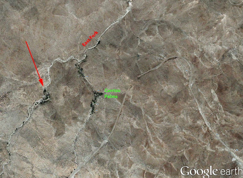
Here you go (red arrow) although I am not sure that is North of the Carrizo Palms
Bob
Yeah, the topo map looks a little funny because the "southern" Carrizo Palms have a little circle on both the right and left side of the name which is confusing as to which canyon the palms actually are in. Looks like they are in both. The topo map shows the "northern" palms to be in the East Fork at the very top edge of your picture. Went back to the oldest sat photos (1994) on Google Earth and still don't see any palms there. Maybe that grove died out. Tom |
11/5/2012
Topic:
Dos Cabezas Road
tommy750
|
dsefcik wrote:
I too lost my way a month or so ago when I went out to Piedras Grandes. All of the workers will slow down driving and the water tanks will start spraying as soon as they see you watching them.
The guy on the surfboard looked like graffiti to me when I saw it, did you go see graffiti cave?

No, must have missed that one. Is it in the same general area on the left side of the road? Saw the water truck headed my way and immediately rolled up my windows! Tom |
11/6/2012
Topic:
Truck Camper
tommy750
|
Anyone have info on a good place to get a Pickup cap in San Diego? Best brand? Tired of wedging everything inside the cab. Thanks. Tom |
11/6/2012
Topic:
Dos Cabezas Road
tommy750
|
dsefcik wrote:
You need to go past the signed pictos and keep poking around, you can't miss it....it's right next to the big boulder....
Will check it out. Thanks. Tom |
11/7/2012
Topic:
Truck Camper
tommy750
|
dsefcik wrote:
I have bought my last two shells and bed liners from SoCal Truck http://socaltruck.net/
They had the best prices around and are a family business. Ask for Elizabeth.
I have no affiliation with them other than being a satisfied customer.
tommy750 wrote:
Anyone have info on a good place to get a Pickup cap in San Diego? Best brand? Tired of wedging everything inside the cab. Thanks. Tom
Thanks for the info. Will check them out. Tom |
11/7/2012
Topic:
Truck Camper
tommy750
|
anutami wrote:
Tom,
My Dad is selling his 2007 palomino 1251 pop top truck camper. Google the brand and you can see they are pretty cool. It has a 60watt solar system. It would fit your tundra perfect! He is selling it for 5,800 obo. Not sure if you are in the market for one but you are welcome to check it out.
Nolan
Thanks for the reply. I checked out the Palomino online and not sure that would work for me. Looks like they have some nice rigs, though. Tom |
11/7/2012
Topic:
Dos Cabezas Road
tommy750
|
dsefcik wrote:
Yep, the hands are right below the graffiti...so guess where the hands came from...
surfponto wrote:
Is that the same cave as the handprints?
Never found out the story on those.
That tagger looks like he broke is left index finger and forgot to get it pinned. Keep your eyes peeled for that guy! Think I recall a similar finger deformity noted on prehistoric cave paintings at a European site. Tom |
11/13/2012
Topic:
Pinto Wash Petroglyphs
tommy750
|
Been wanting to check out the petroglyphs in Pinto Wash so hiked out there yesterday. Read a few online stories that seemed to exaggerate the difficulty of the hike. Now, it doesn't seem so exaggerated! Uploaded waymarks to my GPS to make it easy for me but was in the wrong canyon before my second waymark. The maze of deep canyons makes it a real challenge your first time out.
Parked on Old Hwy 80 and crossed over into Boulder Creek under I-8. Quick stop at the old shack nearby. You can see my Tundra in the far distance through the hole in the shack on the right.
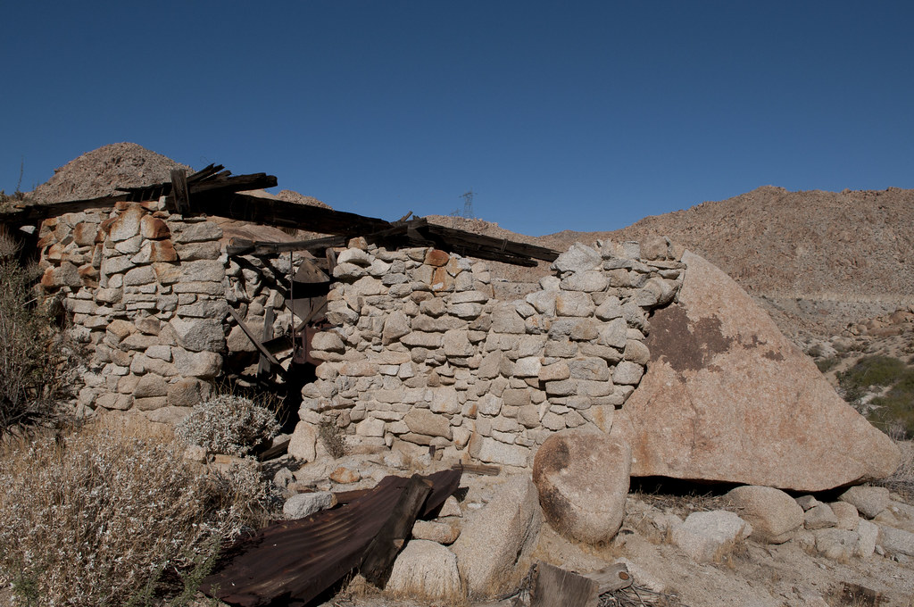
Miner's Shack by tomteske, on Flickr
Few hundred yards upstream found a lot of morteros on the stream bank.
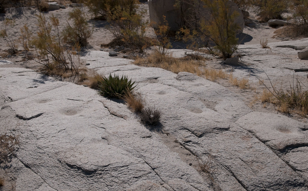
Boulder Creek Morteros by tomteske, on Flickr
Few miles south, came upon this nice palm grove with a presumed campsite on a ledge above the stream bank. Morteros and lots of fairly large pottery fragments all around.

First Palm Oasis by tomteske, on Flickr
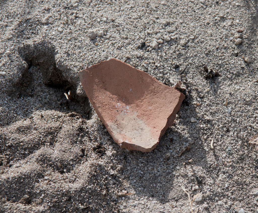
First Palm Oasis Sherd by tomteske, on Flickr
First petroglyph site in Pinto Canyon is a hundred yards downstream of a wash branch heading due north from Mexico containing a large palm grove. Faint figures and shapes seen on two boulder surfaces.

Site F Panorama by tomteske, on Flickr
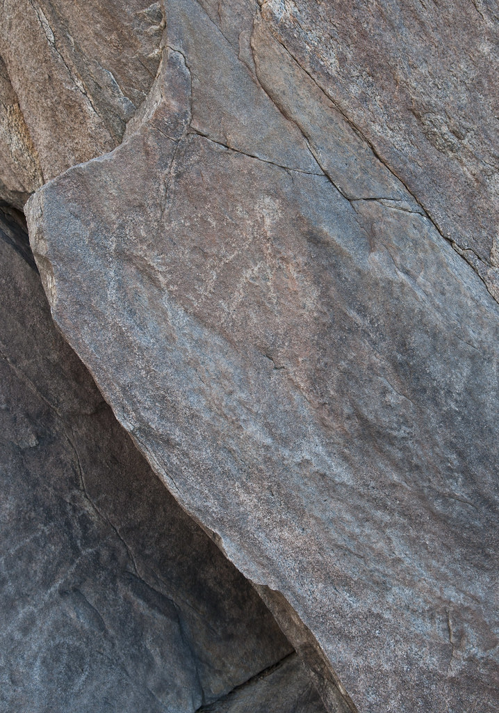
Site F 2 by tomteske, on Flickr
Downstream, the well known shelter cave with the alleged boat glyph. Looking at all the bizarre stuff out there, I'm not so sure it's really a Spanish sailing vessel.

Site E by tomteske, on Flickr
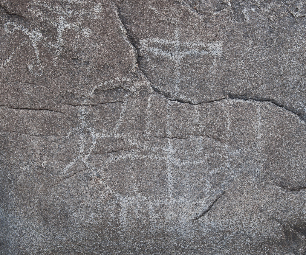
Site E Ship by tomteske, on Flickr
Farther downstream on a boulder midstream is supposed to be a very faded glyph, maybe this.
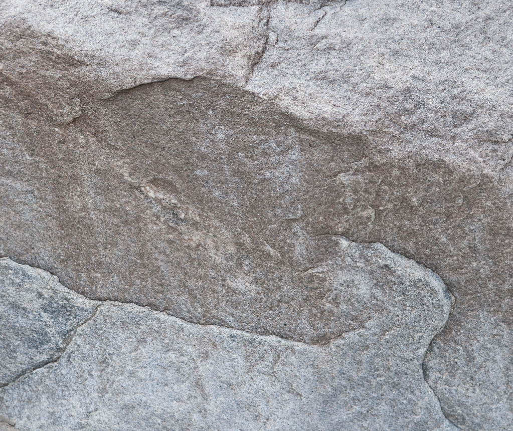
Maybe Site D by tomteske, on Flickr
There's reportedly another site on rocks well outside the wash which I didn't find. The biggest site is supposedly on both side of the canyon on boulders with dark brown varnish and I just couldn't seem to locate it. Kept walking down the wash till I hit this nice oasis with running water. Found a monument dedicated to a Martin Zamora Torres.

Last Palm Spring by tomteske, on Flickr

Cruz Azul2 by tomteske, on Flickr
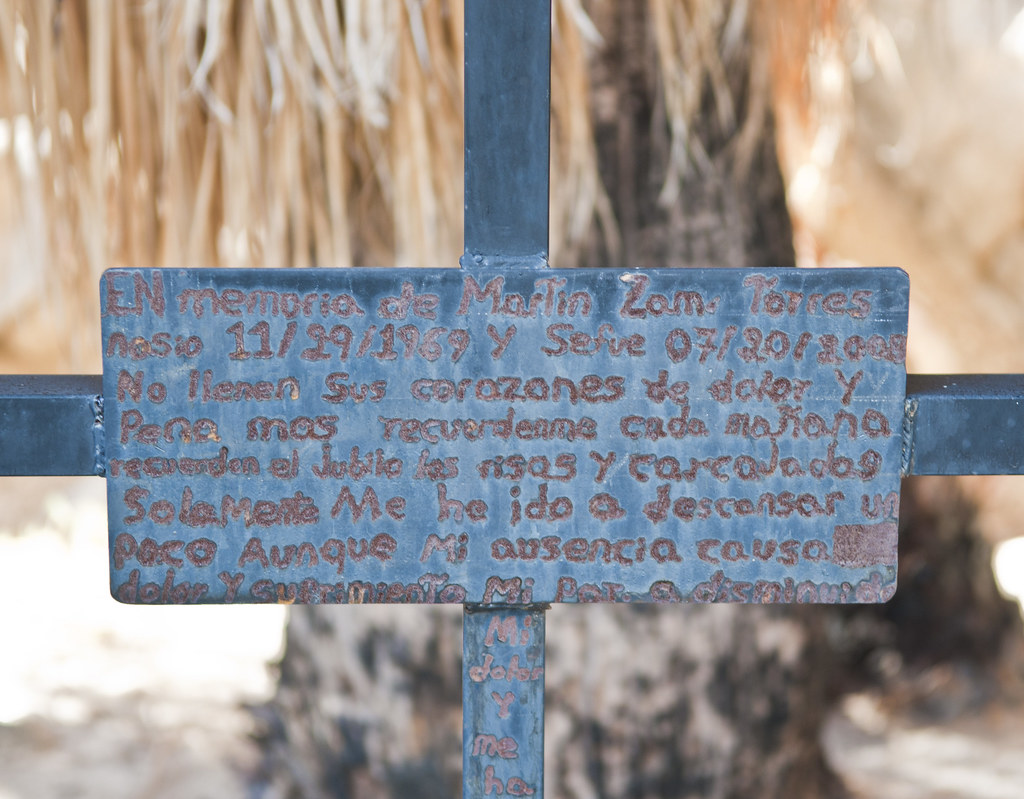
Cruz Azul by tomteske, on Flickr
Was getting way too late and dark when I turned around and I couldn't find my hiking poles I left stuck in the sand while I hiked downstream taking photos. Was not motivated to turn around and search for them so they're down there as a nice nearly new freebie for someone.
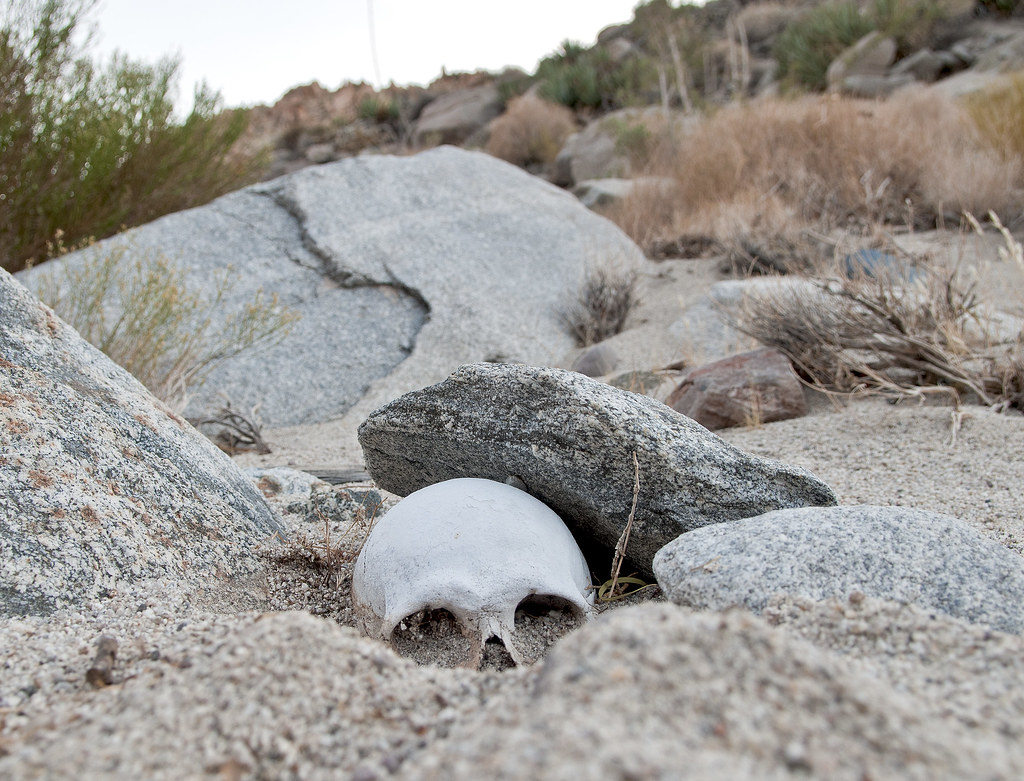
Past the petroglyphs, I saw something white and round nearly buried in sand which I didn't notice hiking by just an hour earlier. Closer inspection revealed a human skull. Was a pretty somber moment. Don't know this individual's story but Rest In Peace, fellow traveler.
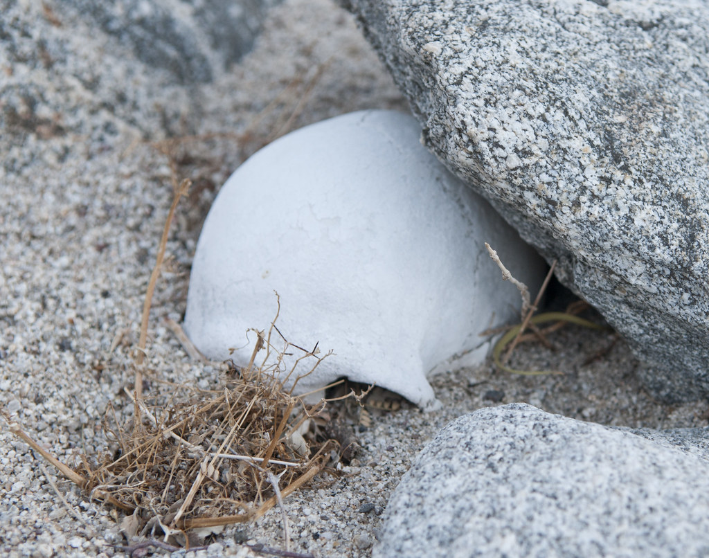
Skull RIP by tomteske, on Flickr
A little excavation confirms the object's identity.
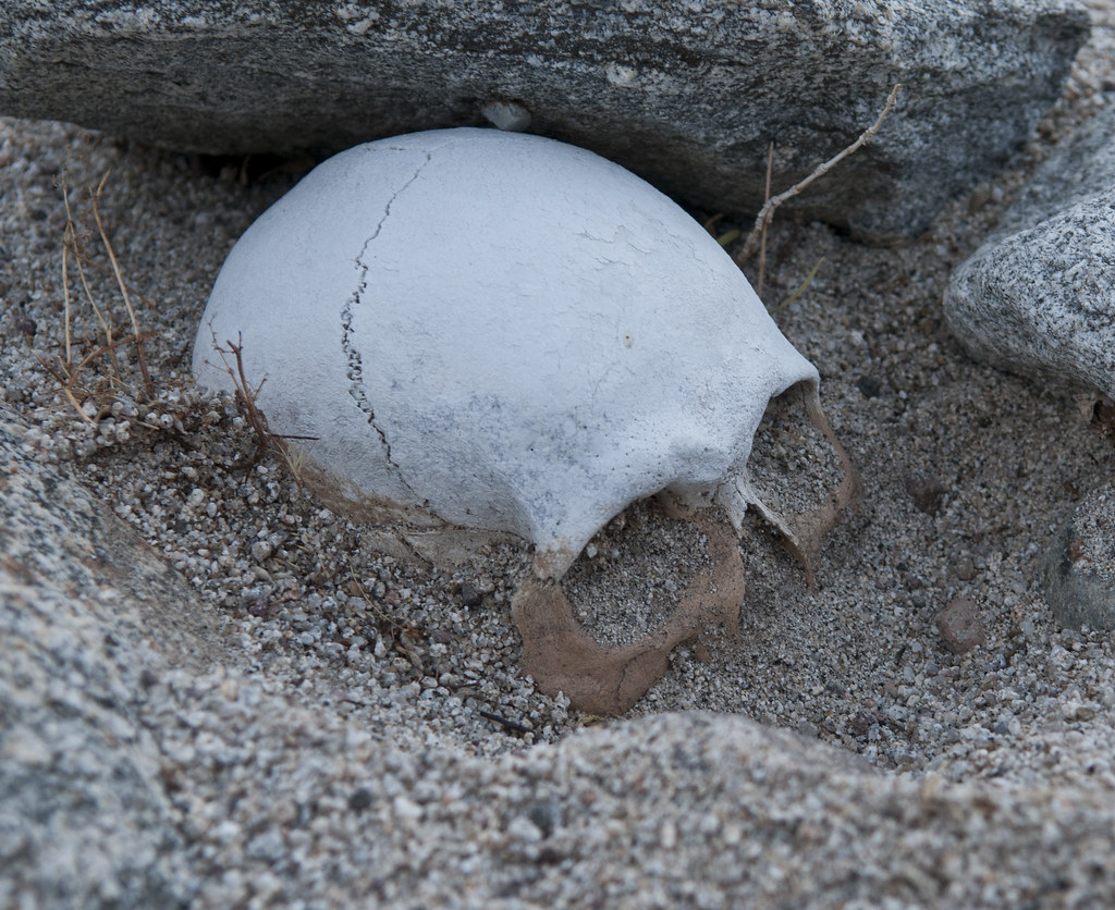
Skull2 RIP by tomteske, on Flickr
Fifty yards further upstream, came across a single bone, possibly a metacarpal bone.
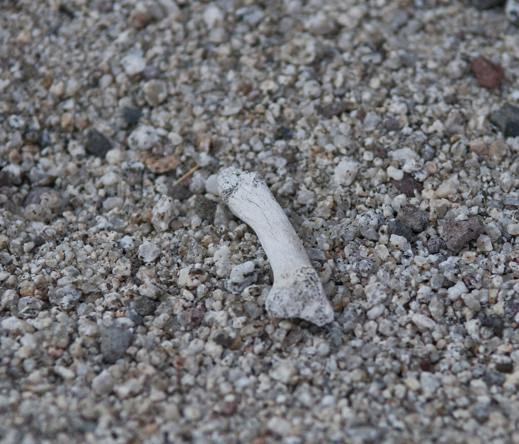
Possible Metacarpal Bone RIP by tomteske, on Flickr
Had the usual meet and greet with two USBP agents when I finally hit Boulder Creek next to I-8. Gave them the coordinates of the human remains and they said they'd be out today checking it out. It's an easy drive out there if you have a gate key to Davies Valley. 16 miles, few wrong turns but a great hike overall. Would like to head back and find those other glyphs. Any one have any clues where they are? Enjoy. Tom |
11/13/2012
Topic:
Pinto Wash Petroglyphs
tommy750
|
Obviously, these remains have been around for a while since not much soft tissue is present. The upstream watershed of Pinto Wash is big and a lot of it arises in Mexico. If someone was reported missing in the previous years in the area, maybe DNA or dental records (didn't check out the teeth) could give a family missing a loved one closure. I asked the USBP agents who this needs to be reported to and they said they'd take care of it. Was somewhat surprised I walked away into the night after describing human remains with neither agent asking my name or number. They probably already knew because they were aware of my pickup and may have ran the plates. Tom |
11/14/2012
Topic:
Pinto Wash Petroglyphs
tommy750
|
BorregoWrangler wrote:
tommy750 wrote:
It's an easy drive out there if you have a gate key to Davies Valley.
Wait, key? Does some have a key to that gate? I went out there a few years ago expecting to be able to drive the trails around Davies Valley but was stopped by a few locked gates. Anyway, great report! That's crazy that you just came upon a human skull. I found one a few years ago out at my in-law's ranch in Delzura. Authorities said it was an immigrant who probably died of exposure.
I also remember driving out to Davies Valley all excited to use those dirt roads I spotted on Google Earth and discovering "The Gate." It's part of the Jacumba Wilderness and only USBP gets to drive back there. AND the guy who abandoned his Chevy Blazer out there which is slowly being reclaimed by scavengers. Suspect he used the unlocked Southern Entrance.
Yeah, pretty weird coming across the skull. Would be interesting to know if there's some kind of clearinghouse for border crossers who disappear. Tom |
11/14/2012
Topic:
Pinto Wash Petroglyphs
tommy750
|
Daren Sefcik wrote:
This really was a great TR Tom, thanks for sharing. Best pictures of the glyphs out there I have seen.
Thanks Daren. Found an old 1973 Pacific Coast Archaeology Society Journal that described "Sites A through I" with B,C,D,E and F containing petroglyphs. Found F and E and maybe D but missed C and B. Will see if I can post a copy online. Looks like the sites were labelled consecutively and start at Davies Valley. There's sketches of the glyphs but not a lot of locational info. Definitely up for a second trip out there sometime. Tom |
11/14/2012
Topic:
Pinto Wash Petroglyphs
tommy750
|
anutami wrote:
Tom, That human skull is amazing! My thoughts and prayers go out to the unfortunate soul. It looks like it has been there awhile and I wonder if they will be able to identify them. Did the BP agent take down your info to report back to you any info? I wonder how many other people just walked right by without noticing, or with noticing and kept going. Were you hiking solo? It really makes you think twice before heading out alone in the desert...
One of my good friends was backpacking in the sierras and came across a rock climber who had fallen to his death. He kept on his hike and reported the guy to the authorities a few days later when he was done with his backpack trip. They really read him the riot act for not reporting it right when he found the guy.
Was pretty weird seeing that out there and wondering about the zillion other things you walk right by. Was out solo which is the usual unless I can get the girlfriend to go. My 11th essential has been a sat phone which seems kinda extravagant at first but is a cheap insurance policy if you need to make that one call. Fortunately it's only been needed for important stuff like drunk dialing Mom from deep in Baja  . Going to check back with USBP to see if they recovered the remains. Tom . Going to check back with USBP to see if they recovered the remains. Tom |
11/14/2012
Topic:
Combating bright sunlight and shadows
tommy750
|
Daren, does it stack photos well handheld or do you need a tripod? Tom |
11/14/2012
Topic:
New Forum
tommy750
|
I'm likin the new software Bob! Need to try out the app. Tom |
11/15/2012
Topic:
Goat Canyon Trestle Hike
tommy750
|
surfponto wrote:
Yeah the railroad camp is pretty cool to checkout.
Seems it will eventually fade into obscurity.
The powder keg wall was noticeably smaller the last time we were there 
BorregoWrangler wrote:
Just a few more days to go! I was really sick for over a week and afraid I'd have to cancel this trip. So happy I've been feeling better! On the return trip along the tracks I'm thinking about cutting through where the old railroad workers camp is along with Indian Hill. I don't think the guys I'm going with have been there yet so it would be a great addition to the hike. Then we'd just make our way to Doz Cabezas Road.
Here's a comparison pic from the Horace Parker's Anza/Borrego Desert Guide Book, 1964 Edition. Think it would be kind fun to recreate the pics in old guides and books in order to see the changes over time. Tom

Indian Hill by tomteske, on Flickr |
11/18/2012
Topic:
Goat Canyon Trestle Hike Trip Report
tommy750
|
Great trip! Like the pics. Tom |
11/19/2012
Topic:
Paiute Petroglyphs Stolen and Defaced
tommy750
|
Maybe you've seen this LA Times story about some idiots stealing petroglyphs. Tragic. Hope they get those guys.
http://www.latimes.com/news/local/la-me-petroglyphs-theft-20121119,0,6886011.story |
11/20/2012
Topic:
DStretch tutorials
tommy750
|
Have been through your first three tutorials so far. Was at about level one. Seems to me DStretch works the best with red paint and maybe yellow and blue. What I have trouble with is light on dark, for example, petroglyphs. Any tips on accentuating these? Tried image inverse in photoshop but still didn't do much. Thanks. Tom |
11/22/2012
Topic:
Hapaha Flat, Dave Mcain Spring, Split Rock
tommy750
|
Great report! Never been past Split Rock. How is the hilly area a little way up the road from Split Rock and before Pinyon Wash? Looks a little hairy from Google Earth. Tom |
11/22/2012
Topic:
Torote Canyon Loop - Solo Backpacking TR
tommy750
|
Nice trip. Was in Torote Canyon on 12-11-10 and noted the Ocotillos were changing colors. There seemed to be two distinct groups, red and yellow. Not sure this was a transition they all went through or two different hybrids. Anything similar this year? Also noted our Torotes have nothing on the Baja Torotes! Tom
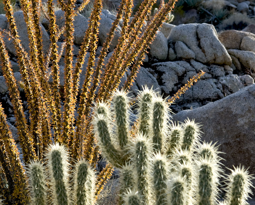
Christmas Lights10 by tomteske, on Flickr
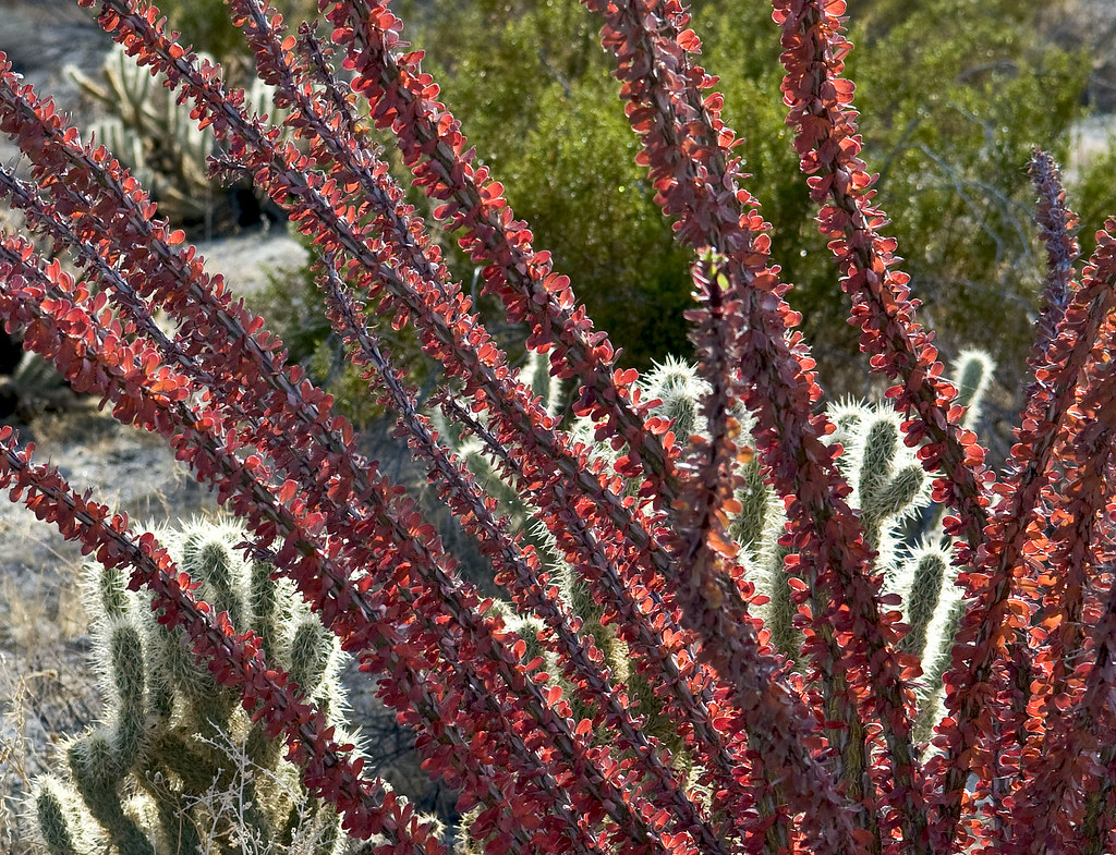
Christmas Lights9 by tomteske, on Flickr

Senor Torote by tomteske, on Flickr |
11/22/2012
Topic:
Paiute Petroglyphs Stolen and Defaced
tommy750
|
When Sandie and I went to Utah this past summer we quickly found the way to locate all the rock art sites was to buy a $4 roadmap at any gas station and there they were. Looks like vandals have been coming for generations to desecrate these sites. A real shame.

Sego Canyon Bizarre2_lbk by tomteske, on Flickr
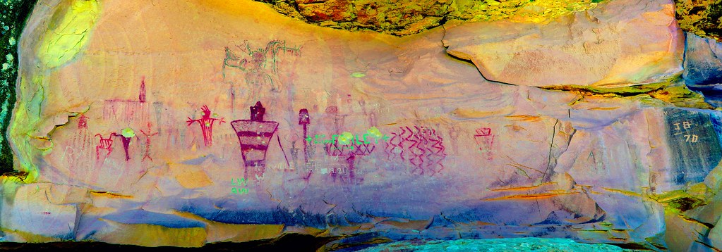
Sego Canyon Panel4_lds by tomteske, on Flickr

Sego Canyon Grafitto by tomteske, on Flickr
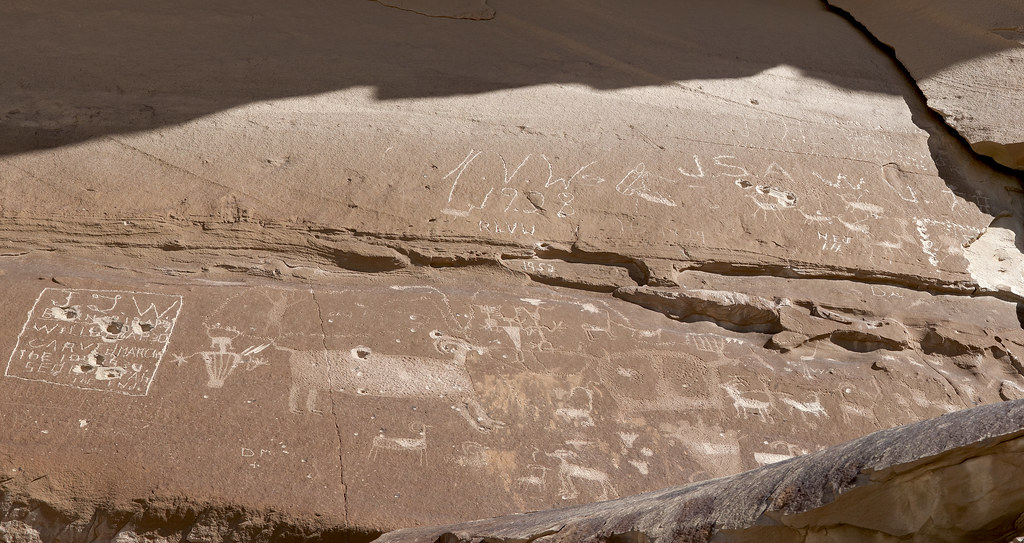
Sego Canyon Panel by tomteske, on Flickr
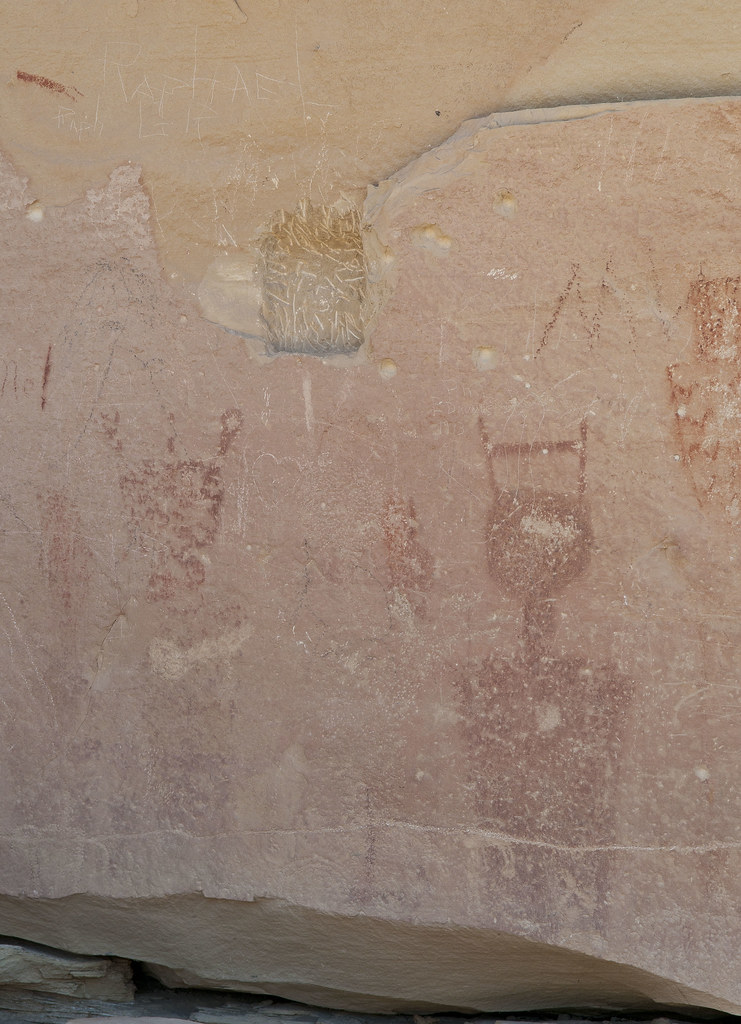
Missing Piece by tomteske, on Flickr |
11/23/2012
Topic:
Torote Canyon Loop - Solo Backpacking TR
tommy750
|
Daren Sefcik wrote:
ziphius wrote:
I'm planning on "camping high" for the views and opportunities to look into some nooks and crannies that I've spied through binoculars on my last trip.  Jim Jim
Be careful of what you might find up in those nooks and crannies...

That is an awesome pic!! |
11/23/2012
Topic:
Exploring The Island and Myer Valley
tommy750
|
Daren Sefcik wrote:
tommy750 wrote:
Oops! You're absolutely right. The other site is 32 41.42 -116 3.68
Great, I have that marked for my next trip out there. I have been wanting to go up that wash anyway (among 5 million others also). It seems that Chris Wray's book is a little hard to find. I wonder if the Butterfield Ranch store or the visitor center has it. The Butterfield store has some pretty funky old books on it's shelf by the register.
Daren, I know you posted on going out to find this cabin but I don't recall what topic it was under. Anyway, stopped by on my way down the grade today and the road was as you described, 4X4 only. Made it to the little plateau but wasn't able to find any signs of a cabin. Had my GPS on with coordinates from Chris Wray's book but nothing. Tom
Just before the site, a BLM greeting.

Wilderness by tomteske, on Flickr
The shack is supposed to be just to the left of the road.
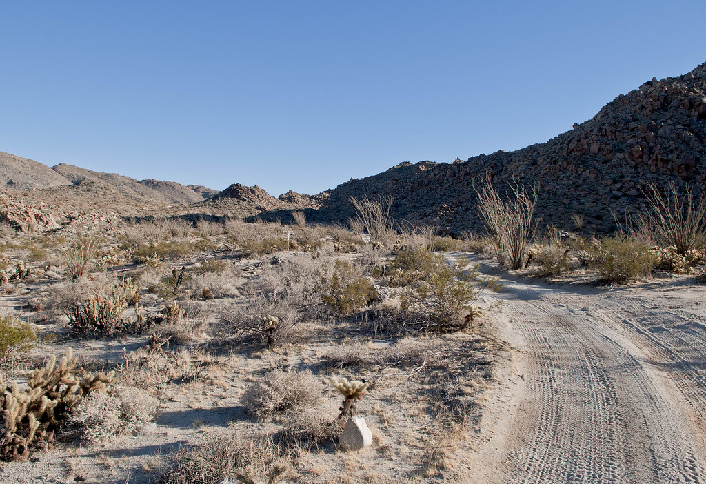
Lower Miner's Shack Site by tomteske, on Flickr
GPS
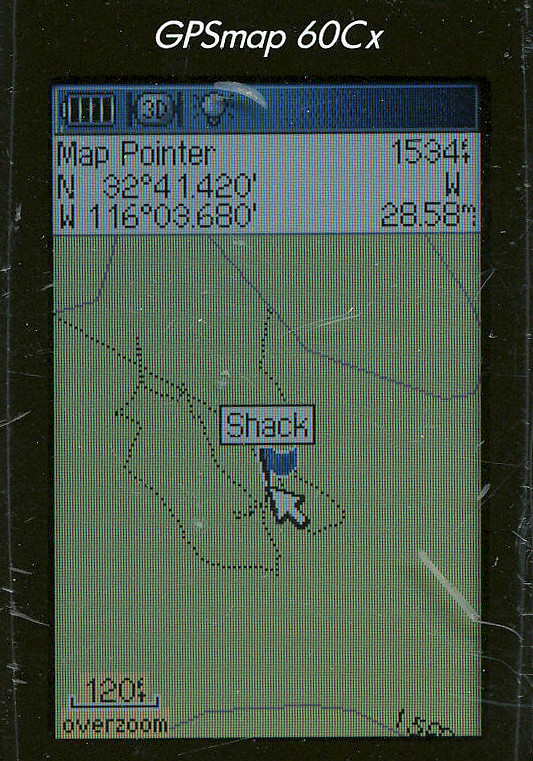
Shack GPS by tomteske, on Flickr |
11/25/2012
Topic:
Box Canyon
tommy750
|
You're right Bob, I too have driven by the monument numerous time and never stopped! Would suggest everyone check out Wikipedia's article on the Mormon Battalion. An amazing story even more apropos in view of our recent presidential election, the battalion has numerous additional local monuments most (including myself) are not familiar with. Tom
http://en.wikipedia.org/wiki/Mormon_Battalion |
11/25/2012
Topic:
iPhone app for Anza Borrego Desert State Park?
tommy750
|
kylekai wrote:
I have another idea, and would like some feedback. This one is solely to help the park. Suppose you're driving down the road and you see a road hazard. What do you do? Who do you call? Or suppose you're driving around in the backcountry, and you see a group of people illegally camped, littering the landscape. What do you do?
I am toying with the idea of writing an app that allows anyone with an iPhone to report these and other incidents with a few taps on their iPhone. With the app I tentatively call "Anza Borrego Reporter" you would choose from selections such as "Road Hazard" or "Illegal Activity" or "Environmental Damage" or even something like "Sheep Sighting." Then you'd add more info, take a picture, and all this info would be either posted to a web site, or sent as an email message to a responsible party for them to act upon.
Those are just some basic ideas. But at the same time I don't want to unnecessarily burden an already over-burdened understaffed park with more information than they may want to deal with. But I would develop this app for the park because I love this park and want to do something to help it.
Anyone have any thoughts on what I've posted so far? Thanks!
-Bill
Kinda like Waze for the desert? That would be great. Tom |
11/25/2012
Topic:
Table Mountain Pictographs
tommy750
|
Wanted to go back to Pinto Canyon via Davies Valley but the girlfriend said no way. We ended up looking for pictographs near Table Mountain. Was somewhat condescending toward my friend with the OJ Bronco when she beached it on a rock a couple trips back--til I did it myself at the exact spot! The girlfriend laughed at my newfound humility while I jacked and dug the Tundra out.
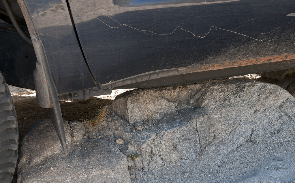
Beached Tundra by tomteske, on Flickr

Tundra Jack by tomteske, on Flickr
Found a couple of stones that could be metates.

Broken Metates by tomteske, on Flickr
Lots of deer tracks and Sandie spotted this deer running away.
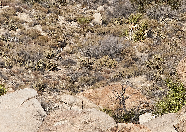
Table Mt Deer by tomteske, on Flickr
Weren't sure we would find anything till we saw this telltale clue.
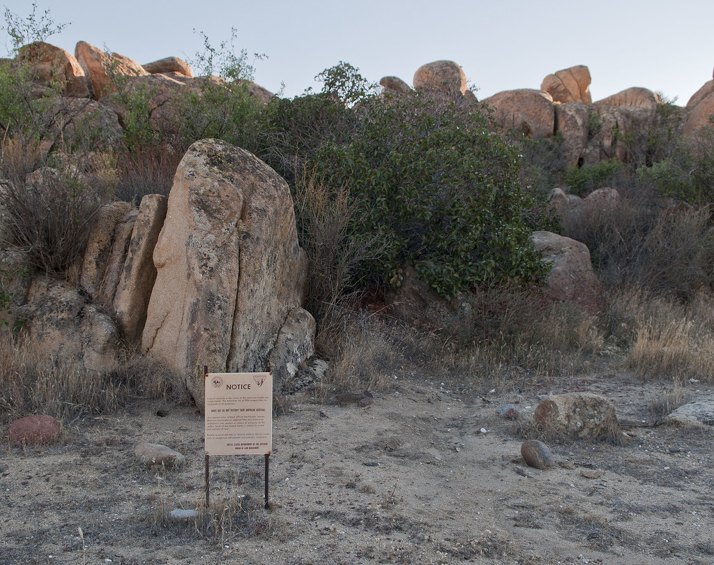
Table Mt Notice by tomteske, on Flickr
I found some old honeycomb and a couple of glyphs in a large cupule while Sandie found the real site.
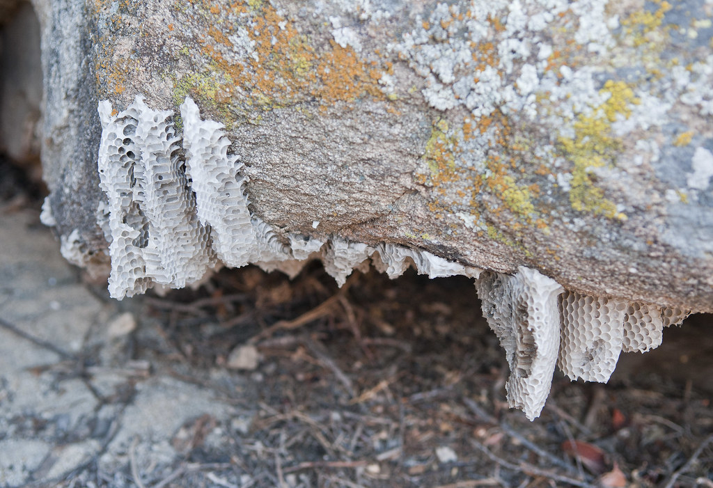
Table Mt Honey Comb by tomteske, on Flickr
Looks like a little stick figure and possible some other shapes on the left side of the pic.
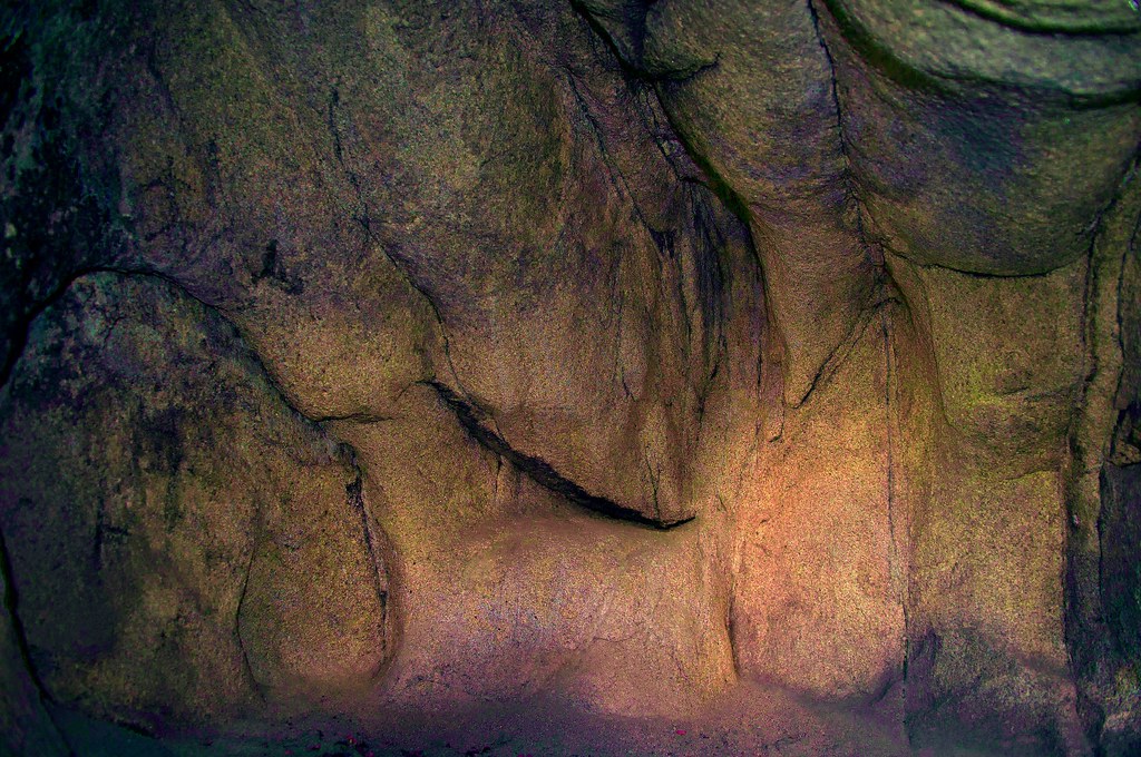
Table Mt Cupule_yxx by tomteske, on Flickr
The little pictograph cave.

Table Mt Cave by tomteske, on Flickr
Digitate Anthromorph in the middle.
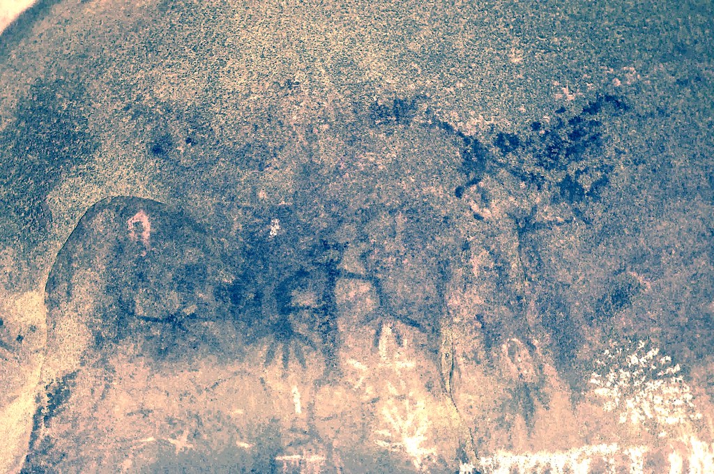
Picto1_yxx by tomteske, on Flickr
Weird looking abstract stuff.

Picto2_lxx by tomteske, on Flickr
Nearby morteros.

Table Mt Morteros2 by tomteske, on Flickr
Heading home.
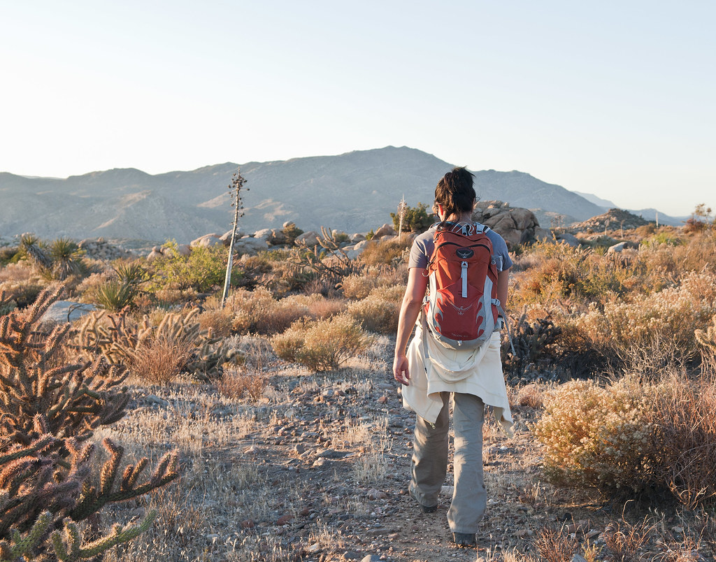
Sandie at Table Mt by tomteske, on Flickr
My first scat pics ever, thanks to you guys 

Scat by tomteske, on Flickr

Scat2 by tomteske, on Flickr
Nice afternoon trip out in the desert. Enjoy. Tom |
11/26/2012
Topic:
Great 2-day trip: Inner Pasture and BM Stage area
tommy750
|
Great trip. Amazing how everyone goes out into the desert for a hike and sees so many completely different things. If those dragonfly pics are taken with a point and shoot, I'm leaving my bulky DSLR at home! Tom |
11/26/2012
Topic:
Table Mountain Pictographs
tommy750
|
Nolan wrote:
Nice report! I have always wondered if the rocks you find in the morteros are the ones the Indians really used or if people just put them in there. Tom, is that your stock jack or did you upgrade to a better/faster jack. I only have my stock jack and thinking about upgrading. I just upgraded to a better air compressor after the ryobi I bought from home depot sucks.
From some research this is the one I chose
Q Industries MV50 SuperFlow High-Volume 12-Volt Air Compressor
Automotive; $56.97
In Stock
Sold by: Amazon.com
Yeah, that's the stock Tundra jack. Works okay but open to any suggestions if anyone has a better choice. Kinda limits where on the frame and how high you can go. Tom |
11/26/2012
Topic:
Table Mountain Pictographs
tommy750
|
ziphius wrote:
Congrats Tom on your 1st scat photo! Some creepy pictos there. Some of them look like boot prints. I wonder what the symbols mean? Those metates look like the real deal, heh? - Jim
The scat looks like my kitty's fur balls which is probably just about right except these probably took the long route through. Coyote scat? Whatever left them sure liked to use the wildlife guzzler as its bathroom. The star/sun looking pictos look weird compared to the Indian Hill/Solstice Cave ones. |
11/28/2012
Topic:
Sombrero Peak
tommy750
|
Don't feel too bad about getting off track out there. Here's a pic of returning from my first hike to Sombrero from the West. Was parked at the end of McCain Valley Rd. Forgot to turn on the GPS at the vehicle, but no problem I thought. Since the end of McCain Valley Rd is much higher than the trail and surrounded by a hedgerow of dense 10-15ft brush, I got really disoriented. Clawing through the brush in the dark wih the temp dropping and my young companion increasingly disillusioned with my wilderness prowess, it was a disheartening moment realizing even my GPS was lost. Our actual position was hundreds of yards away from the GPS map location. Could have saved the day using the GPS coordinates with my printed topo map but it fell out of my backpack on the way back  Lots of lessons learned that night! If you make it to the junction of Canebrake Rd and the old 4WD road and head due East, you'll have no problems. Tom Lots of lessons learned that night! If you make it to the junction of Canebrake Rd and the old 4WD road and head due East, you'll have no problems. Tom
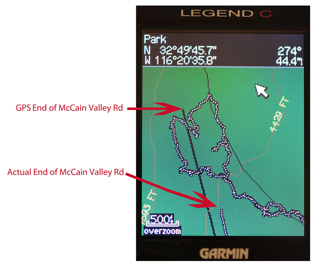
McCain Valley Miss by tomteske, on Flickr
edited by tommy750 on 11/28/2012 |
11/28/2012
Topic:
Torote Canyon Video
tommy750
|
Awesome video makes your previous report even better. Tom |
11/30/2012
Topic:
Tropical Storm Kathleen Sept 10, 1976
tommy750
|
I posted on this book after seeing it in East County Magazine earlier this month (http://www.anzaborrego.net/anzaborrego/Forum/topic316-more-split-mountain-flash-flood.aspx#post2438). Downloaded it from scribd.com ($9) and agree it's an awesome book. Always wondered what the concrete blocks and twisted rebar in Myers Creek were from and the book explains. No way the current Myers Creek culverts under I-8 would help with a flood of this magnitude. Also looks like North Ocotillo was built directly in the Myers Creek flood plain. Tom

Myers Creek Floodplain by tomteske, on Flickr |
11/30/2012
Topic:
Peg Leg Smith Lost Gold
tommy750
|
Did you notice this comment at the end of the magazine? Just so happens I'll be spending a few days after Christmas traveling the southern branch of the Old Spanish Road AKA Mojave Road. Will let you know if I find any black gold nuggets  Tom Tom

Pegleg Was an Honest Man by tomteske, on Flickr |
12/4/2012
Topic:
Little Petroglyph Canyon (AKA Renegade Canyon)
tommy750
|
Wow, nice side trip. Amazing collections of petroglyphs. Took me 20 minutes just to skim through your pics link! Looks like a clean site with not a lot of vandalism. So, do you have to make every site a restricted military base to keep it pristine? Tom |
12/6/2012
Topic:
Vallecito Valley 3 Day Backpack Trip
tommy750
|
Great trip Daren. Nice MacGyver move with the hose clamp. Amazing amount of artifacts out there. Tom |
12/8/2012
Topic:
Goat Canyon MTB Video
tommy750
|
Awesome videos! Never been out there. Definitely need to go. Thanks. Tom |
12/8/2012
Topic:
Vallecito Valley 3 Day Backpack Trip
tommy750
|
Nolan (anutami) wrote:
Pretty crazy I am in little blair right now with 4g
I hear you. The girlfriend and I are in the Table Mt. backcountry right now enjoying a campfire and both surfing the net. |
12/8/2012
Topic:
Vallecito Valley 3 Day Backpack Trip
tommy750
|
Jim (ziphius) wrote:
tommy750 wrote:
Nolan (anutami) wrote:
Pretty crazy I am in little blair right now with 4g
I hear you. The girlfriend and I are in the Table Mt. backcountry right now enjoying a campfire and both surfing the net.
You guys get off the internet right now and look at the stars!
You mean Google Sky, right?  |
12/10/2012
Topic:
Baja Desert
tommy750
|
Awesome video. I'm with David, you have a gyro mount for that camera? Those cirios are really green and loaded with leaves. Last time I was there was in summer and they looked pretty barren. Tom
Cirios on the way to Sierra San Francisco. That's Tres Virgenes in the far background.
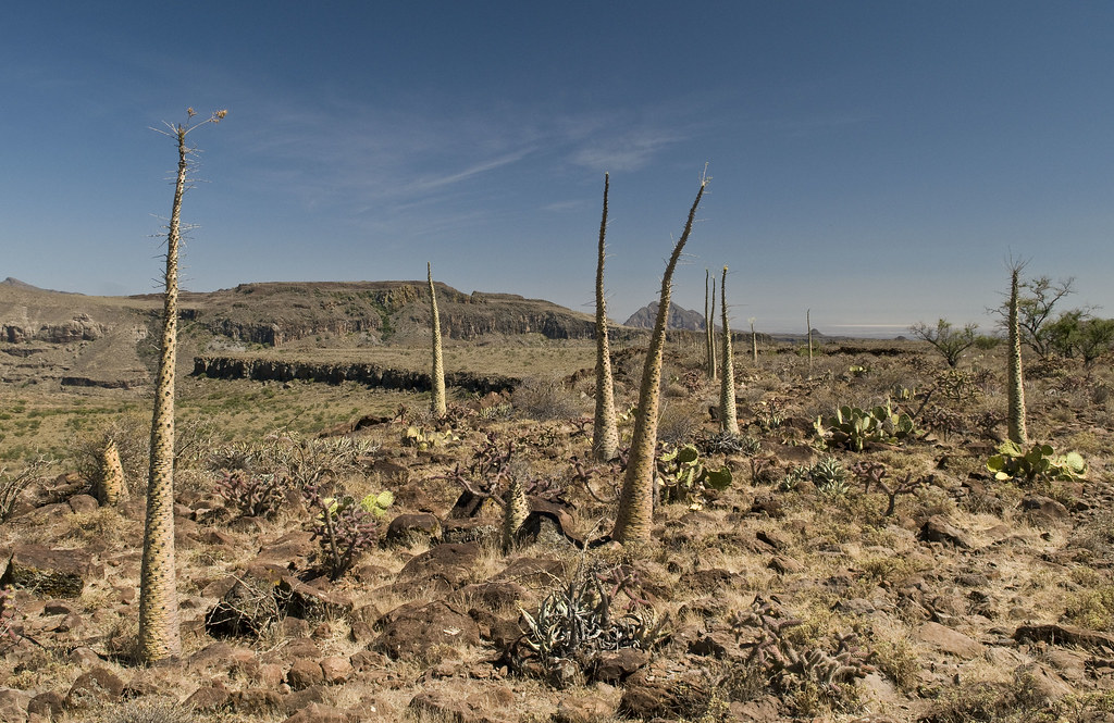
Sierra de San Francisco Cirios by tomteske, on Flickr |
12/10/2012
Topic:
Vallecito Valley 3 Day Backpack Trip
tommy750
|
Nolan (anutami) wrote:
Wow! Looks like they painted the whole cave red! Is there any info on what minerals/plants they used to get that red pigmant?
There's a great book called "Earth Pigments and Paint of the California Indians, Meaning and Technology" by Paul Douglas Campbell. Apparently there were multiple sources of red ocre in CA used for face paint and rock art, the locations a closely guarded secret. Red ocre AKA hematite AKA iron oxide AKA rust would be mixed with animal fat and applied to surfaces. There's even research trying to identify which red ocre mine supplied individual rock art sites. Pond scum containing a certain bacteria that produced hematite could also be used. The book contains info on the other pigment colors used in CA pictograph sites. Tom |
12/10/2012
Topic:
Vallecito Valley 3 Day Backpack Trip
tommy750
|
Nolan (anutami) wrote:
Keep that fire going! it was in the low 30's last night in BV
On Table Mt, was 42 when we went to bed Sat and dropped into the high 30s. Was a little chilly for our sleeping bags in my wimpy opinion. Tom |
12/11/2012
Topic:
First Trips To Baja
tommy750
|
Started reminiscing after Bob's Baja video post and found these June 1981 Kodachromes from my first (okay, second but no picture evidence from the first Nov '77 trip so it doesn't really count) trip down to Bahia de las Animas. Right after graduation, headed down in Richard's Datsun PU and my Superbeetle. Made it down and back with plenty of time to spare before grad school  You guys must have pics of your first trip down. Would love to check them out. Tom You guys must have pics of your first trip down. Would love to check them out. Tom
The gang at Bahia de los Angeles.

Bahia de los Angeles June 81 by tomteske, on Flickr
The road out to Bahia de las Animas wasn't the nice gravel road it is now. The last mile or so was a silty nightmare with lots of shovel work required.
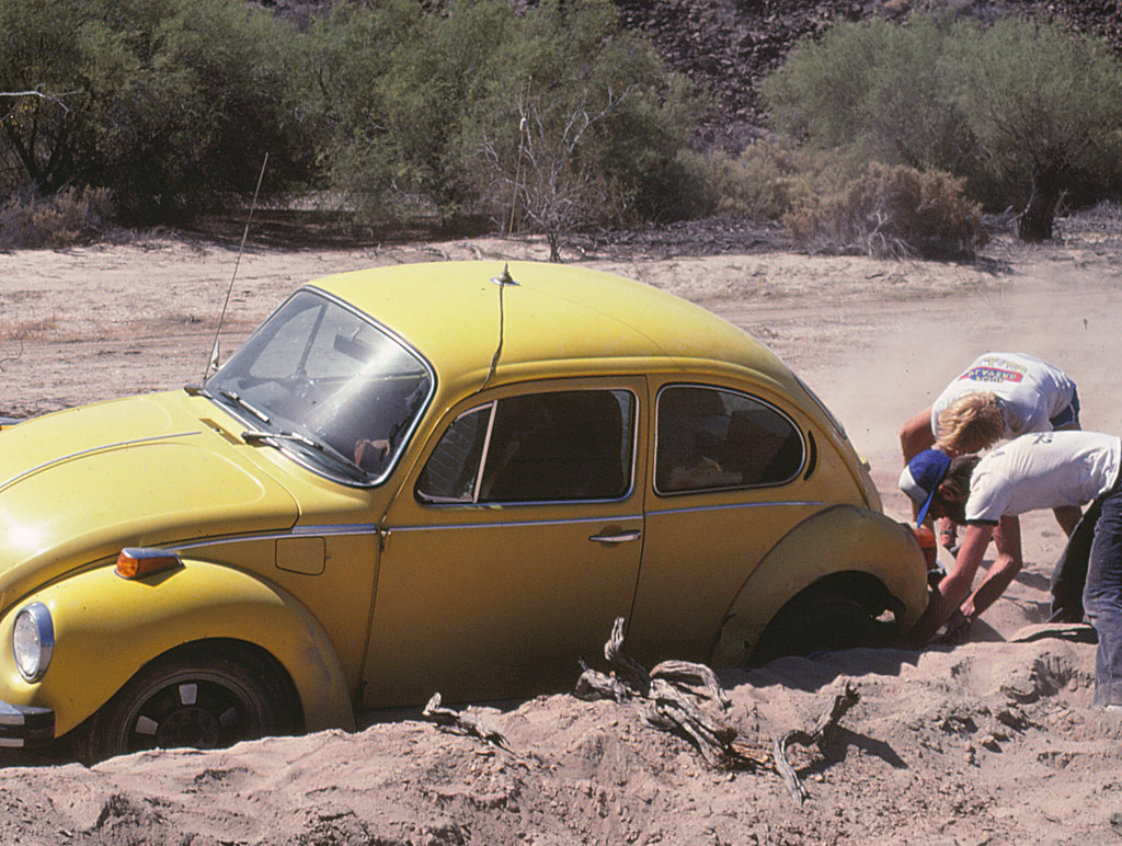
The Silt Road to Bahia de las Animas June 81 by tomteske, on Flickr
The campsite at Bahia de las Animas.
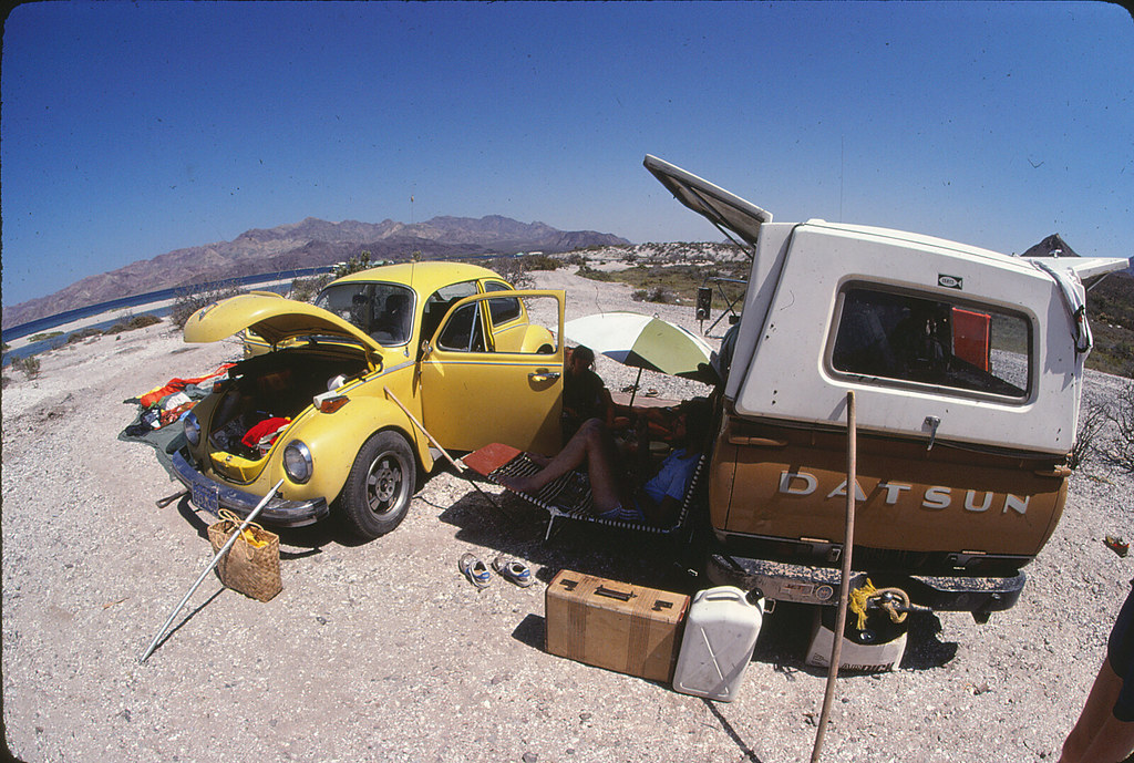
Campsite Bahia de las Animas June 81 by tomteske, on Flickr
My favorite cheap sunglasses.
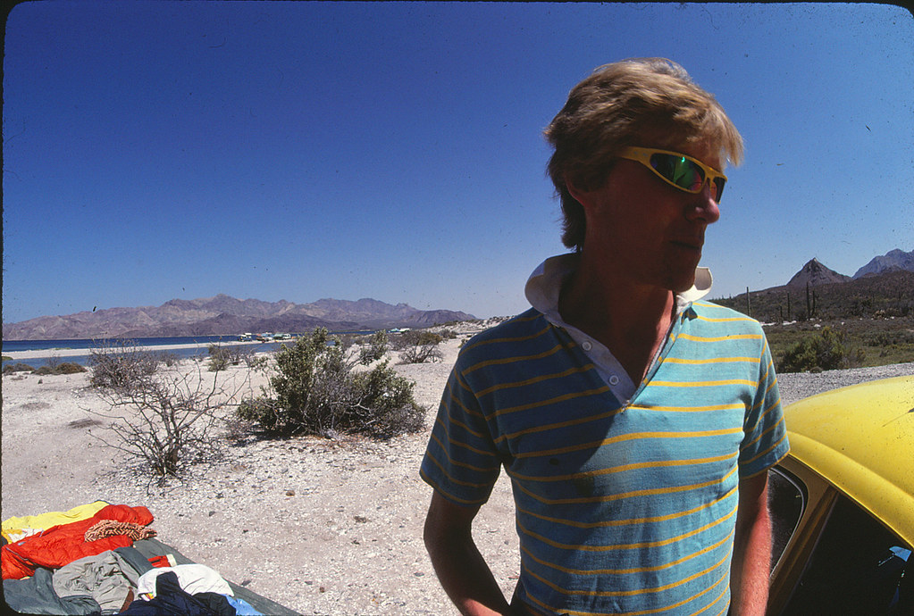
Cheap Sunglasses at Bahia de las Animas June 81 by tomteske, on Flickr
Nice view of the bay and the two islands offshore. Nearly died of fright snorkeling out to them when a school of big mahi-mahi zoomed by about ten feet in front of us.
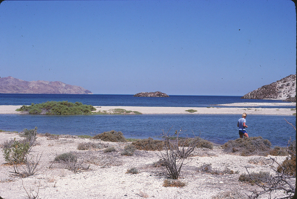
Bahia de las Animas June 81 by tomteske, on Flickr
One last shot as we packed to leave.
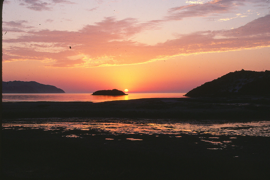
Bahia de las Animas Sunrise June 81 by tomteske, on Flickr |
12/11/2012
Topic:
Yuha Day Trip
tommy750
|
DRT Lakeside wrote:
Most of the area is "limited use" which means you need to stay on the designated trails and have a street legal vehicle. However a couple of the larger trails are "open" which I think means anything goes, but not sure, you may want to double check with BLM.
Here are the only 2 readable maps I was able to find.
The BLM has a paper map they hand out for free on Yuha routes of travel. The entire area is covered with roads and they're actually well marked every few hundred yards so offroad travel isn't really an issue. Does get pretty sandy as you head east in Yuha Wash. The rest seems not as bad. Tom |
12/11/2012
Topic:
Vallecito Valley 3 Day Backpack Trip
tommy750
|
Daren Sefcik wrote:
Tom, have you also read his survival skills of native california book?
Hey, I just ordered that on amazon! Saw it was the other book by Douglas Campbell and checked it out on amazon. Is it pretty informative? Looks like an interesting read. Thanks. Tom |
12/11/2012
Topic:
Vallecito Valley 3 Day Backpack Trip
tommy750
|
Daren Sefcik wrote:
Tom, great info..thanks!
Found this interview on KPBS with the author of that book and Diana Lindsay
http://www.kpbs.org/news/2009/apr/08/discovering-the-history-of-california-indian-art/
Just read the transcript of the PBS interview. Interesting. Will have to read the chapter on how the blue pigment is made. Would be fun to try and make some. They discussed Indian revival and relearning pigment techniques, etc. I wonder if there's a few guys smoking toloache creating new shaman caves somewhere out there. tom |
12/11/2012
Topic:
Vallecito Valley 3 Day Backpack Trip
tommy750
|
Daren Sefcik wrote:
Some initials on the active water trough, I think it is "LG"

Was at the Brawley Stockman's Club last week. It's a private club set up decades ago by local cattlemen and now used a lot for community functions. They have an entire wall of cattle brands used in the Imperial Valley over the years and I wonder if this may be one of them. Tom |
12/12/2012
Topic:
Yuha Day Trip
tommy750
|
waning moon wrote:
Yuha Basin / Bluffs brings back so many memories, it has always been mystical / magical, at least to me. First went there in early sixties when I was young, hiked most of the basin, the well (had water in the casings then), concretion and mud hills, pebble terraces with agate, quartz, jasper, petrified wood and palm, and of course the shell beds. Walking the bluffs there were 5 to 6 foot cleared circles, desert varnish heavy on the repositioned rocks, been that way for at least centuries, cannot remember if the geoglyphs were even known or fenced, but do not remember a fence. Melting old adobes were at the turn off road from highway into Yuha, by Coyote wash a few wattle and daub adobes also slowly melting.
Picked up a wrecked Datsun 1200 fastback in 1970, bought a wrecked counterpart (rear end damage) and welded them together, a couple of lift shackles and it was off road, all of Yuha was open, air out of the tires, R's kept up to 3k or over and went everywhere, never got stuck (what a lucky stupid kid I was) In the early 70's it was one of the off road places to be, very crowded on weekends, Yuha even served as a short course off road race track, I was there on the first Honda three wheeler and the place was being ruined, I stayed on the roads and would almost fall off and wreck a couple of times because I was looking at rocks and or plants, look there is desert holley, 'crash" look arrow weed, petrified wood, crash crash crash, I was not that good on a three wheeler.
It was easy to get lost in Yuha even after having been there a hundred times, but you could climb a bluff and always see the bunker, get your bearings, Bunker has been gone for a long time. My kids learned how to ride (on three wheelers) in Yuha, always went on destination rides, never understood making "tracks" like a hamster on a wheel, what is the purpose. By then a pipe corral had been put up around the bluff geoglyph but there was a hill climb diectly to the East and behind the enclosure, and the morons got in, I do not known how many times my family and I put boulders at the base of the hill climb, to try and block off the #%*!%& who had to destroy everything. I knew it would be closed to ORV's eventually and I agreed.
Stopped going in early 80's, kids almost grown and interested in other things, been back once or twice since. Why no one is there now has alot to do with the un-checked illegal immigrants entry, when the US economy was good, I understand campers, motorhomes left un-attended, while you took a ride, were often broken into.
Glad to see people going back, probably never camp there again, but a day trip is great,
Wow, what a great recollection of the Yuha area. My first trip there was this past August after the big storm. Was the only vehicle out there and the place looked fairly pristine considering how our deserts go. In view of your description of the past use, looks like it may bounce back. Except the geoglyphs which are so trashed it makes you want to cry. Thanks for sharing. Tom |
12/12/2012
Topic:
What are you reading?
tommy750
|
Currently reading this:

Untitled by tomteske, on Flickr
Just purchased these:

san by tomteske, on Flickr

pre by tomteske, on Flickr

61tsK7w933L by tomteske, on Flickr

61GOojL-i4L__SL500_ by tomteske, on Flickr

41OqHb4D1vL by tomteske, on Flickr |
12/12/2012
Topic:
First Trips To Baja
tommy750
|
surfponto wrote:
We still go down to Bahia every year, Still a great destination.
 
 
THis is from this past summer
rockhopper wrote:
We used to go down to Bahia de Los Angeles every year during the 80's and 90's. Good times!
Thanks for sharing. I've got some old photos around herer somewhere 
edited by surfponto on 12/12/2012
Is that Punta Gringa? Looks awesome. When we drove to Cabo two years ago (my first trip down there in 25 years), couldn't believe the amount of development. Every pristine beach had a dozen shacks and a fence around it. Back then, LA Bay only had Papa Diaz' place and that was about it. Tom |
12/12/2012
Topic:
First Trips To Baja
tommy750
|
Daren Sefcik wrote:
My wife and I in San Quintin, probably mid 80's. That is my XT 500 and my mexican plated Jeep....good times...


Nice pics! Can you still drive on the beach at San Quintin? Tom |
12/13/2012
Topic:
What are you reading?
tommy750
|
rockhopper wrote:
Thanks for the suggestions.
Heres a short one I liked
http://angeles.sierraclub.org/dps/archives/dps00752.htm
Wow, that's an impressive trip report. Sounds like a superhuman endeavor. Does this guy have narcolepsy? Not aware of people dropping hypnagogic and hypnopompic into a backpacking story unless they're personally familiar with this sleep disorder. That would make the trek even more impressive! Thanks. Tom |
12/13/2012
Topic:
Yuha Day Trip
tommy750
|
Not to try and swamp this topic with another TR, but must say, it is a nice little area. Was out there 11-9-12 in the dark (really late start) for a dinner and drink in the desert. Tried to find an old burial mound excavated in the '70s but no luck. Maybe Borrego Wrangler had better luck since he passed 20 ft to the west of it according to his map.
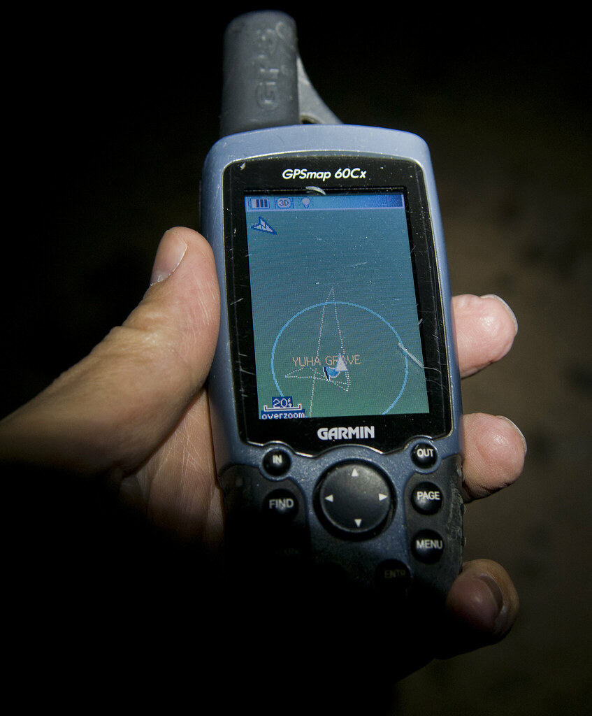
Yuha Grave GPS by tomteske, on Flickr
Did find BM "Ancient" off 247, a nice barely used road.
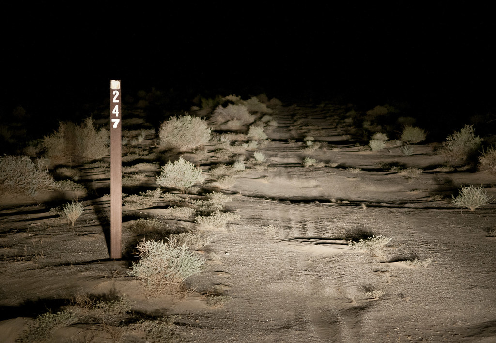
Road 247 by tomteske, on Flickr
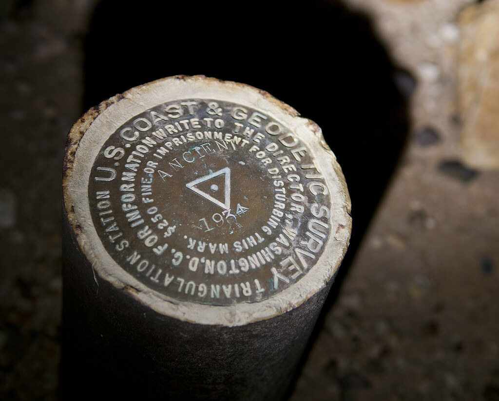
BM Ancient by tomteske, on Flickr
A Juan Bautista de Anza Trail sign.
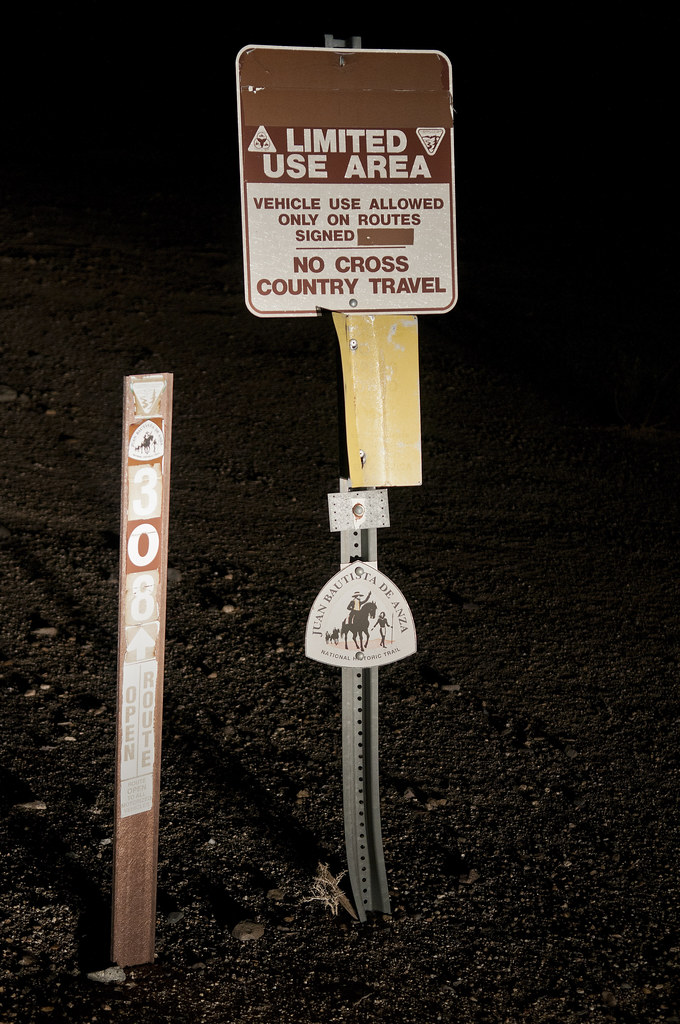
Juan Bautista de Anza Trail by tomteske, on Flickr
The monument.
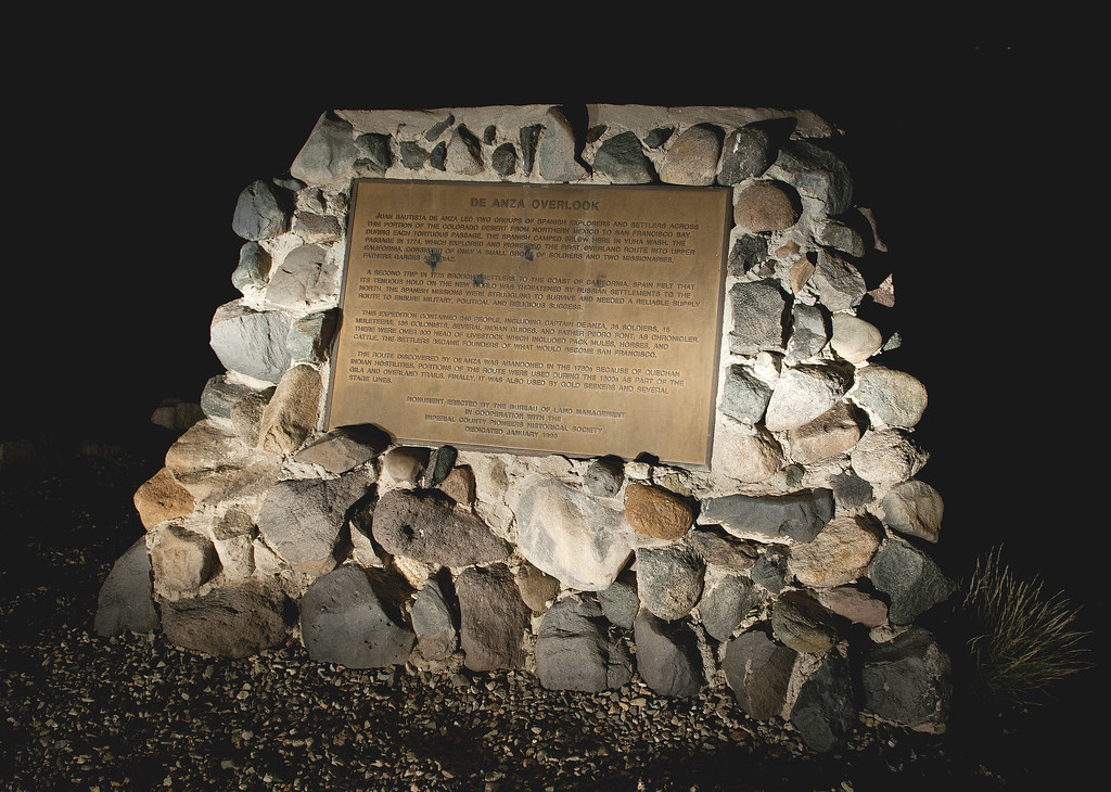
De Anza Overlook by tomteske, on Flickr
Can't recall if this is the east or west tower. How can you not be tempted to "empujar el boton rojo", but according to a USBP agent I spoke with recently, these two towers get frequent use during the summer months and both are functioning.
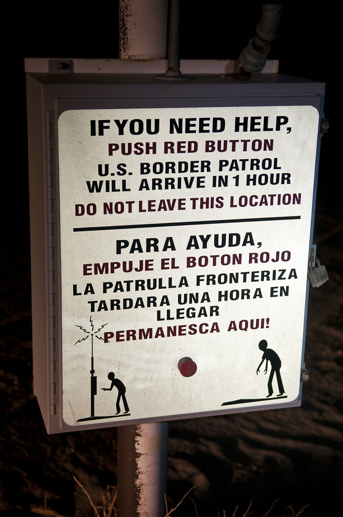
El Boton Rojo by tomteske, on Flickr
The trip with a quick asphalt cheat on Hwy 98. Enjoy your weekend out there, Borrego Wrangler. Should be really nice after the rains. Tom
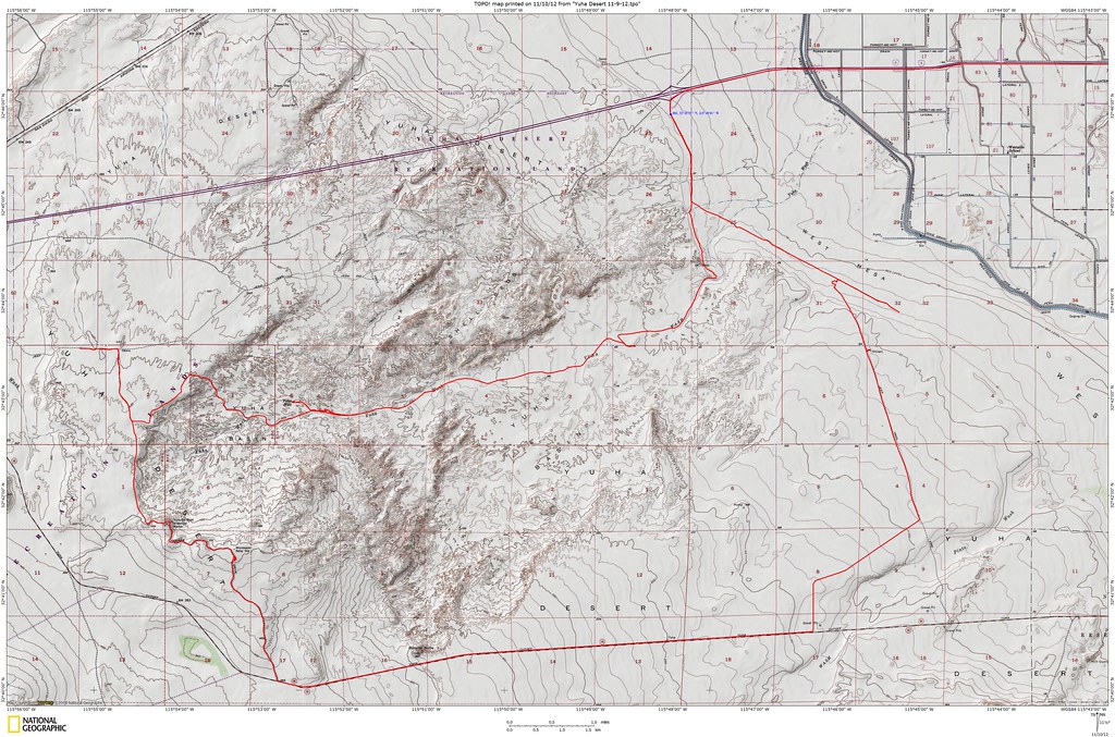
Yuha Desert Trip by tomteske, on Flickr |
12/17/2012
Topic:
Carrizo Mountain & Yuha Basin
tommy750
|
Nice. Am guessing your campsite was on the long ridge NE of Carrizo Mt? Have hiked the ridge twice and think it's harder than Carrizo Mt itself (14 miles rt vs 9 miles from the Painted Gorge gate) but love the view of the Carrizo Badlands from both especially in the late afternoon. Looking forward to your other pics. Tom |
12/17/2012
Topic:
East Carrizo Canyon and June Wash
tommy750
|
DRT Lakeside wrote:
Stayed at Agua Caliente Friday and Saturday night. On Saturday we went out Carrizo Canyon and up the East Fork hoping to see the palms as explained in the Lindsay book "The Anza Borrego Desert Region". Did not make it all the way to the palms, but now that I check the maps/google earth, we were not far off. We were wondering if we took a wrong turn. Book says about 2 miles, and we hiked for 2 hours before we turned around and figured we should have seen them by now. Finally started a GPS track on my phone once we headed back and it indicated 2.2 miles. We were pretty close. bummer.
Dave
It's closer to 4 miles each way. The topo map's northern "Carrizo Palms" doesn't exist, only the two southern "Carrizo Palms." Still worth the hike. Tom |
12/17/2012
Topic:
Carrizo Mountain & Yuha Basin
tommy750
|
Daren Sefcik wrote:
Jim (ziphius) wrote:
That first photo is ethereal and I'd be tempted to do some Photoshop magic to 'erase' the vehicles. Nice spot! Ditto, I like that photo....Starting with CS5 you can use the Content Aware Fill feature and it works very well for that sort of thing. If you are like me and don't use Photoshop you can use the free PS alternative The Gimp and achieve the same result via the re-synthesizer plugin.
I really do not edit my photos much more than color/sharpness/crop but there are times when this type of thing comes in handy.
Apologies for the unauthorized use of this lovely pic 
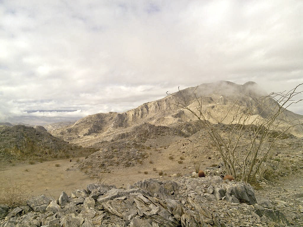
Lasso Backspace Content Aware by tomteske, on Flickr |
12/18/2012
Topic:
Pinto Wash Petroglyphs
tommy750
|
FYI: The skull I found 11/12/12 in Pinto Canyon and reported to the USBP the same day was apparently not recovered. Was subsequently found by the Adventure Hikes of Anza Borrego meetup group when they recently visited the area. Noticed a pic of the skull in their posts (http://www.meetup.com/Adventure-Hikes-Of-Anza-Borrego/photos/12136782/187932592/#187200562) and their subsequent re-reporting to USBP. The coroner did recover the skull and according the coroner's office (spoke with them today), they recovered additional long bones, etc. nearby. They'll be making a f/u visit out there soon. Informed them of the possible metacarpal bone found upstream to the skull. Also, noted a pic of one of the adventure hikers carrying one of my lost hiking poles! At least someone gets to use them  Tom Tom
Frontal View by tomteske, on Flickr |
12/19/2012
Topic:
East Carrizo Canyon and June Wash
tommy750
|
hikerdmb wrote:
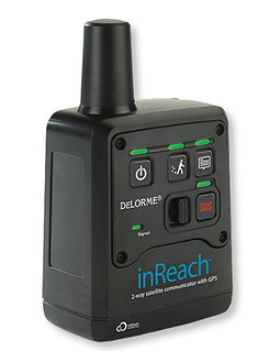
I always carry a paper map and compass. That is how I learned to navigate so many years ago. I also carry my iPhone linked to my inReach which has turned my phone into a nice GPS and satellite communicator. My wife feels much better about me going solo now. However I still use the map way more than the GPS and I think I always will. But I have to say when in doubt of the map the GPS helps.
David
InReach by tomteske, on Flickr
David, was curious how you like your inReach. Just saw one in REI the other day and had no idea it was on the market. Have been packing an Iridium 9555 for the last few years and have zero problems paying the monthly bill to always be able to "make that one call." Can you explain how your unit works with your phone, how easy it is to send texts and about what the monthly bill is? Sat phone is nice but kinda pricey and a bit overkill. Your unit sounds like the perfect compromise. Thanks! Tom |
12/19/2012
Topic:
Carrizo Mountain & Yuha Basin
tommy750
|
BorregoWrangler wrote:
Carrizo Mountain is the highest point of the rocky Coyote Mountains, located in the transition zone between the Salton depression of Imperial County, and the mountains and desert valleys of the Anza-Borrego Desert State Park to the west. The range is located not far north of Interstate-8 near the small community of Ocotillo.
Photos and write-up can be seen here: Carrizo Mountain & Yuha Basin
edited by BorregoWrangler on 12/19/2012
Not finding the above link valid  Tom Tom |
12/20/2012
Topic:
East Carrizo Canyon and June Wash
tommy750
|
hikerdmb wrote:
Tom,
That is my unit. I got it last spring from REI and used it on 3 backpacking trips to the Sierra this summer. Also used it on a 2 week trip to Colorado and every trip to the desert this fall. With inReach I was never out of contact with wife and kids. It connects to my iPhone4 (can sync with Android phones and they also make a unit that will link with a GPS). It tracks my path wherever I am, on a trail or in the truck or jeep. It is very easy to use. I can send e-mails and text messages to anyone in the world. I can also pre-set 3 messages and send those without being connected to the iPhone. It has turned my iPhone into a GPS with the map package that comes with it. I download the area where I will be (So Cal is one map for all the topo maps of the whole area). Since I put my phone in airplane mode when in the backcountry it does NOT eat through the phone battery. Basically it is blue tooth connected to the inReach and the inReach is using the Iridium Satellites to send and receive e-mails and SMS text messages. I have had a couple of issues with it not staying synced to the iPhone but it is easy to re-sync. They have different packages from $10/month up. I have the $25/month that lets me have 40 text/SMS messages a month and unlimited pre-set messages. With the inReach I can also give a link to my wife and buddies and they can follow my track on topo, satellite, or road maps on their computers while I am out. Basically they can see where I am on Google Earth. It updates every 10 to 60 minutes depending on how I set it up. Makes them jealous but that is okay. With my plan I also get unlimited tracks that I can share and I can see my trip when I return. When I got my inReach I got it for about half price with a sale and rebate. If you go solo a lot it is a good thing to have.
Thanks for the info. Sounds like a great setup. The live feed of your tracks is a great idea I wish I had. Tom |
12/23/2012
Topic:
Davies Valley and Pinto Canyon
tommy750
|
Had enough shopping malls for this year so decided to head back to Pinto Canyon and locate the petroglyph sites I missed my last trip out (http://www.anzaborrego.net/anzaborrego/forum/topic373-pinto-wash-petroglyphs.aspx). Parked at the north end of Davies Valley and headed south.
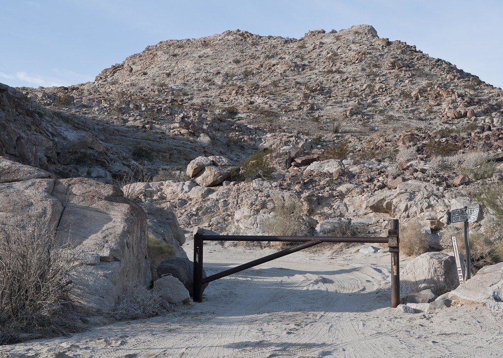
Gate to Davies Valley
Davies Valley Gate by tomteske, on Flickr
Took one of several canyons ascending the long ridge on the western edge of the valley. The canyon mouth had an old General Land Office marker with a nice tower over it.
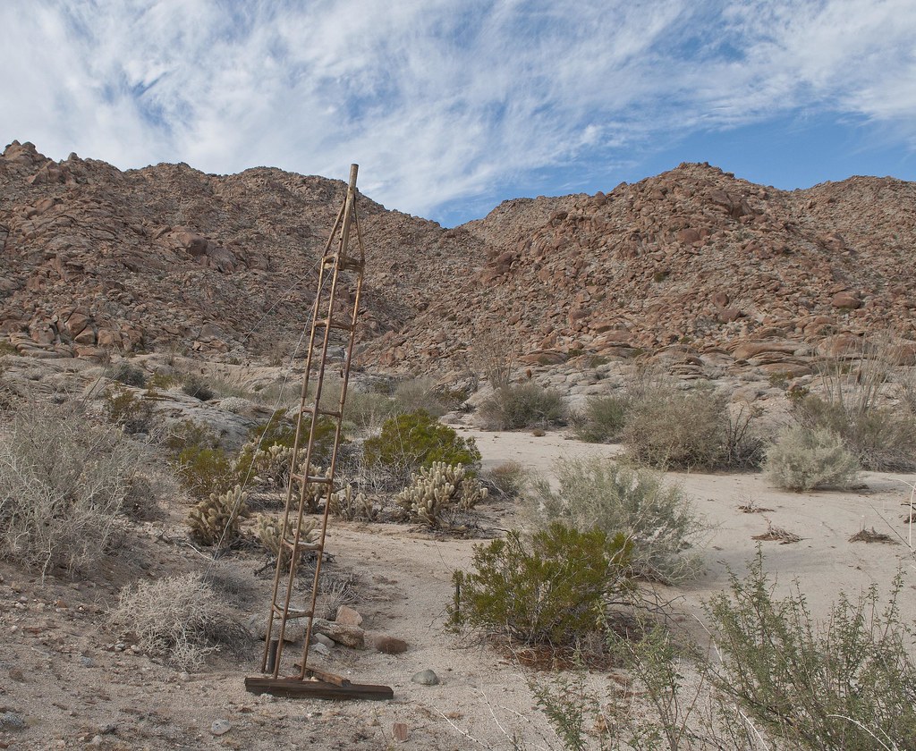
BM Tower by tomteske, on Flickr
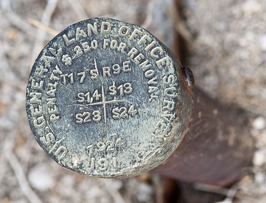
BM 1924 by tomteske, on Flickr
Wasn't sure what the markings meant so did a little internet research. This is a section marker in Township T17 S R9E and is located at the corner of Sections 14,13,23 and 24. The GLO was an agency set up by the Homestead Act and tasked with mapping government land in the west. It was subsequently absorbed by BLM.

Section 14 by tomteske, on Flickr
Halfway up the canyon looking toward Coyote Wells
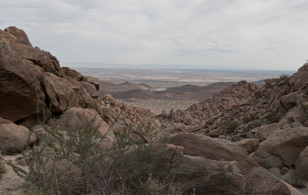
Toward Coyote Wells by tomteske, on Flickr
Morteros at the top

Canyon Entrance Morteros by tomteske, on Flickr
Headed south on a well worn trail not needing the GPS at all.
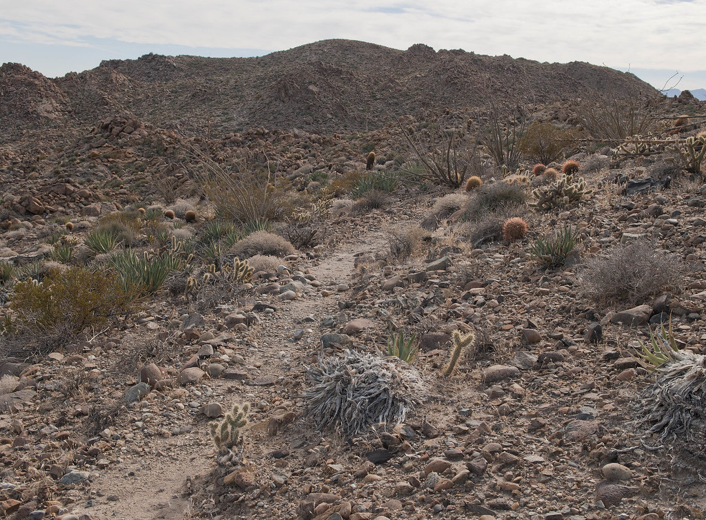
Immigrant Trail by tomteske, on Flickr
Nice view north toward Whale and San Jacinto beyond
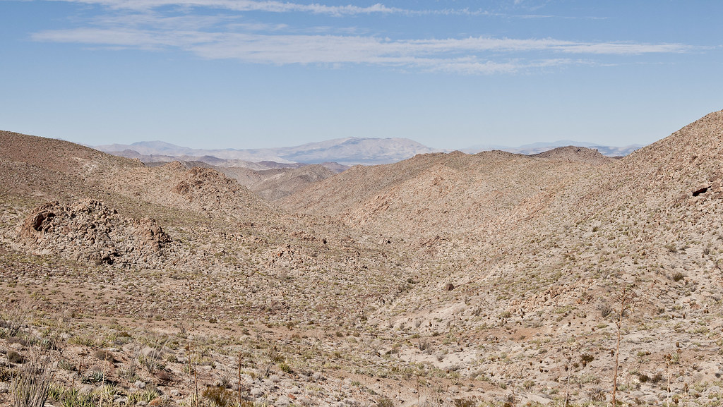
Toward Whale Peak by tomteske, on Flickr
Stumbled onto a presumed sleeping circle overlooking the canyon leading south to Pinto. First one I've ever seen.
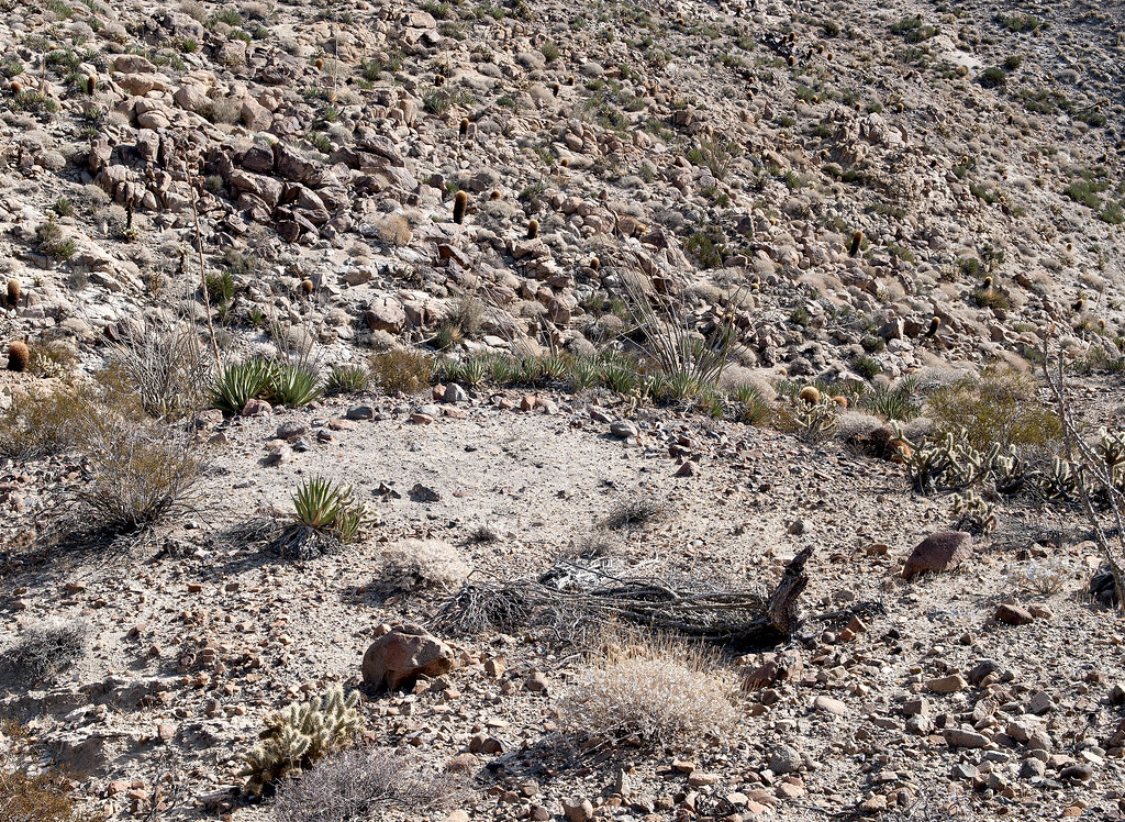
Sleeping Circle by tomteske, on Flickr
Sleeping Circle2 by tomteske, on Flickr
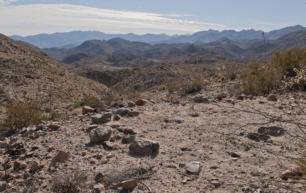
The canyon narrowed and steepened as it approached Pinto
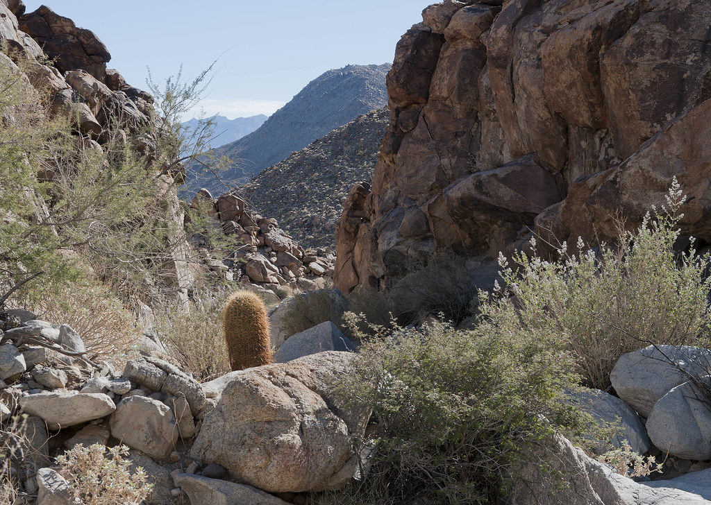
North of Pinto Canyon by tomteske, on Flickr
One of two modern pictographs I saw
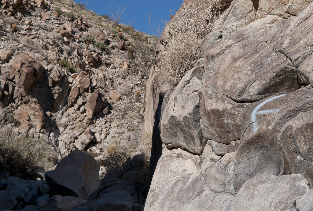
Modern Pictograph by tomteske, on Flickr
Strange geoglyph by the trail
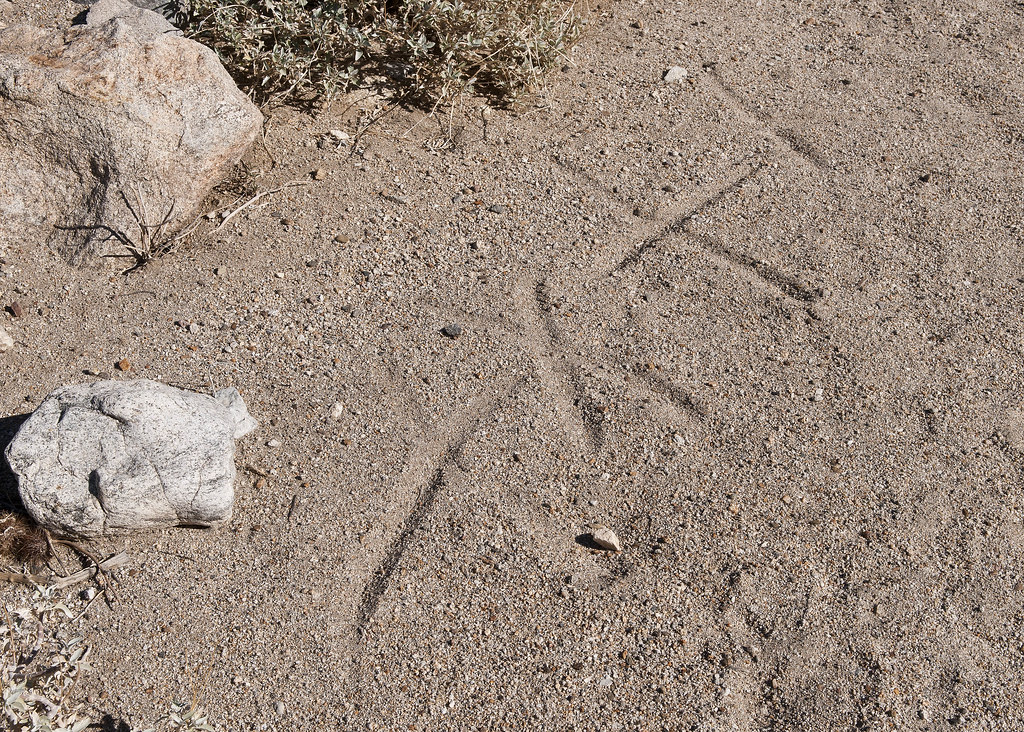
Modern Geoglyph by tomteske, on Flickr
Finally made it into Pinto Canyon. Took a brief peek at the palm oasis with the blue cross before heading downstream. No water there this time.

Cruz Azul Spring by tomteske, on Flickr
Mapped out a likely spot for the petroglyph site way downstream but something caught my eye
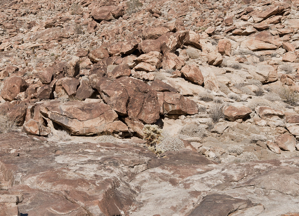
Site B by tomteske, on Flickr
Had walked right by the site last time out although it was pretty dark by then
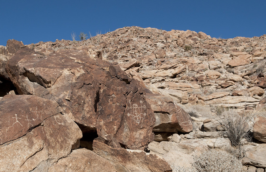
Site B2 by tomteske, on Flickr
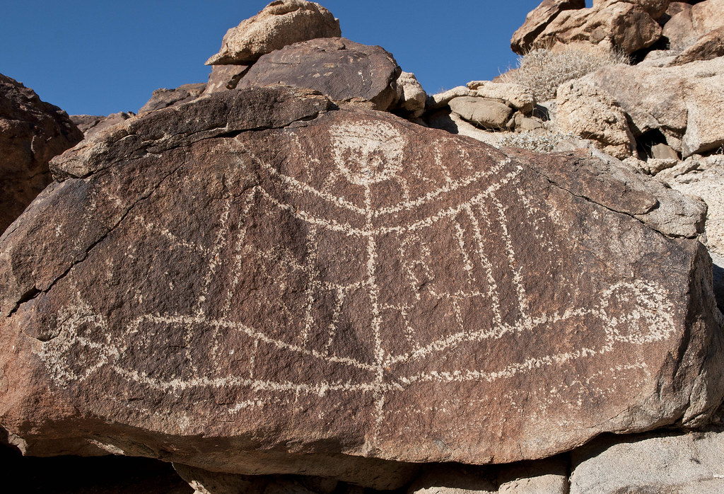
Pretty bizarre looking glyphs with even carved eye sockets
Site B Detail2 by tomteske, on Flickr

Site B Detail4 by tomteske, on Flickr
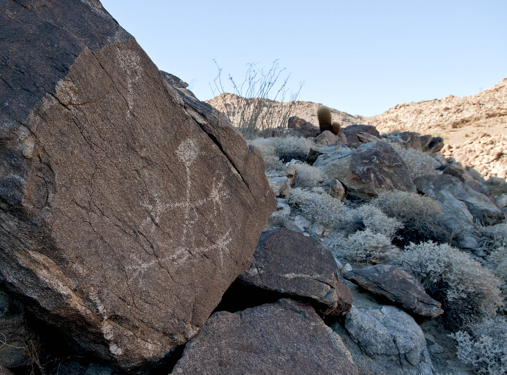
Across the canyon was another glyph location
Stie B Detail7 by tomteske, on Flickr
Didn't have time to look for another site between this one and the shelter cave with the boat-looking petroglyph farther upstream. Headed out of Pinto Canyon and into Davies Valley.
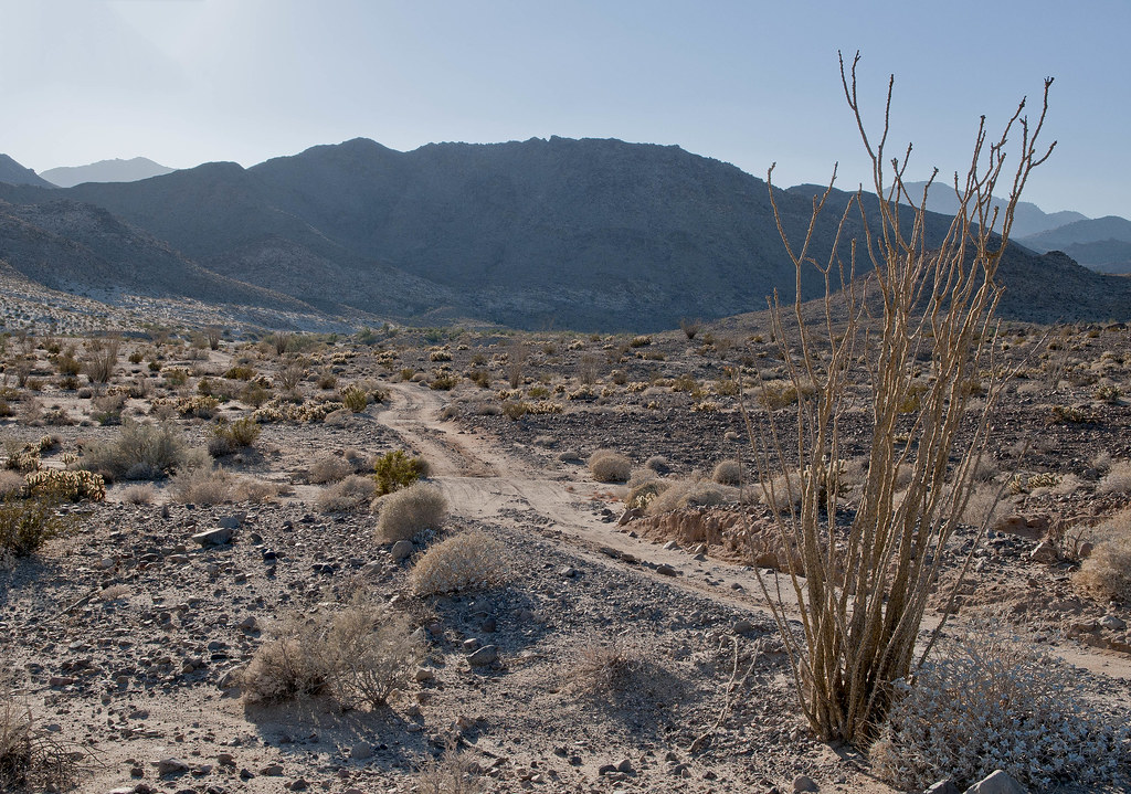
Looking back toward the mouth of Pinto Canyon
Mouth of Pinto Canyon by tomteske, on Flickr
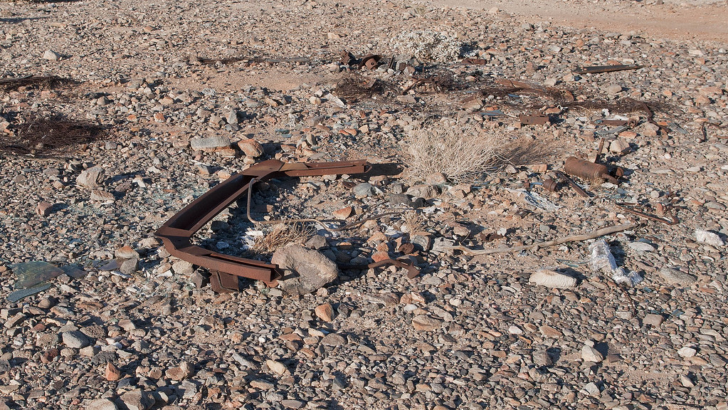
Remnants of one of two completely destroyed vehicles next to the Davies Valley road
Davies Car by tomteske, on Flickr
Looking south down Davies Valley as the Sun fades
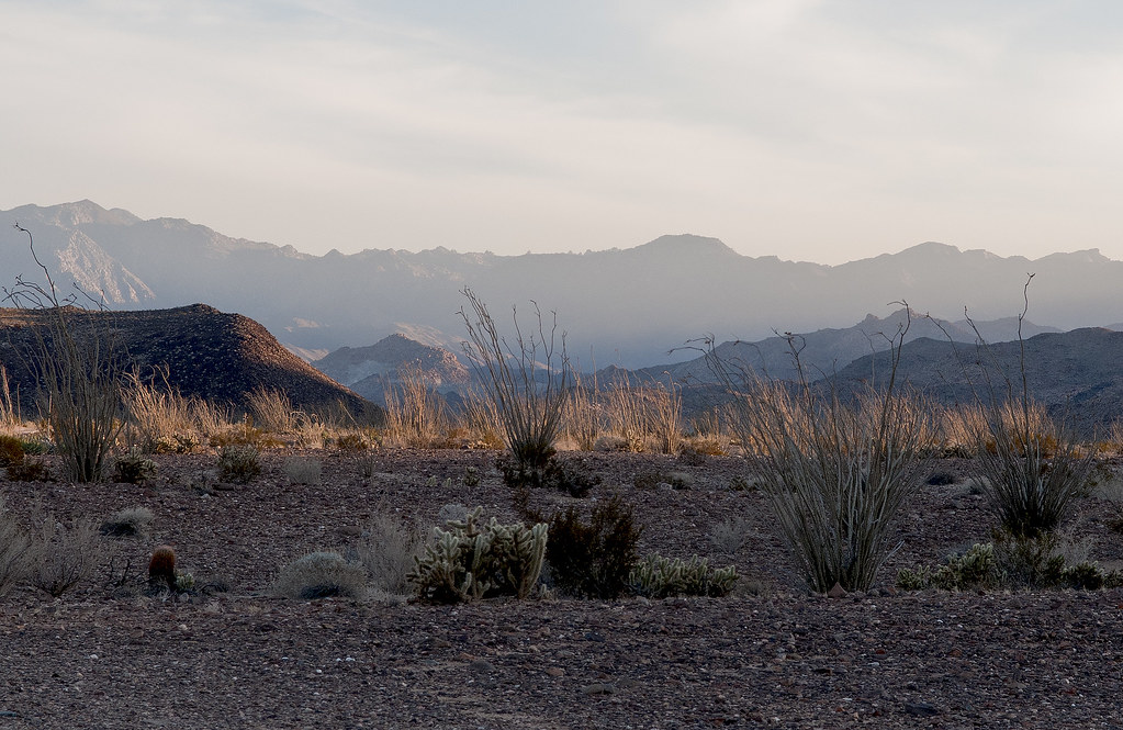
Davies Valley Looking South by tomteske, on Flickr
Have been watching the devolution of this Blazer over the past couple years
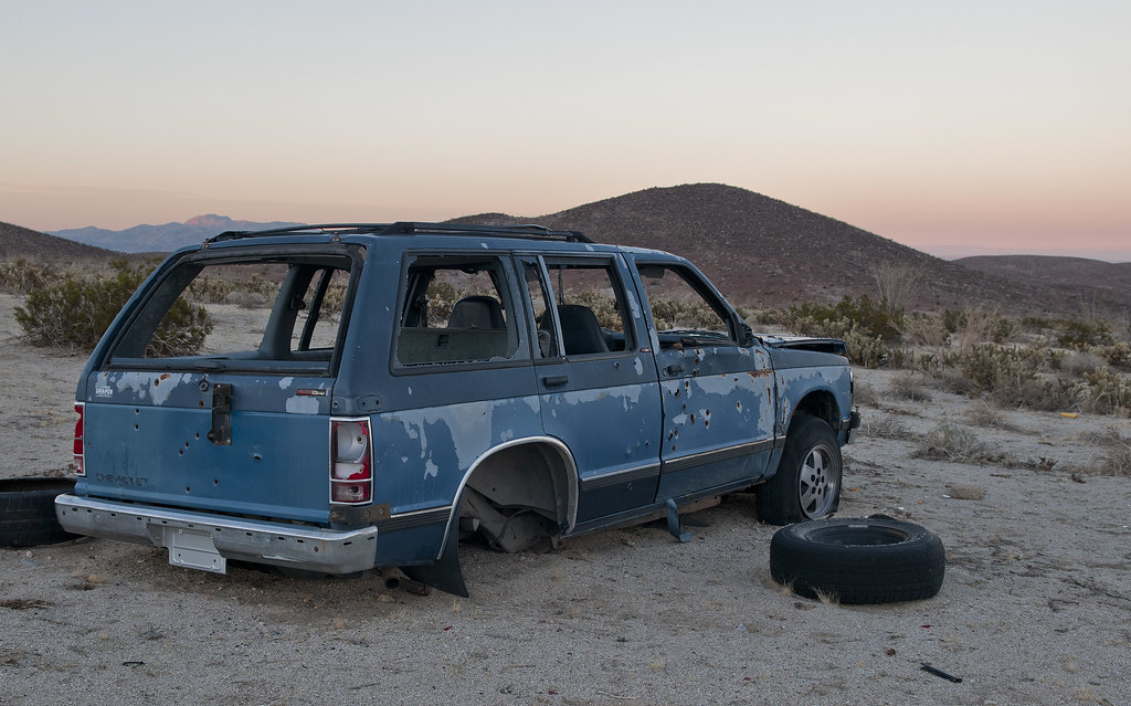
Davies Blazer2 by tomteske, on Flickr
Was rolled over on its side to harvest the rear end last time out but now upright again
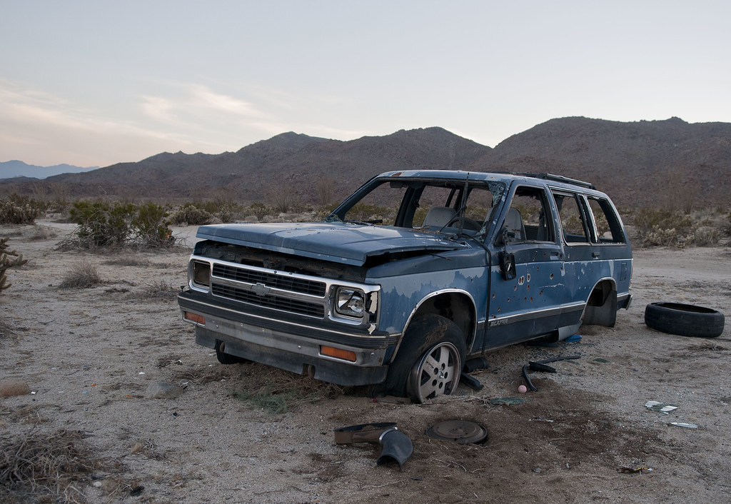
Davies Blazer by tomteske, on Flickr
If you want to see it over the last couple years, here's a couple videos taken in Feb '11 and Feb '12
http://www.flickr.com/photos/tommy750/8301216511/
http://www.flickr.com/photos/tommy750/8302314224/
Father up, found another SUV, new since my last trip out 2/26/12
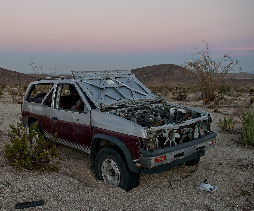
Davies Nissan by tomteske, on Flickr
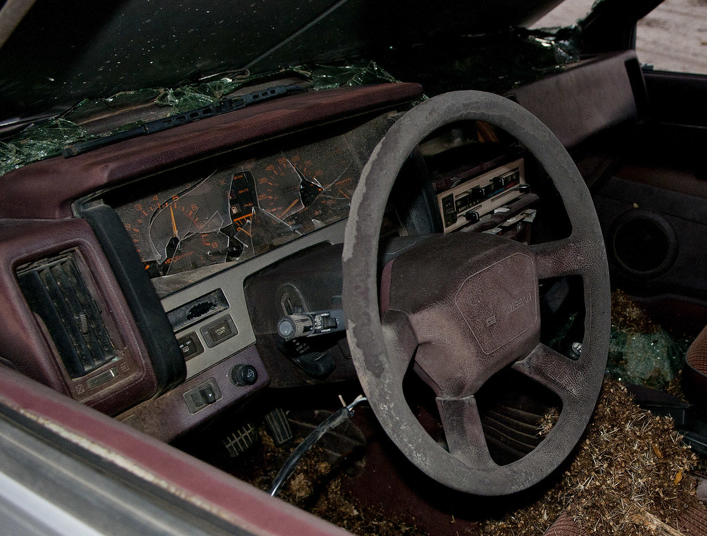
Davies Nissan2 by tomteske, on Flickr
Nice enjoyable time in the Jacumba Wilderness. Sixteen miles, five mylar balloons and zero fights over parking spaces  Happy Holidays. Tom Happy Holidays. Tom

Pinto Canyon From Davies Valley 12-22-12 by tomteske, on Flickr
edited by tommy750 on 12/23/2012
edited by tommy750 on 12/23/2012 |
12/23/2012
Topic:
Dos Cabezas advice
tommy750
|
If you haven't alread gone, would skip crossing the loop of tracks in a low clearance vehicle. Both my Tundra 4X4 and my friend's Bronco scraped since there's not really a RR crossing. Take the road around the loop. Also, you're going to have to cross a berm and get back onto the non-Ocotillo Wind version of Dos Cabezas Road at the circle. Enjoy. Tom
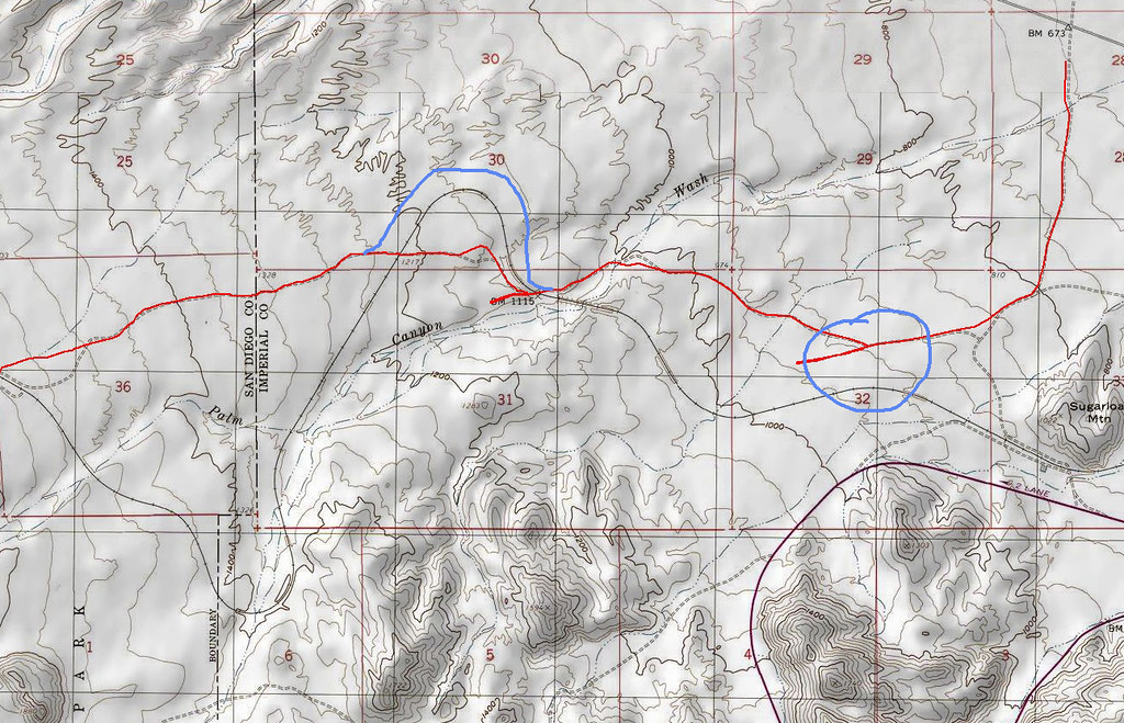
Dos Cabezas Road by tomteske, on Flickr |
12/23/2012
Topic:
Canyon Sin Nombre to Indian Gorge
tommy750
|
I feel your Summer Solstice Cave pain! Have yet to find that place myself. Definitely on my hiking season's list of things to do. Really like your Canyon Sin Nombre pic with the camper at the bottom of the cliffs. Great trip. Tom |
12/23/2012
Topic:
Davies Valley and Pinto Canyon
tommy750
|
mrkmc wrote:
Is that gate ever open or is the area only accessible by foot?
My understanding is it's always closed except to USBP (and the drivers of those two SUVs  ). ). |
12/24/2012
Topic:
Davies Valley and Pinto Canyon
tommy750
|
dsefcik wrote:
Tom, that is just an awesome TR...!!
I have been looking at my maps for sometime thinking about a route close to that, now I am inspired to get out there. I have seen pictures of those glyphs before, glad you were able to find them. Seeing those two vehicles all shot up near the border like that all I could think of was the movie No Country for Old Men.....you didn't find any cash did you??
The sleeping circles are interesting, I have found many of them in the park, usually up on small hills that have small saddles overlooking a valley.
Thanks for Earthpoint lead, that looks interesting.
Here's a route for you. Found it in Desert Magazine July 1946. Have been trying to reconstruct the path based on their clues and help from Google Earth and topos. It's quite a challenge. Would have to skip the dip into Mexico but the rest looks like it could be done. Have tried to find old maps with those springs but can't find any. Mortero and Juniper can be located by their description. Not sure about Mesquite. Caltopo etc doesn't seem to cover that area circa the 1940s. If you know a source, let me know.
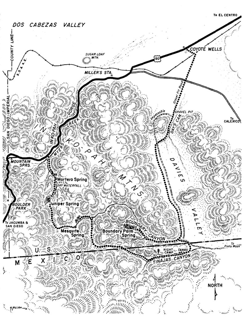
194607-DesertMagazine-1946-July(Pinto Canyon)-15 by tomteske, on Flickr
Yeah, that was one scary movie. Have daydreamed about that scenario on long hikes and just don't think I could pull off something like that. One of my favorite movie quotes is from Mickey Rourke speaking to William Hurt in Body Heat, "There's fifty ways to f#@* up every crime. If you think of 25, you're a genius, and you're no genius."
With regards to Earthpoint and the General Land Office marker, was embarrassed to discover the topo map has the township sections already marked off and numbered. Need to reread my Wilderness Navigation book! Tom
edited by tommy750 on 12/24/2012 |
12/24/2012
Topic:
Davies Valley and Pinto Canyon
tommy750
|
Nolan (anutami) wrote:
Nice report! Never heard of the sleeping circles, Do they have any significance other than a flat place to call home for the night? I bet I have passed by them not even knowing what they were. I really like the pic with the morteros. It is pretty rare to see granite boulders in the Desert w/out the desert varnish all over them. I wonder why they are so clean.
Apparently Malcolm Rogers is the archeologists in the late '20s and onward who found "8000" sleeping circles in the Desert Southwest. I can proudly say I've now found one (and maybe one more). Here's his book sleeve (with a few sleeping circles!) and an illustration describing some of the ones he discovered.
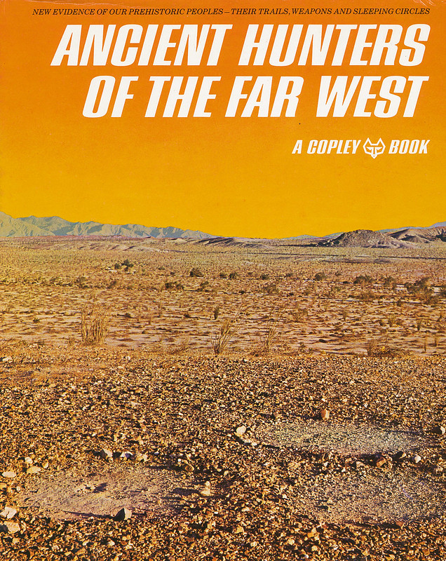
Malcolm Roger's Ancient Hunters by tomteske, on Flickr
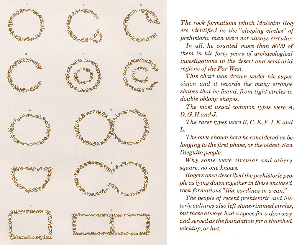
Sleeping Circles Doc2 by tomteske, on Flickr
Here's my maybe sleeping circle farther down the same canyon
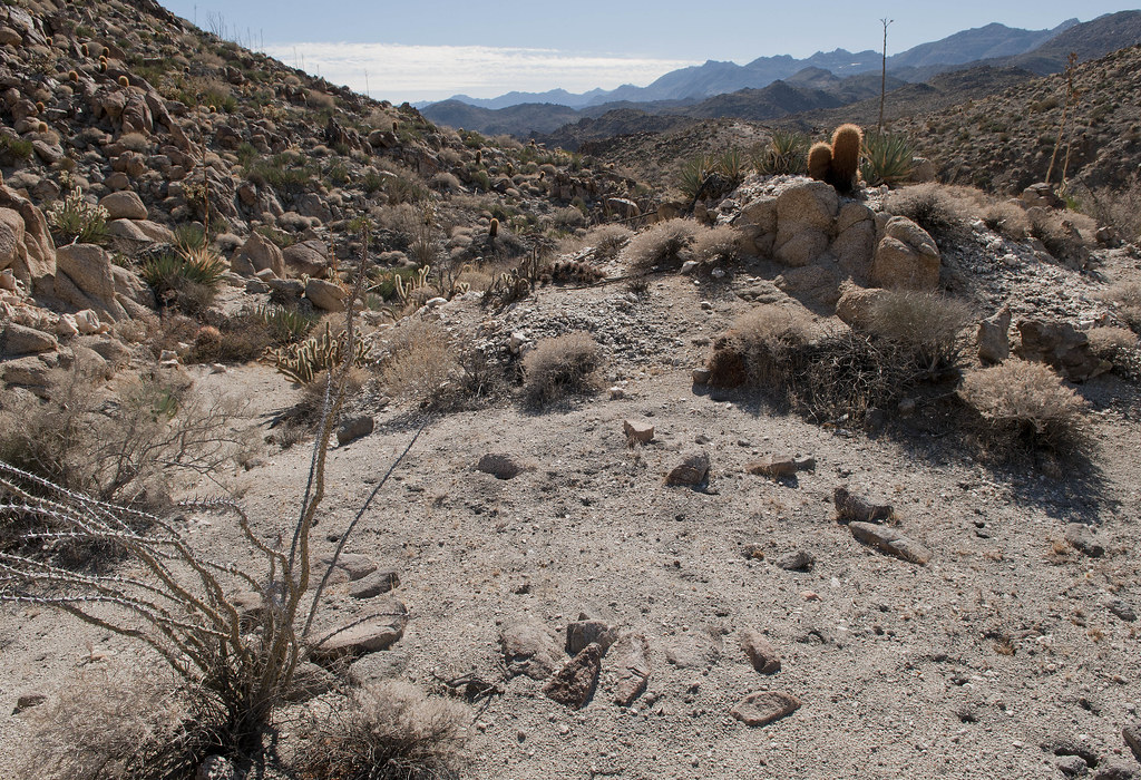
Sleeping Circle Maybe by tomteske, on Flickr
I'm thinking the chunk of granite has no varnish because it's in the stream bed and is getting sandblasted. Tom |
12/26/2012
Topic:
Davies Valley and Pinto Canyon
tommy750
|
DRT Lakeside wrote:
Saw this on our almost hike to the Diablo BM via June Wash and it was on a ridge/overlook/saddle area on the way up. Sleeping circle? or more modern? If I knew what it was, I wouldn't have let the dog on it.
 

I've climbed that ridge to Diablo and saw that clearing. Had never heard of sleeping circles at the time and only thought what an awesome place to pitch your tent for the night. Sure looks like it could be a sleeping circle in retrospect. Tom. |
12/27/2012
Topic:
Agua Caliente Park
tommy750
|
How's the water temp anyway? Always wanted to take a hot soak out there on a chilly winter day. Tom |
12/27/2012
Topic:
Davies Valley and Pinto Canyon
tommy750
|
Jim (ziphius) wrote:
Thanks for sharing that awesome trip Tom. I was so mesmerized by the glyphs on the right of your 1st photo, that I completely missed the human figures to the left. Those petroglyphs are quite ornate and eery. Yep, No Country For Old Men ran through my mind when I saw the bullet-ridden SUVs. I'd say you've found a 2nd sleeping circle for sure. Great trip.  Jim Jim
Those two large ones are the real iconic glyphs but a few others are nearby like this one:
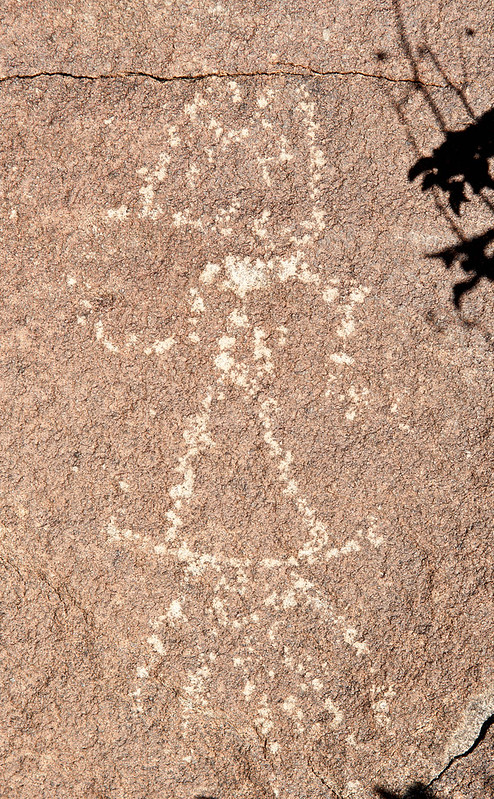
Site B Detail5 by tomteske, on Flickr |
12/27/2012
Topic:
Davies Valley and Pinto Canyon
tommy750
|
DRT Lakeside wrote:
Great trip and photos. I would love to check out that area as well. Nice to know about the gate as well. Maybe I could paint the samurai in USBP livery and mosey on through....though I fear that might only add one more to the # of bullet riddled vehicles out there. 
Nice info on the Land Office marker as well. We found one near Superstition Mt. on Thanksgiving, and could only figure out that it was the corner of 4 sections, with a ton more marks on it. Now the mystery may be solved. I finally got ahold of the (bad) photo I took with my dads flip phone and it seems I only got a part of the marker in the photo. "Land Office" is there but no #s in the pic. We are going out to that area this weekend and I will try to find it again if it is not covered in blowing sand.
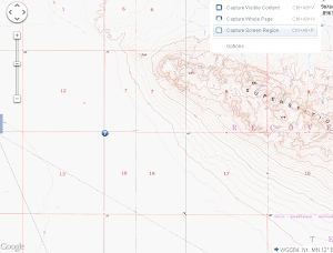 
I'm going to go out on a (short) limb and say your marker will have a cross with S12|S7 on top and S13|S18 below and above the cross T14S R10E. If it doesn't, I still don't have the township thing figured out |
12/27/2012
Topic:
Goat Canyon Trestle from Dos Cabesas Rd
tommy750
|
Nice trip! Still have to get out and visit Goat Canyon Trestle. Thanks. Tom |
12/30/2012
Topic:
Davies Valley and Pinto Canyon
tommy750
|
dsefcik wrote:
tommy750 wrote:
Here's a route for you. Found it in Desert Magazine July 1946. Have been trying to reconstruct the path based on their clues and help from Google Earth and topos. It's quite a challenge. Would have to skip the dip into Mexico but the rest looks like it could be done. Have tried to find old maps with those springs but can't find any. Mortero and Juniper can be located by their description. Not sure about Mesquite. Caltopo etc doesn't seem to cover that area circa the 1940s. If you know a source, let me know. Thanks Tom, I want to follow up on the map after I get back from my trip this week. That article in Desert magazine looks interesting, I like the first pictures of Petroglyphs on page 4 that are titled Sand Tank Canyon AKA Renegade AKA Little Petroglyph Canyon. I have the same photos from my trip out a few weeks ago.
Just had a chance to see p. 4. Have you ever noticed differences between pics you've taken and historic photos you've seen? Tom |
12/30/2012
Topic:
Gray Mountain
tommy750
|
Yesterday, thought I'd take a quick hike and visit Gray Mountain and surrounds. It's a few hundred yards east of the ABDSP boundary and we've all passed it driving past the Jacumba exit on I-8. Parked the car in front of one of the Jacumba exit gas stations and headed north. Found a few large olla sherds and a couple nice landscape scenes. Enjoy.
Seeing this, you have a flicker of hope you've discovered an intact olla.
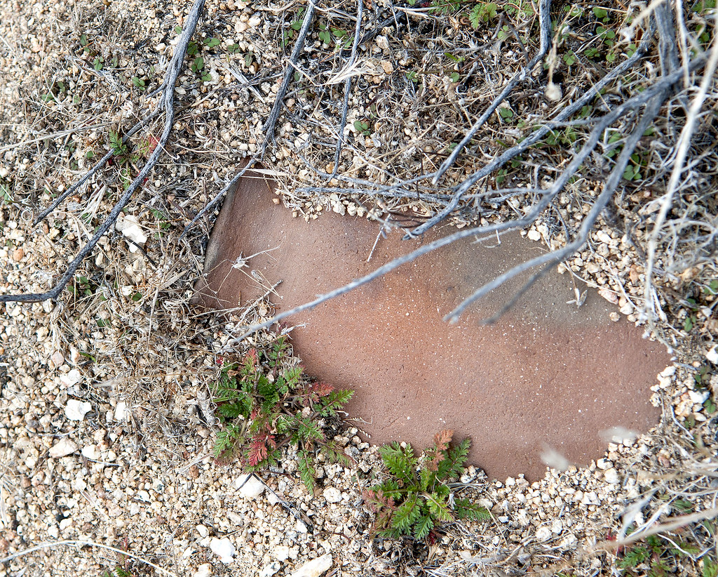
Table Mt Olla by tomteske, on Flickr
Alas, not to be. This was the largest sherd I've ever found.
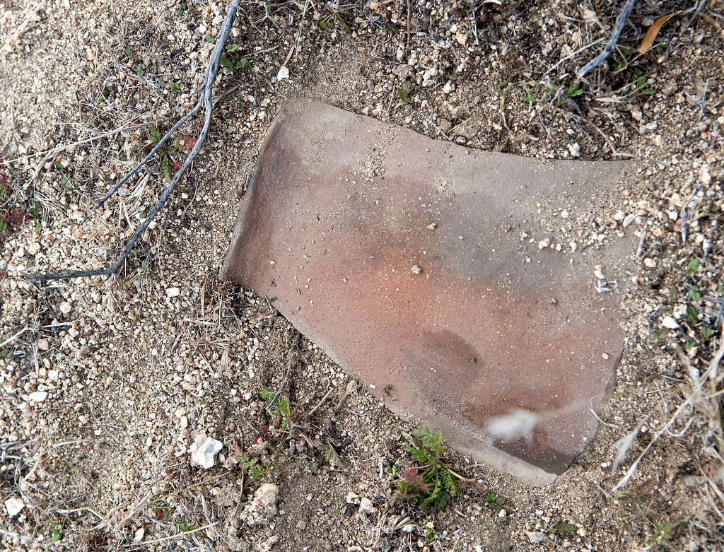
Table Mt Sherd by tomteske, on Flickr
Found this nice granite arch, first one I've seen around here. Gray Mountain is in the background.
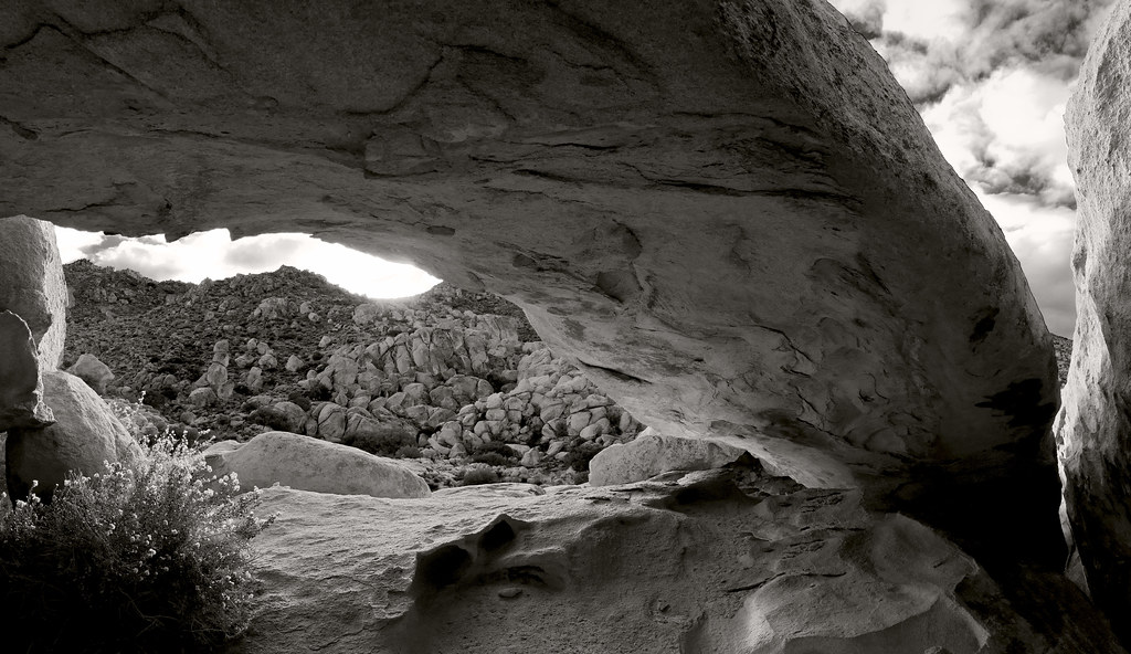
Table Mt Arch by tomteske, on Flickr
One of a few pools after the recent rains.
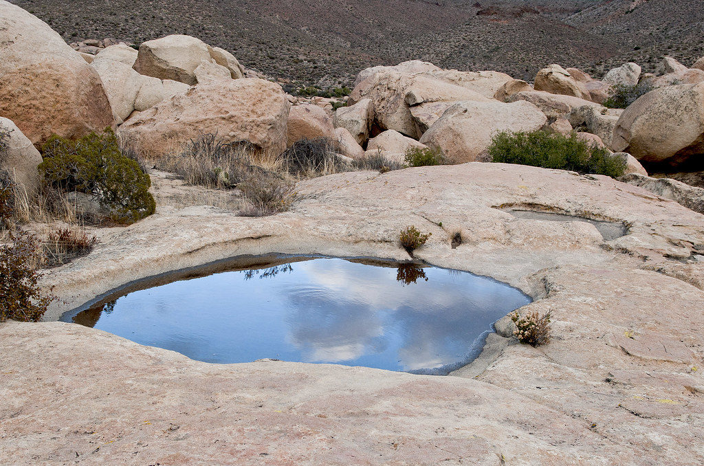
Table Mt Pool4 by tomteske, on Flickr
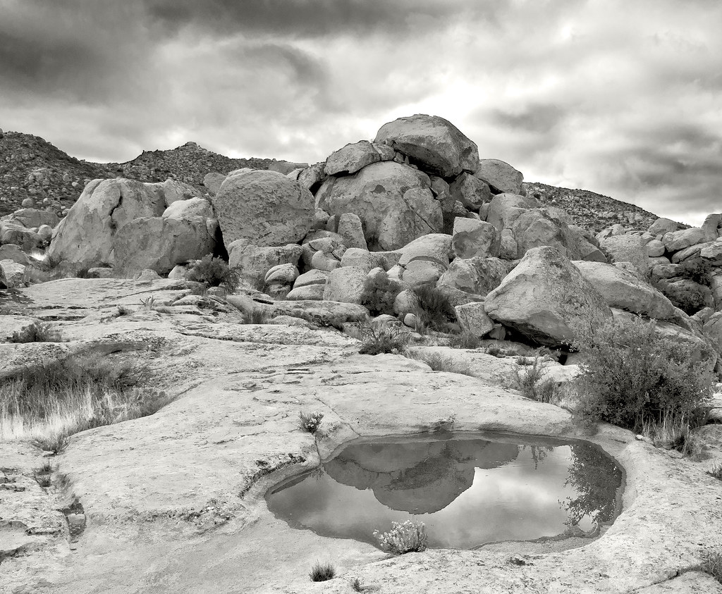
Table Mt Pool3 by tomteske, on Flickr
Thinking this is a coyote skull. Seven miles, zero mylars. Tom
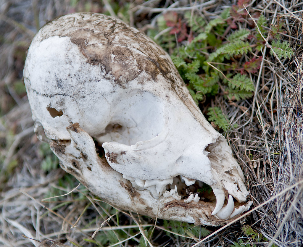
Table Mt Skull by tomteske, on Flickr |
12/30/2012
Topic:
First Trips to ABDSP
tommy750
|
Asked Mom on Christmas if we had any old pics from ABDSP. She directed me toward a large box in the closet and I found these.
This was our first trip out to Anza Borrego in January 1969. Am thinking this is a wash off 78 but not positive.
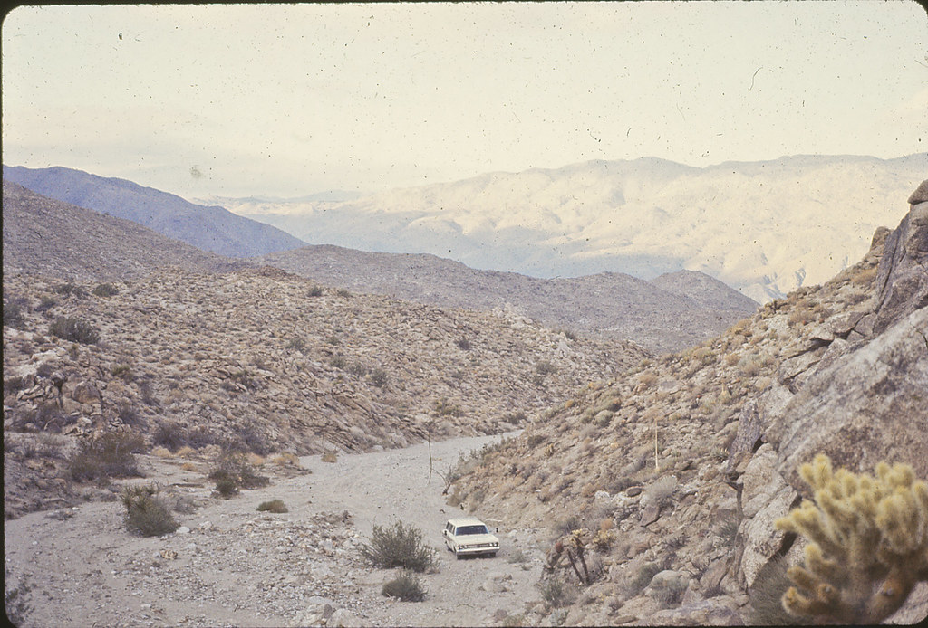
Mercury Wagon Offroad by tomteske, on Flickr
Dad at Pumpkin Patch in March 1971.

Dad at Pumpkin Patch by tomteske, on Flickr
Me at Elephant Tree trail, March 1971. You guys have Anza Borrego photos from the good 'ol days?
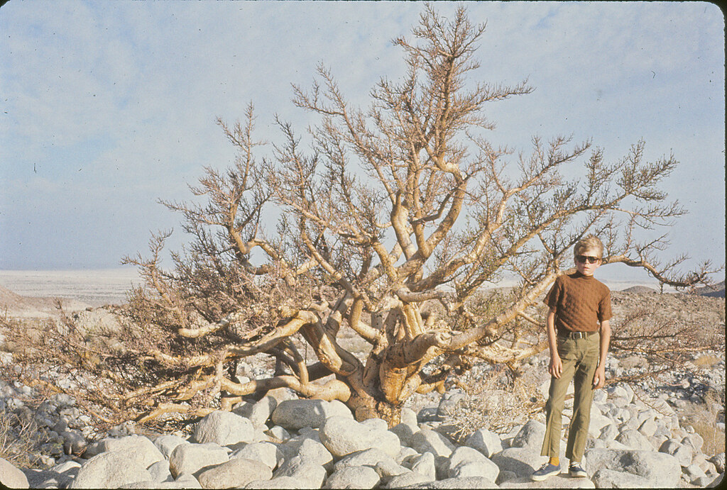
Senor Torote by tomteske, on Flickr |
1/2/2013
Topic:
Nolina Wash
tommy750
|
Did you make it all the way up Nolina to Pinyon Mt.? There's a nice approximately 30ft dry fall somewhere back there that's really pretty. Tom |
1/2/2013
Topic:
June Wash, Torote Canyon, Indian Hill
tommy750
|
Great trip! Like those night shots. Looks like you're doing more than your part getting the next generation excited about the desert. Tom |
1/2/2013
Topic:
Gray Mountain
tommy750
|
dsefcik wrote:
Another "on my list" spot....thanks for posting. Did you just go under the freeway pass and head straight up?
Yes, just walk north. The barbed wire fence next to the freeway has already been conveniently breached. Tom |