1/2/2013
Topic:
Gray Mountain
tommy750
|
Jim (ziphius) wrote:
Wow, that's the biggest piece of pottery I've seen. You almost had the whole olla! Great puddle too. How deep was it? I salivate over desert water. I was adding up all the water that I found in morteros this week and figured I could have extended my trip by a day if I had harvested it all.....
The pool was probably about six inches deep and looked pretty clear. Made a nice reflection. The pottery sherd was probably the size of your hand. Was definitely different than the usual find. Tom |
1/2/2013
Topic:
Nolina Wash
tommy750
|
surfponto wrote:
We didn't make it that far.
I may hike up that way again this coming Sunday.
How far back is the waterfall? We veered off the the left up a side canyon at one point.
Bob
tommy750 wrote:
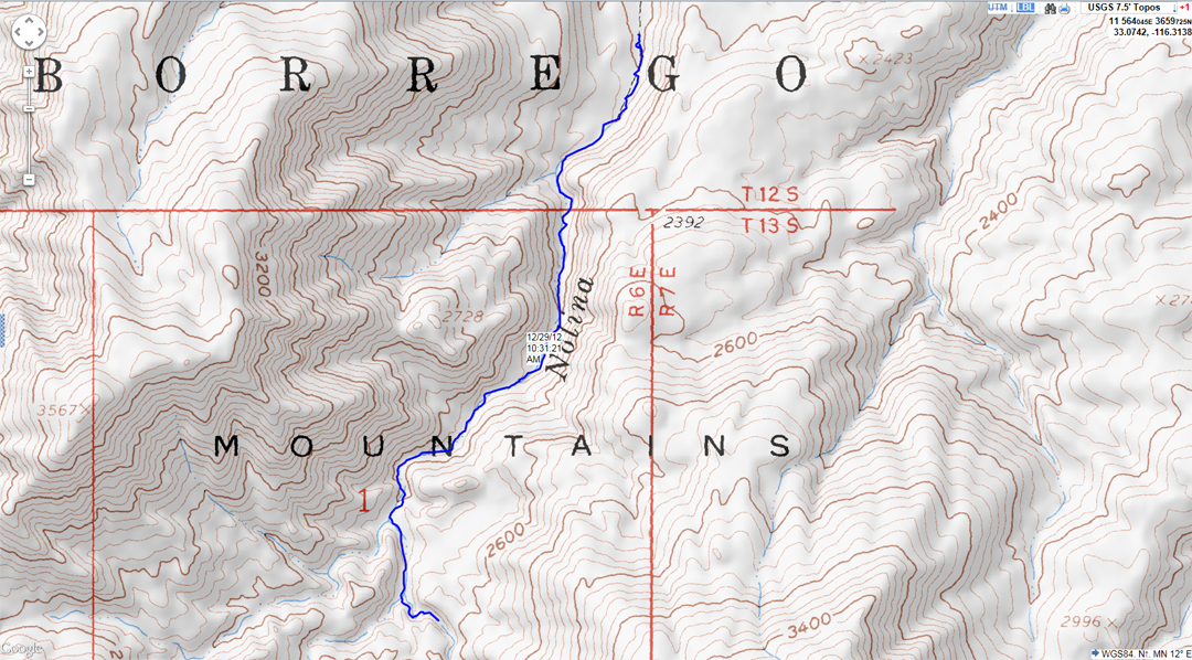
Did you make it all the way up Nolina to Pinyon Mt.? There's a nice approximately 30ft dry fall somewhere back there that's really pretty. Tom
edited by surfponto on 1/2/2013
Not positive how far up it was but think you were getting close. Here's a map of my loop up Pinyon Wash and down Nolina. Was modified from a Schad hike. Think he described a Bighorn to Pinyon Mt to Nolina loop. Tom
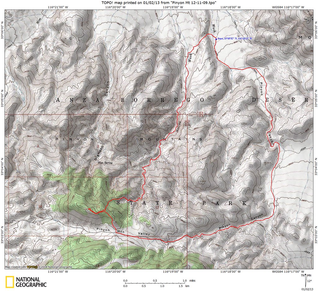
Pinyon Mt by tomteske, on Flickr |
1/2/2013
Topic:
Davies Valley and Pinto Canyon
tommy750
|
DRT Lakeside wrote:
Just got back last night from Superstition area, and long story short-I couldn't find the marker again. I didn't put it into the GPS/Phone and figured I could find it. No luck after driving and walking all over the area for an hour or so. It was getting very cold and the wind and rain was starting, so we gave up (for now) but I put it in the GPS this morning
FYI it rained hard on us Sunday night and on the way back home (monday) there was still snow on the north facing slopes directly across from the In-Koh-Pah offramp. Never seen that before 
DRT Lakeside wrote:
You are correct, there definitely was a cross with the 12,7,13,18 around it, but those were the only numbers we were able to remember, and my crummy pic did not help. I hope to grab a better picture, rubbing or something this weekend. I will definitely let you know if you have the hang of the Township stuff.
Dave
tommy750 wrote:
DRT Lakeside wrote:
Great trip and photos. I would love to check out that area as well. Nice to know about the gate as well. Maybe I could paint the samurai in USBP livery and mosey on through....though I fear that might only add one more to the # of bullet riddled vehicles out there. 
Nice info on the Land Office marker as well. We found one near Superstition Mt. on Thanksgiving, and could only figure out that it was the corner of 4 sections, with a ton more marks on it. Now the mystery may be solved. I finally got ahold of the (bad) photo I took with my dads flip phone and it seems I only got a part of the marker in the photo. "Land Office" is there but no #s in the pic. We are going out to that area this weekend and I will try to find it again if it is not covered in blowing sand.
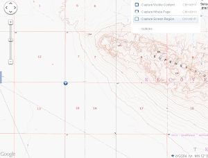 
I'm going to go out on a (short) limb and say your marker will have a cross with S12|S7 on top and S13|S18 below and above the cross T14S R10E. If it doesn't, I still don't have the township thing figured out
Tried to find another section marker last night next to BM Weak. Weak had been vandalized and the bronze disk was missing. Only found a splintered post where the section marker should have been. Wonder how many still even exist. Tom
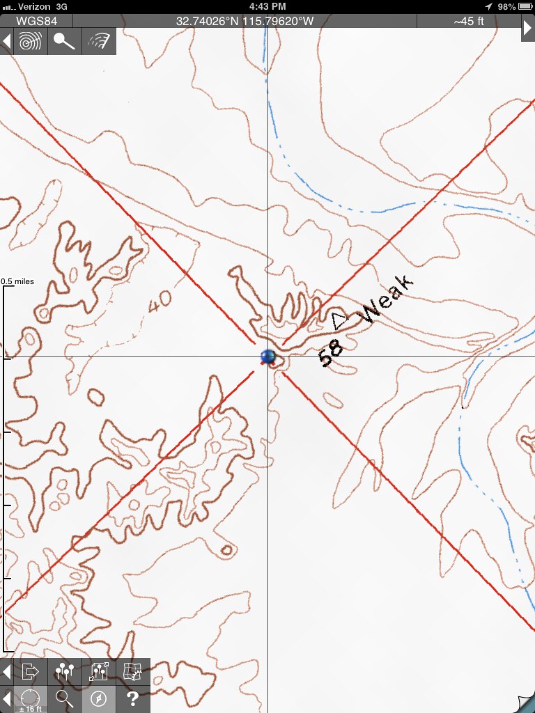
section marker by tomteske, on Flickr |
1/2/2013
Topic:
Mc Cain Valley Sacatone Overlook 1/6/2012
tommy750
|
I agree with Daren. Should be able to make it out okay. Check out the Carrizo Overlook a couple miles up the road while you're there. Tom |
1/3/2013
Topic:
First Trips to ABDSP
tommy750
|
Great pic. Like the nice campsite. Thanks for sharing. Tom |
1/6/2013
Topic:
7 Days in Anza Borrego Desert State Park
tommy750
|
Wow. Like those panorama shots. What program do you use? Really like the Whale Peak sunrise. Agree, those fossilized footprints are amazing. Tom |
1/8/2013
Topic:
Travertine Palms Oasis and Caves
tommy750
|
Great trip! Never have been to the mud volcanoes or Obsidian Butte. Amazing what they can do tracing the origins of obsidian artifacts these days. Here's an interesting link about obsidian sites used by the indigenous in the Southwest including Obsidian Butte. Tom
http://www.swxrflab.net//swobsrcs.htm |
1/8/2013
Topic:
Pinyon Wash to Harper Flat and Cabin
tommy750
|
Nice trip. Walked right past the cabin last trip out and never even saw it. Guess I can start leaving the spray can and chisel behind, a pencil seems to be the best way to leave a permanent tag |
1/9/2013
Topic:
7 Days in Anza Borrego Desert State Park
tommy750
|
Nolan (anutami) wrote:
Paul Remeika should put you on commission! I went ahead and purchased a copy 
Paul Remeika will be giving a two-day course on Anza Borrego geology the weekend of Feb 9-10. Thinking about attending. Sat morning in a lecture and the rest of the weekend out in the desert. Here's the link:
http://theabf.org/event/driving_tours/anza_borrego_land_rain_shadow_0 |
1/10/2013
Topic:
Pinyon Wash to Harper Flat and Cabin
tommy750
|
dsefcik wrote:
Nice TR David, I still want to do an Alma Wash/Harper Cyn backpack trip...anybody interested?
I wouldn't mind trying that route sometime. Assuming it's about a 20 mile one-way trip? Tom |
1/10/2013
Topic:
7 Days in Anza Borrego Desert State Park
tommy750
|

Is that a B-M-W you're on, Daren?? Isn't that a little too bourgeois for that look?  |
1/14/2013
Topic:
Lower Myer Creek and Old Hwy 80
tommy750
|
What a coincidence Waning Moon just posted on Kathleen. Pretty much beat me to half of this post. Know all of you have driven by this a million times and like Bob says, how many have stopped for a closer look?
This is the site of the New Miller's Garage. When Hwy 80 changed locations, they moved to here from the old location (more to come) in 1964. An old stone building to the east dates to the '20s.
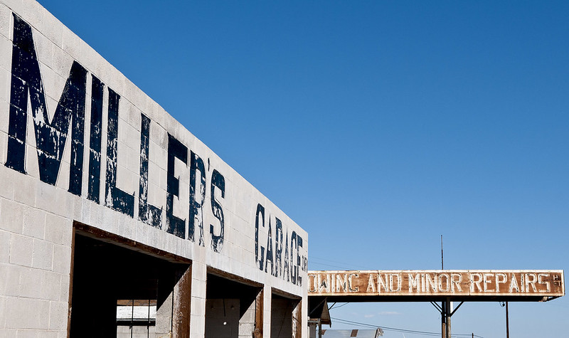
Miller's Garage by tomteske, on Flickr

Miller's Garage2 by tomteske, on Flickr
There's considerable debris from several old buildings just west of the garage including this presumed old well.
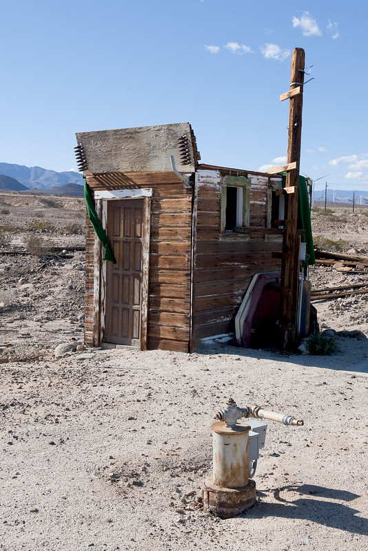
Well House by tomteske, on Flickr
Even an old safe is lying out front.
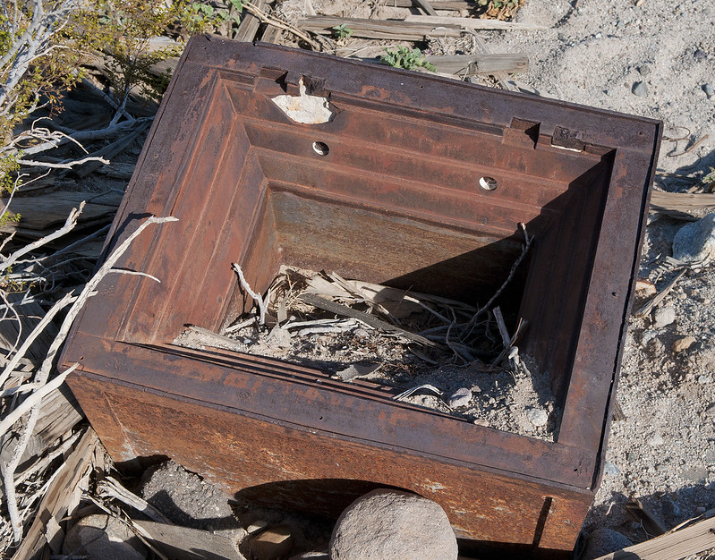
Old Safe by tomteske, on Flickr
Miller's faces away from this, an original 1917 single-lane portion of Old Hwy 80.
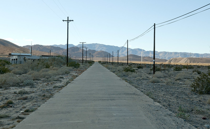
Old Hwy 80 by tomteske, on Flickr
A little farther up Myer Creek, the highway shows the devastation of Tropical Storm Kathleen.
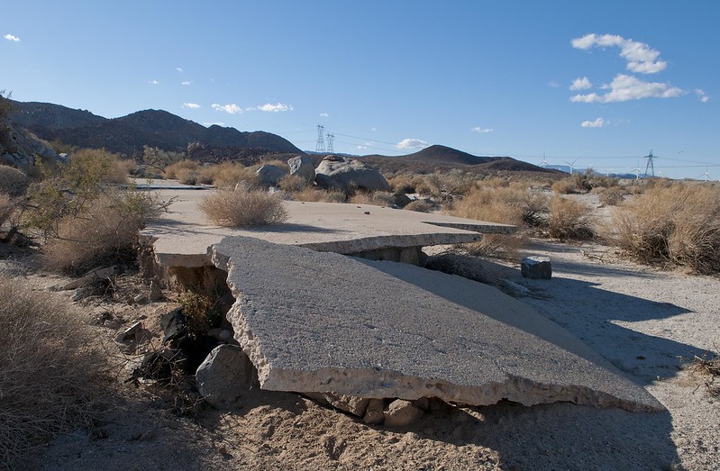
Old Hwy 80 Fragment2 by tomteske, on Flickr
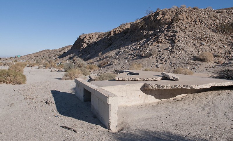
Old Hwy 80 Fragment by tomteske, on Flickr
This is a railroad bridge father upstream that looks like it survived.
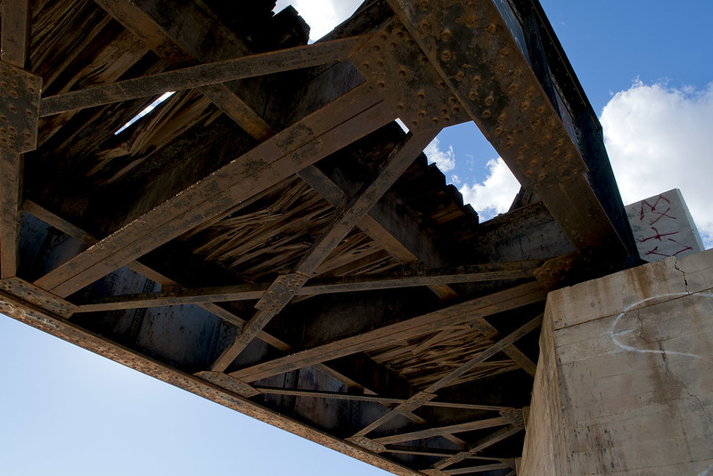
Myer Creek Bridge2 by tomteske, on Flickr
The topo map only lists the old garage site as "Millers" and not the new one. It's right at the split of westbound and eastbound I-8. Just a few ruins remain.
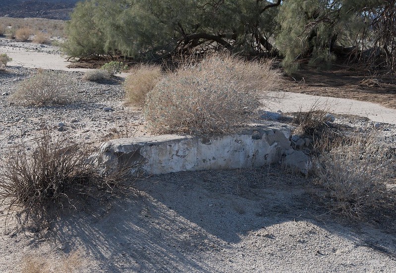
Millers by tomteske, on Flickr
You can see the same two trees still standing behind the Millers site which survived the flood.
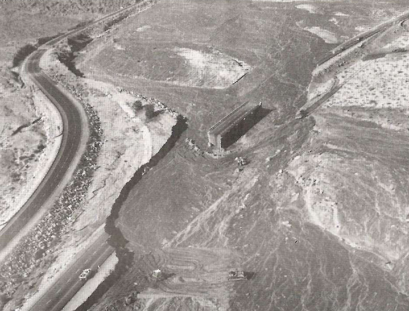
Old Millers by tomteske, on Flickr
Here's the view from Google Earth. Notice a zigzagging trail outlined in painted rock still quite obvious leading up from the original Millers to an observation point old travelers would use.
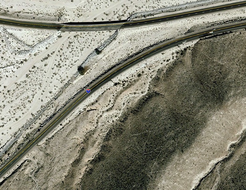
Millers Old Site by tomteske, on Flickr
Wonder if Kathleen did this! Based on the solid black head and dorsum, I'm thinking Pygoscelis adeliae a known Antarctic penguin 
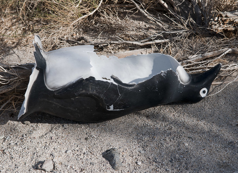
Penguin by tomteske, on Flickr
Decided to hike up into the lower I-8 island. Here's a sleeping circle maybe.
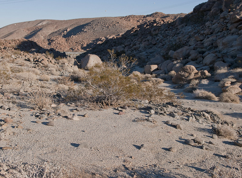
Sleeping Circle Maybe by tomteske, on Flickr
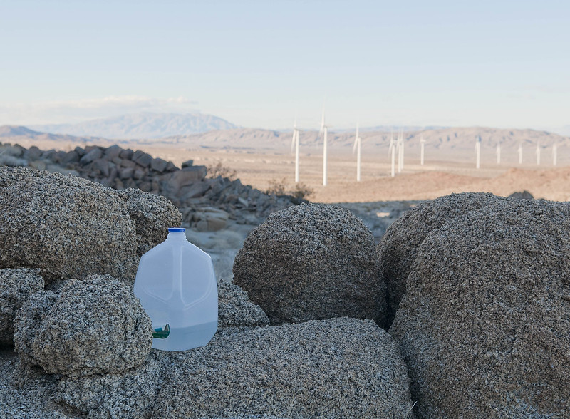
View of the new desert including a partly-used water jug left by a recent traveler.
Whale Peak View by tomteske, on Flickr
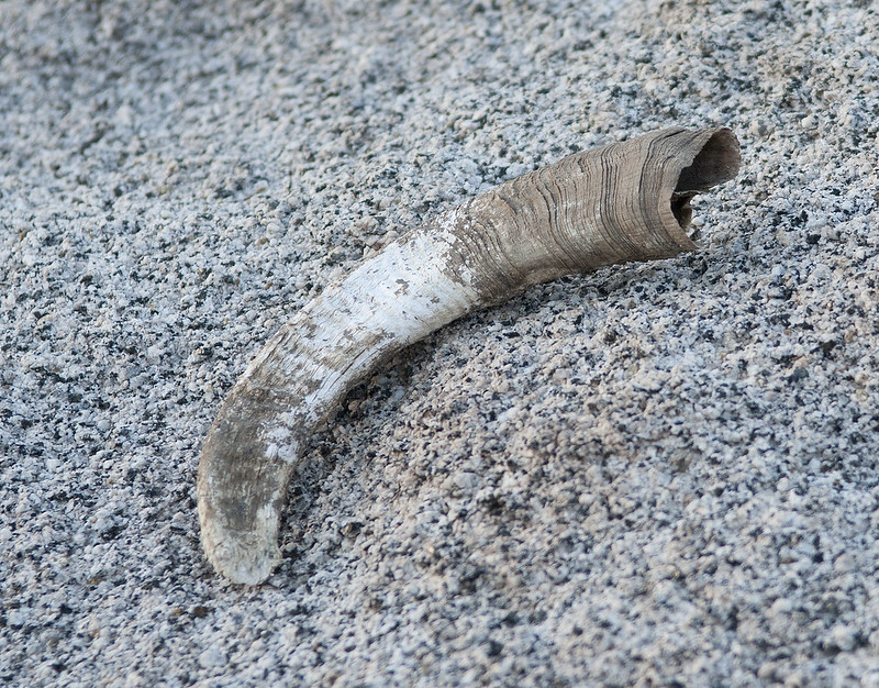
Saw a few bones including two right mandibles from deer or bighorn, a rabbit skeleton and this horn.
Horn by tomteske, on Flickr
Yes, Lettie is still breeding puppies. Sent her an email telling her where she can find her lost sign 

English Bulldog Puppies by tomteske, on Flickr
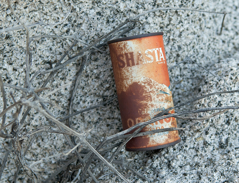
The obligatory ancient soft drink container. It hasta be Shasta!
Shasta Orange by tomteske, on Flickr
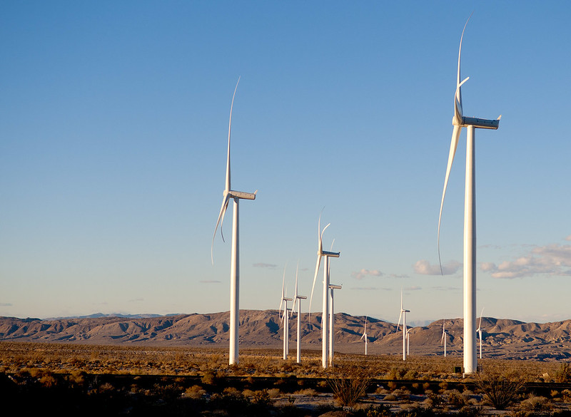
Another view of the new desert. A lot of those are smack in the flood plain of Myer Creek where, according to James Larson's Kathleen description, a torrent raced "five feet deep and a half-mile wide." Never fool with you know whom. Hope you all enjoyed you weekends. Looking forward to seeing Waning Moon's pics which I can't seem to view right now. Tom
Wind Turbines by tomteske, on Flickr |
1/15/2013
Topic:
Lower Myer Creek and Old Hwy 80
tommy750
|
DRT Lakeside wrote:
Found this link to a story about Miller's that indicates it closed in the early 70s. Would like to confirm though. I was bummed that they were getting ready to tear it down soon........until I read the date on the story
http://www.sandiegoreader.com/news/2003/mar/20/prehistoric-gas-station-eyesore/
That is a great story! Thanks for the info. Tom |
1/15/2013
Topic:
Lower Myer Creek and Old Hwy 80
tommy750
|
Nolan (anutami) wrote:
Wow, your pics are crystal clear. The puppy sign caught my eye because of the 789 phone number. It just happens to be a Ramona number of which I have a 789 number as well. Can't say I know Lettie, but if I run into her I will go and tell her where to find her sign. I wonder why a ramona person would put their sign anywhere near there????
A 5 lb camera is probably why the pics look clear  The kennel is located in Ramona per Lettie's website. Am thinking the sign blew off/out of her vehicle while she was on the way back from exploring ABDSP The kennel is located in Ramona per Lettie's website. Am thinking the sign blew off/out of her vehicle while she was on the way back from exploring ABDSP  Tom Tom |
1/15/2013
Topic:
Baja Desert
tommy750
|
If anyone wants to do a Baja trip to whale watch at Ojo de Liebre or Laguna de San Ignacio, how about adding on Sierra San Francisco, one of the world's greatest rock art sites. The Great Murals were best described in Harry Crosby's fantastic book, "Cave Paintings of Baja California: Discovering the Great Murals of an Unknown People." Have been to the most accessible site, Cueva de Raton but it's nothing compared to others located in a canyon below Sierra SF. Would require a 1-2 day backpack trip (or have donkeys carry you and all your supplies) into the canyon and hiring a guide. If anyone wants to do this trip, let me know! Tom
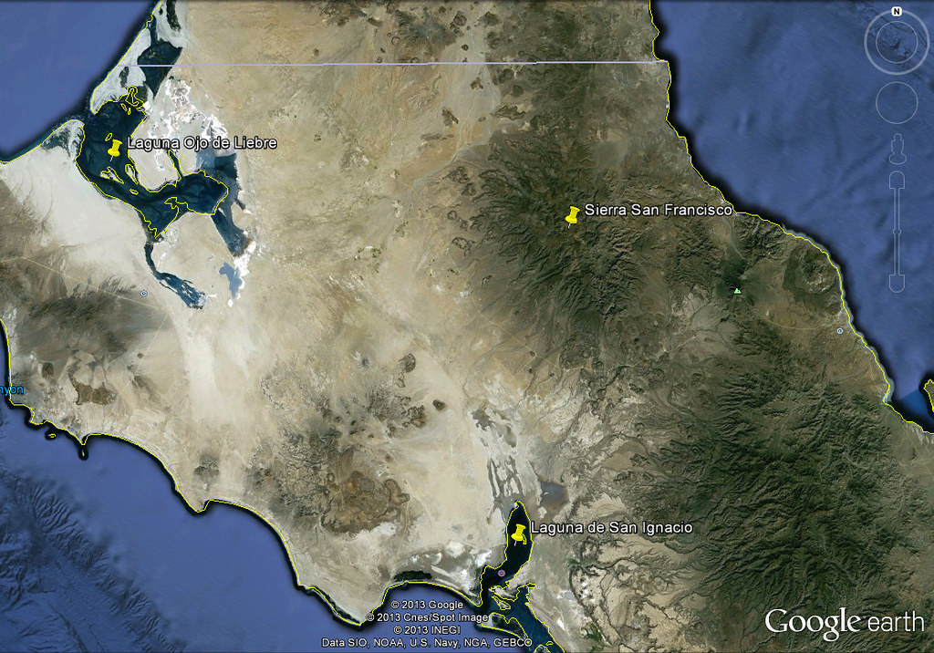
Baja by tomteske, on Flickr |
1/15/2013
Topic:
What are you reading?
tommy750
|
dsefcik wrote:
@tommy750
Looks like your photo links are broken, I wanted to know if the Survival book was any good.
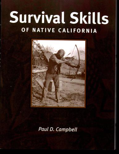
Oops! My mistake in deleting the pics. I haven't done more than glance through it, but it looks very interesting and has tons of info on "surviving" AKA living regular prehistoric life. My favorite section so far is entitled, "Brain Tanning." Tom
41OqHb4D1vL by tomteske, on Flickr |
1/15/2013
Topic:
Carrizo Gorge Old Railway Train Parts
tommy750
|
Nice trip! Your post got me to thinking and I ended up getting this. Wonder what it would capture if left in the same canyon for a night or two. Can't wait to try it out although it will be in the back yard. Any one have any experience with motion-activated trail cameras? Tom

51X9Zx089iL._AA300_ by tomteske, on Flickr |
1/16/2013
Topic:
Hurricane Kathleen 1976
tommy750
|
Waning Moon, how about another try at getting your pics posted? They sound amazing. Thanks. Tom |
1/18/2013
Topic:
Hurricane Kathleen 1976
tommy750
|
Thanks for posting these, they're amazing!! Looks like Carrizo Gorge got a thorough scrubbing alright. Tom |
1/18/2013
Topic:
Goat Canyon Trestle and The Impossible Railroad
tommy750
|
Any update on the January 15 meeting, Casey? I'm already tired of Armstrong and Te'o and in need of fresh scandal 
Casey Van Tieghem wrote:
I periodidally check the SDMTS board meetings regarding the SD&AE railroad because there is a section that gives updates for the "Desert Line" which was the Carrizo Gorge Railway. There was a meeting on January 15th, and there is or was a speaker who is trying to expose PIR who obtained the rights to the railway from SDMTS. (Sorry for the complicated scheme, not sure how to simplify it). At any rate, apparently there could be some litigation, and hesitantcy from people dealing with PIR because of past activity. For example the former President of Carrizo Gorge Railway was sued by the widow of Junior Seau. The whole relevance of this has to do with if there will be any future railroad activity. I personally think it would be great if there was railroad activity although it would get in the way of hiking there. But in the long term the railroad would be maintained (and I'm worried about the Goat Canyon Tresle), and help business in San Diego. It also might some day provide passenger service, and I would like to some day ride on the railroad.
Here is a link to the meeting notes, you can figure it out yourself. If you need more information let me know (due to the sensitivity of the subject, it's sort of vague in public posts).
http://www.sdmts.com/MTS/documents/2013-1-15SDAEPKGFORMAILOUT.pdf |
1/23/2013
Topic:
Where's The Wind?
tommy750
|
Interesting article by East County Magazine on apparent underperformance of Ocotillo Wind and complete opacity of Pattern/SDGE on the subject. Tom
http://www.eastcountymagazine.org/node/12285 |
1/26/2013
Topic:
Favorite Photos from 2012
tommy750
|
Great pics everyone! Here's a few more. Tom
Fish Creek Slot Canyon on New Year's 2012
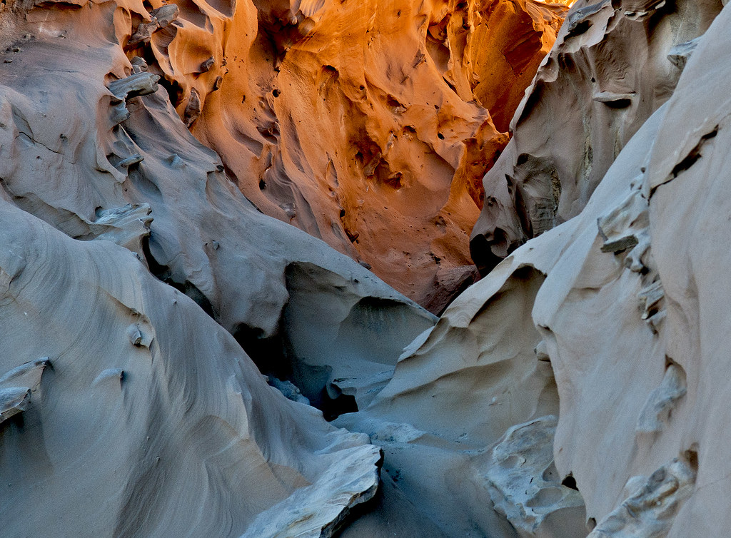
Fish Creek Slot New by tomteske, on Flickr
Carrizo Badlands and Fish Creek Mts From Ridge NE of Carrizo Mt.
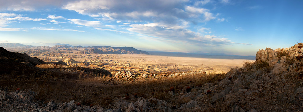
Carrizo Badlands Panorama by tomteske, on Flickr
The Invasion Was Year 12.
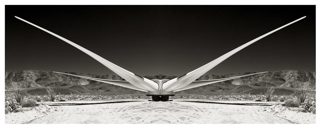
Year 12 by tomteske, on Flickr |
1/28/2013
Topic:
Favorite Photos from 2012
tommy750
|
Just found this in my truck. Could be the best fortune ever!

Desert Sands by tomteske, on Flickr |
1/28/2013
Topic:
Dos Cabezas Spring and vicinity
tommy750
|
Jim (ziphius) wrote:
Did a one-night camp near Dos Cabezas. Hiked around the Indian Hill area on the first day. Set out for Mortero Palm Canyon the next morning, with Goat Canyon Trestle as our goal. Thick ground fog east of Octotillo in the morning, howling coyotes in every direction, mild temps. Fun trip.
On the way to Dos Cabezas Spring:

edited by ziphius on 1/28/2013
edited by ziphius on 1/28/2013
That's an interesting formation. Just read an article about a similar find somewhere in the Yuha Desert between Indian Hill and the Ancient Lake Cahuilla shoreline. The article is from Rock Art Papers Vol 13 and was first described in 1994. At that time, no similar circle had been found in the area closer than Isla Tiburon in Baja. Found another rock circle out day hiking the PCT above Kitchen Creek but mine looks pretty recent. Are these equivalent to the infamous crop circles or what? Tom
Rock Circle "outside of Ocotillo, CA"

Rock Wheel by tomteske, on Flickr
PCT Rock Circle. Trail is in the upper right.
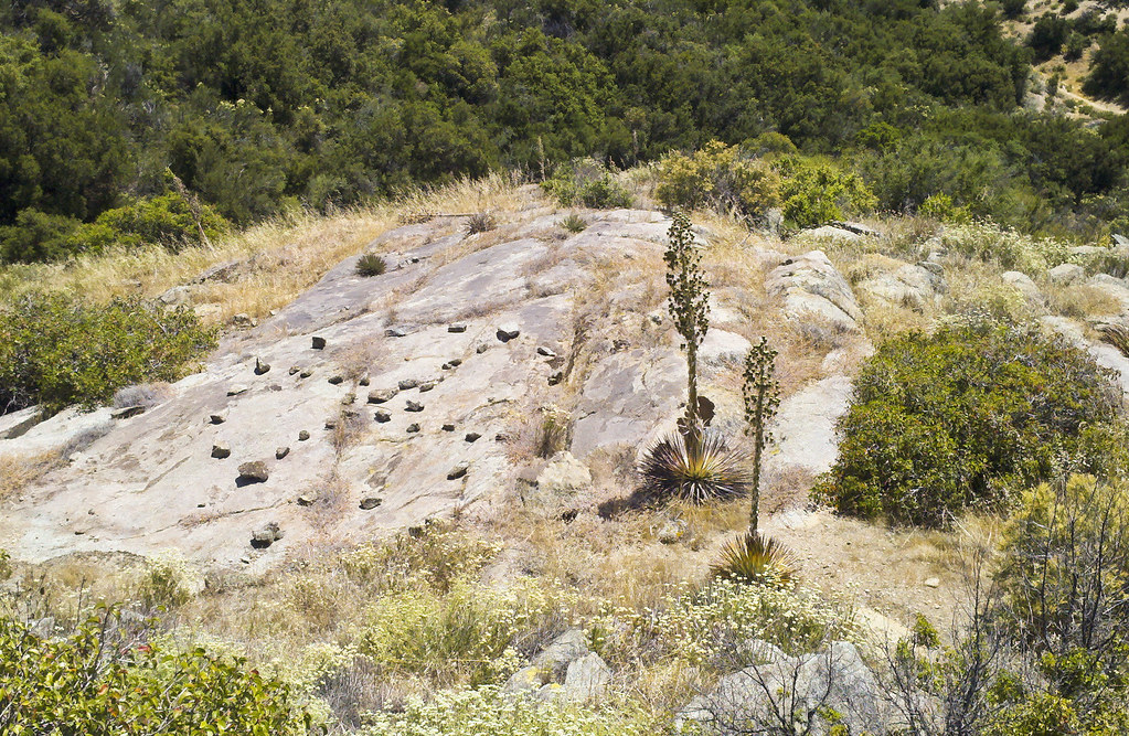
Stone Circle PCT by tomteske, on Flickr |
1/31/2013
Topic:
Favorite Photos from 2012
tommy750
|
TR, really like your pic looking down on the bighorn sheep. That probably doesn't happen too often! Tom |
2/8/2013
Topic:
Where's The Wind?
tommy750
|
Disturbing story in the Imperial Valley Press regarding an assault on a photog documenting Ocotillo Wind:
http://www.ivpressonline.com/news/ivp-ocotillo-wind-express-manager-arrested-20130207,0,6598501.story
Also, check out a similar story in East County Magazine:
http://eastcountymagazine.org/node/12402 |
2/12/2013
Topic:
Goat Canyon Trestle and The Impossible Railroad
tommy750
|
Nice article in the UT about the railroad getting fixed. Four to five trains daily are anticipated if it gets repaired. Hope they eventually put a passenger car in the mix. Tom
http://www.utsandiego.com/news/2013/feb/11/tijuana-san-diego-railroad-tracks/ |
2/20/2013
Topic:
Villager/Rabbit/Dawns Via Mojave & Rockhouse Cyn
tommy750
|
That is one impressive trip, Daren! The Schad entry is really neat. Great pics. Tom |
3/6/2013
Topic:
Rockhouse Canyon / Dawns Peak
tommy750
|
Daren, I feel your pain. Remember haggling with the dealer about a tiny paint defect the day I got my new truck in '09. Now, look what the desert has done! The bad damage was caused by getting jammed up in Arroyo Hueso a couple years back. Think your new "Desert Pinstripes" look nice  Tom Tom
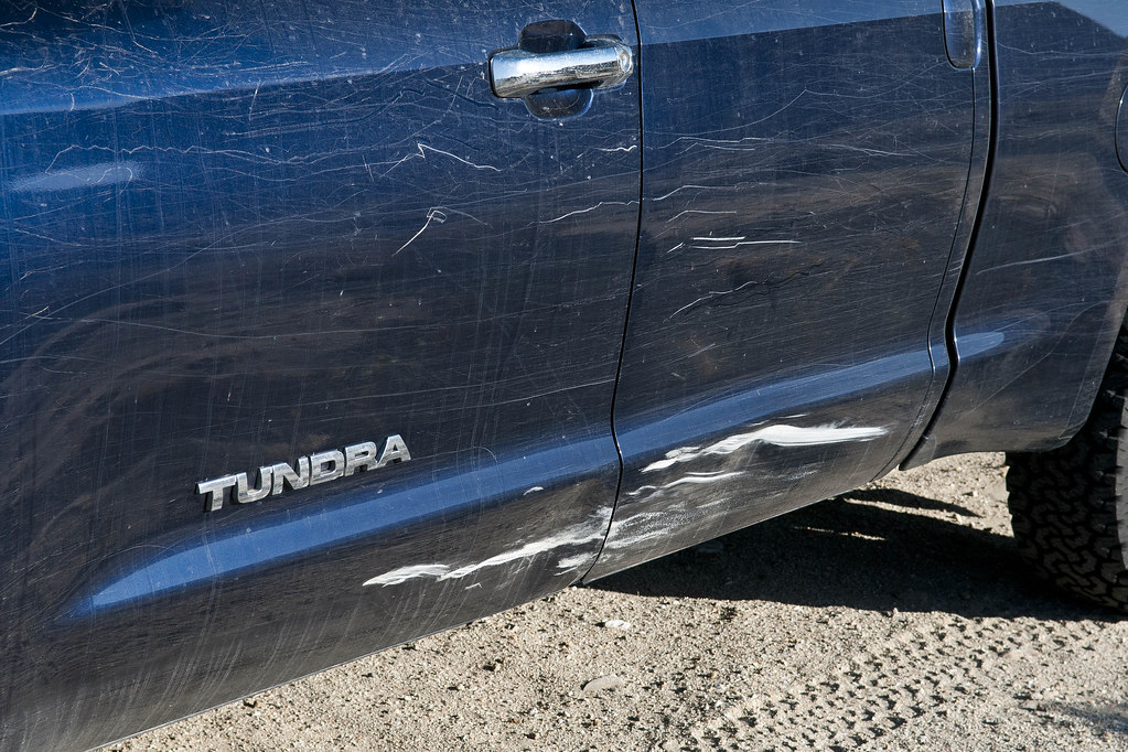
Tundra Rash by tomteske, on Flickr |
3/7/2013
Topic:
The Hunt for the elusive Carrizo Gorge Pictographs
tommy750
|
The Carrizo shaman cave is a great site and I'm glad you visited it. Was at an archaeology meeting a few months ago and met an old timer who told me there's another cave upstream. Forgot to bring his map when I was last out there January 27 and never found his site. Regarding the overpainted figures, they've been noticed since at least Treganza's report in 1942:
"Another group of pictographs in the Carrizo Gorge contains two elements that suggest a rather late origin. One painting is a human figure seated in what appears to be a chair and near the figure a "Christian Cross" is represented. The other figures are human and geometric. The pigment used appears to be a commercial oil paint or lamp black. This suggests either a very late origin for the paintings or retouching by some over-ambitious photographer."
Found another report stating the father of Colorado Desert archaeology, Malcolm Rogers, made a habit of overpainting all the pictographs he encountered! He may be the one who touched up Carrizo. Oh, well. Tom
|
3/7/2013
Topic:
Post your Anza Borrego Sunrise Photo
tommy750
|
Very nice. Kudos to you guys for getting up so early. Waiting for the sunset version of this post  |
3/7/2013
Topic:
The Hunt for the elusive Carrizo Gorge Pictographs
tommy750
|
surfponto wrote:
Hi Tommy
Daren, Mary and I found another cave further up with a few dark pictos. Hard to find. In fact when I was out there a year later I couldn't locate it.

Bob
That might be it. Have no info except a general area. Need to get out there again. That's an interesting pictograph. Looks like a globe with lat/lon marked out. Tom |
3/7/2013
Topic:
The Hunt for the elusive Carrizo Gorge Pictographs
tommy750
|
sddarkman619 wrote:
tommy750 wrote:
The Carrizo shaman cave is a great site and I'm glad you visited it. Was at an archaeology meeting a few months ago and met an old timer who told me there's another cave upstream. Forgot to bring his map when I was last out there January 27 and never found his site. Regarding the overpainted figures, they've been noticed since at least Treganza's report in 1942:
Tom, you mention someone visitied the Shamans Cave, but which is the Shamans cave? that's the cave I'm looking for near the palms. Can you help with the location? Are you speaking of the cave near the palms or where the carrizo pictos are?
Thanks
Larry
edited by sddarkman619 on 3/7/2013
Hi Larry. If we're talking about the Carrizo Palms NW of Indian Hill, I'm not aware of any pictograph sites near these groves except the cave at Indian Hill. If we're talking about further up Carrizo Canyon, there is the cave Bob just posted on. Looking at the pic you recently posted of the rock formation, I'm thinking you walked right by it. Bet you'll find it next time out. Tom |
3/8/2013
Topic:
Another Carrizo Canyon Cave
tommy750
|
As mentioned in an earlier post, heard from an old-timer another Carrizo Canyon cave existed farther upstream from the cave Bob just posted on. Thought I'd drive out today hoping it wouldn't rain too much (it didn't). The road was rough as usual but no standing water.
Here's a view up Carrizo Canyon about a half mile from the end of the road.
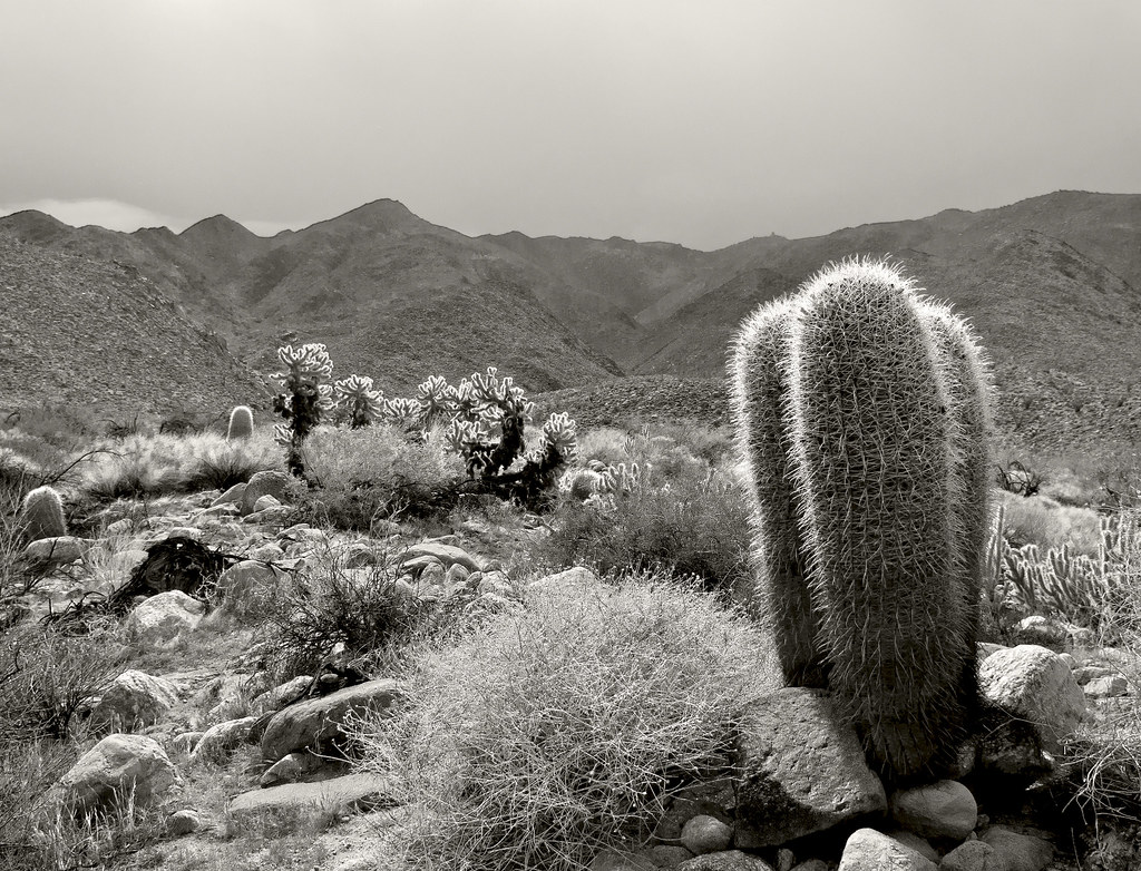
Barrel Cacti by tomteske, on Flickr
Walked upstream till I was near BM Windy, and there it was. Had a very similar feel to the shaman cave farther north. Looks like a bird's nest is in one corner.
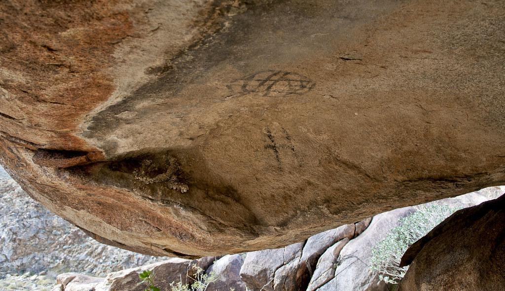
Carrizo Cave by tomteske, on Flickr
The shaman cave downstream.
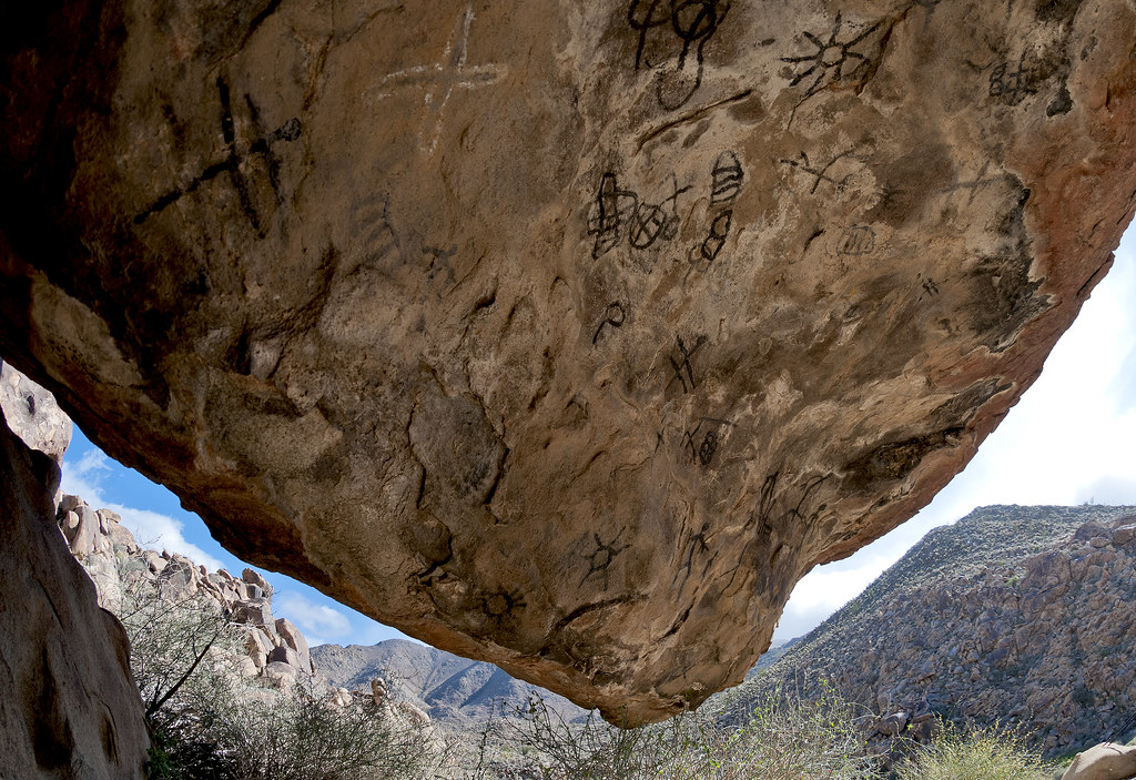
Carrizo Petroglyphs by tomteske, on Flickr
The upstream cave had only a few obvious pictographs which looked retouched. Any others were barely visible. Tried to DStretch any thing visible.
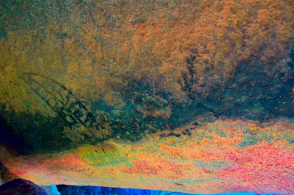
glyph4_lbk by tomteske, on Flickr
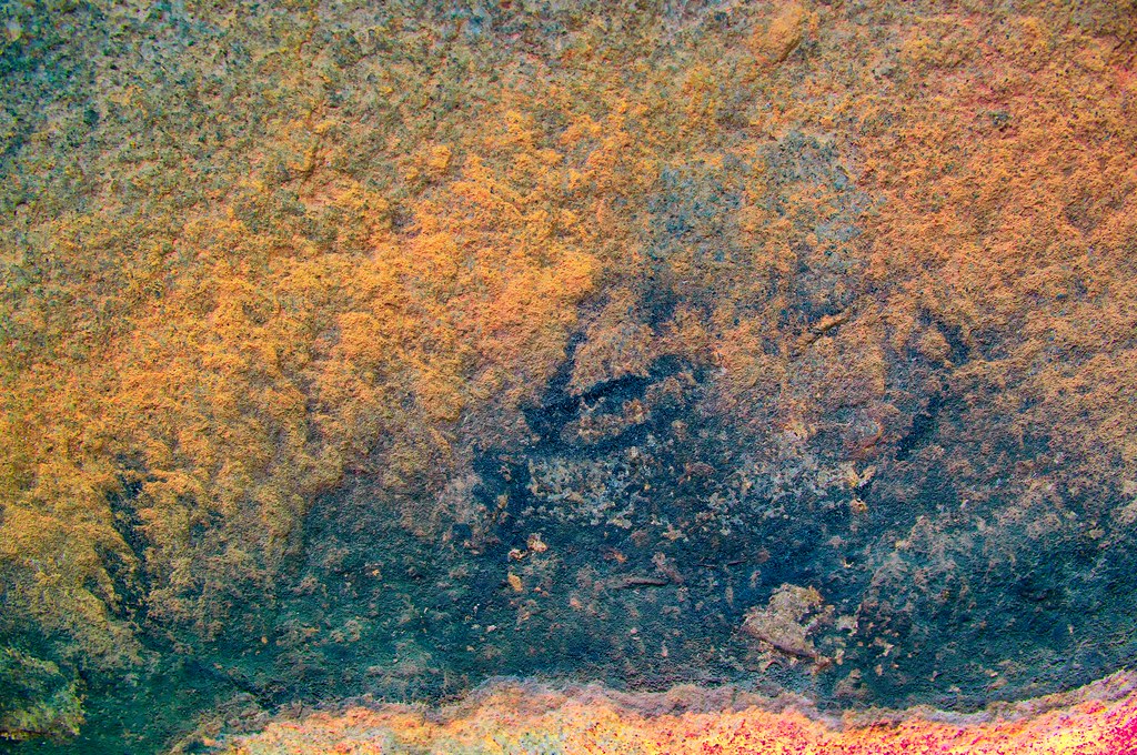
glyph5_lbk by tomteske, on Flickr
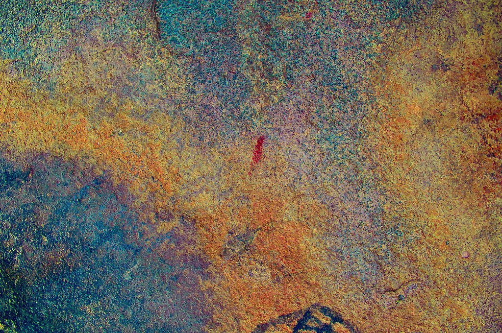
glyph6_lds by tomteske, on Flickr
Bob, this looks like the same pictograph you just posted.
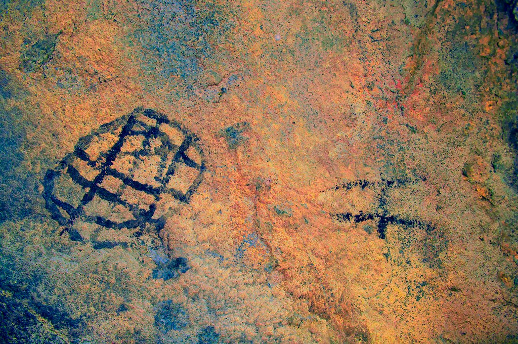
glyph7_lbk by tomteske, on Flickr
I could find one petroglyph which looked like concentric circles or a happy face  Inverted the image to enhance it. Inverted the image to enhance it.
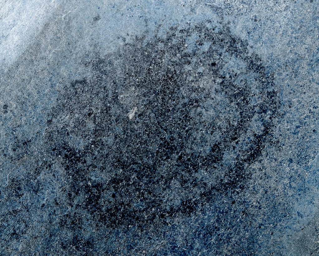
Petroglyph Inverted by tomteske, on Flickr
There were a number of cupules and morteros like the site downstream.
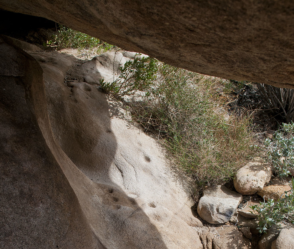
Carrizo Cupules by tomteske, on Flickr
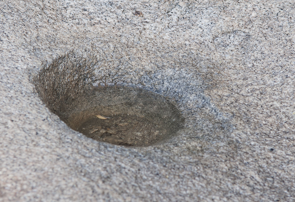
Carrizo Mortero by tomteske, on Flickr
Headed up the canyon and about 100ft from the cave almost stepped on these. A native trash heap?
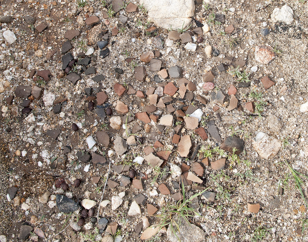
Olla Bits by tomteske, on Flickr
Headed up an east side canyon below Windy and hiked up about half way to the tracks. On the way down came across this presumed camp site with so may sherds lying on the ground I had to be careful where I stepped.
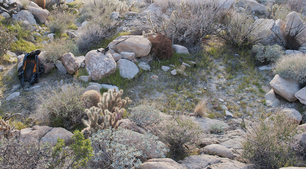
East Fork Site by tomteske, on Flickr
Found this on the rocks a couple feet away.
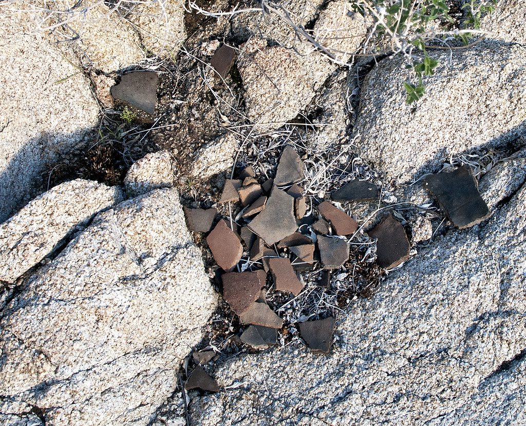
Pot Drop by tomteske, on Flickr
This guy hitched a ride home. Hope he's the only one!

Tick by tomteske, on Flickr
Only a light drizzle most of the time with the temp 48 degrees. Enjoy your weekend. Tom |
3/11/2013
Topic:
Another Carrizo Canyon Cave
tommy750
|
Jim (ziphius) wrote:
Gorgeous photos Tom and it looks like a great trip. I've come home with ticks that I find 2 days later, eeeeeek! I've found that storing your camp clothing in the freezer overnight DOES kill them. 
Two days later. Yikes. Were they attached? I seem to always feel them crawling up my neck on the way home or shortly thereafter. Freezer treatment sounds interesting. Wonder if the freezing sprays for wart removal would get attached ones off. Tom |
3/11/2013
Topic:
Elephant Knees
tommy750
|
Nice trip Nolan and glad you got out okay. So, what's the forum wisdom on getting unstuck when out by yourself? Saw this neat little cartoon on the science of really dropping tire pressure but I'm a novice at knowing what works. Tom
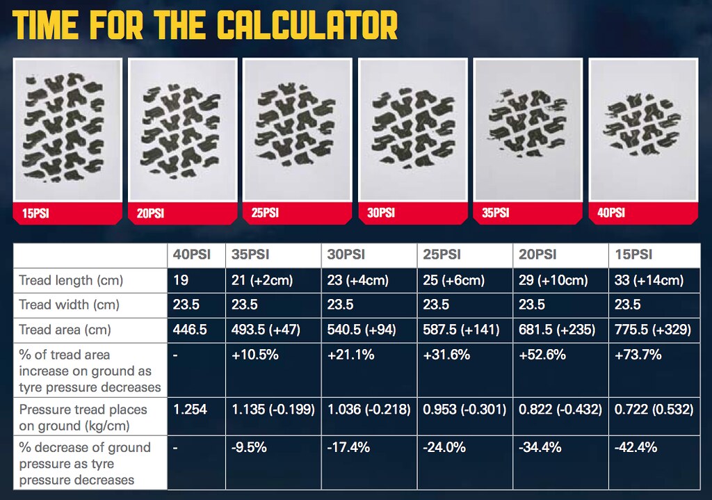
tire pressure by tomteske, on Flickr |
3/11/2013
Topic:
Santa Rosa mountians: Whole lota shaking going on
tommy750
|
Reminds me of the last BIG one out here on the Elsinore/San Jacinto/San Andreas fault system, Easter 2010 (actually, right below the Elsinore fault in Baja). Here's what I came back to after that 7.2 shaker. My house is 40 miles from the epicenter. Was just getting cleaned up when a 6.0 aftershock knocked more stuff down. Could have been worse. Tom
The shaking was parallel to the shelves (east-west) or every bottle would have fallen. Lost only five!

Earthquake2 by tomteske, on Flickr
Everything emptied out of the medicine cabinet.

Earthquake4 by tomteske, on Flickr
The refrigerator was pushed out a foot.

Earthquake3 by tomteske, on Flickr
My favorite vase 
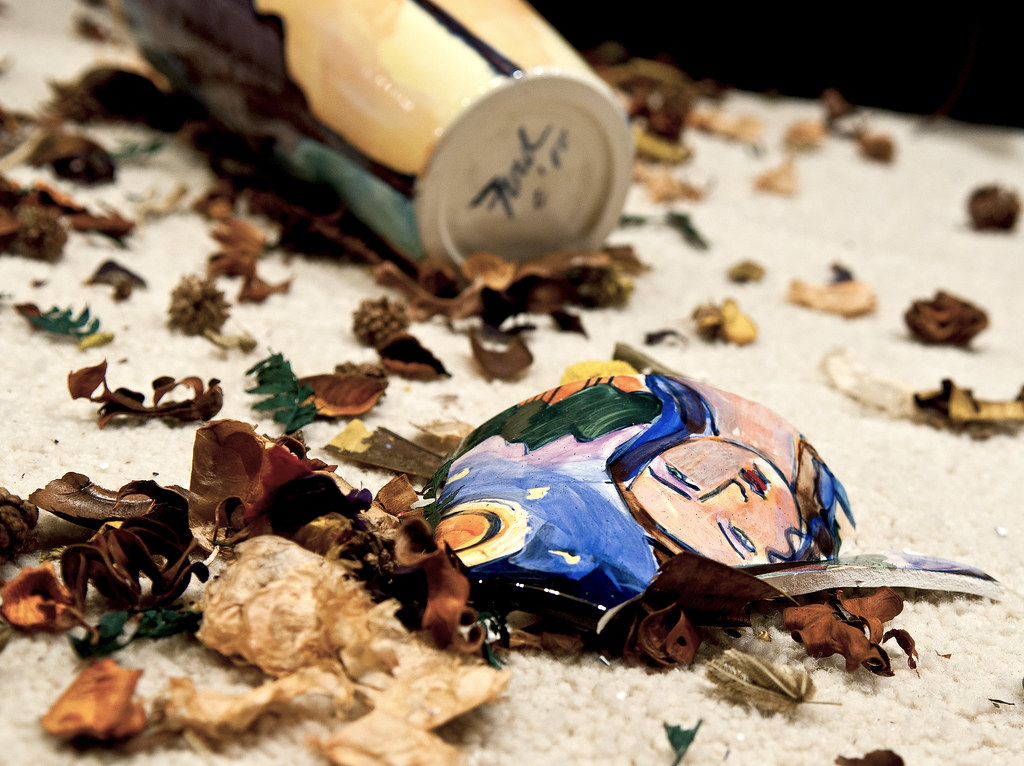
Earthquake by tomteske, on Flickr |
3/12/2013
Topic:
Post your Anza Borrego Sunrise Photo
tommy750
|
dfrancis wrote:
Hi, thought I'd share these-- hope the links work...
https://picasaweb.google.com/lh/photo/-484ZKf17AmK08pzW-5_JtMTjNZETYmyPJy0liipFm0?feat=directlink
https://picasaweb.google.com/lh/photo/7Z5gd-ONU5YyIPQ5Jo9tikVECuu_4yzOrEFIoluDC5E?feat=directlink
https://picasaweb.google.com/lh/photo/kuGT59_OelW93ZYW2XKvtNMTjNZETYmyPJy0liipFm0?feat=directlink
Nice shots. Really like the Salton Sea pic. Tom |
3/12/2013
Topic:
Post your Anza Borrego Sunrise Photo
tommy750
|
dsefcik wrote:
Couple more from the In-Ko-Pah mountains looking east towards Carrizo mtn

This is what I imagine a solstice cave would look like. Nice. Tom |
3/25/2013
Topic:
West Mesa and Ancient Lake Cahuilla
tommy750
|
For some reason I became curious about Ancient Lake Cahuilla and made six trips in the last couple months looking for what still remains. There appears to be a lot! Started by heading out to West Mesa to check out the amazing beach clearly visible from Google Earth. Actually, you can pretty much trace the entire shoreline on Google with little difficulty.
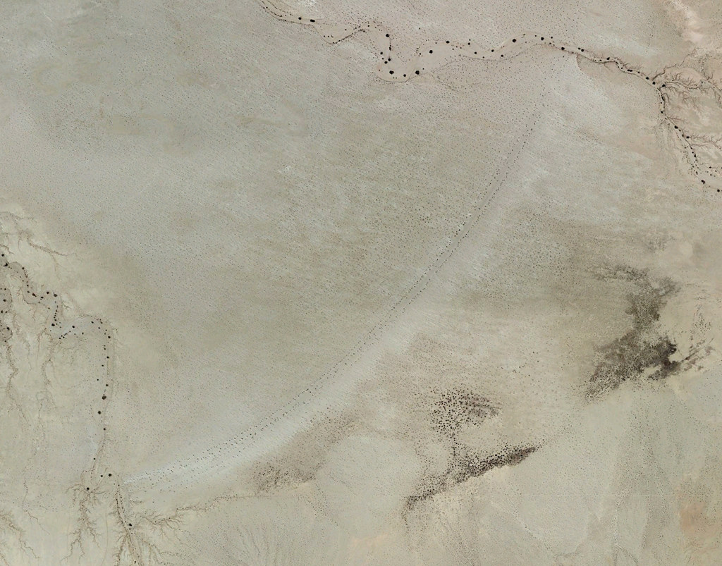
Beach by tomteske, on Flickr
Took the road North from Plaster City. Lots of signage starts to appear.
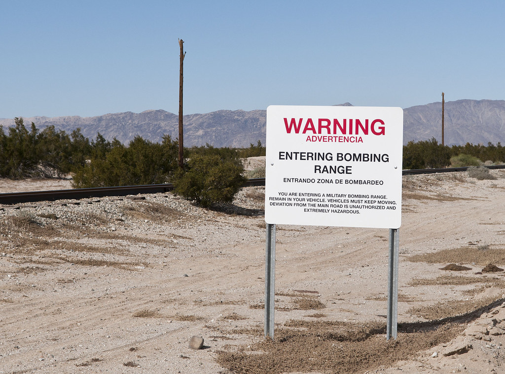
Bombing Range by tomteske, on Flickr
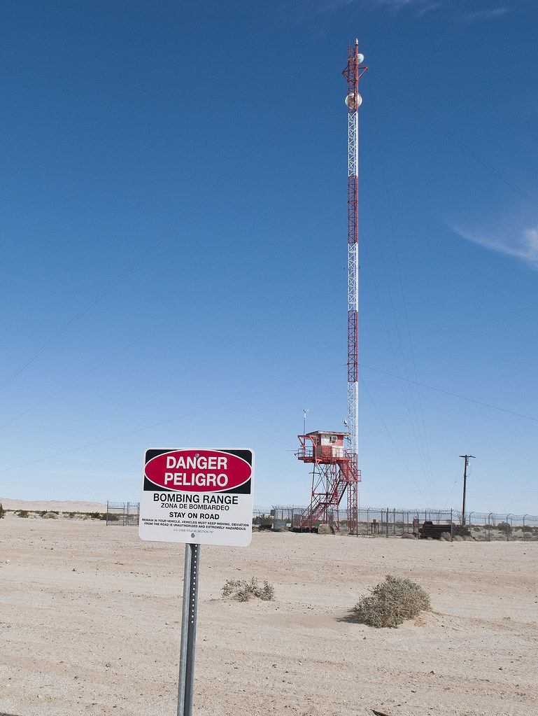
Spotting Tower by tomteske, on Flickr
A few miles in and on the right, a fenced area contains used practice munitions.
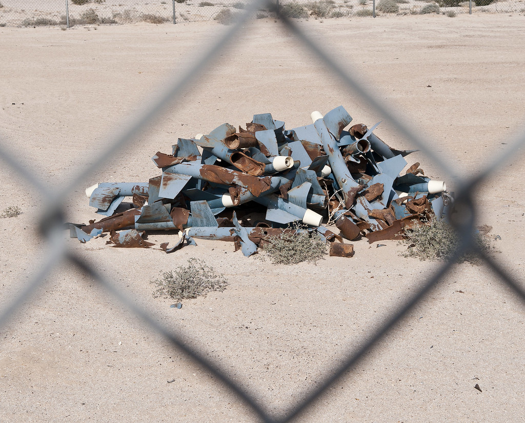
Practice Missiles by tomteske, on Flickr

Practice Bombs by tomteske, on Flickr
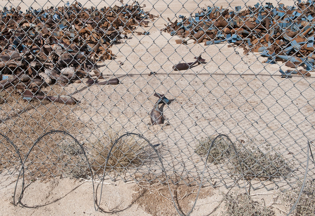
Practice Junk by tomteske, on Flickr
Off to the left, aerial target markers.
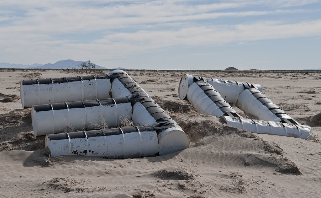
30 Range by tomteske, on Flickr
Nearing Fish Creek Mts. The beach is between these and Superstition Hills.
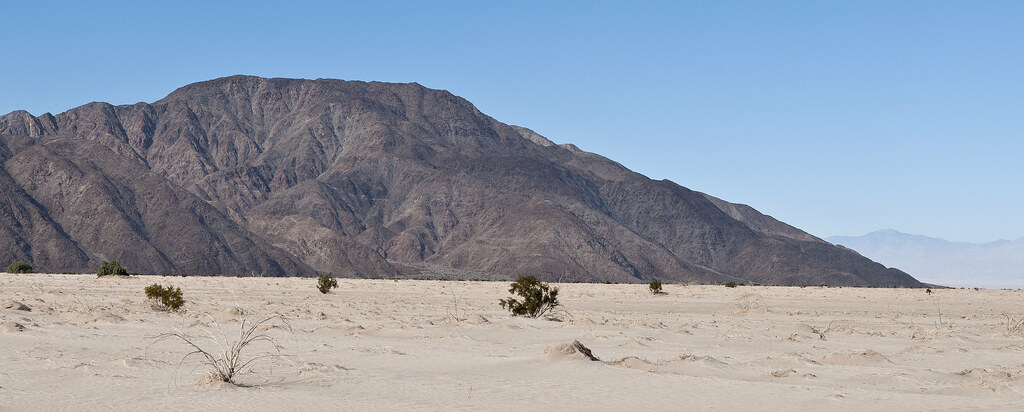
Fish Creek Mts by tomteske, on Flickr
Winding across mud flats and through a few arroyos, finally end up at the ancient beach. The maximum height of Ancient Lake Cahuilla was 42ft. Then it would overflow to the South and re-enter the Colorado River channel.
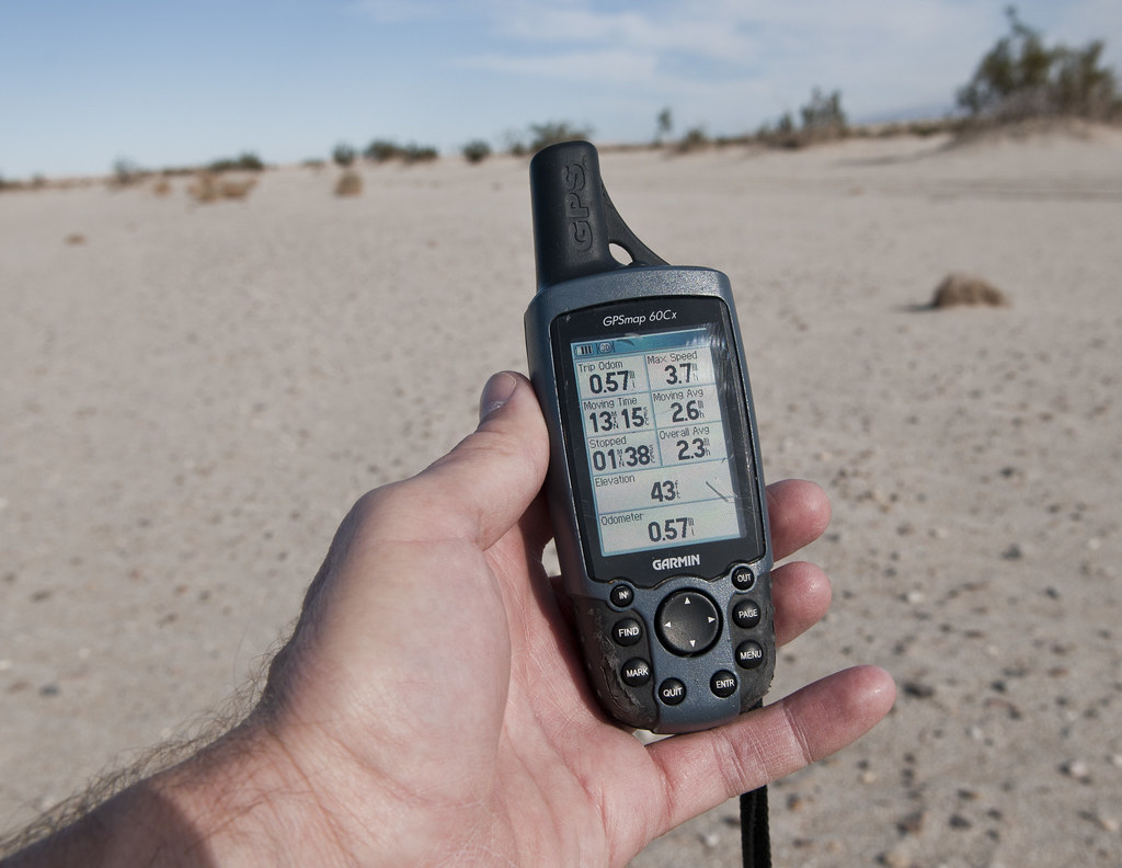
43 Feet by tomteske, on Flickr
Lots of the beach vegetation was in nice parallel rows easily visible from the satellite image. Not sure what this plant is but there were a lot of them on the sandy shore and they had a bonsai kind of appearance.
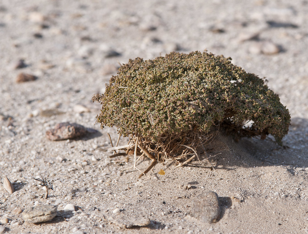
Beach Plant by tomteske, on Flickr
Walked the length of the beach and found lots of sherds on the sandy bluffs above the beach.
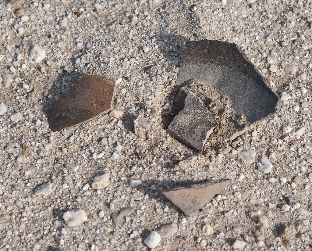
Beach Sherds by tomteske, on Flickr
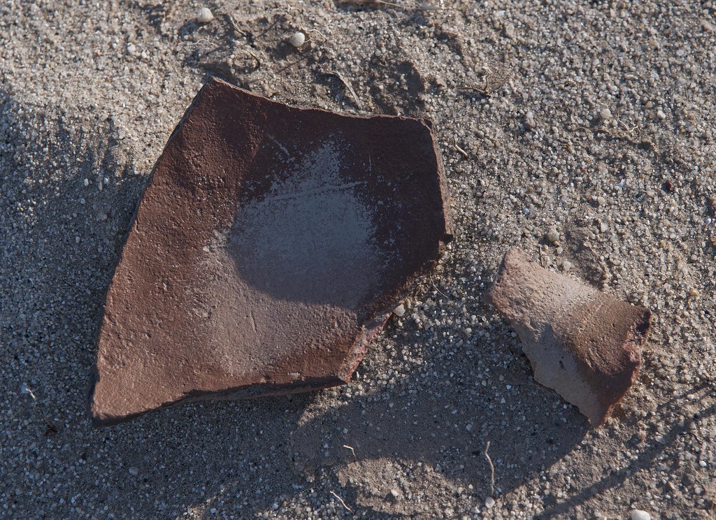
Beach Sherds2 by tomteske, on Flickr
At the far East end of the beach is a wash entering the lake with a nice exposed cross section of a fault.

Uplift by tomteske, on Flickr
Cut across the lake bed on the way back and found lots of shells.
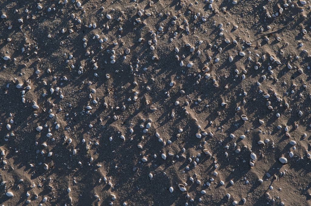
Cahuilla Shells by tomteske, on Flickr
Mandatory mylar photo.
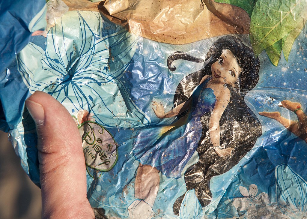
Disney Fairie by tomteske, on Flickr
View of the shoreline from inside the lake bed.
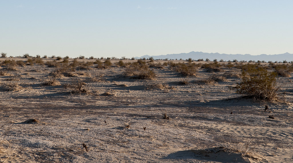
Beach View by tomteske, on Flickr
Time to head home. Toward Carrizo Wash from the beach. Will post more on other interesting parts of the lake. Enjoy. Tom
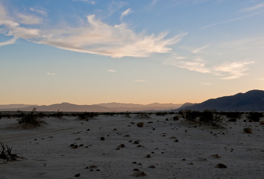
Toward Carrizo Creek by tomteske, on Flickr |
3/26/2013
Topic:
West Mesa and Ancient Lake Cahuilla
tommy750
|
Jim (ziphius) wrote:
Very educational and beautiful Tom. I'd be interested in seeing a KML outline of the ancient lake boundary as viewed from GE. Or is it just portions / fragments that appear to be visible? - Jim
You can actually follow almost all of shoreline on GE except for a few areas that have been graded or washed out. Always being at 42ft elevation helps when the outline isn't clear. The KML outline would be great. I just don't know how to do it Maybe you or someone else does? Maybe you or someone else does? |
3/26/2013
Topic:
West Mesa and Ancient Lake Cahuilla
tommy750
|
herofix wrote:
Fascinating! Thanks for posting, with all your excellent (as usual) pics and descriptions. That's an area waaaay beyond my range, so I'd never see it but for your report.
Dan
Thanks, Dan. What's your usual range? Tom |
3/26/2013
Topic:
West Mesa and Ancient Lake Cahuilla
tommy750
|
Jim (ziphius) wrote:
Very educational and beautiful Tom. I'd be interested in seeing a KML outline of the ancient lake boundary as viewed from GE. Or is it just portions / fragments that appear to be visible? - Jim
Ok, here's my novice attempt to show the lake level near the beach. The view is toward Fish Creek Mts. The edges get pretty rough if you zoom out too far. Tom
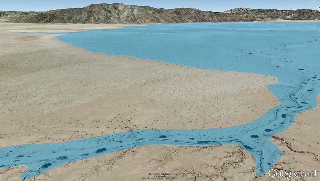
Cahuilla Beach by tomteske, on Flickr
edited by tommy750 on 3/26/2013 |
3/28/2013
Topic:
4 Day Backpack in Rockhouse Canyon / Dawns Peak
tommy750
|
Another great trip, Daren. That Wolf Spider is amazing. Seems like nothing gets by you! Tom |
3/28/2013
Topic:
West Mesa and Ancient Lake Cahuilla
tommy750
|
Nolan (anutami) wrote:
Tom, were you able to find the "bathtub" rings on any boulders on the ancient water line?
Wasn't around a rocky shoreline this particular trip, but here's a shot from Fish Creek Mts a couple miles West. Tom
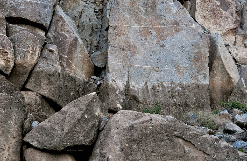
Tufa Line by tomteske, on Flickr |
3/29/2013
Topic:
West Mesa and Ancient Lake Cahuilla
tommy750
|
waning moon wrote:
Tom,
This is Fish Creek Beach and Dunes, "Ancient Beach Line" extensive long term Cahuilla village site, still hundreds of shards, chip and flake throughout the area. When I first started visiting, 1966 or 67, there were still metates and manos buried in the dunes, picked up a few beautiful wonderstone (rhyolite) and agate arrowheads mostly laying on the mud flats. I theorize bow fishing and waterfowl.
I do not know how far West you made it but it looks like your photos are just past the Gyp railroad trestles? where Fish Creek and Carizzo wash join?
Thanks for the pics. Haven't been that far North yet to see the village site. Definitely want to head up that way. When was the last time you were out there? Still look about the same?
The Cahuilla beach I walked on is between Fish Creek Mts. and Superstition Hills. Here's a screen shot from Google Earth. Tom
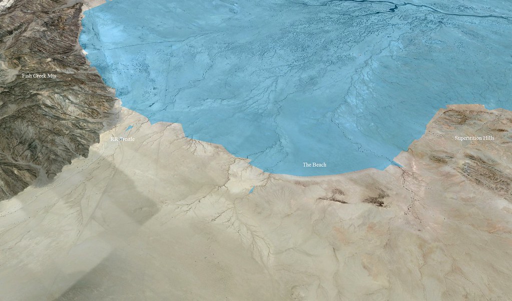
The Beach by tomteske, on Flickr |
3/29/2013
Topic:
Indio Fish Traps and SSTB
tommy750
|
The Indio Fish Traps and petroglyphs are one of those archaeology sites marked on your topo map and definitely worth visiting. Created on the receding rocky shoreline of Ancient Lake Cahuilla, the traps are all well below the maximum lake height. Based on the degree of tufa deposition and recovered artifacts, they were probably created about 400 years ago with the last complete infilling of the lake. Decided to take the drive out last Sunday and stop by Salton Sea Test Base on the way back.
Here's a view northward along the shoreline.
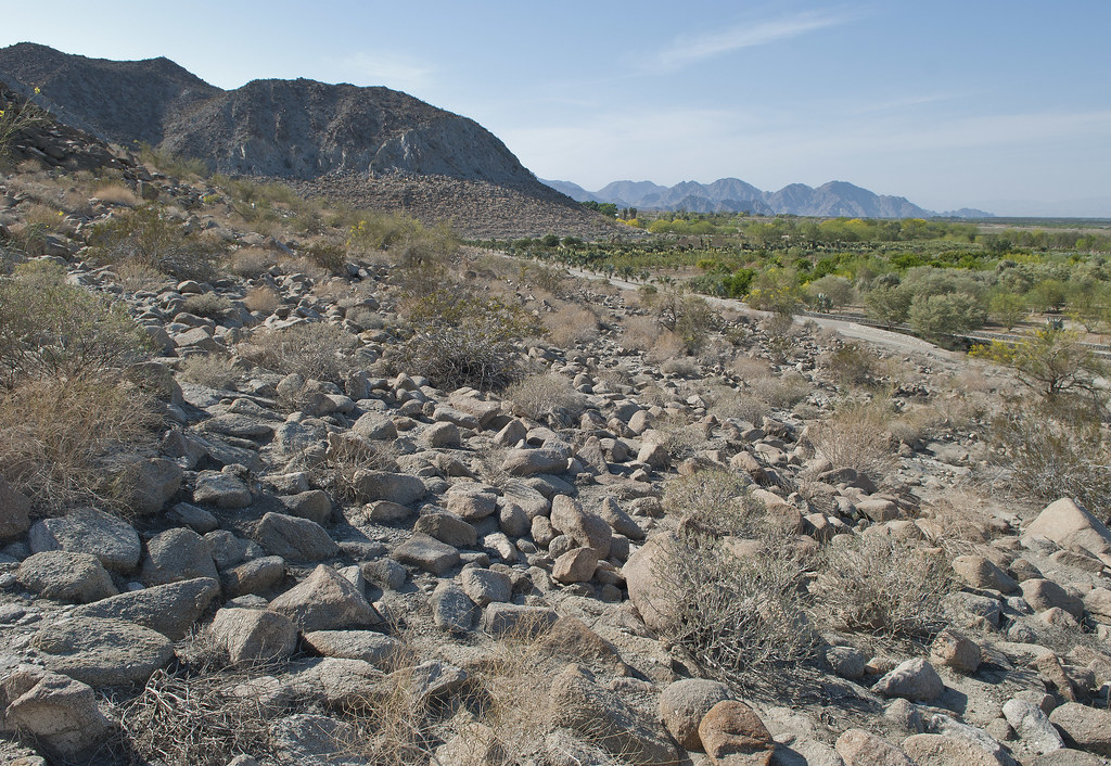
Indio Fish Traps Vista by tomteske, on Flickr
There's several rows of traps and some of them that are farther south look like sleeping circles but simply may be filled in.
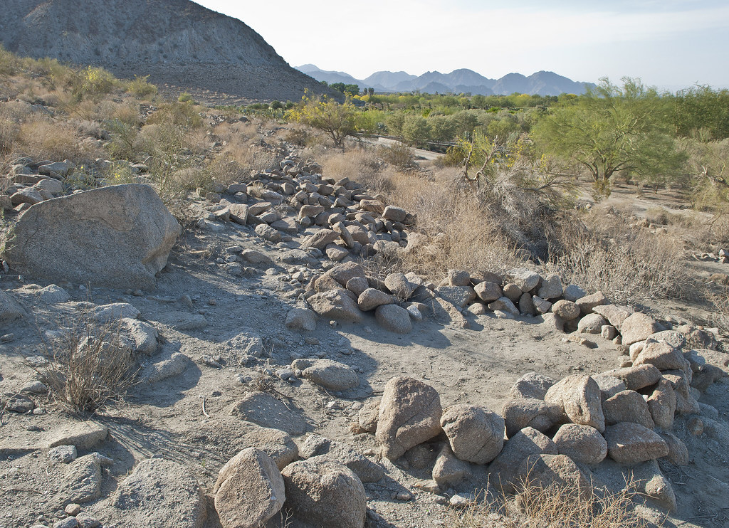
Indio Fish Traps by tomteske, on Flickr
Farther north on the very rocky shore, the rather deep traps.
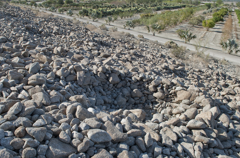
Indio Fish Traps2 by tomteske, on Flickr
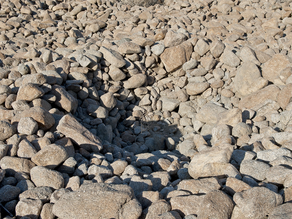
Indio Fish Trap by tomteske, on Flickr
Didn't really find any pottery till stumbling on this one area.
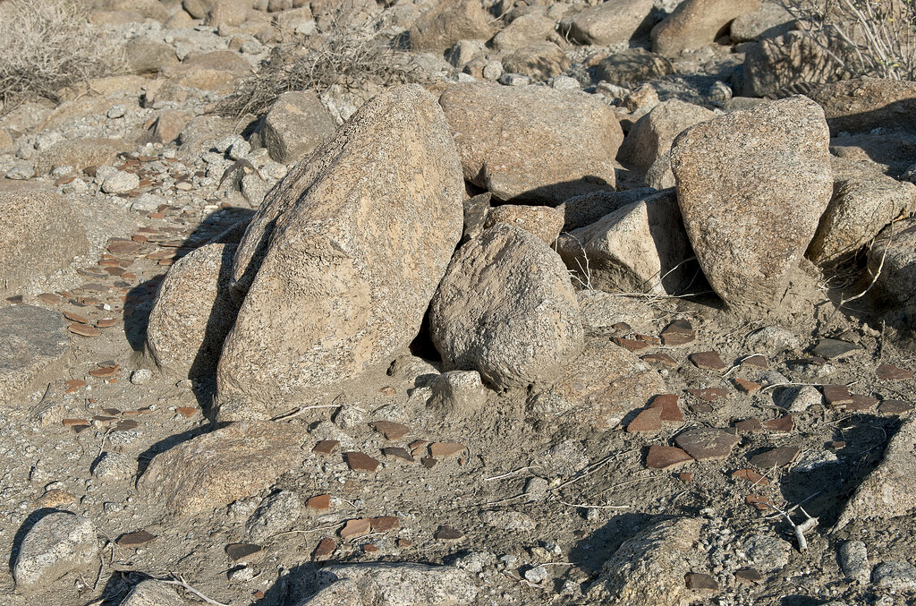
Indio Sherds by tomteske, on Flickr
Vaguely remember reading an article stating someone dumped a bunch of artifacts at this site that were not native for unclear reasons but now I can't seem to find the reference.
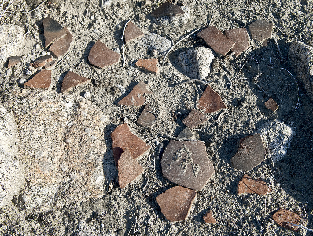
Indio Sherds2 by tomteske, on Flickr
Further south are petroglyphs carved into the tufa coating which are heavily damaged with graffiti. Here's a faint digitate anthromorph.
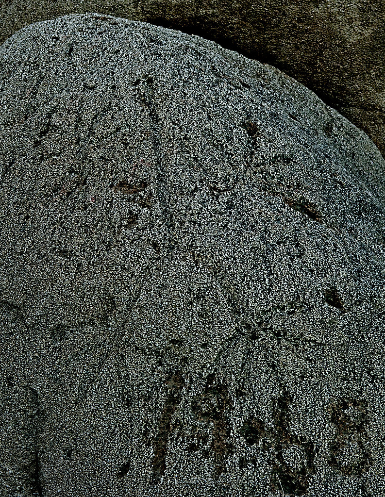
Indio Digitate Anthromorph by tomteske, on Flickr
More petroglyphs.
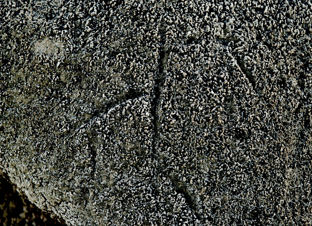
Indio Tufaglyph9 by tomteske, on Flickr
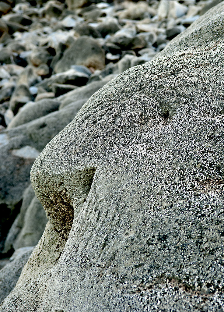
Indio Tufaglyphs by tomteske, on Flickr
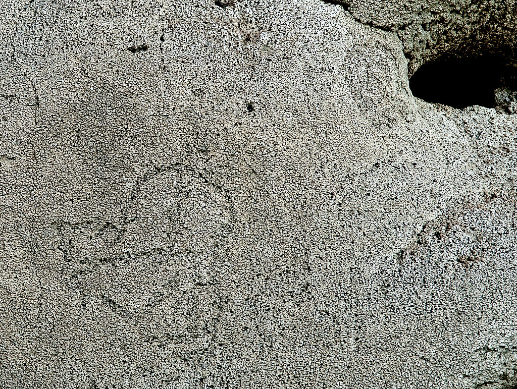
Indio Tufaglyphs2 by tomteske, on Flickr
Lots of graffiti
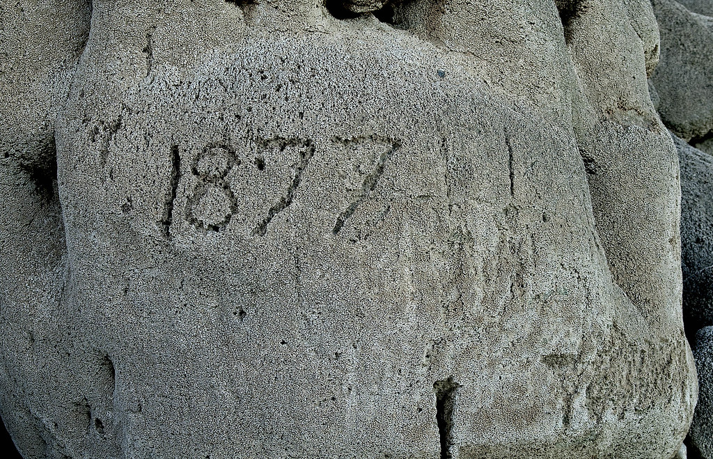
Indio Tufaglyphs5 by tomteske, on Flickr

Indio Tufaglyphs7 by tomteske, on Flickr
Maybe a mortero.
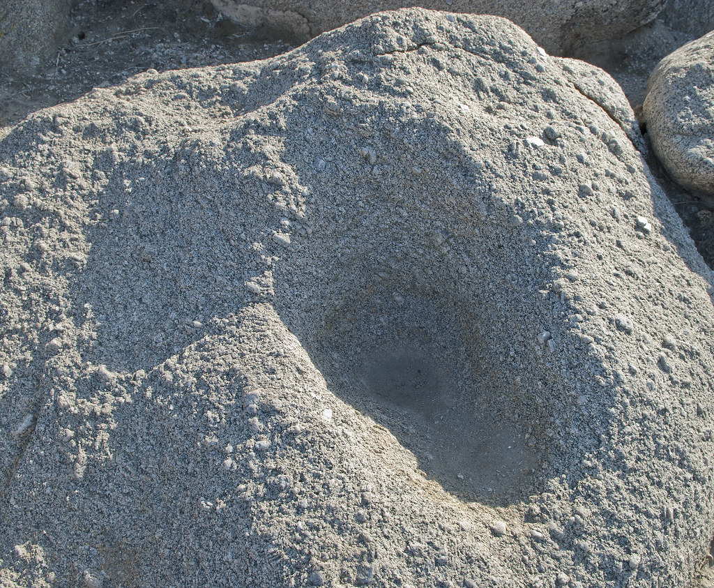
Maybe Morteros by tomteske, on Flickr
On the way back, stopped by Salton Sea Test Base. Have been out there once before looking for fish traps and sleeping circles. Combining a couple maps off the internet led to this rough estimate of some of their locations. The yellow dots are sleeping circles and the green are fish traps.
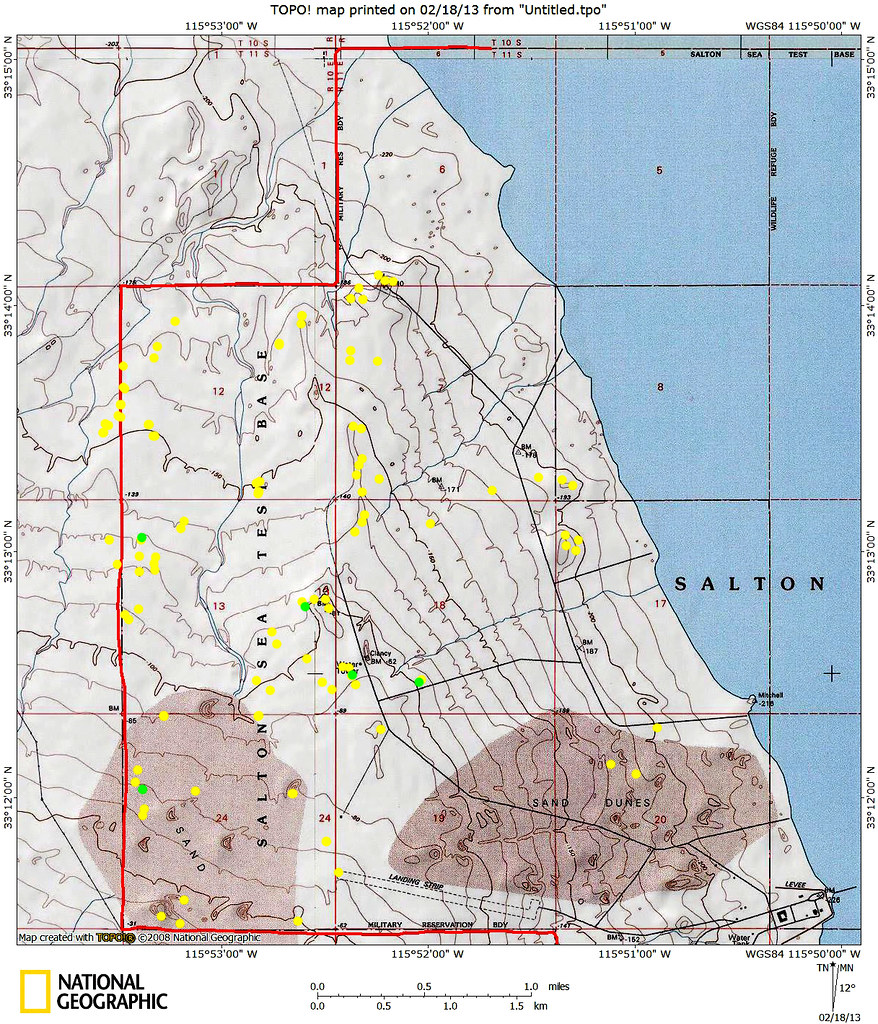
TOPO!map by tomteske, on Flickr
There's a lot of old structures still out there although most have been razed. Here's a couple of the pier in BW.
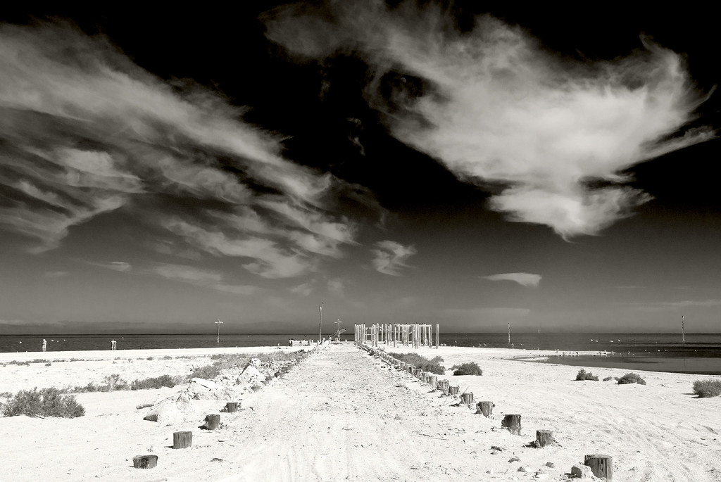
SSTB Pier by tomteske, on Flickr
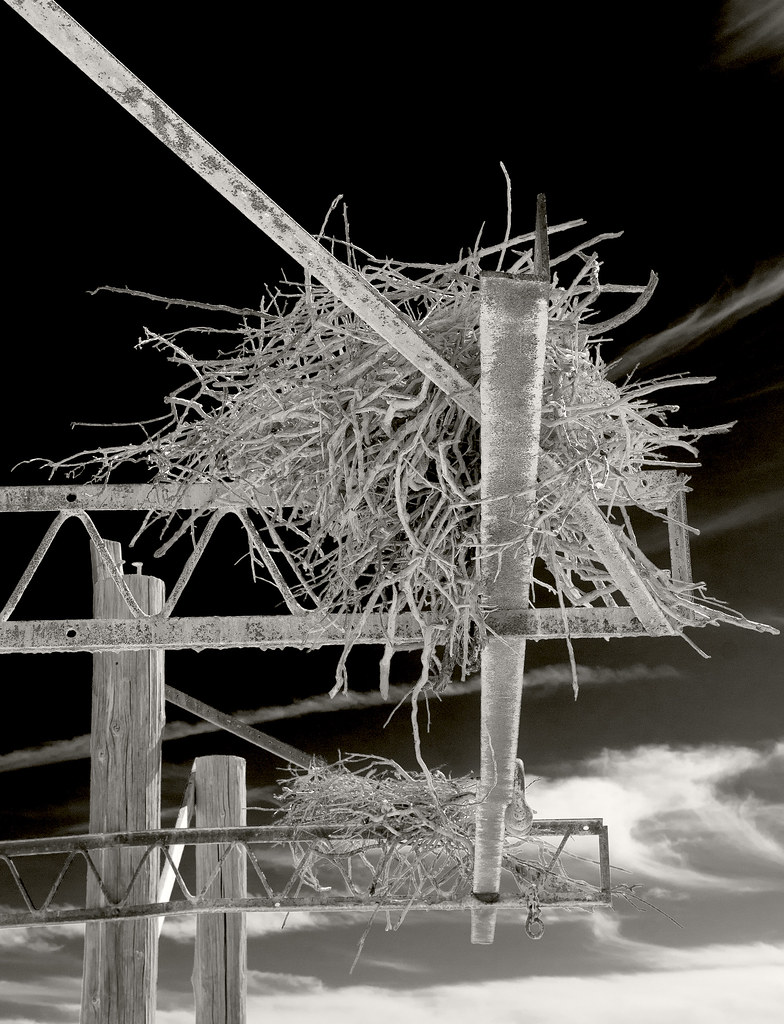
Two Nests2 by tomteske, on Flickr
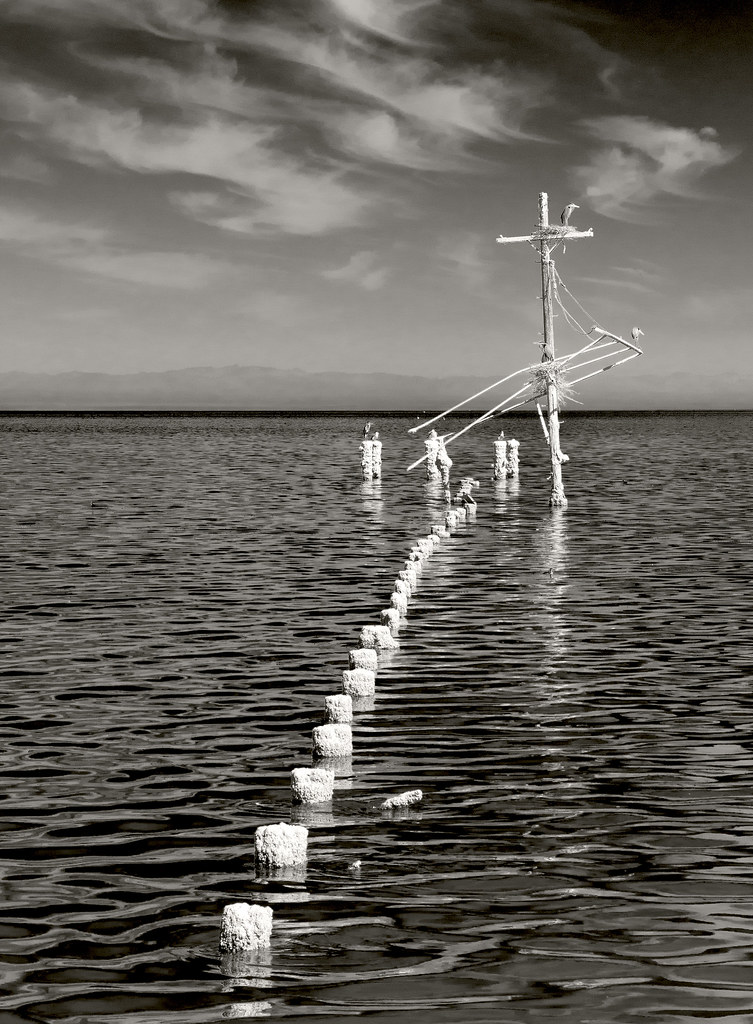
Pier by tomteske, on Flickr
Rusted out jeep dissolving into the ground.
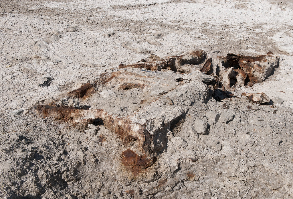
Jeep by tomteske, on Flickr
This guy was on the road heading north.
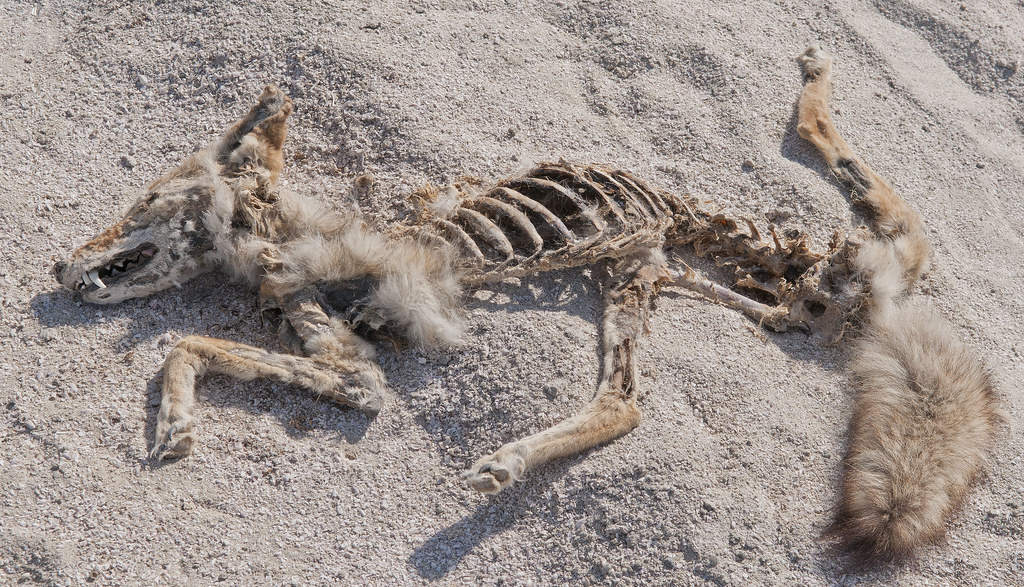
Coyote by tomteske, on Flickr
Finally, some camp circles.
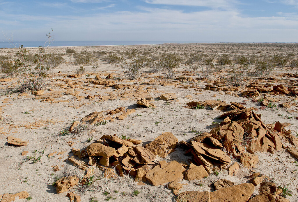
Sleeping Circle by tomteske, on Flickr
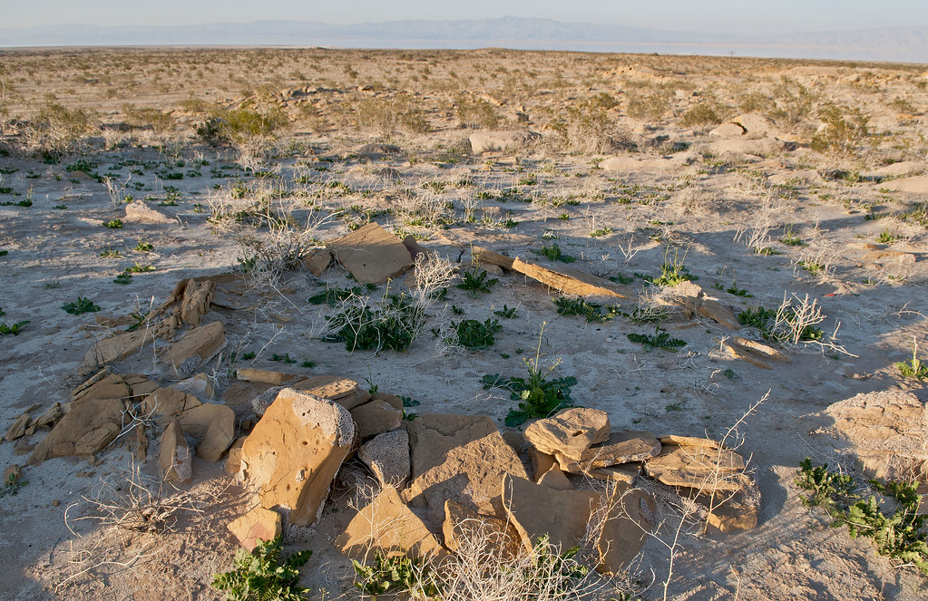
SSTB Circles by tomteske, on Flickr
On the second trip out, finally found the iconic triangular fish traps.
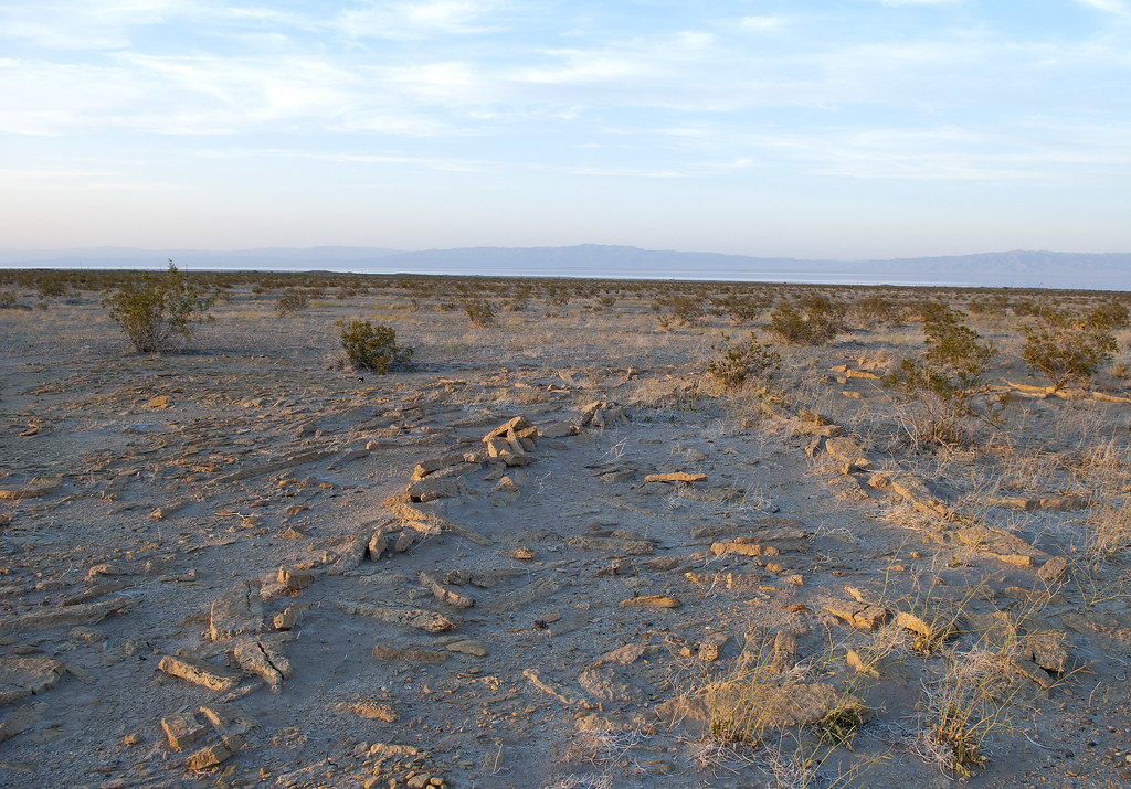
SSTB Fish Trap by tomteske, on Flickr
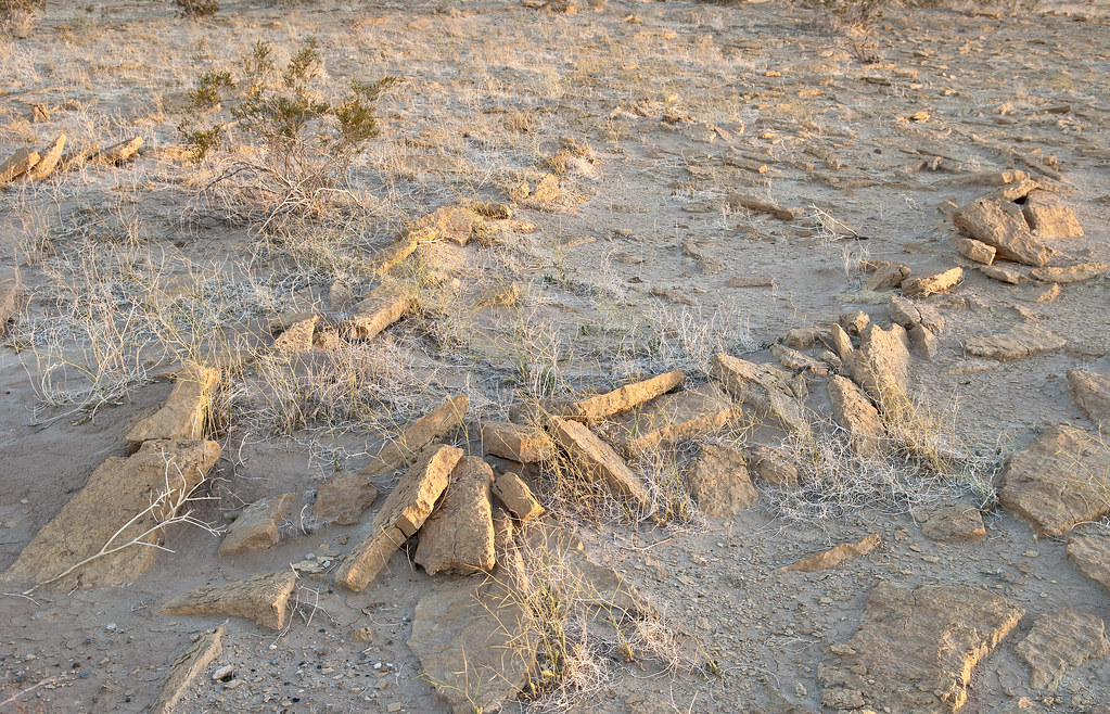
SSTB Fish Trap2 by tomteske, on Flickr
Make sure and bring your 4X4 when you come out here since dunes have covered parts of the access road.
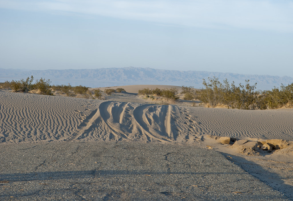
SSTB Road by tomteske, on Flickr
Time to head home. Enjoy. Tom
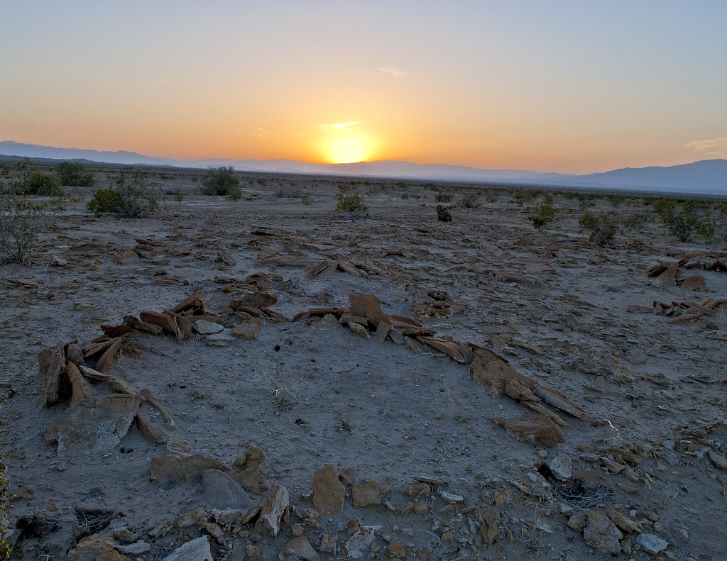
SSTB Sleeping Circle Sunset by tomteske, on Flickr |
3/31/2013
Topic:
Indio Fish Traps and SSTB
tommy750
|
surfponto wrote:
What an amazing area!
Very cool that the fish traps are still there.
I really need to check that out.
Thanks for posting that Tom
Bob
It's kinda amazing you can still find these artifacts out there since it was a Navy base for decades and most of the ground has been disturbed by roads, buildings, etc. Neat place to visit. Tom
edited by tommy750 on 3/31/2013 |
3/31/2013
Topic:
Mojave Desert and Las Vegas
tommy750
|
Those Saguaro skeletons look amazing. Never seen one before. Thanks. Tom |
4/1/2013
Topic:
Indio Fish Traps and SSTB
tommy750
|
Nolan (anutami) wrote:
Wow! I can't imagine being out there with a fresh water lake. 1877? Is that real?
Here is what was going on then
Jan 8th - Crazy Horse and his warriors fight their last battle with the United States Cavalry at Wolf Mountain (Montana Territory).
Jun 17th - Indian Wars: Battle of White Bird Canyon - the Nez Perce defeat the US Cavalry at White Bird Canyon in the Idaho Territory.
Aug 12th - Thomas Edison invents Edisonphone, a sound recording device
Nov 21st - Tom Edison announces his "talking machine" invention (phonograph)
I completely agree, Nolan. I was under the impression the traps were discovered by a pilot in the 1920's. Here's the earliest photo I found, taken in 1929.
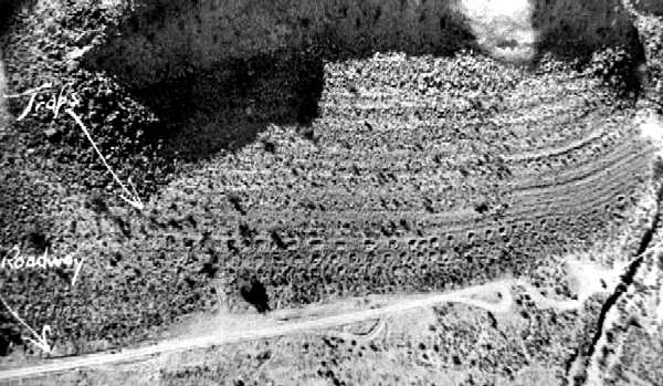
1929 Traps by tomteske, on Flickr
Ancient Lake Cahuilla was also named Blake Sea after this guy, the first geologist to publish a detailed description of the Salton Trough in 1858. It was also called Lake LeConte after a UC Berkeley geologist and early Sierra Club supporter. So there were people poking around in the 19th Century but not sure about this particular spot. Would be curious when it first showed up on a topo map.
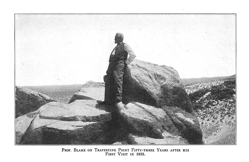
Professor Blake by tomteske, on Flickr
Not to beat this topic to death (actually, have found the lake really really interesting) but here's a view of Travertine Pt and the fish traps as if near the max lake level. Tom

Travertine Point by tomteske, on Flickr
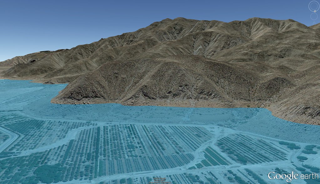
Indio Fish Traps by tomteske, on Flickr |
4/1/2013
Topic:
Indio Fish Traps and SSTB
tommy750
|
dsefcik wrote:
Great stuff Tom...not sure how you have so much time out there but great to read your trip reports..keep it coming..thanks!
Daren, while you were out doing epic hikes in the Santa Rosas, I was strolling the ancient shoreline sipping from a red cup  |
4/1/2013
Topic:
Rattlesnake Spring / Pyramid Peak
tommy750
|
Love that sheep skeleton. Can you ever find telltale signs of big predators on those things, like bite marks or broken long bones?
Also, where exactly is "Desert Cahuilla," the newest annex to the park? Somewhere north of Rattlesnake Canyon? Can't seem to find any updated maps. Thanks. Tom |
4/1/2013
Topic:
Indio Fish Traps and SSTB
tommy750
|
Jim (ziphius) wrote:
Great photos and tour Tommy. What camera are you using? That digitate petroglyph took a moment to take form for me. Thanks for finding my jeep, forgot where I had parked it. 
Still using my 2008 Nikon D300. Just had the shutter replaced for $250 this month after only 46K shutter releases. Supposed to last 100K but cant' really say I've been gentle with it. Those petroglyphs were pretty hard to see and the pics were tweaked a lot in photoshop to even show as much as they do.
That jeep was pretty funny. We all walked around it knowing it was probably a vehicle but not able to find a clearly discernible part that would prove it. More like a jeep rust mark! That part of the base was flooded for quite a few years when the Salton Sea level was a lot higher after Kathleen and Doreen. Your jeep is at -233 ft and the max sea level was -195 ft after the storms. |
4/1/2013
Topic:
Indio Fish Traps and SSTB
tommy750
|
waning moon wrote:
Incredibly interesting and surealistic photos, how out of touch I am, did not know base was shut down and abandoned, now another place I have to go. I have not see photos of the traps that well done. Shame about the graffiti, last time I drove through grapes were being planted up and over sand dune behind Travertine rock, so much is being lost
The grape vines at Travertine Pt are almost all gone! Now there's young phoenix dactylifera palms in their place. Hear date farming is pretty lucrative these days. The base is pretty surreal. Here's pics of the some of the only remaining buildings. Tom
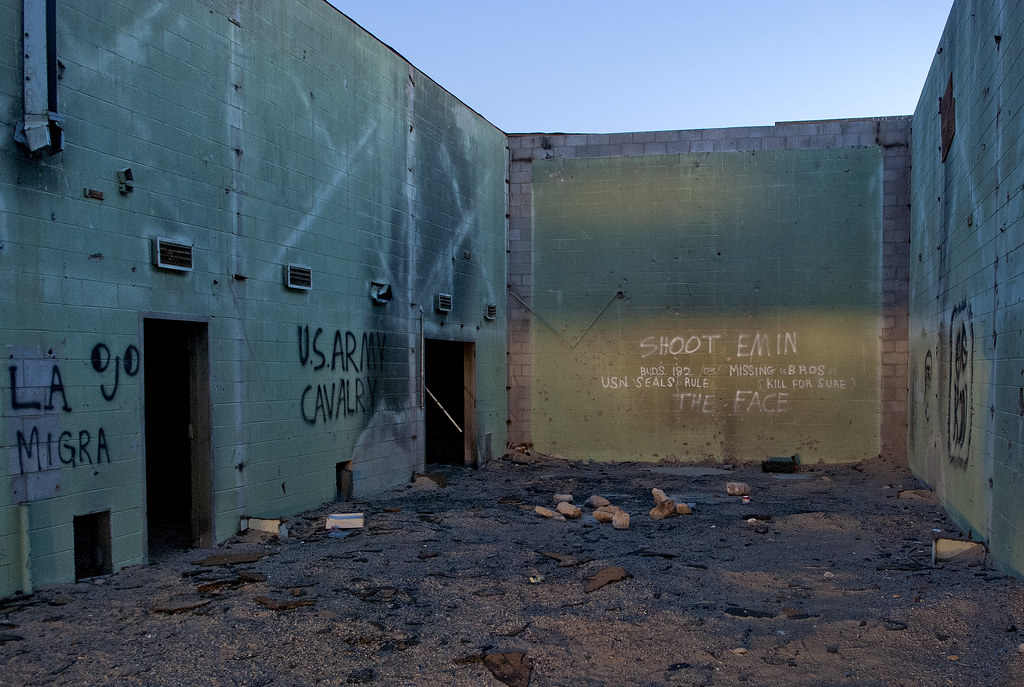
SSTB Building by tomteske, on Flickr
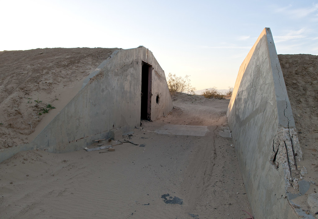
Bunker by tomteske, on Flickr

SSTB Building by tomteske, on Flickr |
4/1/2013
Topic:
West Mesa and Ancient Lake Cahuilla
tommy750
|
waning moon wrote:
Tom,
The photos are from a month or two ago, while I was out photographing wildflowers. The area has changed greatly since I first saw it, heavily used for offroad, drive right through the old camps, full on morons. The area is semi closed now, vehicle travel on established trails only, almost no one goes there anymore. I usually fill a 30 gal trash bag everytime I visit and could continue until I am dead and never make a dent. Sad
When I camped there we would be gone all day, to Carrizo Stage Station following the Overland Stage route on West to Palm Ssprings and back, or the Superstions, or shell beds NW of Plaster City
Well enough, rememberances, doubt you could make that run with Rangers in the Air now
Thanks for the update. Agree, there's unfortunately a lot of trash around there. Tom |
4/2/2013
Topic:
Rainbow Wash
tommy750
|
Nice trip. Camped up Hills of the Moon Wash a few years back but not as colorful as Rainbow as I recall. Pretty nice dents in the skid plate! Tom |
4/3/2013
Topic:
What are you reading?
tommy750
|
dsefcik wrote:
I am thinking of buying the Survival Skills of Native California book, any of you reading this have any reviews/comments?
Get it. Lots of interesting brief chapters on making bows, arrows, slings, shoes (e.g. emergency yucca sandals), ollas, snares, hunting (liked the description and graphic pics of shooting, grilling and eating wood rats), shelters, all from an Indian perspective. Haven't finished it cover to cover but it's an interesting read. Tom |
4/3/2013
Topic:
Rattlesnake Spring / Pyramid Peak
tommy750
|
waning moon wrote:
On the Cahuilla Desert, ABF is bringing it into the park, area North of Ocatillo Wells Vec Rec to about Traverntine Rock and from the San Diego / Imperial County Line East to Salton Sea. Truckhaven hills area, TMIReservation, Wonderstone, Rosa's etc
Thanks for the info. Any maps floating around? Wasn't able to find any with a brief internet search. Thanks. Tom |
4/6/2013
Topic:
Table Mountain day hike
tommy750
|
Nice trip report. Was out there in December hiking between Gray and Table. Looks like you made it to the top of Table. How about Gray? Didn't actually climb Gray because it was really windy. Amazing how quiet it is out there and so close to I-8. Agree that looks like a Patch Nose Snake having seen a total of one myself  |
4/6/2013
Topic:
West Mesa and Ancient Lake Cahuilla
tommy750
|
DesertWRX wrote:
http://www.scahome.org/publications/proceedings/Proceedings.08Laylander.pdf
I read that article. Laylander has a couple more worth reading on SSTB and its archaeological survey prior to its closing. Thanks. Tom |
4/9/2013
Topic:
Cougar Canyon and Boulder Alley
tommy750
|
Looks like an awesome trip. Never been out that way and need to get out there before the gate closes. The Xterra's paint looks a little too pristine for those videos you posted  Tom Tom |
4/9/2013
Topic:
Exploring The Island and Myer Valley
tommy750
|
dsefcik wrote:
There are no trespassing signs on the roads going to the buildings. I hiked around them to get to the palms and the historic marker location. Along the old road down the middle it is nothing but sections of shooting debris left by thoughtless target shooters. I have been there twice when Border Patrol agents were putting undocumented folks into their vehicles.
Space Cowboy wrote:
There's a historical marker for the old stage coach station up at the Desert View Tower. I suspect they moved the marker from its original spot to there when they put in the freeway. Although, I remember seeing the marker/monument there as early as 1964. The freeway wasn't completed yet, I don't think, but maybe someone was thinking ahead.
Now, does anyone know what's going on at Mountain Springs, the town, I mean. Its one of the few ghost towns that I know of with its own interstate off-ramp. I would love to walk through there. Some of those structures I remember being a bar and store in the '60's.
edited by Space Cowboy on 4/9/2013
This is the new (1991) plaque at Desert Tower.
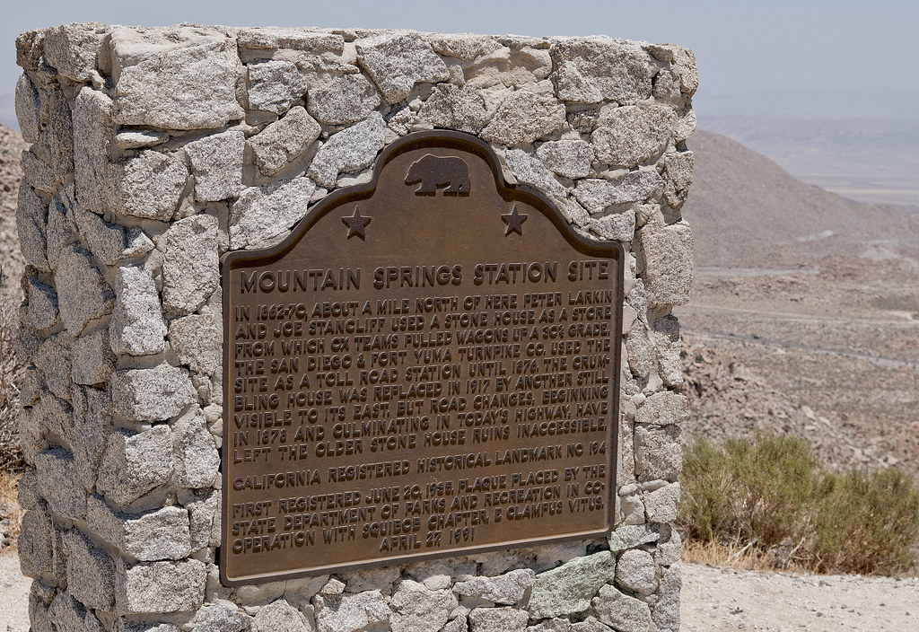
Mountain Springs Station Site by tomteske, on Flickr
Best description of what's going on at Mountain Spring is in Chris Wray's "The Historic Backcountry." Apparently McDonald Service Station from the '30's evolved into the cluster of buildings you now see. Think that whole place has been for sale for a few years. Have written the real estate agent's number down a few times just to call and see what's going on but have never done it. Remains of a stone corral are visible to the west of I-8 at where a dirt road drops in from Table Mt. Need to check it out. Tom |
4/10/2013
Topic:
Cougar Canyon and Boulder Alley
tommy750
|
Anyone found the Cougar Canyon solstice cave? Read an article about it some time back that included a vague location. Apparently had a window constructed in one end that created a solstice alignment. Tom |
4/14/2013
Topic:
Fish Creek Mts and Ancient Lake Cahuilla
tommy750
|
John Rocque is a cartographer most famous for his 24 sheet map of London published in 1747, by far the most detailed to date. This map is the only known depiction of an inland sea past the confluens of the Colorado and Gila Rivers. It's felt by many to be a depiction of Ancient Lake Cahuilla although I wonder if it could be Laguna Salada. The final infilling of the lake not counting modern times commenced about 1600 with the lake empty by about 1700.
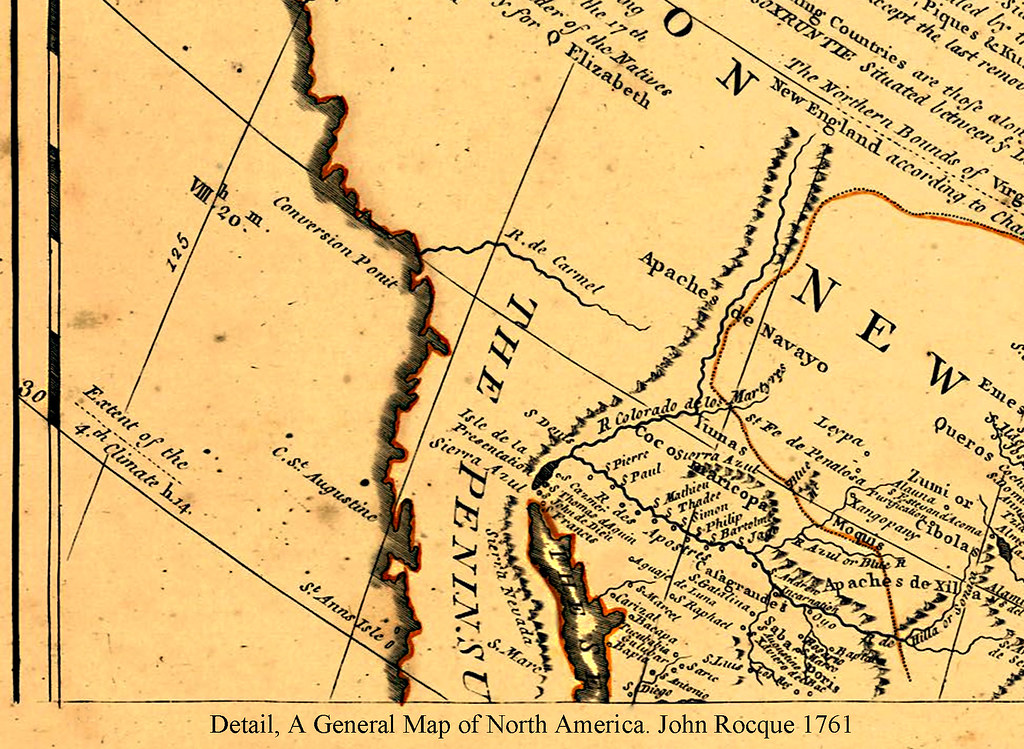
John Rocque A General Map of North America 1761 by tomteske, on Flickr
Decided to take a few trips out to the shoreline near Fish Creek Mts and see what was still there. Here's tumbled beach rock and shells in the middle of the desert. Pretty amazing.
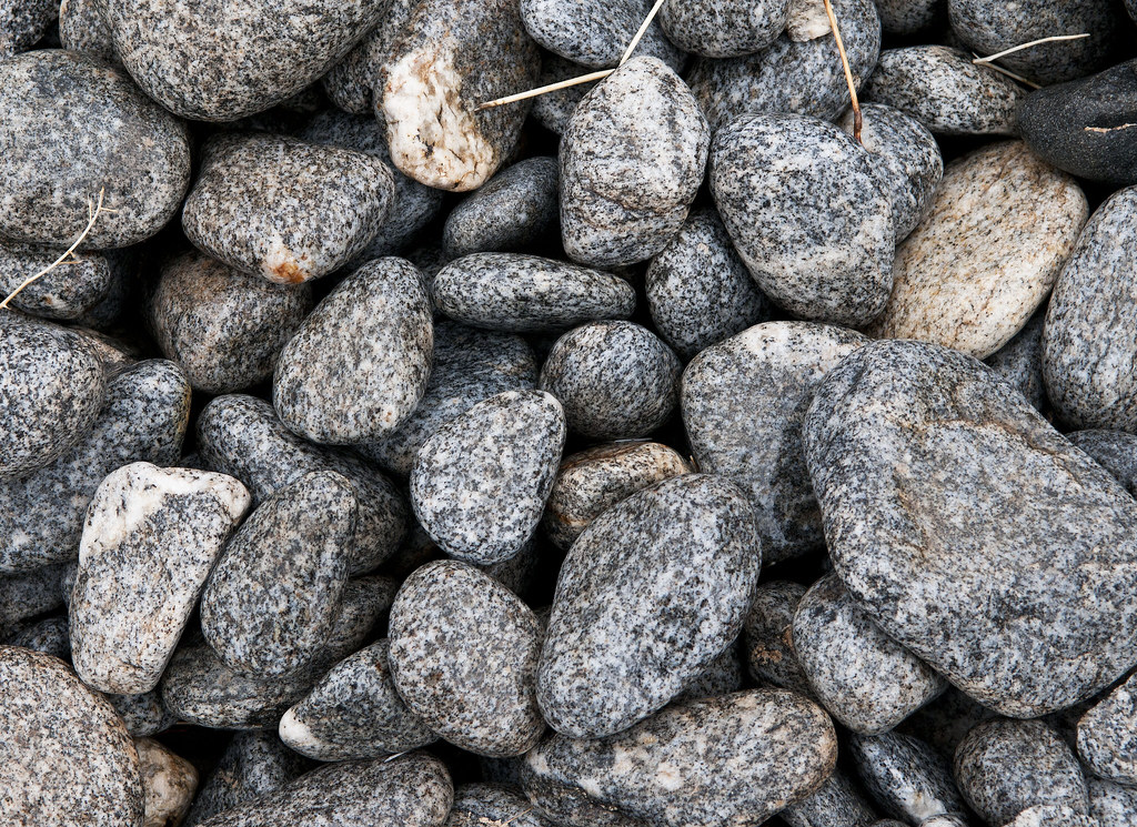
Polished Beach Rock by tomteske, on Flickr
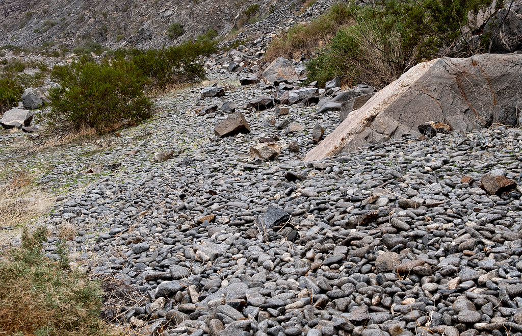
Cahuilla Shoreline3 by tomteske, on Flickr
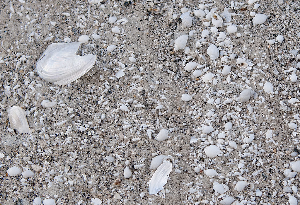
Cahuilla Beach by tomteske, on Flickr
Up close, most of the rock is covered by a layer of tufa with a worm eaten appearance.

Tufa Line by tomteske, on Flickr
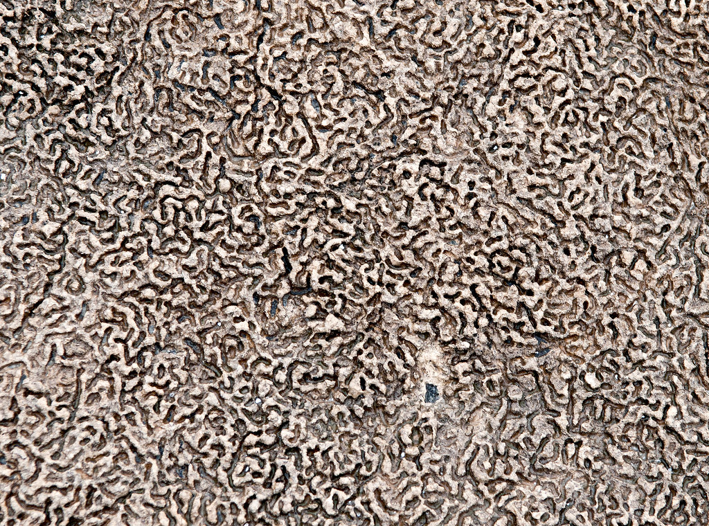
Cahuilla Concretions by tomteske, on Flickr
A number of circles are found on the actual shoreline and overlooking it. Thought they might be fish traps like Indio, but some look more like sleeping circles with clear floors. Not sure.
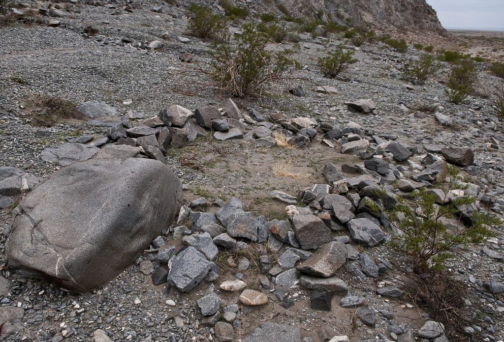
Fish Trap2 by tomteske, on Flickr
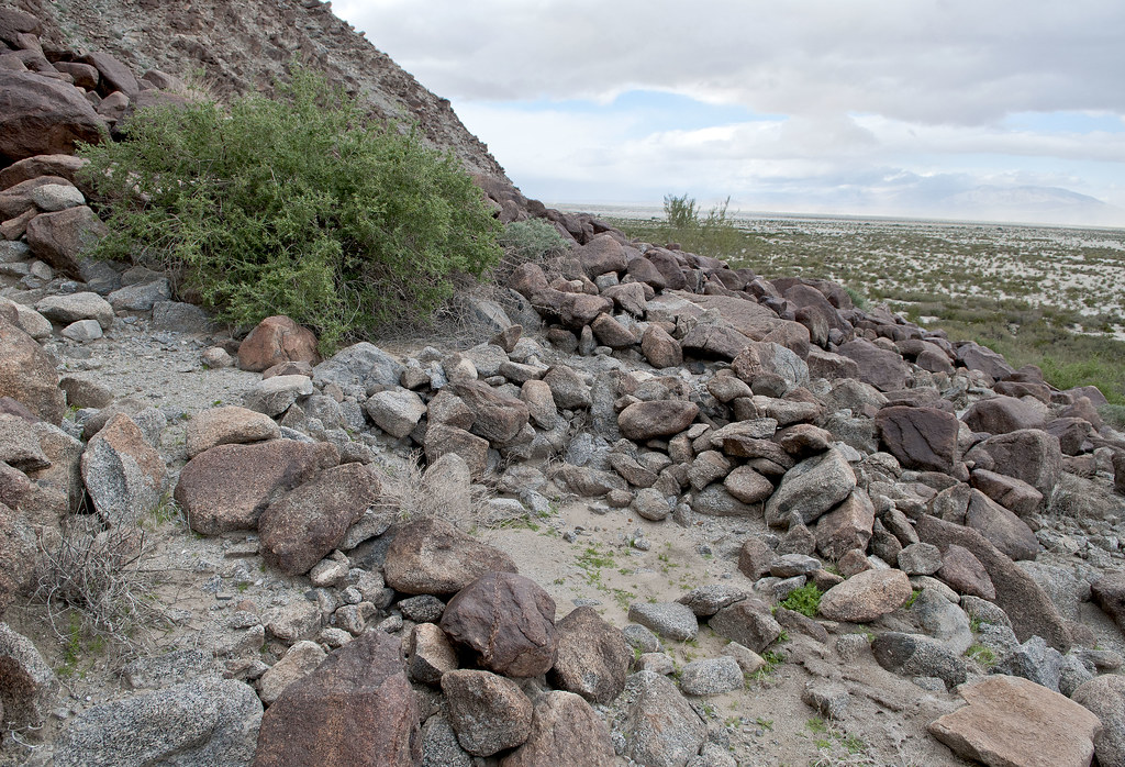
Middle Sleeping Circles by tomteske, on Flickr
Above the shoreline in an alluvial fan, I found 10-20 circles in a group.
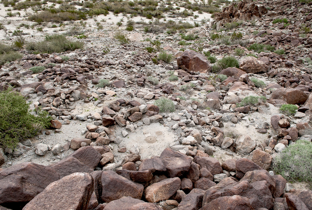
Sleeping Circles by tomteske, on Flickr
Another site up the shoreline had multiple circles and evidence of a previous archaeological investigation.
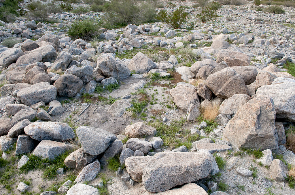
North Sleeping Circles by tomteske, on Flickr
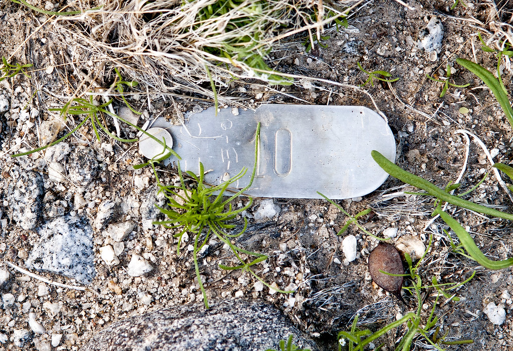
IVC 10 by tomteske, on Flickr
Back home, I noticed a trail arising from this last campsite and heading up into the Fish Creek Mts. Figured it was an old Indian trail and worth another trip.
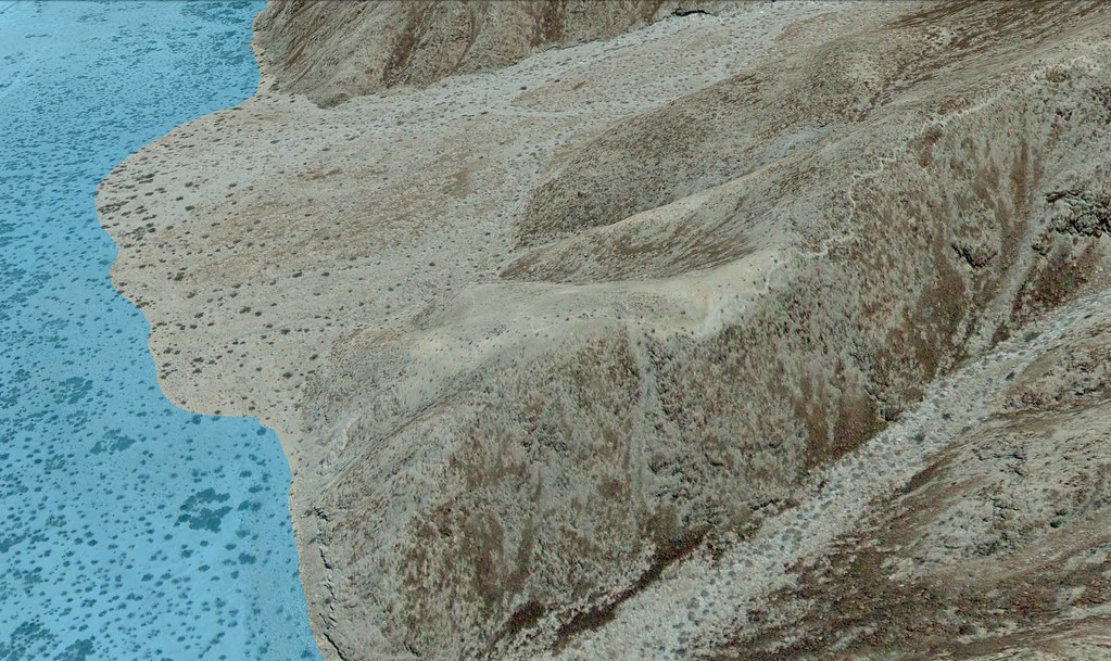
Fish Creek Trail by tomteske, on Flickr
Here's the trail a couple hundred yards up.
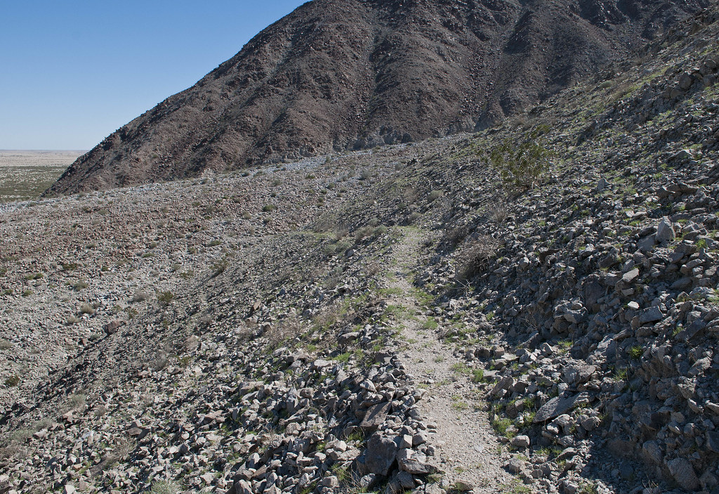
Trail by tomteske, on Flickr
Higher up the trail, a nice view of the shoreline looking toward The Santa Rosas.
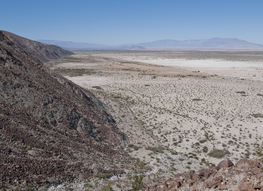
Cahuilla Beach by tomteske, on Flickr
Found a pottery sherd so started thinking this definitely was an old native trail. Then I found several mine pits and realized it was actually an old mining trail.
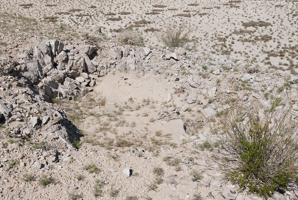
Mine Pit1 by tomteske, on Flickr
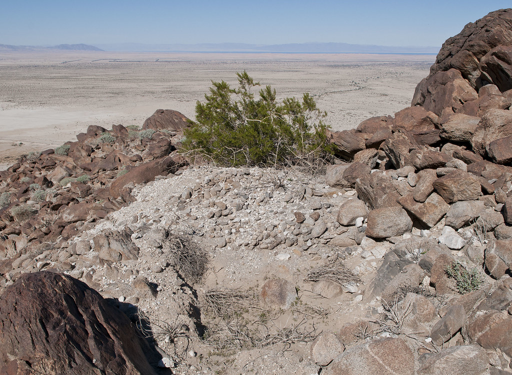
Mine Pit by tomteske, on Flickr
However, found some sleeping circles higher up just off the trail, so who knows.
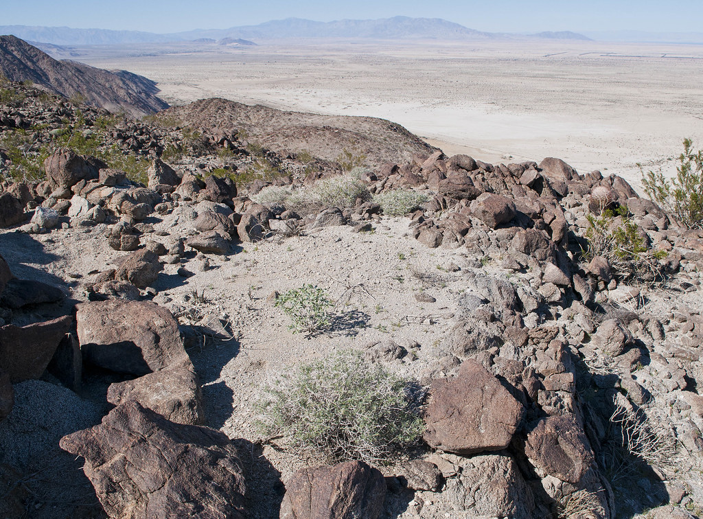
Two Sleeping Circles by tomteske, on Flickr
The only petroglyph I saw 
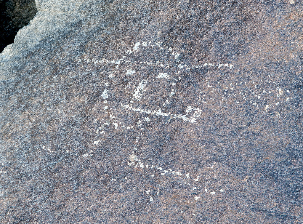
The Pipe by tomteske, on Flickr
On top, several mines. Not sure what they were mining but some of the tailings had pretty colors.
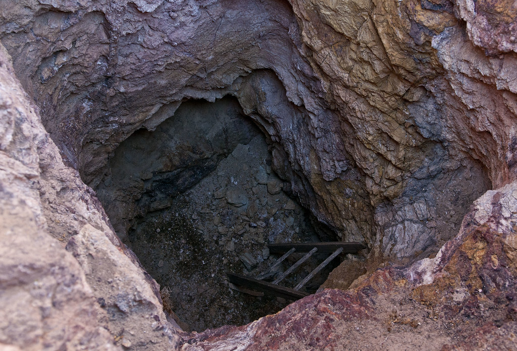
Mine2 by tomteske, on Flickr
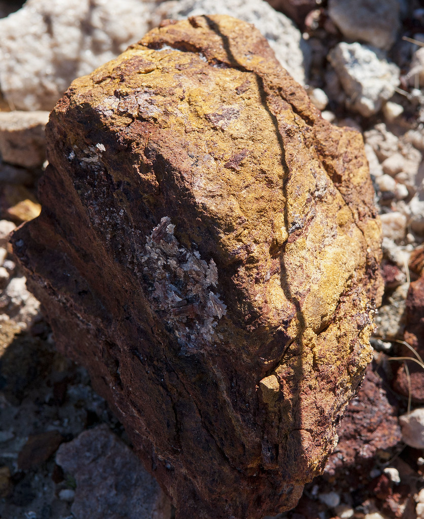
Mine2 Tailings by tomteske, on Flickr
Old windbreak maybe for a tent since no ruins were seen. Lots of old tin cans were strewn about.
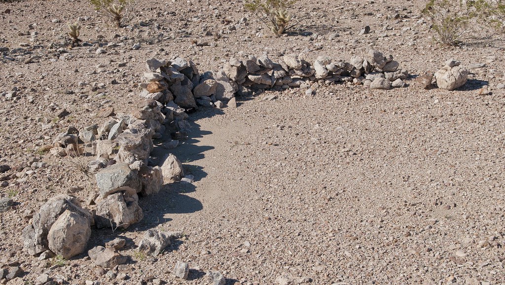
Mine1 Windbreak by tomteske, on Flickr
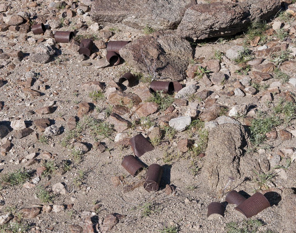
Mine1 Cans by tomteske, on Flickr
Headed further West and came across this in an isolated canyon. Is this what they mean by a "pot drop" as in dropped pot? Think you could piece this olla back together.
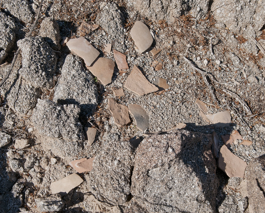
Olla by tomteske, on Flickr
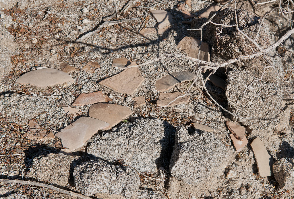
Olla2 by tomteske, on Flickr
A few feet further, a view of BM Eagle in the foreground. The little clearing is the start of Red Rock Canyon to the right and a tributary of Barrett Canyon to the left.
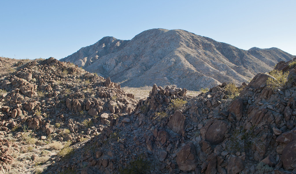
Toward BM Eagle by tomteske, on Flickr
The only traces of ordinance I found on top.
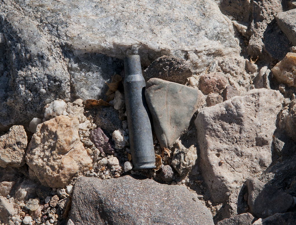
Shell by tomteske, on Flickr
At the Eastern flank of Fish Creek Mts, the US Gypsum mining railroad is still quite active. There are several old spurs on the West side of the tracks in areas that look like beach rock was being mined.
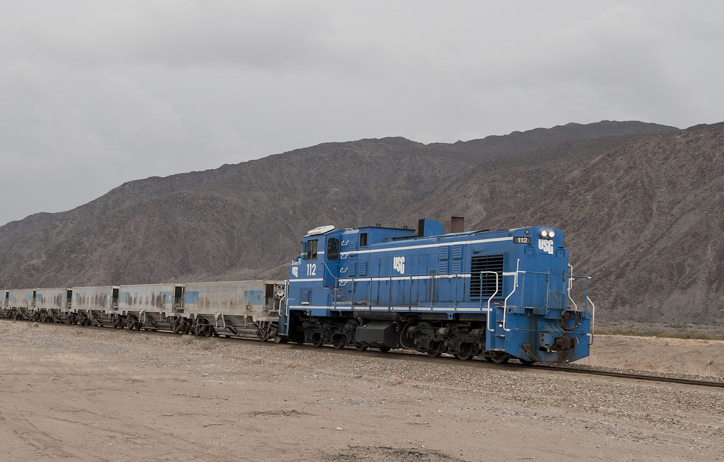
USG Train by tomteske, on Flickr
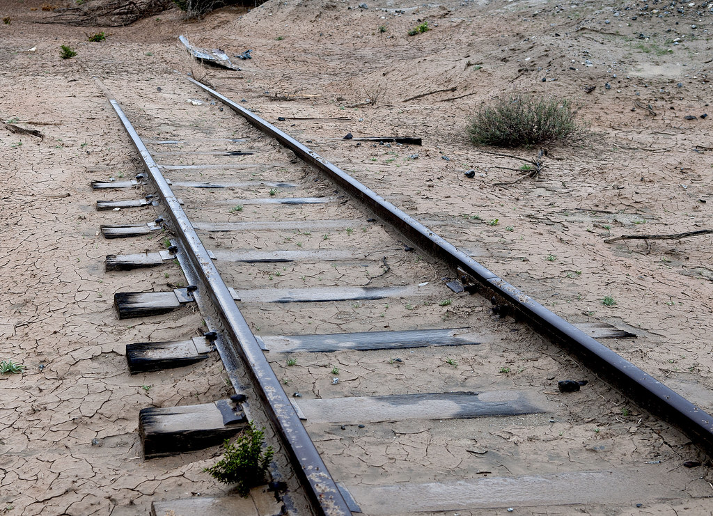
Mining Railroad by tomteske, on Flickr
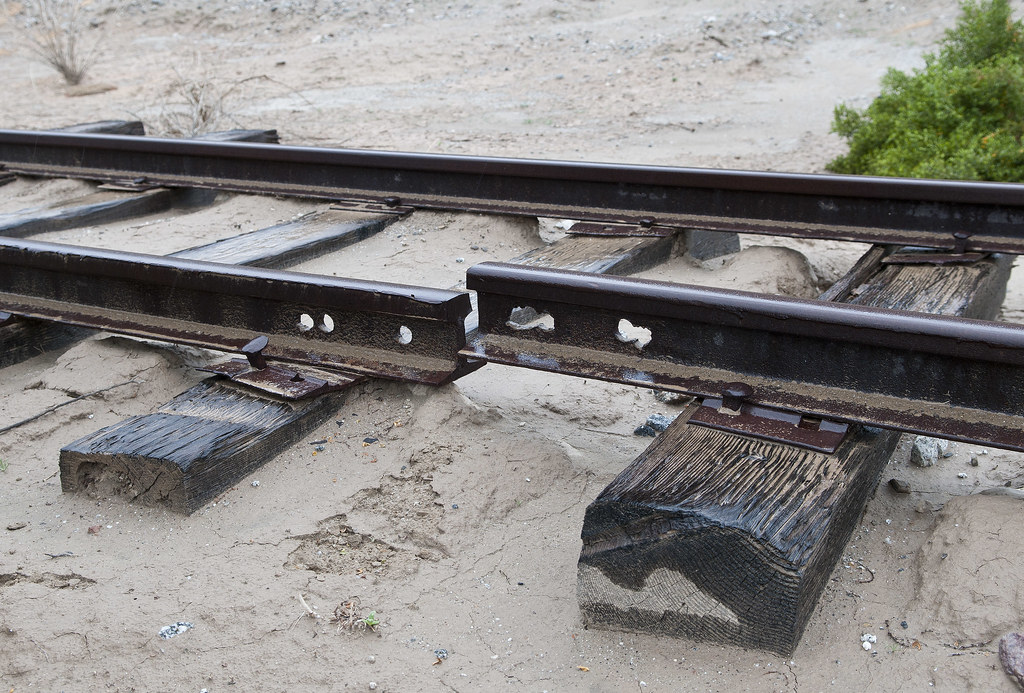
Broken Rail by tomteske, on Flickr
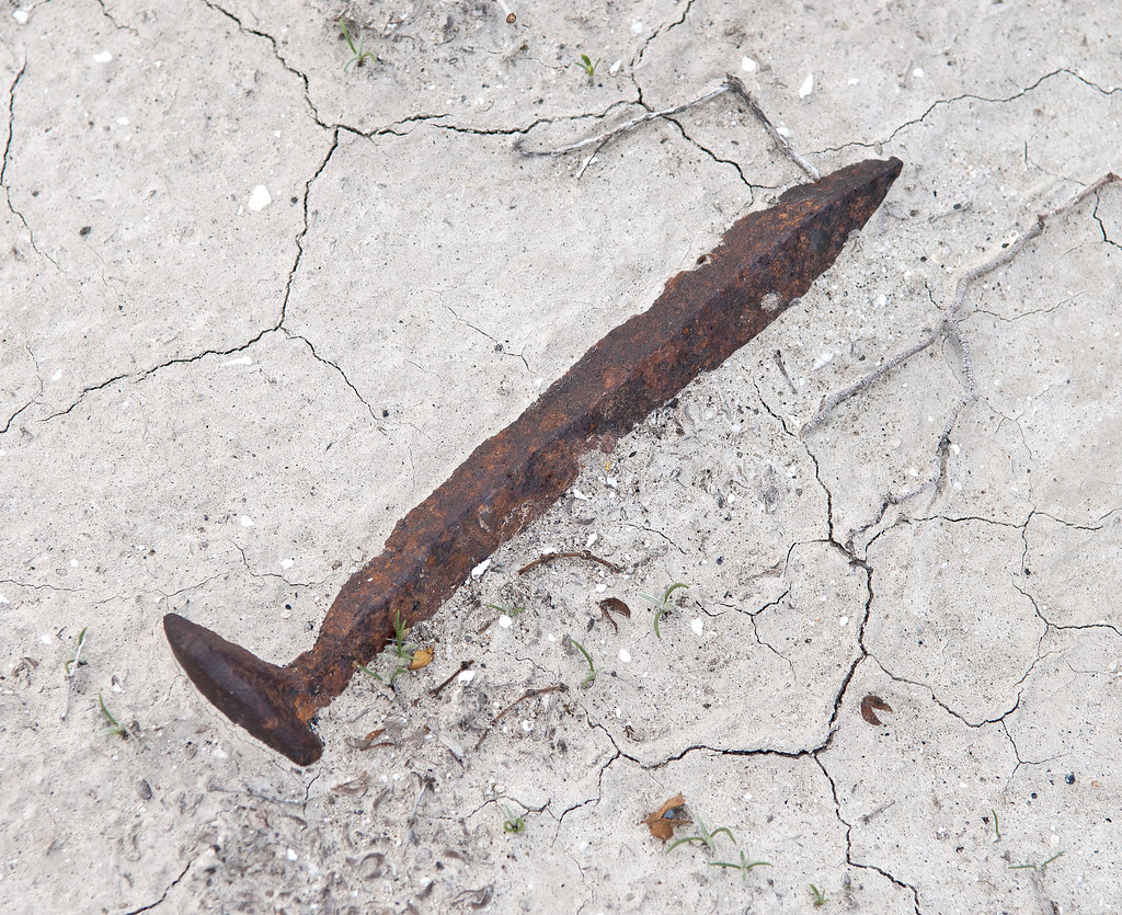
Fish Creek Mts Spike by tomteske, on Flickr
The trestle at Carrizo Creek. Was surprised to see one of the graffiti artists is a client of mine. Tisk, tisk! Enjoy you weekend.
P.S. I promise to never post on Lake Cahuilla again! Tom
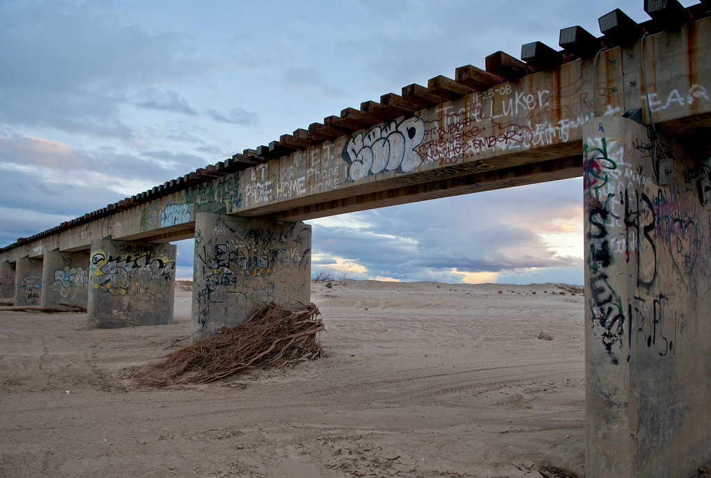
The Bridge by tomteske, on Flickr |
4/15/2013
Topic:
Fish Creek Mts and Ancient Lake Cahuilla
tommy750
|
hikerdmb wrote:
Great pics. That trail looks like it took you up to a nice area and some very interesting stuff. Good find. Red Rock and Barrett Canyons are great places.
The trail was still pretty intact with only a couple bad spots. Nice plateau on top which would make a nice camp spot. Started way too late to make it into any of the canyons. Care to elaborate on "Red Rock and Barrett Canyons are great places?" Thanks. Tom |
4/15/2013
Topic:
Fish Creek Mts and Ancient Lake Cahuilla
tommy750
|
dsefcik wrote:
Great stuff Tom, I enjoy reading your trip reports and photos. Great subject, post all you want, it is inspiring and makes me want to head out that way. Some of those circles looked pretty small, almost uncomfortably small to sleep in....hard to tell though from the photos.
Agree, some of the circles look snug. Could be the flat bottoms are merely Indio-style traps filled with sand. The two clusters of circles on the alluvial fans are above the lake level and presumably campsites. There's someone named Jerry Schaefer who's written multiple articles about West Mesa and the Fish Creek Mts shoreline but I can't seem to find any of his papers online. Tom |
4/15/2013
Topic:
Fish Creek Mts and Ancient Lake Cahuilla
tommy750
|
Jim (ziphius) wrote:
I agree, please post more on Lake Cahuilla! You gave a great history of the area in these last couple of posts. Few of us make it that far east, so this post is like water for thirsty desert explorers.  - Jim - Jim
Thanks for the upvote! Tom |
4/15/2013
Topic:
Fish Creek Mts and Ancient Lake Cahuilla
tommy750
|
rockhopper wrote:
Fantastic map of 1761. Great trip. Thanks for sharing.Those first rock circles look like fish traps. I love the rounded beach rock photo. Definately a pot drop right there!Those miners were a tough bunch. Looks like they gave up too!
I've traced the ancient shores line(s) on Google Earth and on foot over the years. From articles out there on google searchs the lake has been filling and evaporating for hundreds of thousand of years. Taking about 50 years to go dry. The high water mark has changed over time due to the pull apart basin and tectonic uplfting. It is a very interesting area indeed! Some more photos to add in.


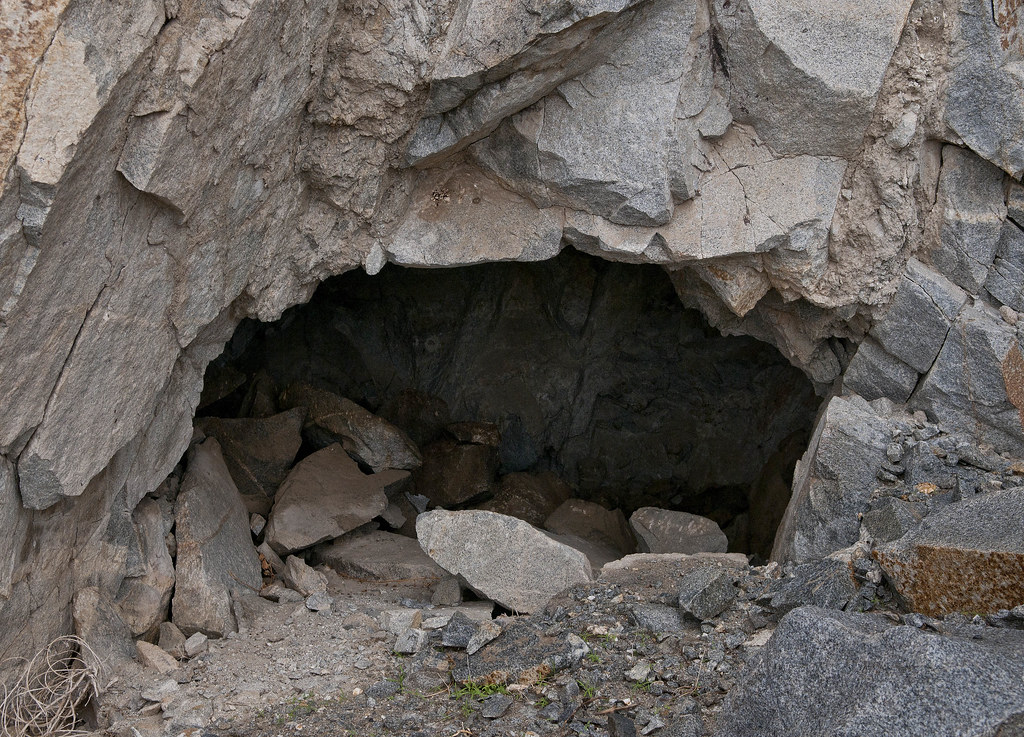
One of many caves near shoreline
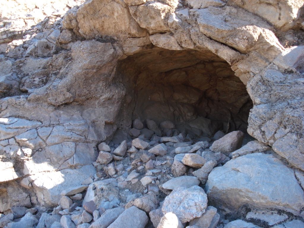
edited by rockhopper on 4/15/2013
edited by rockhopper on 4/15/2013
Thanks for the photos and maps. Your second map is interesting since it seems to be showing Cahuilla with the glacial lakes? Found a couple mine shaft right at the old waterline. Indio supposedly has a shelter cave right above the traps but I never saw it. Thanks. Tom
Fish Mt Mine Shaft by tomteske, on Flickr |
4/16/2013
Topic:
Weather Watch
tommy750
|
I usually open up the front door and look outside. Very accurate. Oh, that's right. You guys live on the coast with all that FANCY temperate weather  |
4/18/2013
Topic:
Weather Watch
tommy750
|
Jim (ziphius) wrote:
tommy750 wrote:
I usually open up the front door and look outside. Very accurate. Oh, that's right. You guys live on the coast with all that FANCY temperate weather 
Ok, it is agreed that we all call Tom for weather updates before heading out! Just post your cell phone number here Tom and you will be hearing from us!  Jim Jim
Touche Jim! Any good webcam sites out in ABDSP? |
4/19/2013
Topic:
Seco Del Diablo and Tapiado
tommy750
|
Since the Colorado Desert weather looked amazing from the office parking lot yesterday afternoon, decided to call Bronco Amy and see if she was up for a drive (she was). Headed out toward Carrizo Wash and then toward Seco del Diablo.
The turnoff.

Sweeny by tomteske, on Flickr

Toward Carrizo Mt. by tomteske, on Flickr
Couple choppers were flying over and managed to get one of them and the moon in a tight formation. Farther up Seco del Diablo, one flew right over the arroyo and I missed the perfect shot.

Moon Shot by tomteske, on Flickr
Battered smoke tree at the mouth of Seco. The seep had water in it.
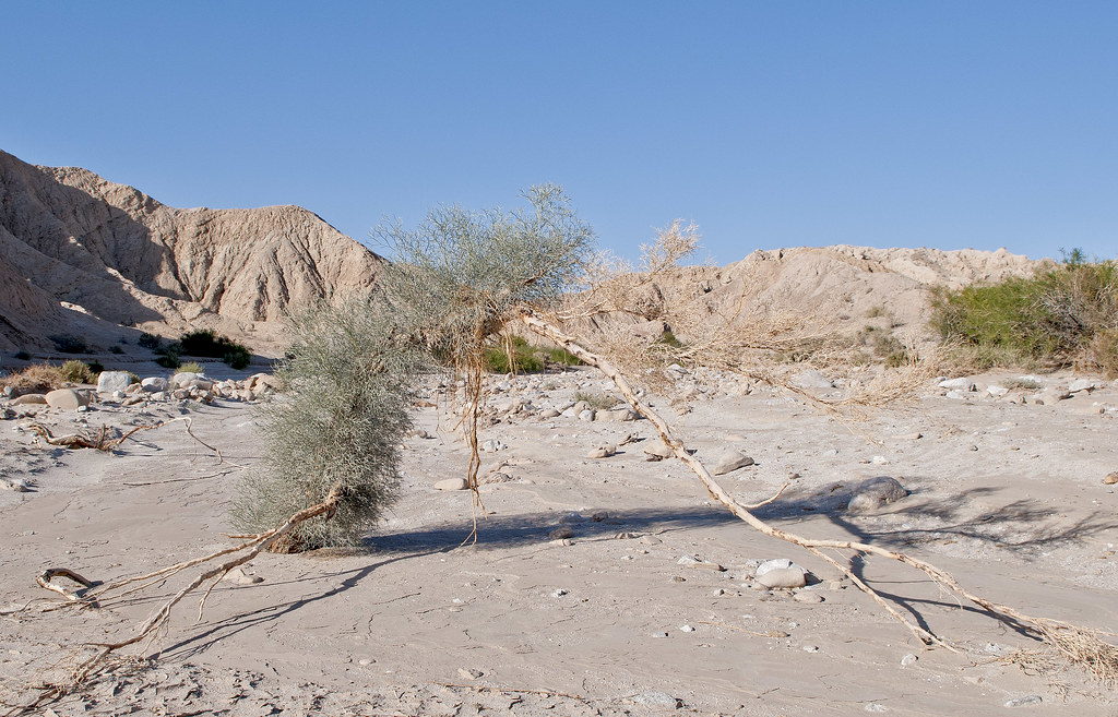
Smoke by tomteske, on Flickr
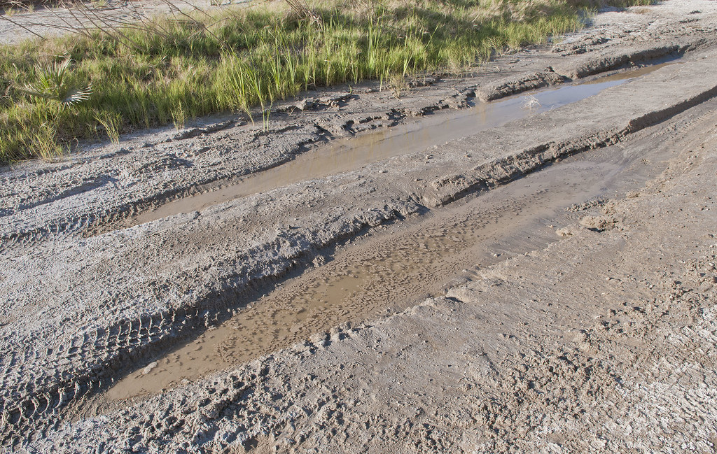
Seco de Diablo Seep by tomteske, on Flickr
Amy with her out of shape Weiner Dog Gretchen and the '91 White OJ Bronco.
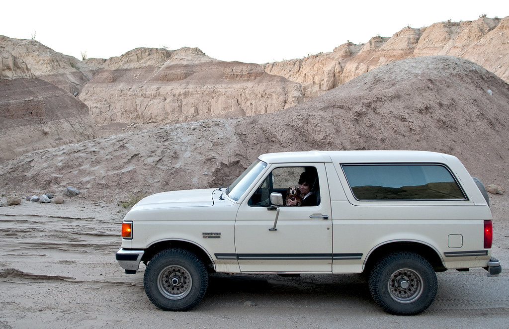
Amy, Gretchen and The Bronco by tomteske, on Flickr
Walked up a Seco side canyon with a new layer of sediment.
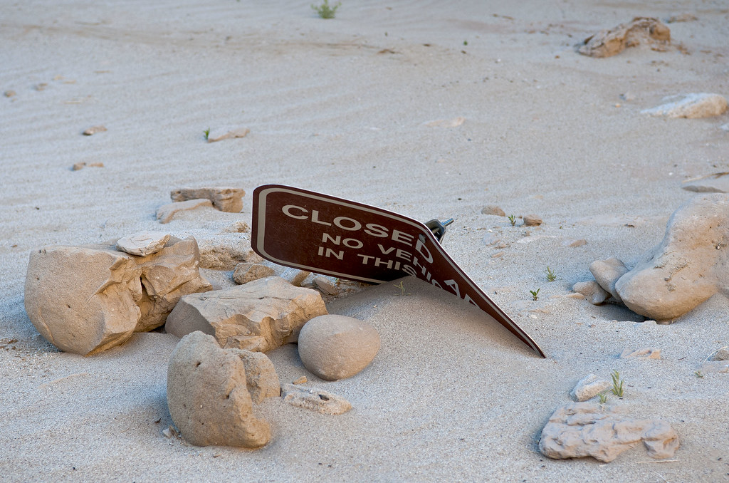
Closed by tomteske, on Flickr
Lots of weird concretions.
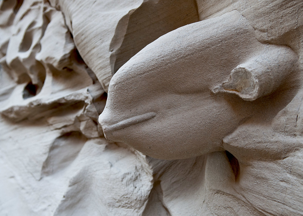
Concretion by tomteske, on Flickr

Concretions by tomteske, on Flickr
Someone's concretion cairn.
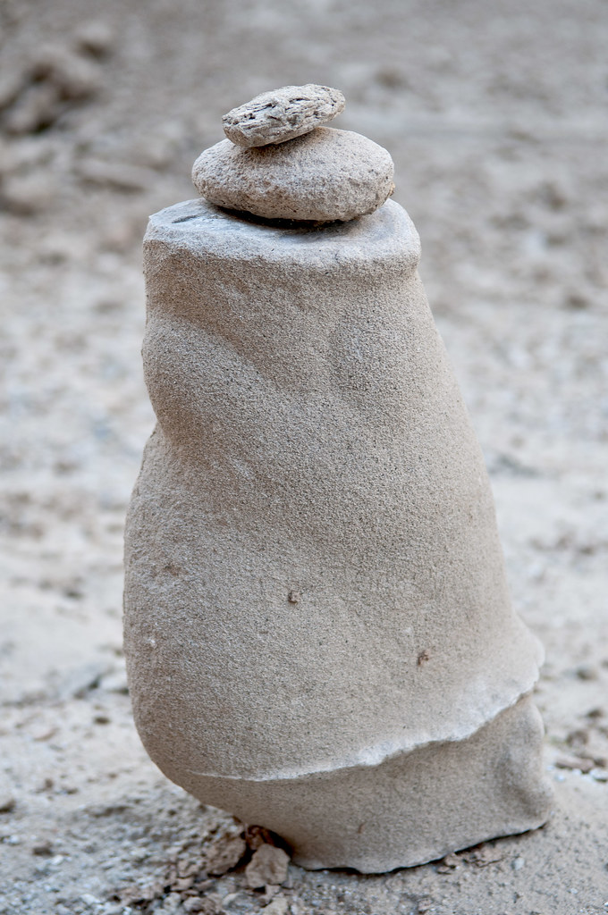
Concretion Cairn by tomteske, on Flickr
A rock fall blocked the canyon creating a small lake. Amy with her beverage. Love the patterns created by cracked clay.

Red Cup by tomteske, on Flickr

Cross Roads by tomteske, on Flickr
Was out in this same side canyon in March '09 and a couple of hawks were diving at us. Not sure what bird this feather is from.
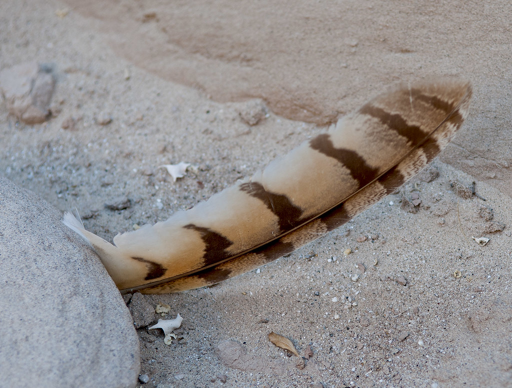
Pluma by tomteske, on Flickr
Lots of fairly fresh rock falls up Seco and Tapiado.
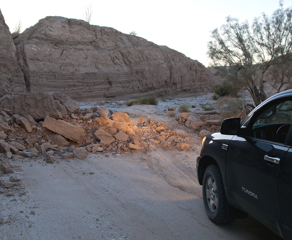
Rock Fall by tomteske, on Flickr
Joshua Tree is not the only park with taggers.

Arroyo Diablo Turnoff by tomteske, on Flickr
Somewhere in Tapiado.
Tapiado Night by tomteske, on Flickr
Back in Vallecito Wash and time to head home. Enjoy. Tom

Arroyo Tapiado by tomteske, on Flickr |
4/21/2013
Topic:
Fish Creek Mts and Ancient Lake Cahuilla
tommy750
|
Nice pics, Nolan! So bizarre to see those delicate shells deep in the desert. Agree, EC085 is a great way to get to Split Mt/Fish Creek from I-8 AND bypass the Hwy 86/78 USBP checkpoint . Definitely agree with you on the sandy areas and can't imagine getting through after a rain. My favorite "war zone" pic was returning from an Anza Borrego Foundation trip in Fish Creek and seeing this guy on EC085. Like the Tahoe bull bars 
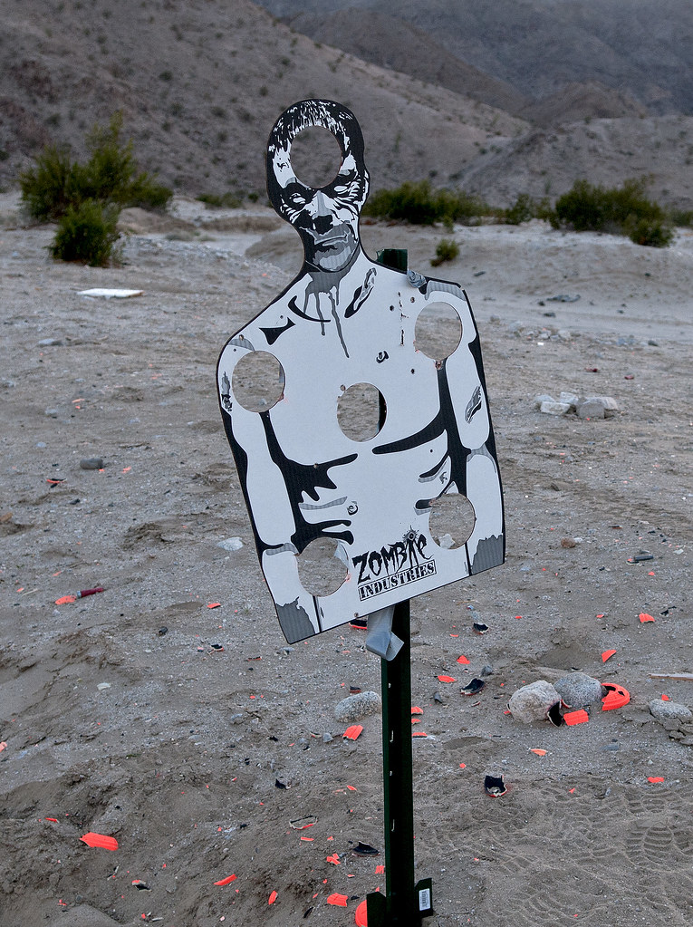
Zombie by tomteske, on Flickr
edited by tommy750 on 4/21/2013 |
4/24/2013
Topic:
Inner Pasture Day Trip
tommy750
|
Awesome pics and videos, Daren. My sightings of BHS are usually seconds in length and your videos are minutes! Do you know why the ewe was digging at the ground in the video? Some sort of foraging behavior for? Thanks. Tom |
4/26/2013
Topic:
Dos Cabezas and Goat Canyon
tommy750
|
Great post Rail Explorer. Nice Rosy Boa pic. Need to get out there before they reopen the RR. Tom |
4/28/2013
Topic:
Seco Del Diablo and Tapiado
tommy750
|
Nolan (anutami) wrote:
Must be nice having your office so close!!! Is that in el centro?
Yes, that's the place. Was "so close" for years but never went out till getting a 4x4. Never knew I was missing so much! Tom |
4/29/2013
Topic:
Inspiration Wash: Must Do
tommy750
|
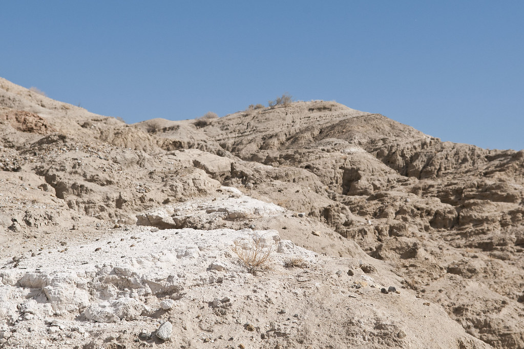
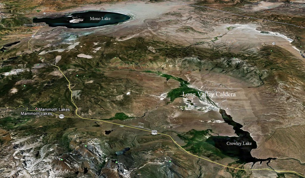
Nice post, Nolan. Guess the new Tahoe stayed home? Was out in Beckman Wash and Inspiration Wash in February with the geologist Paul Remeika and a ABF tour. He pointed out this white layer visible all through this area. He correctly identified it years ago as ash from the Long Valley Caldera eruption 760,000 years ago. All you guys who frequent the Eastern Sierras have driven through the caldera on 395. On GE, it's 340 miles north of Anza Borrego. The explosion pumped out 140 cubic miles of debris. Mt. St. Helens was only 0.3 cubic miles. Really hard to imagine a foot of ash here in the desert from that far away!
Bishop Tufa by tomteske, on Flickr
Long Valley Caldera by tomteske, on Flickr
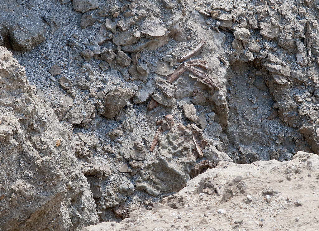
Here's an unexcavated skeleton of a horse or camel Remeika pointed out in the same area. He says the park has so many collected horses and camel skeletons they're just going to leave this one there. Tom
Bones by tomteske, on Flickr |
5/1/2013
Topic:
Inspiration Wash: Must Do
tommy750
|
Nolan (anutami) wrote:
dsefcik wrote:
Good stuff Tom.....thanks for more amazing and great info.
Yeah great stuff!!! Camel bones are amazing. Ash? Would have never guessed, how on earth did they come to that conclusion? Did the ash accumulate in the shallow sea and accumulate as stagnate water or was it before the shallow sea? And before a freshwater lake.... The area has soooo much history. Thats why I love the place!
Unfortunately this was the xterras last trip. I did it before I got the tahoe....still regretting it since it was my wife and I first big purchase
Apparently every volcanic eruption has a distinct ash fingerprint. Remeika said he sent off a sample to the "big volcanic ash repository back east" and a month or so later, voila, a positive ID as Bishop Tuff, the ejecta from the Long Valley Caldera. Not sure the climate of Anza Borrego back then. Agree, lots of history. Tom |
5/11/2013
Topic:
EL VALLECITO AND LA RUMOROSA STYLE
tommy750
|
dliponi wrote:
Thank you for the photos and the info. Are the panels locked up - I assume the caretaker unlocks them during the day?
Is there anyway to see more of the panels than the few they have on display [like hire a local guide?], etc.
Thanks, Tommy, very nice display.
Don Liponi
There's about 18 sites if I recall correctly but less than half are open to the public. There is a caretaker at the site and with a small fee you get a map and as much time as you want to view the various pictographs. Hours are Wed-Sun 0800-1700. Here's the map. Tom

Zona Arqueologica El Vallecito by tomteske, on Flickr |
5/13/2013
Topic:
Fish Creek Mts and Ancient Lake Cahuilla
tommy750
|
Glad you made it out okay, DesertWRX. Kinda warm out there to get stranded for too long! |
5/13/2013
Topic:
Fish Creek Mts and Ancient Lake Cahuilla
tommy750
|
dsefcik wrote:
So is where you went largely a passable road in a regular 4wd truck? I have wanted to go out that way but was not sure of the "roads".
Daren, you shouldn't have any trouble with your rig. Some areas of soft sand and silt but not a problem with 4WD. If it has recently rained, wouldn't go near that road! Tom |
5/13/2013
Topic:
Rockhouse Canyon / Toro Peak BackPack Trip
tommy750
|
Another amazing trip, Daren. Have only been on top of Toro once and it was the easy way. What was your gain/loss? Certainly an impressive climb. Tom |
5/13/2013
Topic:
Cattelmen's Shack in Rockhouse Cyn Carrizo Gorge
tommy750
|
Always interesting to reproduce someone's pic from 50 years ago. Looks like some interesting palm groves about the shack. Do you know if the water source to the cabin has dried up or is the plumbing just broke? |
5/13/2013
Topic:
All American Man
tommy750
|
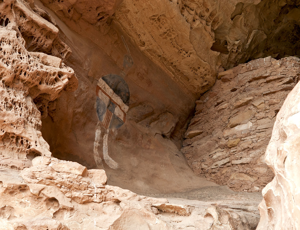
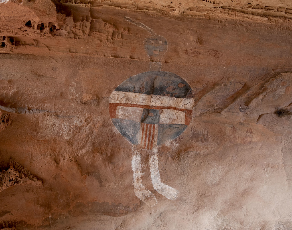
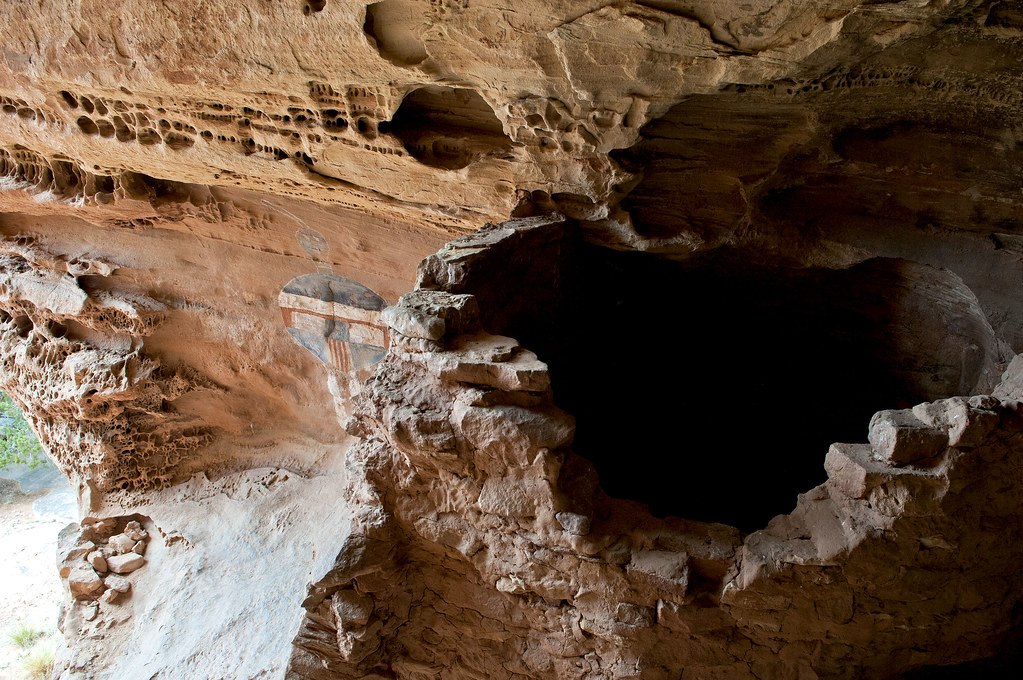
Just a little far afield of ABDSP, the All American Man pictograph may be the most famous in all of American rock art. Was gone last week volunteering with the Sierra Club doing archaeological site surveys just outside Canyonlands NP and decided to day hike 19 miles to see this guy. Located deep in Salt Creek in Southern Canyonlands, this Ancestral Puebloan (Anasazi) pictograph has been dated to about 700 years before present. The chalk outline is modern and presumably from the now banned chalking technique often used on petroglyphs. Enjoy. Tom
The cave is about 15ft above ground and requires a little work to enter.
All American Man by tomteske, on Flickr
A few hand prints are present, also being found at multiple sites up and down Salt Creek
All American Man2 by tomteske, on Flickr
The cave contains a couple rock storage structures.
All American Man3 by tomteske, on Flickr
edited by tommy750 on 5/13/2013 |
5/13/2013
Topic:
All American Man
tommy750
|
dsefcik wrote:
So what's your take...real or fake..??
Apparently archaeologists feel it stylistically looks Anasazi and surrounding artifacts are consistent with this. Have read of two studies dating fallen pigment fragments that found no modern materials. Of all the rock art to alter, a site discovered in 1951 a LONG way from anything seems a peculiar choice to enhance. But who knows! |
5/20/2013
Topic:
Siemens Shuts Down Wind Turbines after accident
tommy750
|
Yep, every turbine was still yesterday afternoon driving eastbound on I-8 although it was quite windy. You could see the one with the missing blade south of the Coyote Mts. The damaged blade was not visible. East County Magazine has an interesting story on the incident plus photos along with dirt on Siemens here: http://www.eastcountymagazine.org/node/13251 Tom |
6/3/2013
Topic:
Indian/Cougar/Sheep Canyon Day Hikes
tommy750
|
Just when you thought the Daren Sefcik backpack couldn't possibly get heavier, in goes a 500mm lens! Thanks for bringing it because your pics are awesome. You shot the video with than lens as well? Really neat seeing those sheep pics. Great TR. Tom |
6/11/2013
Topic:
The Desert Magazine
tommy750
|
Found an interesting story on how Desert Magazine got its start. Apparently the two publishers, Henderson and McKenney, were brainstorming atop the Santa Rosas while hiking to "the peak" (presumably Santa Rosa or Toro). First issue in Nov 1937 was 25 cents and a year's subscription $2. Sounds worth it to me. Enjoy. Tom
http://www.desertreport.org/wp-content/uploads/2013/05/DR_Summer_2013.pdf
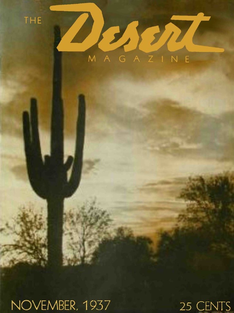
Desert Mag by tomteske, on Flickr |
6/18/2013
Topic:
Anza Borrego Misc Summer Backpack Trip
tommy750
|
As always, nice pics Daren. Like the little guy on your red shirt. Looks like an underwater pic of a shrimp on a coral reef  |
6/19/2013
Topic:
Verizon Does It, Why Not Pattern?
tommy750
|
Made the San Diego-Imperial Valley round trip today and got to thinking while passing the turbine forest. According to the internet, in 1996, South Africans may have built the first cell tower in the shape of a tree. Now, lots of the unsightly towers look like palm trees or pines. Why not mitigate the ugly turbines with some pleasing 300ft boojum trees or agaves? Just wondering. Tom
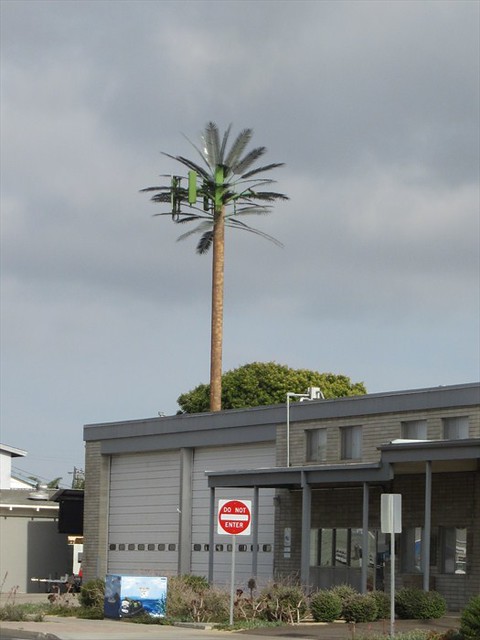
107fe01c-d1b9-44f5-b3e5-da9e0d66343f by tomteske, on Flickr
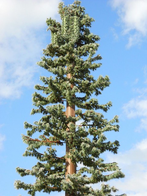
cel phone tower by tomteske, on Flickr
Now, that looks better!
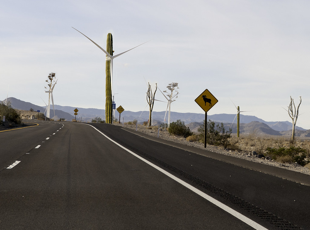
Visual Mitigation by tomteske, on Flickr |
6/21/2013
Topic:
Verizon Does It, Why Not Pattern?
tommy750
|
Not to flog this less than popular post even more, but this might be a great way to decrease the visual footprint of the turbines with a low energy solution, adaptive lighting. The video is pretty amazing:
http://cargocollective.com/taismauk/Adaptive-Camouflage-for-Offshore-Wind-Turbines |
7/8/2013
Topic:
Any Home Brewers out there?
tommy750
|
The San Diego History Center is hosting a series on local craft beers called, History Happy Hours. The first is July 26 and is called "Bottled & Kegged: San Diego’s Craft Brew Culture." It includes beer tasting and meeting local brewers. Here's the link:
http://www.sandiegohistory.org/calendar/historyhappyhours
Tom |
7/8/2013
Topic:
Chariot Fire
tommy750
|
Amazing time lapse video of the Chariot Fire from the Mt Laguna UCSD HPWREN camera starting Saturday through this morning:
http://anr.ucsd.edu/HWB/20130706-Chariot/index.html |
7/11/2013
Topic:
Bighorn Sheep Count 2013
tommy750
|
Are there any wildlife guzzlers for sheep out there? Or is that not a feasible solution here in the Colorado Desert? Tom |
7/12/2013
Topic:
Bighorn Sheep Count 2013
tommy750
|
dsefcik wrote:
tommy750 wrote:
Are there any wildlife guzzlers for sheep out there? Or is that not a feasible solution here in the Colorado Desert? Tom There are, several of them. A couple have dried up also and another that is very large had just a little water left.
Thanks for the info, Daren. Still months of hot summer to go  |
7/14/2013
Topic:
Bighorn Sheep Count 2013
tommy750
|
DesertWRX wrote:
Thanks to Borrego's golf courses and citrus the water table has been dropping fast. Mark Jorgensen told me several years ago this affects the parks water supplies. That's just lovely, wealthy white guys can knock a ball around and growers make money and the plants and animals can suffer.
Here's an nice link discussing the water situation in the Borrego Valley: http://borregowaterunderground.org/
All of Borrego's water comes from pumping fossil water from the aquifer. 90% of it is utilized by agribusiness and golf courses with zero incentive to conserve since the water for them is nearly free. Tom |
7/17/2013
Topic:
Bighorn Sheep Count 2013
tommy750
|
Everyone may want to check out East County Magazine quoting Daren regarding the sheep count here: http://eastcountymagazine.org/node/13610  |
7/24/2013
Topic:
Desert Rain
tommy750
|
BorregoWrangler wrote:
It was flowing pretty good around Fish Creek on Sunday.

edited by BorregoWrangler on 7/22/2013
You were out on BLM 085? A lot of that below Split Mt Rd gets pretty treacherous when wet. Nice pic. Tom |
7/25/2013
Topic:
Desert Rain
tommy750
|
Here's a video of Ocotillo activist Jim Pelley driving some Ocotillo Wind access roads during the recent storm. Pretty amazing footage. Tom
http://www.youtube.com/watch?v=4gtEdOm9d38 |
7/30/2013
Topic:
Desert Rain
tommy750
|
Nolan (anutami) wrote:
tommy750 wrote:
Here's a video of Ocotillo activist Jim Pelley driving some Ocotillo Wind access roads during the recent storm. Pretty amazing footage. Tom
http://www.youtube.com/watch?v=4gtEdOm9d38
That is an amazing video!!!!!
Check out the parks website on how the mighty ocotillo copes with the summer rain!
http://www.parks.ca.gov/?page_id=638
I have a new respect for the desert in the summer months!!! I think we will have to plan a summer trip soon!!!!
That's an amazing transformation! The Torote tree flowers are really bizarre with differing number of petals depending on the sex. Had to look up dioecious  Wonder if the flower's "sex" changes with the seasonal weather since they never noticed the perfect flowers before. Nice link, Nolan. Tom Wonder if the flower's "sex" changes with the seasonal weather since they never noticed the perfect flowers before. Nice link, Nolan. Tom |
7/30/2013
Topic:
Desert Rain
tommy750
|
dsefcik wrote:
Nolan (anutami) wrote:
Check out the parks website on how the mighty ocotillo copes with the summer rain!
http://www.parks.ca.gov/?page_id=638
Sam had just sent me that photo, he is also a volunteer at the VC, he is a god guy.
Have a look at this video from souther Utah
Now, that is an amazing video. Would be a little harder to pull off here since the upper watershed is not that far away but I would love to try it! Tom |