11/11/2013
Topic:
The Desert Magazine
rockhopper
|
How True! looks Like a great day to be hiking across the desert varnish in the middle of another adventure. |
11/14/2013
Topic:
Memorials in the Park
rockhopper
|
Hi Tommy 750,
Either hike in from Rock house Canyon or Hike down from Toro Peak. It's eaiser coming down from the mountian.
As I remember there were about 8 or more marked ( falling apart) wooden grave markers with no info. No idea of age
or who they were. But the view from the memorial ground was fantastic! I have a guess.
a) Converted Christian native Americans
b) Lumber mill workers ( seems like a lot) from the old Santa Rosa lumber mill
c) Homesteders who lived on or around the mountian
Going back has been on my list. If I can still find it! We just stumbled on it hiking down towards Toro Spring. |
11/20/2013
Topic:
South Carrizo Creek to the Arroyo Tapiado Mud Caves
rockhopper
|
Welcome to the adventure |
11/26/2013
Topic:
Orocopia Mountains
rockhopper
|
Looks like you all had a great trip! Did you stop at the Dos Palmas spring? I understand that was an important water stop
for hundreds (thousands) of years. I spent a lot of time in the Cuckwallas years back prospecting on my CR480 dirt bike motorcycle. Stoped by the famous mines, The Red Cloud mine, the Aztec mines and others. Corn springs, cabins etc.. I follwed the old miners foot paths that traversed through the mountians. Lots of mineralization, Copper, Gold, Silver but no reliable water source. Those old miners were tough! That area has been mined by the native americans for thousands of years( some figure) just like down in the Picacho mtns to the south. Also found a lot of military shells waaaay outside of the impact zone. yikes!! Found a lot of neat ore( hot rocks) pieces with my back pack metal detector I still have. Found a metorite too! That whole area is just amazing and little traveled out there up in the mountians. I also followed the Kaiser rail road. They hauled the iron ore down from Eagle mtn. to the rails along the Salton Sea and then on the the Kaiser steel mills in Fontana. Does anyone remember the old steel mills? The smog in Fontana back then was like China today.
Thanks for sharing the report and great pics.
BTW feel free to claim the entire desert south west in this fourm.  |
11/27/2013
Topic:
Ticks!
rockhopper
|
Had my share. It's a miracle I never got lymes disese. Soaking in ubber hot hot mineral baths kills the virus. |
11/29/2013
Topic:
Ticks!
rockhopper
|
Indeed!
edited by rockhopper on 11/29/2013 |
12/3/2013
Topic:
Mese Verde National Park
rockhopper
|
Neat pics. Just got back from Colorado too! Garden of the Gods, Red rocks. Neatest part was soaking in Idaho springs Hot Springs and hanging with the Denver green peps.  |
12/15/2013
Topic:
N/E ABDSP
rockhopper
|
Took a trek out to the "hinterlands" of our wonderful back country last week. Hiked in the back country from the intersection of the SD county / imperial county and Riverside county lines. Found some old trails along the way and followed em'. Covered about 20 miles in 2 full "short" daylite days.
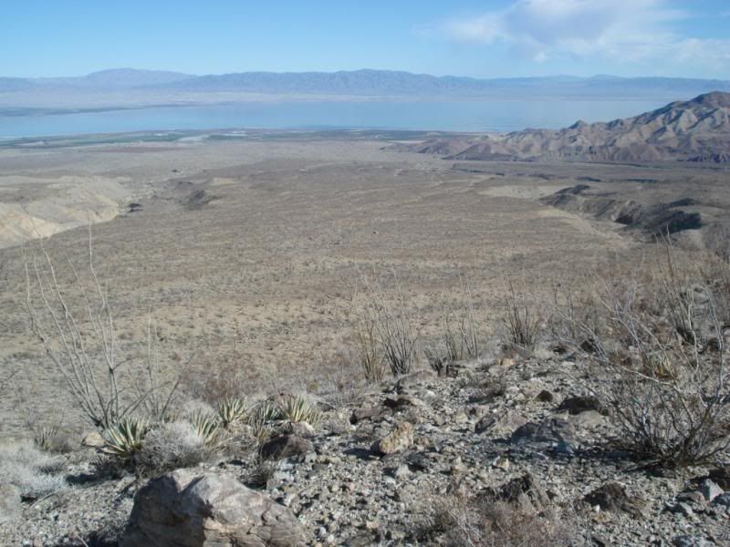
Trail not used much anymore
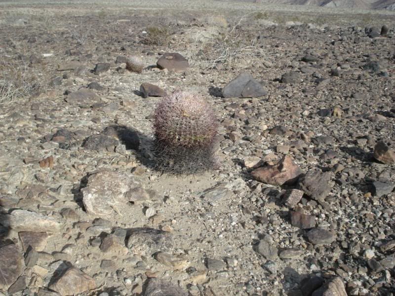
Trail follwed up the desert varnish up to here. Thats Villager peak beyond.
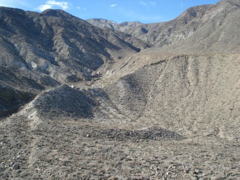
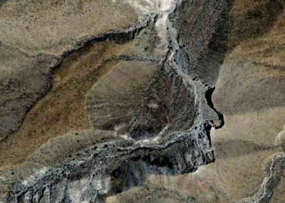
G. Earth photo of the spot. Could it be?
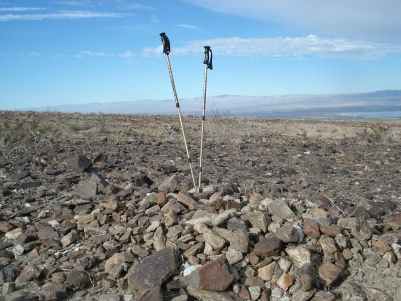
On the way back down found several burial mounds near the trail.
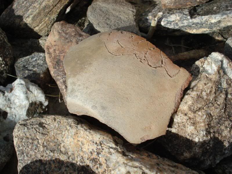
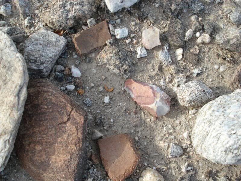
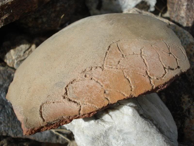
Sherd with some engraved design near the mounds. fish? mountians?
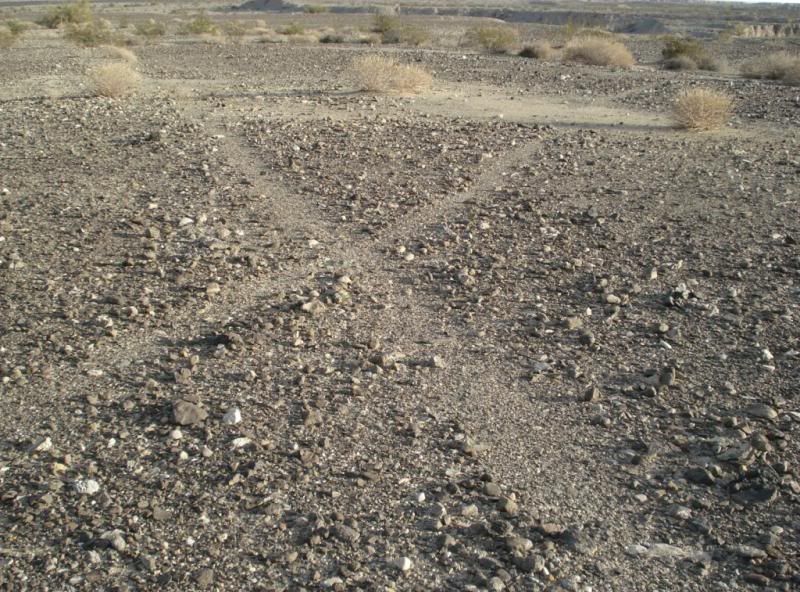
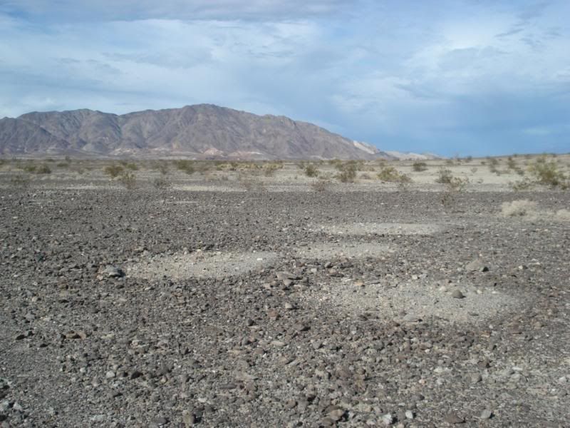
Next day after the rain. Saw these out on the desert varnish.
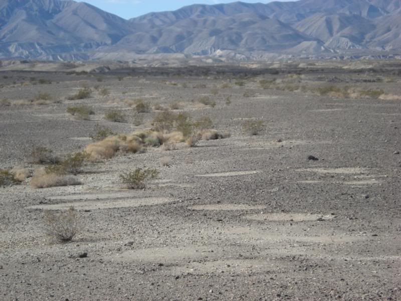
Chipings around sleeping circles
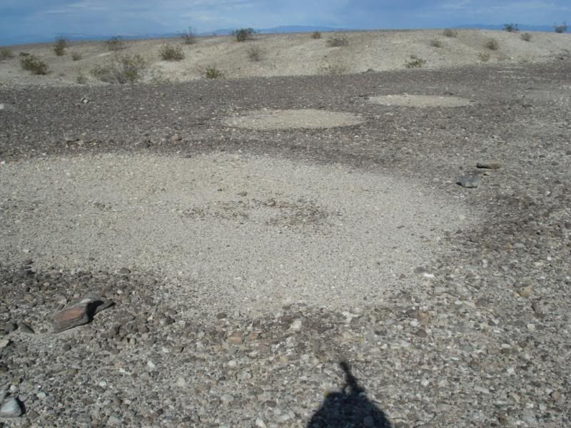
More sleeping circles. Shadow is hiking poles in pack.
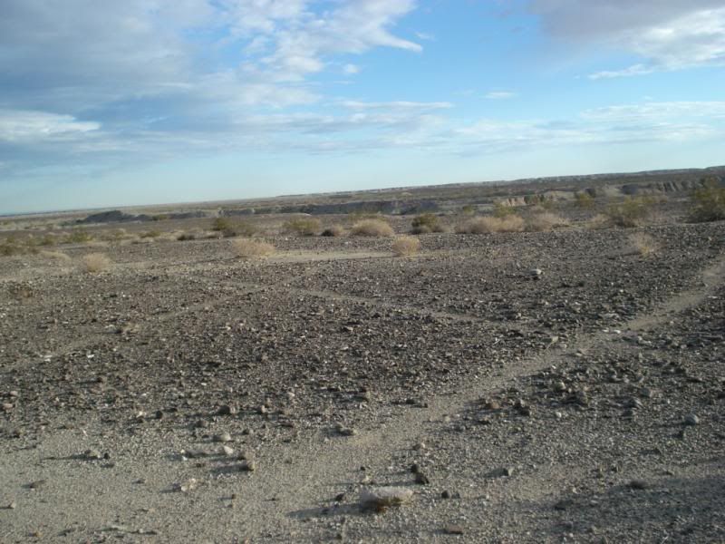
Trails near sleeping circles
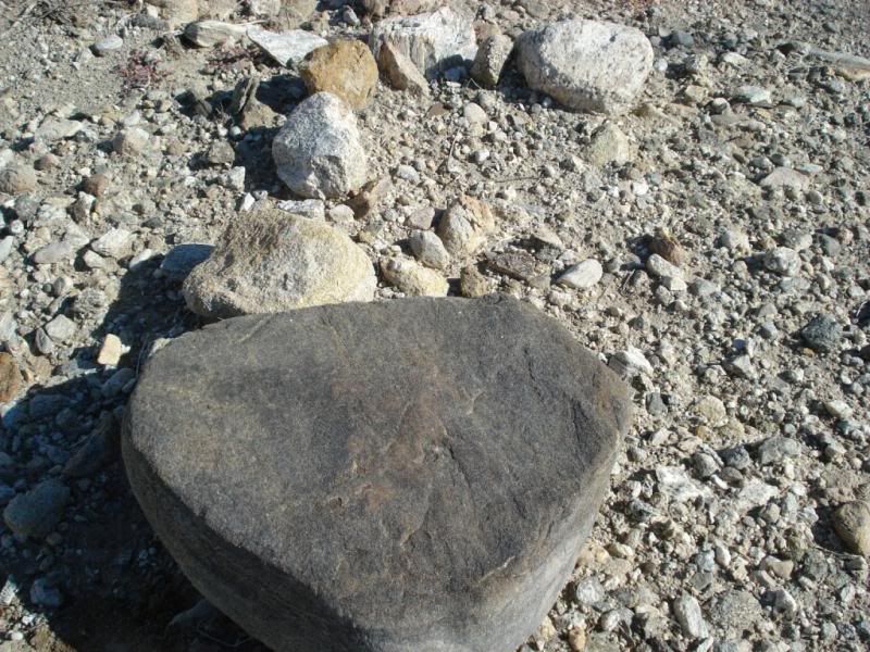
Neat grinding rock
ABDSP intersection :-)
And more sleeping circles.
Already planning the next hike... Cheers!!
edited by rockhopper on 12/15/2013
edited by rockhopper on 12/15/2013
edited by rockhopper on 12/15/2013
edited by rockhopper on 12/15/2013 |
12/16/2013
Topic:
Found Camper Part in Sheep Canyon
rockhopper
|
Yikes! I've had my share of bad luck too, but man. Glad you are OK. Stuff can be replaced. |
12/16/2013
Topic:
N/E ABDSP
rockhopper
|
Hello all. Had a chance to upload some youtube videos of the hikes.
http://www.youtube.com/watch?v=Wr-MJkSh7tI
http://www.youtube.com/watch?v=6NFe8vf_xVo
Daren: Your very close. Its a unnamed canyon south of Barton canyon. I am planning a 4 dayer up or down the Martinez canyon route to the Cactus spring trail to Hwy 74 after some serious rain. I'm looking for some fellow explorers
mrkmc: The could it be pic? I sent the pic to the Meteorite Men Show on cable. Stay tuned
ziphius: I still think it looks like a impact crater. But, I'm probably just dreaming.
Edit: Added photos and video.
Mylar balloon count : 7
edited by rockhopper on 12/17/2013 |
12/19/2013
Topic:
Found Camper Part in Sheep Canyon
rockhopper
|
I'm still trying to see where the camper was bolted to the bed? Am I missing something? |
12/19/2013
Topic:
Found Camper Part in Sheep Canyon
rockhopper
|
Daren is correct. Looks like faulty manufacturing. That 3/4" +/- plywood piece is not continuous to the main camper frame. Looks like a glue joint failed. Glued joints don't due to well in combined tension + bending or shear. That metal plate with the thru bolts is about 100x stronger than the failed joint. |
12/19/2013
Topic:
The Mud Palisades & Anicent Forest of Fish Creek
rockhopper
|
You and your kids will be saying years from now. " Remember that trip into Fish Creek"
100 million year old petrified tree branches, portable metate discovery, Mud Palisades, Camper Liftoff...
The whole salton sink area around the E. side of the ABDSP is just fantastic in geologic history, paloentology and archeology. You were right near the area of the high water stand of Ancient Lake Cauhilla. The shore line length
was a whopping 250 miles long. Some say there was a even higher water stand due to plate tectonics as you clearly see
at the anticline! The Salton sink terrace and river deposits are over a mile deep due to the Ancient mighty Colorado drainage. Read up on flood bursts during ice age retreats is a real eye opener.
That portable metate is just awesome. I need to visit my find again. I hope it is still there. I also have seen the petrified wood branches laying ontop of the desert varnish North of where you were at near the Ancient shoreline.
Expedition survived!
And now a moment of moorning of your Camper and Truck bed
edited by rockhopper on 12/22/2013 |
12/22/2013
Topic:
A priceless desert find by a kid
rockhopper
|
I saw that today in the morning paper. Neat! Ranger( edit: Sam) Thanks Daren : " Could be thousands of years old. Ranger (edit Sam) : " Ollas are being found on a regular basis within the park" I wonder how many ollas are still buried out there in those mud caves where those boys found this one! They said they found it in the South end of the park.
edited by rockhopper on 12/22/2013
edited by rockhopper on 12/23/2013 |
12/23/2013
Topic:
A priceless desert find by a kid
rockhopper
|
The article said that olla could be thousands of years old. Thats amazing! But considering the last Ice Age maximum was around 20,000 years ago and we have been in a warming trend ever since and that the ABDSP area has been a desert enviroment for thousands of years that burried olla could be that old. Just like the ancient trails surrounding the Ancient Lake Cahuilla.
Thanks for the new pics Daren. Seeing the almost complete olla must have been a eye wide experience at first site!
Here is another pic of piece from my previous post on my hike last week
edited by rockhopper on 12/23/2013
edited by rockhopper on 12/23/2013 |
12/29/2013
Topic:
Staying at and hiking from Fish Creek Campground
rockhopper
|
If you do go over soft sand in 2WD bring small strips of plywood and a shovel to get un-stuck 
Welcome to the fourm!
edited by rockhopper on 12/29/2013
edited by rockhopper on 12/31/2013 |
12/30/2013
Topic:
N/E ABDSP Part II
rockhopper
|
Hard to believe this was two weeks ago. But I made time between Family to up load more pics.
As before I was hiking around and near the ancient Lake Cahuilla shore line.
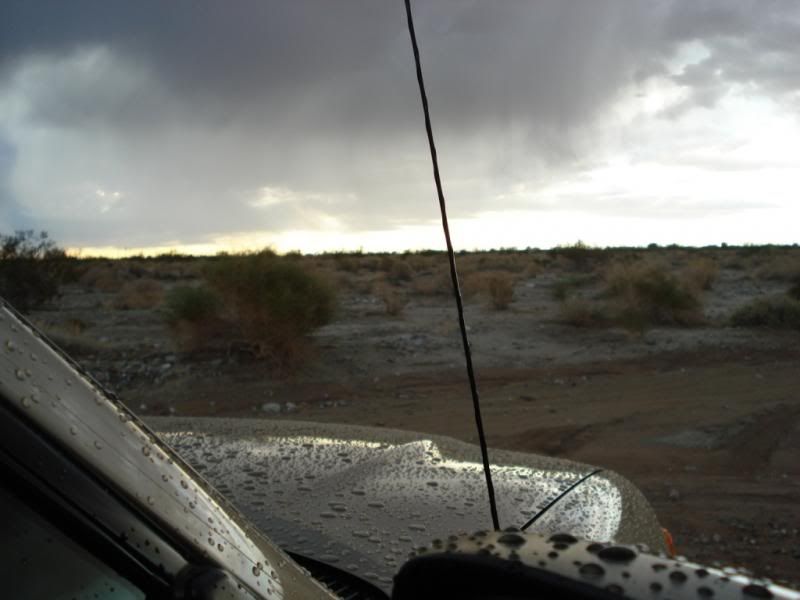
This was not a meteor crater !
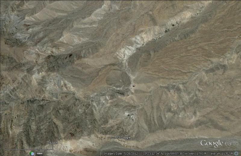
But, I followed a neat old trail to get there. G.Earth photo from about 1500 ft. up
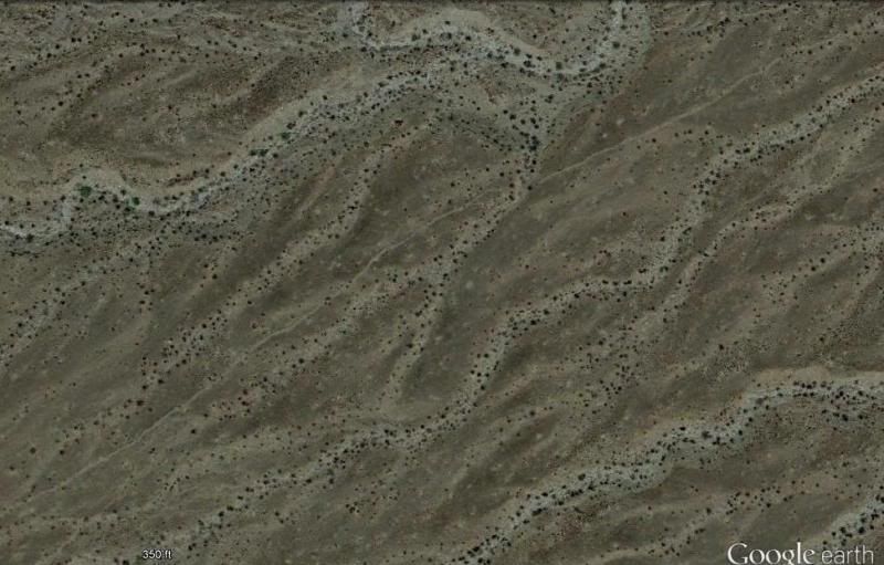
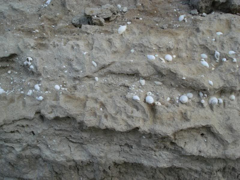
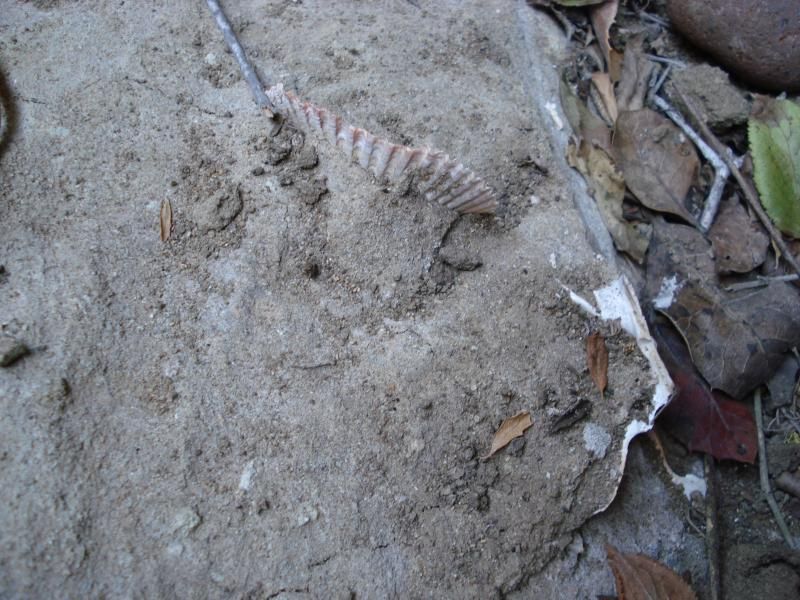
Slightly above the ancient shore line. Sea shell fossils from the much older Imperial Sea. 5MYA
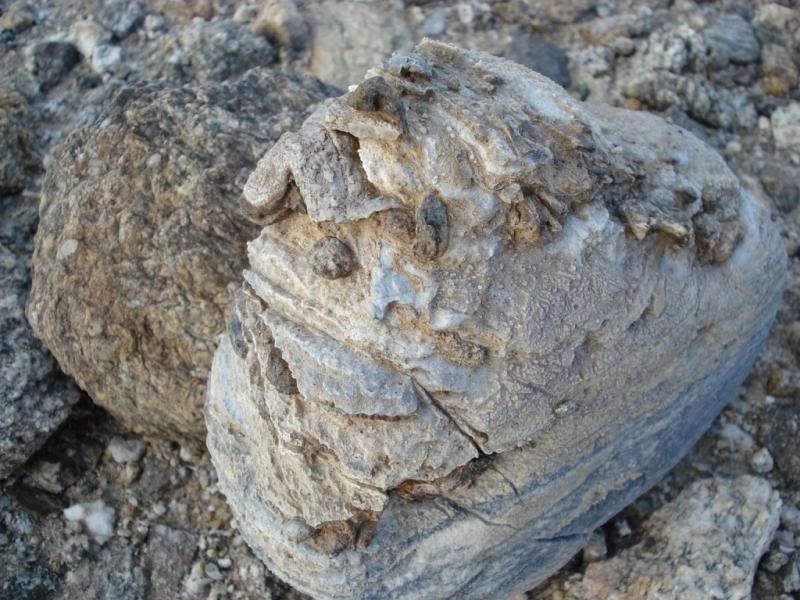
Slightly below the recent high water mark of the Ancient Lake Cahuilla. It's last full fill at around 600 years ago.
Smaller shells in silty shore sand.
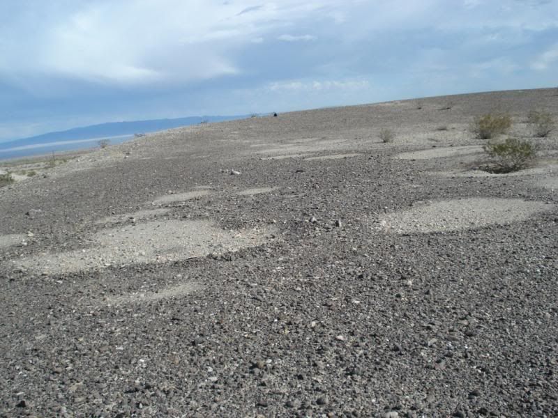
More sleeping circles near the shore line of Lake Cahuilla
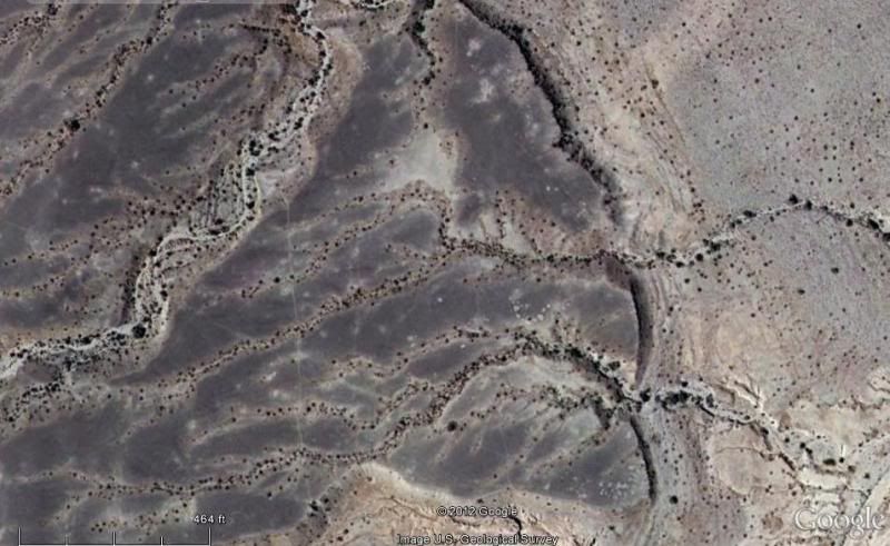
View from G.Earth about 10,000 ft up
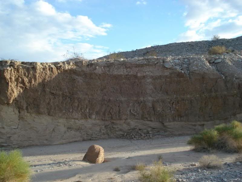
Evidence of uplifting going on the flat lake bed
The Main trail was about 100 yds from the edge of the lake. There were multiple trails. Hard to imagine but, the old shore line was a whopping 250 miles long! Only a tiny percentage of this trail remains
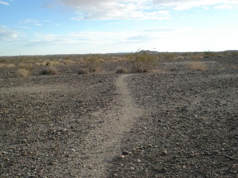
Did a big loop and came out through a lower wash and found
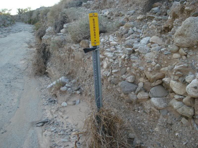
Futher back down found this in the sand wash
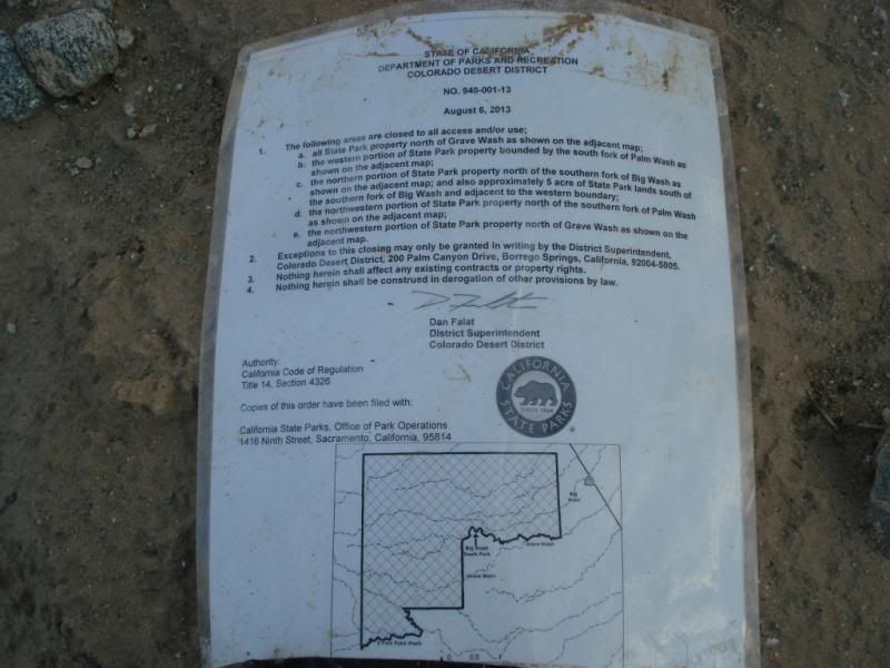
Yikes! This area is closed to all???
I can see banning 4x4, ATV, dirtbikes. (There has been some 4x4 and motorcycle damage to the fragile desert patina in some areas) but to hikers??
edited by rockhopper on 12/30/2013
edited by rockhopper on 12/30/2013 |
12/31/2013
Topic:
N/E ABDSP Part II
rockhopper
|
Jim,
The 5th photo up showing the ancient shore line was part of the closed area. You can see the sleeping circles and ancient trail on the photo. I had no idea the area was recently closed until hiking out. Again, I could see closing to ATV's etc. But to hikers????
The "Looks like meteor crater" on G. Earth was really a landslide. I stood in the center of it . It was about 1000ft across and about 200 feet deep and was a bowl on three sides. I followed an old trail up to that area. . Beyond where I stopped it looked like some extreme canyon climbing. Hard to imagine the Early Americans going back in there. But the most likley did!! Kinda like a Auga Alta canyon on seriods. It was about a 13 mile round trip hike. About half of the hike was on the old native trail ( 9th photo up) on the desert varnish with pot sherds and burial mounds along the way.
edited by rockhopper on 12/31/2013 |
1/9/2014
Topic:
What are you reading?
rockhopper
|
dsefcik wrote:
Nolan (anutami) wrote:
Geology of Anza-Borrego: Edge of Creation
This is a great book and a must read. My son just bought this for me...looks good so far
Geology of Anza-Borrego: Edge of Creation

Daren,
Just bought the book while in Borrego Springs! Highly recommended. Makes you realize just how amazing the geology
of the whole area is. Just fantastic! |
1/9/2014
Topic:
Found Camper Part in Sheep Canyon
rockhopper
|
Glad it is working out for ya. I would have done the same thing with your truck. Any word from the Camper manufacturer? |
1/9/2014
Topic:
Calcite Mine
rockhopper
|
I drive by there alot. Need to check that out. My Geology book says the calcite formation happened quite rapidly.
Hot fluid calcium rushed up new cracks in host rock ( earthquake ). But where did the calcite come from? An old sea bottom super heated the ancient shell bed into liquid? |
1/12/2014
Topic:
Sold my truck
rockhopper
|
Have you considered a regular fuel 4x4. The new ones are pretty darn good. I am partial to Toyotas.
Pre-smog vehicles are getting pretty slim these days condidering all the "crush all old car/truck" programs by big brother over the years. Heck even my 67' Ford 390 has air injection and pvc valve. |
1/15/2014
Topic:
Hot Springs, Mud Volcanoes and ABDSP week 2 Jan.
rockhopper
|
Went to visit our relatives who moved to Borrego Springs from Mission Beach. They said they traded desert sand for beach sand
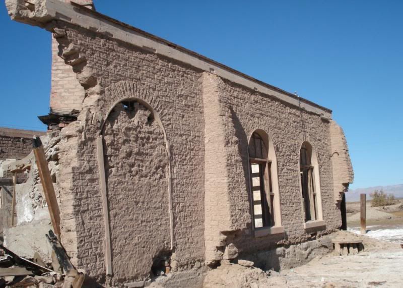
But before we stayed a few days at thier new house we took a loop around the Salton Sea to check out the Hot Mineral Springs on the East side of the "Sea"
On the way to the hot springs we stopped at obsidian hill again. Torro peak in distance.
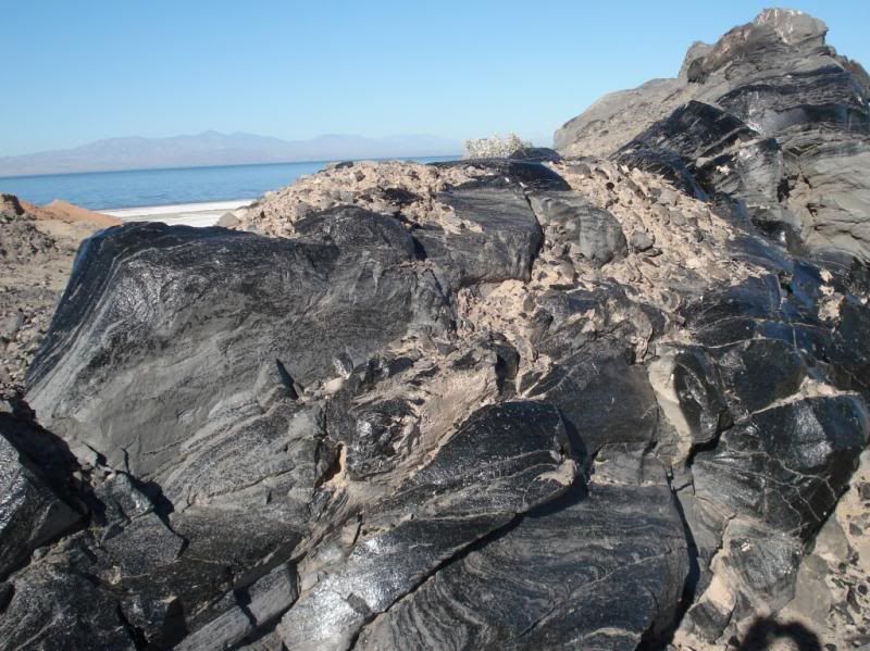
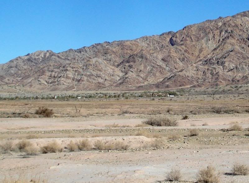
Hot Mineral Baths at base of the Chocolate mountians.
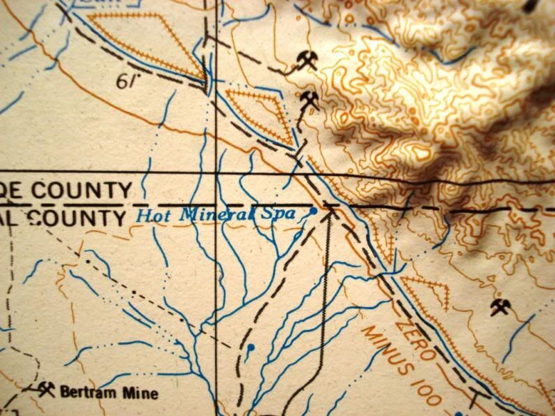
USGC relief map 1969 road data showing hot springs
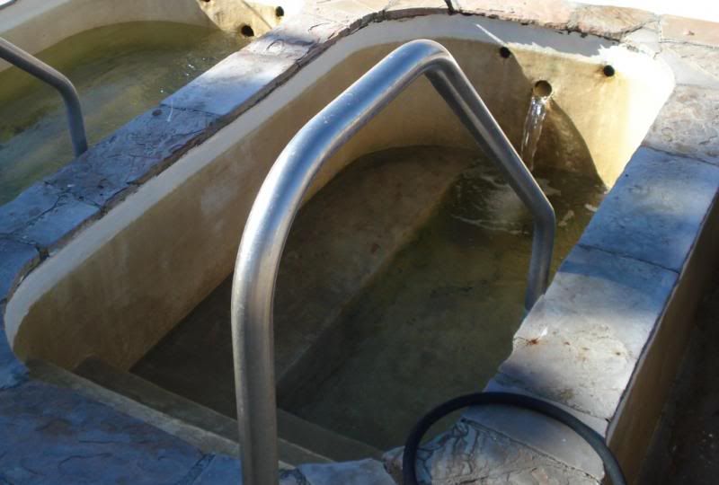
Called Bashfords Roman Hot Baths now. Well is about 300 ft. deep. Hot Mineral water comes out of the ground at about 180 deg and cooled to 103 degrees. No Clorine added.
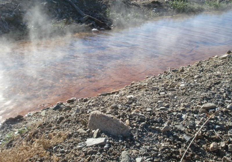
Hot Mineral creek nearby. Smell slightly of sulfur.
Abandoned Hot springs spa ( fixer, needs tlc) ha ha
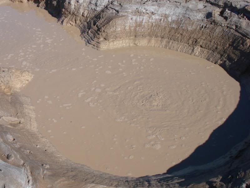
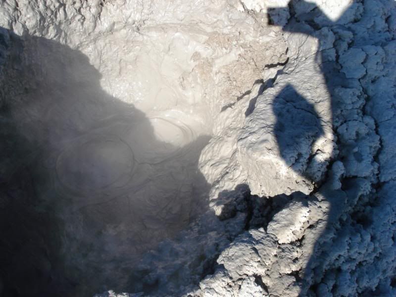
Boiling Mud Volcanoes and Mud pots nearby
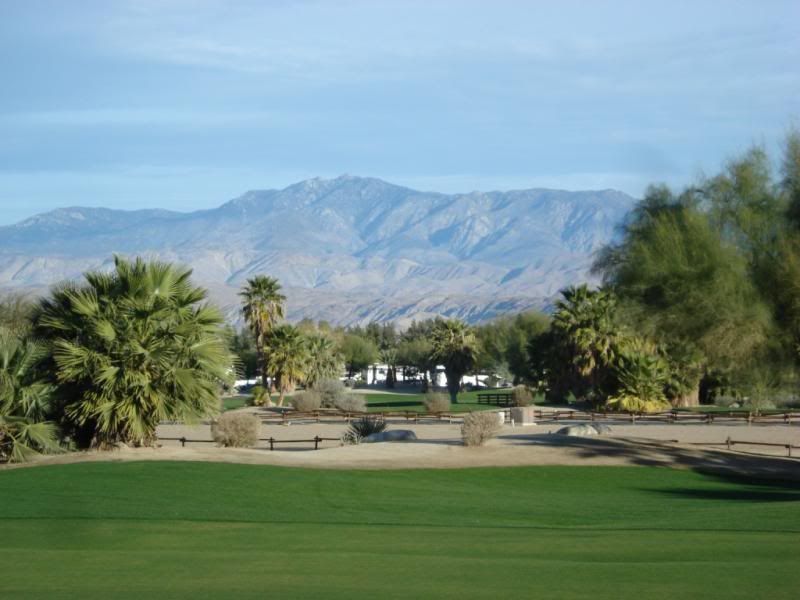
Our Relatives new Borrego Springs house with view. Sweet!
He is really into Geology, Archeology and Paloentology. Couldn't pick a better place!
Added Youtube link of Mud Volcanoes
http://www.youtube.com/watch?v=JBZ7HL4MKcE
edited by rockhopper on 1/15/2014
edited by rockhopper on 1/15/2014
edited by rockhopper on 1/15/2014
edited by rockhopper on 1/15/2014
edited by rockhopper on 1/15/2014 |
1/15/2014
Topic:
Hot Springs, Mud Volcanoes and ABDSP week 2 Jan.
rockhopper
|
Hi Daren,
Yes the baths are really relaxing. We did 2 long hour soaks about 2 hours apart. Everything was in slow motion after that  . The baths are open from Oct. to May. Closed during the summer. They have daily , weekly and monthly rates. . The baths are open from Oct. to May. Closed during the summer. They have daily , weekly and monthly rates.
alot of cool folks hanging out there. Most say they soak at nite and check out the Moon, planets, stars, and UFO's
No slab city this time. Wife not interested. I wonder why?
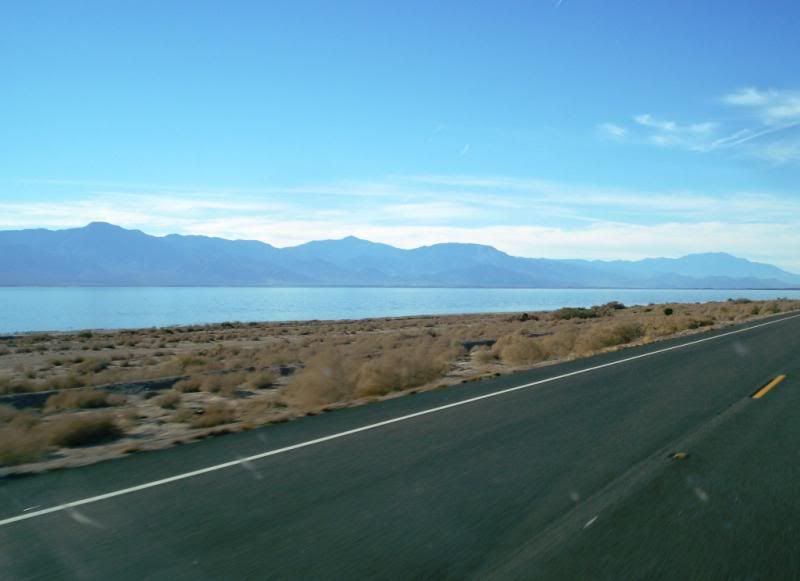
Heading around the Salton Sea. Rabbit Peak at the left. Torro peak in the center. San Jacinto to the North.
edited by rockhopper on 1/15/2014
edited by rockhopper on 1/15/2014
edited by rockhopper on 1/15/2014 |
1/15/2014
Topic:
Sold my truck
rockhopper
|
Congrats! Those 4x4 Toyotas go just about anywhere you want to go even in 2wd.
Switch to full 10w-40 full sythnetic oil if they haven't done it already.
Again congrats. The Desert beckens! |
1/19/2014
Topic:
Jamul Kiln Ruins
rockhopper
|
" Boundry Ecological Reserve"........ I see Borrego Wrangler and his date are "walking over" fresh tire tracks in the mud. Sooooooo only State of California government workers only? I see no problem leaving only foot prints if there aren't any No Trespassing signs posted. |
1/20/2014
Topic:
Mine Wash Trail Cam
rockhopper
|
Nice pictures. I would freak if I was in a small tent and saw a pack of Coyotes that were as heathy as that one!
Guestimet of size and weight? |
1/24/2014
Topic:
Illegal camping
rockhopper
|
Agree. I always respect "parking" areas within the park. I do my "off road" truck camping outside the park boundrys to the North , South and East.
edited by rockhopper on 1/25/2014 |
1/26/2014
Topic:
Trans Anza traverse of ABSP
rockhopper
|
Yes please give a route. ABDSP is huge so you know why I am asking. Water will be the number 1 concern of course.
Please post pics of their adventure and best wishes to your wife. |
2/8/2014
Topic:
West Mesa
rockhopper
|
Ditto on the old indian trails above the old shoreline. Some references state the Lake Chauilla filled multiple times going back thousands of years. It's neat hiking on those old trails. I've seen that trail you hiked on Google E. Need to hike those trails in that area still .There was a lot of prospecting and mining in that area in the last 1800's and 1900's
edited by rockhopper on 2/8/2014
edited by rockhopper on 2/8/2014 |
2/8/2014
Topic:
West Mesa
rockhopper
|
Tommy750,
Not near Fish Creek , but up near the northern boundry of the ABDSP where the ancient lake met the mountians also is where there are quite a few cross mountianous terrain trails are also. I'll post a "best of" picks from my recent hikes.
Still praying for big rains in the Santa Rosa mtns. |
2/9/2014
Topic:
West Mesa
rockhopper
|
Found this in a book ("Our historical desert" Lindsay) describing the mining in the area maybe?
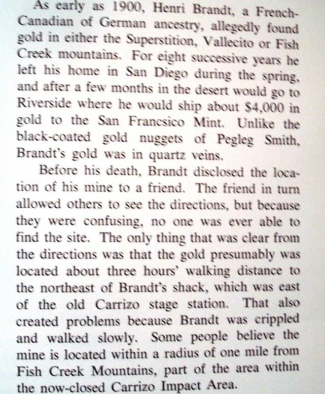
edit to make picture post
edited by rockhopper on 2/9/2014 |
2/10/2014
Topic:
West Mesa
rockhopper
|
I think the "shack" shown as a pinned photo on G.E. near the Carrizo stage station maybe Brandts shack. |
2/12/2014
Topic:
Subject: Presidents Weekend
rockhopper
|
1. Heading in to the Visitors Center is a great idea. Tha place is fantastic. Movies playing, exhibits and GREAT folks.
2. DV and ABDSP have a lot in common. Geologically, both are pull apart basins. Both are very diversified and offer endless expeditions.
3. Spent alot of time in DV in the 1970's thru the 90's. Telescope peak, Hot springs, Salt flats, Volcanoes,Mines, Mines and tons of Mines,( That was our main adventure) Ghost towns, etc......Outstanding exposed geology.
Even more desolate in certian areas IMHO |
2/18/2014
Topic:
Blair Valley and Mud Caves with the Kids
rockhopper
|
Kids will be hikers forever now. Wow, neat arrow point. Never seen one like that in ABDSP. Did you find that in Blair valley or mud cave area. The visitor center would love that one! |
2/20/2014
Topic:
Salton Sea Exploration
rockhopper
|
Great trip. Read the report also. I did the round the sea trip last month with a stay at the hot springs near Salvation Mtn.
( Hot springs thread below)  |
2/22/2014
Topic:
Happy Presidents Day Weekend!!!
rockhopper
|
I thought the wild life was a baby coyote. Never seen a kit fox out there before. Neat trip! |
2/24/2014
Topic:
Show us your Cholla bomb photos
rockhopper
|
I have yet to take a photo of my Cholla bomb photos but I'll just say "Been there, done that" Ouch!
btw I read that the old Ranchos used to ring cactus around thier adobe homes to keep cattle and hostle indians out. |
2/25/2014
Topic:
Show us your Cholla bomb photos
rockhopper
|
OMG! |
2/25/2014
Topic:
Subject: Cactus Spring Trail backpack : March
rockhopper
|
With Rain/Snow in the forecast FINALLY!!! I am prepping for a 3-4 day hike along the Cactus spring trail sometime in mid March. Plan A is to park off Hwy 74 in a safe parking area and hike all the was thru down to the base of Martinez canyon
to an other vehicle. Preferable would be a 4x4 Any takers? My truck is a Tundra 2wd. Plan B if is to reverse the trip hiking up the trail. I have hiked to the Auga Alta spring from the Hwy 74 side and have hike up Martinez canyon and Agua Alta canyon multiple times but never a "All the way thru trip".
Its about 20 miles more or less. 4 days would be ideal to allow a middle day for day pack exploring. Highlites would be
1. Hiking on the 1000+ year old trail connecting the mountian to desert
2. Horse thief creek. Main water source.
3. Martinez peak option.
4. Jack Miller Rock House built in 1925 option
5. Multiple Native American camping sites
Total hiking would be about 30miles or so including a day hike. Of course this is all flexable at this point.
The best senario would have plenty of rain water at lower elevation and hike up the trail as the climb has some step sections. Most of the trip is a 5 on a scale of 1 to 10. But a few sections are 9.5++ if we go the Agua Alta route.
edited by rockhopper on 2/26/2014
edited by rockhopper on 3/17/2014 |
2/26/2014
Topic:
Chuckwalla Mountains, The Bradshaw Trail
rockhopper
|
Neat trip. I will have to see that movie when it comes around. I used to go mine exploring in that area back in the day. Most of the old mining roads were washed out up in the mountians so we had to hike in. The wild life seems to be geting more bold/ smarter every year maybe as a result of the drought.
Shoe story: Not wildlife related by once truck camping out at Lucerne dry lake , I kick off my tennis shoes onto the ground below my rear bumper as I crawled into my camper shell to sleep at nite. During the nite it got windy, real windy. When I woke, my shoes where no where to be found. Gone. No back up shoes. Drove home in my socks. |
2/26/2014
Topic:
Subject: Cactus Spring Trail backpack : March
rockhopper
|
Thanks Daren. Hope your back gets better. It should be a great trip. Hope you can go. I thought it would be a good idea to post to this fourm regarding this trip because.
1. My backpacking buddy (my Brother) is unavailable next month.
2. Need 2 vehicles to do the one way trip.
3. I think this fourm covers the Santa Rosa Mtns as well as the ABDSP
4. Fourm members might be interested.
5. Rain = Water and I want to go!
I'll keep you all posted. Still looks like around mid March Full moon/ First day of spring period or earlier.
edited by rockhopper on 2/26/2014 |
2/26/2014
Topic:
Subject: Cactus Spring Trail backpack : March
rockhopper
|
I didn't have my morning cup of Joe. Yes it is 2014 not last year
Florian I will keep that in mind. Thanks.
Yes Pinyon down to Valerie Jean is a long 20+ mile hike. I wanted to spend a lot more time in the area.
Cheers
edited by rockhopper on 2/26/2014
edited by rockhopper on 2/27/2014 |
3/1/2014
Topic:
Ella Wash and Coyote mtn hike
rockhopper
|
I did almost your exact hike last year. Hiked up and down from the east side. Basically a rock scramble up and down the ridges. Was the sign at the top still there? "Meets 1st Thursday every month at 2am" Also remember some wood lashed together with bailing wire at the peak near the register. Agree, views are fantasic. I always wanted to climb it too after all these years.
I know Alcoholic pass was a native trail but they probably climbed all the summits.
btw Thanks again for the offer for a pick up at Martinez Canyon. I'll keep you posted |
3/13/2014
Topic:
Peace and quiet, stars and pottery
rockhopper
|
Re: Pottery
I found this: " Southern Diegueno ceramics were sometimes decorated by incising and painting, with incising being the older of the two techniques."
From: Background to prehistory of the Yuha desert region. |
3/17/2014
Topic:
What Ollas Can Tell Us
rockhopper
|
Sounds interesting. Don't think I can make it but if you do please give us a report. I read that some ollas in the area were up to 30 inches in diameter! For storage of acorns to be cached in caves or sheltered areas.
edited by rockhopper on 3/17/2014
edited by rockhopper on 3/17/2014 |
3/17/2014
Topic:
Subject: Cactus Spring Trail backpack : March
rockhopper
|
Well, my repaired A16 pack is out sitting on my work bench in the garage. Life time warranties are great.. I am still planning the hike but looks like it is pushed into April due to some family comitments which came up. Also looks like
rain fall in the area has been lacking below what I was hoping for at this point and the temps have been rising pretty fast. Which means:
1. Pack in more water if my water sources are duds.
2. I will now most likely do a in and out from the same trail head at pinyon. Go down as far as I made it up Auga Alta canyon on a prior trip and return. This will double my mileage but keep me out of the time in the heat. ( This may change if anyone here wants to join me and go all the way through)
3. Still looking at 3 nites and 2 soild days of all day day packing th area.
edited by rockhopper on 3/17/2014 |
3/17/2014
Topic:
What Ollas Can Tell Us
rockhopper
|
Here's acouple of interesting pics.
I posted this previously. This olla is on display in the Visitors discovery center. Found in 1970.
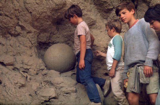
This one was found about a mile from our old house in E. Encinitas by a local resident many years ago.
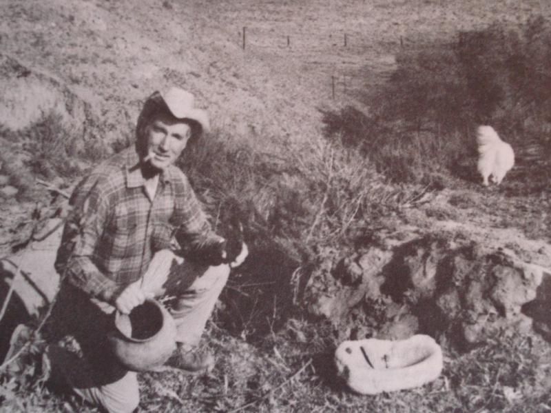
San Diego State University did a "Dig" close by our old house on a hill near a creek back in 1974 and found "thousands" of artifacts.
edited by rockhopper on 3/17/2014 |
3/19/2014
Topic:
Subject: Cactus Spring Trail backpack : March
rockhopper
|
Daren,
Hope your back gets better soon. How did you hurt it? I hurt mine pretty bad during my Gold mining days ( wear and tear)
but I am doing pretty good the last 10 years. I credit this product with my recovery:
http://www.thebackbubble.com/
along with stretching, MSM suppliments, fish oil, rest and exercise. Best of luck
Regards |
3/23/2014
Topic:
Santa Rosa traverse (Toro-Dawns-Rabbit-Villager)
rockhopper
|
Great trip! You were really moving at a pretty good clip for a one nighter. Thanks for the trail maintance busting thru the brush  I need to hike that gap between Toro and Rabbit peak someday. Great report and photos. I need to hike that gap between Toro and Rabbit peak someday. Great report and photos. |
3/23/2014
Topic:
Santa Rosa traverse (Toro-Dawns-Rabbit-Villager)
rockhopper
|
BTW, what did you eat on your trip? Did you see anything unusual ? Did you see the indian trail crossing at the ridge line
coming up from the Santa Rosa Indian Ruins over to Martinez canyon? Awesome hike! |
4/14/2014
Topic:
Southern AB, April 2014
rockhopper
|
I like the "jet" photo at the edge of the bombing range. Sorry about the warm beer. |
4/16/2014
Topic:
Carrizo Valley this week
rockhopper
|
Desert mornings are the best. Notice any Cochilla music fest partiers in the State Park?
Its part II this weekend. Looks like I will be heading out next week after the "Fest" is over. |
4/22/2014
Topic:
Blair Valley Meditation Retreat 4/11 - 4/20
rockhopper
|
Welcome! The desert is a wonderful place if you want to meditate!
Daren, I love the bees drinking from the monsoon storm rain filled morteros.
I saw the same thing at the " Natural Rock Tanks" years back. Must have been thousands of friendly bees all drinking at the same time shoulder to shoulder all the way around the water pool maybe 30 feet circ. and not one bee flying in the air. |
4/28/2014
Topic:
Cactus spring trail to Martinez Canyon Rock House
rockhopper
|
Hello all. Took a mid week 3 day trek 4/23-4/25 from Hwy 74 along the Cactus spring trail down to Martinez canyon and back. This was the 20 year anniversary of a trip I made to the rock house back in 1994. Weather was good. Lows in the 40's and highs in the 80's. Water of course was my main concern so I packed in about 2 Gals and added water when I could find it.
Day 1
Covered about 6 miles and made base camp at the West side of Martinez peak. It felt good to dump my 60 pound pack!
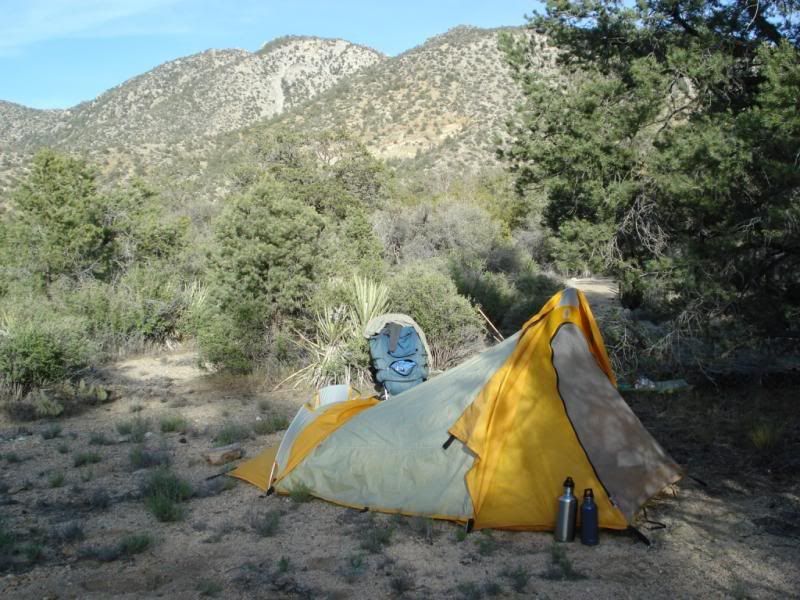
Day 2
Left around 8am with day pack and 6 pints of water. I boiled water I picked up at Horse Thief creek the previous day. At first the trail was real familiar but then just started to peter out once I made it about a mile passed the pass leading down toward Martinez canyon. The rest of the day was mostly spent X-country.
At the pass with Toro peak beyond.
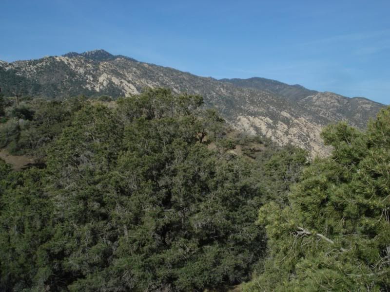
Agua Alta Spring
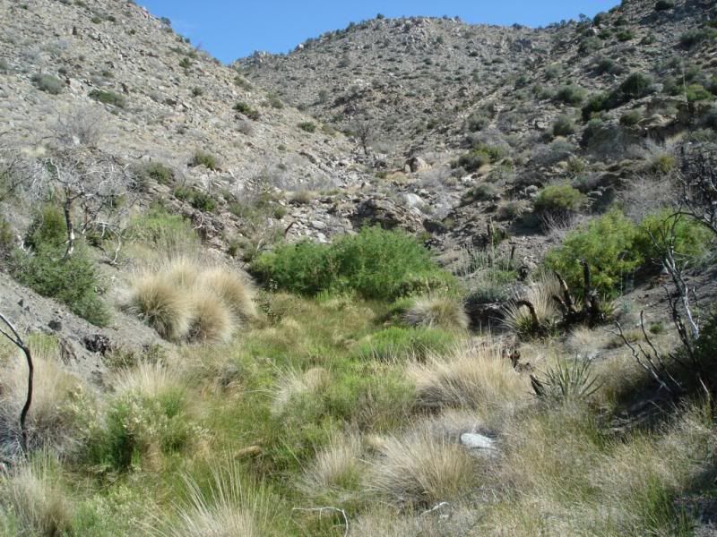
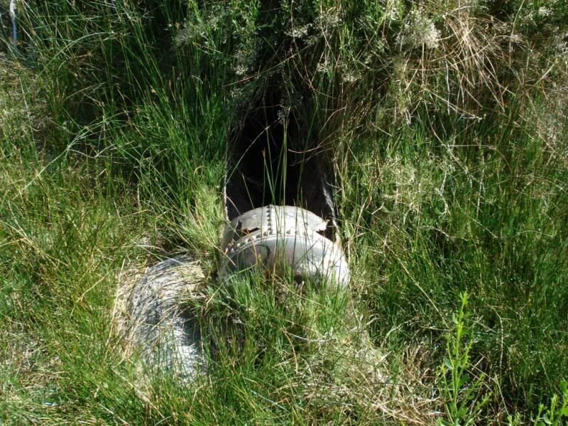
Followed of and on again trail to Auga Alta Canyon and found a Native American Village site
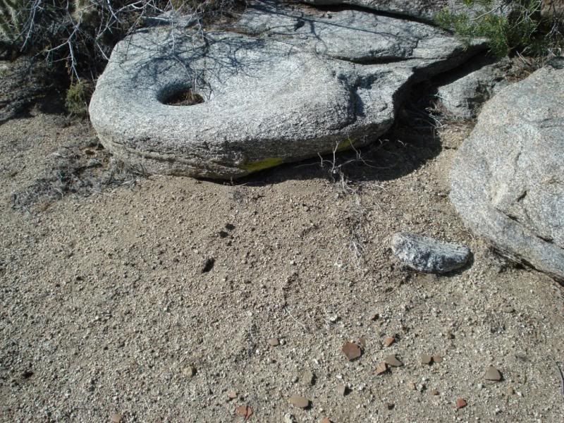
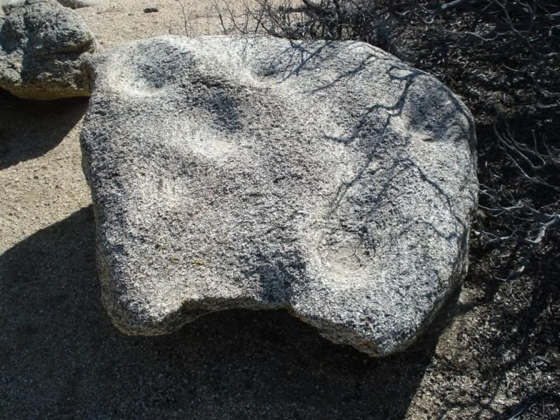
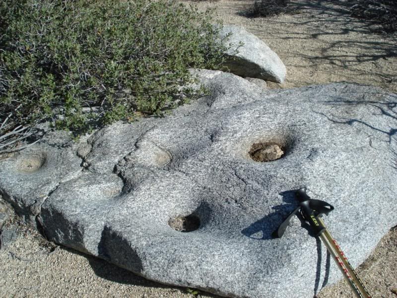
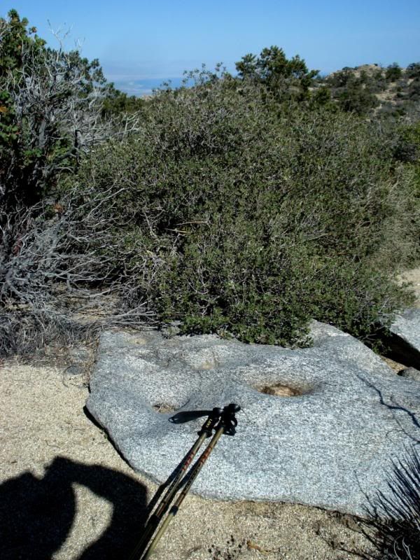
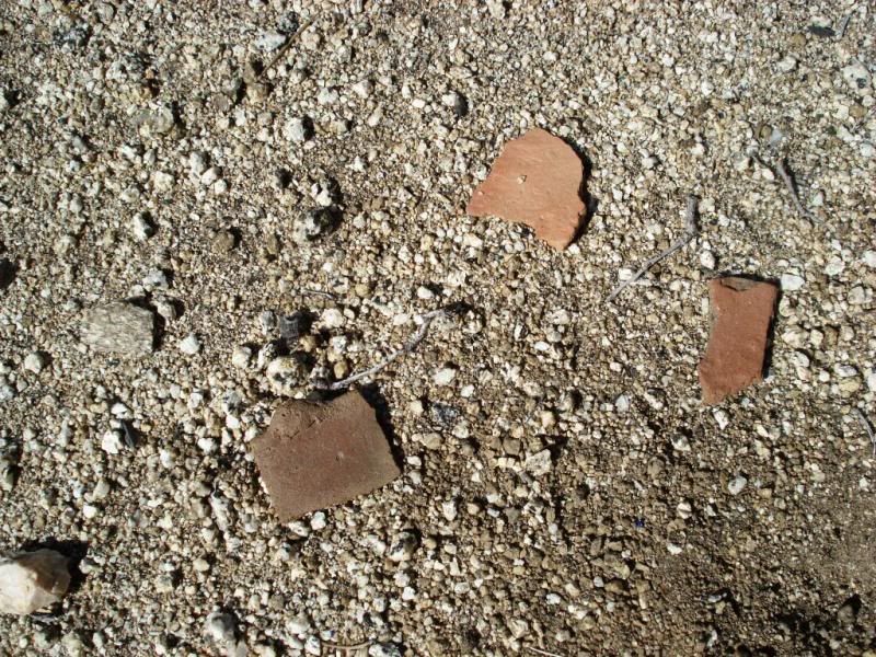
Pottery sherds everywhere. Never seen one with a mini knob on it before.
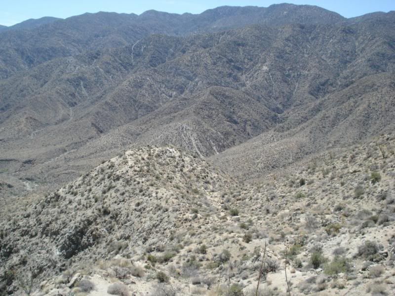
Down toward Martinez canyon
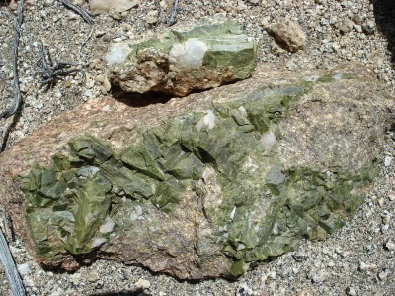
Neat crystals along the way
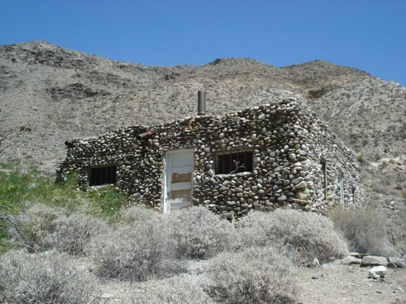
Martinez Canyon Rock House also known as Jack Miller Cabin in sight!
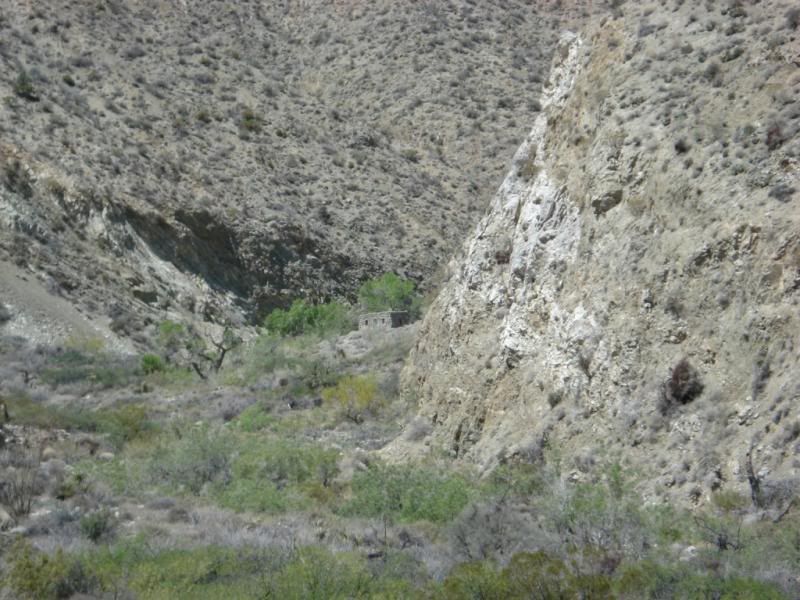
Jack lived here from 1922 into the 1950's ! Not many folk come here. Register showed only 1 entry in 2012 and 4 in 2013.
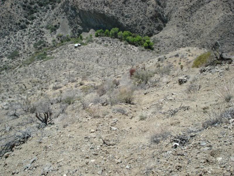
Heading back out of the canyon X-Country leaving the cabin below.
Arrived back at base camp at sun set.
Day 3
Hike back out back to the Hwy with a 20 lb. lighter pack and back home.
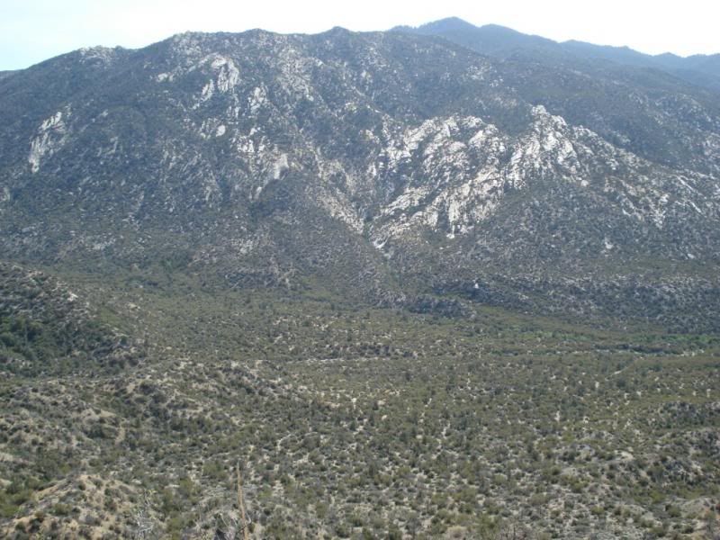
Little Pinyon Flat with Toro peak beyond
G. Earth path
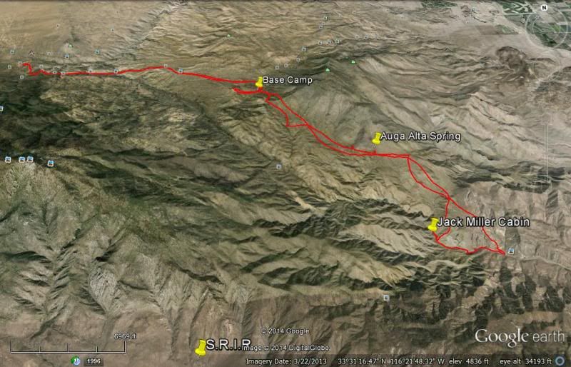
Total miles 28
Water avail. ( advise Boil / filter)
Horse Thief creek: Yes but low flow. Frogs
Agua Alta Spring: Almost nil. enough for the Birds and Bees
Martinez Canyon: Yes, but only in granite pools. None flowing. Frog.
Big horn poop everywhere.
Mylar balloons: 5
edited by rockhopper on 4/28/2014
edited by rockhopper on 4/28/2014
edited by rockhopper on 4/28/2014 |
4/30/2014
Topic:
Cactus spring trail to Martinez Canyon Rock House
rockhopper
|
Hello all
ziphius : Here is a mini video below I took of what the inside of the cabin looks like today. The place was full of mice poop but I didn't see any mice. Yes, those are deer antlers. Not seen on the video is a pot belly iron stove in the kitchen. He had plumbing inside and out from the creek source. Jack had a steel pipe about 2" dia. running up the creek for hundreds of yards to build head pressure. Menu: Breakfasts: oatmeal and coffee Dinners: canned salmon with olive oil + salt + crackers and cabbage ( I learned the cabbage trick on long Sierra backpacks. It keeps fine and tastes fantastic when you are hungry) Snacks while X-Countrying nuts and dates during the day.
Jack Miller Cabin Video: https://www.youtube.com/watch?v=L-2GbTEi6Ag
dsefcik: Maybe next time. Hope your back is feeling better. I use the "backbubble" for my back. You can goggle it.
tommy750: I barely beat the storm coming in. I drove through a huge dust storm in Anza heading back to the coast. The cabin has been fixed up since the last visit 20 years ago. The cabin steward ( forest service) added a post in the middle of the floor and beam to support the roof sag. I have some old photos from 20 years ago somewhere.
Florian: Thanks again for the offer for a pick up at Martinez. But the water sources were too lean for that plan. Did you hike out from Agua Alta down Agua Alta canyon or down Martinez?
hikerdmb: Agree. The Santa Rosas are rugged and Beautiful!
edited by rockhopper on 4/30/2014
edited by rockhopper on 4/30/2014 |
4/30/2014
Topic:
Cactus spring trail to Martinez Canyon Rock House
rockhopper
|
A few more pictures from the trip to post:
Horse Thief creek
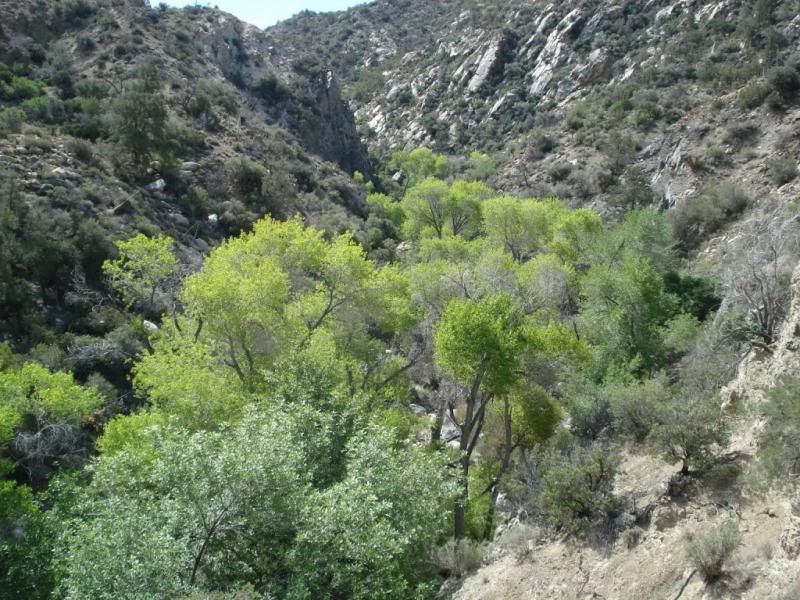
Along the trail with San Jacinto beyond.
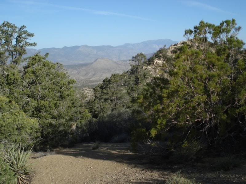
Cactus spring trail with Lorenzens peak ( Peak 6252) beyond.
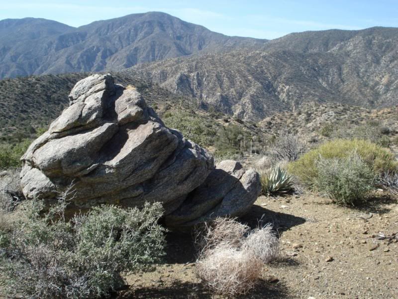
The "Trail" with Santa Rosa Peak beyond.
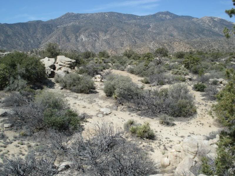
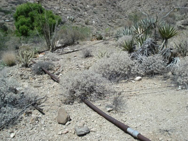
Millers water supply lines and corral.
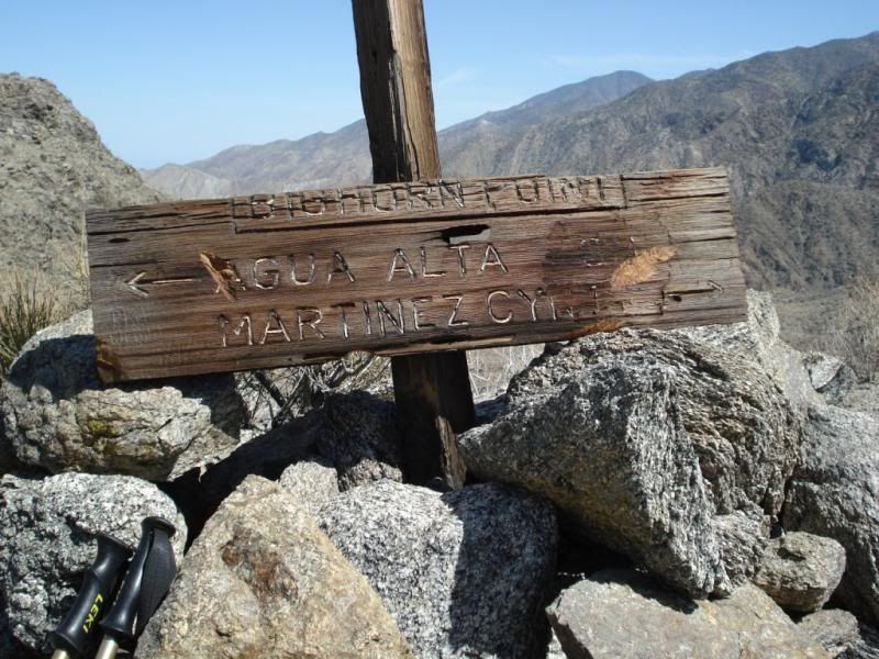
Climbing out of Martinez canyon.
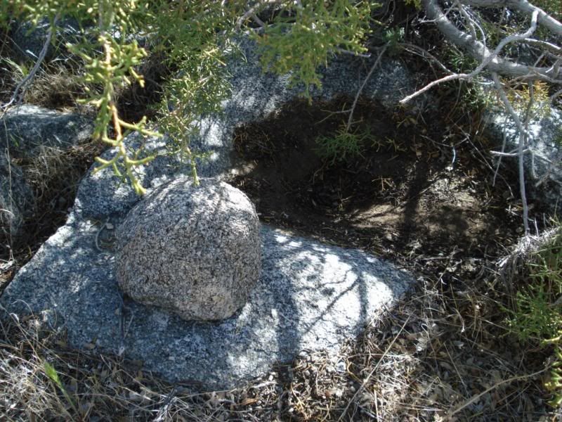
Cleaned out grinding rock. Still damp from weeks prior light rain. Grind stone?
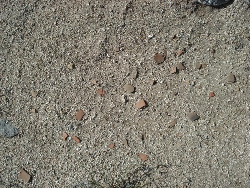
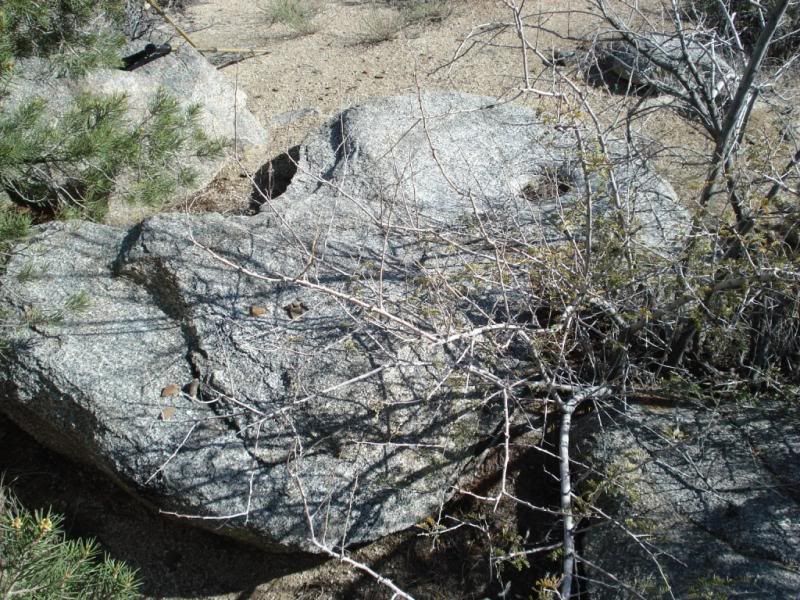
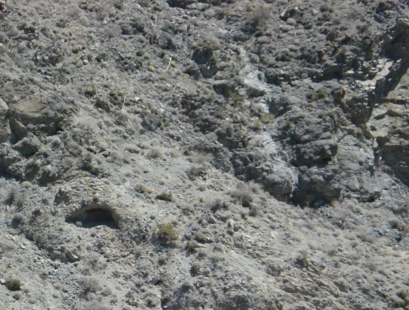
Numerous Wind caves on the cliffs. This one is about 10+ feet across. For another trip.
Cheers
edited by rockhopper on 4/30/2014 |
5/5/2014
Topic:
Sombrero Overnight Backpack
rockhopper
|
Nice TR Tom. Backpack tent camping connects with the surrounding environment in a higher level IMHO. Going up in elevation was the smart thing to do. Water sources for boiling, water weight and consumption becomes a huge factor.
Re: Back pack camping: The older I get the "thicker" my foam sleeping pad gets.
edited by rockhopper on 5/5/2014 |
5/8/2014
Topic:
Hike in the Grand Canyon
rockhopper
|
Sounds like a great trip with your son. He will never forget this trip! Your son is now a wilderness explorer for life.
Great pics. I love the Garmin track. I need to do something like that. Glad you beat the heat.
I read that that area of Arizona where the sedimentary rocks were formed prior to the Grand canyon forming was covered by an ocean at least 8 times! Rafting down the Colorado has been on my bucket list. |
5/21/2014
Topic:
Short overnight in northern AB
rockhopper
|
Florian,
Glad you had a great trip in AB after your Arizona hike. Looks like we all may need to be camping at higher elevation soon to keep cool and get water as peak dez. season winds down.
Fire Rings. Hate to be the bearer of news but, there are tons of Fire rings through out the ADDSP wilderness. Some quite old. Many at old native village sites still used by todays travelers. Personally I don't build fires. I use my MSR stove , eat and drop dead in my tent , feet exhausted to be ready for the next day.:-) |
6/1/2014
Topic:
Memorial Day Hikes
rockhopper
|
Great photography. I miss the old negative film in one regard. Blow up Detail!
My old photo wall was full of blow up prints from negs. Outstanding detail. Can you still get prints from negs. anywhere still? |
6/7/2014
Topic:
First Trip Report with my new rig
rockhopper
|
Smith rivers brings back great memories of camping along the river with some nice " Earthy Folks" many moons ago.
We have Family up in Oregon and N. Calif. and enjoy the Summer trips up in the "shade country"
Great Trip report. Glad the whole camper situation worked out. |
6/19/2014
Topic:
Borrego Palm Canyon "Fannypack" Trip
rockhopper
|
Daren,
Nice TR and great photos as usual. Glad to hear your leg and back is getting stronger. I like to slowly work out my injuries, but not push it. Good luck.
edited by rockhopper on 6/19/2014 |
6/25/2014
Topic:
Hikes to Local native American campsites
rockhopper
|
Hello all. Now that our "backyard" ABDSP daytime high temps are pegged at the 100 deg F + level for the next several months, I did what the ancient peoples did. Head for cooler ground. Below are pics from two hikes around and nearby a local lagoon near the coast in the N. County. The area was inhabited for thousands of years. Some interesting factoids I picked up reading about the area.
1. Scuba divers back in the 1950's discovered dozens of morteros underwater hundreds of yards off shore at ancient village camp sites when the oceans receded during the ice ages.
2. These ancient paleo peoples were walkers. It was not uncommon for them to walk 30 to 40 miles a day!
Day one starts around the Eastern edge of the lagoon
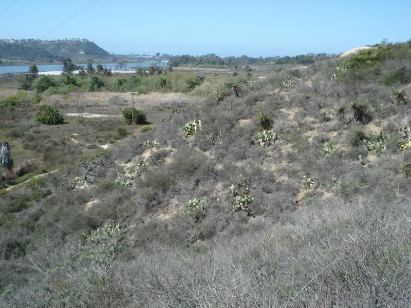
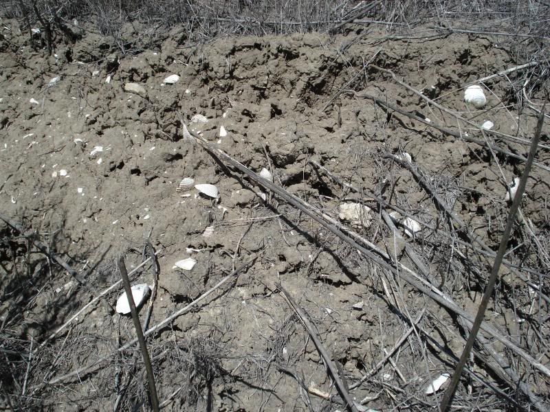
Quickly find a shell dump from several hundred years ago.
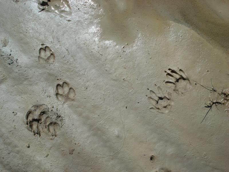
Local critter tracks
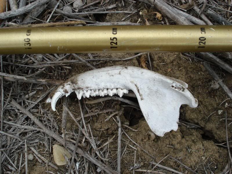
Hiked into one of many brush choked canyons. Coyote jaw?
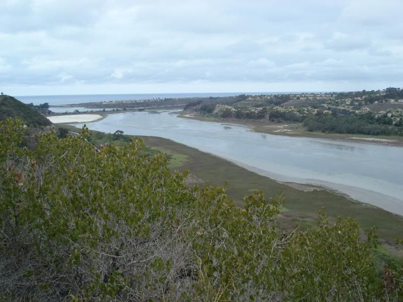
Up a ridge for a view and a breeze.
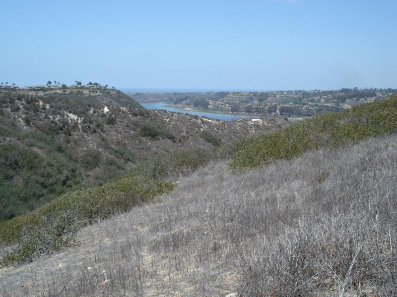
Day 2. Explore more of the southern reaches of the lagoon.
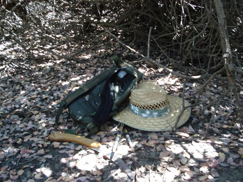
Spent a lot of time cutting tunnels through 8-10 ft high brush.
Took a break. At this point my day pack and my self are fully soaked with sweat.
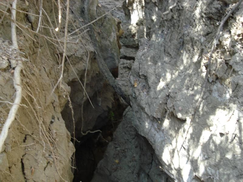
Dropped into a gully for faster travel
On the side of the gully, and exposed clam cooking site with charcoal , shells and bone.
Good picture of the charcoal pieces.
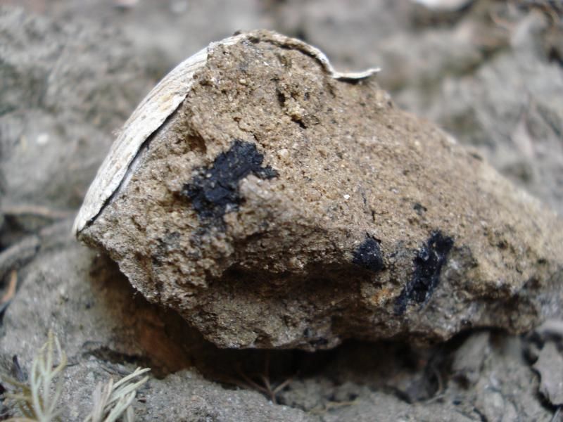
This camp is much much older than the shell site from day one judging by the soil height deposited above. Over 10 feet.
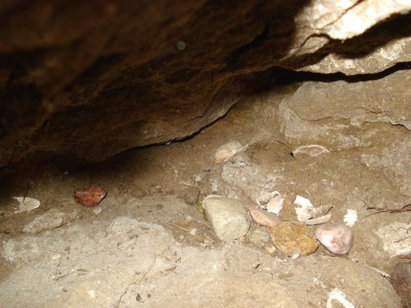
Cheers all. I miss the Desert!
Looks like I will heading up the higher elevations of the Santa Rosas next to escape to warming period.
Paul
edited by rockhopper on 6/25/2014
edited by rockhopper on 6/25/2014
edited by rockhopper on 6/25/2014 |
6/25/2014
Topic:
Hikes to Local native American campsites
rockhopper
|
surfponto wrote:
Nice hike David.
Batiquitos lagoon?
Can almost see my house in the first pic in the left corner. (That's our complex up on the hill)
Where did you start the hike?
Hi Surfponto,
Yes it is Batiquitos ( which means little baptized one) go figure?
btw its Paul not David
Hiked in from Swallow tail. Saxony to Quail hollow to Swallow tail then on foot. If you go be careful of the 20 ft gully in the middle of the heavy brush. I almost fell in. It's very hidden in spots. |
6/25/2014
Topic:
Hikes to Local native American campsites
rockhopper
|
No Problem. Cheers
Added a few more pics for grins.
Crawling and cutting through here was the hardest part.
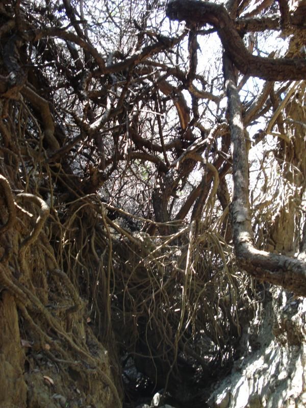
Another shot of the same spot as above.Erosion exposed old clam fire pit.
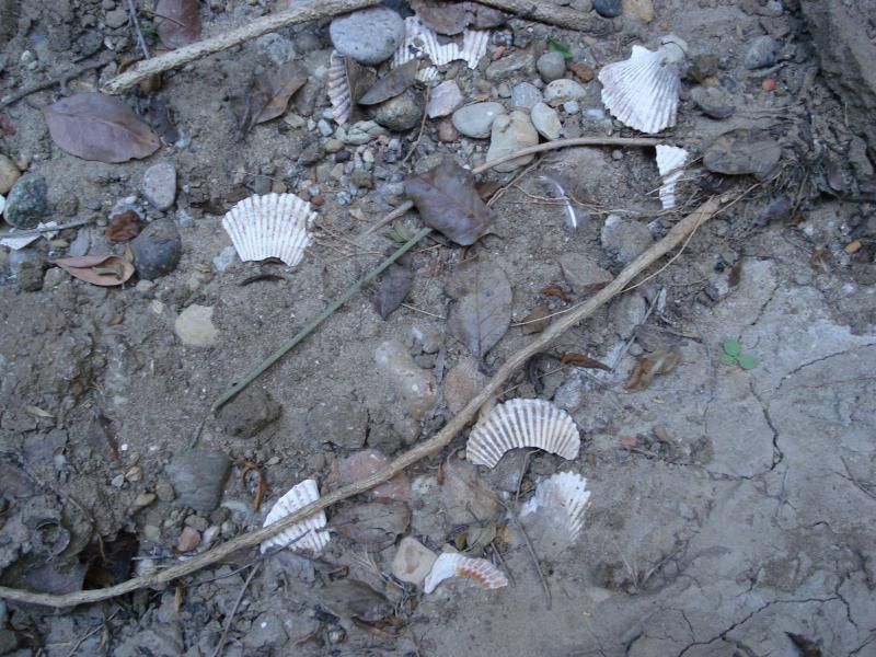
More charcoal bits and pieces from some ones ancient dinner.
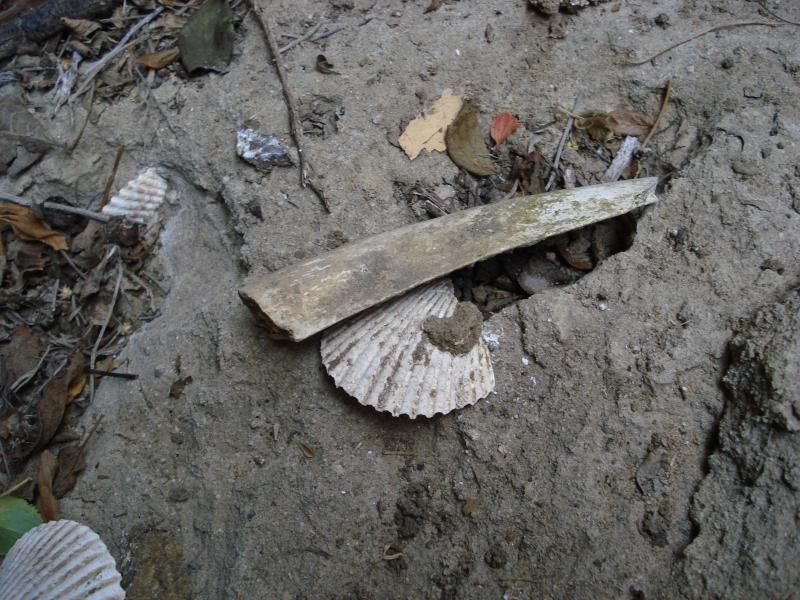
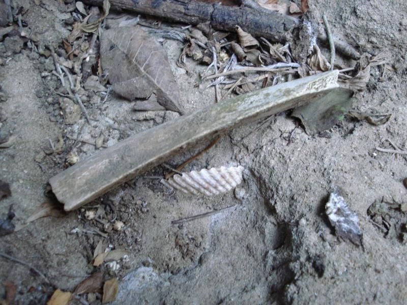
Bone frag in pit area. Bone id anyone?
other subject.
Re: Santa Rosa mtn drive up. Is the spring 3/4 the way up still flowing? The one flowing from the Galv. pipe on the left side of the dirt access road.
Paul
edited by rockhopper on 6/25/2014 |
6/30/2014
Topic:
Samurai Surprise...Hit and Run
rockhopper
|
Sorry to see that. Hope they catch the guy or (girl)? for doing that. That damage could add up to thousands of dollars at a quality shops mechanics rate of $85-$115 / hr. Hope it works out for you and your ride is ready for desert season. |
7/9/2014
Topic:
Bighorn Sheep Count 2014
rockhopper
|
Daren,
Good show! Man that's tough hiking in those high temps. Glad to see your back is getting better. I hope to hike up that canyon some time. Here's a pic of the spring from the ridge trail heading up to Villager Peak.
[IMG]http://i67.photobucket.com/albums/h294/metalmeister/ABDSP/Copyofsantarosamtn016.jpg[/IMG] |
7/9/2014
Topic:
Arizona/Utah vacation pics
rockhopper
|
Great trip photos. Thanks for sharing. |
7/25/2014
Topic:
Bighorn Sheep Count 2014
rockhopper
|
I have another picture from the Villager ridge trail I will find and post.
Thank goodness for those Big Horn sheep for pushing thru the back country wilderness and keeping some of the only trails in existence open, even though some are almost straight up!
Here it is
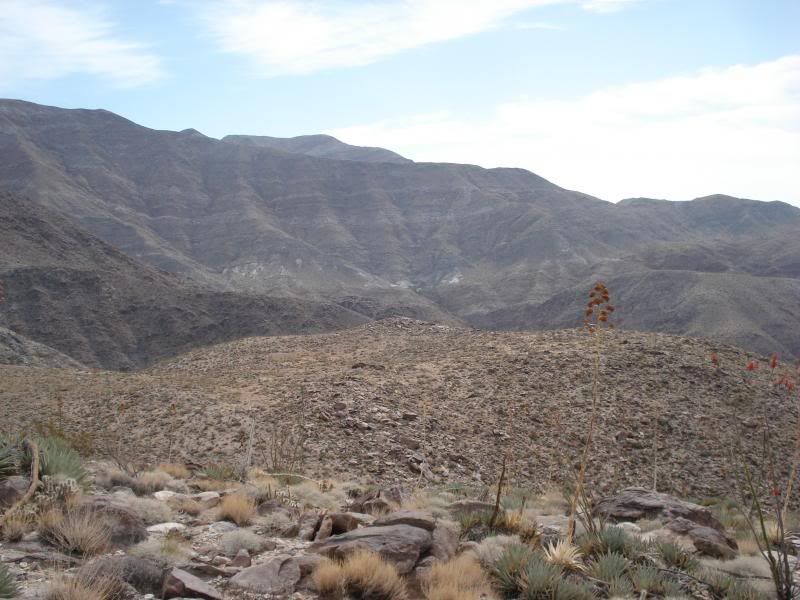
Some trails punched in by are four legged friends coming down/up Auga Alta canyon.
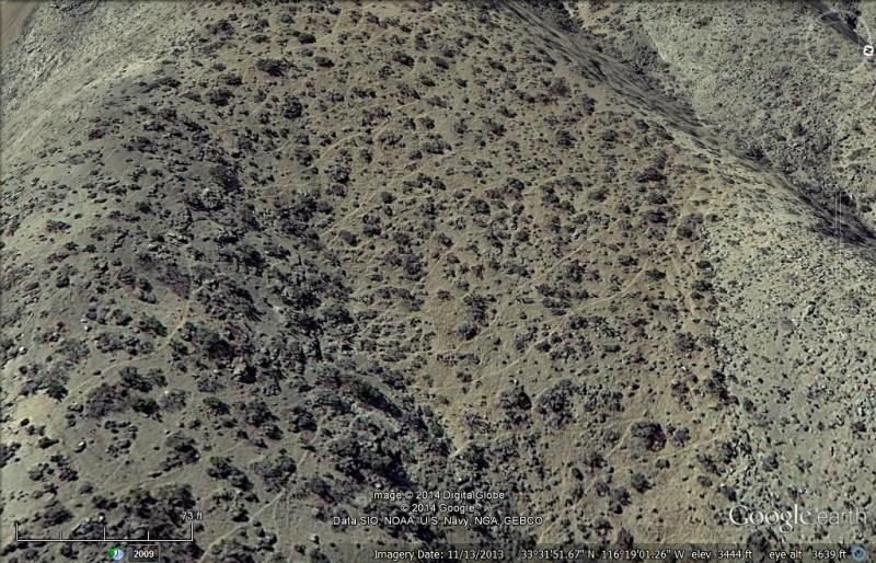
There was water at Agua Alta spring as of May this year. hopefully the moonsoons coming will recharge the spring.
edited by rockhopper on 7/25/2014
edited by rockhopper on 7/25/2014 |
8/2/2014
Topic:
Carrizo Gorge
rockhopper
|
Great report and photos! In the news a while back the was a group of investors planning to open the rail line down to Mexico. Any new info? That train ride would be one of the top train rides in the world and would bring in tourists from all over. Oh, Oh! Maybe better if left as is. After all is was/is the impossible railroad! |
8/9/2014
Topic:
North AB day trip, 8/4/14
rockhopper
|
Great Trip report and nice photos. Mud and I have a history also |
8/9/2014
Topic:
Mud Caves via Vallecito Creek in Summer
rockhopper
|
Looks like a memorable trip. Those mud caves could be a life saver to escape the heat but dangerous at the same time.
Your kids are some of the luckiest kids in the universe. |
8/10/2014
Topic:
Carrizo Gorge
rockhopper
|
btw Awesome map Tommy 750c. |
8/29/2014
Topic:
Racetrack Mystery Solved
rockhopper
|
I always thought it was the mud playa in the winter and high winds. It was the ice!
Glad those guys camped out in the bitter wet cold to figure that out |
9/20/2014
Topic:
Little Blair and Thomas Mountain
rockhopper
|
Yes, Thomas mountain and valley are great areas to "hang out" and explore. Miles and miles of fire roads running from the south end all the way to Hemet lake. My Dad bought property up near the area back in the 60's. You could spent weeks roaming around up there. I always liked to go after a light snow fall ( man am I dreaming) for a water source. The road would dry out quickly but still find snow in the shade. There are remnants of buildings and home steads and mines all around Thomas peak. Many have been overgrown by brush.
One time in my previous non-politically correct life back in the 80's I was traversing the n-s ridge road on my motorbike when I found a fire brake running due west down from the top of the mountain down to Bautista canyon. Bulldozed probably from the 1950's. You know the ones that go straight up /down. Only a deer trail remained. Let's just say I dumped my CR480 cycle more than a few times to avoid going over the handle bars. Going back up was an other story. It was a 2000 ft hill climb. Like an endless Matterhorn hill climb from "On any Sunday" but hitting / busting thru scrub oak and Manzanita all the way up. It was one #^>^%&!!!! Well at least I widend the trail for the deer for a year or two. |
9/25/2014
Topic:
Olancha, Sirretta Peaks and Monache Meadows Sierra
rockhopper
|
Great trip report and photos with different cameras. My brother is up there right now! Just a little further north. I will be heading up to the Sierras and then further up to Eureka next week to visit family. We have a cabin to stay in near the San Joaquin river.
Mt Olancha is the last highest peak heading south until you hit San Gorgonio. I found an arrow head just below Olancha peak near the Owens lake bed about 20 years ago. Lots of obsidian shards near the passes too. The views to the east are just fantastic. How were the mosiqutos? Down with the lower water?
I am going to be doing the rain dance soon myself! |
10/20/2014
Topic:
Return to Ghost Mountain
rockhopper
|
Like I said before, you have some of the luckiest kids around. I have been to that site a few times. It just keeps melting back into the Earth! One time I just happened to be there when Rider South ( one of the 3 children who lived there ) was giving a speech to a Historical society at the top at the ruins. I got to talk to him in person. Man that was neat. Looks like the desert heat is wanning so I near to get my rear in gear. Just got back from the big trees in N.Cal. |
10/26/2014
Topic:
Yuha and Mt Springs Exit
rockhopper
|
Kinda similar to the Blyte Intaglios near the Colorado river. Done by the same tribe? Neat photography again..
That buck with the red earrings is hilarious ! |
10/26/2014
Topic:
Driving The Mojave Road
rockhopper
|
Neat Trip! Neat traveling on a trail that's thousands of years old and still dirt! I've been on parts of it and traced most of it on google earth. The ancient ones followed the water. Many of the walk in wells have been erased by the sands of time. Those petroglyphs were markers describing what's ahead . Great photography once again Daren!
Did you get near Mitchel caverns ? |
10/30/2014
Topic:
Palo Verde canyon hike
rockhopper
|
Great Report. I stopped by that mine years back. I was on my way to the " Natural Rock Tanks" . Anyone know what they were looking for at that prospect ? |
11/8/2014
Topic:
Indian Valley / In-Koh-Pah Mountains Backpack
rockhopper
|
Great TR. and pics. The foxy fox photos are great!
Sorry your back is still hurting.
This helped eliminate my back pain
http://www.thebackbubble.com/
edited by rockhopper on 11/8/2014 |
11/8/2014
Topic:
Halloween weekend trip
rockhopper
|
I love the desert after the rains. Great for the animal tracks! The keys on the door handle must have been a surprise! Hope it worked out ok for those folks that lost em'!
Also, On pic no.4, I am looking at Coyote Mtn with Villager and Rabbit beyond right?
On Pic. #1 please tell us where that photo is taken. Near Montezuma Grade?
edited by rockhopper on 11/8/2014
edited by rockhopper on 11/8/2014 |
11/17/2014
Topic:
Rockhouse Canyon in Carrizo Gorge Backpack
rockhopper
|
Neat trip report. Nice glyph photos. Where they near a old water source? Old spring or creek perhaps. The whole area was much wetter in past ice age advances and retreats. I have never seen a quartz like artifact like that out in ABDSP. Neat! |
11/17/2014
Topic:
Carrizo Gorge Backpack
rockhopper
|
That hydra -Cushion box car looks like it rode down the "hill" better than that other box car . haha
I take it that Tamarisk is non native. Nice of them to clear it out! |
11/18/2014
Topic:
Whale Peak via the Pictograph Trail
rockhopper
|
Welcome! Whale peak has some great views on a clear day. Looks like you nailed it. |
11/26/2014
Topic:
RockhouseValley (north) backpacking TRIP
rockhopper
|
I love Rock House Valley. It never changes. As a matter of fact It may never change in our lifetime and our grand kids life time. That's the beauty of it. That was my exact first trip into the valley. Camp at the lower rock house at the entrance and day trip to the Santa Rosa Indian ruins. We found broken arrow heads and broken pottery around a burial cairn west of the main ruins. The ancient peoples used to break the dead persons personal possesions and scatter them. Go figure.
Great photos and great trip report! |
12/2/2014
Topic:
Rockhouse Canyon / Buck Ridge / Jackass Flat 4 Day
rockhopper
|
Great photos and trip report. Looks like you went during great weather. Man we go from hot to 20 deg nite time temps. That's the desert! Brrrrrr!
1. How in the world did you spot that quartz arrowhead? Looks like for hunting rabbit and birds.
2. Was there any remnant of the 4x4 rock built road going up the 30 ft water fall drop off? Others may chime in on the history of this. A 4x4 club back in the day (1950's- 1960's) ?? built a road up Rock house canyon. I don't know if they ever made it to the valley floor. But parts of the 4x4 ( rock and boulder) road built by these guys still was intact about 20 years ago.
3. A big hats off to Gary and you guys doing conservation work in one of the most fragile eco-systems treasures.
Its raining good at the coast as I write this. I guess my rain dance worked |
12/12/2014
Topic:
Post your Anza Borrego Sunrise Photo
rockhopper
|
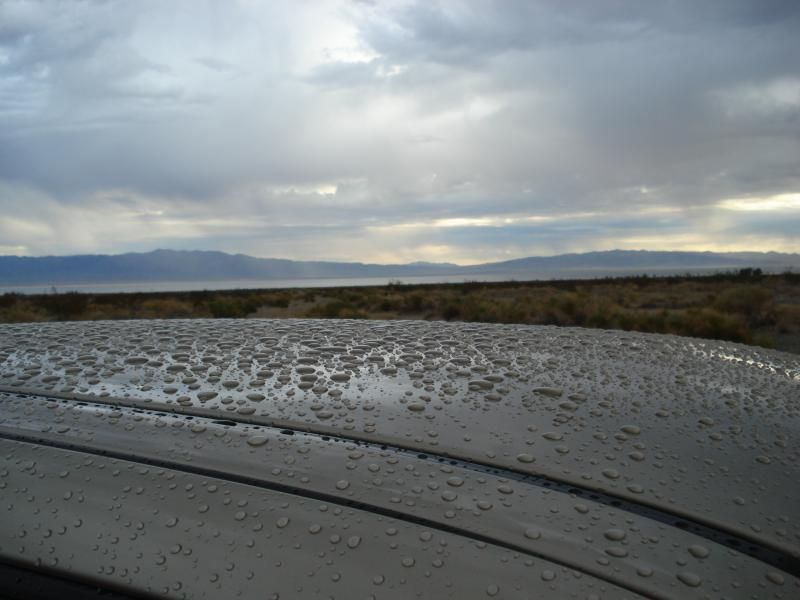
Rain rise pic. Awoke to rain hitting my sleeping bag while sleeping in the bed of my truck. Pic is from Dec. 12 2013 exactly one year to the day!
edited by rockhopper on 12/12/2014 |
12/12/2014
Topic:
Pepperwood Canyon to Canebrake Valley
rockhopper
|
Great trail report. I've always wanted to traverse Canebrake valley. That valley is huge! |
12/12/2014
Topic:
Pepperwood Canyon to Canebrake Valley
rockhopper
|
Tommy750,
Amen to that! I've been doing my own trail clearing near my home in the coastal canyons in the Summer.

edited by rockhopper on 12/12/2014
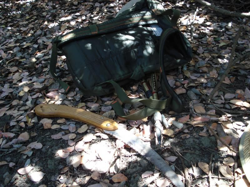
edited by rockhopper on 12/12/2014
edited by rockhopper on 12/12/2014 |
12/30/2014
Topic:
5 Day Backpacking Trip Indian Gorge/Canebrake-
rockhopper
|
Daren,
Great photos and always enjoy the wildlife pics. Lazer eye for finding those arrow points! I would have to be on my knees nowadays to find those! Great shooting star picture!
Great TR
Thanks for sharing |
1/3/2015
Topic:
Plane Wrecks
rockhopper
|
I Found a jet fighter wreck near plaster city near the ABDSP border and lots of 50 Cal brass shell casings. Also found a pile of titanium from the turbine engines. Maybe still out there?
Also found single engine aircraft wrecks on Otay mountain and several on the San Gorgonio Mtns.
I saw crashed single engine aircraft on GE in ABDSP a while ago but can't find it now!!! |
1/3/2015
Topic:
Gear Reccomendations
rockhopper
|
This old Native American trick only works where you can build a roaring fire on sandy loose soil in the wilderness in a survival situation.
1. Dig a trench at your sleeping bag location.
2. Build a rounded stone rock fire ring. Stones / boulders about the size of softballs.
3. Build a roaring fire.
4. At the end of the fire, roll the hot rocks in the trench and cover with sand.
Personally I carry a 2" thick foam pad nowadays mainly due to the fact I am a side sleeper AND keeps me warmer. My A16 bag is Xtra wide and rated to 20 deg. Don't forget the beanie!! |
1/4/2015
Topic:
The Potrero / Vallecito Valley 3 nights
rockhopper
|
Glad you missed the "cold front" that came in and hasn't left yet :-o
Great photos and trail report! |
1/4/2015
Topic:
6 Days in the Turtle and Orocopia Mountains
rockhopper
|
Excellent trip and photos! That whole area in that corner of the SoCal desert has some spectacular and complex geology. Those miners and early explorers out there were tough! I gotta belive it was a wetter time closer to the last ice age out there during the ancient people habitations.
Again superb photos. Sorry you froze your butts. I guess you guy hit the " Alaska / Canada cold front express" |
1/4/2015
Topic:
Mud Hills Wash to Elephant Knees
rockhopper
|
Jerry Schad said it best! RIP
Great trip photos! |
1/28/2015
Topic:
Loop and Olla Wash yet again
rockhopper
|
Neat trip photos. Need to head out there again. Looks like you all had a great time! That whole area out there is a fossil trove. Marine fossils from the now extinct Imperial Sea. Geology play ground no kidding!
Old but neat brief article of the complex history of the area
http://www.utsandiego.com/uniontrib/20051116/news_lz1c16anza.html |
1/28/2015
Topic:
Sawtooth & Tierra Blanca Mtns Solo Backpack
rockhopper
|
Nice to hear you were able to cover over 20 miles with the short days. Great trail report and photos.
That jet crash site looks like they didn't salvage much. |
1/30/2015
Topic:
Between the coast and ABDSP
rockhopper
|
Hello all. While waiting for longer daylight to head out for my Feb-May ABDSP expeditions this year I am forced to do a lot of open space mini local hikes closer to the coast mainly due to my family commitments on both sides of the family. Well, these hikes are at least at the same latitude as ABDSP.
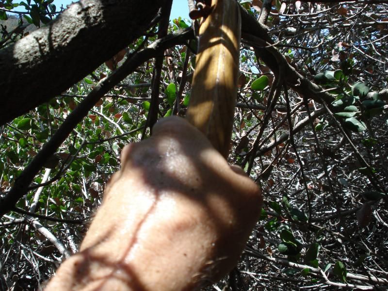
Did a lot of "You can't get there from here" hiking through dense brush. This is a self overhead shot. I am looking head on into head high brush as I bust my way through to the clearing beyond.
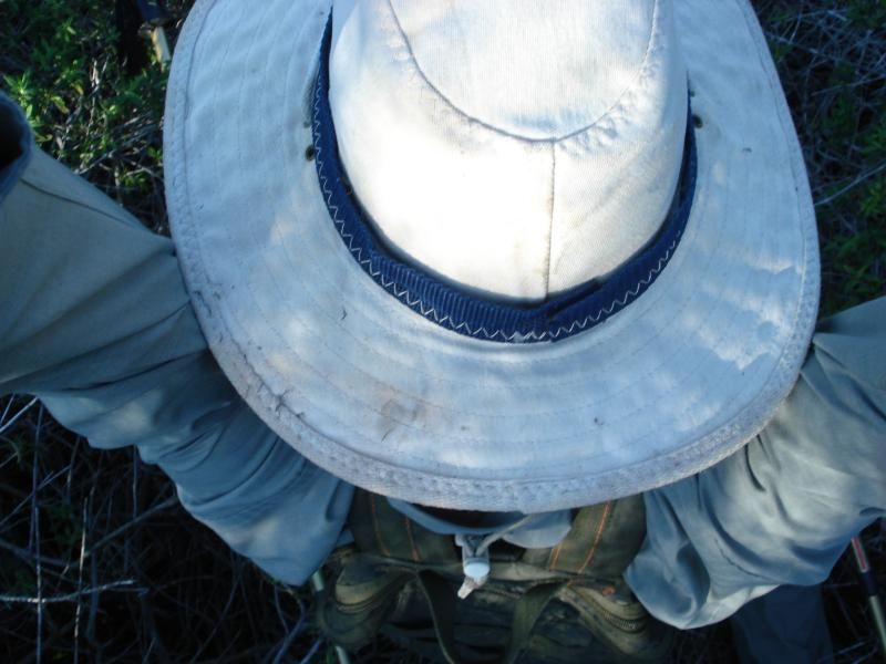
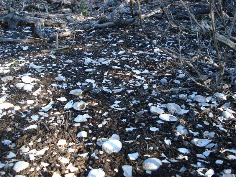
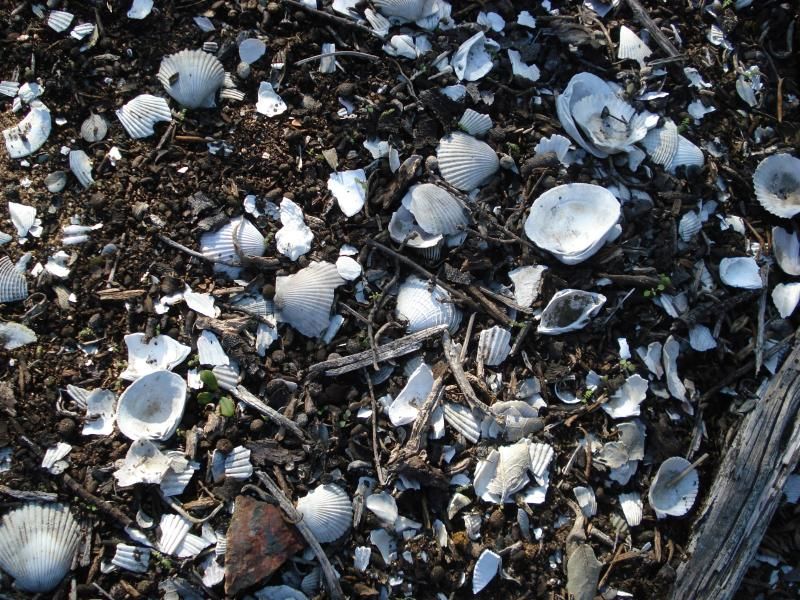
Finally made it to a clearing where there was a shell midden dump site. I noticed the arrow head looking thing in the photo when I got home. It's still there :-D
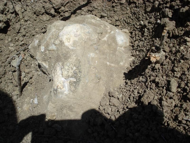
Some sort of Marine fossil? This is about 2 feet across and heavy. Dusted off to photo and left as is.
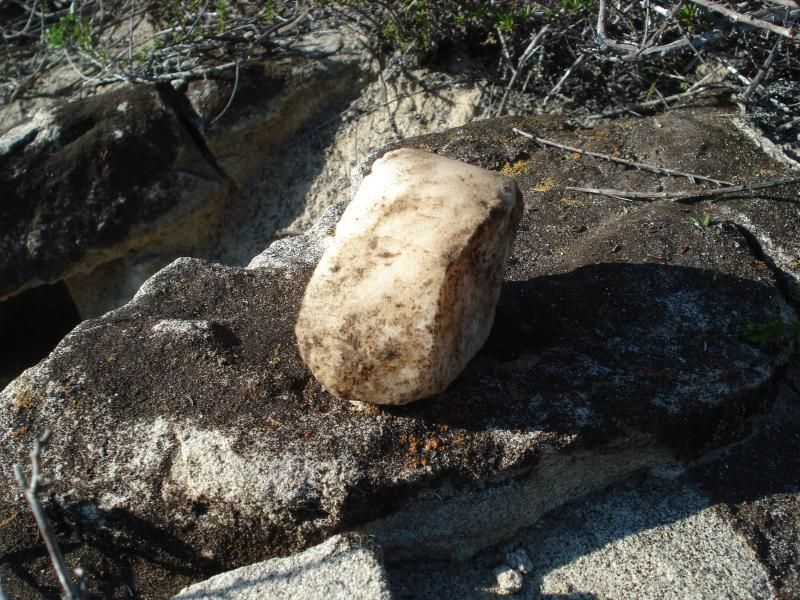
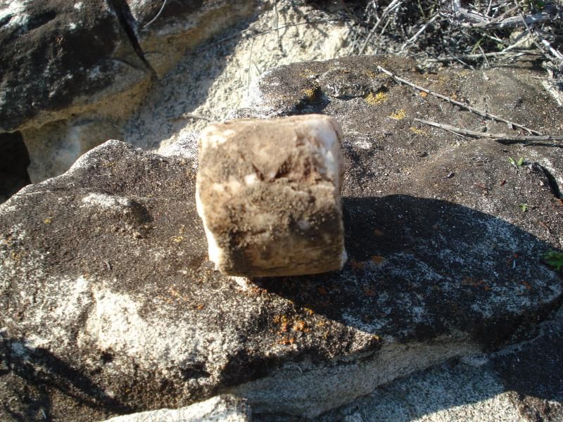
Hiking near a hill crest I saw some Quartz sticking out of the ground. I always pick up white Quartz for a look see. Man made? Found 2 like this in the same area. Same size, same shape. About size of a womans fist. Hid it in a bush.
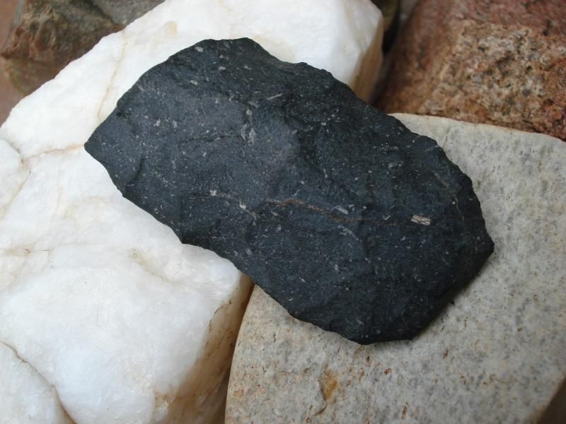
Hiking further though some brush to a clearing found this on the ground surrounded by lots of stone chippings. I cleaned the mud off it with my precious water to photo. It looks like a broken spear tip. It is about 2 inches long.
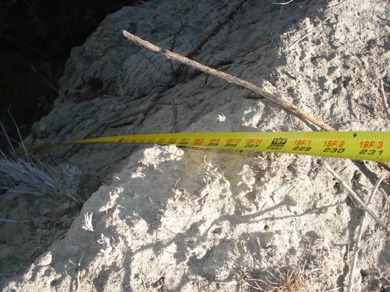
Took a turn hiking down in some gullies. Getting down was easy part. getting back up, well not so much! :-o
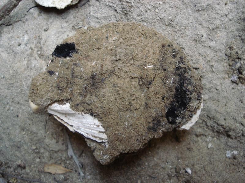
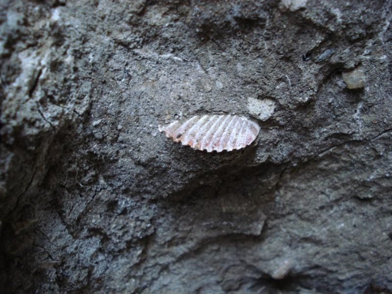
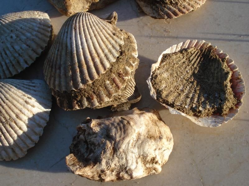
Some ones scallop dinner from along time ago buried about 15 feet below the surrounding surface.
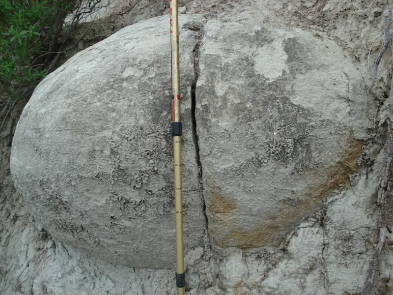
Some big concretions in the area were a surprise.
Now this was interesting. On the side of another gully there was a exposed shell midden about 12 feet below the surface. Probably hundreds or thousands of shells. The shells were falling off the side to the creek bed below. After who ever ate the scallops for dinner a long time ago neatly stacked the shells! Posed a few to photo.
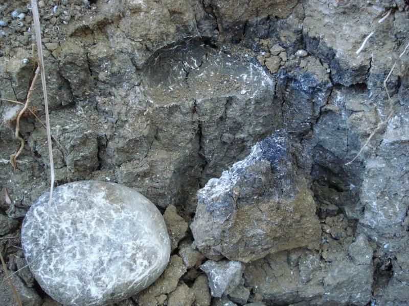
Finally, while climbing on a rock to get out of about 15 foot gulley I stepped on this and it flipped out. It was buried about 12 feet below the surface. Closer look it appears to be a large mill stone about 2 ft across surrounded by dissolved charcoal. I came back a few weeks later and it was gone. Probably washed down a buried again for someone else to find.
edited by rockhopper on 1/30/2015
edited by rockhopper on 1/30/2015
edited by rockhopper on 1/30/2015 |